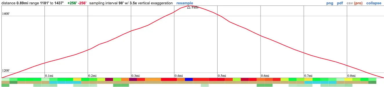
- Miles: .9
- Time: 30 min
- Difficulty: Easy
- Best Season: Mid-Late Spring
- Elevation Gain: 256 ft
- Max Elevation: 1437 ft
- Type of Trail: Out & Back
- Parking Lot: Fits ≈ 20 cars
- Dogs: Allowed On A Leash
- Restrooms: Available
- Trail Popularity: Very Low
- Pics Taken On: Sept 2, 2023
Bailey Canyon Nature Trail takes you to a rarely flowing waterfall which has been kept a secret by the locals for a very long time. However, if you pick the right day to visit, you might just see it flowing.
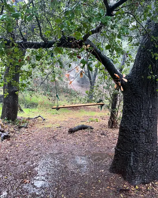
PLEASE READ: This waterfall is a gem to all the people who live nearby. There is no trash or graffiti, and there are many signs of little people playing in the area (children), such as the swing and branch teepees. Please, for their sake, keep the place between yourself and those who you know will respect the area. Thank you 🙂
How to See Bailey Canyon Falls When It’s Flowing
Bailey Canyon Falls is rarely flowing, even during spring. The only time there is water at the falls is the day it rains and the day immediately after.
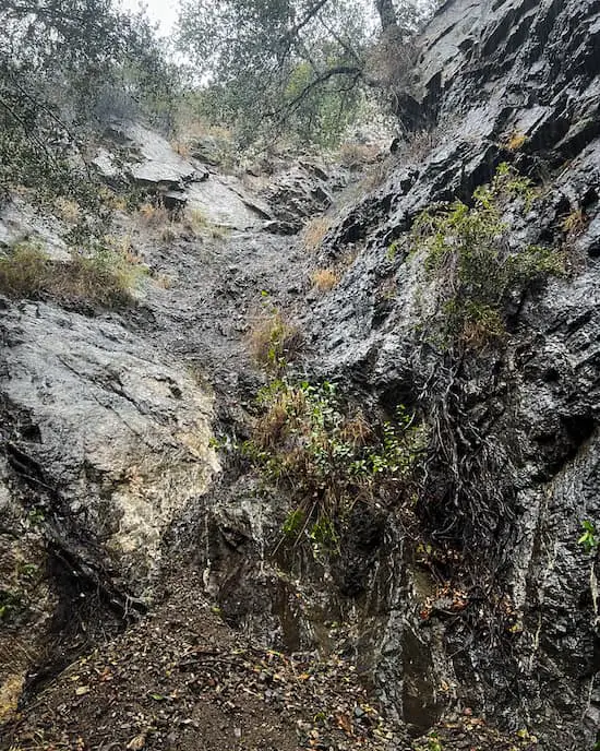
However, I HIGHLY advice against visiting the area while it’s raining, as my buddy and I were nearly hit by rockslides during our visit, and two people have drowned during flash floods. Instead, I recommend visiting a day or two after it rains.
Bailey Canyon Nature Trail Map
Bailey Canyon Nature Trail Directions
Click the link HERE to be redirected to the Bailey Canyon Nature Trail parking lot via Google Maps.
Bailey Canyon Nature Trail
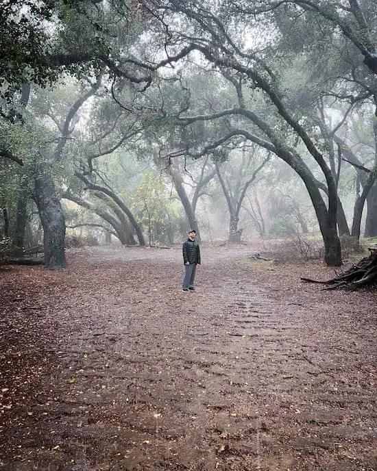
The nature trail begins in a little parking lot tucked into the foothills of the lovely town known as Sierra Madre.
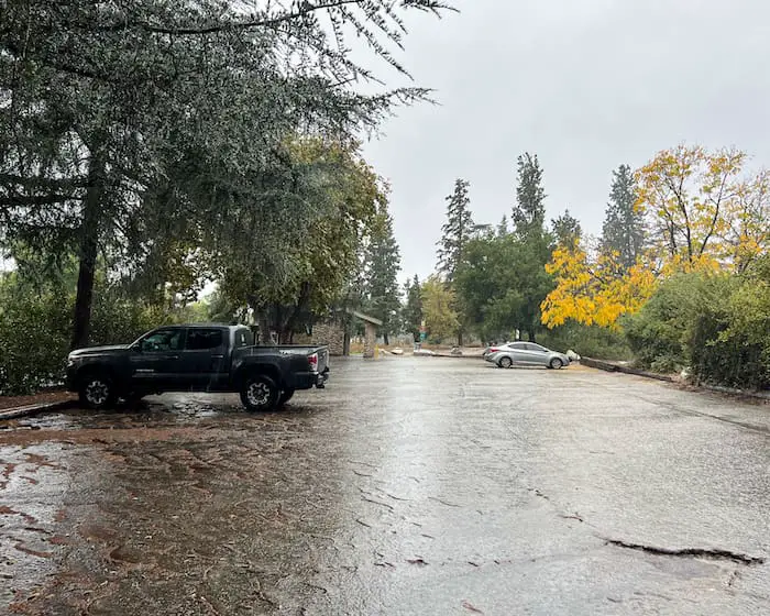
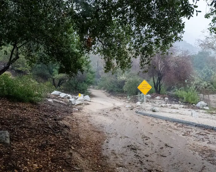
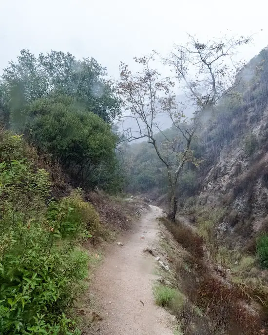
Since we visited while it was raining, the water was flowing directly into the parking lot, and the crystal clear droplets poured all around us from the tall pine trees.
Surprisingly, one of the houses which borders the road had a waterfall raging down about 15-20ft (if only Bailey Falls had the same flow).
Although it wasn’t raining too hard, you can see from the picture below why flash floods can be a huge danger.
Detour
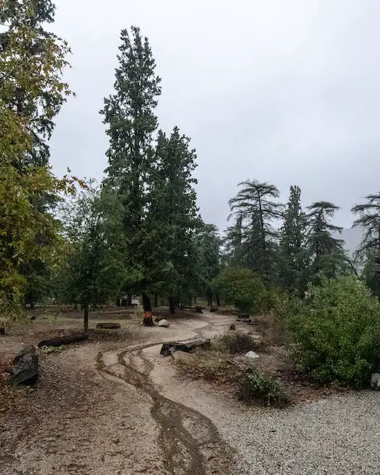
Right before entering the canyon, you’ll notice a bridge traversing the debris reservoir.
I didn’t add it on the the map as it’s a detour, but I highly recommend checking it out.
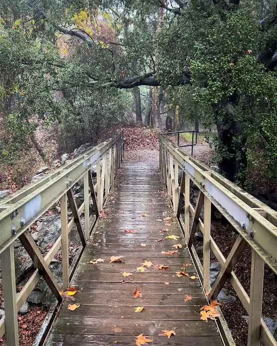
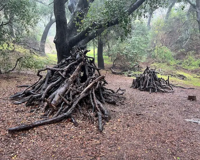
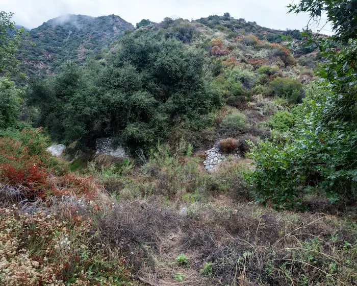
It leads to a little flats covered by the forest canopy, as well as a couple of shelters and a swing.
Notice the area (and all of Bailey Canyon Wilderness Park for that matter) is extremely well preserved. I didn’t see a single piece of trash anywhere on the ground.
Head back the way you came to return to the main route.
Detour Ends. Back on The Main Trail
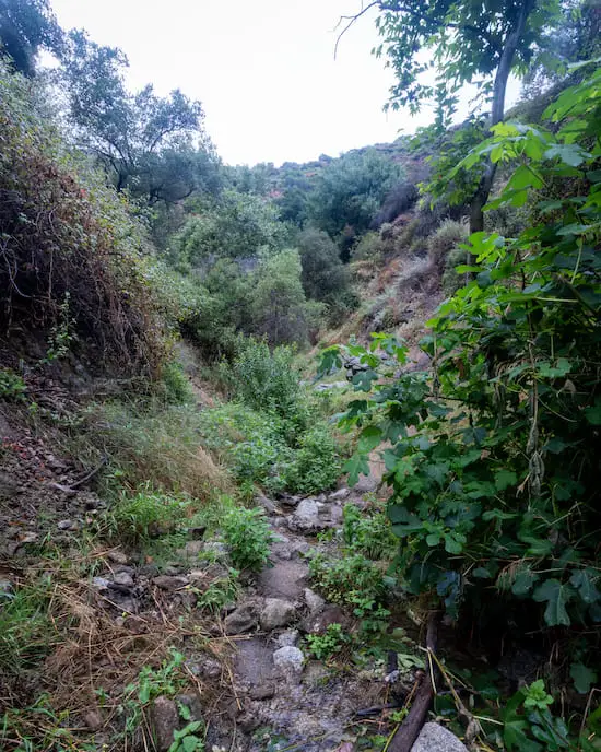
As I ventured into the canyon, the creek will be located to your right and below you. I spotted some ruins on the opposite side of the creek, but have yet to find any information on them.
I kept moving forward, wondering how flash floods could be so dangerous on this trail when the creek was a few feet below me.
My questions were answered within a few minutes when the trail descended to the same elevation as the creek.
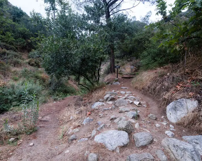
By the way, the image below is the fork where you can head up to Jones Peak from Baily Canyon.
During my second visit, I noticed the beginning of the hike didn’t have running water in the creek, but about halfway, that quickly changed. There was a lot of creek crossing over slippery rocks involved.
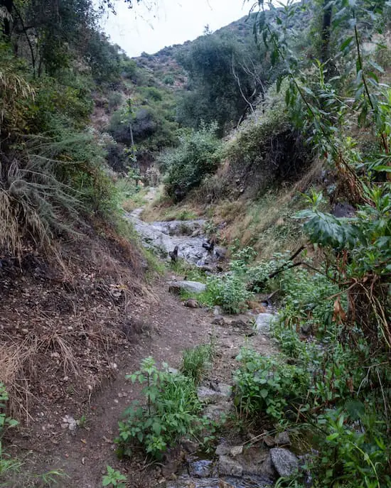
There are some sections of the trail which are very overgrown, especially during the spring. Make sure not to accidentally make contact with poison oak.
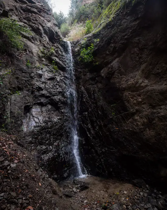
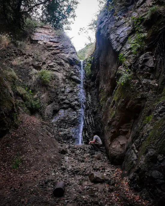
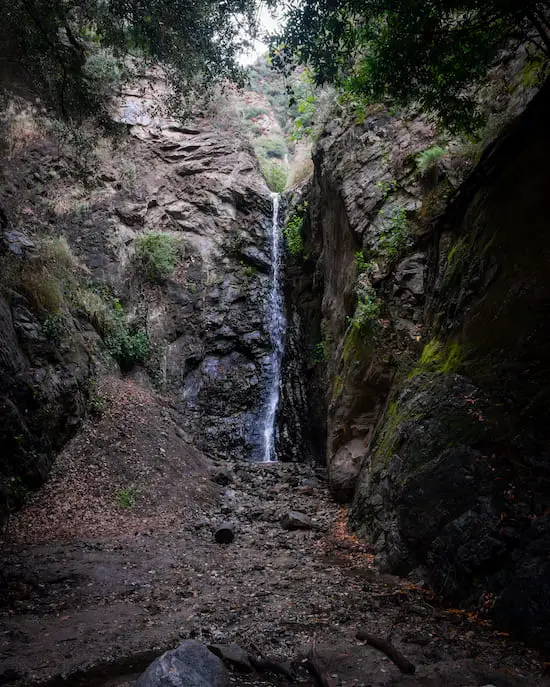
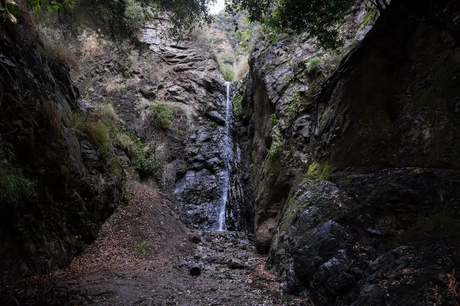
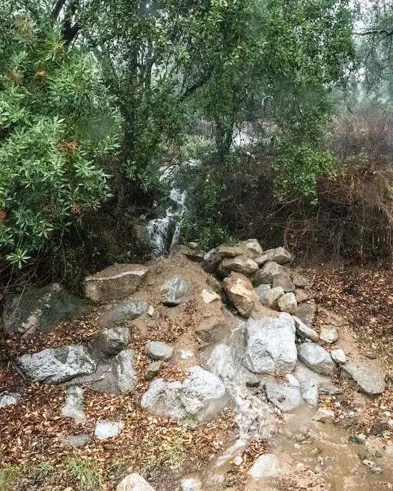
I made a sharp right turn and came face to face with a beautiful 25 foot falls. While most waterfalls are roaring due to the wet winter we just had, Bailey Cn Falls was still barely more than a trickle.
Seeing it flow really is a especially occasion.
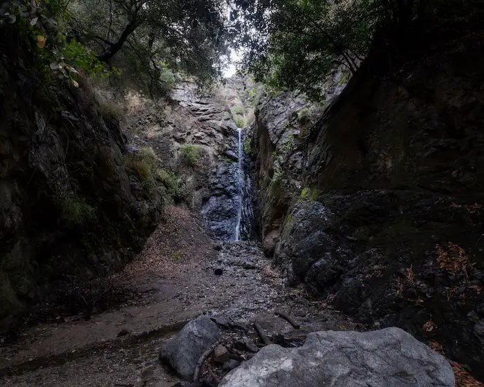
A second cascade is located to the left and resembles a curved playground slide. Unfortunately, it had even less water.
Bailey Canyon Falls measures roughly 25ft.