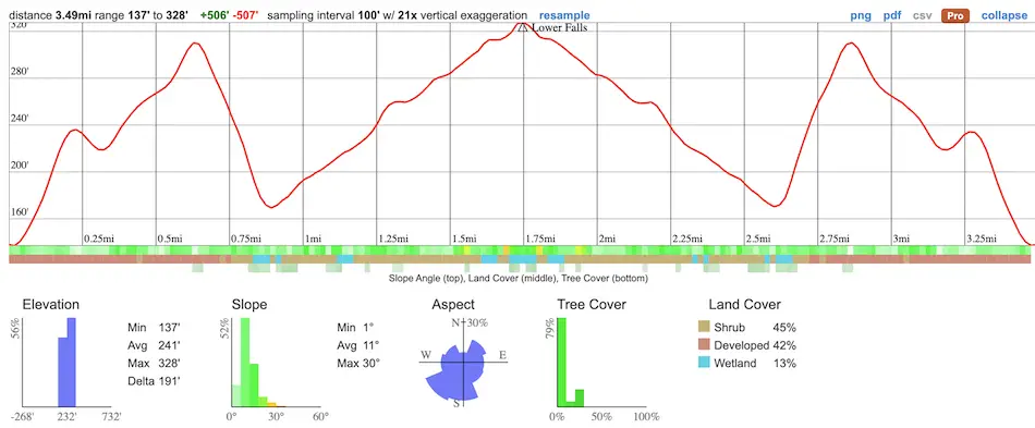
- Total Miles: 3.49
- Time: 1.5 Hrs
- Difficulty: Easy
- Best Season: Spring
- Elevation Gain: 507 ft
- Max Elevation: 328 ft
- Type of Trail: Out & Back
- Parking: Lot Fits ≈ 15 cars
- Dogs: Allowed On A Leash
- Restrooms: 1 Porta Potty At The Parking Lot
- Trail Popularity: Extremely High
- Pics Taken On: Feb 13, 2024
I’ve known Escondido Falls is one of the most popular waterfalls in LA County, and the Santa Monica Mountains, but I had no idea why. That is until I paid a visit.
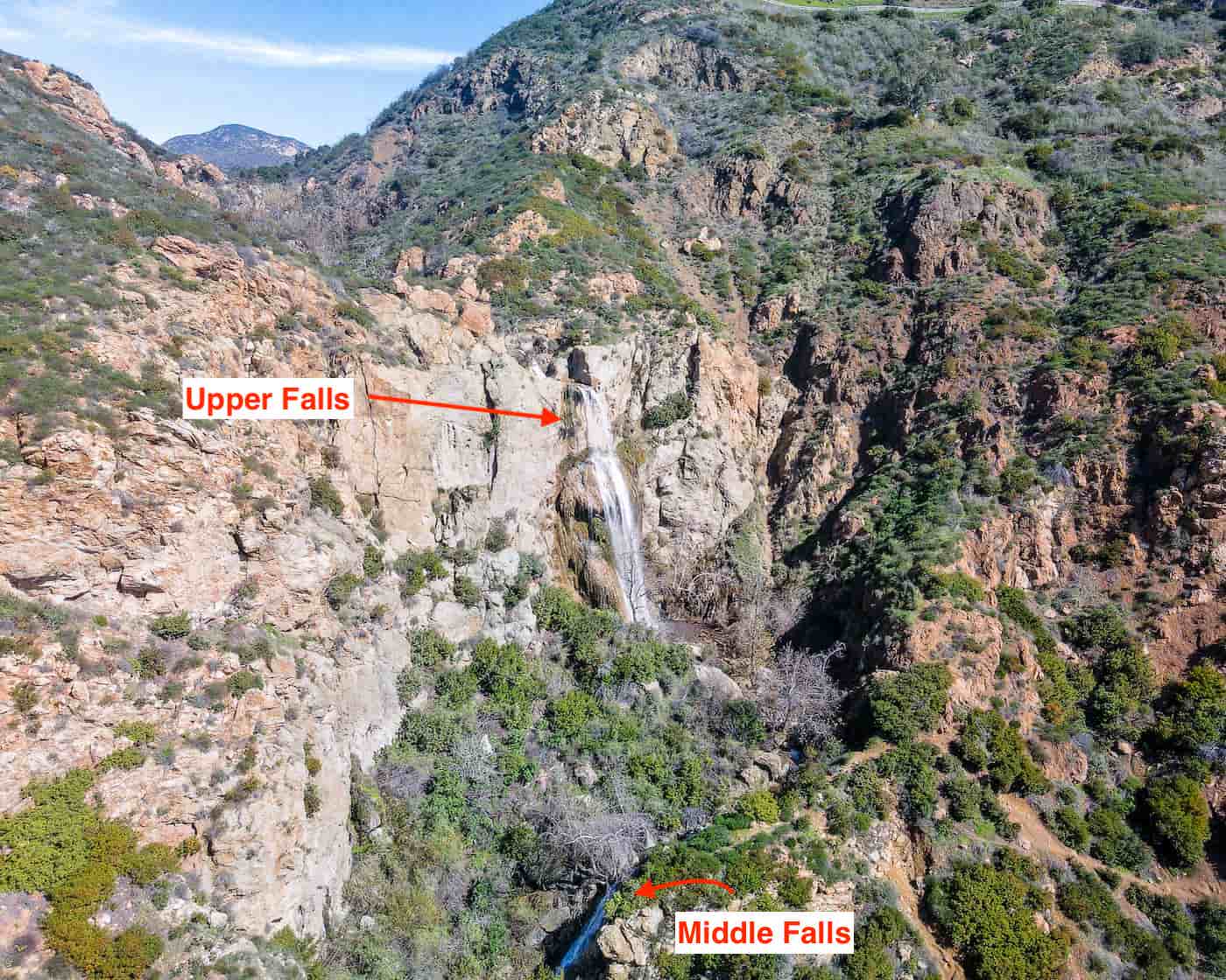
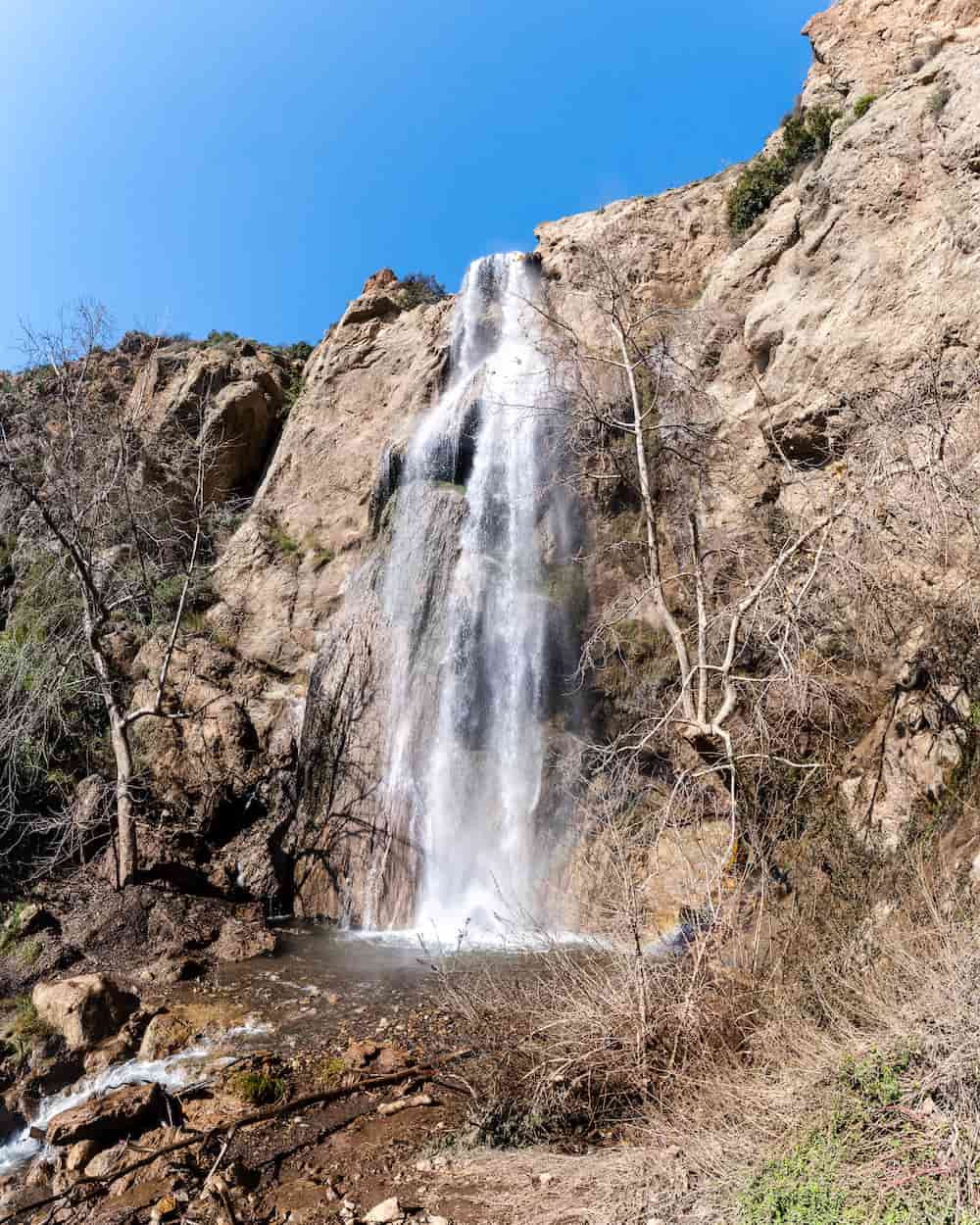
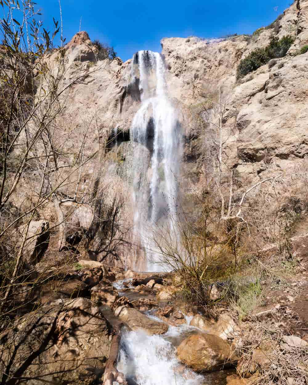
Escondido Falls is three waterfalls, not one. The lower falls is roughly 50 feet high, and the middle falls is about 20 feet high, but the upper falls is undoubtedly the primary attraction. Escondido Creek plunges off a150 150-foot cliff, slamming into moss-covered protrusions in the cliff wall on the way down and forming various grottos, which collectively create one of the most captivating cascades in Southern California. It truly is a sight to see.
That being said, the official trail, which is family-friendly, ends at the lower falls. The “trail,” (if you can call it that) leading up to the middle and upper falls is closed to the public as it’s very steep, rocky, slippery, and therefore, dangerous.
Looking for the best waterfalls? Say less, click the following link to view a post I wrote on the best and my favorite waterfalls in Southern California.
Escondido Falls Trail Map
Parking And Directions
To be redirected to the Escondido Falls visitor parking lot via Google Maps, click here. Since parking is extremely limited, you may have to find a space on PCH.
A parking fee of $12, which can be purchased in person using cash or a debit card, must be displayed on all vehicles.
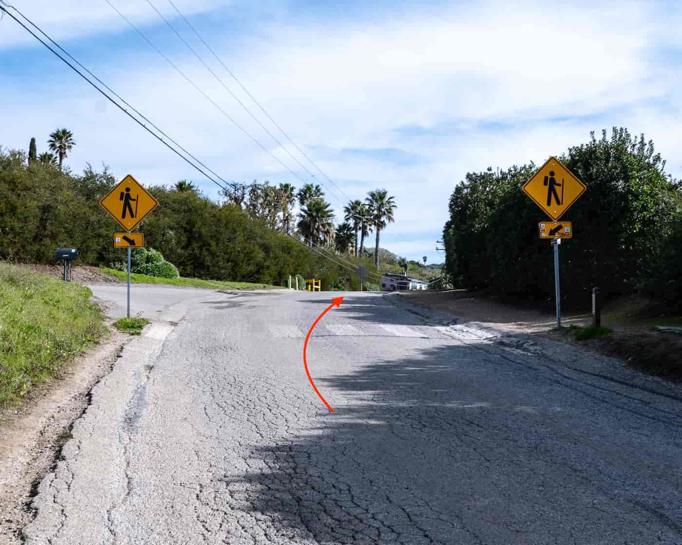
The official Escondido Falls trailhead is located about a half mile up Winding Way from the parking lot. However, parking is not allowed past the designated lot, and you risk being towed if you do. Hence, the hike technically begins at the parking lot (or PCH depending on where you park), as is shown in the map above.
Helpful Info
Escondido Falls Weather Forecast
Escondido Canyon Park Site Info
Escondido Park Hours: Sunrise To Sunset
Hiking Escondido Falls
I paid for the $12 parking permit and began my hike up Winding Way, a concrete road that makes up almost half of the entire hike and led me through various Malibu estates.
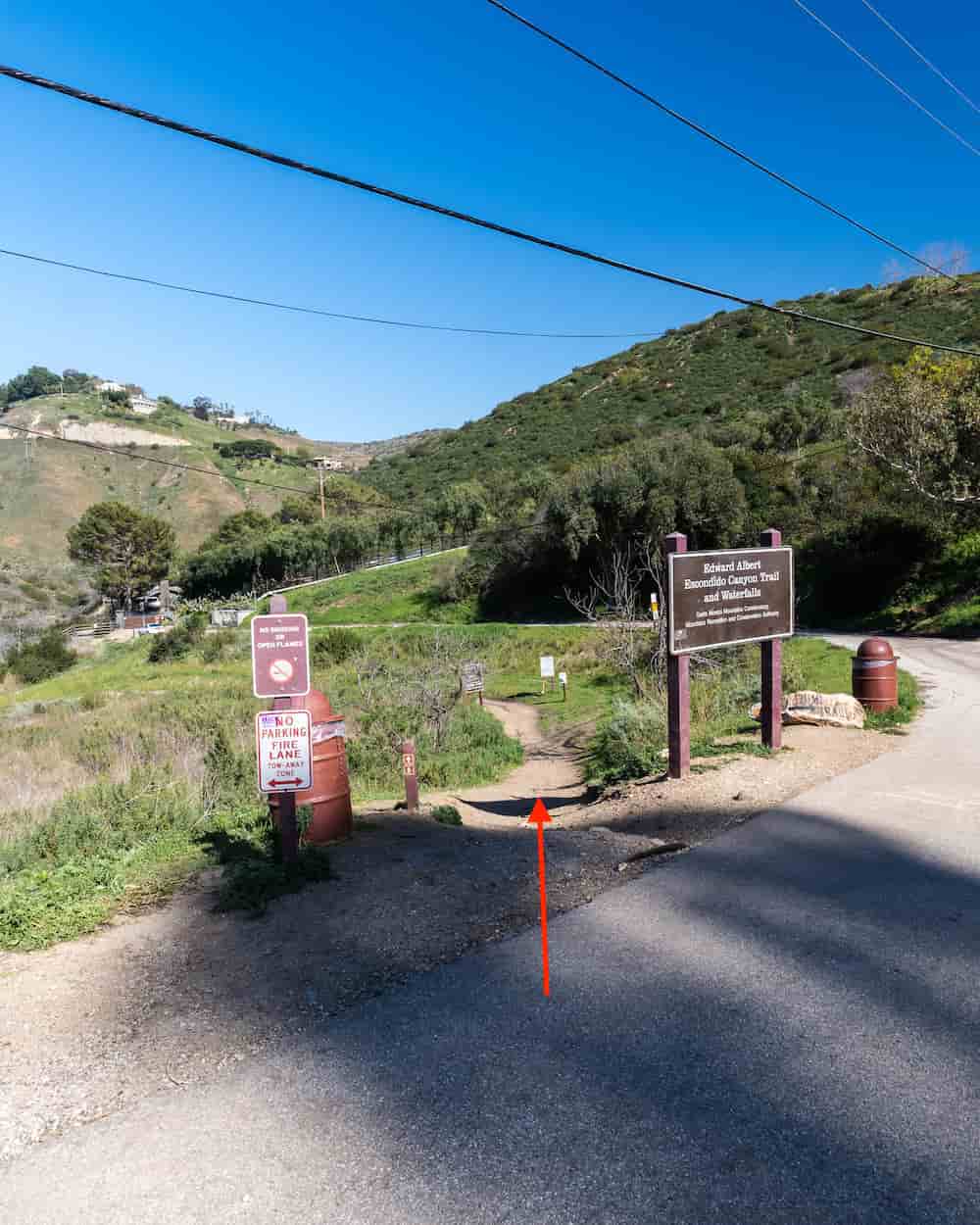
Eventually, the road begins to descend toward the canyon floor where the official trail, called the Albert Talbert Escondido Canyon Trail, begins.
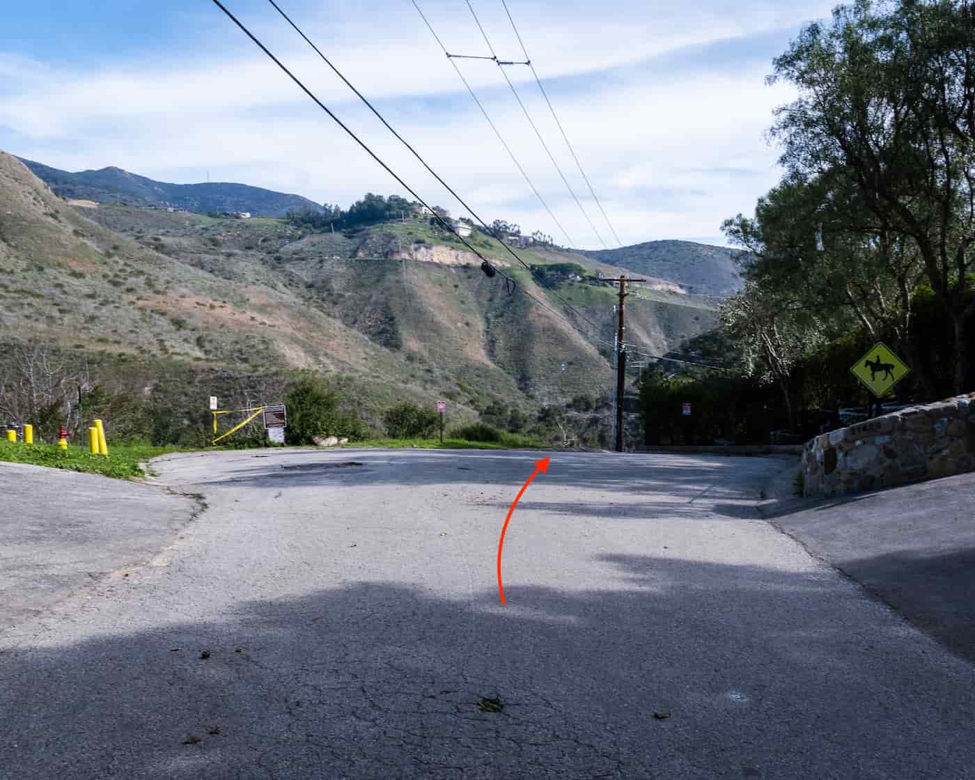
The trailhead is located at the edge of a mustard-filled meadow, and marked by multiple signs.
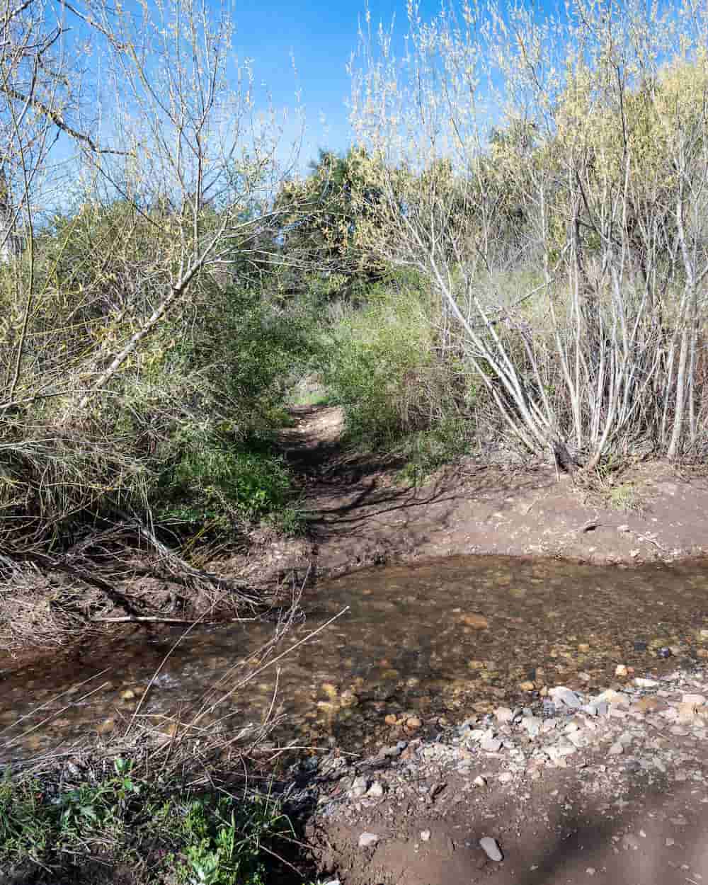
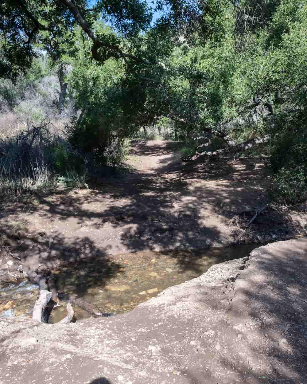
Shortly thereafter, I found myself amidst an oak and riparian woodland, crossing the thicket-covered Escondido Creek multiple times, and enjoying the scenery.
The frequent number of creek crossings reminded me of the popular trail to Eaton Canyon Falls, a 50 foot waterfall in Pasadena.
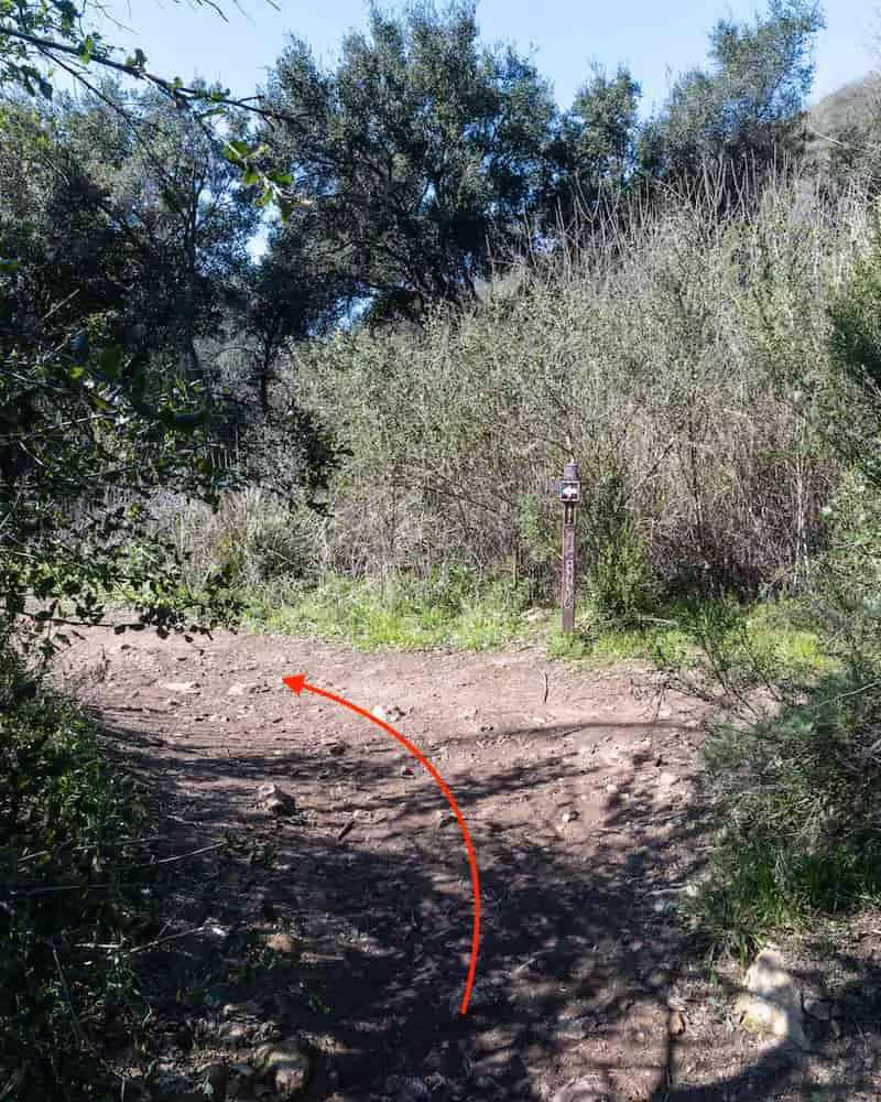
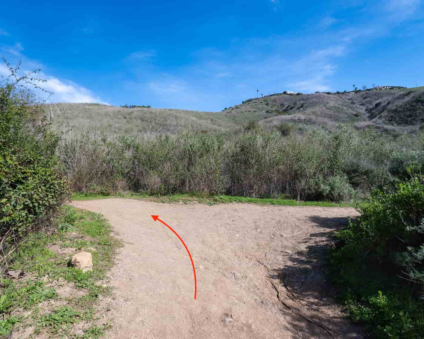
The first fork is marked by a sign. The trail continues to the left.
Although we had recently received a major rainstorm, labeled by the media as an atmospheric river, the creek was not flowing the way I thought it would.
I began to suspect the waterfalls may also not be very full.
I was very surprised to see virtually no visible damage from the 2018 November Woolsey Fire in the canyon. Everything from Alder, Black Sage, Toyon, and even the notorious poison oak and hemlock seemed to be teeming with life.
I made a left at the next fork.
My concerns regarding a dry waterfall were quickly relieved as I was able to see the upper falls roaring off the cliff before even reaching the lower falls.
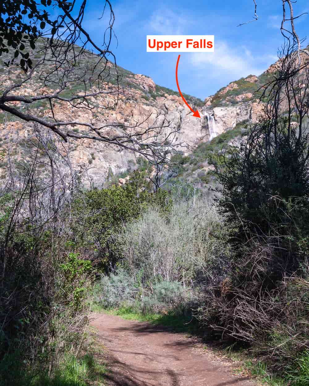
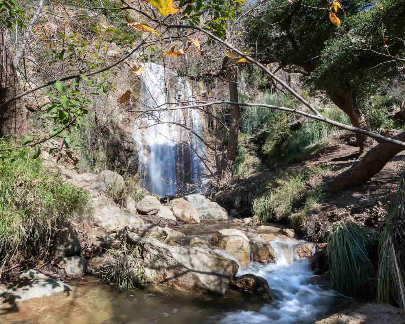
A couple of minutes later, I arrived at the lower falls.
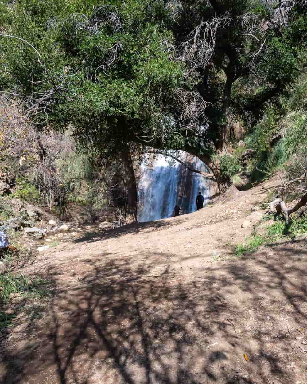
The 50-foot waterfall with calcium carbonate (limestone) walls was roaring. I liked how wide it was, unlike most waterfalls in LA County. It reminded me of Cooper Canyon but with a subtle sulfuric smell.
Believe it or not, the waterfall is dry throughout most of the year, which is why it’s crucial to get out there as quickly as possible following a good rainstorm.
It was mid-February, and the Western Sycamore trees clung on to their last few vibrant orange leaves. Although the fall’s surrounding area lacked the usual vibrant green ferns, it nevertheless preserved a scenic and wild look.
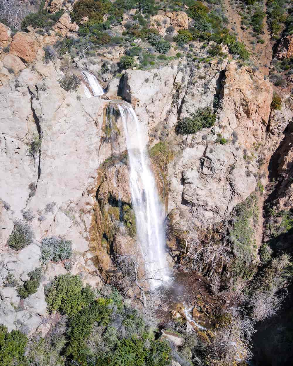
The 20-foot middle falls can be seen in the drone shot below. It was even fuller than the lower and upper falls.
Unfortunately, it can’t be seen when standing at the lower falls.
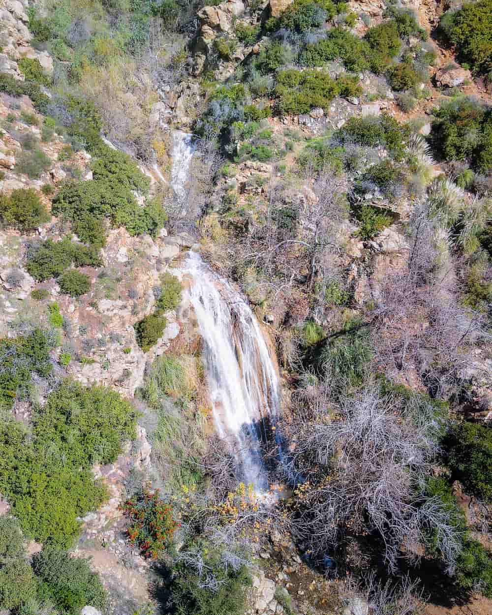
The canyon looked even more impressive from the skies.
The green coastal sage scrub boasted a deep green thanks to the recent rains and contrasted very nicely with the canyon walls.
Remember, the trail ends at the lower falls, but I have excellent news.
Escondido Park is headed by the Mountain Recreation and Conservation Authority (MCRA), which received $1.5 million in funding from California’s Wildlife Conservation Board (WCB) as of Feb 17, 2023 “to [help] acquire approximately 88 acres of land for the protection of threatened and endangered habitat and to provide for future wildlife-oriented, public-use opportunities located near Malibu in LA County.”
Part of the land includes the 150-foot upper falls, whose market value is $4.8 million. However, the landowner has generously offered it at $985k. Time will tell, but the future looks hopefully regarding an official trail to the upper falls.
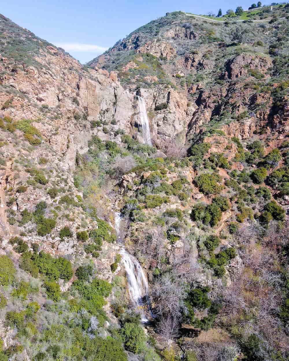
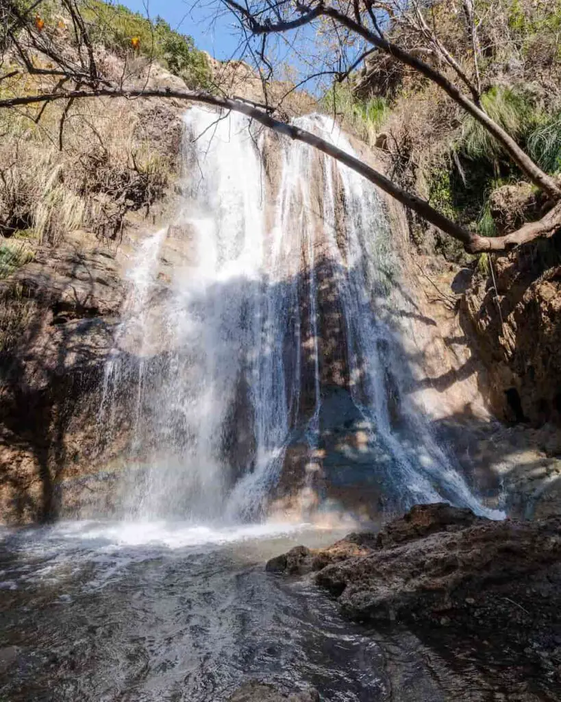
The upper falls is breathtakingly beautiful. In my opinion, it’s without a doubt the best waterfall in LA County,
Its height and width remind me of Cedar Creek Falls in San Diego County, which has been dubbed the best waterfall in Southern California by yours truly.
Most of the greenery is gone for the winter. However, the cliffs sport a vibrant green moss during spring and early summer, giving the falls an even more stunning look.
I can see why the native Chumash people once inhabited the area. It’s paradise.
As you can see from the image below, a few parts of the canyon protrude outward, slightly bouncing the stream and forming little grottos.
I’ve seen some people climb on top of the first grotto and sit behind the falls.
Hold on! Don’t leave just yet. Check out a list of the best waterfalls in LA County which I know you’ll be sure to love.
FAQs
Is Escondido Falls Worth Hiking?
Escondido Falls is most definitely worth hiking. When the upper falls is flowing, it’s arguably the nicest waterfall in Southern California.
How High Is Escondido Falls?
The lower falls is roughly 40-50 feet, the middle falls is about 20 feet, and the upper falls is an impressive 150 feet high.
Can You Drink The Water From Escondido Falls?
It is unsafe to drink the water from Escondido Falls as bacteria may be present, resulting in sickness or death.
Is Escondido Falls Flowing?
Escondido Falls is flowing as of Feb 2024. However, conditions may quickly change.
Is Escondido Falls Dog Friendly?
Dogs are allowed at Escondido Canyon Park but must remain on a leash at all times.
Can You Swim At Escondido Falls?
The water at Escondido Falls is not deep enough to swim.
Is Parking Free At Escondido Falls?
Parking at Escondido Falls requires a $12 permit, which can be purchased in the parking lot.
How Do I Get To Upper Escondido Falls?
The 150-foot Upper Escondido Falls is officially closed to the public as it’s unsafe and considered private property.