
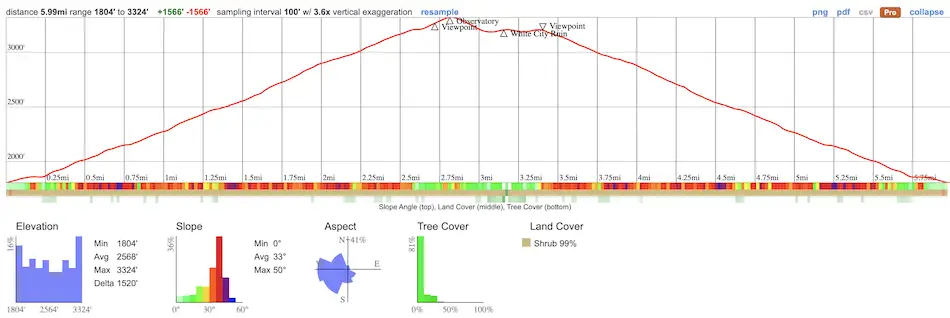
- Total Miles: 6 (includes 0.2 mile to falls viewpoint & observatory ruins)
- Time: 3 Hrs
- Difficulty: Moderate – Hard
- Best Season: All Year
- Elevation Gain: 1566 ft
- Max Elevation: 3324 ft
- Type of Trail: Out & Back
- Parking Lot: Street Parking
- Dogs: Allowed On A Leash
- Restrooms: Not Available
- Trail Popularity: Very High
- Pics Taken On: Dec 28, 2023
I love the Echo Mountain hike because of the fascinating history behind the ruins. Although the mountain park was once known as the eighth wonder of the world, Mother Nature has reduced it to a sad shadow of its former self.
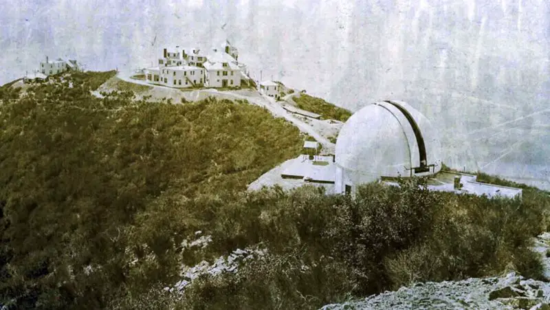
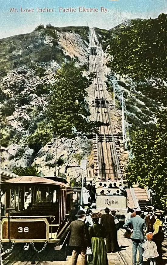
If it were possible for us to travel back in time to the turn of the 20th century, we’d find the “Railway In The Clouds,” electric trolleys that seemingly defied gravity, meandering up the mountain. Just as breathtaking was the Great Incline, a steep rail system that transported passengers 1500 feet up from Rubio Canyon to Echo Mountain, where the glamourous “White City” stood. This is the best footage I’ve found on the subject as it shows the railways, incline, and zoo.
I’ve given it my best effort to write this post not just as another hiking guide, but hopefully one that will leave you feeling more appreciation for our local history, and ultimately, mesmerized about the forgotten world that once existed in our backyard. I’ve added a bonus viewpoint to a secret waterfall that I know you’ll enjoy.
Want to explore abandoned bridges, 128 year old gold mines, and breathtaking waterfalls all within LA County? Check out the link below!
Echo Mountain Trail Map
Parking & Directions
To be redirected to the trailhead via Google Maps click the link here. No parking permit or fee is required.
Helpful Links
Echo Mountain Weather Forecast
Download White City Ruins Map (identifies Echo Mt structures)
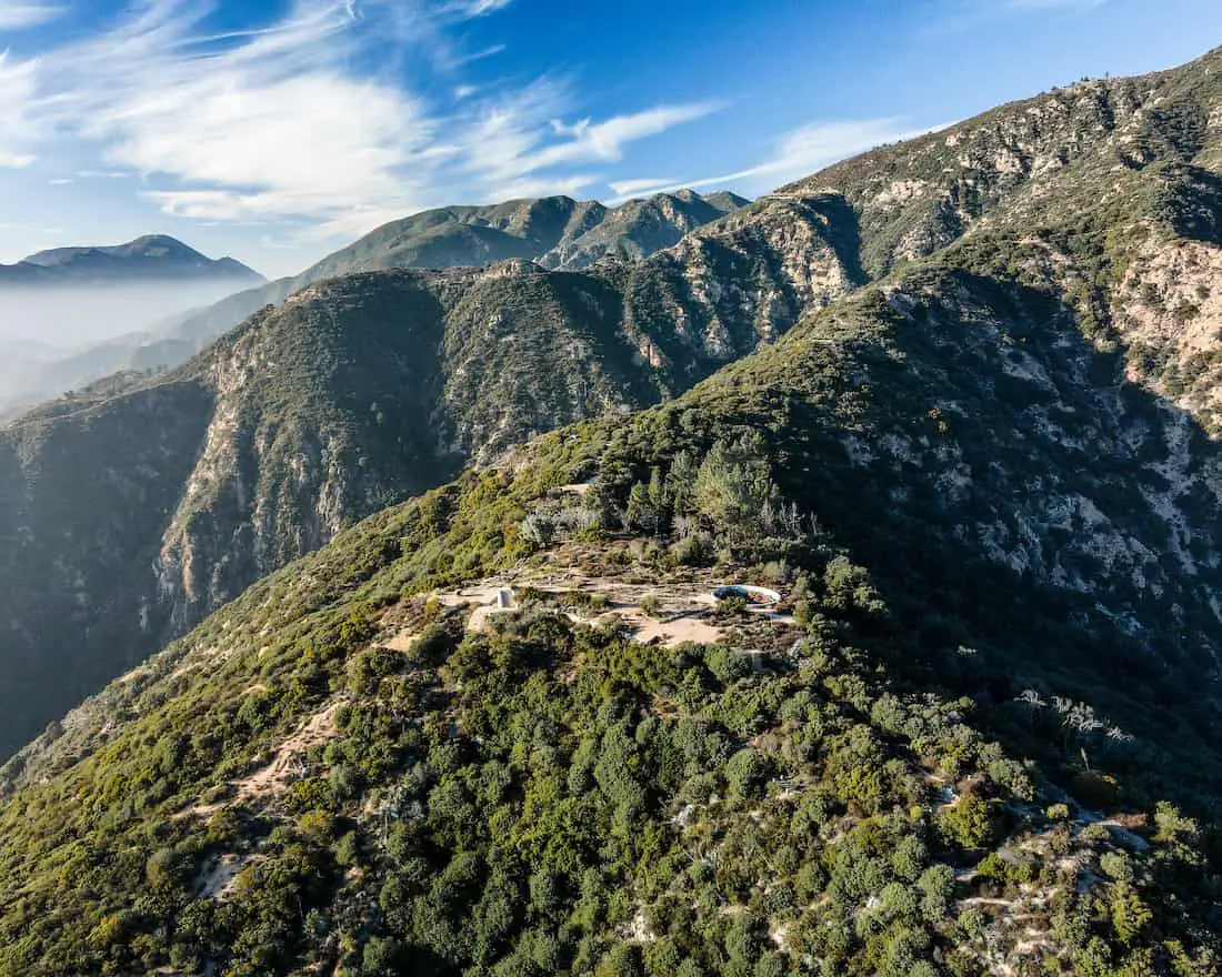
Hiking Echo Mountain
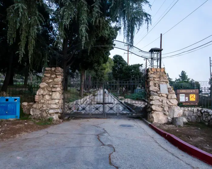
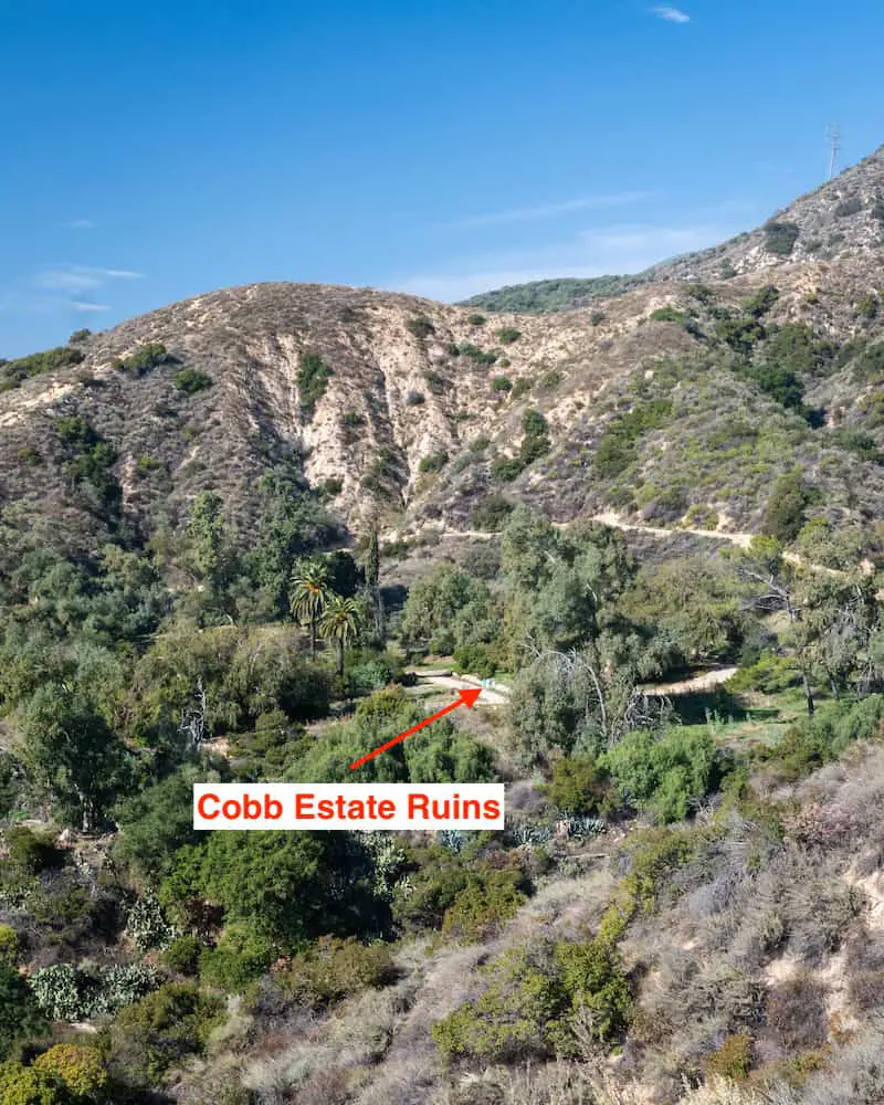
Starting the hike requires walking past the once elegant yet creepy-looking gate of the Cobb Estate. Although at least one dead body has been found in the area, the Cobb Estate was dubbed the name the Haunted Forest years before any murderous activity occurred.
I’m almost positive the gate and the ruins are the reason for its supernatural nickname, but I digress.
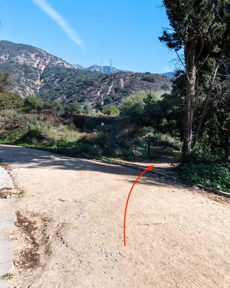
I hopped onto the Lower Sam Merrill Trail which split off to the right.
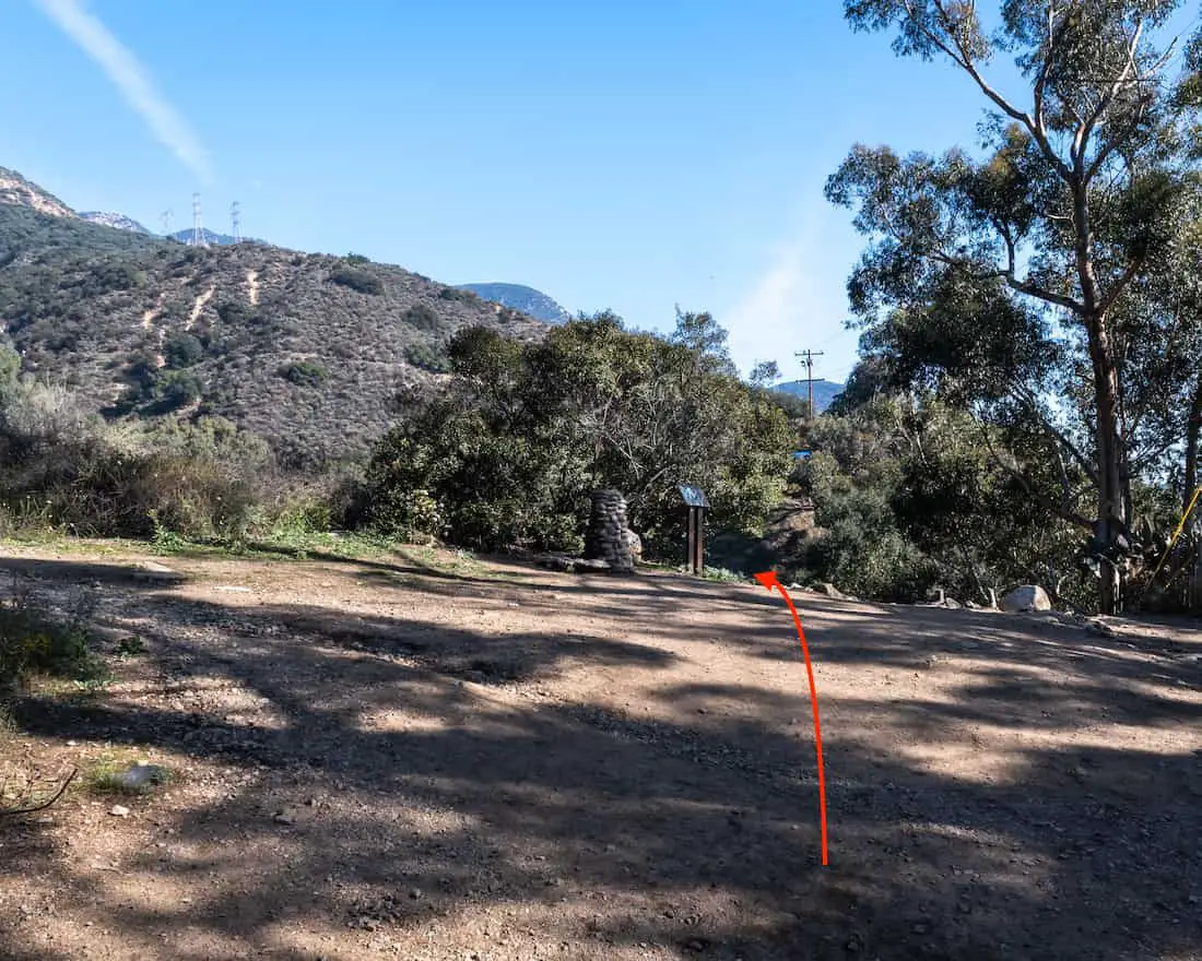
A water fountain is located right before descending to the canyon floor. Make sure to fill up your water bottles as there is no water at the top.
Also, I stayed on the trail to the left after passing the water fountain. This trail will traverse the creek bed and immediately begin ascending the east side of Las Flores Canyon.
Although I wasn’t able to see the Cobb Estate ruins from the ground, the mansion’s foundation was now evidently clear. The estate was built and belonged to lumbar magnate Charles Cobb and was part of Las Flores Ranch.
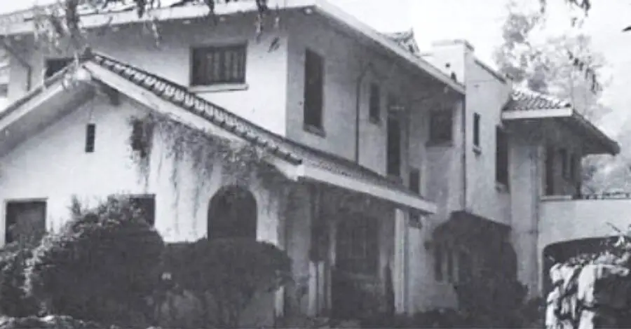
This is what the building looked like before vandalism left the Forest Reserve no choice but to tear it down.
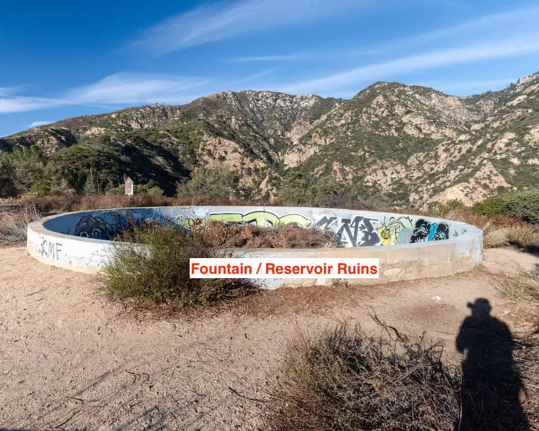
As I made my way further up the trail I could see the reservoir below.
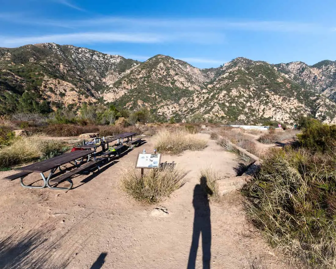
Benches are placed along the trail for those who wish to take a break with nice views.
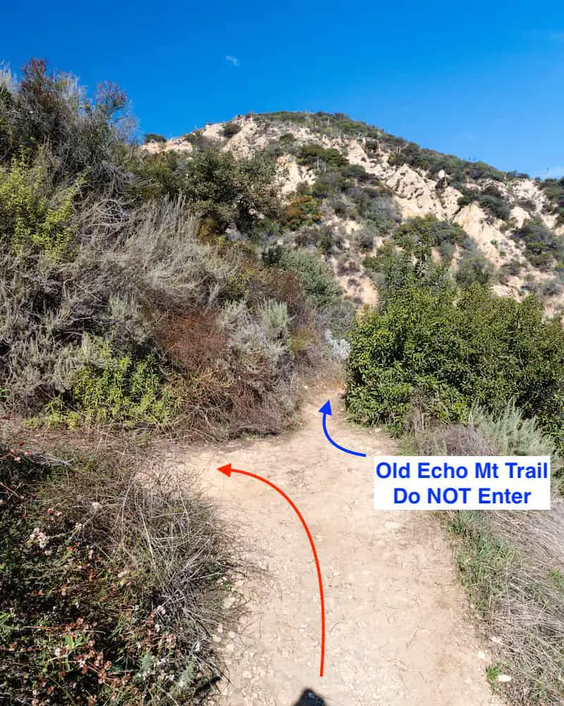
I came across a fork in the trail about halfway up the mountain. At first, I thought it was a footpath that hikers unintentionally create when they veer off the trail before realizing they’re heading in the wrong direction.
However, when I looked at my map I realized it was the Old Echo Mt Trail that leads down to Rubio Canyon and merges with the Rubio Canyon Trail. At a glance, it didn’t look too overgrown but I’m sure it got worse further down the hillside.
I took a break and admired the progress I had made thus far.
I made a right onto the Mt Lowe Railway Trail, which was the exact route used by the electric trolleys.
You know you’ve arrived at the top of the mountain when you see the tomb-looking markers scattered throughout the area. I believe those markers have been there since the founding of the railway.
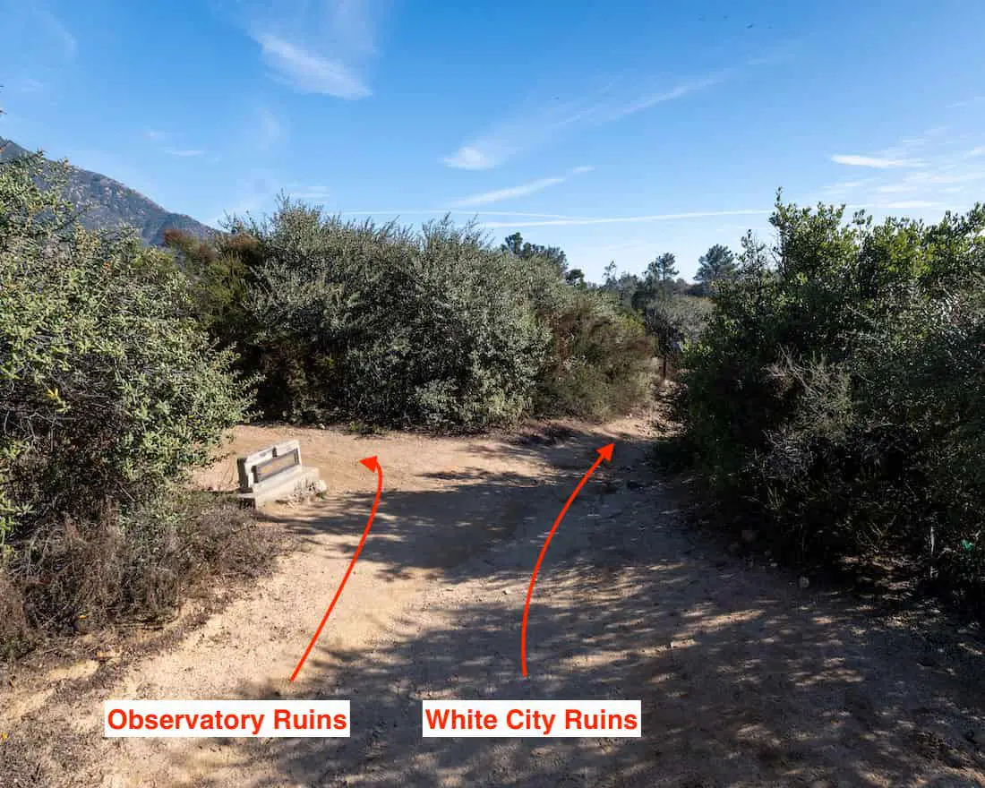
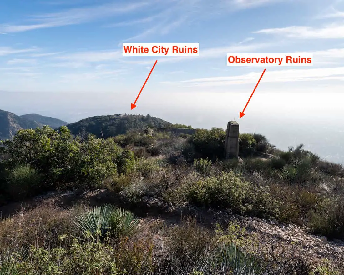
This is where the observatory detour begins. It’s only 0.2 miles roundtrip via the Middle Sam Merrill Trail and includes the seasonal waterfall and the Mt Lowe Observatory ruins. If you want to skip the detour head straight towards the White City ruins.
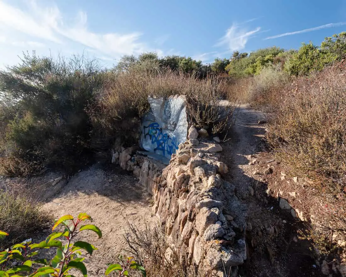
Before arriving at the observatory, I randomly stopped at the sign shown below. I had no idea that a 50-foot waterfall could be seen across Rubio Canyon. It was pure chance and luck.
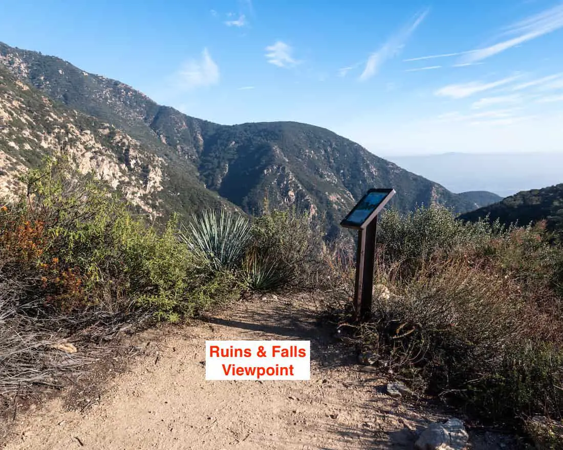
Look for a v-shaped gulch to the south of the canyon. This is where the barely visible waterfall is located. Please keep in mind the waterfall will more than likely be dry from summer to winter unless we’ve had a very wet winter as was the case for 2023.
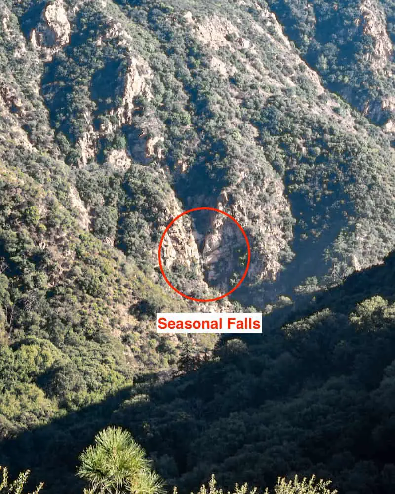
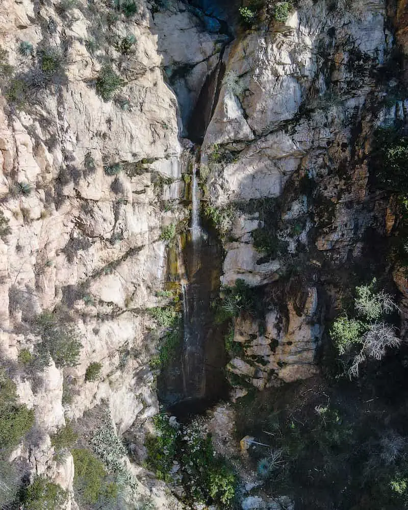
I wasted no time in flying the drone to grab a closer shot. This is the mystery falls. Notice the smaller tier at the top.
If you like waterfall hikes, check out Eaton Canyon Falls. It’s the most popular waterfall in all of Southern California, only a few minutes away from Echo Mt, and likely has more water than this seasonal falls.
I hiked further up the trail than was necessary as I wanted to take a shot resembling the vintage photo of the Mt Lowe Observatory and White City ruins.
I retraced my steps down Middle Sam Merrill and made a left to hop on the Mt Lowe Railway Trail once again.
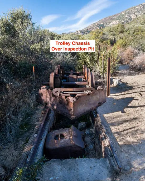
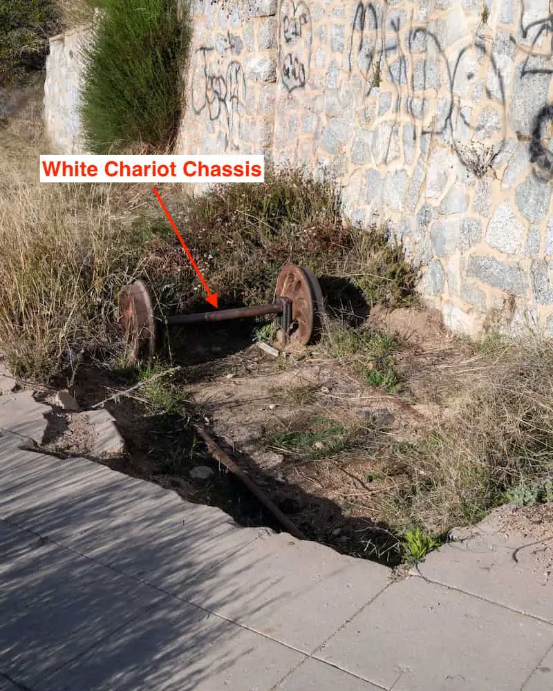
Shortly afterward I came across one of the electric trolley chassis indefinitely parked over the inspection pit, the area where I believe mechanics would service the vehicles.
Here is a photo of what the first trolleys looked like. Eventually, the trolleys were built with a roof that covered the entire vehicle.
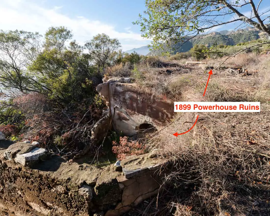
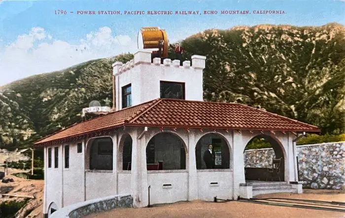
Moving forward, I arrived at the ruins of both powerhouses. The first was built in 1895 and the second, which was smaller and made of concrete, was built in 1899.
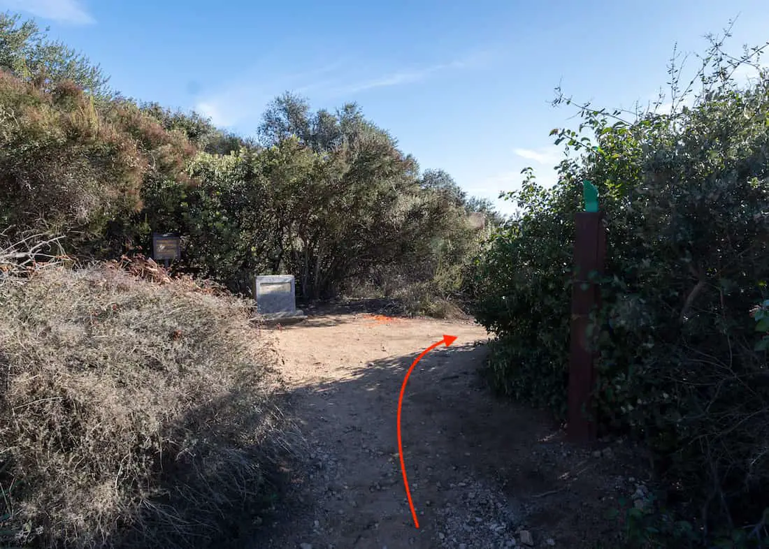
A signed marker (can’t be seen in the image below) identifies the ruins. The foundation to the left of the sign is the newer powerhouse while the older powerhouse, whose ruins can’t be seen in the image below, is located on the right.
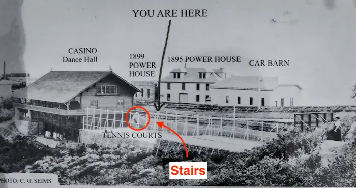
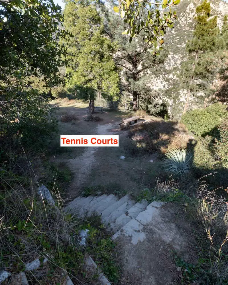
Next was the picnic area, dance hall, and tennis courts, which can be accessed by walking down the stairs to the left of the sign shown below. These same stairs are the labeled stairs in the vintage photo above.
Nothing is left of these structures. Hence, I took a picture of what used to be the tennis courts and kept it moving.
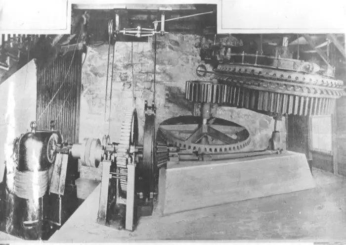
Although the bull wheel sits in the middle of the trail, it was once housed in the powerhouses and powered by a 75-horsepower electric motor.
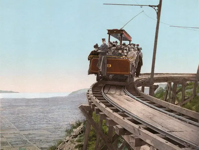
It was used to pull opera box cars known as the White Chariots up the steep Incline, a cable funicular railway, from the bottom of Rubio Canyon.
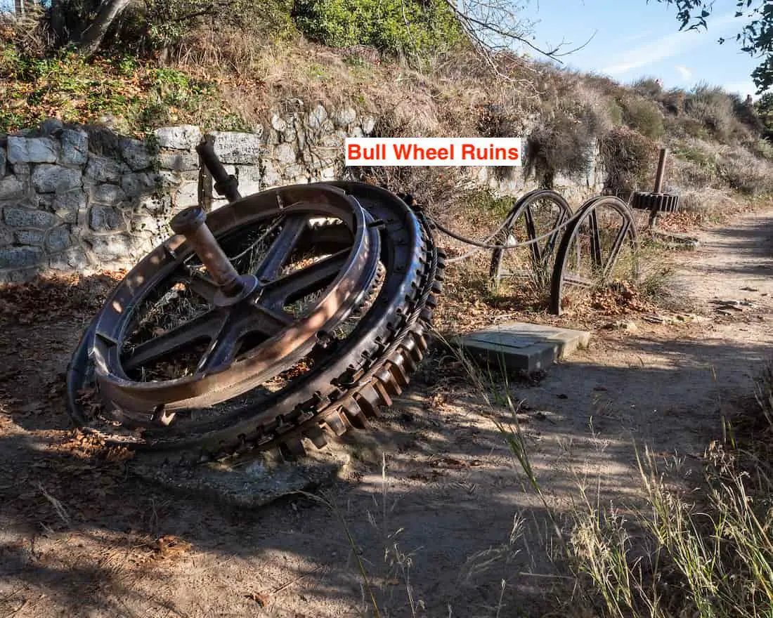
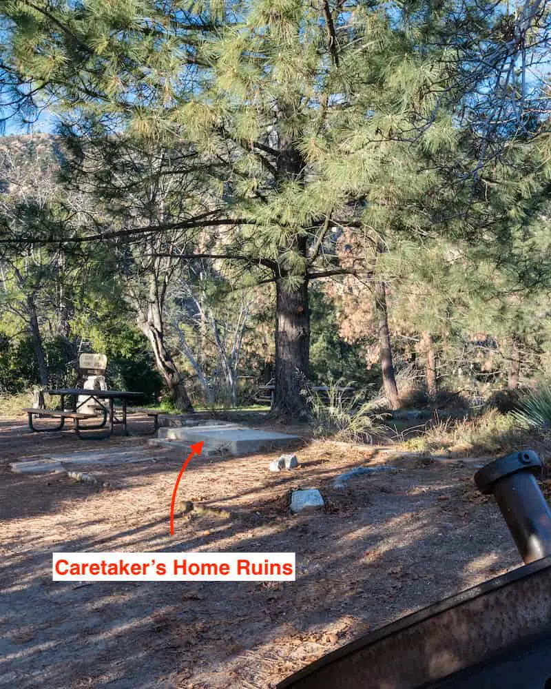
To the left of the bull wheel is the foundation of the caretaker’s home, which I imagine was the person who lived on the premises.
Pictured below is the area where the White Chariots would drop the passengers off after being pulled up from the Rubio Pavilion in the canyon below.
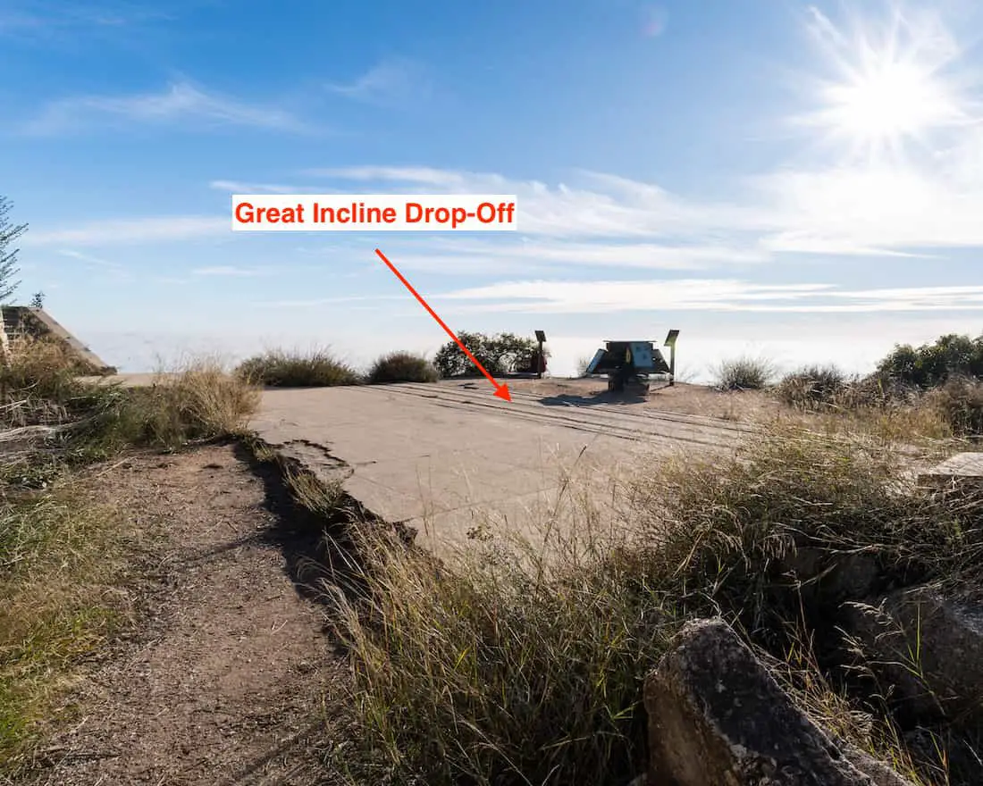
Passengers would take a train ride from nearby towns to the Rubio Pavilion in Rubio Canyon where they would transfer from the trolley to the White Chariots and head directly up to the White City.
Once on Echo Mountain, visitors would hang out at the White City or board the Mt Lowe Railway and get dropped off at Ye Alpine Tavern, the fourth and last of Professor Lowe’s hotels.
I’m almost certain the chassis below belongs to one of the White Chariots.
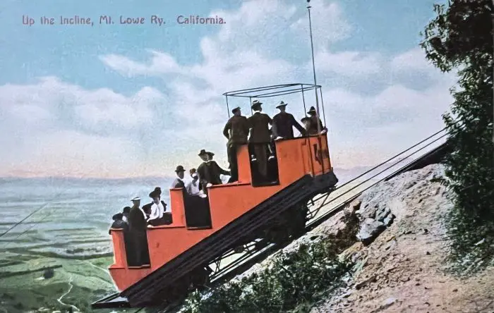
Fun Fact: The White Chariots were, as you probably already guessed, white! However, I purchased the photo below because I believe it was mistakenly colored red. Before 1939, photos were all in black and white, but they could be manually colored after printing. This is the first of multiple mistakes I’ve observed.
Located at the end of the Incline path is the Cable House that ran the operations for pulling the White Chariots up the mountain.
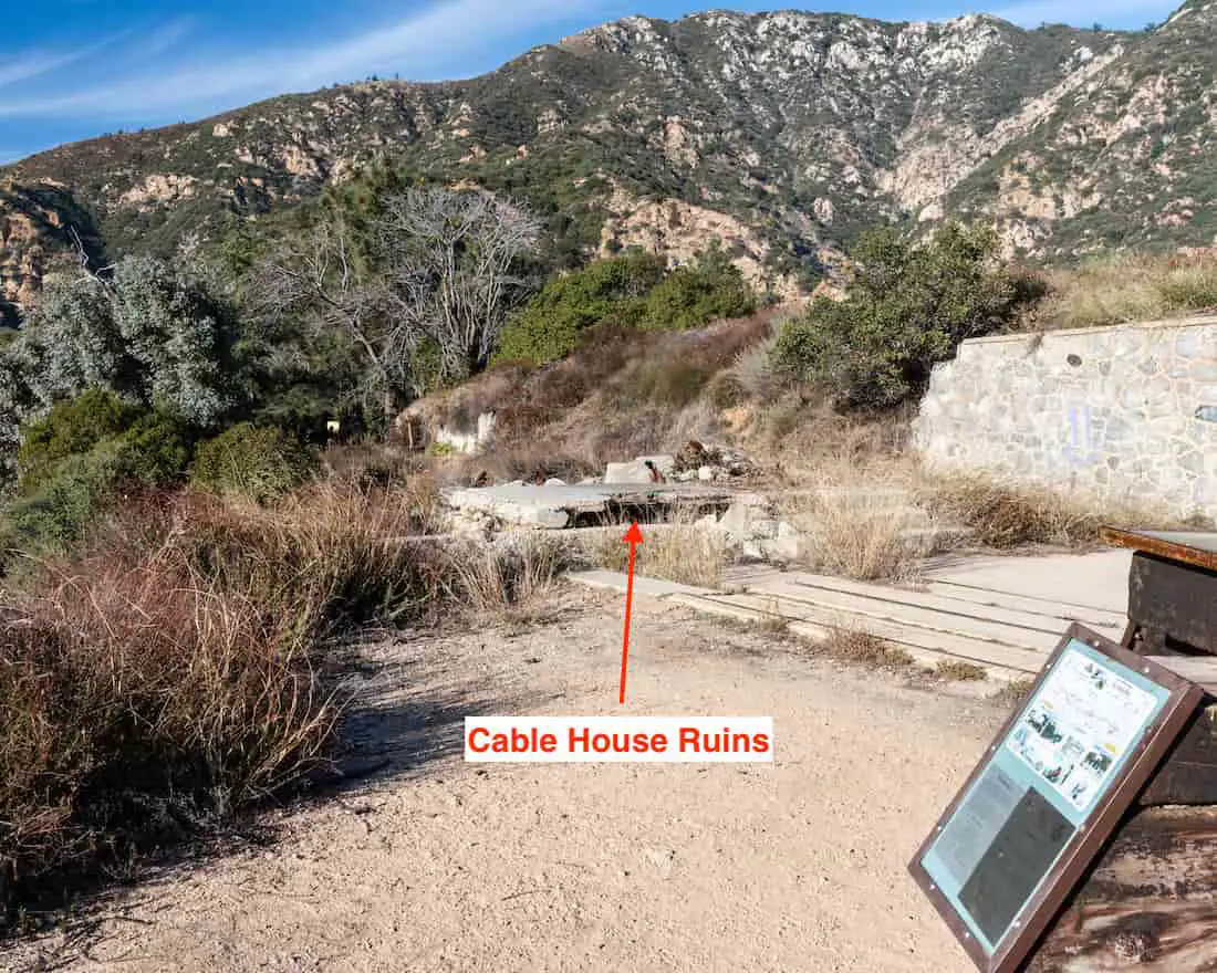
Here is the second mistake in another one of my photos. The Cable House, shown in the image below, is incorrectly labeled the power station, but that’s not possible, as we’ve already identified the powerhouses.
Mounted on top of the Cable House was the Mt Lowe Searchlight which was visible as far away as 60 miles in Catalina Island.
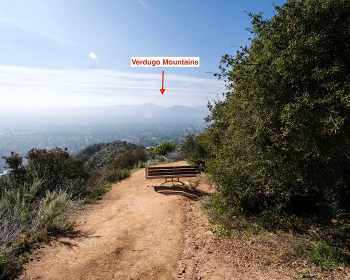
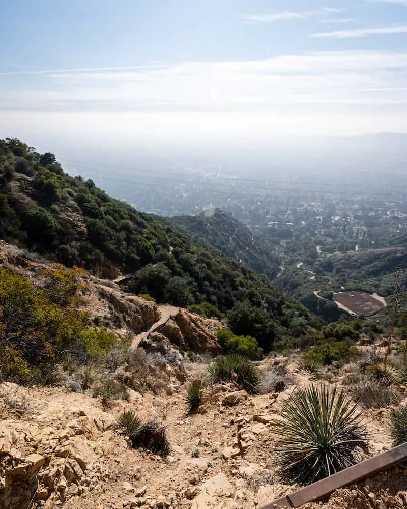
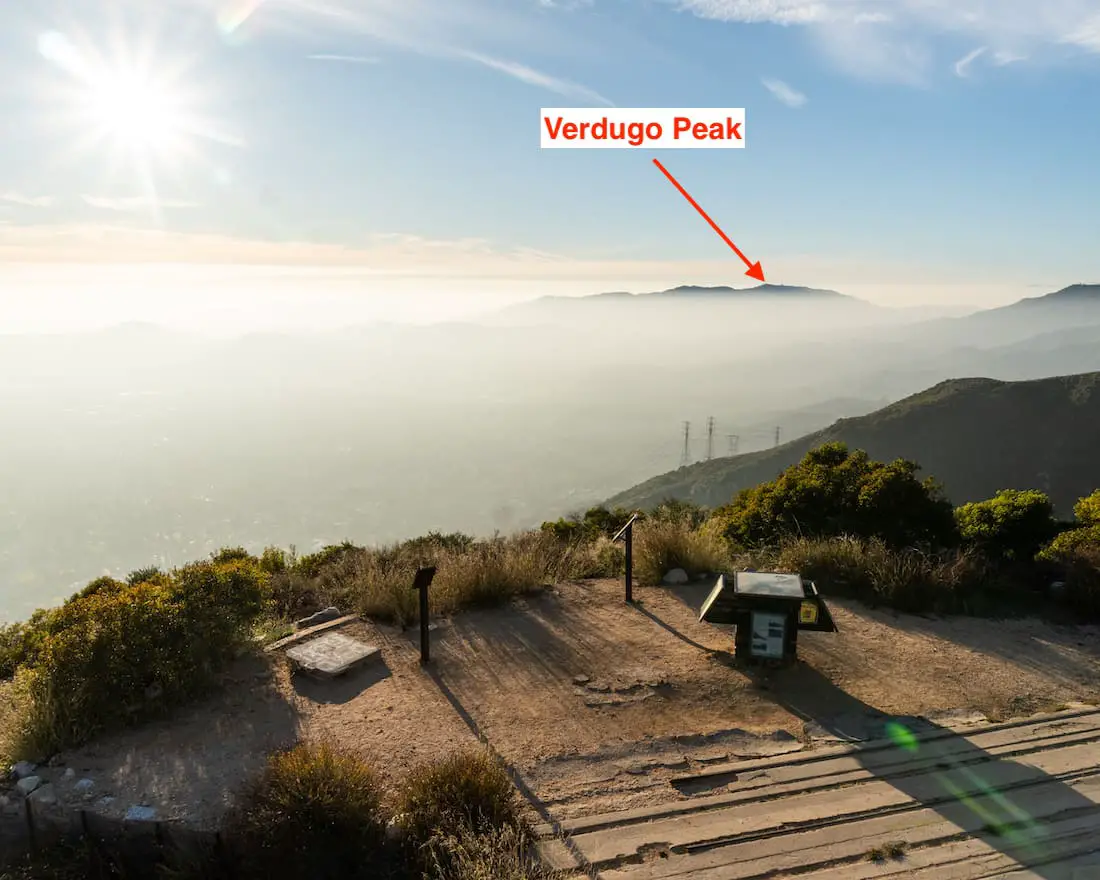
I walked up the Echo Mt House stairs to “walk inside,” but before doing so I turned around to check out the view. Unfortunately, the smog was really bad but I was still able to make out the Verdugo Mts and, on the opposite end of the valley, the Santa Ana Mts.
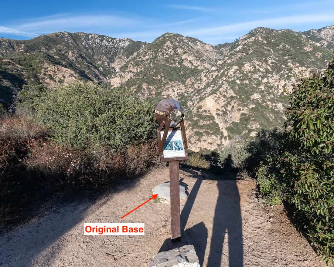
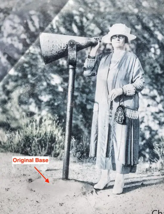
I turned my attention back to the “inside” of the Echo Mt House, also known as the Echo Mt Hotel, in search of the famous Echo Phones.
Don’t be alarmed if you hear people constantly screaming at the ruins. The Echo Phone bounces your voice back from the headwaters of Rubio Canyon hundreds of feet away. It’s quite impressive to say the least, and fun to try.
Fun Fact: The Echo Phone’s original base is located just a few feet away from the current site.
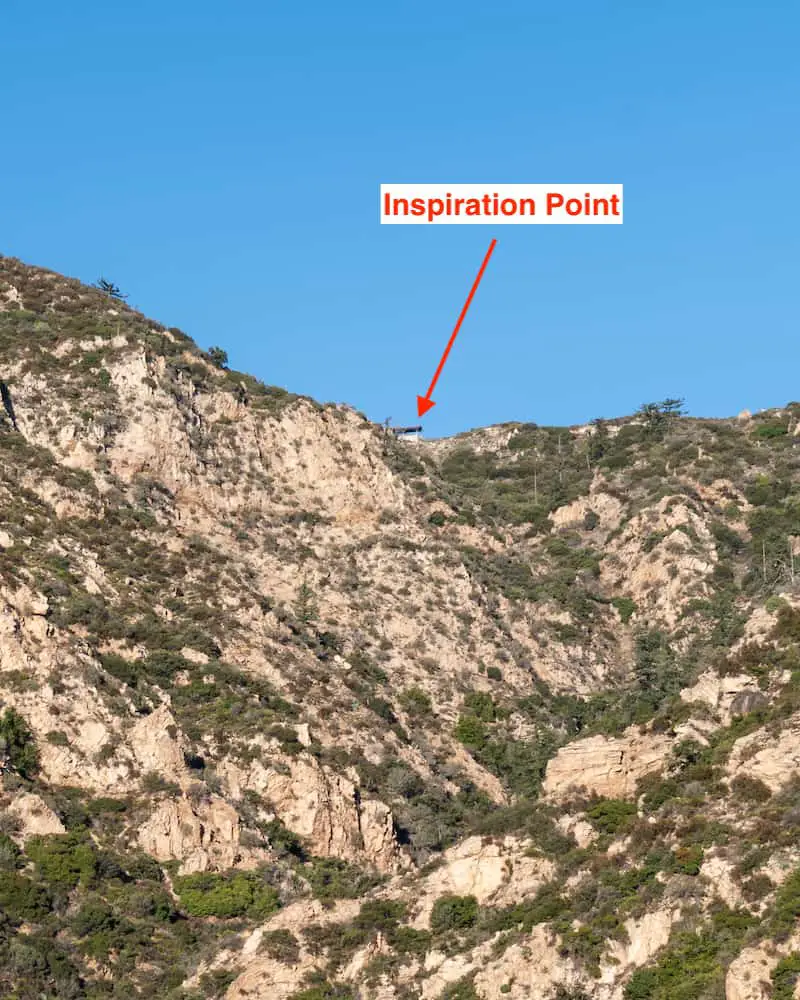
Inspiration Point, a pavilion-type shelter that offers amazing views of specific locations in the valley, can be seen perched on the ridge above.
I explored the south side of the Echo Mt House where the Chalet building once stood and came across this bench. An outdoor water fountain was located here as well.
The complex known as the White City is probably the largest, and surely, the most interesting of all SoCal ruins. Imagine what the shot below would look like if all the structures were still in operation. What an era to be alive.
Hold on! The adventure doesn’t have to end here. Check out the largest mine in the Angeles National Forest. It’s got over 2 miles of tunnels and the structure at the mine entrance is still there. Click the link below for more info.
FAQs
How Long Is The Echo Mountain Hike?
The Echo Mountain hike is a total of 6 miles via the Sam Merrill Trail and includes a 0.2 mile detour to the secret waterfall viewpoint and observatory.
How Hard Is It To Hike Echo Mountain?
The Echo Mt hike is rated moderate to hard, as the trail is very exposed and has an elevation gain that beginners may find challenging.
Does The Secret Waterfall Flow Year-Round?
The secret waterfall only flows after heavy rain or a really wet winter, such as the one we had in 2023.
What Happened To Echo Mountain?
Multiple brush fires between 1906 and 1936, and a flood in 1909 took a toll on the structures, forcing them to close over time. The railway’s last trip was on December 1937.
Can I Hike To Inspiration Point From Echo Mountain?
After arriving at the Echo Mt ruins, Inspiration Point can be reached via the Middle Sam Merrill or Castle Canyon Trails, or by combining both to create a loop.
Can I Hike Down To Rubio Canyon From Echo Mountain?
Rubio Canyon can be accessed from Echo Mt via the Incline Railway Trail which begins on the south side of the White City Ruins or via the Old Echo Mt Trail that branches away from Lower Sam Merrill about halfway up the mountain. Please note, both trails may be overgrown. Especially, the Incline Railway Trail.
Why Are Ruins Located At Echo Mountain?
Echo Mt is home to many ruins because Professor Thaddeus Lowe, a brilliant mind and inventor, created a ” mountain theme park” in 1893, the primary attractions of which included the Mt Lowe Railway, Great Incline, Echo Mt House, casino, tennis courts, zoo, and observatory to name a few.
Is Echo Mountain Well Shaded?
Echo Mountain is very poorly shaded. Be sure to take a hat, sunglasses, sun block, and 1.5 to 2 liters of water.
Does Echo Mountain Offer Nice Views?
Echo Mountain offers amazing views of the Verdugo Mountains, San Gabriel Valley, Rolling Hills at Palos Verdes, Pacific Ocean, and the Santa Ana Mts.
Recommended Gear
The following links are Amazon affiliated. I receive a small commission every time someone makes a purchase via these links, allowing me to continue making this kind of content. I only recommend gear I personally own and use.
Merrell Men’s Moab 2 Hiking Boot
Merrell Women’s Moab 2 Hiking Boot


