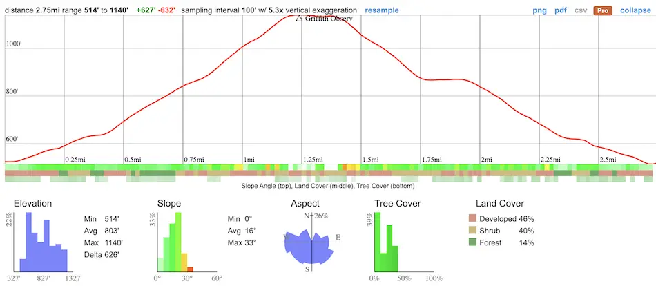
- Total Miles: 2.75
- Time: 1-1.5 Hrs
- Difficulty: Easy – Moderate
- Best Season: All Year
- Elevation Gain: 632 ft
- Max Elevation: 1140 ft
- Type of Trail: Loop
- Parking Lot: Street Parking
- Dogs: Allowed On A Leash
- Restrooms: Available At The Observatory
- Trail Popularity: Very High
- Pics Taken On: Jan 16, 2024
This hike combines two trails to get the best of both worlds. First is the virtually flat Ferndell Nature Trail, a tropical oasis that couldn’t be anymore different from the rest of Griffith Park. The luscious trail is shaded by dense foliage which resembles an arboretum and runs adjacent to a flowing creek. The second is the Observatory Loop, a sunny dirt road that leads up to the Griffith Observatory and is comprised of three parts; east, west, and the third which doesn’t contain a cardinal direction.
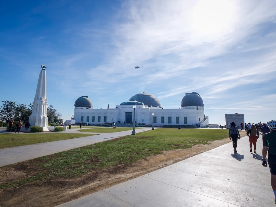
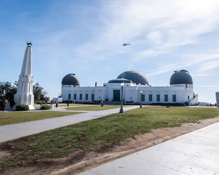
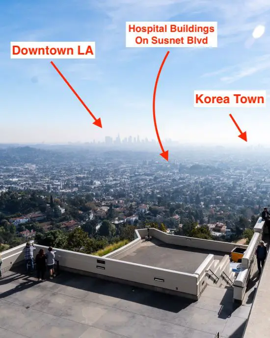
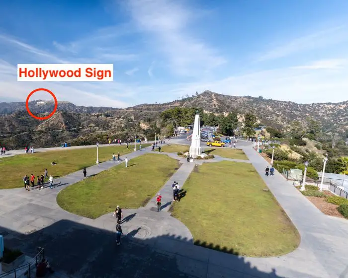
The hike ends at the world-famous Griffith Observatory, whose outside perimeters can be explored almost any day of the year. Although visibility was horrible during my visit, I was nevertheless able to spot Downtown LA, Korea Town, Hollywood, and Santa Monica to the south. To the north, the Hollywood Sign sits precipitously on dry rolling hills while the San Bernardinos flaunt their full view as far as Mt Gorgonio, assuming the smog allows it. The Pacific Ocean can also be seen on a clear day.
Want to explore century-old ruins, huge waterfalls, and abandoned places in LA County? Click the link below.
Ferndell To Observatory Trail Map
Parking & Directions
To be redirected to the Ferndell Nature Trailhead via Google Maps, click the link here.
Expect large crowds and difficulty parking every weekend.
Helpful Links
Ferndell Nature Trail Weather Forecast
Griffith Park Additional Info & Maps
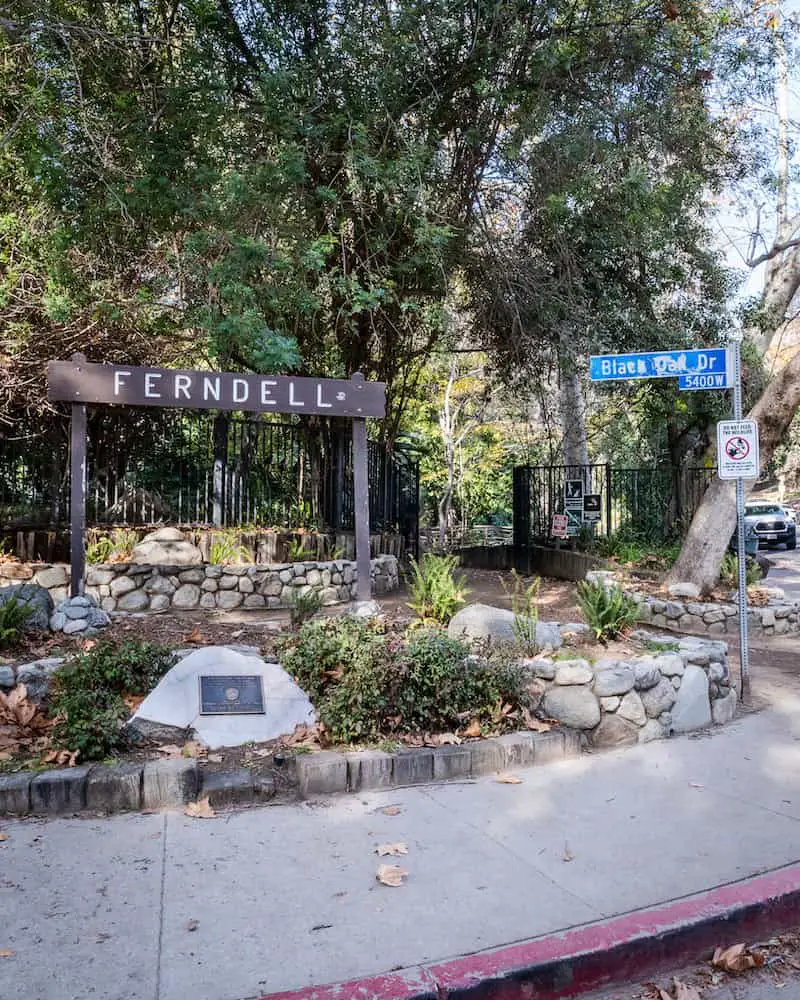
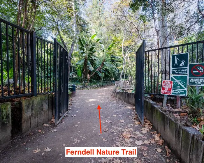
Ferndell Nature Trail
The Ferndell trailhead is located at the intersection of Ferndell Dr and Black Oak Dr. in Western Canyon.
Fun Fact: The native Tongva people called the canyon “Mokawee’nga.” They used it as a gathering spot for councils and found it so pleasing that a village was built at the canyon entrance.
A black gate encompasses the Ferndell Nature Museum, the scenic section of the trail containing the creek and plants, some of which include ferns, orchids, and elephant ear.
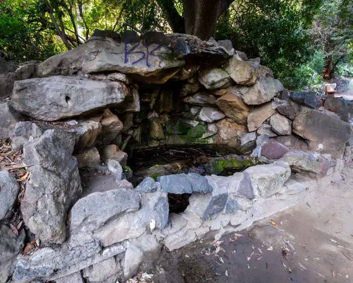
It’s no exaggeration to say the the museum resembles the gardens at the Hunting Library. The city went above and beyond by building a rocky grotto and waterfall alongside the creek.
The luscious greenery retains its vibrancy year-round thanks to the constant supply of water from a nearby natural spring formerly known as the “fountain of youth,” a name attributed by 19th century American settlers who believed that mild climate and certain springs, especially hot springs, had the power to improve one’s health.
Ironically, the water source became contaminated, and a deeper well with pipes and faucets was dug to facilitate public use.
Below is the rocky grotto. Unfortunately, the black gate is not enough to deter all vandals.
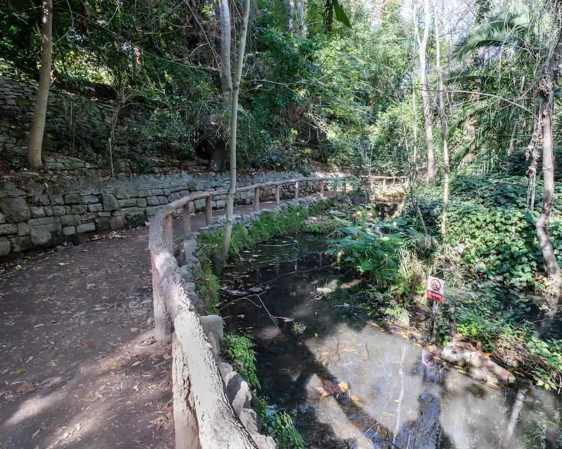
This bend is located alongside a small pond containing koi, goldfish, turtles, frogs, and crayfish. Fishing is prohibited.
Benches have been placed throughout the museum, should you want to take a peaceful break. A young man who was reading on a bench made me wish I had one of my favorite reads with me, Fingerprints Of The Gods, for a relaxing session. Maybe next time.
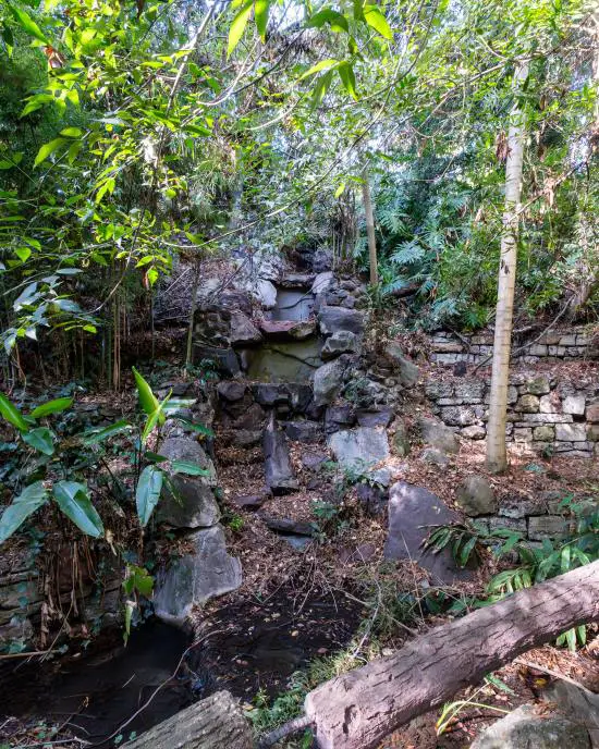
Here is the manmade waterfall.
I took the path to the right at the fork to walk over the bridge and through the black gate. Thus, completing the Ferndell Trail.
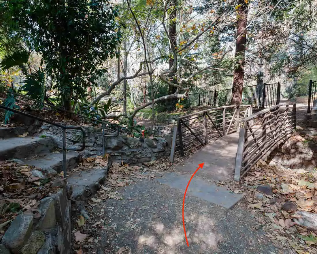
The abundant vegetation came to an abrupt end and I found myself at a picnic area that’s shaded by a grove of tall redwoods. Restrooms and a water fountain are available here.
For those who don’t mind taking a short detour to grab a meal, “The Trails Cafe” is located across the road. However, I avoided the cafe and pressed on towards my destination.
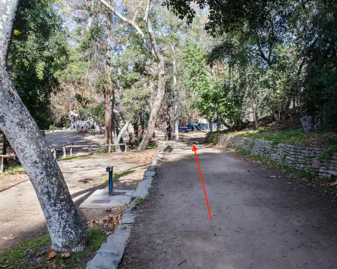
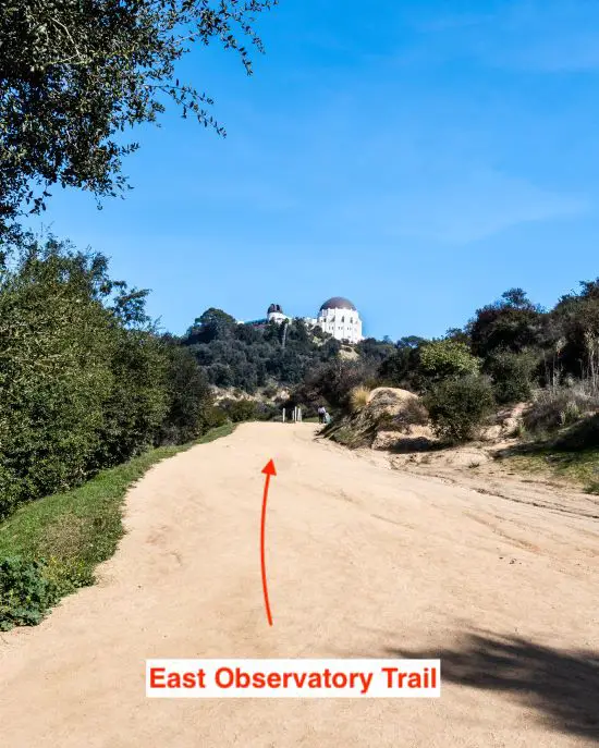
East Observatory Trail
After hiking through the picnic area, I hopped onto the East Observatory Trail, a sunny dirt road with nice views of the Griffith Observatory, to begin the loop.
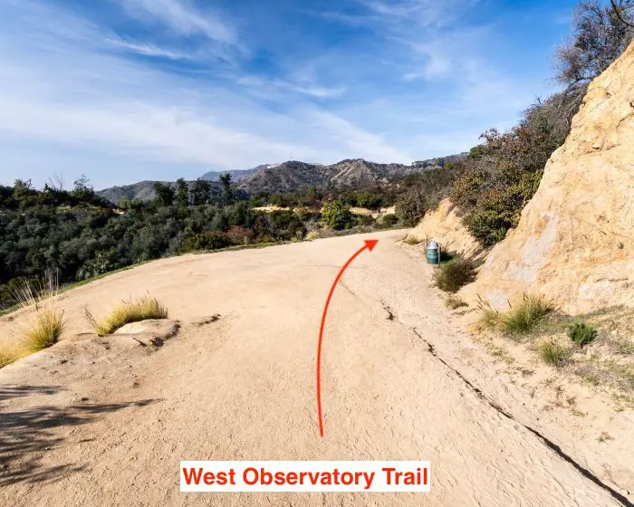
Technically, it is possible to begin the loop via the west trail, which offers better views of the Hollywood Sign, but is steeper than the east side.
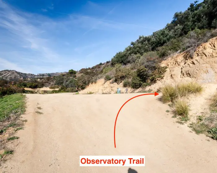
Observatory Trail
I made a right at the next fork to hop onto the Observatory Trail. This section of the trail is undoubtedly the steepest part of the hike, so take your time.
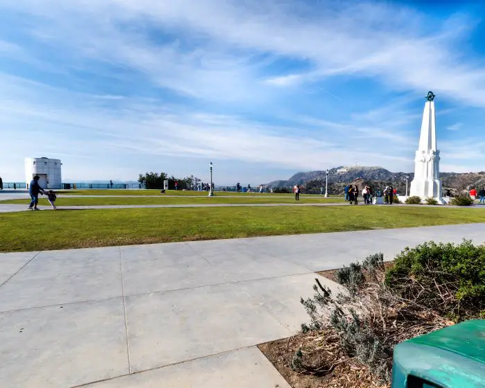
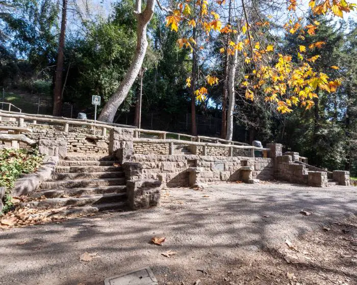
Arriving At The Griffith Observatory
The trail ended on the east side of the lawn, and I wasted no time walking to the opposite side in order to enjoy better views.
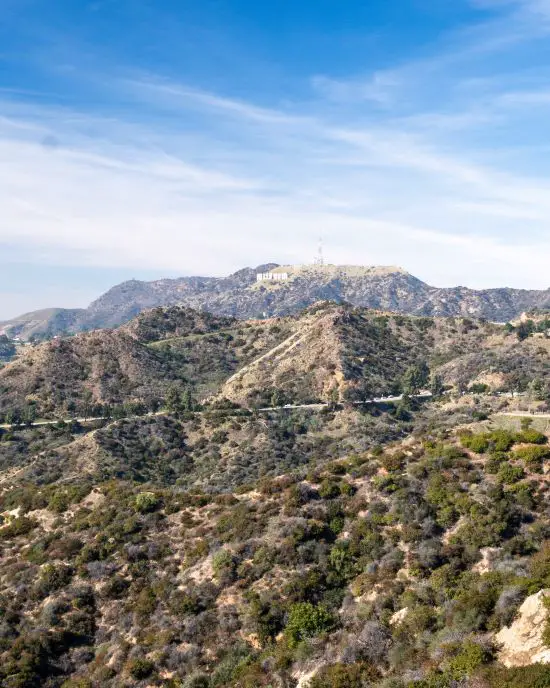
Behind me was the renowned Hollywood Sign sitting precipitously on the hillside. It may not look like it from far away, but each letter is a whopping fifty feet high.
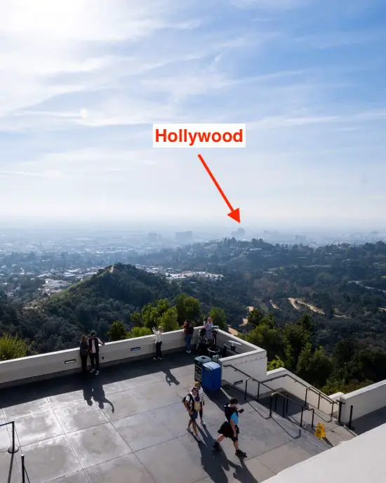
Afterward, I climbed the staircase on the east side of the observatory, which leads to the roof, to get the best views of the city. Unfortunately, the smog was pretty bad during my visit.
To the north, I had a nice view of the lawn and the chaparral-covered hills.
The sunset strip in Hollywood and the tall buildings in Santa Monica are visible from the west side of the roof.
Returning Via Observatory & W. Observatory Trails
When I finished taking all my shots, I returned the same way by hiking down the Observatory Trail.
Instead of making a left at the fork to continue retracing my steps via the east side of the loop, I descended via the W. Observatory Trail to the right at the fork until its end at the previously mentioned picnic area.
I traversed the picnic area once again.
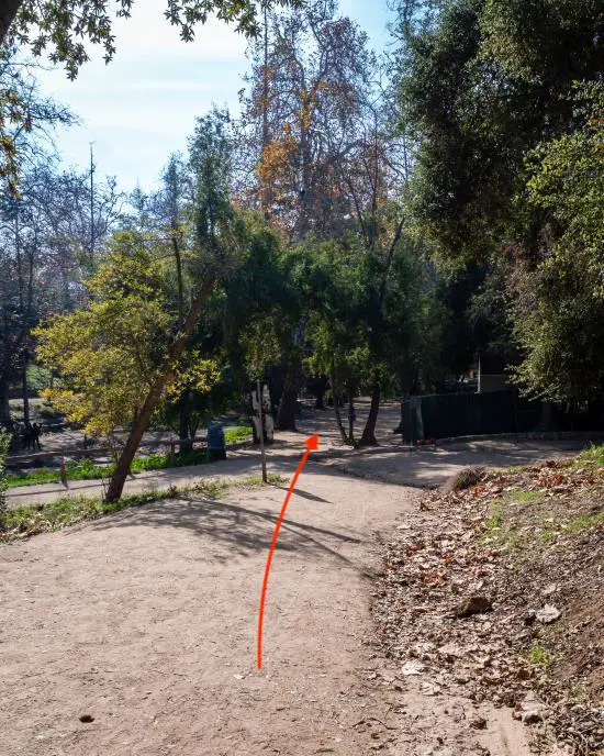
I found myself at the museum’s black gates again, but didn’t walk through them. Instead, I took the fork’s left side.
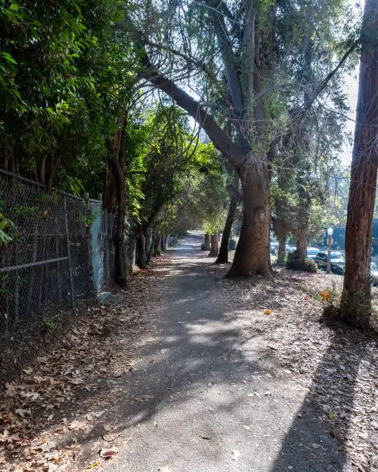
This was the last section of the hike which consisted of a sidewalk meandering through more beautiful redwoods and eucalyptus trees.

A very rustic-looking memorial shaded by tall pine trees caught my attention. Benches can be found here, making it more than ideal for a break.
The sidewalk runs alongside Fern Dell Dr. where I happened to be parked. Hence, I concluded the hike when I arrived back at my truck.
Hold on a second! This hike is very short, which is why I combine it with another hike in Griffith Park located only five minutes away. The hike ends at Vista Viewpoint and overlooks LA County.
Click the link to check it out: Riverside Trail to Vista Viewpoint.
FAQs
How Long Is Ferndell Trail?
Excluding the trails leading up to the observatory, Ferndell Nature Trail is an easy 0.5 miles.
How Long Is The Hike Up To The Observatory?
The hike up to the observatory includes both the Ferndell Trail and Observatory Loop, and is a total of 2.75 miles.
Where Can I Park To Hike Ferndell Nature Trail?
Street parking is available on Fern Dell Dr, which happens to run parallel to the trail.
Is Ferndell Trail Stroller Friendly?
The Ferndell Nature Trail is stroller friendly. Strollers are manageable for the observatory loop (second half of the hike) as the entire hike consists of a dirt road, but the steep incline may not be feasible for some people.
Does Ferndell Nature Trail Get Crowded?
This hike is extremely popular. Expect large crowds every weekend, and average foot traffic during the week.