
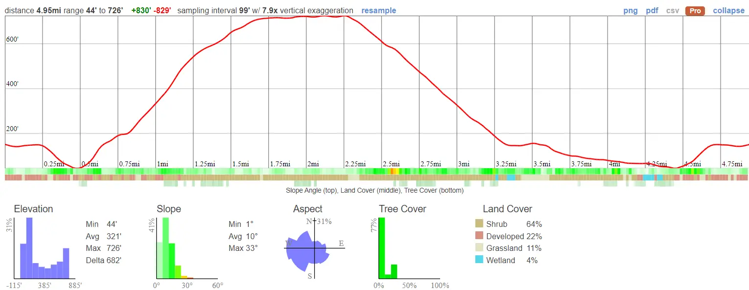
- Total Miles: 4.95
- Time: 2-2.5 Hrs
- Difficulty: Moderate – Hard
- Best Season: All Year
- Elevation Gain: 829 ft
- Max Elevation: 726 ft
- Type of Trail: Loop
- Parking Lot: Fits ≈ 50 Cars ($15 Fee To Park)
- Dogs: Not Allowed
- Restrooms: Available At The Parking Lot
- Trail Popularity: Very High
- Pics Taken On: Dec 24, 2023
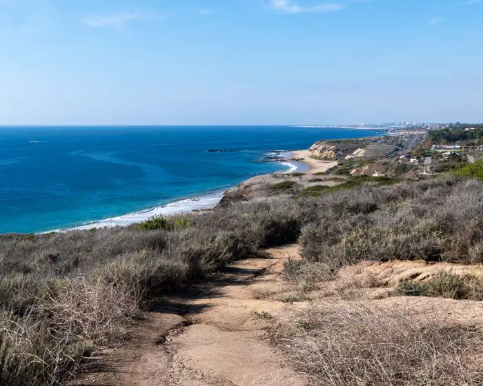
Located in Crystal Cove State Park, El Moro Canyon Loop Trail is a sunny and popular hike with a temperate climate, at least when compared to the mountains. The trail begins at the parking lot near the visitor center and loops up the south side of the canyon through an abundant and native coastal sagebrush. The Santa Ana Mountains are visible from the ridge. Lastly, I dropped back down to the canyon floor to complete the last stretch of the loop.
Would you like to explore 1940’s car ruins, a cave used by bandits in the 1800s, and beautiful waterfalls in Orange County? Check out the list below!
El Moro Canyon Loop Trail Map
Parking & Directions
A parking fee of $15 required, and can be paid for at the nature center (located at the parking lot)
To be redirected to El Moro Canyon Loop Trailhead via Google Maps click the link here.
Helpful Links / Info
El Moro Canyon Weather Forecast
Crystal Cove Activity Adventures E-Book (highly recommend for kids)
Hours: 6:00 am To Sunset
Trails in Crystal Cove are subject to temporarily close if rain creates muddy conditions. You can check the trail’s status by calling the number below.
Phone Number: (949) 494-3539
Hiking El Moro Canyon Loop
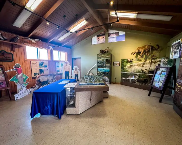
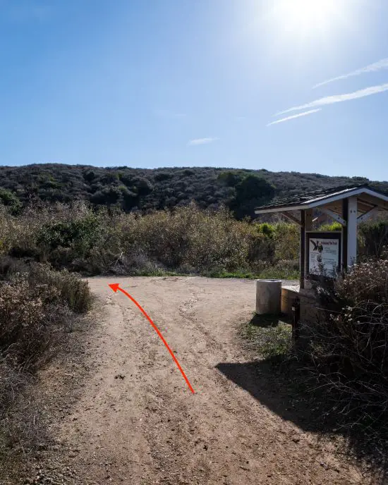
I passed by the visitor center before hopping on the trailhead, as curiosity had gotten the best of me. I highly recommend you do so as well. They have neat-looking replicas of the surrounding area and a lot of helpful info regarding Crystal Cove’s plants and wildlife.
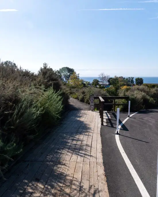
The trailhead is located on the south side of the parking lot. If you’re having trouble finding it, simply look for and follow the wooden sidewalk towards the ocean and you’ll eventually get to it.
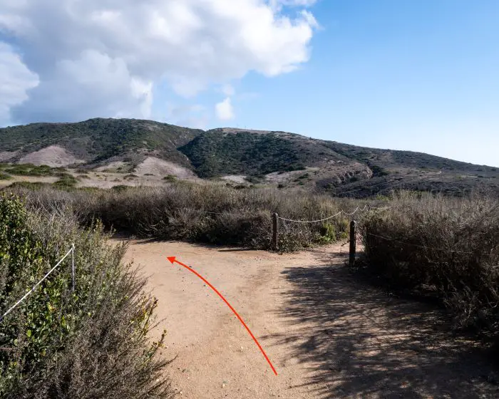
The first trail is called Moro Canyon Trail. Most of the trails in the loop have very similar names. Be extra careful not to confuse them and end up in the wrong place.
The first part of the trail ran adjacent to the RV campgrounds via a dirt path. Remember to stay on the trail if you want to avoid ticks, rattlesnakes, poison oak, and cactuses.
Although e-bikes aren’t allowed in the park, regular bikes are, so be on the lookout for speedy cyclists, especially if you’re hiking uphill and they’re riding down.
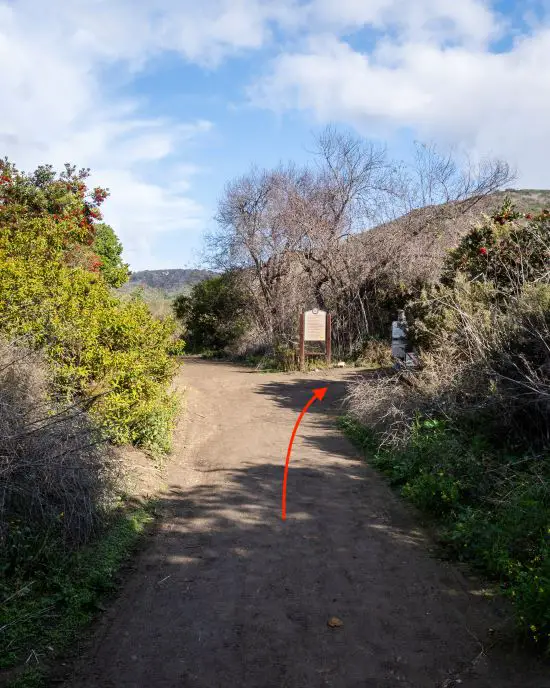
A sign reminding hikers to stay safe in the backcountry was located at the second fork. Remember that mountain lions are native predators in Crystal Cove, and although they’re highly unlikely to attack, you should know exactly what to do just in case the situation arises.
Make yourself look bigger by waving your arms up in the air, screaming at the lion while facing its direction, and, if you have kids, put them on your shoulders to make yourself look even larger. NEVER run away. Their instinct is to chase anything that runs.
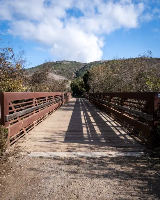
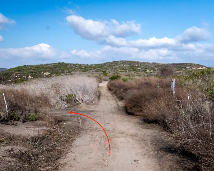
Immediately after making a left at the fork in the image above, I crossed the large bridge located over Moro Canyon Creek.
The next fork (shown below) will determine the direction of your loop. I chose the trail to the right known as B.F.I. to enjoy the ocean views sooner and hike counterclockwise.
Hiking the loop in a clockwise direction results in a steeper climb, but if you’re all for it don’t let me stop you.
The B.F.I. trail is short, sunny, and the beginning of the climb. It ends rather quickly at the intersection with Moro Ridge Rd (called the Moro Ridge Spur on All Trails and Topo Maps), the route on which I continued my ascend.
However, I looked behind me right before hopping onto the Moro Ridge Rd and enjoyed some of the loop’s best views.
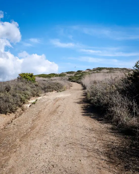
The first part of the Moro Ridge Rd is the steepest section of the hike, but it is still doable for the average person.
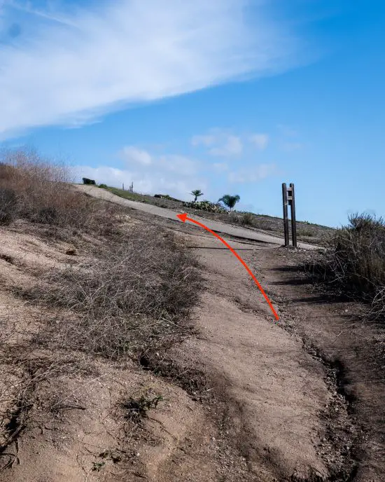
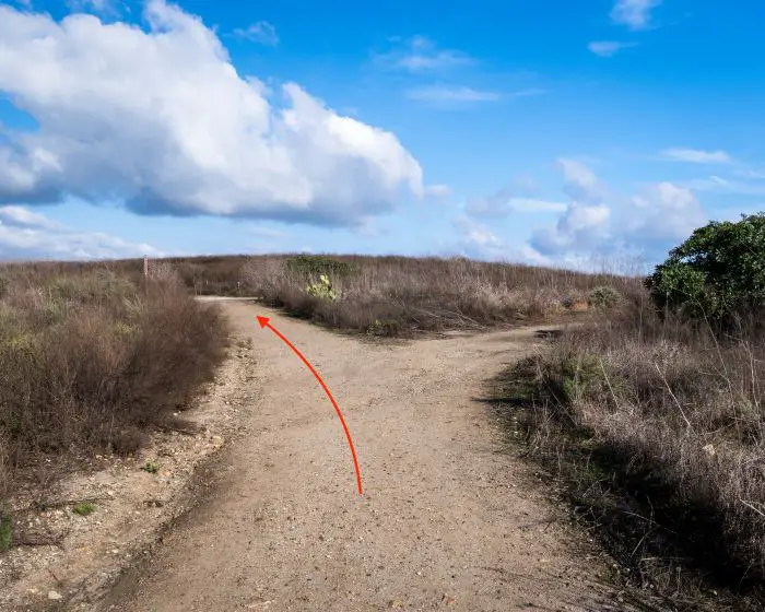
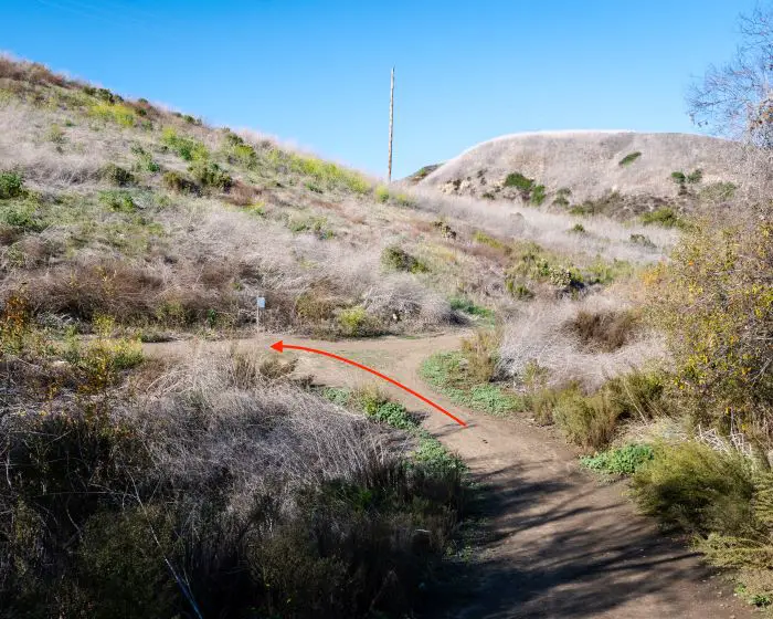
Nothing lasts forever, and all ascends must come to an end. You’ll know you’re at the ridge when you get to the fork shown below.
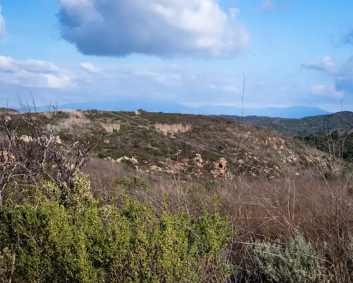
Unfortunately, the Cleveland National Forest was partly obscured by the clouds, but had they been visible, I could’ve identified Old Saddleback, the two largest peaks in the Santa Ana Mts.
I made a left at the next fork to transition from Moro Ridge Rd to, and I swear I’m not making this name up, I Think I Can, also known as East Cut Across.
The steep descent had me feeling grateful for heading up the south side of the loop and not up I Think I Can.
I made it down to the canyon floor after roughly 25 minutes, traversed the dry creek bed, and made a left at the fork to finish the loop via Moro Canyon Trail.
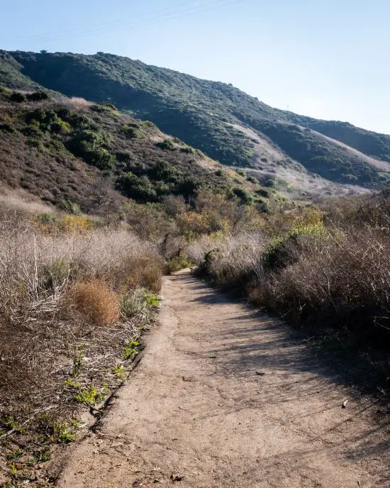
Due to water and abundant vegetation, the canyon floor is typically the most scenic part of the trail. Moro Canyon is no exception.
Sycamore trees lined the sides of the creek and boasted their vibrant orange leaves, contrasting with and giving life to the much-needed dry chaparral.
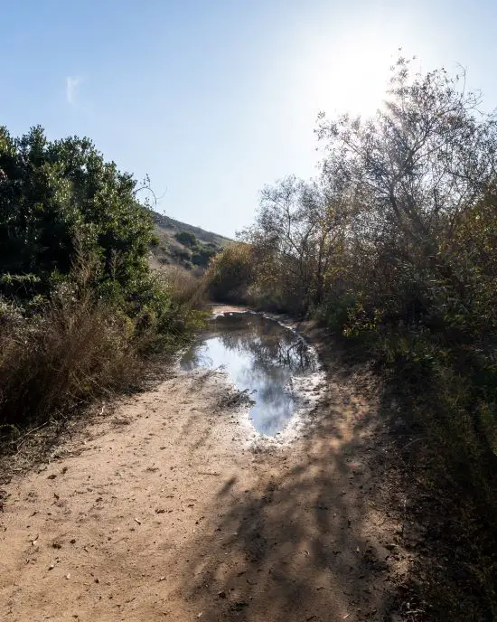
Since I visited a couple of days after the area received a bit of rain, large puddles consumed much of the road. Luckily, I was able to walk around them. The largest of all puddles can be seen below.
I continued on Moro Canyon Trail until reaching the fork where B.F.I. began, then retraced my steps back over the bridge and to the parking lot. Thus, completing the entire loop.
Wait, don’t go! Check out this very similar hike in Laguna Beach. It’s one of the most popular trails in the county and offers better ocean views than El Moro Canyon Loop. It’s called Top Of The World.


