
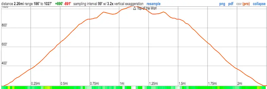
Distance
2.2 Miles
Time
~1.5 Hrs
Difficulty
Moderate
Season
All Year
Elevation Gain
862 Ft
One of the most popular hikes in the beautiful and breezy city of Laguna Beach is definitely the Top of the World hike. It’s a nice and easy trail to the top with amazing views of the ocean, large mansions, and hills. After, you can head to the main beach for some fun!
Top of the World hike is a moderately difficult, 2.2-mile trail located in Laguna Beach within the Aliso and Wood Canyon Wilderness Park. The total elevation is 1,207 feet, with an elevation gain of about 862 feet. There is limited parking near the trailhead. This is a dog-friendly and family-friendly hike.
Click the following link to view the best hikes in Laguna Beach.
Map of Top of the World Trail
Directions & Parking
For directions to the trailhead and parking area, click here.
I took the CA-133 S to Laguna Beach until I reached Canyon Acres Drive. I followed this all the way, eventually reaching a dead end.
There’s no actual parking lot for this trail, so I parked right by the trailhead on a small dirt road. It only fits about 3 cars.
You’ll see two dirt roads, the left and right. Take the left, which is also where a very small slope-style jump line for bikes is.
Hiking To The Top Of The World
The hike continues behind the gate shown in the image below.
I came on a beautiful Thursday evening and enjoyed how peaceful it was. There was hardly anyone here.
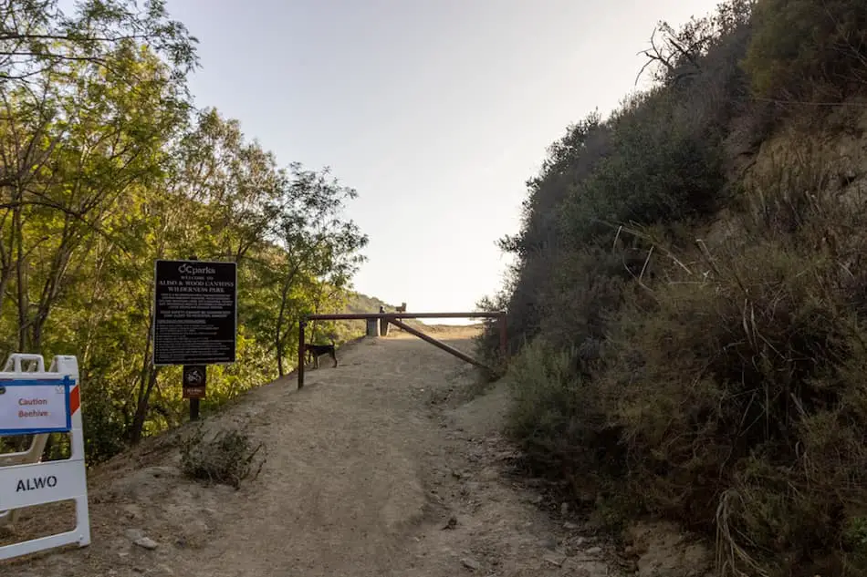
(Do you spot the furry friend?)
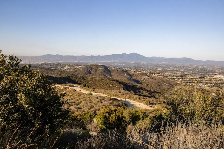
Only about 1/3rd of the way, there’s an amazing view of the hills and city in the distance. I had to stop and take a look!
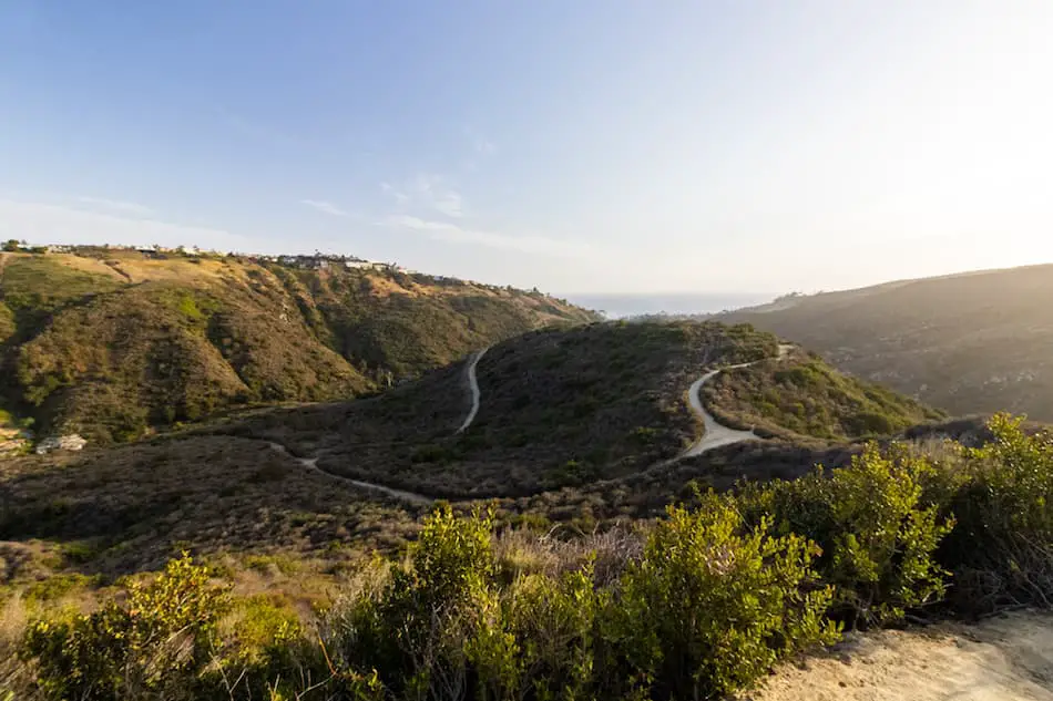
Most of the trail is really nice and wide. There are also lots of mountain bikers on this trail, so you’ll want to be careful and aware.
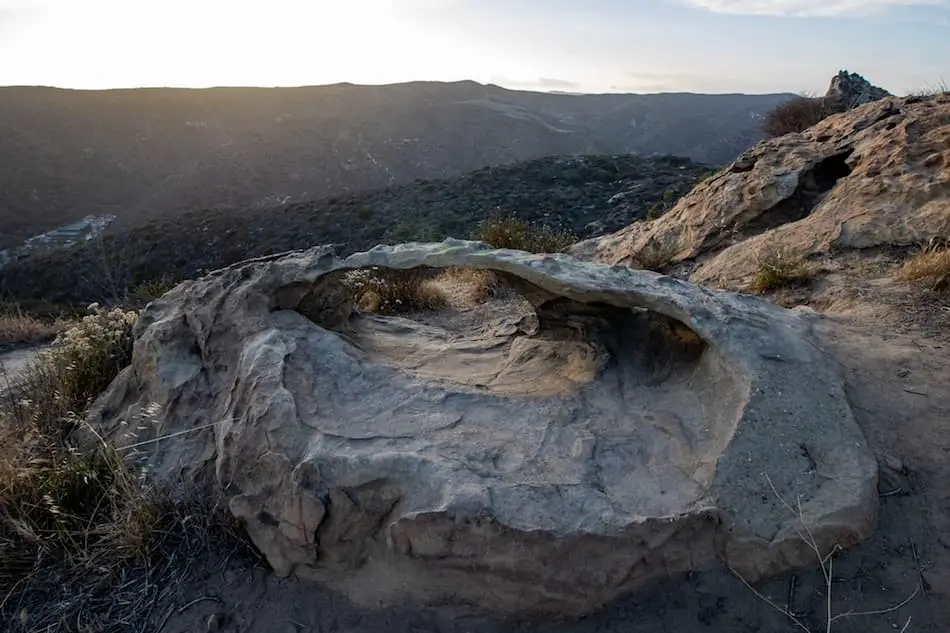
Almost to the top, I spotted these super interesting, cave-like boulders. They look like they could be perfect little hideouts for animals.
To view an actual cave in Laguna Beach, check out this post: Dripping Cave Trail
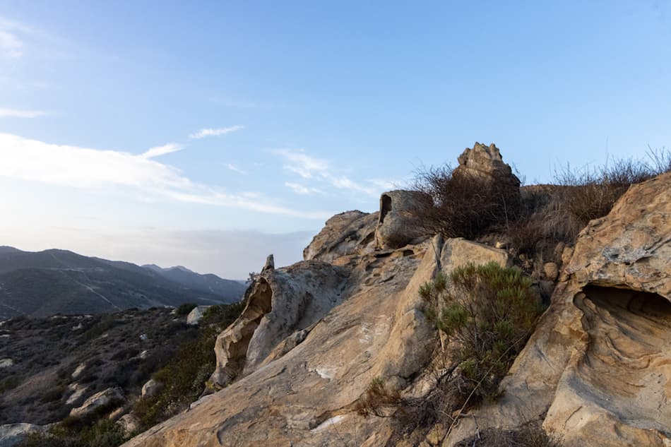
Here’s a closer look at one of these.
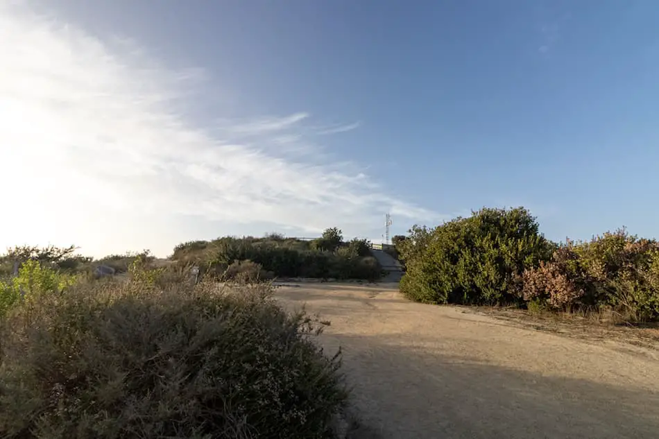
Further up from these “caves”, the dirt road splits. Make sure you take the right, which leads all the way up.
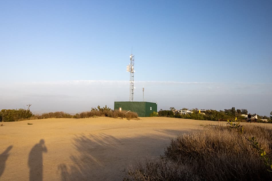
From this point, I was basically at the top. I could spot the antenna!
This is the marker indicating I had made it.
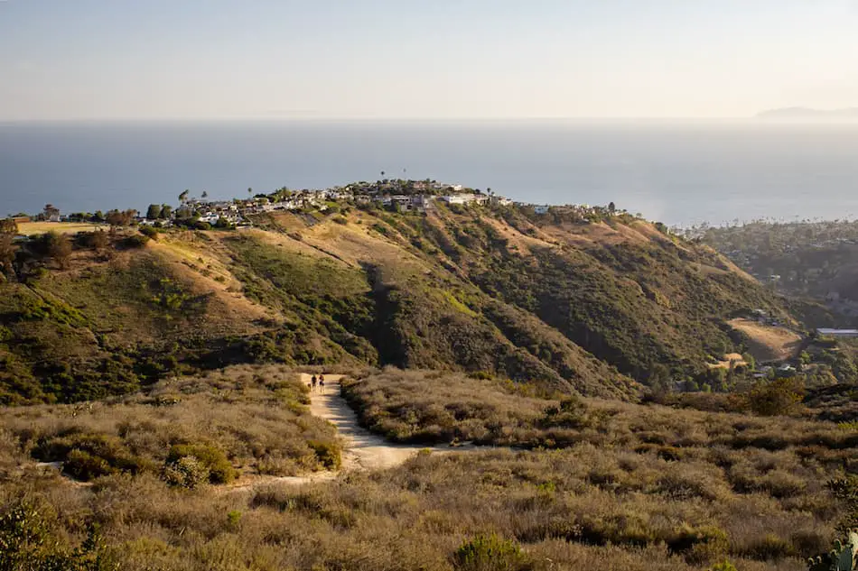
It was a breezy and sunny clear day, which called for epic views!
Here’s an amazing shot of the mansions perched upon the hills, the ocean in the distance, and the downtown area to the far right.
Check out this other hike in Laguna Beach! Car Wreck Trail
The two humps you see are known as Old Saddleback which consists of the two highest peaks in the Santa Ana Mountains, Santiago (the highest) and Modjeska.
There’s still so much to explore.
This is a great hike that lets you explore Orange County’s beauty and adventure. It’s a short and sweet hike with gorgeous views.
Stay tuned for more Orange County hikes!


