Choose Your Trail

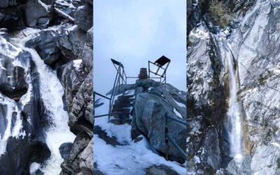
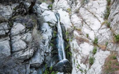
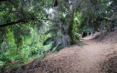
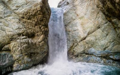
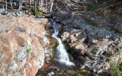
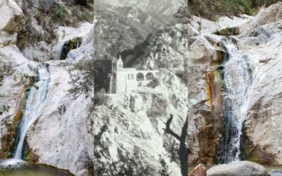
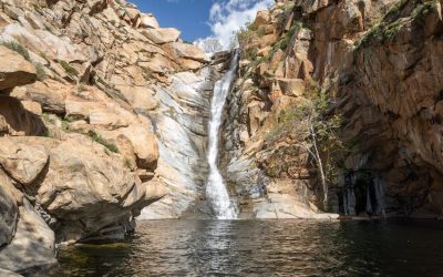
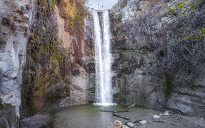
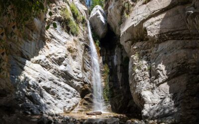
Santa Ynez Falls: Wading, Scrambling & Off-Trail Thrills
Total Miles: 2.27 Time: 1 Hr Difficulty: Moderate Best Season: Spring Elevation Gain: 206 ft Max Elevation: 798 ft Type of Trail: Out & Back Parking: Street Parking Dogs: Not Allowed Restrooms: Not Available Trail Popularity: High Pics Taken On: Feb 8, 2024 Santa...

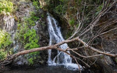
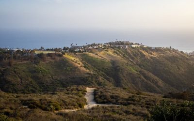
Escondido Falls: Malibu’s Best Hike
Total Miles: 3.49 Time: 1.5 Hrs Difficulty: Easy Best Season: Spring Elevation Gain: 507 ft Max Elevation: 328 ft Type of Trail: Out & Back Parking: Lot Fits ≈ 15 cars Dogs: Allowed On A Leash Restrooms: 1 Porta Potty At The Parking Lot Trail Popularity: Extremely...
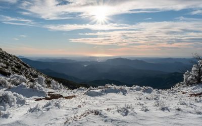
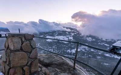
30 Fun Winter/Snow Hikes In Southern California: By County
What's up guys. Since we got a really good dump a few weeks ago, I compiled a list of many, but certainly not all, SoCal hikes which get snow almost every year. If you plan on getting out there, remember to always check the weather forecast before stepping on the...

Ferndell Nature Trail To Griffith Observatory Loop
Total Miles: 2.75 Time: 1-1.5 Hrs Difficulty: Easy – Moderate Best Season: All Year Elevation Gain: 632 ft Max Elevation: 1140 ft Type of Trail: Loop Parking Lot: Street Parking Dogs: Allowed On A Leash Restrooms: Available At The Observatory Trail Popularity: Very...

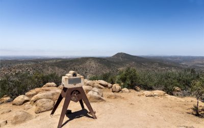
Riverside Trail To Vista Viewpoint: Picturesque LA Views
Total Miles: 2.46 Time: 1 Hrs Difficulty: Easy - Moderate Best Season: All Year Elevation Gain: 407 ft Max Elevation: 1062 ft Type of Trail: Out & Back Parking Lot: Fits ≈ 50 Cars Dogs: Allowed On A Leash Restrooms: Available At The Parking Lot Trail Popularity:...
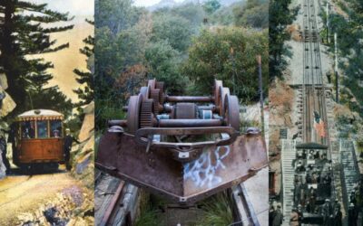
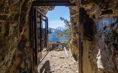
Echo Mountain Hiking Guide: The 8th Wonder Of The World (Closed)
Total Miles: 6 (includes 0.2 mile to falls viewpoint & observatory ruins) Time: 3 Hrs Difficulty: Moderate – Hard Best Season: All Year Elevation Gain: 1566 ft Max Elevation: 3324 ft Type of Trail: Out & Back Parking Lot: Street Parking Dogs: Allowed On A...
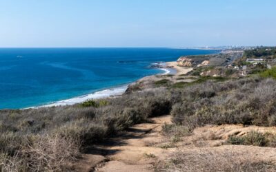
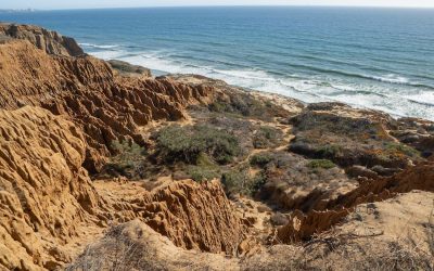
El Moro Canyon Loop Trail: Beautiful Ocean Views
Total Miles: 4.95 Time: 2-2.5 Hrs Difficulty: Moderate - Hard Best Season: All Year Elevation Gain: 829 ft Max Elevation: 726 ft Type of Trail: Loop Parking Lot: Fits ≈ 50 Cars ($15 Fee To Park) Dogs: Not Allowed Restrooms: Available At The Parking Lot Trail...
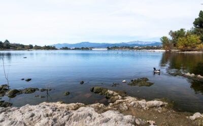
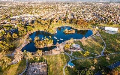
Bonelli Park Loop: Safe Stroll, Lake Views, & Playgrounds
Total Miles: 1.8 Time: 45 min Difficulty: Easy Best Season: All Year Elevation Gain: 107 ft Max Elevation: 1023 ft Type of Trail: Loop Parking Lot: Fits 30+ Cars Dogs: Allowed On A Leash Restrooms: Available Throughout Loop Trail Popularity: High Pics Taken On: Nov...
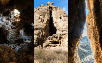
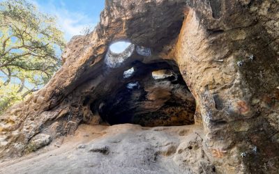
Exploring The Cave Of Munits: Best SoCal Cave
Total Miles: 1.53 Time: 45 min Difficulty: Easy Best Season: All Year Elevation Gain: 214 ft Max Elevation: 1116 ft Type of Trail: Out & Back Parking Lot: Street Parking Dogs: Allowed On A Leash Restrooms: Available At The Trailhead Trail Popularity: High Pics...

Hiking Potato Mountain: Home Of The Crazy Potatoes
Total Miles: 4.42 Time: 2 Hrs Difficulty: Easy - Moderate Best Season: All Year Elevation Gain: 1251 ft Max Elevation: 3425 ft Type of Trail: Out & Back Parking Lot: Turn Out, Fits 10+ Cars Dogs: Allowed On A Leash Restrooms: Not Available Trail Popularity: High...
First Water Via Mount Wilson: Waterfalls Galore
Total Miles: 3.25 Time: 1.5 hrs Difficulty: Easy - Moderate Best Season: All Year Elevation Gain: 1149 ft Max Elevation: 2034 ft Type of Trail: Out & Back (Small Loop Included) Parking Lot: Street Parking Dogs: Allowed On A Leash Restrooms: Not Available Trail...
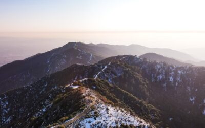
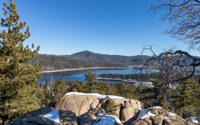
Pine Knot Trail To Grand View Point: Fall Is Here!
Total Miles: 6.89 Time: 3.5 hrs Difficulty: Moderate Best Season: All Year Elevation Gain: 1213 ft Max Elevation: 7709 ft Type of Trail: Out & Back Parking Lot: Fits ≈ 10 cars Dogs: Allowed On A Leash Restrooms: Available On The Trail Trail Popularity: High Pics...
11 Best Hikes For Kids In Los Angeles: Fun & Safe!
Get your kids to fall in love with the outdoors by tackling one of the easy hikes listed below. After digging through my website for the most kid-friendly hikes in Los Angeles, I came up with eleven trails that are primarily safe, but also easy and fun, so that you...
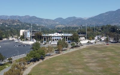
Rose Bowl Loop: Hiking Around Pasadena’s Iconic Stadium
Total Miles: 3.08 Time: 1.5 Hrs Difficulty: Easy Best Season: All Year Elevation Gain: 129 ft Max Elevation: 905 ft Type of Trail: Loop Stroller Friendly: Yes Parking Lot: Fits ≈ 100+ cars Dogs: Allowed On A Leash Restrooms: Available On The Lawn Trail...
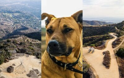
9 Best Los Angeles Hikes For Dogs: Not Your Typical Trails
I remember the first time I hiked with my dogs, Macy, a Pitbull and German Shepherd mix shown in this post's featured image, and Mina, an enormous full-breed German Shepherd. I felt like I was walking in the mountains with two bodyguards, but I also seemed more...
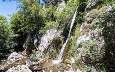
12 Best Waterfalls I’ve Hiked In Los Angeles: 2026 Update
Contrary to popular belief LA is not only a dry concrete jungle. Every spring I see dozens of waterfalls come back to life, incentivizing thousands of Los Angelinos to trade the usual screen time for their hiking boots and some fresh air. I grew up and still live very...
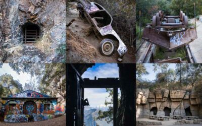
10 Spooky SoCal Hikes Plus Bonus Haunted Places
Just because summer is over doesn't mean you have to stop hiking. Simply hit the trails that fit in with the season, such as the following ten spooky hikes. These trails include various abandoned ruins, many of which hold very dark secrets, while others gave me eerie...
17 Best SoCal Hikes For Kids: Safe, Easy, & Fun Trails
Not all trails are steep, sun exposed, backpack-lugging adventures. In fact, a huge portion of them are the complete opposite, and therefore, suitable for small children. I browsed through my entire website to put together a list of the most kid-friendly hikes in...
Oso Creek Trail: Mission Viejo’s #1 Hike
Miles: 1.7 Time: 35 min Difficulty: Easy Best Season: All Year Elevation Gain: 80 ft Max Elevation: 490 ft Type of Trail: Loop Parking Lot: Fits ≈ 30 cars Dogs: Allowed On A Leash Restrooms: Not Available Trail Popularity: Moderate Pics Taken On: Apr 15, 2023 Although...
Big Dalton Canyon Trail: Gem Of The Glendora Mts
Total Miles: 2 Time: 45 min Difficulty: Easy Best Season: All Year Elevation Gain: 286 ft Max Elevation: 1431 ft Type of Trail: Out & Back Parking Lot: Fits ≈ 20 cars Dogs: Allowed On A Leash Restrooms: Available On The Trail Trail Popularity: Moderate Pics Taken...
Sycamore Canyon Trail: Whittier’s Perfect Getaway
Miles: 3.3 Time: 90 min Difficulty: Easy Best Season: All Year Elevation Gain: 370 ft Max Elevation: 617 ft Type of Trail: Out & Back Parking Lot: Fits ≈ 20 cars Dogs: Not Allowed Restrooms: Available At The Trailhead Trail Popularity: High Pics Taken On: Aug 9,...
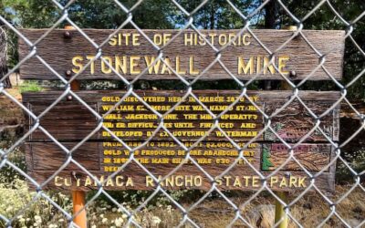
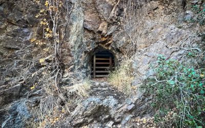
Stonewall Mine: San Diego’s Forgotten Relic
Miles: 0.7 Time: 20 min Difficulty: Easy Best Season: All Year Elevation Gain: 75 ft Max Elevation: 4640 ft Type of Trail: Loop Parking Lot: Fits ≈ 20 cars Dogs: Not Allowed Restrooms: Available At The Trailhead Trail Popularity: Moderate Pics Taken On: Jul 25, 2023...
Mystic Canyon Trail: Stunning Views In The Glendora Mts
Miles: 1.92 Time: 45 min Difficulty: Moderate Best Season: All Year Elevation Gain: 707 ft Max Elevation: 1907 ft Type of Trail: Out & Back Parking Lot: Turnout, Fits ≈ 20 cars Dogs: Allowed on a leash Restrooms: Not Available Trail Popularity: Low - Moderate Pics...
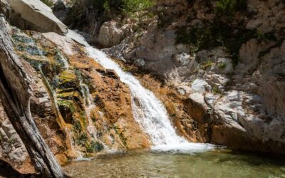
Ortega Falls: 2 Cascades Off Of Hwy 74
Miles: 0.2 Time: 25 min Difficulty: Easy Best Season: Spring Elevation Gain: 67 ft Max Elevation: 2198 ft Type of Trail: Out & Back Parking Lot: Turnout, Fits 20+ cars Dogs: Allowed on a leash Restrooms: Not Available Excluding the plethora of graffiti, Ortega...
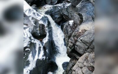
Stoddard Canyon Falls: Rock Slide & Pool
Miles: 0.75 Time: 45 min Difficulty: Moderate Best Season: Spring Elevation Gain: 160 ft Max Elevation: 3781 Type of Trail: Out & Back Parking Lot: Dirt Lot, Fits 30+ Cars Dogs: Allowed on a leash Restrooms: Not Available Trail Popularity: High Pics Taken On: May...
Holy Jim Falls: Plus Rarely Seen 2nd Larger Falls
Miles: 3 Time: 1 Hour Difficulty: Easy Season: Late Spring Elevation Gain: 617 ft Max Elevation: 2352 ft Trail Type: Out & Back Parking Lot: Dirt Lot, Fits ≈ 20 Cars Restrooms? 1 Porta Potty Available Dogs Allowed? Yes, on a leash What can possibly be better than...
Stoddard Peak Hiking Guide: Map, Directions, & Fun Facts
Miles: 5.9 Roundtrip Time: 2.5 Hours Roundtrip Difficulty: Moderate Season: All Year Elevation Gain: 1224 ft Peak Elevation: 4611 ft Trail Type: Out & Back Restrooms? Not Available Dogs Allowed? Yes, on a leash Take a windy dirt road up Stoddard Canyon to be...
Henninger Flats: Hike to a Scenic Forest Nursery (Closed)
Total Miles: 5.04 Time: 3 hrs Difficulty: Moderate Best Season: All year Elevation Gain: 1531 ft Max Elevation: 2543 ft Type of Trail: Out & Back Dogs: Allowed on a leash Restrooms: Available at the flats Feel like learning a bit of local mountain history on your...
Sunset Peak Trail Guide: 2 Routes + Maps & Directions
Distance 7.2 MilesTime 3.5 HrsDifficulty Moderate Season All Year Elevation Gain 1281 Ft Dogs allowed on a leash Out & Back Trail No Restrooms available You can't go wrong with a trail in the Mt Baldy area. Lower temperatures, possible snow, and amazing views....
Etiwanda Falls Trail: Most Popular San Bernardino Hike
Miles: 3.19 Time: 1.5 hrs Difficulty: Easy Best Season: Spring Elevation Gain: 756 ft Max Elevation: 2823 ft Type of Trail: Out & Back Parking Lot: Dirt Lot Fits 30+ Cars Dogs: Not Allowed Restrooms: Not Available Trail Popularity: Very High Pics Taken On: Nov 30,...
Tin Mine Canyon Trail: Corona’s Forgotten Past
Distance 4.38 Miles Time 2.5 Hrs Difficulty Easy Season All Year Elevation Gain 705 Ft Dogs allowed on a leash Out & Back Trail Restrooms Not Available Deep in the Corona woods, an abandoned mine lays waiting to be explored. Tell me this doesn't get your heart...
Two Trees Trail in Box Springs Mountain Regional Park
Distance 2.5 MilesTime1.5 HrsDifficulty ModerateSeasonAll YearElevation Gain977 Ft Dogs allowed on a leash Out & Back Trail Restrooms Not Available Looking for a short hike before or after work? Two Trees Trail is just the hike for you! Two Trees Trail is a short...
Cowles Mountain: #1 Trail in San Diego County
Distance 3 Miles Time 1.5 HrsDifficulty ModerateSeason All YearElevation Gain 908 Ft Dogs allowed on a leash Out & Back Trail Restrooms Available at The Trailhead Ready for a quick adventure to a sunny peak in the San Carlos neighborhood? If so, I have just the...
Quail Hill Trail in Irvine Open Space Preserve
Distance 1.8 MilesTime45 minDifficulty EasySeasonAll YearElevation Gain152 Ft Trail type: Loop Restrooms: Yes, in the parking lot Dogs: Yes, on a leash Didn't have enough time to get outside this weekend? Checkout this hike, especially if you live in or near Orange...
Ho Chi Mihn Trail in San Diego: Slot Canyon & Waterfall!
Total Miles: 0.62 Time: 20 min Difficulty: Hard Best Season: All Year Elevation Gain: 278 ft Max Elevation: 330 ft Type of Trail: Out & Back Parking Lot: Street Parking Dogs: Not Allowed Restrooms: Not Available Trail Popularity: High Pics Taken On: Sept 28, 2022...
Upper Newport Bay Nature Preserve: Avoid The Summer Heat
Distance 5.2 MilesTime2 HrsDifficulty EasySeasonAll YearElevation Gain226 ftNot a fan of Socal's brutal heat? Visit Upper Newport Bay Nature Preserve to enjoy a beautiful coastal hike surrounded by white cliffs and amazing sunsets. The scenic preserve is a 5.2-mile...
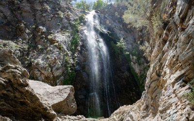
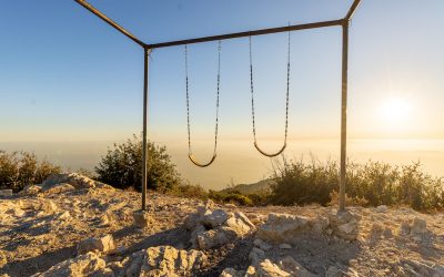
Switzer Falls Hiking Guide: 2 Falls, Chapel Ruins, Swing
The following info doesn't include the ruins detour nor the extra trek up to Silver Spray Falls. Total Miles: 3.6 Time: 2 hrs Difficulty: Moderate Best Season: Spring (2023 is an exception. It's flowing as of Dec 2023) Elevation Gain: 691 ft Max Elevation: 3247 ft...
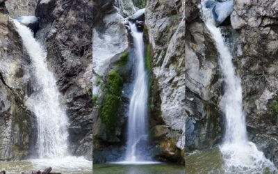
11 Best Waterfall Hikes in Southern California: 2026 Update
Looking for breathtaking waterfalls in Southern California? After 15 years of exploring our local mountains, I'd be more than happy to share with you what I think are the11 most awe inspiring cascades, many of which are also the largest in Socal. All of the following...
Bonita Falls: 2nd Largest SoCal Waterfall + Bonus Tiers
Miles: 1.28 Time: 45 min Difficulty: Easy Best Season: Spring Elevation Gain: 443 ft Max Elevation: 3269 ft Type of Trail: Out & Back Parking Lot: Fits ≈ 10 cars Dogs: Allowed On A Leash Restrooms: Available At The Campground Trail Popularity: Very High Pics Taken...
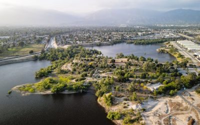
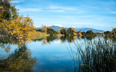
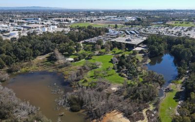
Peck Road Water Conservation Park: Riparian Sanctuary
Many parks have lost their touch with their wild side, resembling a larger version of your lawn. Peck Park retains its unkept and natural beauty, boasting two lakes, stunning views of the San Gabriel and San Bernardino Mountains, and offering a wide variety of...
San Gabriel Peak Hiking Trail Via Eaton Saddle
Distance 2.8 MilesTime~1-1.5 HrsDifficulty ModerateSeasonAll YearElevation Gain971+ FtExperience breathtaking birds-eye views of various local sites of interest, such as Mount Wilson and Mount Lowe Peak, atop San Gabriel Peak. San Gabriel Peak is a moderate-level,...
Top of The World Hike At Laguna Beach: 2024 Guide
Distance 2.2 MilesTime~1.5 HrsDifficulty ModerateSeasonAll YearElevation Gain862 FtOne of the most popular hikes in the beautiful and breezy city of Laguna Beach is definitely the Top of the World hike. It's a nice and easy trail to the top with amazing views of the...
26 Best Hikes in Southern California: Caves & 500 Ft Falls
Looking for abandoned creepy places, breathtaking views, and stunning waterfalls? Say no more. I browsed through my entire site and chose the trails which I believe are the most breathtaking, jaw-dropping, hikes that'll leave you thinking, "How is this located in...
Cedar Creek Falls: SoCal’s Most Beautiful Waterfall
Miles: 5.5 Time: 3 hrs Difficulty: Moderate Best Season: Spring Elevation Gain: 1026 ft Max Elevation: 1836 ft Type of Trail: Out & Back Parking Lot: Fits 15+ cars Dogs: Allowed On A Leash Restrooms: Available At The Parking Lot Trail Popularity: Very High Pics...
Cuyamaca Peak: 2nd Highest Peak In SD County
Total Miles: 7.24 Time: 4 Hrs Difficulty: Moderate - Hard Best Season: All Year Elevation Gain:1815 ft Max Elevation: 6463 ft Type of Trail: Loop Parking Lot: Available At The Campground Dogs: Not Allowed On Trail Restrooms: Available At The Campground Trail...
Big Falls Trail: SoCal’s Largest Waterfall
Total Miles: 0.66 Time: 25 min Difficulty: Easy Best Season: Spring - Summer Elevation Gain: 174 ft Max Elevation: 6016 ft Type of Trail: Out & Back Parking Lot: Fits ≈ 20 cars Dogs: Allowed On A Leash Restrooms: Available At The Parking Lot Trail Popularity: High...
Mile Square Regional Park: Fountain Valley’s #1 Park
Whether you like paddle boats, jogging, or archery, this park has everything to offer, and that’s not an understatement. Mile Square Park is a beautiful 607 acres of land located in Fountain Valley. The public has tons of amenities to choose from, some of which...
11 Best Hikes In Los Angeles: Not Found Anywhere Else
Los Angelinos have been in love with hiking since the late 1800s. With the never-ending list of trails growing each year since the hiking boom at the turn of the 20th century, finding the best hiking trails in Los Angeles can be daunting. But not to worry, I'm here to...
Trail Canyon Falls: Plus Seasonal Waterfall
Total Miles: 4.54 Time: 2.5 Hrs Difficulty: Moderate Best Season: Spring Elevation Gain: 1067 Ft Max Elevation: 2481 Ft Type of Trail: Out & Back Parking Lot: Fits ≈ 20 cars Dogs: Allowed On A Leash Restrooms: Not Available Trail Popularity: High Pics Taken On:...
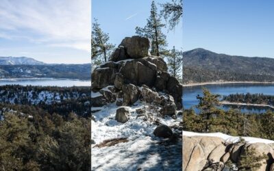
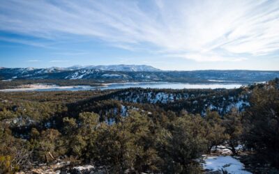
Top 4 Big Bear Hikes: Forested Trails, Grand Views, & More
Big Bear, CA is a beautiful mountain town located in the San Bernardino National Forest. It’s home to ancient Western Juniper trees, Big Bear Lake, two winter resorts, and of course, multiple forest hikes. Today I’d like to share with you the four best Big Bear...
Santa Fe Dam Recreation Area: A Little Known SGV Gem
Distance 3.7 MilesTime2 HrsDifficulty EasySeasonAll YearElevation Gain75 FtSanta Fe Dam holds a very special place in my memories because my parents would bring me here every year in the summer to swim at the lake. It's the perfect place for a day out with the family,...
Woodland Trail 1E23: Interpretive Big Bear Hike For Kids
Total Miles: 1.52 Time: 45 min Difficulty: Easy Best Season: All Year Elevation Gain: 232 ft Max Elevation: 6967 ft Type of Trail: Loop Parking Lot: Fits 20+ Cars Dogs: Allowed On A Leash Restrooms: Available On The Trailhead Trail Popularity: High The Woodland Trail...
Cougar Crest Trail: Best Views Of Big Bear Lake
Total Miles: 5.43 Time: 3.5 hrs Difficulty: Moderate - Hard Best Season: All Year Elevation Gain: 900 ft Max Elevation: 7717 ft Type of Trail: Out & Back Parking Lot: Fits 20+ Cars Dogs: Allowed On A Leash Restrooms: Available On The Trailhead Trail...
Eaton Canyon Falls: Best Guide On Hiking LA’s #1 Waterfall (Closed)
Total Miles: 4.02 Time: 2.5 Hrs Difficulty: Easy Best Season: Spring Elevation Gain: 449 Ft Max Elevation: 1370 Ft Type of Trail: Out & Back Dogs: Allowed On A leash Restrooms: Available At The Parking Lot Trail Popularity: Extremely High I've hiked Eaton Canyon...
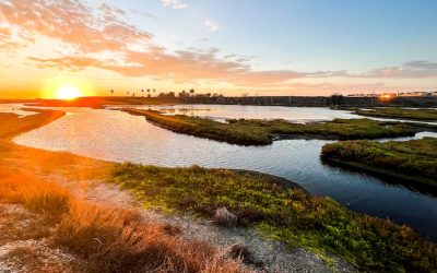
Bolsa Chica Ecological Reserve: HB’s Saltwater Wetlands
Distance 3 MilesTime1.5 HrsDifficulty EasySeasonAll YearElevation Gain72 FtBolsa Chica Ecological Reserve is a 1400 acre saltwater marsh with seasonal estuarine conditions located alongside Pacific Coast Highway in Huntington Beach, CA. It boasts five miles of trail...
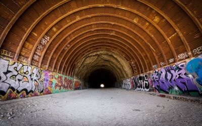
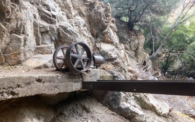
Shoemaker Canyon Road: LA’s Nuclear War Escape Tunnels
On this adventure, we visited some tunnels in LA with a very interesting backstory. There are four tunnels to check out, two of them being off-trail. I’ll show you how to get to them!
Huntington Central Park: HB’s Best Local Park
Huntington Central Park is an expansive, 350-acre park located at 18000 Goldenwest St in Huntington Beach. This dog-friendly park features Talbert Lake, a library, cafe, gardens, and an abundance of wildlife. It's the largest city-owned park in all of Orange County,...
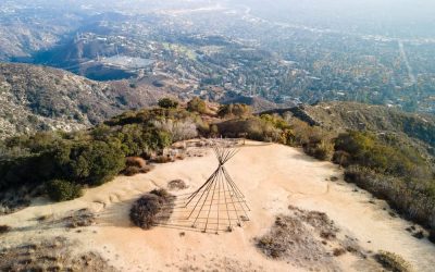
La Canada Teepee Trail: Bee Farm, Lavender Fields and Views
Distance 5 MilesTime ~2.5 HrsDifficulty ModerateSeason All YearElevation Gain 1025 Fthttps://youtu.be/pR-oajL9zWA The Teepee trail is a really easy and fun hike within the foothills of the San Gabriel Mountains. You'll be able to experience fall colors during the...
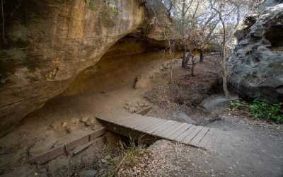
Dripping Cave Trail: Secret Hideout for Robbers in 1800s
Distance 5.1 MilesTime ~2.5 HrsDifficulty EasySeason All YearElevation Gain 400 FtWithin the canyons of Laguna Niguel, you'll find a cave known as Dripping Cave with a shocking past pertaining to 19th-century thieves! You'll love this Orange County hike that'll take...
7 Best San Diego Hikes: Slot Canyons, Beaches, & Views
San Diego is one of the most beautiful counties in SoCal. Not only does it have amazing coastal beaches, but there are tons of amazing hikes both by the ocean and in the mountains of Cuyamaca Rancho State Park. You can wait to experience the snow in the winter months...
![3 Best Hikes in Laguna Beach [Prior OC Resident]](https://cahikingadventures.com/wp-content/uploads/2021/10/FINLA-400x250.jpeg)
3 Best Hikes in Laguna Beach [Prior OC Resident]
As a current resident of Huntington Beach, I can assure you that some of the best hikes in Orange County can be found at Laguna Beach, more specifically Aliso and Woods Canyon Wilderness Park. Due to the stunning views of the ocean and downtown Laguna Beach, the 4500...
Torrey Pines Beach Trail Loop: This SD Hike is a Must!
Distance 3.1+ Miles Time ~2.5 Hrs Difficulty Easy Season All Year Elevation Gain 338 Ft Torrey Pines State Beach has some of the most breathtaking beach views and beach trails in SoCal. Escape the warm weather and treat yourself to a very breezy and dreamy adventure!...
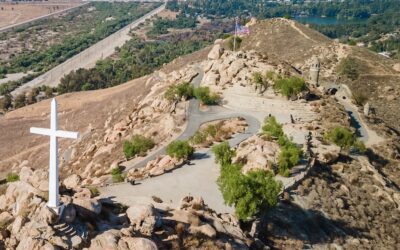
Mt Rubidoux Trail: #1 Hike In Riverside County
Total Miles: 3.13 Time: 60 min Difficulty: Easy Best Season: All Year Elevation Gain: 551 ft Max Elevation: 1323 ft Type of Trail: Out & Back Parking Lot: Fits 30+ Cars Dogs: Allowed On A Leash Restrooms: Available At The Parking Lot Trail Popularity: Very High...
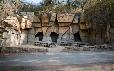
Old LA Zoo: Explore Abandoned Ruins In Griffith Park
Total Miles: 2.63 Time: 60 min Difficulty: Easy Best Season: All Year Elevation Gain: 374 ft Max Elevation: 704 ft Type of Trail: Loop Parking Lot: Fits ≈ 40 cars Dogs: Allowed On A Leash Restrooms: Available At The Merry Go Round Trail Popularity: Moderate Pics Taken...
9 Best Pasadena Hiking Trails (Fire Updates)
Pasadena is a beautiful city nestled in the foothills of the Angeles Forest boasting a hiking history that goes as far back as the 1800’s. I grew up near the City of Roses, as it’s commonly referred to, and actually attended Pasadena City College. Therefore, I’m very...
Claremont Loop: Easy 5-Mile Hike with Views (Drone Shots!)
Distance 5 MilesTime ~3 HrsDifficulty ModerateSeason All YearElevation Gain 839 FtClaremont Loop is a very popular hike nestled in the foothills of the LA National Forest, but only the locals really know about it. It features a nice overlook with multiple benches...
Paramount Ranch: Old Western Movie Set in LA
Distance 2.53 MilesDifficulty EasySeason All YearHours of Visitation 8AM - 8PMOne of the most "LA" things you can do is visit an old movie set. Paramount Ranch is definitely one you'll want to check out. Tons of classic movies and popular TV shows were shot in this...
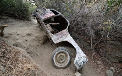
1940s Car Wreck Trail Hike in Laguna Beach
Distance 3.4 MilesTime ~2.5 HrsDifficulty ModerateSeason All YearElevation Gain 836 FtLooking for an interesting and cool hike to beat the summer heat? Car Wreck Trail takes you to an abandoned car wreck deep in the woods where deer and coyotes run wild. Car Wreck...
San Antonio Falls: Scenic Hike To A Huge Waterfall
Miles: 1.33 Time: 30 min Difficulty: Easy Best Season: Spring Elevation Gain: 277 ft Max Elevation: 6425 ft Type of Trail: Out & Back Parking Lot: Fits 30+ cars Dogs: Allowed On A Leash Restrooms: Not Available Trail Popularity: Very High Looking for an easy...
Topanga Lookout Trail: Best Views In Santa Monica Mts
Total Miles: 2.26 Time: 60 min Difficulty: Easy Best Season: All Year Elevation Gain: 348 ft Max Elevation: 2426 ft Type of Trail: Out & Back Parking Lot: Fits ≈ 10 cars Dogs: Allowed On A Leash Restrooms: Not Available Trail Popularity: Very High Pics Taken On:...

Bell View Trail to Flag Summit: OC Hike To Amazing Views
Distance 3.39 MilesTime ~1.5 HrsDifficulty ModerateBest Time to Visit Oct - Early JuneElevation Gain 1245 FtMy experience at Bell View Trail was one of peace and solitude. We only encountered two groups of people, granted it was during the week. Although it's not a...
Annie’s Canyon Trail: Family Friendly Slot Canyon Hike
Total Miles: 1.3 Time: 45 Min Difficulty: Easy Best Season: All Year Elevation Gain: 224 ft Max Elevation: 145 ft Type of Trail: Out & Back Dogs: Allowed On A Leash (Except The Slot Canyon) Restrooms: Not Available Trail Popularity: Very High Take your family on a...
Kitchen Creek Falls: Swimming Pools & Hidden Falls
Total Miles: 4.84 Time: 2 Hrs Difficulty: Moderate Best Season: Spring Elevation Gain: 956 ft Max Elevation: 3794 ft Type of Trail: Out & Back Parking Lot: Fits ≈ 10 cars Dogs: Allowed On A Leash Restrooms: Not Available Trail Popularity: High Pics Taken On: May...
Murphy Ranch Trail: Abandoned Nazi Ruins In Santa Monica Mts
Total Miles: 2.26 Time: 45 min Difficulty: Easy Best Season: All Year Elevation Gain: 615 ft Max Elevation: 849 ft Type of Trail: Out & Back Parking Lot: Street Parking Dogs: Allowed On A Leash Restrooms: Not Available Trail Popularity: Very High Pics Taken On:...
Millard Canyon Falls: Scenic Trail To 50 Ft Cascade
Miles: 1.3 Time: 45 min Difficulty: Easy Best Season: Mid-Late Spring Elevation Gain: 308 ft Max Elevation: 2108 ft Type of Trail: Out & Back Parking Lot: Fits 30+ cars Dogs: Allowed On A Leash Restrooms: Available At The Trailhead/Campground Trail Popularity:...
Kwaay Paay Peak Trail: A Hike with Panoramic Views
Distance 2.3 Miles Time ~1.5 HrsDifficulty ModerateElevation Gain 875 ftSeason All YearBathrooms No Kwaay Paay Peak is a 2.3-mile trail located in Mission Trails Regional Park near Santee, California. It's considered to be a moderate hike because of steep inclines....

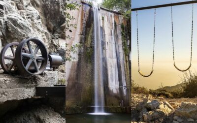
Brown Mountain Dam: 80 Ft Falls (2 Trailheads Included)
https://youtu.be/1f0Wo18lWzU Brown Mountain Dam Waterfall is a must-do for SoCal residents! The breathtaking cascade towers above the abundant trees and forms a shallow 3-4 foot pool for you to cool off. Brown Mountain Dam Waterfall is a scenic hike which can be...

Pumpkin Rock Trail: Easy Hike to a 15-Foot Pumpkin
Total Miles: 1.69 Time: 45 min Difficulty: Easy Best Season: All Year Elevation Gain: 458 ft Max Elevation: 1164 ft Type of Trail: Out & Back Parking Lot: Fits 20+ cars Dogs: Allowed On A Leash Restrooms: Available At The Parking Lot Trail Popularity: High Are you...
Exploring The Vanalden Cave: A Must-Do Hike
Total Miles: 2.65 Time: 60 min Difficulty: Easy Best Season: All Year Elevation Gain: 510 ft Max Elevation: 1778 ft Type of Trail: Out & Back Parking Lot: Fits 20+ Cars Dogs: Not Allowed Restrooms: Available At The Parking Lot Trail Popularity: Moderate Pics Taken...

3 Sisters Falls: San Diego’s Most Popular Waterfall Hike
Total Miles: 3.39 Time: 2.5 hrs Difficulty: Moderate - Hard Best Season: Spring Elevation Gain: 1069 ft Max Elevation: 2936 ft Type of Trail: Out & Back Parking Lot: Fits 40+ cars Dogs: Allowed On A Leash Restrooms: Available At The Parking Lot Trail...
Big Horn Mine Trail: Map, Directions, & Bonus Cabin Ruins
Total Miles: 3.84 Time: 2.5 Hrs Difficulty: Easy Best Season: All Year Elevation Gain: 983 ft Max Elevation: 6894 ft Type of Trail: Out & Back Parking Lot: Fits ≈ 30 cars Dogs: Allowed On A Leash Restrooms: Available At The Parking Lot Trail Popularity: Very High...
Dawn Mine Trail: Hike to an Abandoned Gold Mine from 1895
Total Miles: 4.66 Time: 2.5 - 3 Hrs Difficulty: Moderate Best Season: All Year Elevation Gain: 1175 ft Max Elevation: 3156 ft Type of Trail: Out & Back Parking Lot: Fits ≈ 10 cars Dogs: Allowed On A Leash Restrooms: Not Available Trail Popularity: High Want to...
Stonewall Peak: Breathtaking Panoramic Views
Distance 3.9 MilesTime ~2 HrsDifficulty EasySeason All YearElevation Gain 830 FtStonewall Peak is a 3.9 mile, roundtrip, hike in Cuyamaca Rancho State Park near Julian, California. It has a total elevation of 5,730 feet, with an elevation gain of 830 feet, and takes...
Mount Lowe Hike: Wander to A Peak Above the Clouds (Closed)
Distance 3.2 MilesTime 2 HrsDifficulty ModerateSeason All YearElevation Gain 623 FtDid you know you can view the valley from an altitude of 5588 feet as well as amazing sunset views of Mount Wilson, Mount Baldy, and Los Angeles? Visit Mount Lowe peak for your next...
Lewis Falls In Azusa Canyon & 2nd Bonus Falls
Total Miles: 0.73 Time: 35 min Difficulty: Moderate Best Season: Spring - Fall Elevation Gain: 328 ft Max Elevation: 4197 ft Type of Trail: Out & Back Parking Lot: Fits ≈ 5 cars Dogs: Allowed On A Leash Restrooms: Not Available Trail Popularity: High Pics Taken...
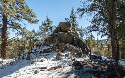
Castle Rock Trail: Fun Hike at Big Bear Lake
Total Miles: 1.44 Time: 1.5 Hrs Difficulty: Easy - Moderate Best Season: All Year Elevation Gain: 567 ft Max Elevation: 7401 ft Type of Trail: Out & Back Parking Lot: Road Turn Out Or Neighborhood Dogs: Allowed On A Leash Restrooms: Not Available Trail...
Hiking Heart Rock Waterfall In The Snow: A Crestline Gem
Total Miles: 1.87 (From Hwy 138) Time: 45 min Difficulty: Easy Best Season: Spring Elevation Gain: 392 Ft Max Elevation: 4175 Ft Type of Trail: Out & Back Parking Lot: Fits ≈ 15 cars Dogs: Allowed On A Leash Restrooms: Not Available Trail Popularity: High...
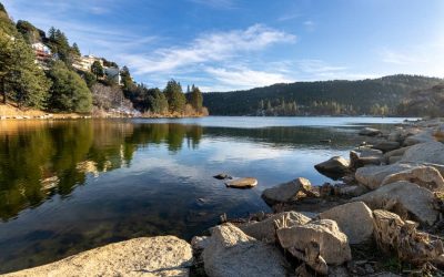
Lake Gregory Complete Guide & Events
At Lake Gregory, expect an inflatable water park, sandy beaches, and giant water slides all surrounded by tons of majestic cedar pine trees. This is by far one of my favorite mountain towns. The lake, which is an 84-acre reservoir in the town of Crestline, lies...
![Norco Powerhouse: Spooky Riverside Relic [DEMOLISHED]](https://cahikingadventures.com/wp-content/uploads/2021/01/POWERHOUSE-400x250.jpg)
Norco Powerhouse: Spooky Riverside Relic [DEMOLISHED]
Distance 0.9 MilesTime ~25 MinDifficulty EasySeason All YearElevation Gain 98 FtBefore getting demolished, the Norco Powerhouse was a spooky Riverside relic dating back to the time when CA was beginning to power its cities. The abandoned building quickly became an...