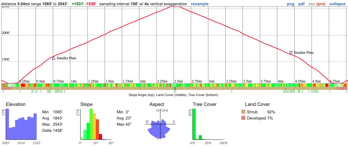
- Total Miles: 5.04
- Time: 3 hrs
- Difficulty: Moderate
- Best Season: All year
- Elevation Gain: 1531 ft
- Max Elevation: 2543 ft
- Type of Trail: Out & Back
- Dogs: Allowed on a leash
- Restrooms: Available at the flats
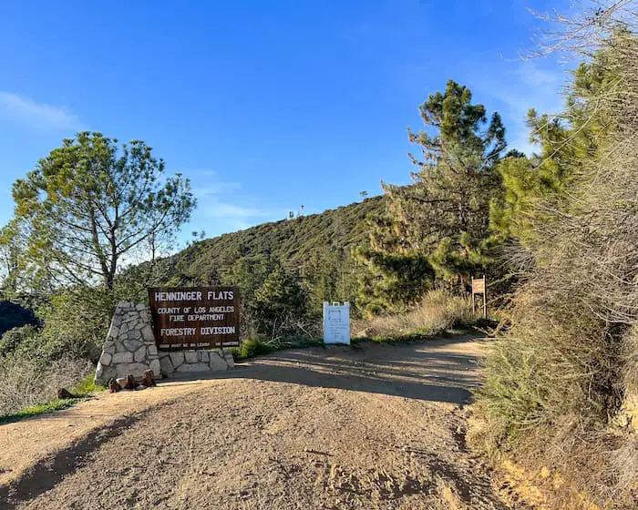
Feel like learning a bit of local mountain history on your next hike? If so, I highly suggest paying a visit to Henninger Flats.
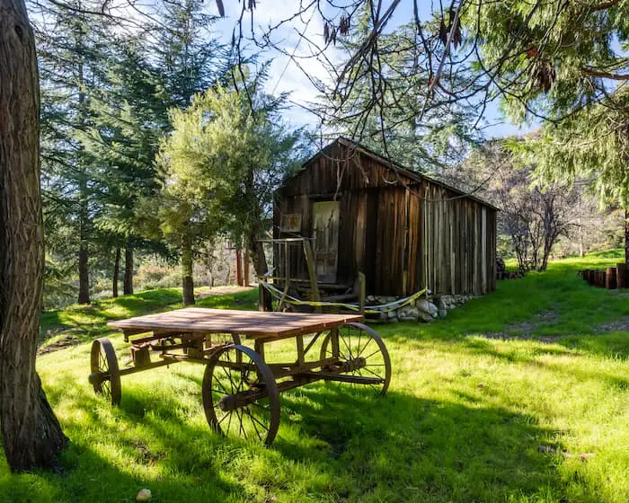
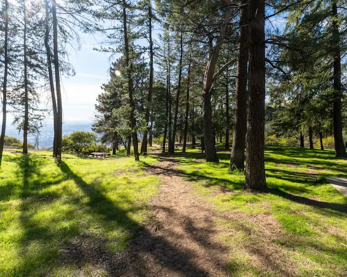
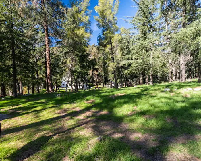
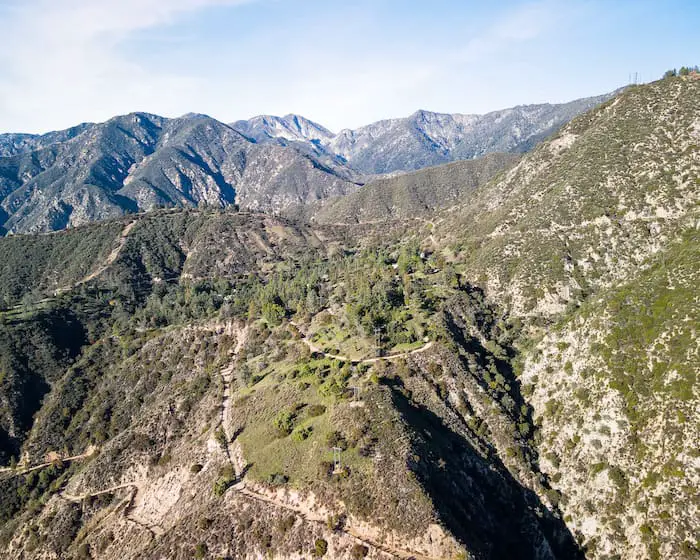
Henninger Flats Campground is a wooded flats located above Eaton Canyon in Pasadena. The hanging basin features multiple relics from local history including a fire tower, tram wheels, and a cabin. The flats also serves as a high elevation nursery for reforestation purposes, and is home to a museum. The scenery at the flats is radically different compared to the environment at the trailhead, where everything looks dead and dry most of the year. At Henninger, expect a dense canopy of tall pine trees and green grass.
Henninger Flats Map
Parking & Directions
To be redirected to the trailhead on Google Maps, click the following link: Henninger Flats Trailhead
Many people who hike to Eaton Canyon Falls also use this trailhead, so expect lots of people on the weekend.
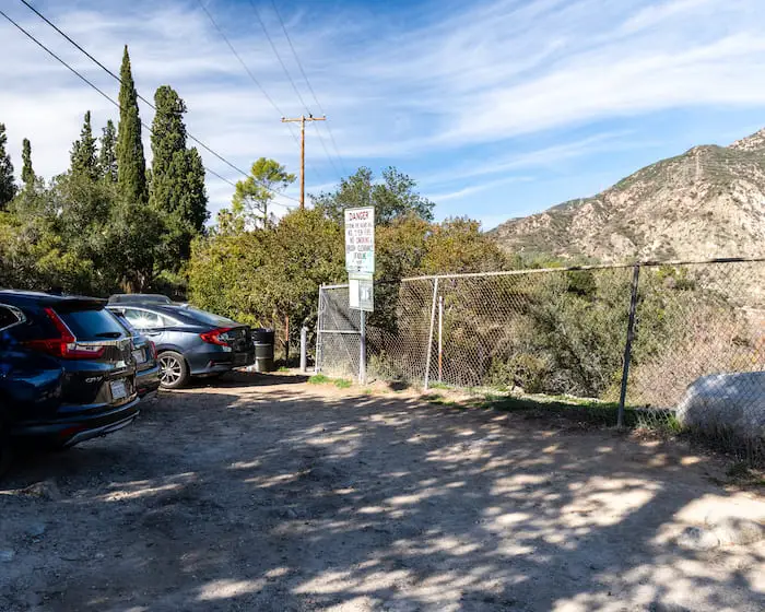
The parking lot for Henninger Flats is very small, and unless you get there really early, it will more than likely be full. If so, you can park on Midwick Dr right across the street.
Hours
The flats area is open 24/7. However, the museum/visiting center has a schedule.
Unfortunately, when I visited it was closed, and I couldn’t find its hours online, but here is their number incase you’d like to call before visiting. 626 794 0675
Helpful Links
Thoedore Lukens: Father of Forestry (and Henninger Flats)
Other nearby hikes you’ll absolutely love!
- Brown Mountain Dam: 80ft Man-Made Waterfall
- Dawn Mine Trail: Hike To An Abandoned Gold Mine From 1895
Henninger Flats Trail
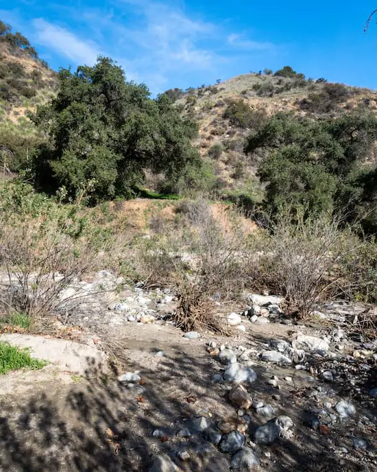
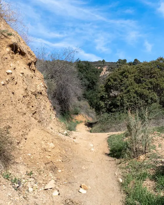
To hop onto the Henninger Flat trail, walk through the gate that is on the Henninger Flats parking lot. It will immediately descend onto the canyon floor.
You’ll have to cross the Eaton Wash and hop onto the dirt road. Crossing the wash is safe the majority of the year.
Just be careful during the rainy season, as you don’t want to be caught in a flash flood.
After crossing the wash make a right onto the dirt road and a left to begin ascending up Walnut Canyon.
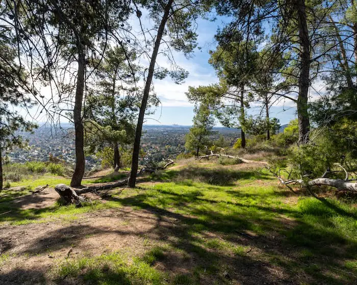
There’s a little flats area where Walnut Canyon Trail intersects with the Mt Wilson Toll Rd.
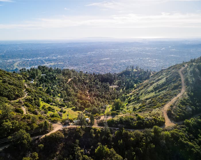
It’s shaded and offers a nice view of downtown LA. If for any reason you can’t make it to Henninger Flats, this is your next best destination.
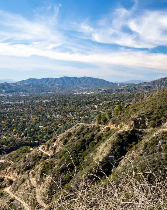
Hop onto the Mt Wilson Toll Rd to continue up to Henninger Flats. If you look back, you’ll be able to spot Jet Propulsion Laboratory (JPL) in the distance.
It’s the cluster of white buildings in the background.
And just like that, you’ve made it to your destination.
The scenery instantly transforms from dry buckwheat to pine trees and vibrant green grass.
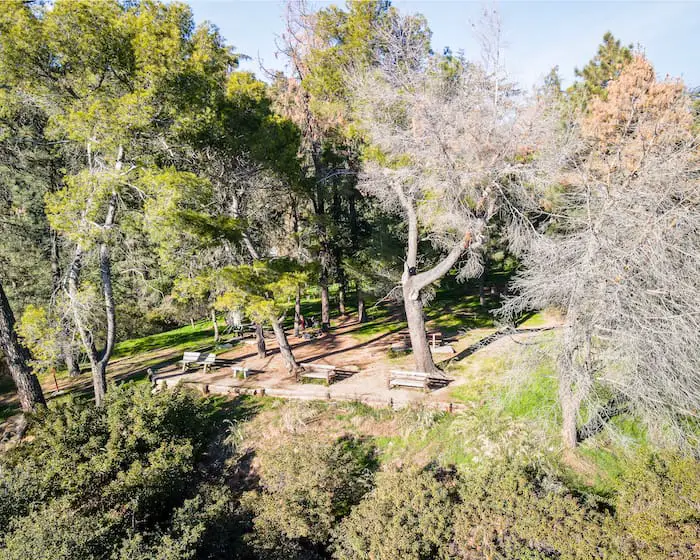
As you’ll notice, there are multiple campsites as backpackers travel through the area.
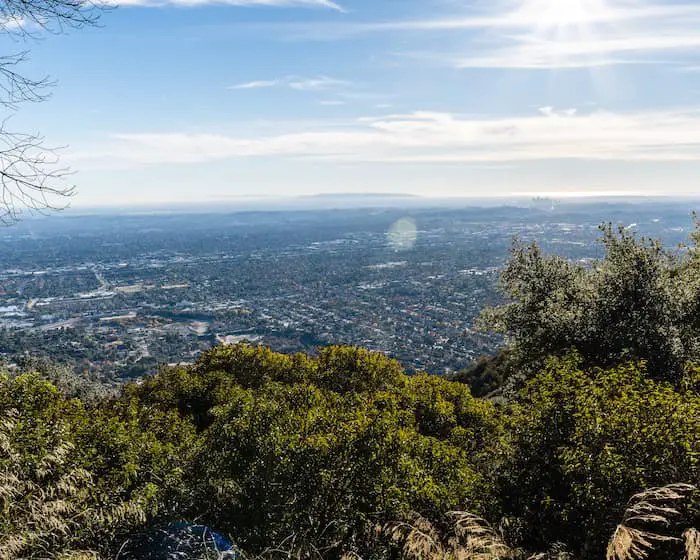
The day that we visited had extremely clear skies. We were able to see everything from the Cleveland National Forest to Catalina Island and the Palos Verdes, and hopefully you will too!
The hills closest to the ocean in the image below are the Rolling Hills in Rancho Palos Verdes.
Read More: Millard Falls: Scenic 50 ft Falls In Altadena
These are the best seats at Henninger in my opinion. I took the shot above while sitting on these benches.
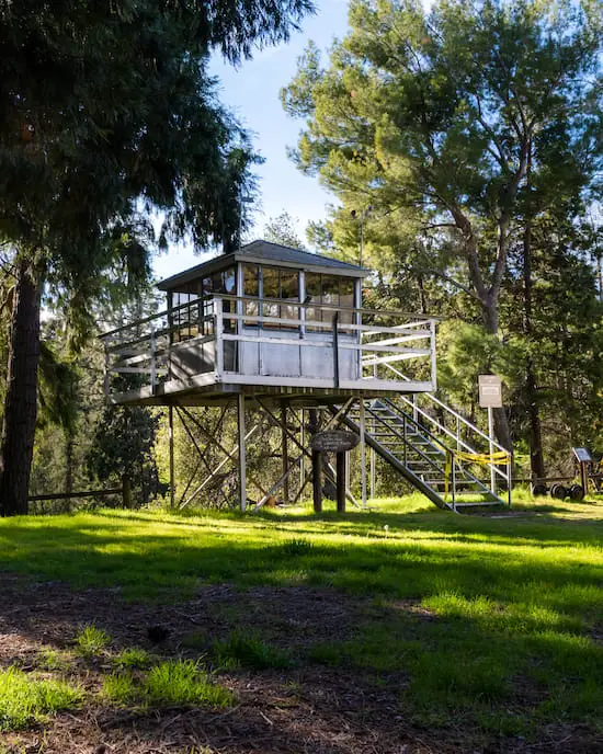
I love how Henninger Flats features historical relics from our local mountains.
For example, a fire lookout that was once located in the Santa Monica Mts from 1925-1971 and known as the Castro Peak Fire Lookout Tower, has been permanently moved to Henninger Flats.
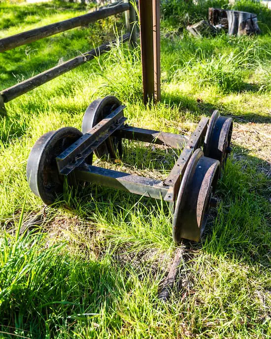
The object below is one of the two sets of wheels which belonged to the OM&M or One Man & Mule Railway.
The tram was powered by a mule named Herbert, and transported people from Inspiration Point to Panorama Point.
Read More: Eaton Canyon Falls: Most Popular Falls In LA
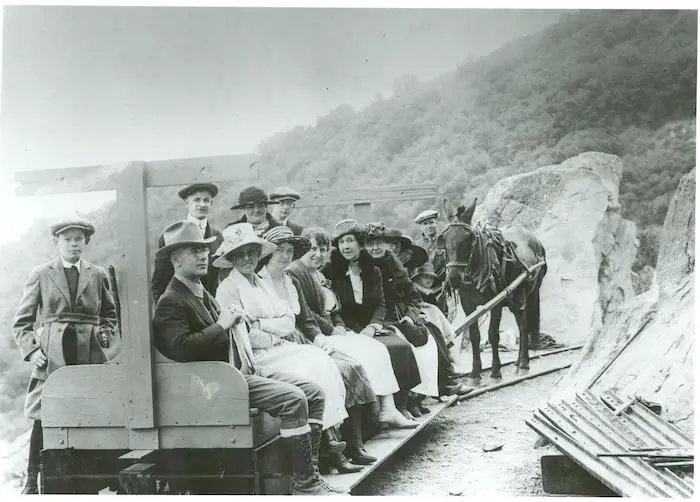
The famous Herbert. Courtesy of the Altadena Historical Society.
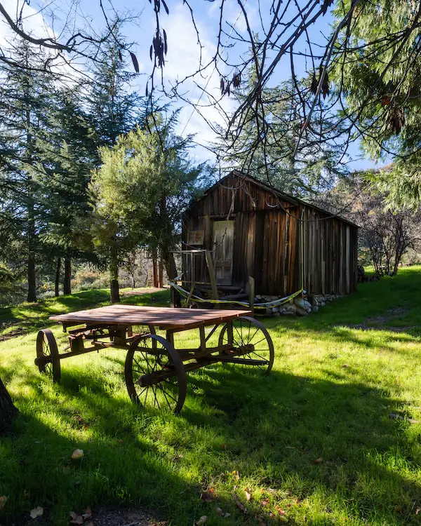
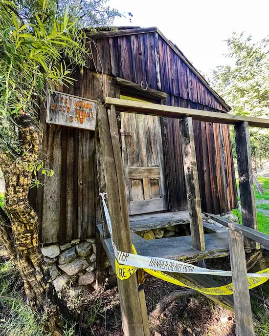
The cabin in the image below was built in 1875!!! It belonged to Theodor Pickens, the first American to settle in La Crescenta.
The area he settled was called Brigg’s Terrace. In the 1960’s, the new owner of the property had the cabin removed to Henninger Flats as a means of preserving an amazing part of our local history.
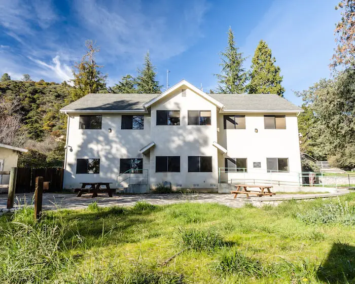
Don’t forget to check out the Henninger Flats Museum shown below.
Although I couldn’t find a schedule online, you can call this number 626 794 0675 before you visit to see if they will be open during your hike.
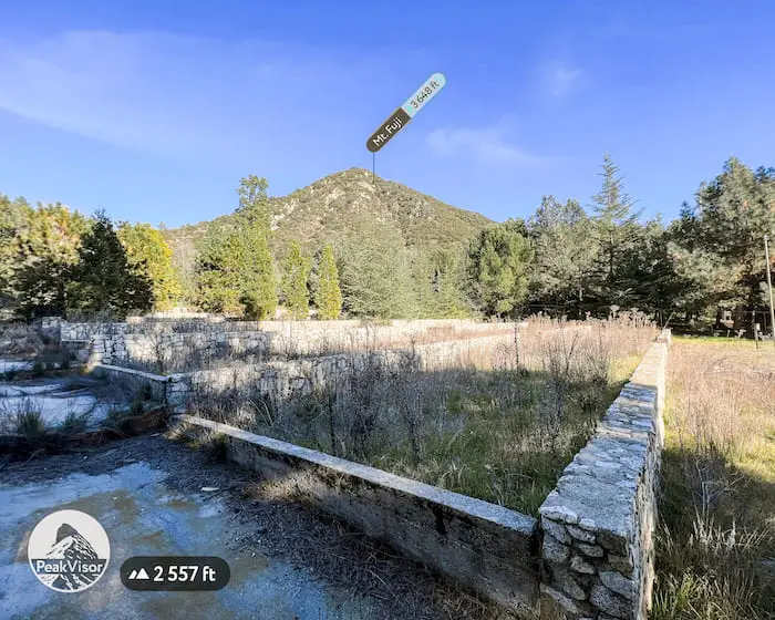
The nursery can be seen towards the back of the flats while Mt Fuji towers above.
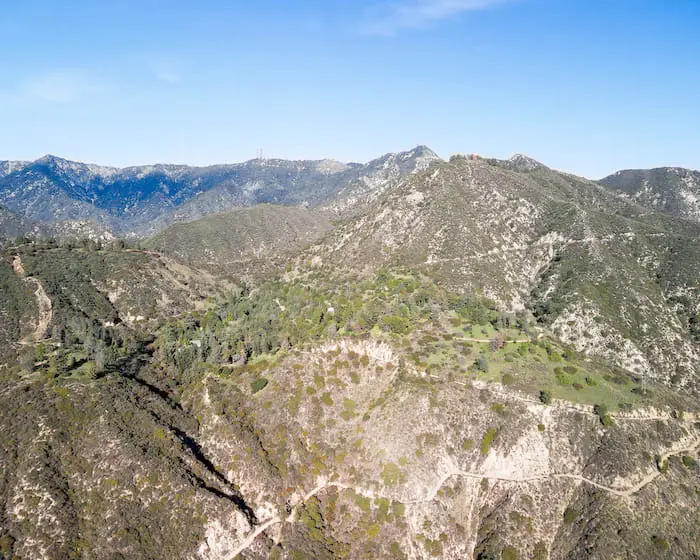
However, Henninger Flats is surrounded by many peaks. Although it’s a bit hard to see, Mt Wilson, where are the antennas are located, is in the image below.
Read More: Mt Lowe Peak: Hike To A Peak Above The Clouds
If you haven’t already, get yourself to Henninger Flats.
The area, along with its local history, will help you feel more appreciation for our beautiful San Gabriels.
Wait! Don’t go! Before you leave let’s get connected. Click the link below to join us on Instagram.
CA Hiking Adventures Instagram
Henninger Flats History
Based on SoCal maps depicting the regions controlled by our local Native American tribes, Henninger Flats was more than likely a part of the Tongva people’s region, or possibly the Serrano people.
Unfortunately, because most of our Native American history was lost, we cannot say for sure.
However, we do know that the first American settler was a man from Virginia by the name of William Kimber Henninger who arrived in the area in 1880 due to the gold rush. Henninger married a Native American woman and quickly turned Henninger Flats into a small mining operation.
However, this is where the online confusion begins.
According to James Henninger Aguirre, Henninger’s great great great grandson, his family name was intentionally misspelled and his William’s wife was incorrectly labeled as a Tongva tribesman. After much research and investigative work on his family history, James was able to prove that William’s wife was actually a part of the Serrano tribe.
Serrano means “mountain people” in Spanish, a term given to them by the Spanish because their territory included much of the San Bernardino mountains and a good portion of the San Gabriels. You can find the interesting story of the Henninger family by clicking the link here.
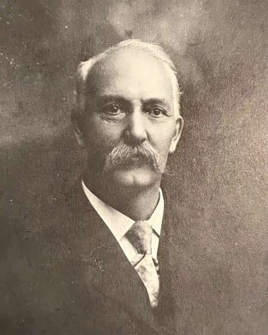
In 1892, one my favorite local mountain men and also a mayor of Pasadena, Theodore Lukens (shown below), visited Henninger in 1892 requesting a bit of land for a reforestation purposes. This is how Henninger Flats became one of the most important forest nurseries of its time.
After William died, Henninger Flats was sold to the Mount Wilson Toll Rd by his daughters. Eventually, the land came under the control of the Forest Service, as it still is this day.
However, the most significant period in Henninger Flats history was during the time of Lukens direction. Lukens leased the land from the Forest Service in 1903 and used it to carry out experimentations including the planting of conifer seeds, fire prevention, and more.
Many of the pine trees in our mountains were planted by Lukens, and they’re still there today!
According to Shirley Sargent’s book, “Theodore Parker Lukens: Father of Forestry,” Lukens received orders for seeds and seedlings from such diverse sources as Henry E. Huntington, Theodore Payne, Sen. Thomas R. Bard, Harrison G. Otis, the Mt Wilson Toll Rd Company, and locations as far away as Chile and Australia.
Additionally, one of the largest plantings supplied by Lukens in 1905 included 17,000 seedlings for the development of Griffith Park in Los Angeles!
Although Lukens was removed from the reforestation project, he was not deterred. He got in touch with his buddy, John Muir (yes, that John Muir), and began advocating for watershed conservation in the San Gabriel Mts.
Our mountain patriarchs, John Muir on the left and Lukens on the right 1895.
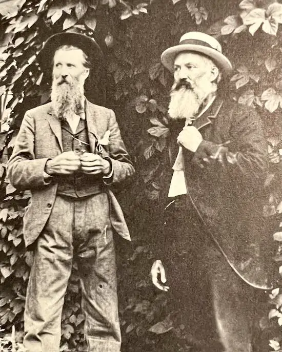
Thanks to people like Theodore Lukens, we have been able to protect much of our beautiful San Gabriel Mountains.
FAQ
Is Henninger Flats open?
Yes, Henninger Flats is open 24/7. However, the visiting center has a set schedule.
How much elevation gain is Henninger Flats?
1531 ft
Can you hike from Henninger Flats to Mt Wilson?
Yes, simply stay on the Mt Wilson Toll Rd all the way to Mt Wilson.
Do Henninger Flats and Eaton Canyon share the same trailhead?
Only if you begin from the Eaton Canyon Nature Center. However, this post begins the hike off of N. Altadena Dr. and cuts through the Eaton Wash.
Is there shade on the Henninger Flats hike?
There is only shade in two sections on this hike. The first is about halfway up and the second is at the flats.
Can you camp at Henninger Flats?
Yes, but campers must obtain a campground and campfire permit from the visitor center by calling 626 794 0675.
Is there water at Henninger Flats?
Yes, there is a water fountain at Henninger Flats. It’s located next to the restrooms.


