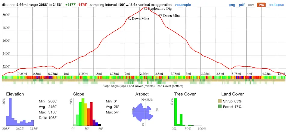
- Total Miles: 4.66
- Time: 2.5 – 3 Hrs
- Difficulty: Moderate
- Best Season: All Year
- Elevation Gain: 1175 ft
- Max Elevation: 3156 ft
- Type of Trail: Out & Back
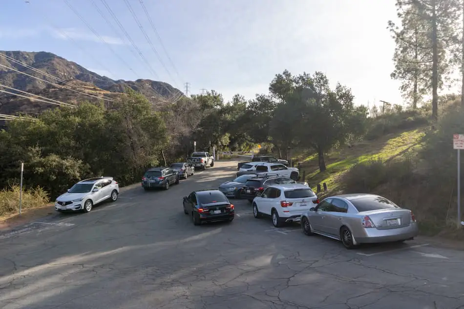
- Parking Lot: Fits ≈ 10 cars
- Dogs: Allowed On A Leash
- Restrooms: Not Available
- Trail Popularity: High
Want to explore an abandoned gold mine deep in the canyons of the San Gabriel Mountains? If so, I have just the perfect trail for you.
The Dawn Mine Trail via Sunset Ridge is a 4.66-mile round trip hike to a mine near the city of Altadena, California. It’s a heavily trafficked, moderate trail that begins on a paved road but quickly converts to a dirt trail which leads hikers to the scenic canyon floor.
Dawn Mine Trail Map
powered by Advanced iFrame. Get the Pro version on CodeCanyon.
Directions and Parking
Click the link to be redirected to the Dawn Mine Trailhead via Google Maps: 34.214819, -118.147778
If you can’t find parking at the trailhead (pictured below), you can park at the Millard Campground Parking Lot and hike up an additional 0.7 miles via the Sunset Ridge Trail to get to the Dawn Mine Trail. Details can be found on the map.
Helpful Links
SoCal Adventure Pass (required to park in SoCal mountains)
Looking for other fun LA County hikes? Check these out!
Hiking The Dawn Mine
I walked past the white gate, and made my way up the Mt Lowe Rd.
The sun was shining bright above my head, and it felt very warm. I could tell this part is unpleasant during the sizzling summer months. Be sure to wear sunscreen and a hat!
While still on Mt Lowe Rd, I reached a fork where the Sunset Ridge begins once again after being cut off by the Mt Lowe Rd, and headed left.

Walking along the Sunset Ridge trail is nice since it was mostly shaded. I could hear Millard Falls flowing and people’s voices echoing throughout the canyon.
After walking over a very interesting iron bridge and passing old cabins, I had reached the canyon floor. From here, I had to cross the creek to continue. Some sturdy trekking poles are recommended, but not necessary for creek crossings along this trail.
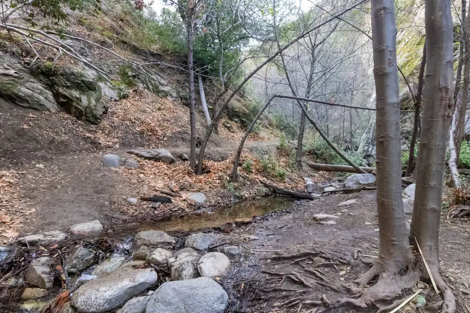
I can see why this trail can get a little confusing for someone who has never been here but keep a lookout for any signs like the one below.
There’s a fun wooden bridge to walk on. I spotted old steel remnants scattered about this trail, like the one on the left of this bridge.
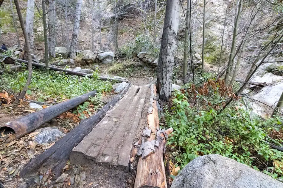
After carefully crossing through the stream a few times and climbing over big boulders, I was getting closer to the mine.
I came across another junction. The left side leads down, then ascends up to the mine. The right side requires more work, climbing up the rocky stairs. It also takes a little longer than the left route.
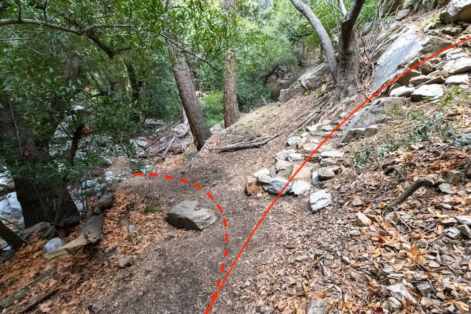
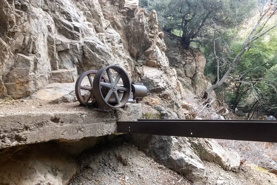
This old water pump system is a very popular photo spot before getting a look into the Dawn Mine itself.
It’s well over a century old!
Behind the rocks, you can see where people used to access the inside of the mine. Since June 2017, it’s been boarded up by this metal gate…never to be accessed again.
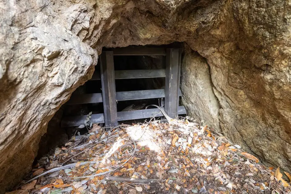
The tunnel above this one, which is pretty risky to climb to, is sadly boarded up as well. That one has a 20-foot shaft, which you wouldn’t want to fall into.
I flashed my light through the darkness and got a peek inside this small and narrow tunnel.
Although inaccessible, it’s still really awesome to see!
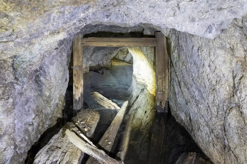
It’s interesting to imagine how they used to perilously and bravely walk through these tunnels, over a century ago, in search of precious gold.
These miners risked their lives for riches and in dreams of better lives. Now, the Dawn Mine sits cold and untouched.
Is there still gold in this mine? Possibly, but now we’ll never be able to find out for ourselves.
BONUS: Open Tunnel Upstream
There’s an exploratory dig further up the creek which you can enter and explore. It’s only about 50 feet long but worth the extra trek.
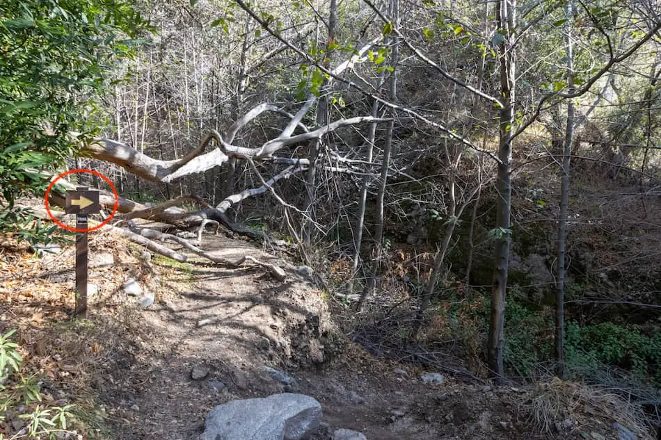
To get there, continue up the trail. When you spot the sign in the image below, take the “Tom Sloane Saddle” path.
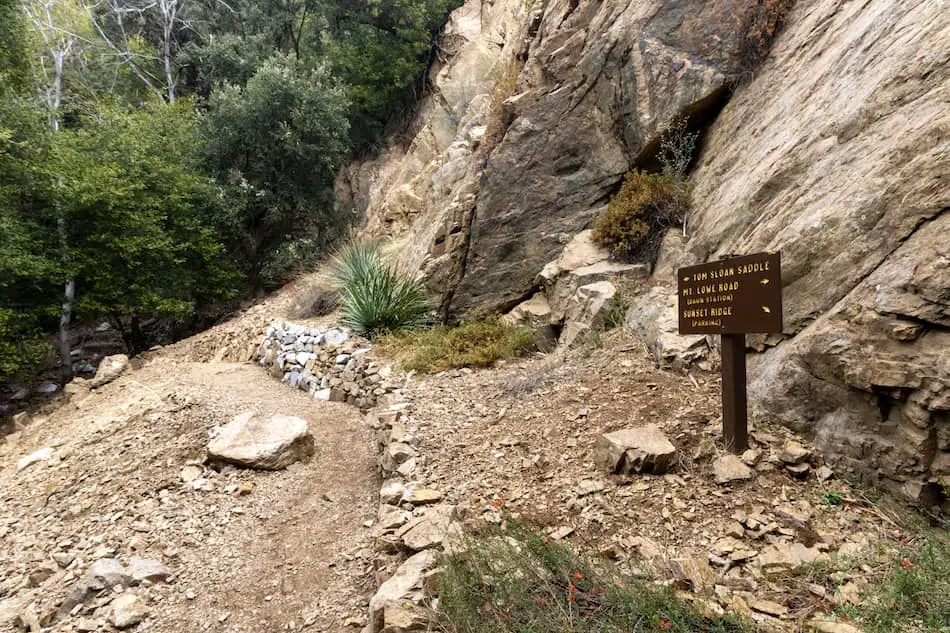
About 5 to 10 minutes later, you’ll see the portal on the left side of the trail.
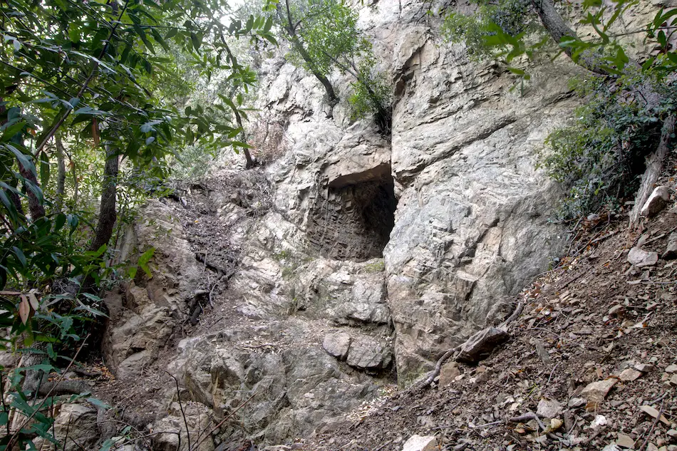
It goes in less than 50 feet. At the end of this tunnel, you’ll see a wall of slimy, icicle-looking stalactites, called calcium carbonate deposits.
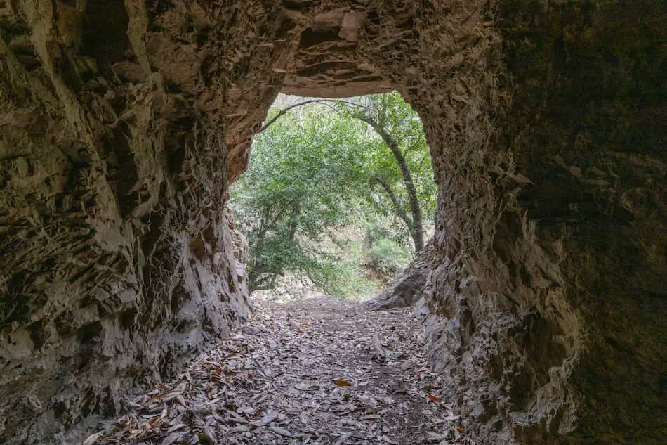
Although it’s interesting to peer through the Dawn Mine portal, it’s not as exciting as venturing inside.
Dawn Mine History
Back in 1985, a man by the name of Bradford Peck staked his mining claim above Millard Canyon in the San Gabriel Mountains. He worked at it for about 7 years, which was barely successful.
Later, in 1902, the ownership of the mine was transferred to a very experienced Australian miner by the name of Michael T. Ryan.
Ryan took the operation further and went tunneled deep inside the Millard Canyon walls. He was bringing in some profit for about seven years, but then reached a problem. It was becoming more and more difficult to transfer the ore down the canyon.
He ended up building a steep trail for his mules, Jack and Jill. These hard-working mules would carry the ore up to the Dawn Mine Station. From here, the ore traveled via railway down to the valley for further processing.
Sadly, in 1929, Ryan’s death approached. The mine sat still for some years. A few years later, other miners would try their look in search of hitting it big.
But, the Dawn Mine was ultimately a cycle of hopeful miners, some success, and then official abandonment by 1954.
Over the years, curious adventurers would crawl through the lower tunnel and explore the inside. They would find 55-foot deep water shafts, along with small exploratory inlets.
Other, more experienced adventurers, would carefully climb up to the upper tunnel and carefully walk around the 20-foot deep shaft that is located right by the entrance.
Now, it’s closed for entry. But, it’s still an interesting and fun hike to venture to in the San Gabriel Mountains.
Fun Fact
Funny enough, the Dawn Mine isn’t named after any of the owners or men who worked there. It was actually named after Peck’s friend’s daughter, who was from another mining company. Her name was Dawn Ehrenfeld.


