
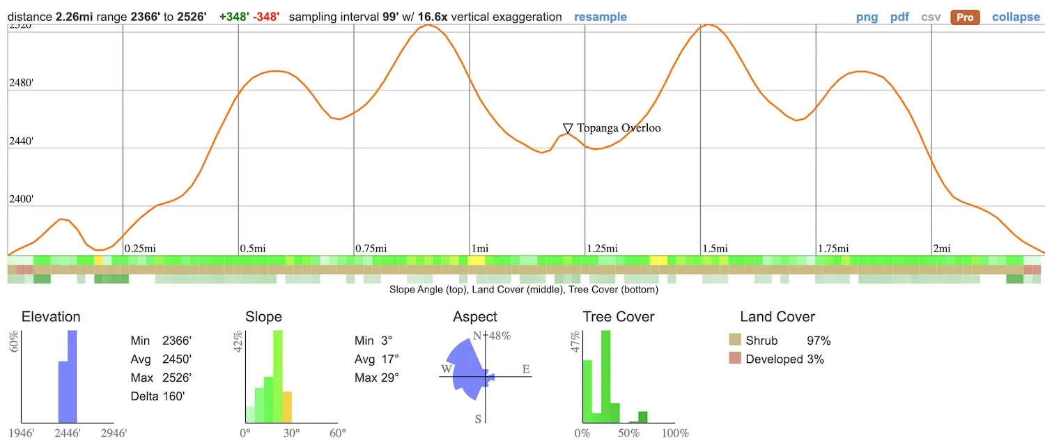
- Total Miles: 2.26
- Time: 60 min
- Difficulty: Easy
- Best Season: All Year
- Elevation Gain: 348 ft
- Max Elevation: 2426 ft
- Type of Trail: Out & Back
- Parking Lot: Fits ≈ 10 cars
- Dogs: Allowed On A Leash
- Restrooms: Not Available
- Trail Popularity: Very High
- Pics Taken On: June 17, 2021
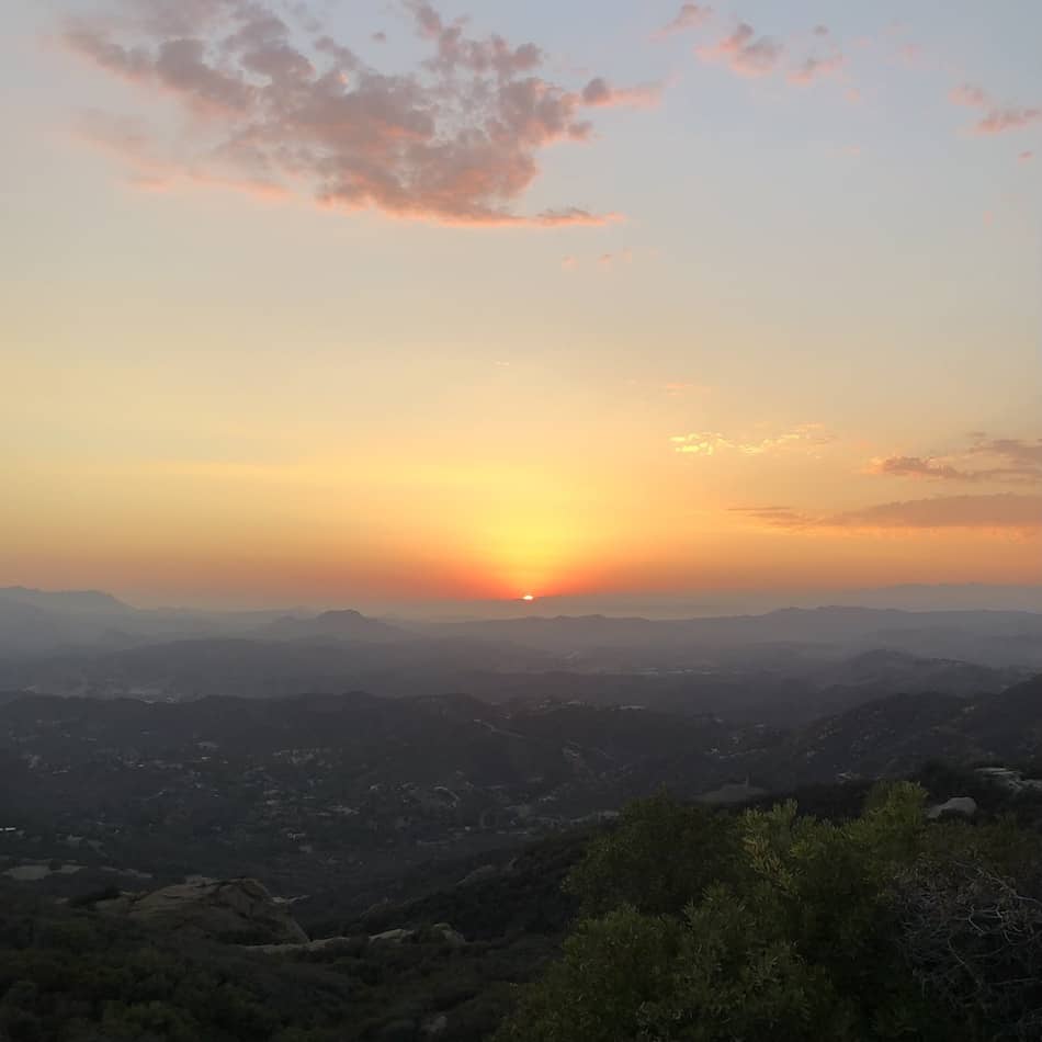
Summer nights call for breathtaking sunsets! This short hike in the Santa Monica Mountains takes you to a ledge where you’ll get insane aerial views and the best cotton candy skies!
Topanga Lookout Trail is a 2.2-mile, roundtrip hike to a graffitied ledge in Topanga, located within the Santa Monica Mountains. This easy trail is child-friendly and dog-friendly. The total elevation gain is around 348 ft.
I enjoyed the views from the Topanga Lookout so much that I added it to my list of best SoCal hikes. The list also includes abandoned gold mines, SoCal’s largest waterfalls, and caves! Click the link below to choose your next adventure:
Best Hikes In Southern California
Topanga Overlook Trail Map
Directions & Parking
For directions to the Topanga Overlook trailhead and parking area, click here.
A small parking lot is located on Stunt Rd. You can always park along the street, just be aware of parking limitations with times.
Helpful Links
SoCal Adventure Pass (required to park in SoCal mountains)
Hiking To The Topanga Lookout
I arrived on a Thursday evening to avoid the summer heat during the day. Plus, I wanted to get those amazing sunset views!
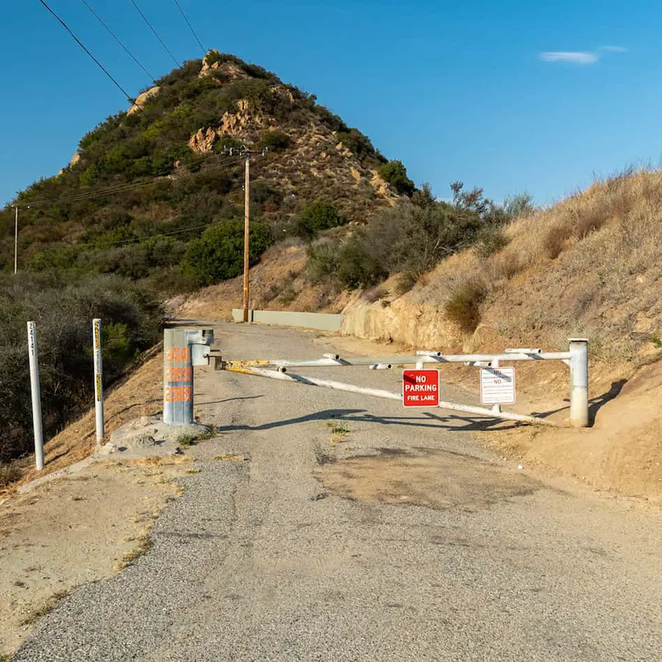
The entire trail will be on the Topanga Tower Mtwy road, so be sure to stick to the left once you get to the split.
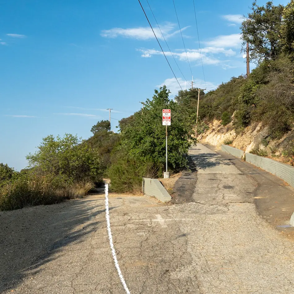
The road is mostly flat and curves. There really isn’t much shade, but the sun isn’t as harsh in the evenings.
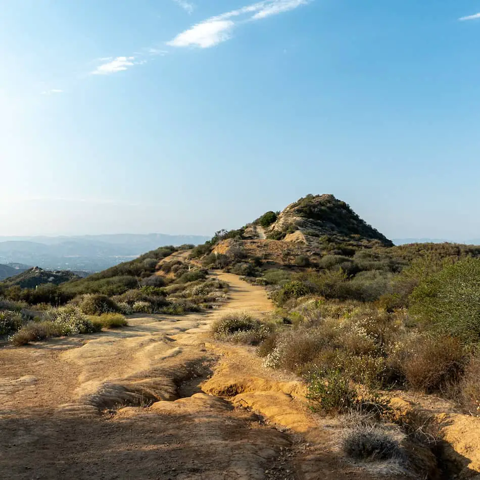
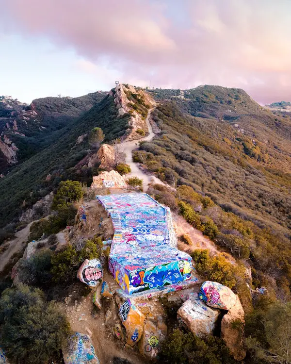
One short mile later, I was at the ledge!
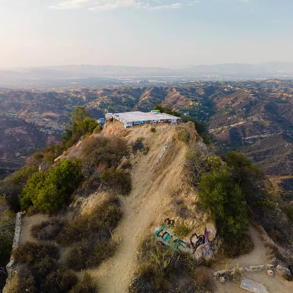
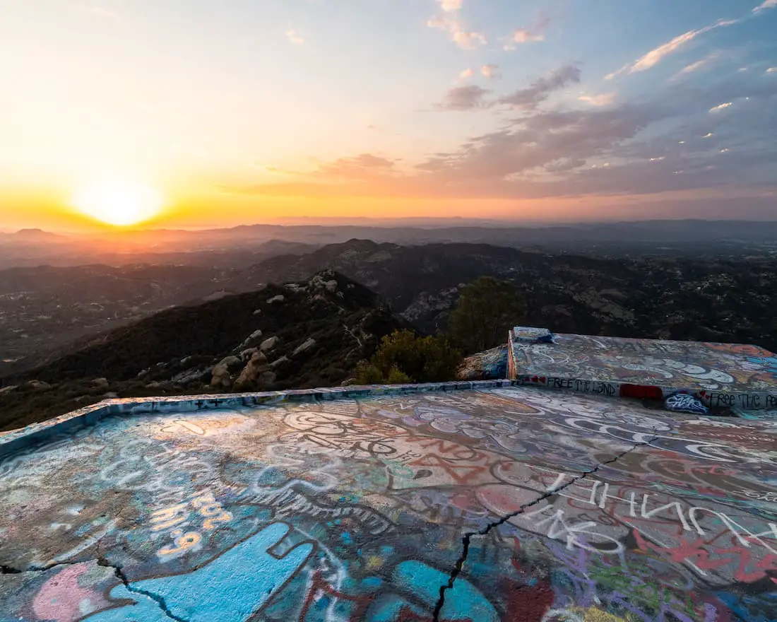
This ledge used to be a fire tower, but it is now a popular place for sunsets and 360-degree views!
There are some stairs to the right which actually lead you to a slim pathway back to the trail.
These are some absolutely amazing aerial views from our drone!
Do you spot the “all-seeing” eye?
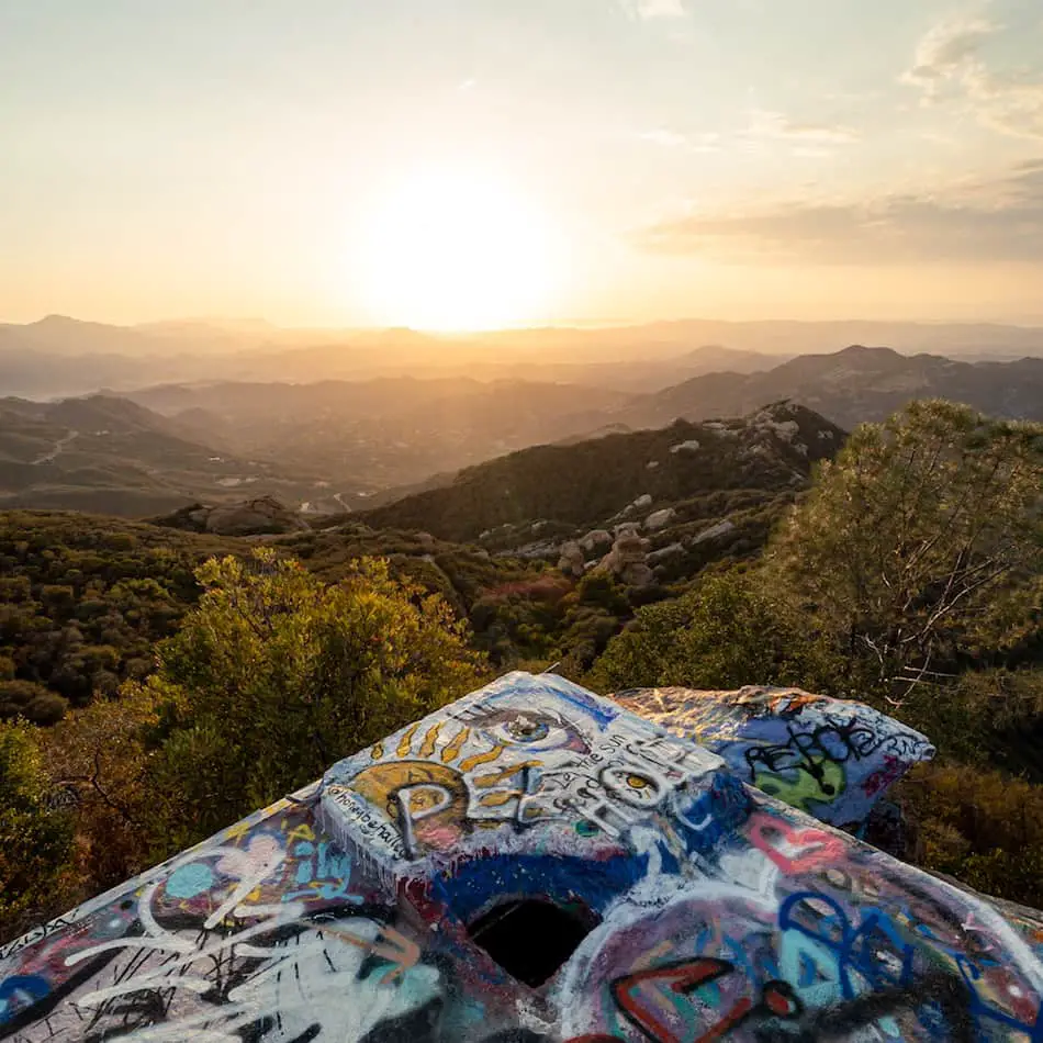
This beautiful sunset gave us a gorgeous show with cotton candy skies!
Just wait until blue hour hits and the city lights begin to twinkle.
I really recommend bringing your family, friends, or even just yourself. You’ll enjoy this summer night hike, or enjoy it all year-’round.


