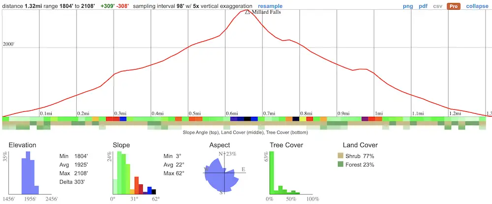
- Miles: 1.3
- Time: 45 min
- Difficulty: Easy
- Best Season: Mid-Late Spring
- Elevation Gain: 308 ft
- Max Elevation: 2108 ft
- Type of Trail: Out & Back
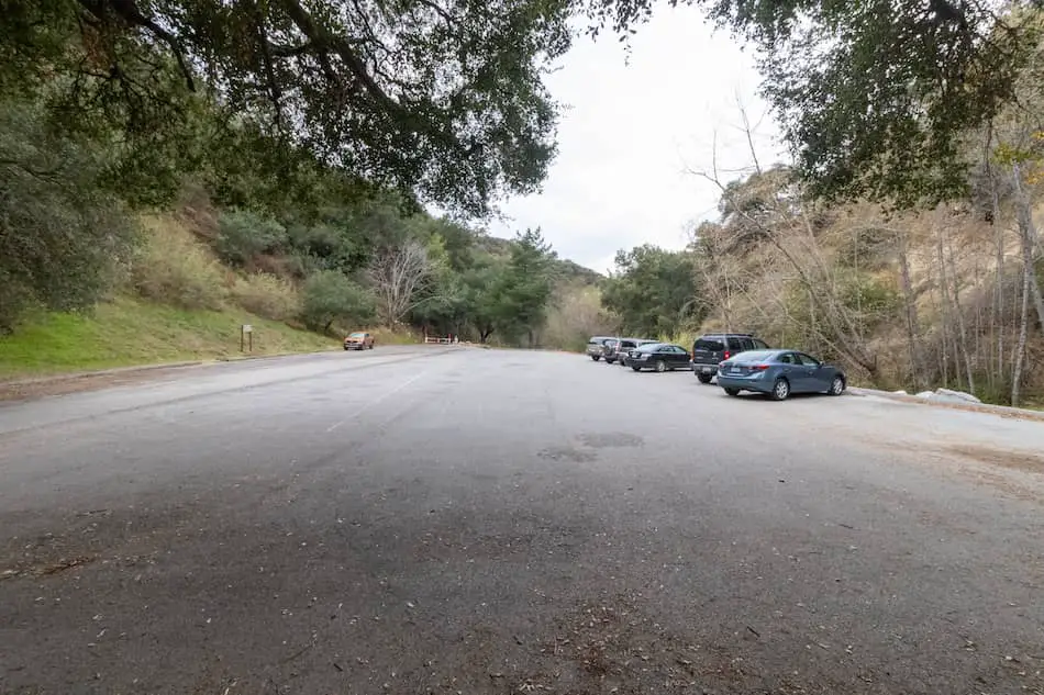
- Parking Lot: Fits 30+ cars
- Dogs: Allowed On A Leash
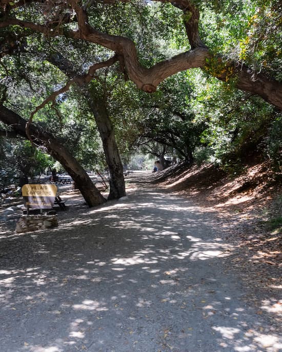
- Restrooms: Available At The Trailhead/Campground
- Trail Popularity: Very High
- Pics Taken On: Aug 31, 2023
Want to explore a quick getaway in the foothills of the Angeles National Forest? Look no further than Millard Canyon Falls, a scenic trek in Altadena!
Millard Canyon Falls is an easy, 1.3 mile hike to a fifty foot waterfall featuring multiple creek crossings, plenty of shade, and abundant vegetation. Although it’s extremely popular, the entire trail and falls are graffiti and trash free.
Want to explore the largest falls in SoCal, abandoned mines, nazi ruins, and more? Check out the posts below:
Best Hikes In Southern California
Millard Canyon Falls Trail Map
Directions & Parking
Click the following link to be redirected to the Millard Canyon Falls parking lot via Google Maps.
Although the parking lot is relatively large, expect it to get full very quickly during weekends.
Helpful Links
SoCal Adventure Pass (required for parking in CA mountains)
For current conditions and/or additional information, call the LA Gateway District Office at (818) 899-1900.
Millard Falls Trail
After parking in the lot, I made my way through the campground. If you’re hiking early in the morning, please be mindful that some campers may still be asleep.
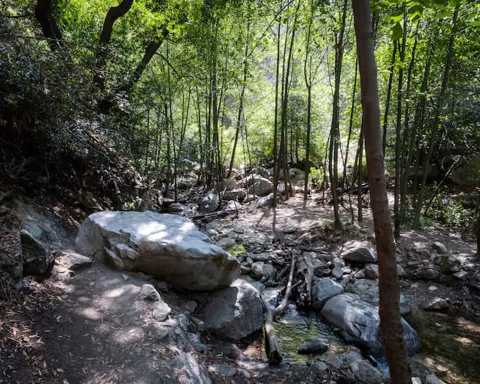
Shortly after walking past the trailhead, I had to climb up a 4-5 foot wall. This is as difficult as it gets, however, and you won’t have to worry about climbing over anything else for the rest of the hike.
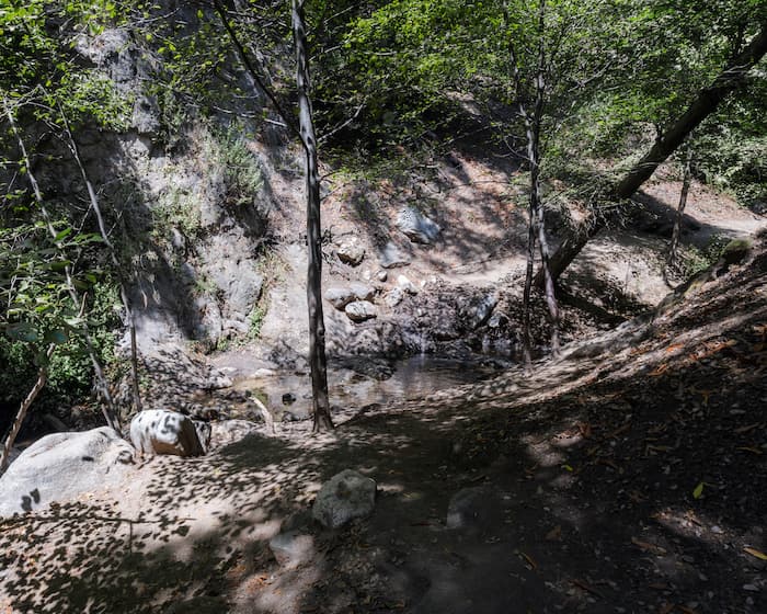
The trail requires balancing over a few creek crossings. If you have poor balance, I highly recommend taking a pair of trekking poles.
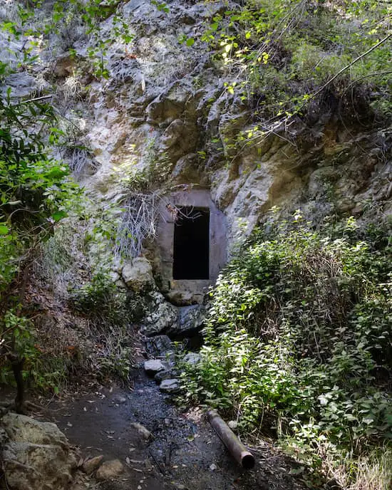
The left side of the canyon wall has what I believe to be a water tunnel. It’s no longer in use, and it only goes in a few feet, but it was fun to explore.
I clearly remember this section of the trail because I almost placed my hand over a cluster of roughly 15 huge spiders huddling together. Needless to say, be careful where you rest your hands.
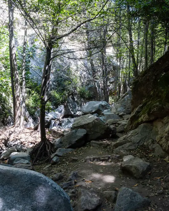
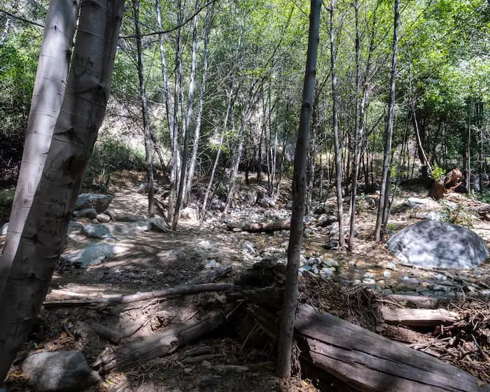
I’m not at all exaggerating when I tell you the trail looked like green paradise. I felt surrounded by a sea of White Alders and their vibrant green canopies.
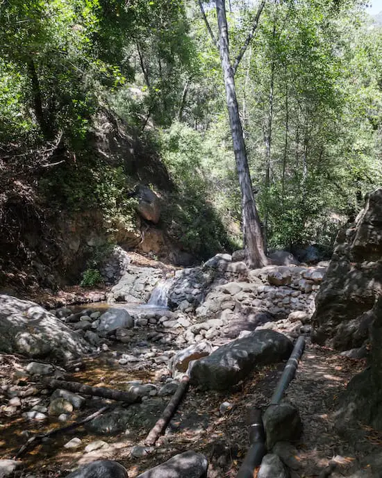
Another creek crossing can be seen below. Luckily for beginners, all of the creek crossings are narrow and shallow.
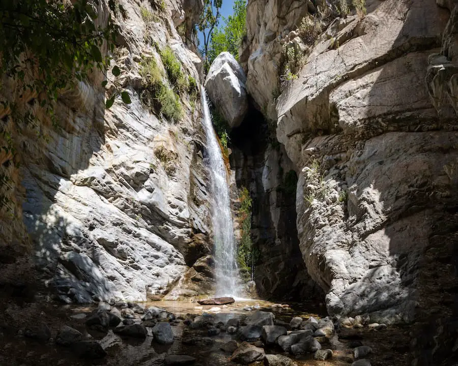
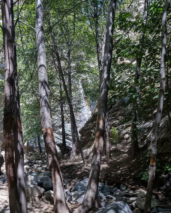
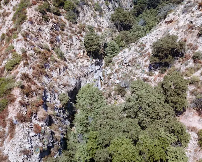
The canyon itself is very narrow, allowing for plenty of shade. I made my way around the last bend, and sure enough, I heard the waterfall roaring from afar.
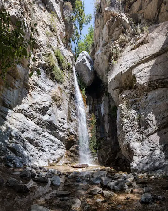
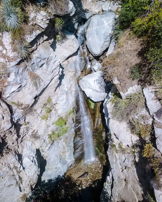
The waterfall is exceptionally beautiful, thanks to its marble looking walls and the obvious lack of trash and graffiti.
I explored the surrounding area, and noticed people had drilled hooks into the canyon walls for rappelling.
You already know. I flew the drone to get some arial shots, and I was not disappointed. The waterfall clearly stands out among the dry chaparral.
Want to keep exploring nearby waterfalls? Check out the best falls in the county by clicking the link below:
Here’s a closer drone shot. I was told there’s a pool at the top of the falls which makes for a more than ideal spot to hang out and freshen up.
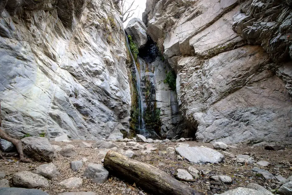
The image below was taken during one of my first visits, and unlike the other shots in this post, it was taken during the winter. Apparently, the lack of vegetation makes the canyon walls stand out more.
Millard Falls is undoubtedly beautiful, but in my opinion, it’s not even in the top three nicest waterfalls. To view Southern California’s most epic waterfalls, including the colossal 500 foot Big Falls, click on the link below.
Since this trail is super short, I highly recommend combining it with a nearby hike such as abandoned mines, another waterfall, or haunted ruins which you can do by clicking the link below:
History of Millard Canyon
The Hahamong’na people were among the first to settle along the Arroyo Seco and Millard Canyon, using the former as a major trade route and resource.
During the second half of the 19th century, a large number of white American settlers continuously arrived in Southern California with the hope of striking it rich while panning and mining for gold. The area quickly became a hotspot for prospectors and miners.
You might be wondering where Millard Canyon got its name. Well, according to Robert H. Peterson in his book, Altadena’s Golden Years, Millard canyon was known as Lilac Canyon due to the profusion of wild lilacs, but was later named after Henry W. Millard who settled in the gorge in 1862.
I’ve also heard others refer to it as Church Canyon, as it’s believed that the lumber used to build some of the Spanish missions was taken from Millard Canyon. However, Peterson makes the claim that Church Canyon is actually the Grand Canyon (yes we have a canyon with that name in the San Gabriel Mts) where Joseph Chapman set up a logging camp.
Henry Millard and his family resided in the canyon for many years. He hauled timber and raised bees as a means for provision. However, after his wife and daughter passed away, he moved to Downey, CA.


