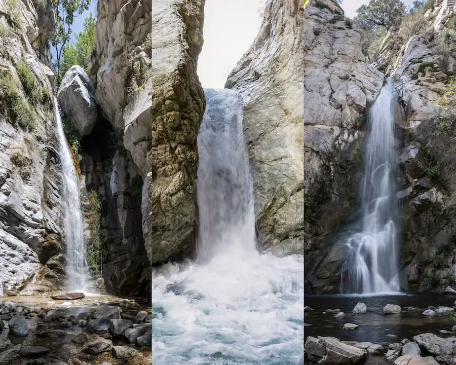
Contrary to popular belief LA is not only a dry concrete jungle. Every spring I see dozens of waterfalls come back to life, incentivizing thousands of Los Angelinos to trade the usual screen time for their hiking boots and some fresh air.
I grew up and still live very near the foothills of the Angeles National Forest where I’ve spent literally half my life hiking, biking, and snowboarding. I know which waterfall hikes have the most scenic trails, flow longer than others, offer the best views, and have additional secret waterfalls that most people have no clue exist. Now, I’m going to share them with you.
Here is a list of the best waterfalls in the County of Los Angeles.
Best Waterfalls In Los Angeles
I organized the following list from least amazing to most amazing. Lastly, please remember to pack out everything that you pack in. Many plants and animals depend on it. Thank you.1
10) Brown Mt Dam Falls: 80 Ft Man-Made Cascade
- Total Miles: 1.45
- Difficulty: Moderate
- Best Season: Mid Spring
- Elevation Gain: 663 Ft
- Time: 45 Min
- Dogs: Allowed On A Leash
- Restrooms: Not Available
- Map, Directions, & Full Post: Brown Mt Dam Falls
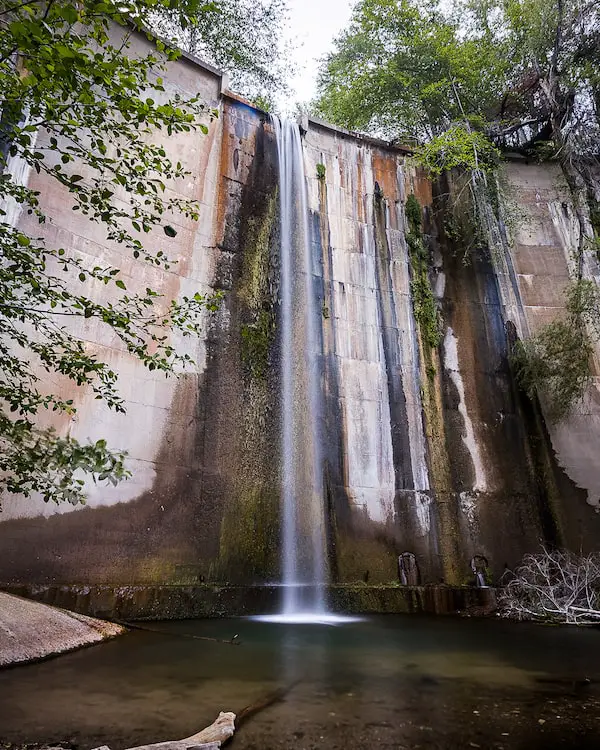
Brown Mountain Dam Falls is an 80-foot man-made cascade in the Arroyo Seco Creek. There are two trailheads for this hike, the 1.45-mile hike that I talk about in this section, and an 8.46-mile route, which you can see by clicking the link to the full post.
I hiked the 1.45-mile route which began on a turnout off the 2 Hwy, right across the street from the Angeles Crest Fire Station. Since the goal was to get to the canyon floor in less than half a mile, you best believe it was steep and loose. Hiking boots are not an option on this trail, they’re a necessity.
However, once I got to the creek, White Alders, Western Sycamores, and large cabin ruins transformed the landscape.
After walking past a wooden hitchrack (for tying horses), and crossing the creek a couple of times, I found myself at the base of the falls. The falls are stunning, and the fact that it was man-made made no difference to me. If anything, it was more unique and interesting.
Fun Fact: Brown Mt Dam Falls is located on the same creek as Switzer Falls, the latter just happens to be located much deeper in the San Gabriel Mts.
9) Monrovia Canyon Falls (Temporarily Closed)
- Total Miles: 2
- Difficulty: Easy
- Best Season: Spring
- Elevation Gain: 439 Ft
- Time: 1 Hr
- Dogs: Allowed On A Leash
- Restrooms: Available At The Parking Lot
Full disclosure, I don’t have the link to the full post because Monrovia Canyon Park closed a year before I started this website. However, I’ve hiked this trail more than most as it was the closest waterfall to where I grew up.
I found this trail to be perfect for kids as it was easy and interpretive. During some of my visits, I’ve seen park guides giving small children a tour of the canyon and nature center.
The scenic trail is mostly shaded and surrounded by plant life. If you’re lucky (or unlucky depending on how you see it), you might come across a bear. I haven’t been lucky while on this hike yet, but I’ve seen multiple bears strolling around the town of Monrovia, once while delivering for Uber Eats.
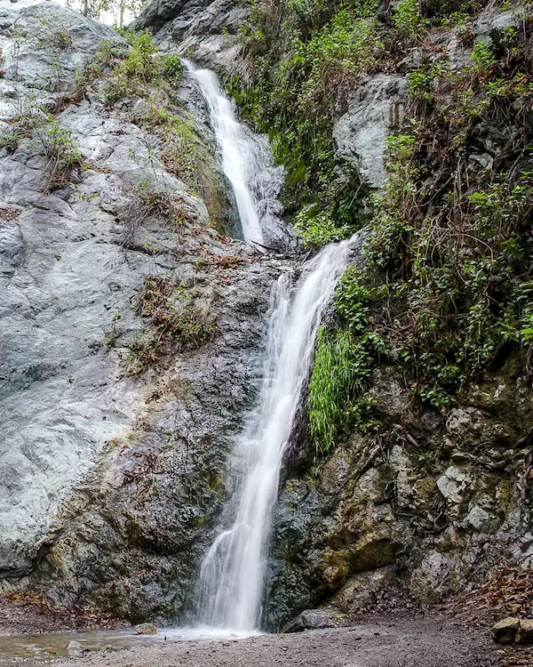
The two-tier waterfall is roughly 30 feet high and surrounded by luscious vegetation.
8) Switzer Canyon Falls & Bonus Secret Falls
- Total Miles: 4.6
- Difficulty: Moderate
- Best Season: Spring
- Elevation Gain: 695 Ft
- Time: 2.5 Hr
- Dogs: Allowed On A Leash
- Restrooms: Available At The Parking Lot
- Map, Directions, & Full Post: Switzer Falls Trail
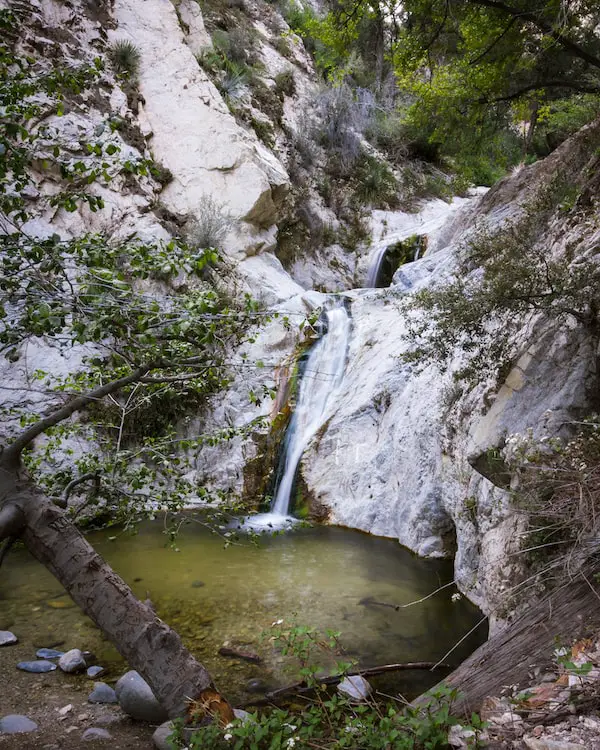
Switzer Falls is a beautiful multi-tiered cascade located in Bear Canyon. In my opinion, the trail was very scenic, and I love the fact that it’s located far away from the city.
The trail began on the canyon floor, ascended the canyon wall to bypass a massive drop in the Arroyo Seco Creek, and then descended back down to the canyon floor before making its way upstream to arrive at the falls.
Throughout the hike, the creek would occasionally widen and flow over barren rock as it hugged the canyon wall, creating the illusion of little rock slides. I was in paradise.
I crossed the creek quite a few times throughout the trail. Some creek crossings required balancing on logs and others on boulders. I felt like I was in an obstacle course.
Switzer Falls has two tiers, measuring roughly 50 feet high, and is very elegant looking. Unlike most waterfalls in SoCal, which roar off a ledge in a loud and violent manner, Switzer Falls graciously flows down the rocks, forming a slight curve that resembles a slide. But it’s not a slide so please don’t try.
Fun Fact: If you climb up the east side of the Switzer Falls and continue making your way upstream, you’ll arrive at a second secret waterfall. More info info in the full post.
7) Eaton Canyon Falls: LA’s Most Popular Waterfall
- Total Miles: 4.02
- Difficulty: Easy
- Best Season: Spring
- Elevation Gain: 455 Ft
- Time: 2.5 Hrs
- Dogs: Allowed On A Leash
- Restrooms: Available At The Trailhead
- Map, Directions, & Full Post: Eaton Canyon Falls
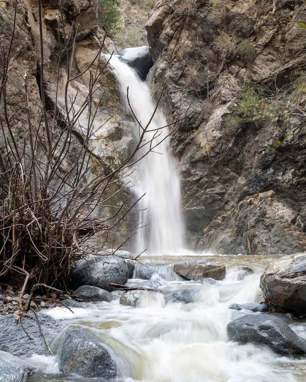
Eaton Canyon Falls is located in Pasadena in a canyon with narrow and steep walls, dubbing it the name, The Precipice Canyon by the Spanish.
I found the first section of the hike to be somewhat dull as it consisted of a dirt road weaving its way through the sun-exposed Eaton Wash. However, once I entered the canyon, the scenery quickly changed to a more woodland look and the road became a dirt trail.
The hike required crossing the creek quite a few times (around 10) some of which were pretty large but luckily not deep. Other than the creek crossing, there were no additional major obstacles.
The base of the falls is a wide section of the canyon, free of trees, and with boulders scattered throughout.
Eaton Falls is a decent fifty feet high, with a shallow pool, and dark walls which vandals have incessantly gratified. If you’re planning to visit the place, make sure to arrive very early, as it gets ridiculously crowded on weekends.
Fun Fact: A secret waterfall is located right up the canyon. Unfortunately, it’s no longer accessible, but those who’ve visited tell stories of great times at a huge rockslide and pool.
6) Trail Canyon Falls: Oasis In Big Tujunga
- Total Miles: 4.54
- Difficulty: Moderate
- Best Season: Spring
- Elevation Gain: 1067Ft
- Time: 2.5 Hrs
- Dogs: Allowed On A Leash
- Restrooms: Not Available
- Map, Directions, & Full Post: Trail Canyon Falls
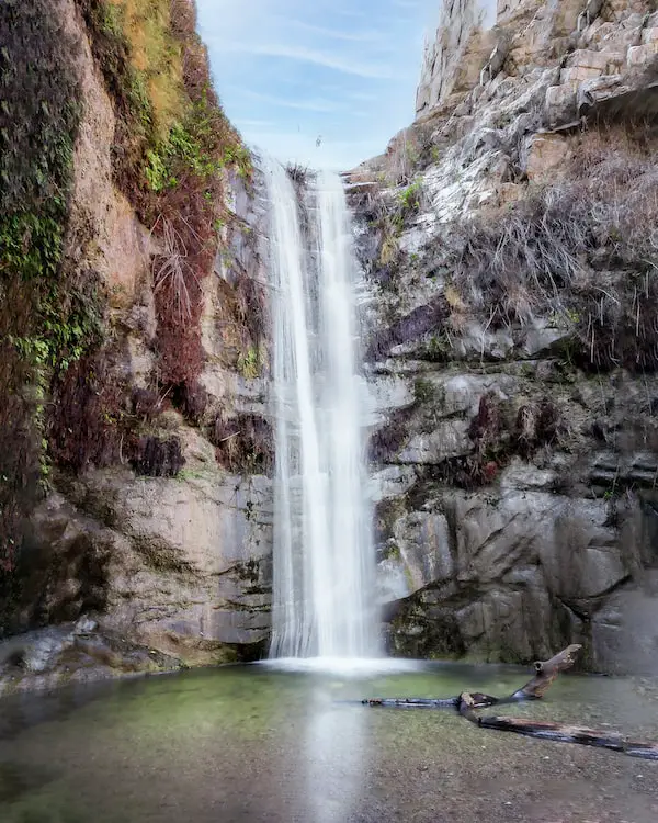
Trail Canyon Falls is not what you’d expect to see in the dry canyon of Big Tujunga.
The trail began on a dirt road but quickly converted into a dirt trail before ascending the west side of the canyon. The trail itself isn’t the most scenic, but the waterfall is more than worth it.
Fun Fact: Multiple seasonal waterfalls on this trail only flow during or after heavy rain, one of which is larger than Trail Canyon Falls. You can see pictures of the seasonal waterfalls in the full post. They’re dry, but at least you’ll know what to look for.
I had to use a rope left behind by the locals to get down to the base of the falls. It wasn’t too difficult, but people who have a hard time sustaining their weight while on a rope may struggle.
Most waterfalls are thin streams flowing off a ledge, but after decent rainfall 40-foot Trail Canyon Fall’s two streams merge into one broad cascade, giving it a powerful look and strong roar.
Additionally, for those who have trouble with heights or climbing, the top of the falls can be explored without climbing down via the rope.
5) Millard Canyon Falls: Scenic Hike To 50 Ft Falls
- Total Miles: 1.3
- Difficulty: Easy
- Best Season: Spring
- Elevation Gain: 308 Ft
- Time: 45 Min
- Dogs: Allowed On A Leash
- Restrooms: Available At The Campground
- Map, Directions, & Full Post: Millard Canyon Falls
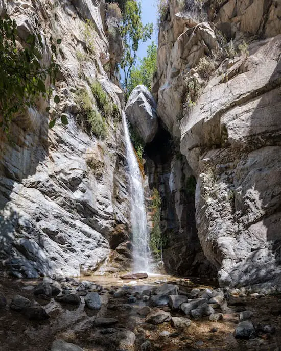
Millard Canyon Falls is a gem located in the foothills of Altadena. The trail is as scenic as they come, almost entirely shaded, and easy enough for the entire family.
I began the short hike at Millard Campground and headed upstream to the waterfall, but not before crossing the creek a few times. There is one very shallow and shaded pool toward the end of the trail where I’ve continuously seen hikers rest and cool off. Maybe you can get to it before others.
The waterfall is 50 feet high and surrounded by white granite walls, probably the whitest I’ve seen, giving Millard Falls a very captivating look.
This is the waterfall hike which I highly recommend for beginners as the only major obstacles are a four-foot ledge at the beginning of the hike and a few easy creek crossings. If you decide to visit, make sure to arrive extra early as it gets super crowded!
4) Hermit Falls: Cliff Jumping Paradise (Temporarily Closed)
- Total Miles: 2.5
- Difficulty: Moderate
- Best Season: Spring
- Elevation Gain: 715 Ft
- Time: 1 Hr 15 Min
- Dogs: Allowed On A Leash
- Restrooms: Available At The Parking Lot
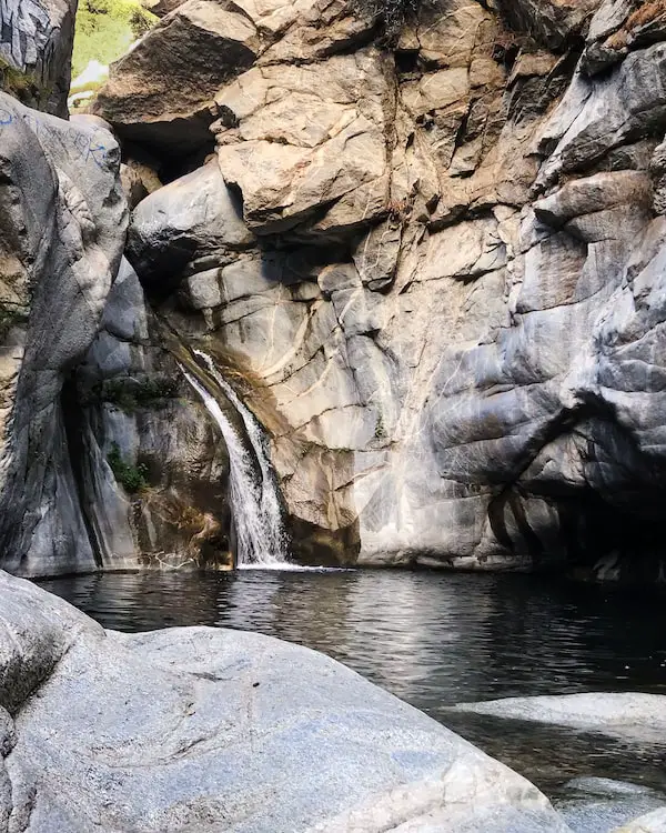
Hermit Falls is located in Santa Anita Canyon, and, in my humble opinion, is the best spot for cliff jumping in the San Gabriel Mts. Unfortunately, it was closed after the Bobcat Fire of 2020, which is why I don’t have the full post. However, I’ve hiked this trail many times.
I started the hike on a steep paved road descending from Chantry Flats where the parking lot is located, then hopped on a dirt trail which led me down to the canyon floor.
The setting turned into green paradise, and the forest canopy provided plenty of shade. I made my way downstream, admiring the multiple waterfalls flowing off the check dams, until reaching Hermit Falls.
Fun Fact: Hermit Falls has TWO large waterholes, one at the top of the falls and the larger at its base, which are deep enough for cliff jumping.
I jumped into the larger swimming hole from a roughly thirty-foot ledge. It was paradise. The barren granite cliffs on both sides seemed to close in on me as I swam out of the pool.
Unfortunately by my last visit, which I believe was in early 2020, every reachable spot on the canyon walls seemed to be covered in filthy graffiti.
To get back to the ledge at the top of the falls, I had to climb up a near-vertical wall using a rope left behind by others. I’ve seen cliff jumpers scramble up a very steep and loose trail which begins at the base of the falls and ends at roughly fifty-foot ledge, but I’ve yet to try it myself.
After calling it a day, I made my way back up to the Chantry Flats where I enjoyed a delicious meal from Adam’s Pack Station.
3) Lewis Falls & Bonus Secret Waterfall
- Total Miles: 0.73
- Difficulty: Easy – Moderate
- Best Season: Spring – Fall
- Elevation Gain: 328 Ft
- Time: 35 Min
- Dogs: Allowed On A Leash
- Restrooms: Not Available
- Map, Directions, & Full Post: Lewis Falls
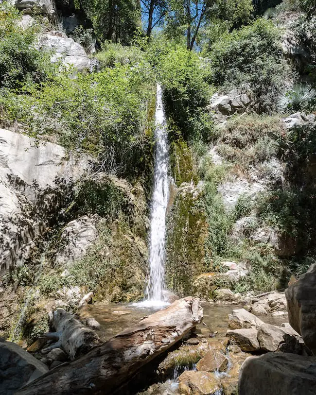
50-foot Lewis Falls is one of those trails that makes you feel like you’ve completely left California.
The trail is easy, teeming with luscious vegetation, and full of water! Unlike most waterfalls which dry up by the summer, Lewis Falls tends to flow late into the fall and sometimes winter!
Virtually the entire trail is shaded thanks to the giant incense cedar trees which tower 100 feet above the canyon floor. Hence, the reason why it feels like you’ve left CA.
Fun Fact: A second smaller waterfall is located about halfway through the hike, but most people miss it because it can’t be seen from the trail. Check out the full post to learn its location!
Once at the falls, part of the canyon was flowing with water from wall to wall. The cascade flowing off the cliff almost looks like its coming from a huge pressurized hose as vegetation surrounds it on all sides.
2) Sturtevant Falls: (Temporarily Closed)
- Total Miles: 3.3
- Difficulty: Easy – Moderate
- Elevation Gain: 400 Ft
- Time: 1 Hr 45 Min
- Dogs: Allowed On A Leash
- Restrooms: Available At The Parking Lot
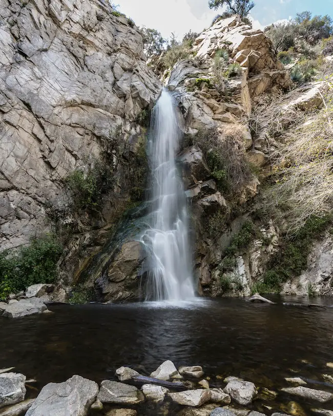
Like Hermit Falls, Sturtevant Falls also begins from Chantry Flats, is located in Santa Anita Canyon, and is also closed due to the Bobcat Fire. A trail that makes its way through the canyon floor connects the two, saving hikers the hassle of ascending to the trailhead to begin the next one.
Assuming I was only hiking Sturtevant Falls, I’d take the paved road from Chantry Flats down to the creek where it became a dirt road.
In my opinion, the ivy-covered cabins with stone walls and wooden bridges make this the most scenic (and probably greenest) trail in the San Gabriel Mts. Additionally, the white alders, western sycamores, and the occasional oak tree provided a thick canopy that shaded much of the trail.
The creek forms small shallow pools and is home to the Coast Range Newts which I’ve spotted a couple of times during and shortly after the rain.
The dirt road ended with the last cabin, and a dirt trail took me the remainder of the way to the roaring falls where the forest canopy opened up. As I got closer I could see the moss clinging to the wet walls, contrasting with the white granite.
While resting at the waterfall, hikers on the narrow Gabrielino Trail 50 feet above the canyon floor made their way over the top of the falls, and get dangerously close to the ledge to peek down on us and the falling stream.
When it rains a lot, the canyon is filled with mist from the falls, making it look like you’re in a dream state.
1) Escondido Falls: Best Waterfall In The County
- Total Miles: 3.49
- Difficulty: Easy
- Elevation Gain: 507 Ft
- Time: 1.5 Hrs
- Dogs: Allowed On A Leash
- Restrooms: Porta Potty At The Parking Lot
- Map, Directions, & Full Post: Escondido Falls
If you’ve read this post before, you know I had previously rated Sturtevant Falls as the best waterfall in LA County. Don’t get me wrong, Sturtevant won’t let you down, but I’ve officially found a waterfall that supersedes it (Sturtevant Fall’s trail is greener and more scenic).
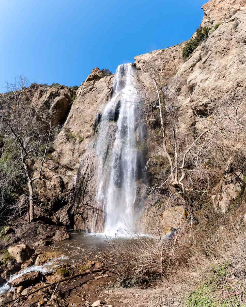
Not so hidden in the Malibu wilderness is a set of three amazing cascades called Escondido Falls. Lower Escondido Falls is roughly 50 feet high, the middle falls about 20 feet, the upper falls, however, is a whopping 150 feet. I was left breathless at its enormous size and power as it plummeted off the coastal cliff.
The lower falls, sometimes referred to as the “limestone falls” is broad, unlike most waterfalls in LA County. Its raging torrent creates a pocket of nature’s paradise among a dense forest of sycamores and coastal chaparral.
All three waterfalls are dry throughout most of the year, which is why it’s crucial to visit as soon as possible following a decent rainstorm or wet winter. A drizzle will do virtually nothing for the falls.
The trail is very beginner friendly, requires a handful of creek crossings, and is fun for the family to enjoy.
Waterfalls Near LA County
The following two waterfalls are no longer considered Los Angeles County, but are still located within the Angeles National Forest, specifically the Mount Baldy area, which happens to be very close to the border between LA and San Bernardino Counties.
2) Stoddard Falls: Rockslide & Pool
- Total Miles: 0.75
- Difficulty: Easy
- Best Season: Spring – Mid Summer
- Elevation Gain: 160 Ft
- Time: 35 Min
- Dogs: Allowed On A Leash
- Restrooms: Not Available
- Map, Directions, & Full Post: Stoddard Canyon Falls
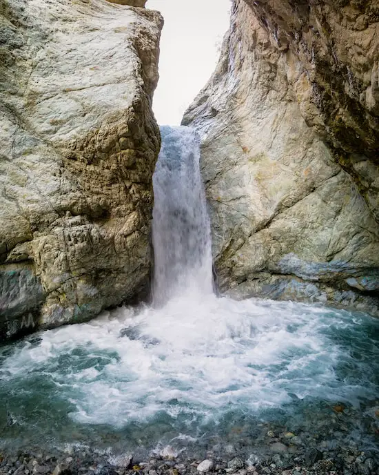
Stoddard Canyon Falls is one of the very few waterfalls in the San Gabriel Mts that has a rockslide and pool.
I started the hike on an abandoned paved road that gradually descends alongside the crystal clear San Antonio Creek. I’m not exaggerating when I claim the water in this creek is the clearest and bluest I’ve ever seen in Southern California.
Finding the section of the hike where a dirt trail descends perpendicularly away from the paved road is very tricky, so make sure to view the full post for pictures.
The dirt trail is very loose and steep, so people who have poor balance or small children may require assistance from other people or trekking poles.
Luckily, the dangerous section is very short, and I was at the canyon floor within a couple of minutes. From here onward I made my way up the creek by boulder hopping.
Stoddard Canyon Falls is roughly 40 feet high and has recently blown up in popularity thanks to TikTok and Instagram. It gets very crowded, so be sure to arrive early on weekends.
Lastly, the waterfall is virtually graffiti-free at the time of writing this post (Oct 3rd), let’s hope the popularity doesn’t change that. If you spot someone vandalizing our mountains, do not engage, but please report it to the authorities.
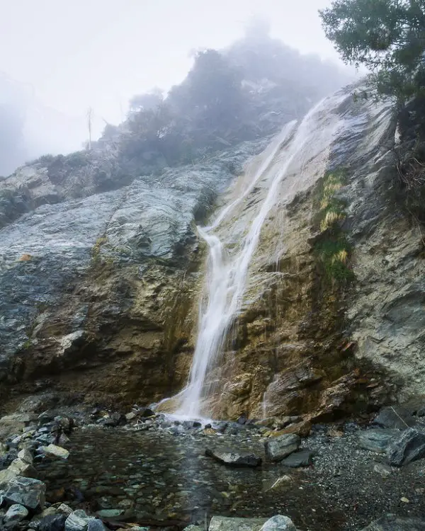
1) San Antonio Falls: Huge Breath-Taking Waterfall
- Total Miles: 1.33
- Difficulty: Easy
- Best Season: Spring – Fall
- Elevation Gain: 277 Ft
- Time: 45 Min
- Dogs: Allowed On A Leash
- Restrooms: Not Available
- Map, Directions, Drone Video, & Full Post: San Antonio Falls
Located further up the road from Stoddard Falls is the largest waterfall on this list, San Antonio Falls, which also had me strolling along a paved road before switching over to a dirt trail.
However, this paved road offered amazing views of the canyon below as well as the pine-filled mountains towering around me.
Fun Fact: San Antonio Falls gets snow! Check out the full post to view a stunning short video of the falls covered in snow.
A viewpoint located on the paved road where the dirt trail begins allowed me to see a few more of the waterfall’s tiers in person.
If I recall correctly, only the bottom tier can be seen from the base of the falls, and only a drone can capture all tiers, but from the viewpoint I was able to see the two bottom tiers which happen to also be the largest.
Fun Fact #2: It’s possible to access some of the top tiers, and those who do are rewarded with a refreshing crystal clear pool.
The agreed-upon size of the falls is 75 feet, but after examining my drone shots, I’m almost 100% positive the waterfall is much larger.
Fun Fact #3: Like Lewis Falls, San Antonio Falls also flows virtually year-round!
FAQs
Does Los Angeles Have Waterfalls?
Los Angeles County has hundreds of waterfalls.
What Is The Largest Waterfall Near LA?
The largest waterfall near LA is San Antonio Falls. There are many claims stating the waterfall is 75 feet high, but that is only true of the bottom tier. When all tiers are taken into consideration, the waterfall’s height is closer to 200 feet.
What Is The Easiest Waterfall Hike In Los Angeles?
The easiest waterfall hike in LA is Monrovia Canyon Falls, but unfortunately, it’s been temporarily closed. The next easiest waterfall hike is Millard Canyon Falls, which aside from a 4 foot ledge that must be climbed over at the beginning of the hike, is short, relatively flat, and very scenic.
Do Los Angeles Waterfalls Flow All Year?
Most LA waterfalls dry up during the summer. However, Lewis Falls typically flow all year.

