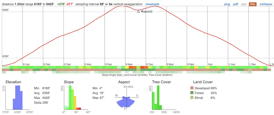
- Miles: 1.33
- Time: 30 min
- Difficulty: Easy
- Best Season: Spring
- Elevation Gain: 277 ft
- Max Elevation: 6425 ft
- Type of Trail: Out & Back
- Parking Lot: Fits 30+ cars
- Dogs: Allowed On A Leash
- Restrooms: Not Available
- Trail Popularity: Very High
Looking for an easy weekend adventure? Visit the enormous San Antonio Falls in the Angeles National Forest! Most guides online claim the falls is only 75 ft high, but I believe that only applies to the bottom tier. The video below shows how much larger it actually is.
The trail at San Antonio Falls totals 1.3 miles roundtrip, and mostly consists of a concrete road leading hikers past beautiful pine trees, mountain cabins, and ending at a huge multi-tiered cascade at the base of Mount Baldy. The best time to visit is in the late winter to early summer months. Since the trailhead begins at a high elevation, snow can be expected during the winter months.
San Antonio Falls is both one of the best hikes and best waterfalls in all of SoCal. Check out the other trails by viewing the posts below:
Best Hikes In Southern California
San Antonio Falls Trail Map
Address & Directions
To be redirected to the trailhead via Google Maps, click the following link: 993 Falls Rd, Mt Baldy, CA 91759
Helpful Links
SoCal Adventure Pass (required for parking in CA mountains)
San Antonio Falls Hike
I hiked San Antonio Falls (sometimes referred to as the Mt Baldy Waterfall) in early June and was pleasantly surprised to see a decent amount of water.
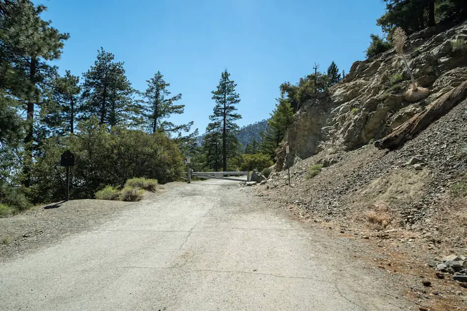
I began the hike by walking past the gate, and heading up a concrete road called Falls Rd.
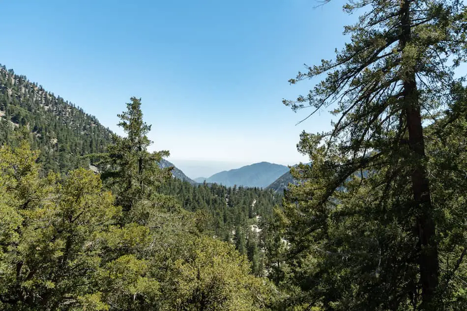
Shade is scarce, and the temperature can get pretty warm, so I suggest bringing some shorts, a hat, and sunscreen! I was surrounded by a sea of pine trees, peaks, and breathtaking views.
If you enjoy bagging peaks, San Antonio Canyon has a plethora of enticing summits with breathtaking views.
Some, such as San Antonio Peak, are better suited for advanced hikers, but others, including Sunset Peak and Stoddard Peak Trail, located just down the road, are only moderately difficult, yet still provide great views.
When I arrived at the first fork, I stayed on Falls Rd. The road to the left is a driveway leading down to privately owned cabins. Please do not enter.
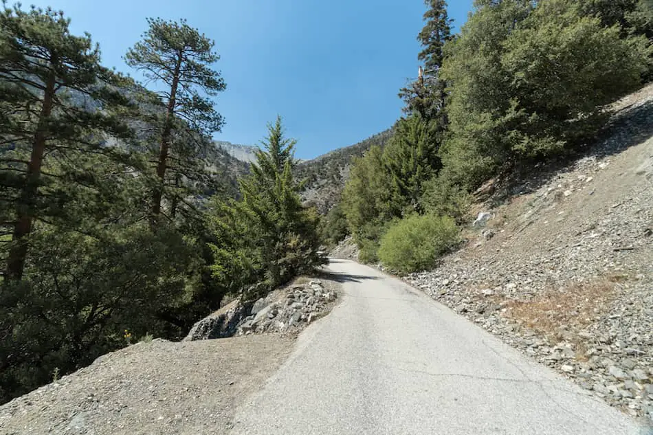
The paved road makes this trail very kid-friendly. For more family hiking adventures, view my post on the best SoCal hikes for kids, which includes waterfalls, caves, slot canyons and more.
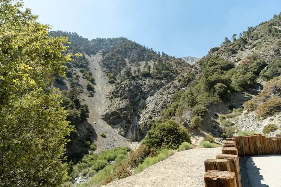
Before switching from Falls Rd to a dirt trail, I noticed a wall made of short vertical logs.
This area is a viewpoint that offers a view of the waterfall’s many tiers, the surrounding canyon, and the creek. It’s the best view the hike has to offer.
A dirt trail leads from the viewpoint to the canyon floor near the base of the falls. This is the only somewhat difficult section of the hike, as the dirt is very loose.
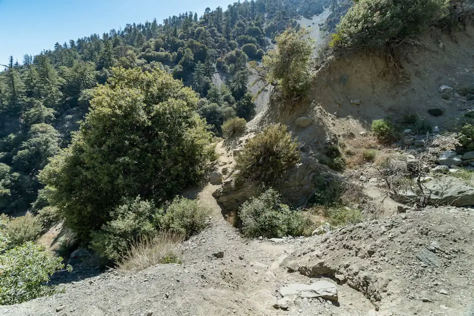
Almost there!
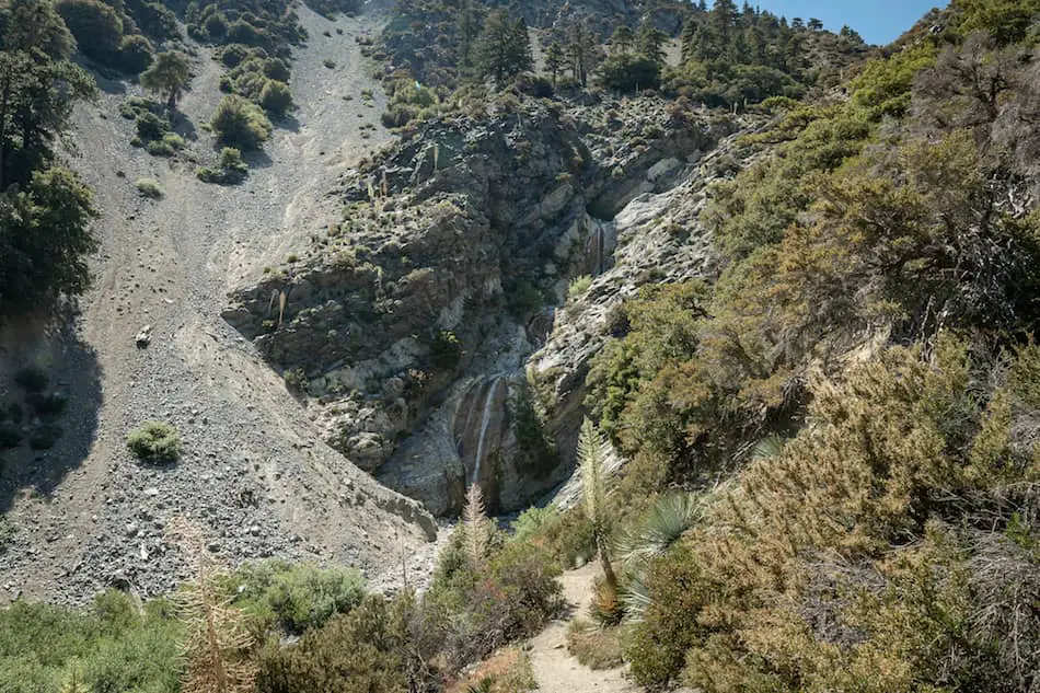
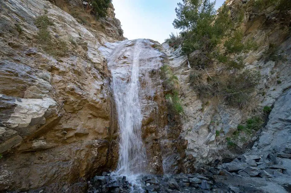
After trekking only 0.6 miles from the trailhead, I made it to San Antonio Falls!
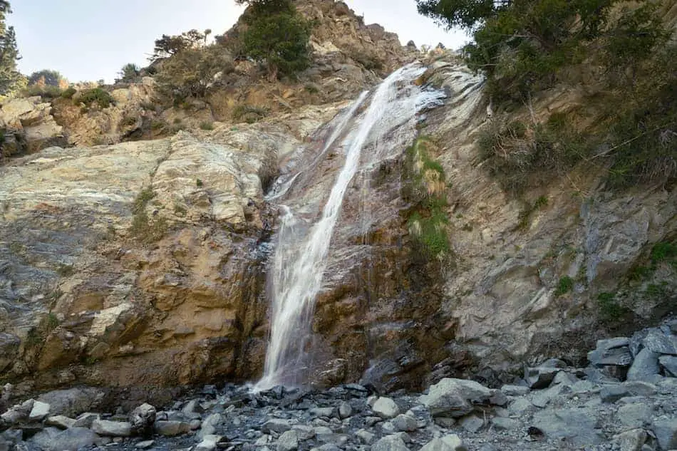
The crystal clear water was pleasantly refreshing, and the mountain breeze felt amazing.
Everywhere I looked I was surrounded by pine trees and canyon walls, just like the waterfall in Crestline, a mountain town deep in the San Bernardino Mountains.
I expected a waterfall of this size and beauty to be the most popular hike in San Bernardino County, but that wasn’t the case. Etiwanda Falls hike is the most popular, and is located just a few miles down the 210 Fwy from San Antonio Falls.
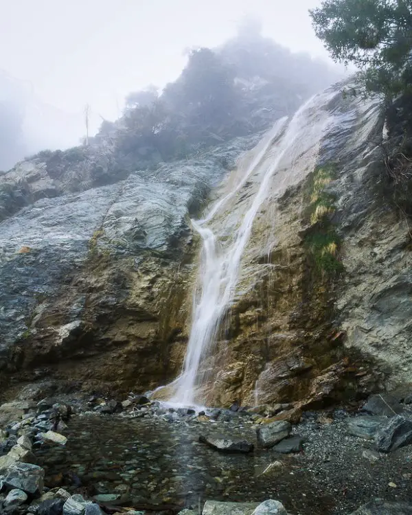
Below is a picture of my very first visit to the falls. I clearly remember it was a very foggy day, and I had no idea more tiers existed above the bottom two.
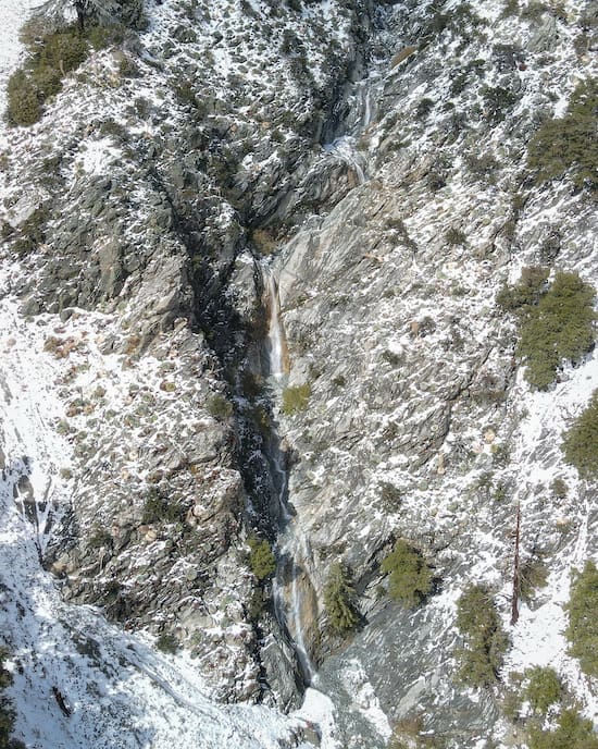
Below is a picture including all of the waterfall’s tiers. Although the waterfall is enormous, it’s dwarfed by 500 ft Big Falls, the largest waterfall in Southern California, which also happens to be located in San Bernardino County.
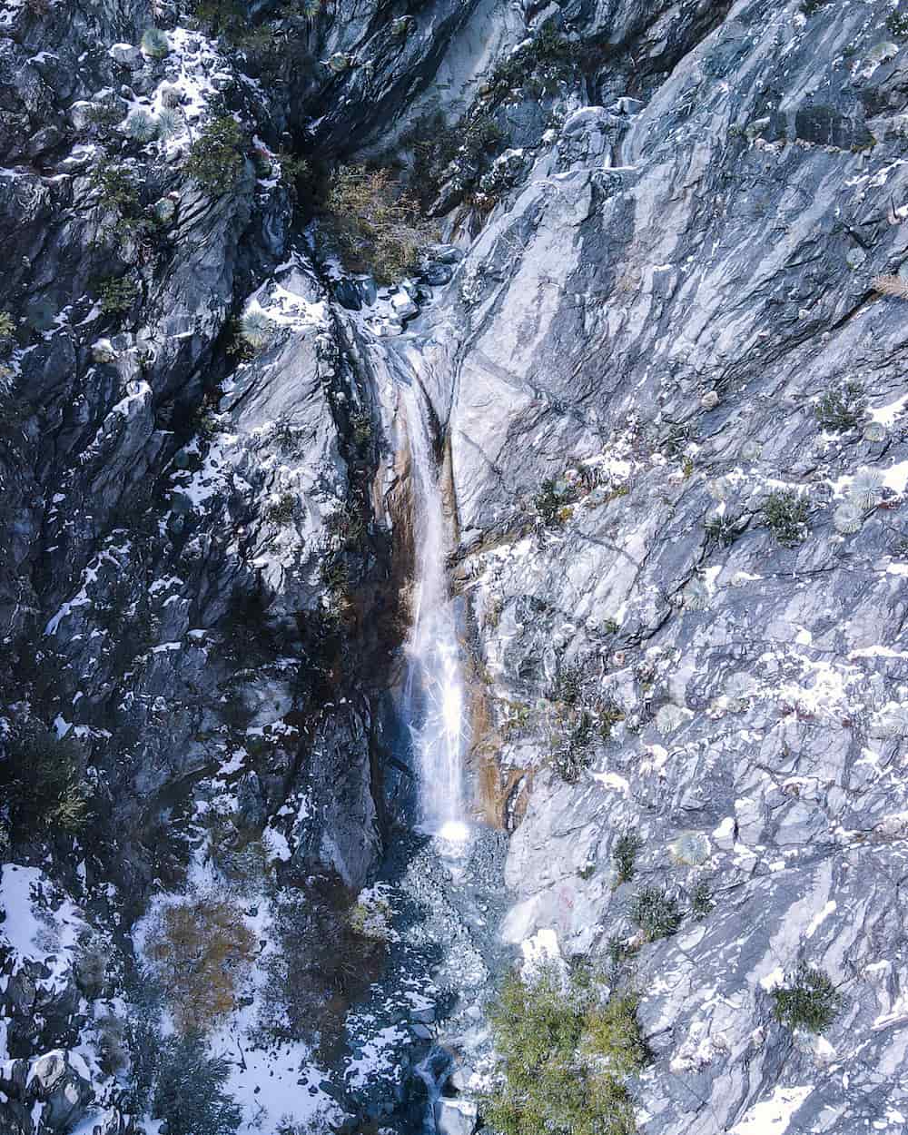
Update: I visited San Antonio Falls on Nov 9, 2022 a day after it snowed. Needless to say, I was blown away. If you like the snow, check out this post I wrote on the best winter hiking trails in SoCal.
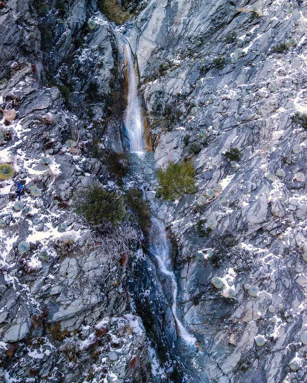
Can you spot the guy in blue in the image below?
Speaking of blue, Stoddard Falls, located just down the road from San Antonio Falls, has the bluest water I’ve ever seen, plus a natural rockslide and swimming hole! It’s only 0.75 miles roundtrip, meaning you can easily hike both waterfalls the same day.
The middle tier shown below reminds me a bit of 495 ft Bonita Falls, the second largest SoCal waterfall, in the sleepy mountain town of Lytle Creek. If you haven’t already, go check it out. It’s an easy and short hike, and the bottom tier alone is a colossal 100 feet tall.
For those who crave more adventure, there is a way to get up to the top tiers, but I’ll let you figure that one out yourselves as it’s not very difficult 😉
Not feeling this hike? Check out the following link to view the best waterfalls in and near Los Angeles
Recommended Gear
- Merrel Moab Hiking Boots (I use the Moab 2 Vent Mid Boot)
- Osprey Daylite Backpack
FAQ
Can You Swim At San Antonio Falls?
No, there is no swimming hole deep enough to swim.
How Is San Antonio Falls Rated?
It’s rated a 4.5 stars from 56 Yelp reviews.
Is San Antonio Falls Easy Enough For Kids?
San Antonio Falls is kid-friendly, as the majority of the trail consists of a paved road. Only the last section, a dirt trail, gets a little slippery and steep. However, venturing down the dirt trail is not necessary to view of the waterfall.
Does San Antonio Falls Have A Viewpoint?
Yes, there is a section of the trail that overlooks the waterfall.
Does San Antonio Falls Get Snow Every Year?
San Antonio Falls gets snow every winter.
How Tall Is San Antonio Falls?
San Antonio Falls’ bottom tier is 75 feet tall. If all the tiers are included, however, the waterfall is somewhere around 200 feet high.


