
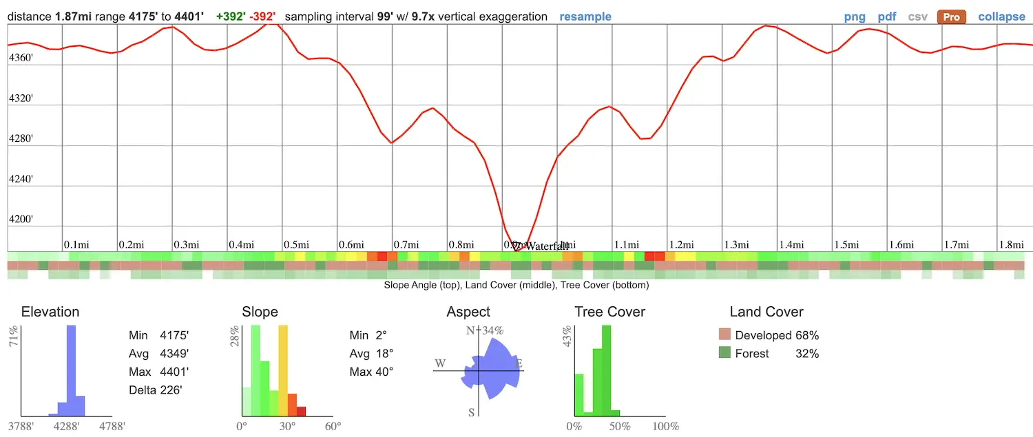
- Total Miles: 1.87 (From Hwy 138)
- Time: 45 min
- Difficulty: Easy
- Best Season: Spring
- Elevation Gain: 392 Ft
- Max Elevation: 4175 Ft
- Type of Trail: Out & Back
- Parking Lot: Fits ≈ 15 cars
- Dogs: Allowed On A Leash
- Restrooms: Not Available
- Trail Popularity: High
A few years ago, I ventured deep into the San Bernardino Mts to a sleepy town called Crestline where my friend Kenny lives. It was the middle of winter, and Kenny had invited us to his beautiful cabin perched high on the mountainside. The day’s goal was to locate the legendary Heart Rock Waterfall in Seely Creek.
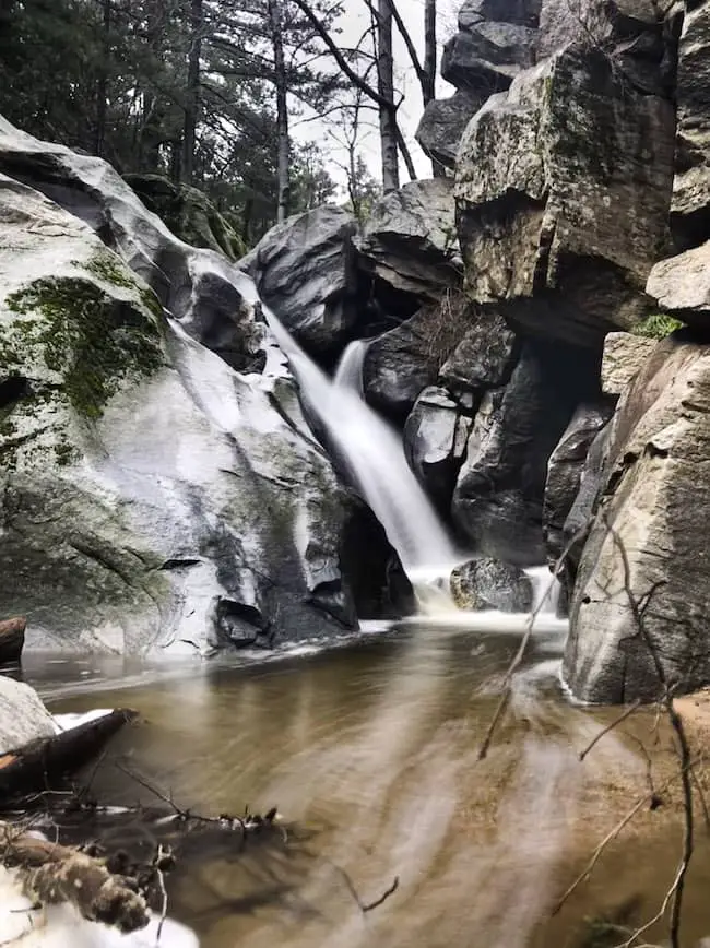
The hike to Heart Rock Waterfall consists of a 1.87-mile roundtrip trail and features a naturally occurring heart-shaped hole next to the top of a 25-foot cascade. The easy and shaded trail weaves its way through a dense sea of pine trees from beginning to end while running parallel to the creek before ending at the falls. Getting to the base of the waterfall requires a bit of boulder scrambling, which most hikers should be able to do without much difficulty.
I enjoyed this hike so much that I added it to the list of best SoCal hikes. The list includes abandoned ruins, 500 ft waterfalls, and slot canyons. Check it out by clicking the link below. You won’t regret it.
Heart Rock Trail Map
Directions & Parking
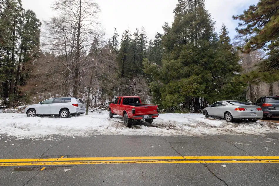
With only one exception, the gate to access the trailhead has been closed during all my visits. However, you can park off of Hwy 138, in a turnout shown in the image below, and begin the hike via the paved road.
Helpful Links
SoCal Adventure Pass (required to park in SoCal mountains)
Hiking Heart Rock Waterfall
We met at Kenny’s cabin before driving to the hike together. From his wooden balcony, I could see the town and lake blanketed with a fresh layer of soft pow. Add to that the conifer forest and oak woodland setting, and I felt like I had been transported to a town in the Northwestern United States, but I digress.
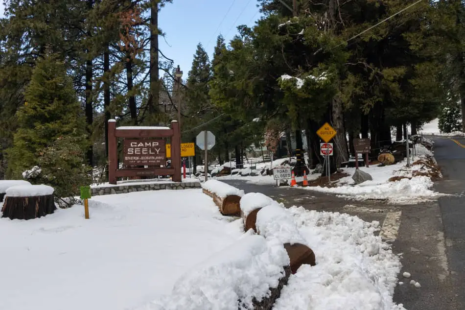
Once at the trailhead, I started the hike by locating the large sign with the words “Camp Seely and proceeded to walk down the paved road shown in the image below.
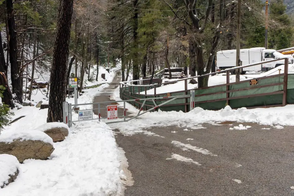
The yellow sign stating the road is closed only applies to vehicles, but as I mentioned in the parking and directions section above, the road is sometimes open for the public to drive through. If such is the case, you’ll be able to park closer to the actual trailhead.
I walked past the gate and was surprised at the sight of the creek not flowing over the road. Usually, the creek has more water and would require getting my feet wet to continue hiking via the paved road.
During the summertime, Crestline temperatures can be up to twenty degrees cooler than in the valley. Today, however, it felt a lot colder.
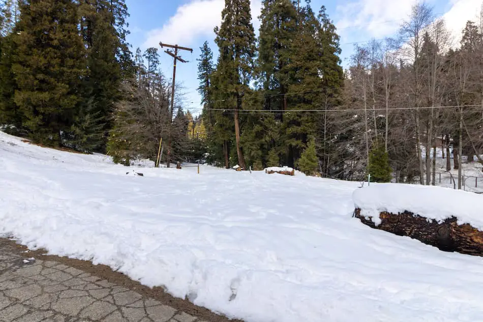
The picture below shows the parking lot that is accessible to the public when the gate is open. I had two options at this point. I could continue up the paved road or begin hiking in the snow until reaching the trailhead, which was very close.
I decided to begin hiking in the snow between tall pine trees and a utility pole
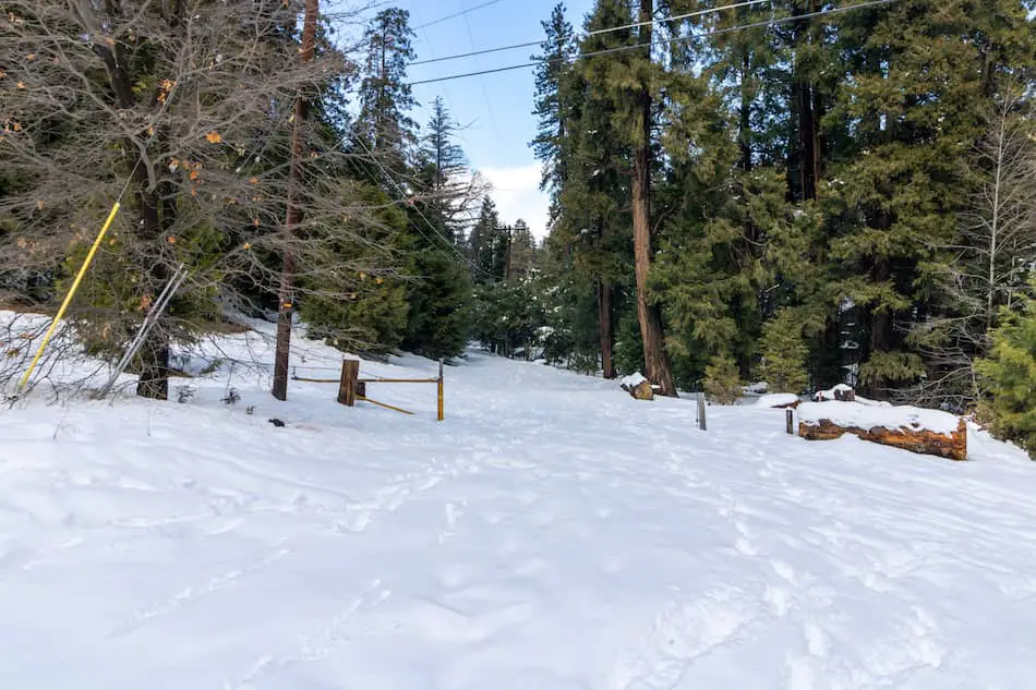
Here’s a closer look.
The snow was very soft and plush due to a recent snowstorm, making me feel like I had left California altogether.
By the way, if you enjoy hiking to waterfalls in the snow, you’ll love San Antonio Falls in the San Gabriel Mountains, a colossal, multi-tiered, waterfall that flows year-round.
I made a slight left upon arriving at the empty swimming pool.
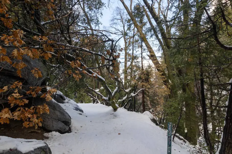
Shortly afterwards, I arrived at the official trailhead. Just look at how many trees there are on this hike. The locals are so lucky.
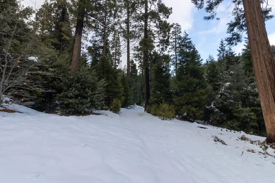
Everything about this trail is very different from the typical drier environments.
As I made my way through the forest, I could hear the sound of running water and the leaves rustling in the soft breeze. From this point forward, the creek never left my sight, as the trail ran parallel to it until arriving at the falls.
I was completely mesmerized by the beauty of the place, which is why I ranked Heart Rock Falls as one of the thirty most popular winter SoCal hikes, a list that includes everything from easy hikes to more adventurous and difficult peaks.
The dense forest is one of the reasons why Crestline is considered a hot zone for birding in the winter and spring.
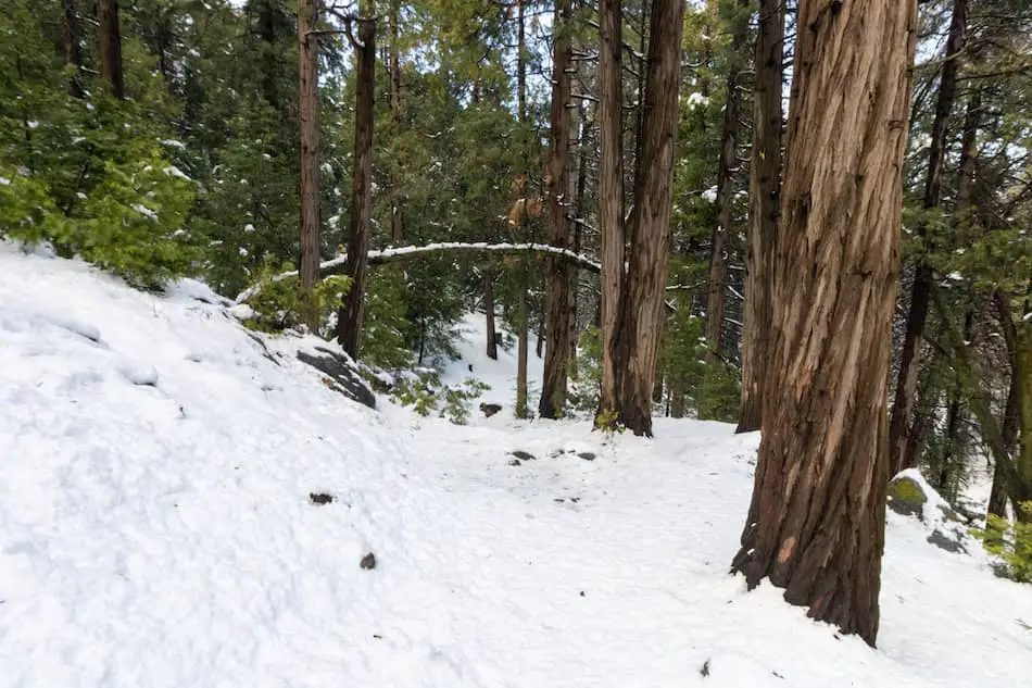
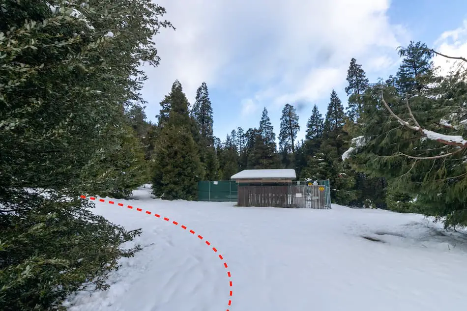
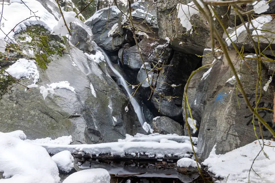
I made a right to arrive at the falls where a large fallen tree traversed the trail.
In the image below, I’m already looking to the right, which is why the log doesn’t seem to be traversing the trail.
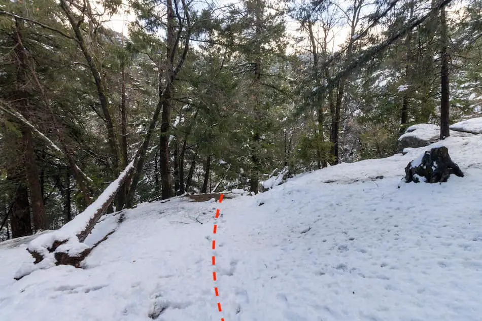
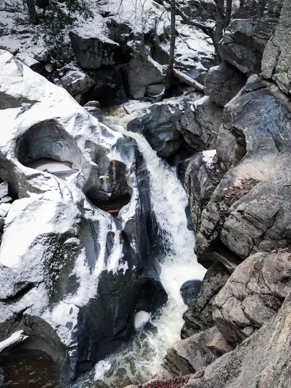
The red dotted line below shows where I descended to get a good view of the top of the falls, but had I wanted to descend down to Seely Creek, I would have made a slight left.
I stood on a boulder platform about 50 feet above the stream to get the best view of the heart. It’s a bit slippery when covered in snow. Watch your step.
How is it possible that nature carved a perfect heart-shaped rock next to a waterfall? It’s truly magnificent and amazing to look at.
You know what’s also amazing? A waterfall with a naturally occurring rockslide, swimming hole, and crystal clear water. It’s called the Stoddard Falls hike and you can learn more by clicking the link.
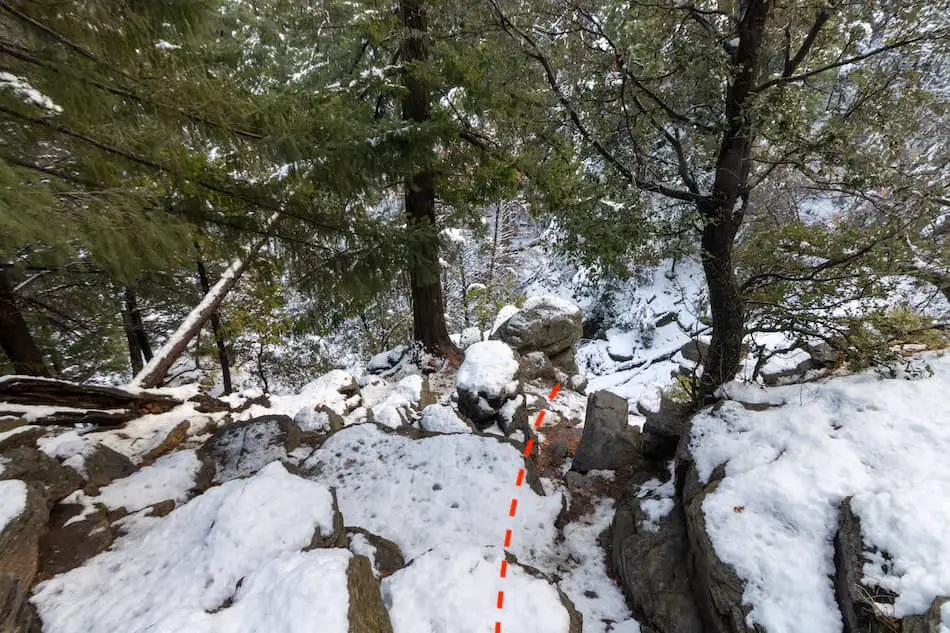
To get a closer look, I boulder-scrambled my way down (about 25-30 feet) to the base of the falls. It’s not very difficult but take your time nonetheless.
I realize 25 feet is not very impressive, but what if I told you the largest waterfall in SoCal is also located in the San Bernardino Mts, and measures a whopping 500 feet high?
If that sparked your interest, you may want to add Big Falls hike to your to-hike list, and while you’re at it, also add the 495-foot Bonita Falls in Lytle Creek’s South Fork, the 2nd largest waterfall in SoCal. You’re welcome.
When I got to the bottom, I found myself face to face with the beautiful Heart Rock Waterfall. I can now cross another adventure off my list.
Although Heart Rock Falls is one of the most scenic waterfalls in the San Bernardino National Mountains, it’s not even close to being the most well-known. To view the most popular waterfall in the range, plan a hike to Etiwanda Waterfall.
Heart Rock Trail is truly one of the most beautiful and scenic hikes in SoCal, and it’s also very beginner-friendly.
Don’t leave just yet! Did you know Crestline is also home to a lake with a water park? It’s called Lake Gregory, and it’s located just a few minutes away from Heart Rock Trail. I highly suggest you visit it, then grab something to eat from the many restaurants located across and down the street.
Recommended Gear
- Merrel Moab Hiking Boots (I use the Moab 2 Vent Mid Boot)
- Microspikes For Icy Conditions
Unique Natural Inhabitants
- Porcupine
- King Snakes
- Eagles
- Flying Squirrels
- Foxes
- Great Blue Heron
Plants To Identify
- Lupine
- Sugar Pine Tree (their pine cones are huge, over a foot long)
- Chickweed
- Stinging Nettle
- Incense Cedar
History of Camp Seeley
I thought I’d share some information on Camp Seeley since Heart Rock Falls was formally known as Seely Creek Falls.
In the 1850s, the Mormon Seely brothers established a water-powered sawmill in what is now known as Camp Seely. Unfortunately, in 1861, winter floods washed away the water-powered sawmill.
In 1914, the city of LA decided to purchase the land and name it Camp Seely, after the Seely brothers.
Nowadays, the camp has roughly 60 cabins available for rent, a game room, a lodge, and much more.
FAQs
Can You Swim At Heart Rock Falls?
The water is not deep enough for swimming at Heart Rock Waterfall.
What Are The Heart Rock Trail Hours?
Heart Rock Waterfall is open 24/7.
Is The Heart Rock Trail Shaded?
Almost the entire Heart Rock trail is well-shaded by the forest canopy.
Is Heart Rock Hike Beginner-Friendly?
Heart Rock hike is beginner-friendly as it has a gradual elevation gain, short distance, and is well shaded. Descending to the base of the falls is the only non-beginner-friendly section, but doing so is unnecessary for viewing the waterfall or the heart.


