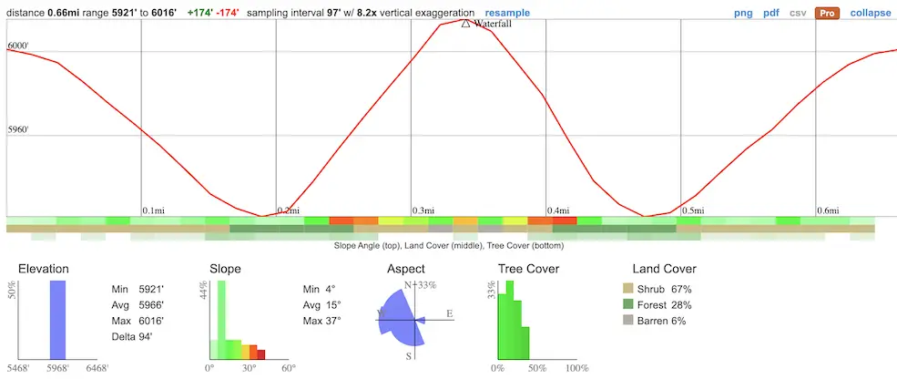
- Total Miles: 0.66
- Time: 25 min
- Difficulty: Easy
- Best Season: Spring – Summer
- Elevation Gain: 174 ft
- Max Elevation: 6016 ft
- Type of Trail: Out & Back
- Parking Lot: Fits ≈ 20 cars
- Dogs: Allowed On A Leash
- Restrooms: Available At The Parking Lot
- Trail Popularity: High
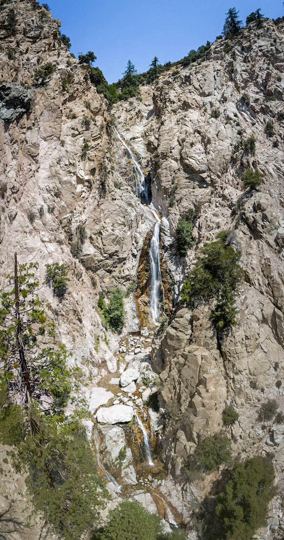
Most waterfalls in SoCal are dead dry in the middle of the summer. Well, not Big Falls Trail! This colossal, multi-tiered cascade is flowing pretty much year-round.
Big Falls Trail is an easy 0.66 hike that features a multi-tiered waterfall located in Forest Falls, California. Multiple smaller waterfalls flow throughout the majority of the scenic trail. At 500ft, Big Falls is the largest falls in SoCal, which is why its higher tiers can be seen from the road as you drive through town.
Big Falls is one of the best waterfalls and hikes in SoCal, but it’s not the most stunning in my opinion. To view the other trails, click the link below:
Best Hikes In Southern California
Big Falls Trail Map
Directions
To be redirected to the trailhead via Google Maps, click the following link: Big Falls Trail, California 92339
You will be required to either display a SoCal Adventure Pass or purchase a recreation day pass to park at the parking lot.
Helpful Links
SoCal Adventure Pass (required for parking in SoCal mountains)
You can purchase a recreation day pass at the kiosk or at the Elk General Store.
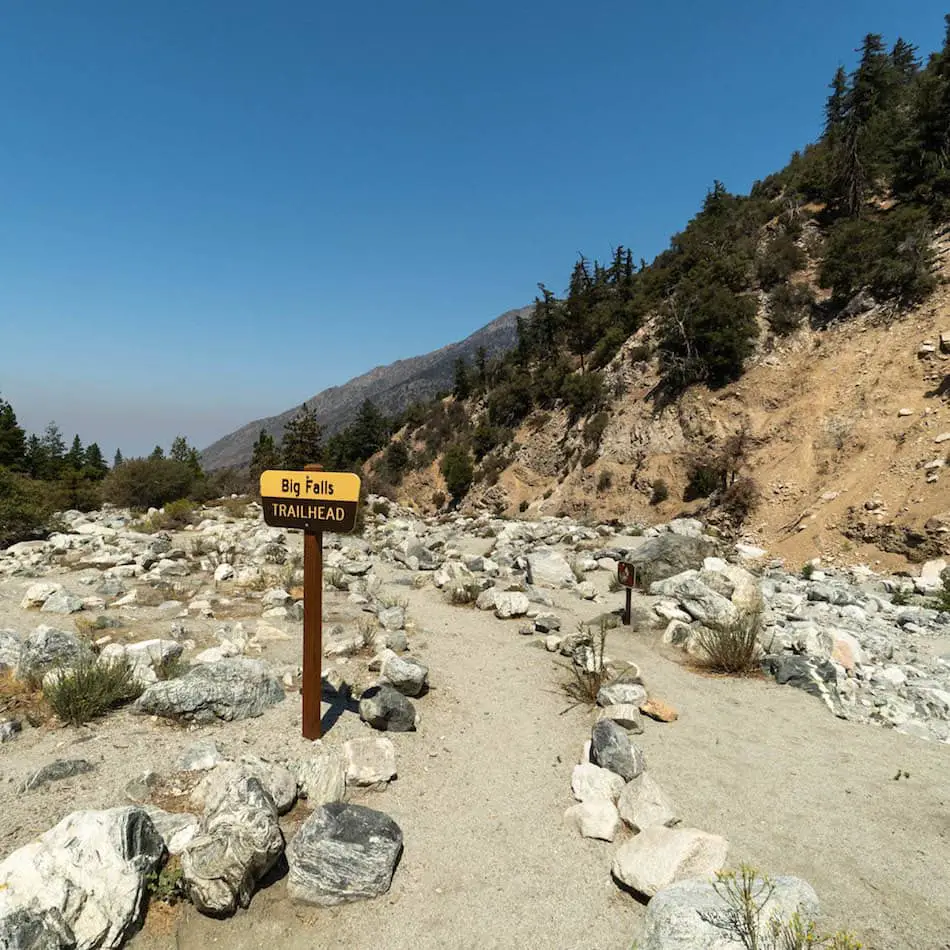
Hiking Big Falls Trail
The hike to the falls is really short, but the beginning part of the trail is a bit confusing since it’s not very clear where the trail is.
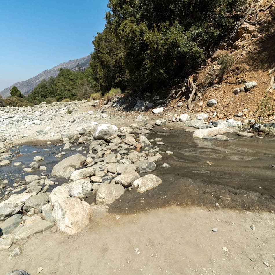
I hiked straight towards the creek bed.
I eventually reached this slightly wet and rocky section and crossed through! Thankfully, I had my Merrell waterproof shoes on.
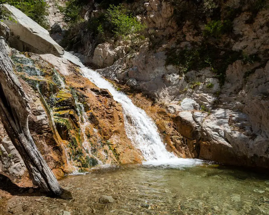
A short moment after, I arrived at the first small waterfall!
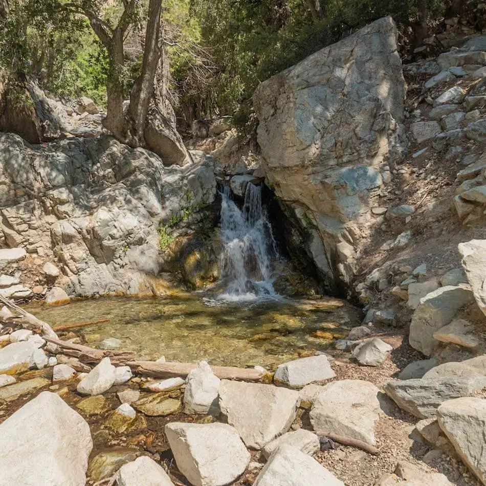
To the right side, there is a dirt path that leads up to the other falls.
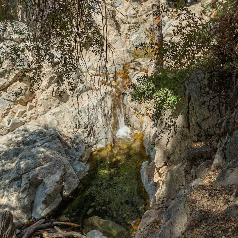
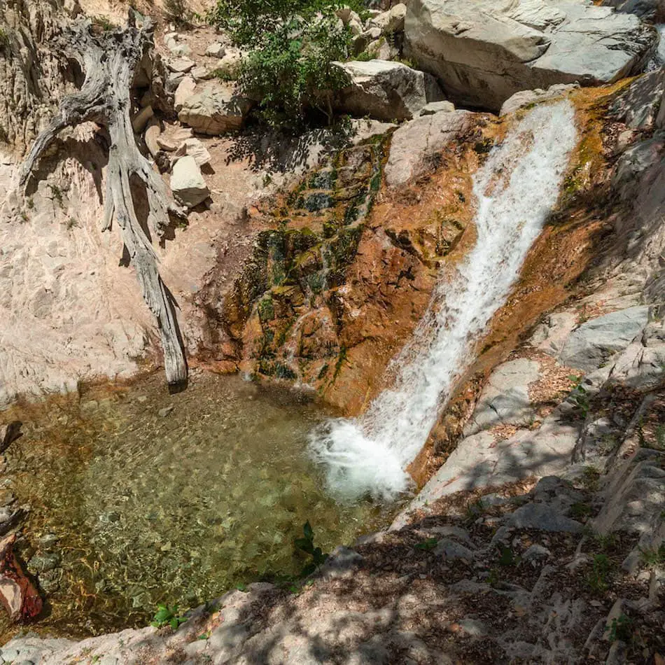
Here’s one of the other falls and pool from above!
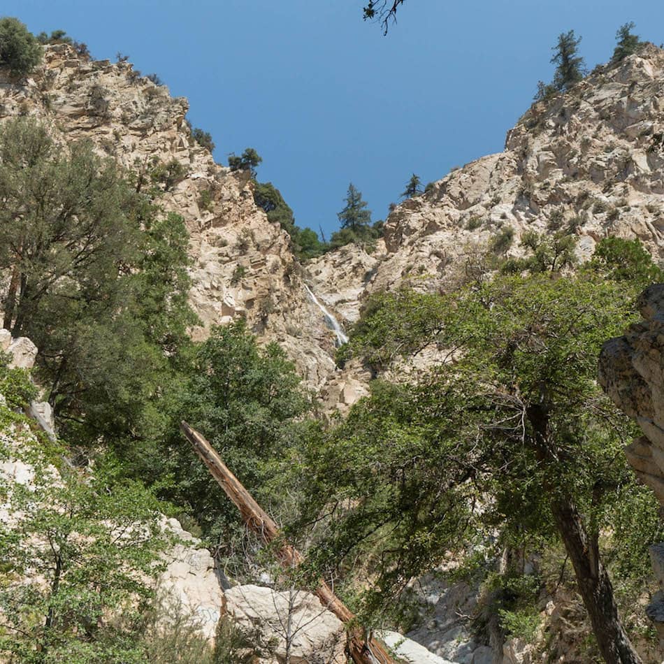
While I was walking back on the trail, I could see the very top tier.
(We did not reach the top part because it seems impossible, but our drone did!)
We then reached the last waterfall tier we could get to.
They all have their glistening clear pools that made me want to jump right in!
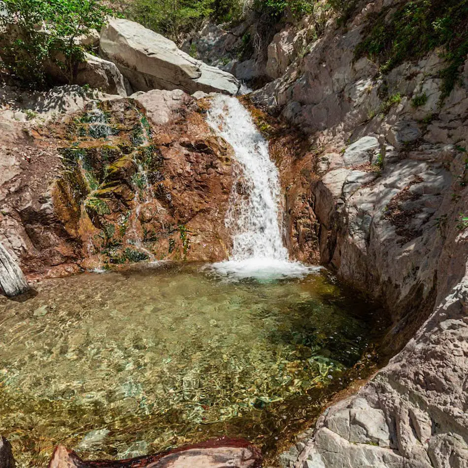
I couldn’t believe how much water these falls had considering I came in the middle of summer!
This last part is very difficult to reach unless you are a skilled propeller. Luckily, our drone was able to get some amazing views of the top waterfalls!
This waterfall has multiple tiers that cascade down the mountain (probably over 10!).
It’s about a 500-feet from top to bottom of Big Falls trail.
I absolutely loved this trail near Big Bear. It’s a perfect summer hike if you want to keep cool.
Not only was the weather less than 75 degrees in the middle of August, but the water flow was pretty nice as well!
Want to hike to the 2nd largest waterfall in SoCal? It’s called Bonita Falls, a 1.4 mile trail which is also located in the San Bernardino Mts.


