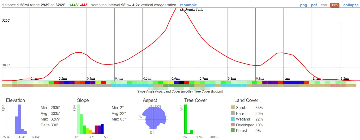
- Miles: 1.28
- Time: 45 min
- Difficulty: Easy
- Best Season: Spring
- Elevation Gain: 443 ft
- Max Elevation: 3269 ft
- Type of Trail: Out & Back
- Parking Lot: Fits ≈ 10 cars
- Dogs: Allowed On A Leash
- Restrooms: Available At The Campground
- Trail Popularity: Very High
- Pics Taken On: May 16, 2022
Most people have hiked to Bonita Falls, but what they don’t know is that two secret tiers lay directly above, and when added together, measure a total of 495ft!
Bonita is a beautiful waterfall located in South Fork Lytle Creek and the second largest in the San Bernardinos. The hike is an easy 1.28 miles roundtrip. Most of the trail is comprised of a dry riverbed surrounded by rugged ridges, and a scenic tributary towards the end.
Bonita Falls is one of the best hikes in SoCal along with abandoned gold mines, nazi ruins, and multiple scenic waterfalls. Check out the posts below to choose your next adventure:
Best Hikes In Southern California
Best Waterfalls In Southern California
Bonita Falls Trail Map
Address & Directions
Click the following link to be redirected to the Bonita Ranch Campground via Google Maps: 900 S Fork Rd, Lytle Creek, CA 92358
***Parking at Bonita Ranch Campground is $10.
It’s sometimes possible to park off the side of Lytle Creek Rd to avoid the campground fee. However, you’ll have to cross Lytle Creek in order to head into South Fork, which may be a bit difficult for those with poor balance.
Helpful Links
SoCal Adventure Pass (required for parking in SoCal mountains)
Bonita Falls Trail
If you begin your trek from Bonita Campground, make your way to the opposite side of the canyon as this is where you’ll find a “trail.”
The hike doesn’t have a nice groomed trail because, as you’ll notice, the only way to the falls is via a dry riverbed with tons of boulders and rocks.
It’s hard to imagine, but raging floods are known to occur here during higher than average rainy seasons.
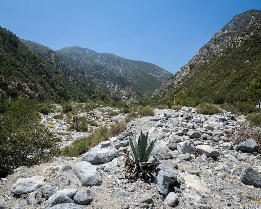
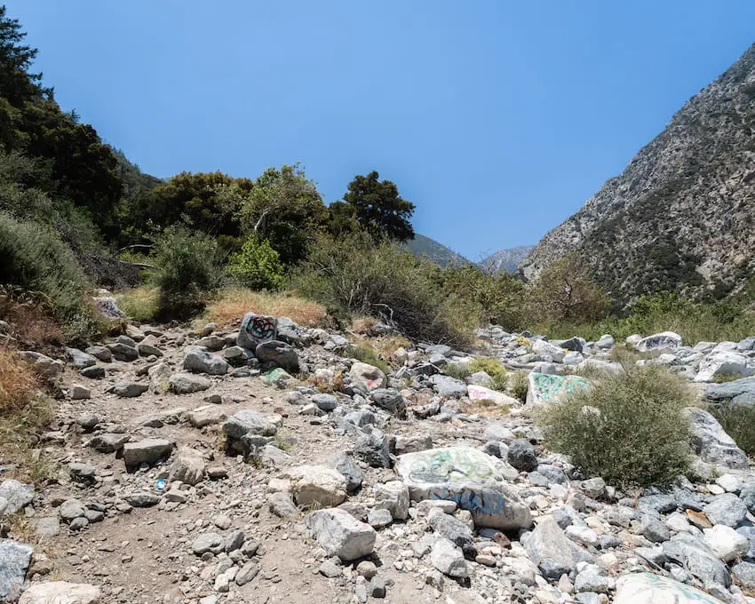
As you head into the canyon, stay as far left as you can and keep an eye out for a dirt trail leading up into the tributary (a smaller canyon with a creek feeding into the main canyon). Shown below.
It’ll be very apparent that the trail continues into a scenic tributary, but if it abruptly ends, you’ve taken the wrong trail and must continue hiking into South Fork via the riverbed.
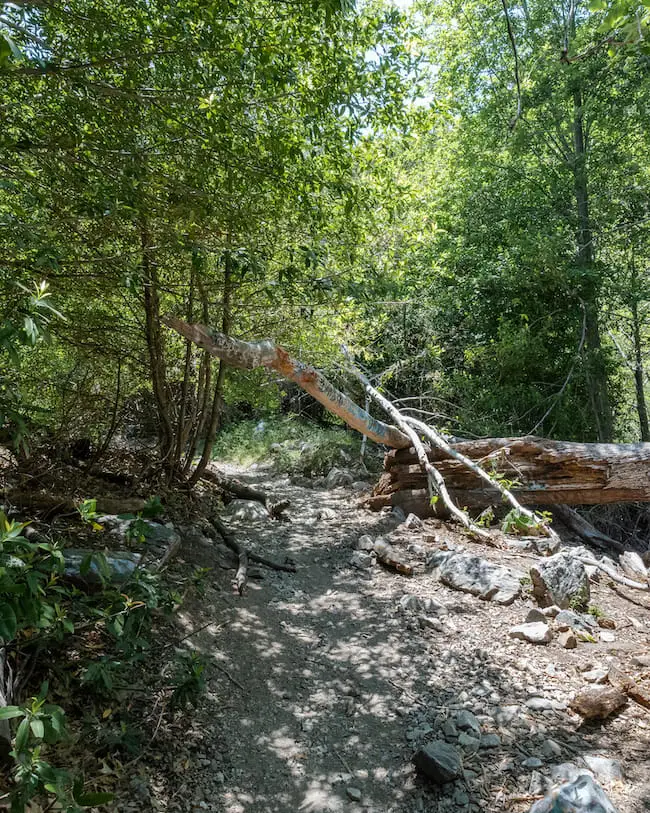
As you make your way into the tributary, the landscape dramatically changes from barren and rocky to dense green vegetation.
Beautiful cottonwood trees and white alders adorn the trail, but so does the notorious poison oak with its three-pronged leaves.
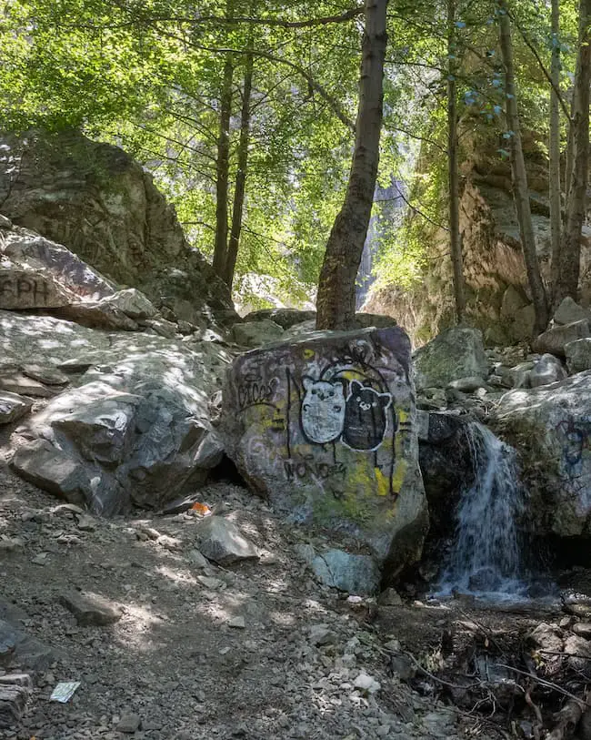
Notice Bonita flowing behind the trees in the picture below. Unfortunately, Bonita Falls has gotten the worst of trash and graffiti.
Within minutes, you’ll hear the sound of roaring water gushing over the edge of a 100-foot cliff. A giant awaits your presence.
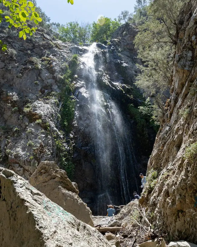
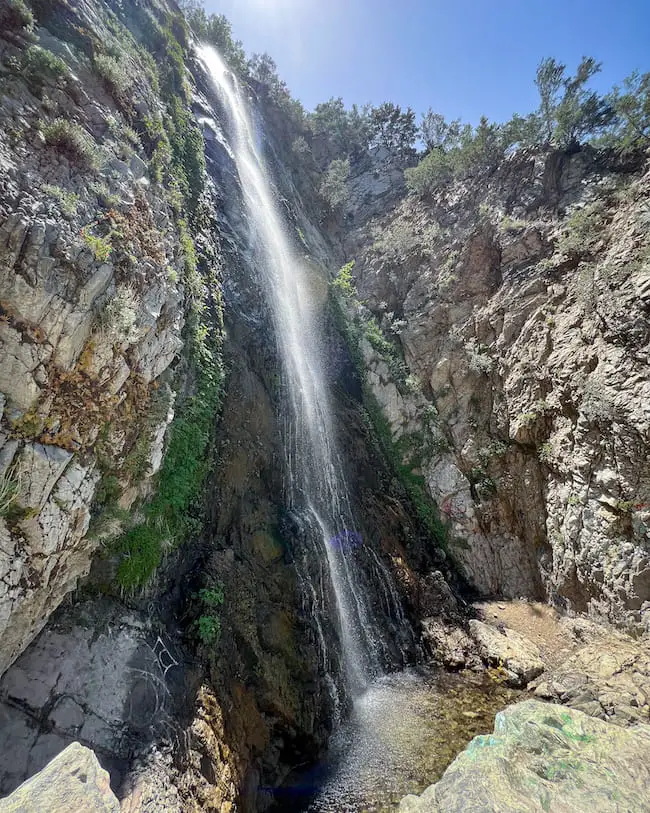
The boulder scrambling has finally paid off. The enormous Bonita Falls, which translates to “beautiful” falls in Spanish, lives up to its name.
Bonita glistens in the sun unlike any other waterfall I’ve ever seen. It’s a sight you’ll never forget. To experience this for yourself, try to arrive at the falls between the hours of noon and 2 pm when the sun directly illuminates the cascade. Just keep in mind the large crowds at that time.
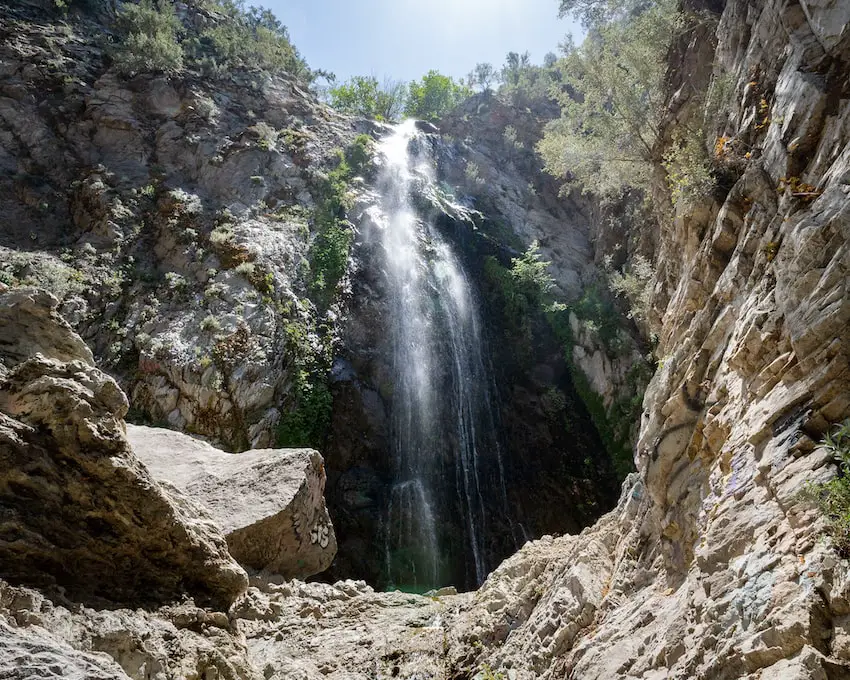
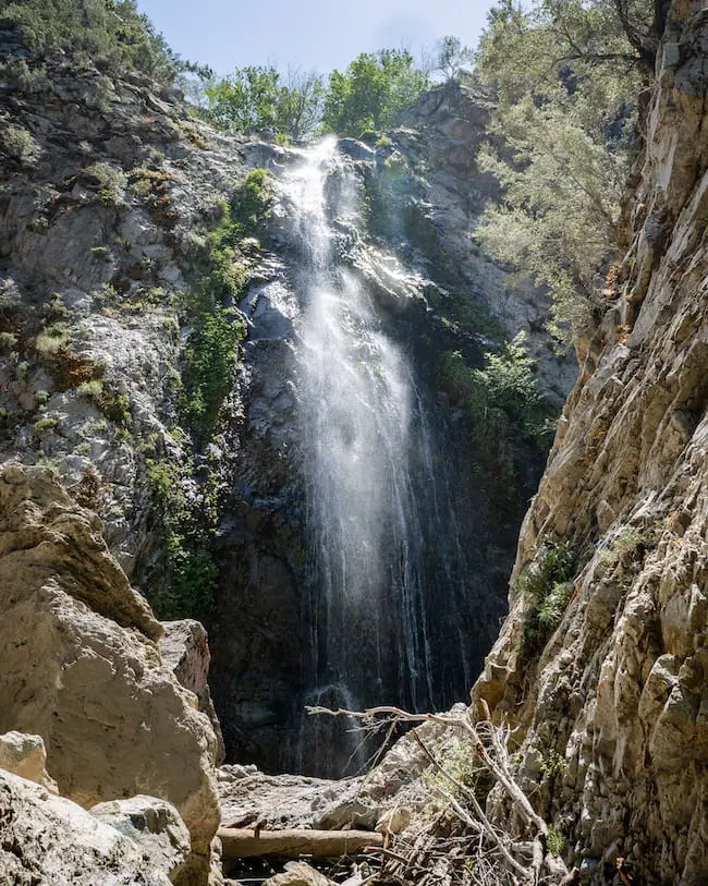
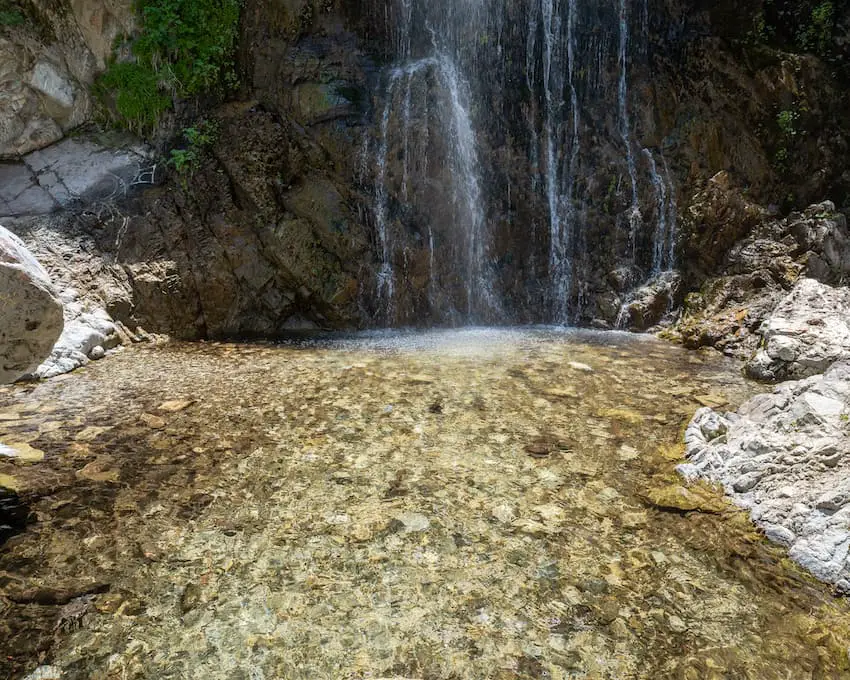
The pool is not deep enough for swimming (only about 2 feet), but it’s still worth taking a dip in the refreshing water fed from the icy springs on the north slope of the Cucamonga Wilderness, especially on those extremely hot sunny days.
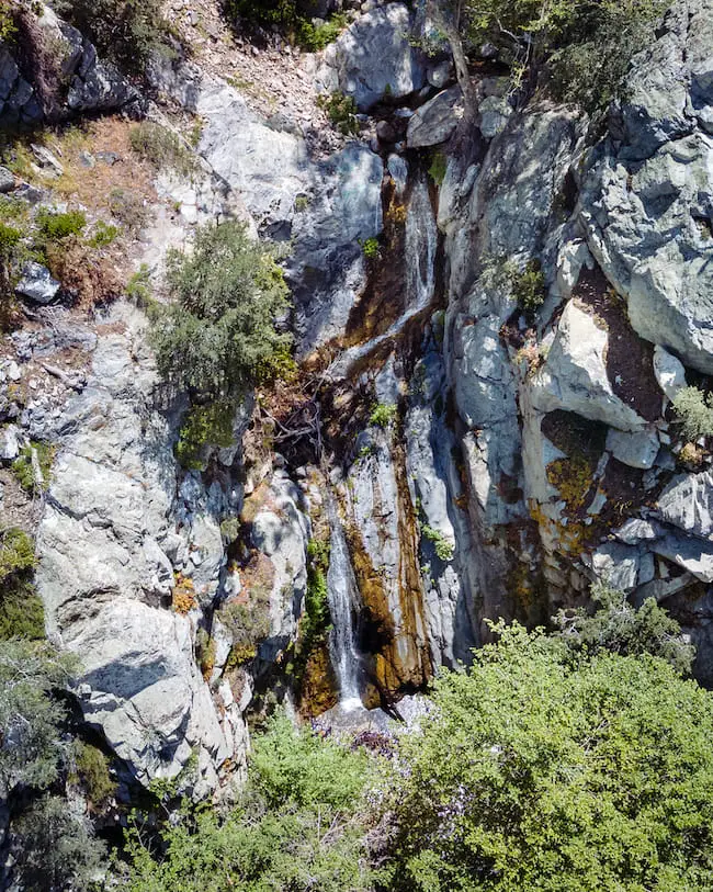
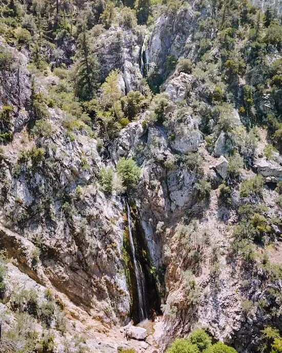
While most people enjoy their time at Bonita Falls’ lowest tier, few are aware of the secret cascades located directly above. The mid-tiers are much smaller than the rest, while the top tier is roughly half the size of the lower 100ft tier.
Do not attempt to climb up to the falls as it’s very dangerous. Numerous rescues have already taken place.
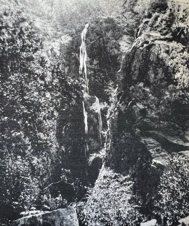
Luckily, I was able to take a drone shot of the falls. Below is a picture of the mid-tiers.
Below is the top tier.
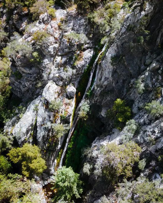
Here’s a shot of all the tiers. The mid-tiers may be hard to see.
Only Big Falls, rising up to 500ft (5ft higher) outranks Bonita.
Want to visit the LARGEST waterfall in SoCal? Check out Big Falls Trail in the tiny mountain town of Forest Falls. It’s only a .66 mile easy hike to the bottom of the falls.
Bonita Falls History
Although much of the history has been lost, it’s safe to say the Taaqtam people, known as Serranos (mountaineers) by the Spanish, also enjoyed visiting the falls as we do today.
Their village, Muscupiabit, which translates to “place of the pinyon pines,” was located in Cajon Pass where the 15 Fwy cuts through the mountain ranges.
The aggressive, and sadly, extinct California Grizzly bear roamed the area along with present-day mountain lions, ring-tailed cats, and big horn sheep, the latter being most likely to be encountered by day hikers.
For a brief period in the 1880s Bonita Falls was renamed Emerald Falls, but the name never managed to stick with the community.
In 1905 W.W. Carlisle filed a claim in South Fork in 1905. One claim was located at Bonita Falls, and the other five were miles up the canyon.
However, Carlisle wasn’t too fond of people wandering onto his claim to get a glimpse of Bonita Falls. Glenn Ranch visitors frequently reported a crazy man hiding in the trees warning them to stay out, or else.
Thankfully, Bonita Falls is now public land. Crazy miners hiding in the bushes are no longer a problem, but unfortunately, the current issue has become the immense amount of litter and graffiti.


