
What’s up guys. Since we got a really good dump a few weeks ago, I compiled a list of many, but certainly not all, SoCal hikes which get snow almost every year. If you plan on getting out there, remember to always check the weather forecast before stepping on the trail as conditions may change, and download the CalTrans app called QuickMap to check road conditions and requirements (chains).
If you’re somewhat new to hiking in the snow, read this article I wrote on the essential items for winter/snow hikes. Additionally, I provided a checklist of year-round gear that people of all skill levels can benefit to look over, and as soon as I get a chance I’ll be converting it into a downloadable link for you guys to print.
Lastly, I’m aware that some of the following images do not have snow, which is due to the fact that I have’t hiked all those places during winter. However, I’m positive regarding the chances of certain places getting snow, as I keep a close eye on all of our mountain ranges year-round. With that being said, let’s start the hikes!
Los Angeles County
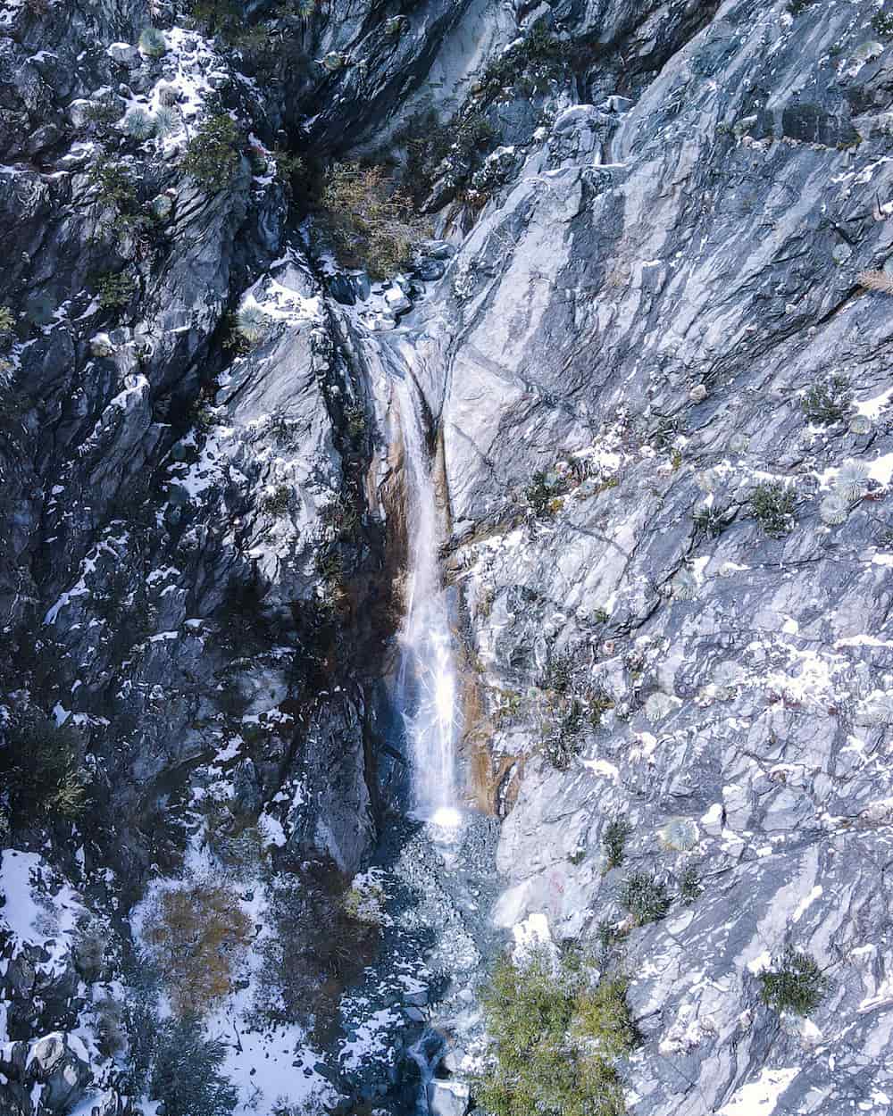
1. San Antonio Falls
Read Full Post: San Antonio Falls
Likely to get snow.
San Antonio Falls is an enormous (and one of my favorite) waterfalls in the San Gabriel Mts. Located at the base of Mt Baldy, it’s no reason why it frequently receives a good amount of snow.
You would think a waterfall such as this one requires a long and difficult trek, but the contrary is true. The majority of the hike consists of a paved road and such a gradual elevation gain that even strollers can be used.
Only the very last section, which converts into a dirt trail leading down to the base of the falls, is a bit steep and slippery. Fortunately, a viewpoint overlooking the waterfall is located at the section where the dirt trail and paved road meet.
2. Mt Wilson
Less likely to get snow.
Road access is blocked at Red Box as of 2/4/24. However, the peak can be hiked from the trailhead in Chantry Flats. Keep in mind the primary form of getting to Mt Wilson via First Water in the town of Sierra Madre is closed as well.
Included as one of the six pack of peaks, Mt Wilson is not for the faint of heart.
The peak can be accessed via a number of routes including the Mt Wilson Toll Road at the Eaton Wash, First Water via Mt Wilson Trail in the lovely foothill town of Sierra Madre, and my personal favorite, Chantry Flats, which happens to be the temporarily closed 14 mile route that takes hikers over the stunning 50 foot Sturtevant Falls and is the official route provided by the pack of peaks challenge.
All routes end at the Skyline Park where numerous observatories and a snack bar is located. The observatory is open to the public every spring and summer.
Since Mt Wilson is not as lofty as its counterpart, Mt Baldy, it only gets snow after a really good dump. For those who want to visit Mt Wilson only when it snows, the peak is visible from most places in the San Gabriel Valley. You can also drive up to the peak.
3. Mt Lowe
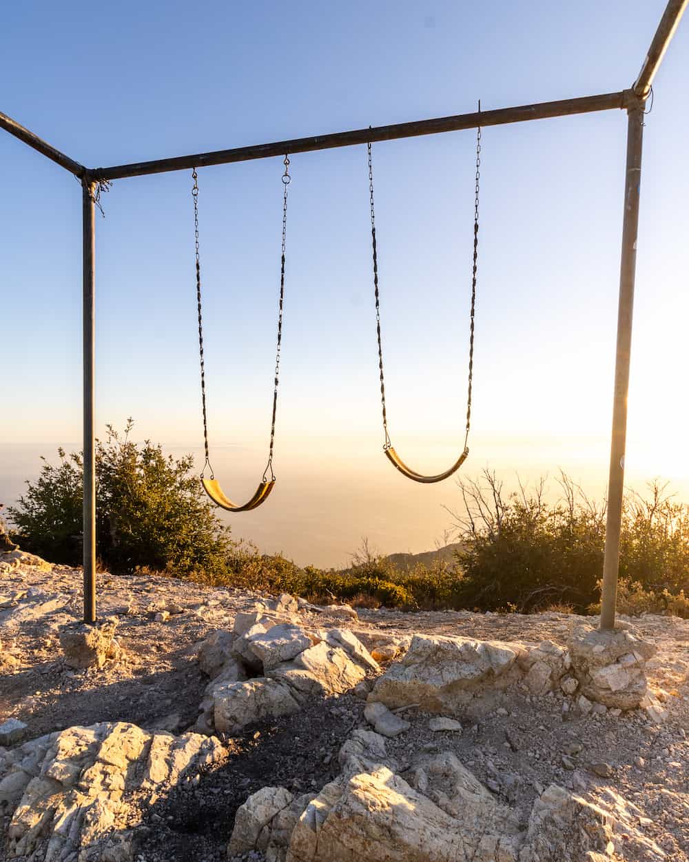
Read Full Post: Mt Lowe Peak
Less likely to get snow.
Named after one of the most ingenious men in California history, Professor Thaddeus Lowe, Mt Lowe Peak offers amazing panoramic views, including Catalina Island, and its larger counterparts, Mt Wilson (accessible via Chantry Flats) and San Gabriel Peak (Closed).
Placing swings on the frame, as shown in the image above, is not allowed, and may have been taken down.
Road access is blocked at Red Box as of 2/4/24, making the Eaton Saddle Trailhead inaccessible. Sadly the route via Sam Merril Trail at the Cobb Estate in Altadena is also closed. Conditions may have changed.
4. San Gabriel Peak
Read Full Post: San Gabriel Peak
Less likely to get snow.
Short and easy, San Gabriel Peak is almost always my recommendation for new hikers who wish to begin their peak bagging journey. The views are amazing to say the least, and the elevation gain feasible for beginners. Microspikes are nonetheless highly encouraged.
Road access is blocked at Red Box as of 2/4/24, making the Eaton Saddle Trailhead inaccessible. However, the peak can be hiked via the Sam Merril Trail at the Cobb Estate in Altadena. Conditions may have changed.
5. Big Horn Mine
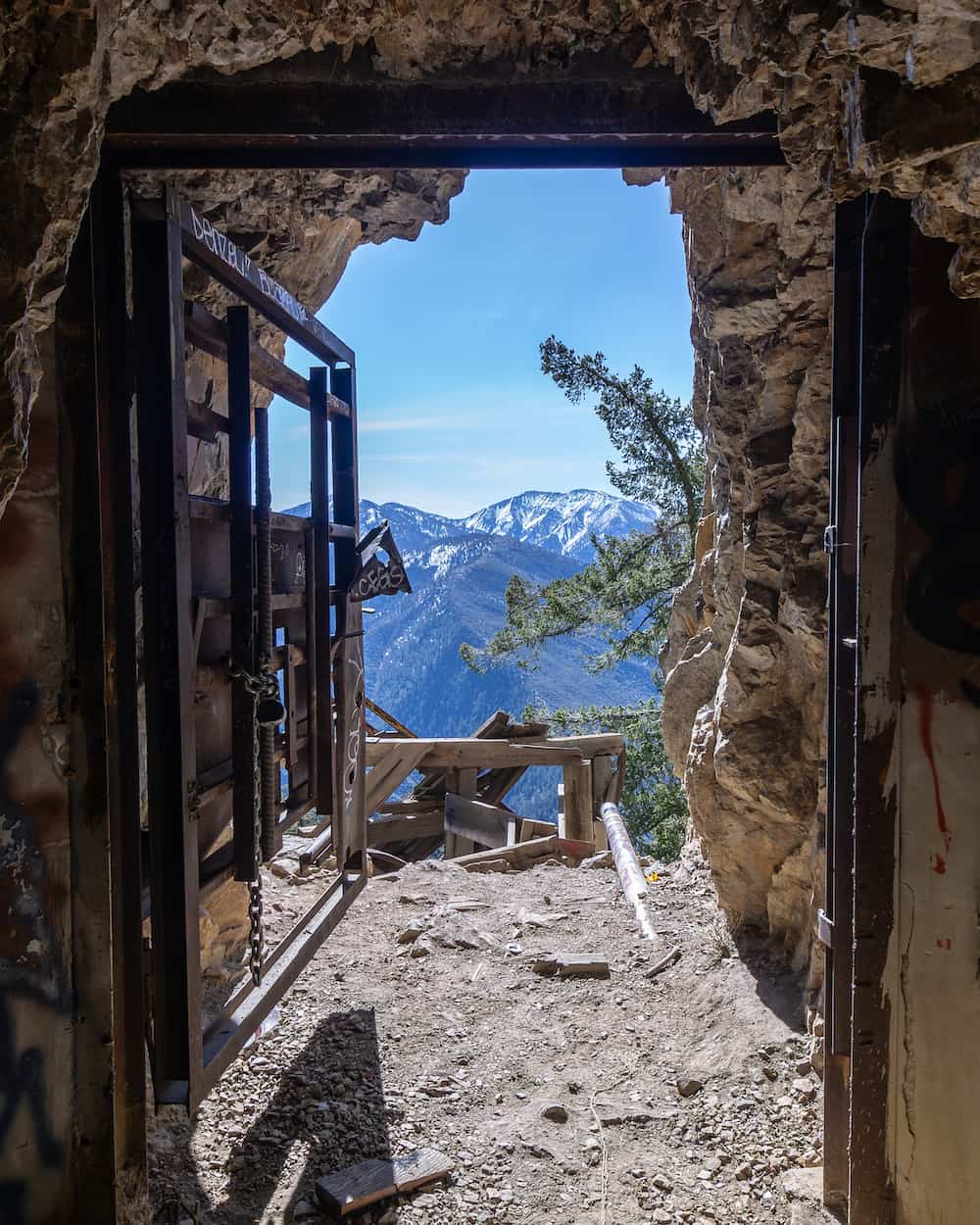
Read Full Post: Big Horn Mine
Likely to get snow.
The road is closed at Vincent’s Gulch where this hike’s trailhead is located. Someone on All Trails left a review as of today, meaning the trailhead is open, as it usually is even when the road is closed.
The Big Horn Mine is one of my favorite hikes, as it leads to an abandoned gold mine near the headwaters of the San Gabriel River. Every winter the trail and enormous pine trees are blanketed with snow, transforming the area into a winter wonderland.
However, certain parts of the trail get really narrow. Should you slip, expect to slide down hundreds of feet. Crampons and trekking poles are highly suggested.
I’ll never forget how a fellow hiker allowed his daughter, who couldn’t have been more than 2 years old and hadn’t fully developed her balance, cross the extremely narrow section of the trail completely by herself without any of the gear suggested above. I literally feared for her life. Fortunately, she was safe.
6. Mt Baden Powell
Very likely to get snow.
The road is closed at Vincent’s Gulch where this hike’s trailhead is located. However, the trailhead is usually still accessible, as is the parking lot.
This hike shares the same parking lot with the Big Horn Mine Trail. If you hike Mt Baden be sure to check out the Wally Wadron, a limber pine tree that is 1500 years old!
7. Mt Baldy
Very likely to get snow.
Mt Baldy is the king of the San Gabriel Mts as it’s the highest peak in the range. Like Mt Wilson, it’s also one of the six pack of peaks, and therefore, a tough hike.
However, those who are up for a challenge will be rewarded with amazing views and a scenic forested trail. You can hike to San Antonio Falls via a small detour since the falls is along the way.
Hiking Mt Baldy after a snowstorm should only be attempted by advanced hikers with proper gear. People go missing at Mt Baldy almost every year during the winter. Play it safe.
8. Ice House Canyon
Very likely to get snow.
Ice House Canyon is a very scenic hike in the Mt Baldy area that parallels the Icehouse Creek and ends at a saddle. Expect a dense forest of snow-covered pine trees, vibrant orange and yellow sycamore trees adorning the creek, and lofty mountains in all directions.
During the mid-19th century, Los Angelinos would transport ice from Ice House Canyon to the city to make ice cream, dubbing the canyon its name to this very day.
9. Islip Ridge Trail
Very likely to get snow.
This was my first snow hike if I remember correctly. The trailhead is located near Crystal Lake campground, a scenic spot at the top of the North Fork of the San Gabriel Canyon that also gets snow.
The hike features amazing views from as far as the Pacific Ocean to the Mohave desert, and the ruins of a stone cabin and fire tower foundation.
This is a challenging hike, and snow only makes it harder, so make sure you’re fit enough to tackle this trail.
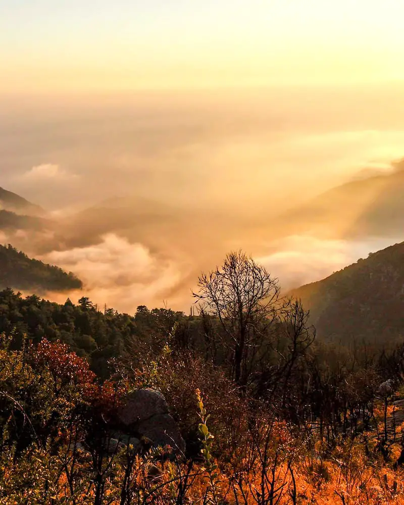
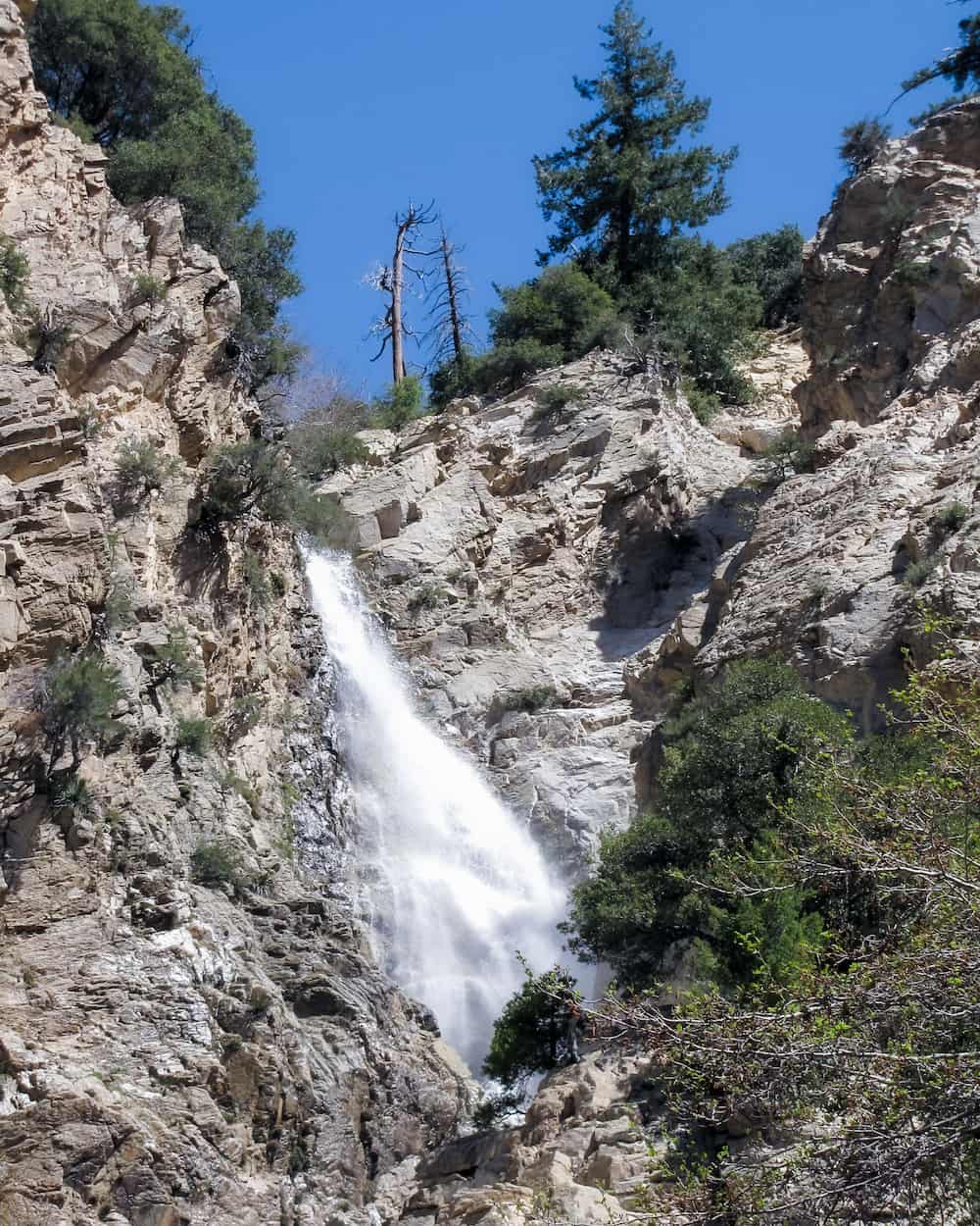
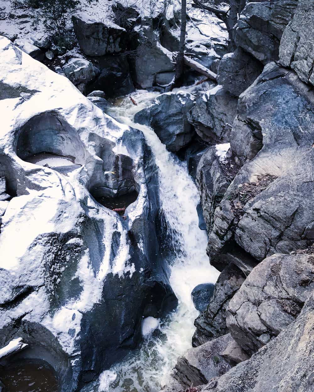
10. Cooper Canyon Falls
Very likely to get snow.
Cooper Canyon Falls is, in my opinion, one of the nicest looking waterfalls in the San Gabriels. Unlike most cascades in the range, which consist of a narrow stream free falling off a cliff, Cooper Canyon Falls is a wide and powerful torrent.
It’s located in one of the most forested and scenic areas of the San Gabriels, making the trail just as pleasant as the waterfall itself.
Road is closed as of 2/4/24. Unlike Strawberry Peak, Cooper Canyon Falls’ trailhead is located very far from the closure. Most people won’t find hiking to the trail worthwhile. Conditions may have changed.
11. Strawberry Peak
Less likely to get snow.
Although the road is closed at Red Box as of 2/4/24, the parking lot at Red Box is a very short walking distance from the trailhead and still worth the visit!
The trail to Strawberry Peak has very narrow sections and requires boulder scrambling in some parts. It should only be attempted by skilled hikers in snowy conditions.
12. Iron Mountain (Via Heaton Flats)
Likely to get snow.
Due to the crazy elevation gain, Iron Mountain is known as one of the toughest hikes in the range, and should only be attempted by advanced hikers. Those who do, however, will be rewarded with amazing views and the feeling of having conquered something most people won’t even attempt.
San Bernardino County
13. Big Falls
Read Full Post: Big Falls Trail
Less likely to get snow.
Big Falls is the tallest waterfall in SoCal, and every year it gets covered in snow. I highly suggest a visit for those who want a real winter wonderland treat. The hike is very short and easy.
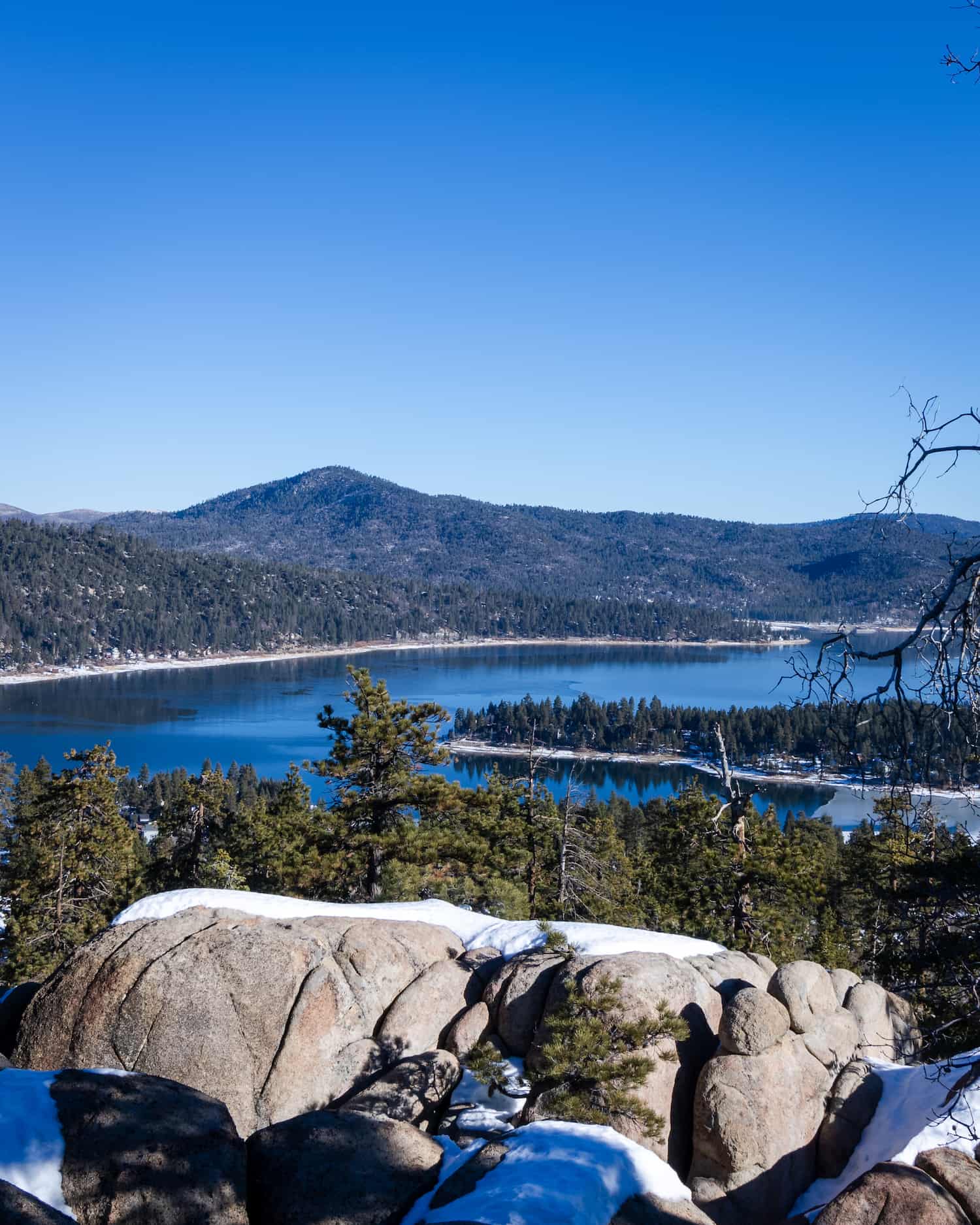
14. Cougar Crest Trail
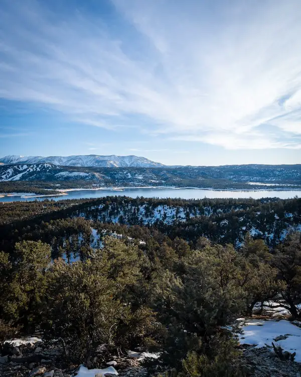
Read Full Post: Cougar Crest Trail
Very likely to get snow.
Arguably one of the toughest hikes in Big Bear Valley, Cougar Crest provides one of the best views in the area.
15. Pine Knot To Grand View Trail
Read Full Post: Pine Knot Trail
Very likely to get snow.
Pine Knot Trail offers stunning views of San Gorgonio, the tallest peak in SoCal and the valley below. Although I haven’t attempted it in the snow, it’s one of my favorite Big Bear hikes because of the densely forested trail.
16. Heart Rock Trail
Read Full Post: Heart Rock Trail
Likely to get snow.
Located in the sleepy mountain town of Crestline, Heart Rock Trail is a magnet for couples, as it features a heart-shaped hole next to the falls. This trail is even more forested and scenic than Pine Knot. Numerous pine trees shade the majority of the hike as the trail follows Soldier Creek to the falls.
17. Castle Rock Peak
Read Full Post: Castle Rock Trail
Very likely to get snow.
Castle Rock is a short, fun, and easy hike to a mount of boulders which faintly resemble a castle. The trail is scenic, like Pine Knot, with lots of pine trees and shade.
Many hikers like to climb to the top of the castle to enjoy a view of the lake.
18. Bertha Peak
Very likely to get snow.
Bertha Peak is essentially the exact same hike as Cougar Crest, but with an additional stretch at the end that leads to the peak.
19. Sunset Peak
Read Full Post: Sunset Peak
Less likely to get snow.
As the name suggests, Sunset Peak is a great spot to relax and admire the glistening rays of golden hour. The majority of the hike consists of a dirt road that meanders its way up the dark side of the mountain.
On a clear day you will be able to see all the way to Catalina Island.
20. Stoddard Peak
Read Full Post: Stoddard Peak
Less likely to get snow.
Stoddard Peak is located across the canyon from Sunset Peak, and is flanked by the enormous Mt Baldy to the north. To the south, you will be able to see as far as Catalina Island.
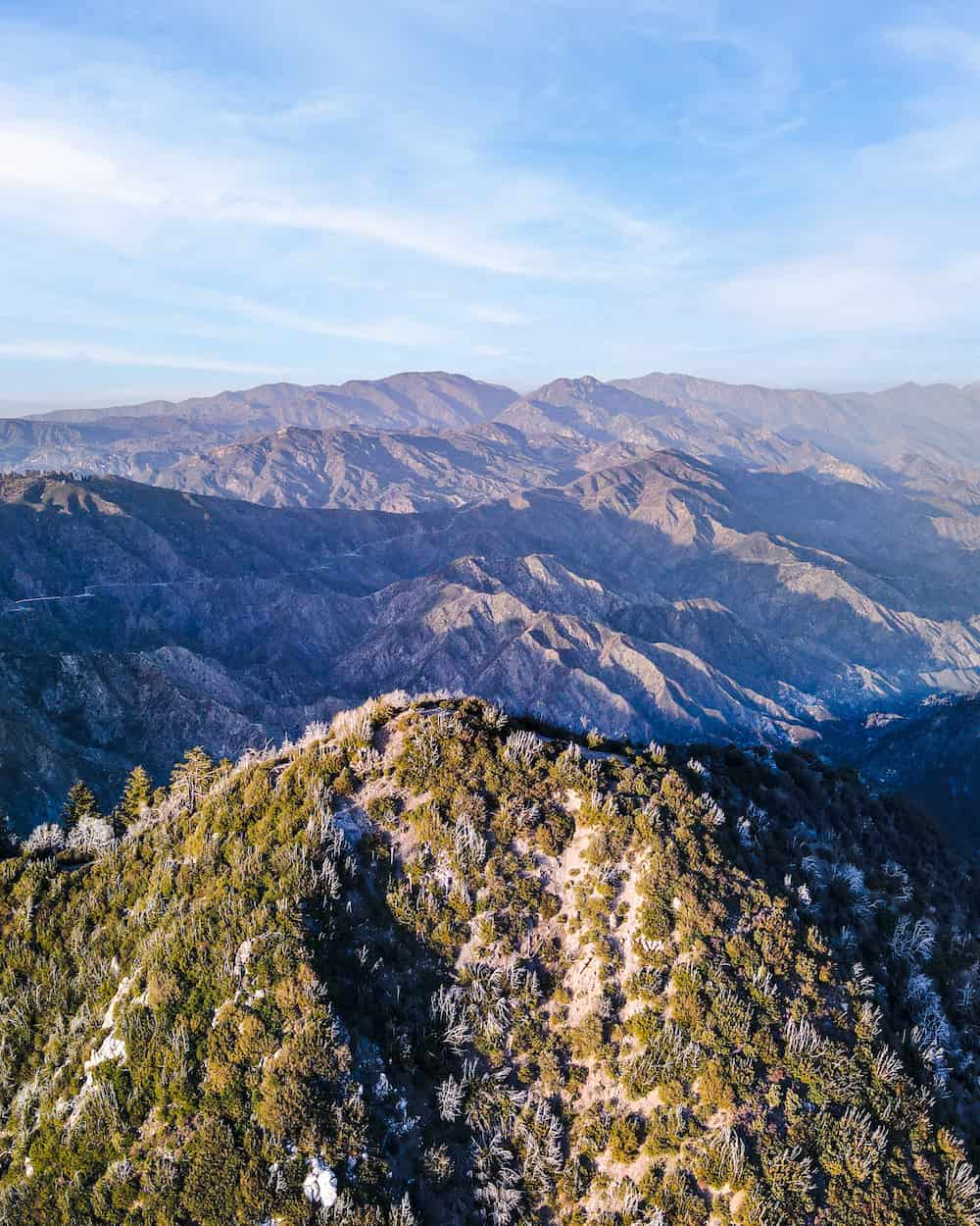
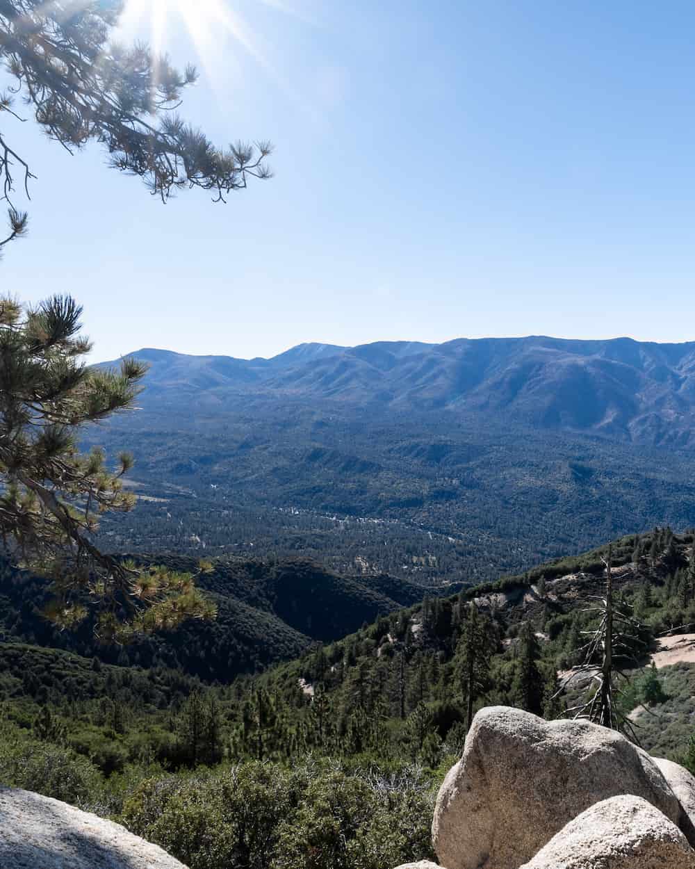
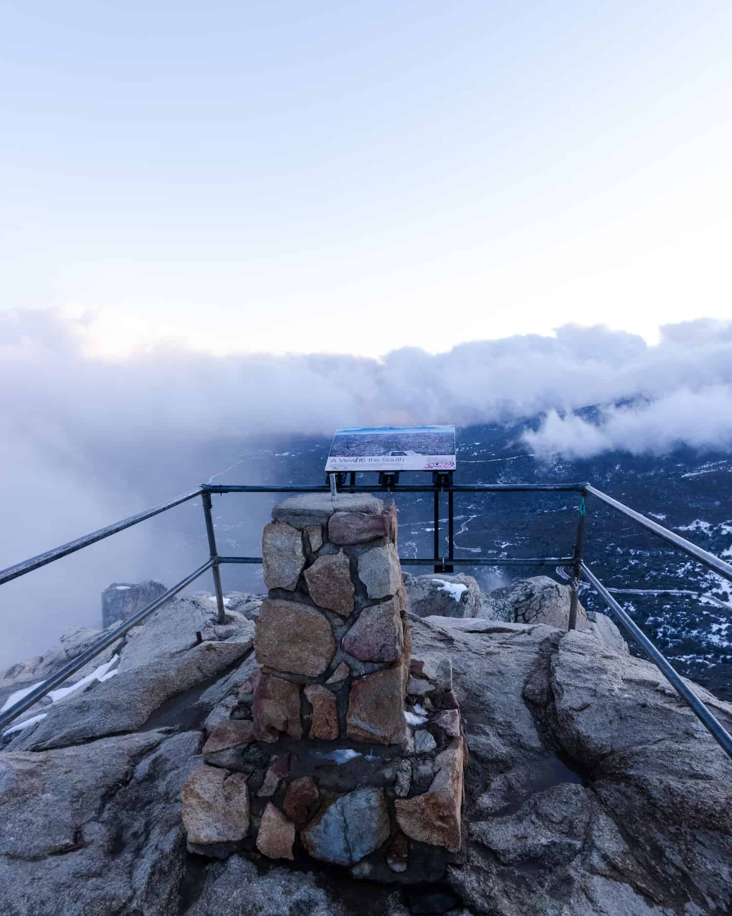
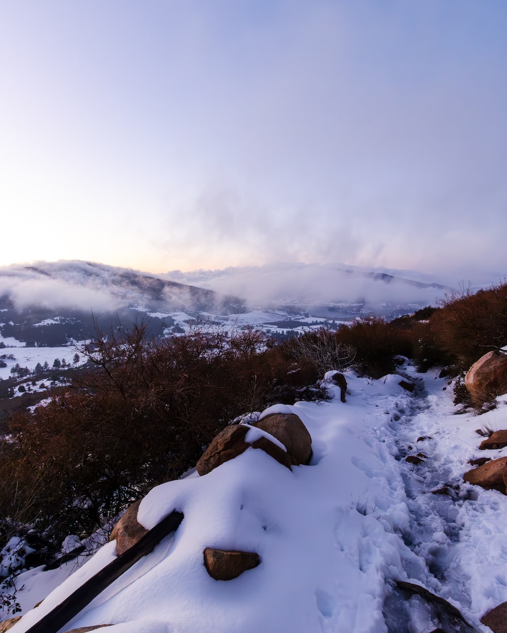
21. San Gorgonio
Very likely to get snow.
At 11,503 feet, San Gorgonio, also known as Old Greyback, is the highest peak in Southern California. Every year, the peak boasts a crown of freshly layered snow, attracting hikers from all over the state.
It goes without saying, only advanced hikers should attempt to summit San Gorgonio in the snow.
The image above is the view from San Gorgonio Peak, an d the mountain in the background is San Jacinto.
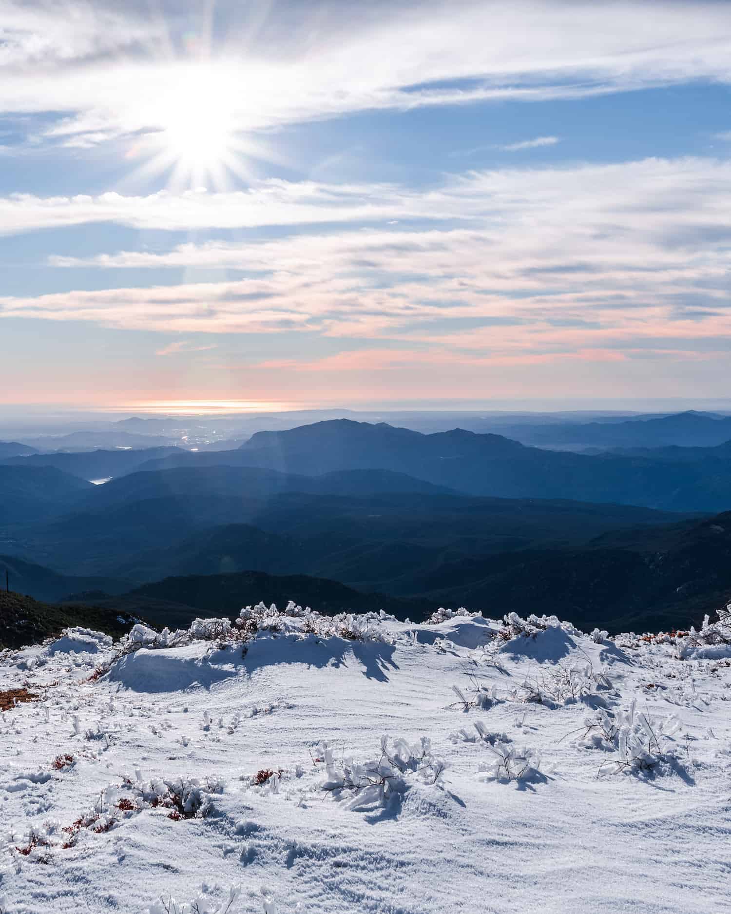
22. Cucamonga Peak
Very likely to get snow.
Known as one of the original six pack of peaks, Cucamonga is not for the faint of heart. Every winter, the mountain is blanketed with much needed snow, and should only be attempted by skilled hikers.
This peak is famous for its precipitous rock ledge which seems to be hovering thousands of feet above the valley when photographed from a certain angle.
The trail leads hikers through a stunning sub-alpine wilderness consisting of a mixed coniferous forest. Therefore, resembling a winter wonderland after a good dump.
23. Ontario Peak
Very likely to get snow.
Ontario Peak is Cucamonga Peak’s smaller neighbor, and therefore, shares a very similar ecosystem. The official peak is located on a pile of large rocks with a pine tree rising from the mount.
The trailhead is located at Ice House Saddle, which technically means you have to hike to the trailhead, if that makes sense.
San Diego County
24. Stonewall Peak
Read Full Post: Stonewall Peak
Less likely to get snow.
Cuyamaca Rancho State Park’s Stonewall Peak is one of my favorite hikes in SD county. The very last section of the peak required walking up a set of extremely icy (and slippery) stairs, with only a pipe railing between me and a near vertical fatal drop. Did I mention I didn’t own microspikes at that time?
The peak is very narrow, almost like a perfect 3D triangle, resulting in one of the most amazing panoramic views I’ve ever witnessed.
The views on the way back from Stonewall Peak were stunningly beautiful.
25. Cuyamaca Peak
Read Full Post: Cuyamaca Peak
Less likely to get snow.
Located across the road from Stonewall Peak is Cuyamaca Peak, the second highest peak in the Cleveland National Forest. Cuyamaca Peak has been one of my favorite snow hikes. It features mortars in Azalea Glen, hundred pound icicles hanging from the antennas, and absolutely mind-blowing views of the Pacific Ocean.
I experienced my first mountain lion encounter about one mile into the hike, which explains why dogs weren’t allowed on the scenic trail. Since the south side of the mountain is very vertical, standing at the peak feels like you’re clinging onto the edge of the world.
26. Palomar Mountain Observatory
Less likely to get snow.
The forested Palomar Mountain Observatory trail is a beginner friendly four mile hike in the Cleveland National Forest that offers panoramic views. As the name suggests, the trail ends at an observatory, which, like the observatory on Mt Wilson, is open to the public, but only through guided tours.
Palomar Mountain typically receives snow only once or twice a year. Hence, keep a close eye on the forecast if you wish to visit in snowy conditions.
Riverside County
27. San Jacinto
Very likely to get snow.
San Jacinto is one of the original six pack of peaks and the tallest mountain in its range, towering above Palm Springs. Just a couple of years ago, an avalanche was witnessed from the freeway. Needless to say, San Jacinto is not ideal for beginners, especially in snow.
28. Tahquitz Peak
Likely to get snow.
Tahquitz originates from the native american Gabrielino’s word Takwis, which means giant hairy man-like beast. This beast was said to have left behind a foul stench, but luckily he did not live at Tahquitz Mountain. He must not have liked the beautiful mixed coniferous forest.
The most popular route to the peak includes the Devil’s Slide trail, and totals at 8.3 moderately challenging miles.
Orange County
29. Santiago Peak
Less likely to get snow.
Although rare, Santiago Peak, the highest mountain in the Santa Anas occasionally gets a good dump. It offers amazing views of the ocean and valley below. The natives believed their god lived on this mountain.
Off roading up the mountain is allowed, but check Caltrans as road conditions may change.
30. Modjeska Peak
Less likely to get snow.
The second highest peak in the Santa Ana Mts is Modjeska Peak, named after a Polish actress. Together with Santiago Peak, they’re known as Old Saddleback.


