Distance
3.9 Miles
Time
~2 Hrs
Difficulty
Easy
Season
All Year
Elevation Gain
830 Ft
Stonewall Peak is a 3.9 mile, roundtrip, hike in Cuyamaca Rancho State Park near Julian, California. It has a total elevation of 5,730 feet, with an elevation gain of 830 feet, and takes 2 hours to hike. Stonewall Peak is currently open from 9 AM to 8 PM. Parking is $10 at Paso Picacho Campground. Dogs are not allowed on this trail.
Stonewall Peak Trail Map
powered by Advanced iFrame. Get the Pro version on CodeCanyon.
Stonewall Peak Directions and Parking
Here are directions to Stonewall Peak: Stonewall Peak Trailhead, Stonewall Peak Trail, Julian, CA 92036.
Tip: If you make the mistake of leaving in the afternoon, you can avoid some of the bumper-to-bumper traffic along the I-5 S freeway by hopping on Highway 78 (just before Carlsbad), then taking the 15 freeway, and so on. If you have a GPS, it should reroute you once on this freeway.
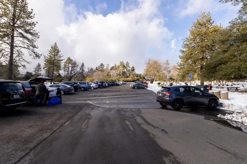
Parking is $10 at Paso Picacho Picnic and Campground.
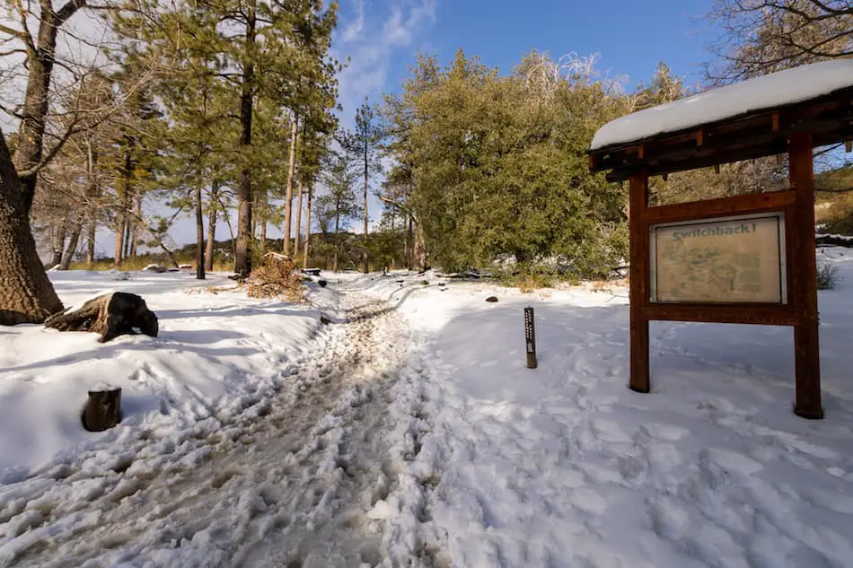
Hike to Stonewall Peak Begins
The trailhead is right across the road from the parking lot. There are a few signs on this trail that tell you where to go.
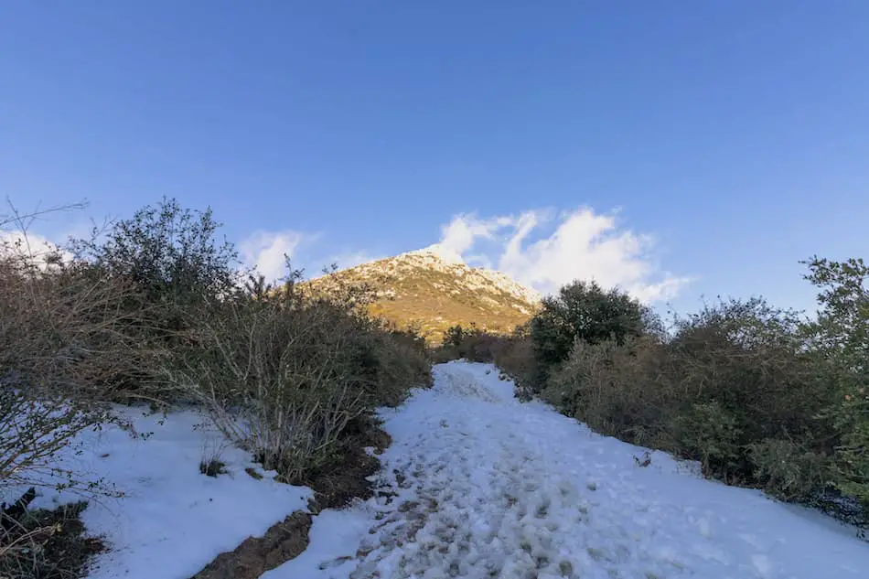
As I was ascending the trail, I got a glimpse of Stonewall Peak. It looks far, but only takes about 2 miles to get to the top.
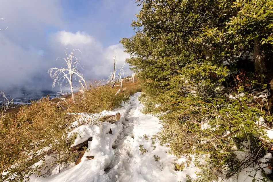
A little past 4 PM and the snow was beginning to melt from both the sun and early birds who hiked the trail before me.
I highly recommend waterproof shoes with grip for the icy and slushy parts of this hike.
The sunlight came and went, illuminating the snowy path beautifully.
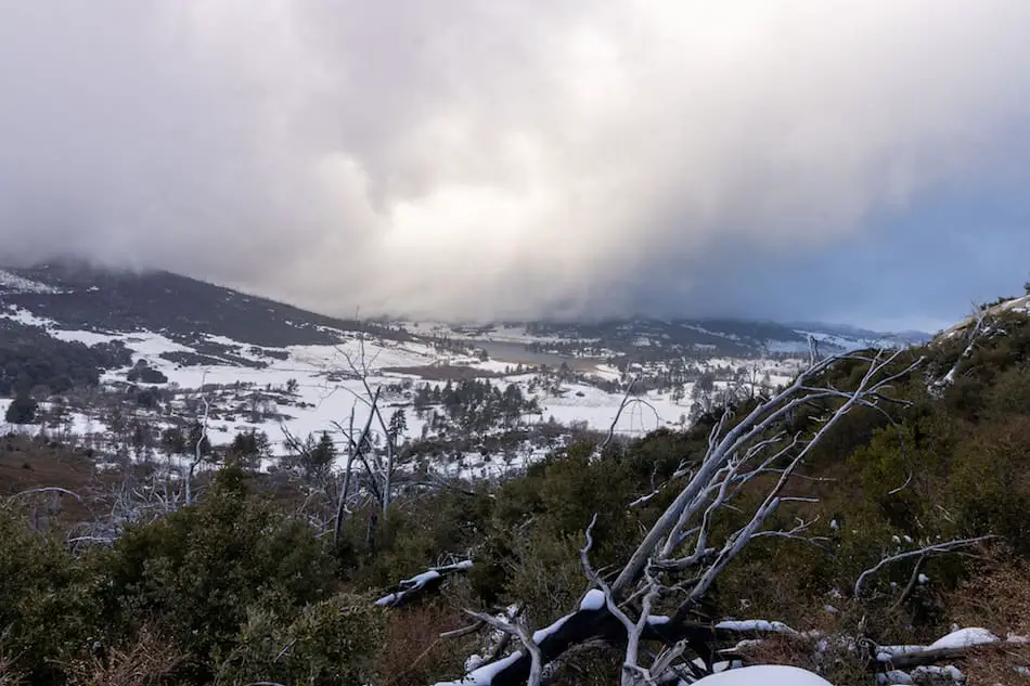
Along the trail, I could see Lake Cuyamaca from a distance (in case you’re wondering, this lake is manmade).
I noticed the dark clouds beginning to roll in.
The trail was quickly enveloped by a dense, foggy mist. It gave the trail a mysterious and eerie look, especially since we were the only ones there.
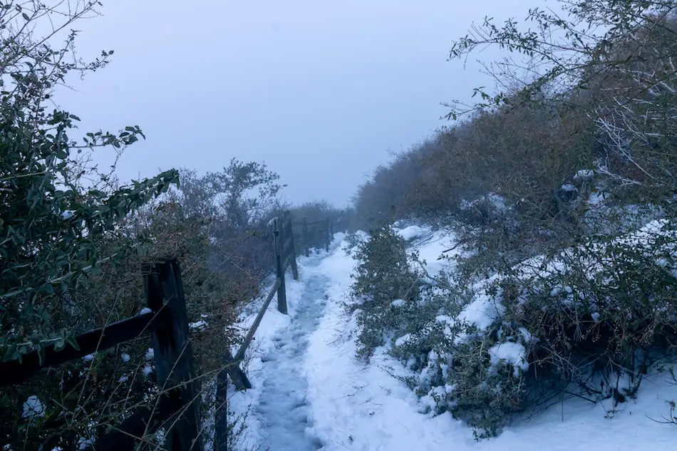
Throughout the trail, there are many switchbacks with fascinating views of the snowy footpath.
The wooden fences, snow-covered ground, and red-colored boulders made me forget I was in San Diego!
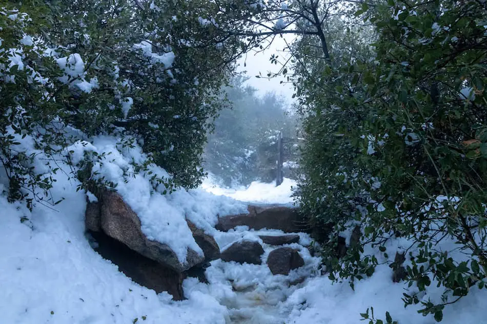
A little over halfway to the peak, I spotted a bit of sunlight peeking through again. This was one of my favorite sights before getting to the top. The archway of trees and stone steps looked like something out of a movie.
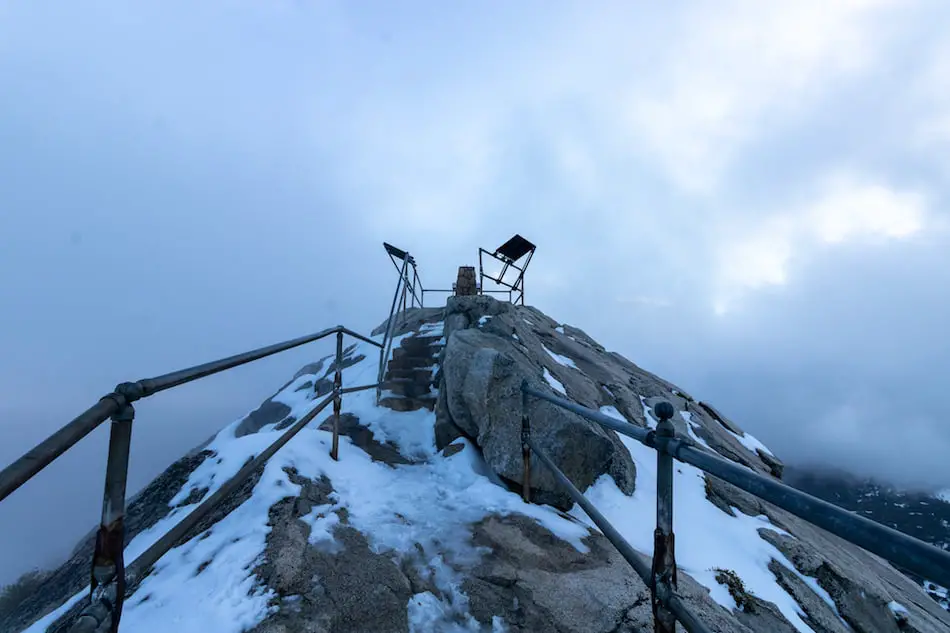
After walking almost 2 miles through cold and wet snowmelt, I could see the stairs that led to the peak.
The hazy gray sky made me feel as though I was walking into the unknown.
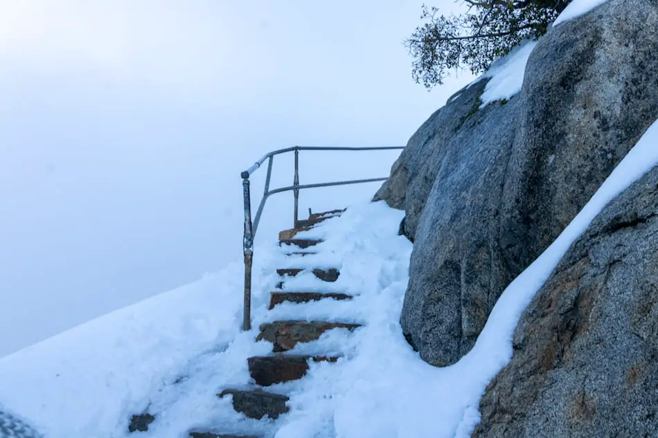
Here’s an awesome shot of the final steps to the top.
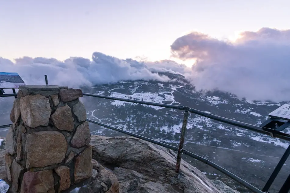
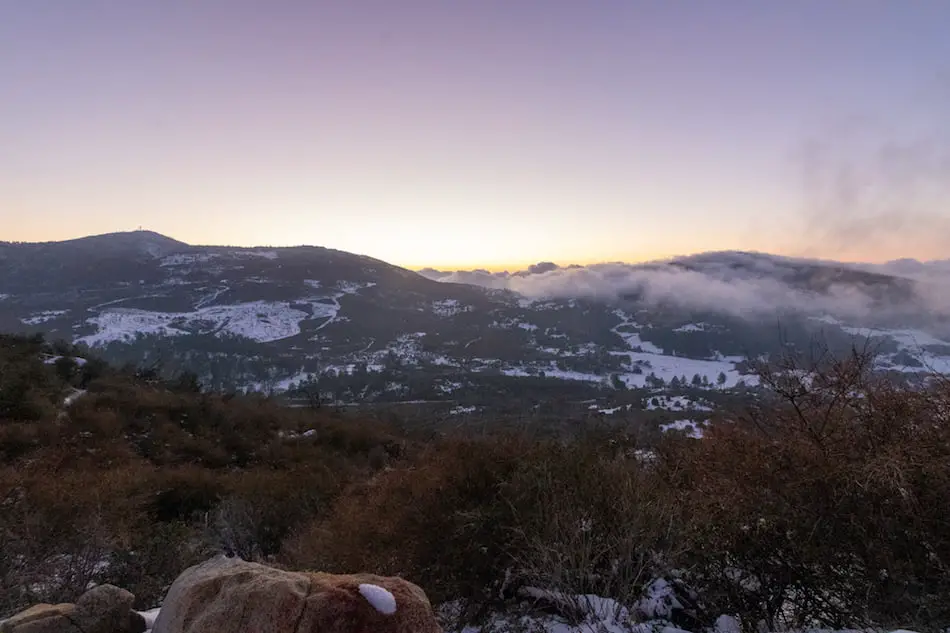
Once at the peak, the clouds were quickly moving in and out. I got to see the snow-covered valley below. I can imagine it looks just as amazing on a day with clear, blue skies.
The clouds made this scene look epic, especially since the sun was beginning to set.
Once the haze covered everything in sight, it was time to head back down the mountain.
Descending the trail, I turned to view this amazing sunset. The clouds had parted, just in time to watch it go down.
I wouldn’t have thought San Diego has such a fun and easy winter snow hike. I highly recommend it after a snowfall, as long as you bring the right gear!
History of Stonewall Peak
How Stonewall Peak Got its Name
I first made a wild guess and thought it was named after the stones along the mountain and trail. Seems like it makes perfect sense, right?
It’s actually named after a gold mine, located on its northeast slope. Originally called the Stonewall Jackson Mine, it was later changed to Stonewall Mine after the Civil War.
Here’s a little background on Stonewall Mine.
In the town of Julian, within San Diego County, prospectors came to the area in search of gold. The city grew as miners began working and exploring here. In 1870, gold was discovered further south of Julian. Then, the Stonewall Mine began operating.
Surprisingly, this mining operation was booming! It soon became the most profitable mining operation in the entire county, bringing in more than 2 million dollars of gold.
Because of the influx of miners and people to the Cuyamaca mountains, there was a need for a better water source. Lake Cuyamaca was then constructed, which brought water to not only the miners and their families, but San Diego city as well.
In 1933, the mine was bought by Ralph Dyar and operations ceased. Although the mine has been filled in, you can still see the remnants of the mine and the nearby city.