
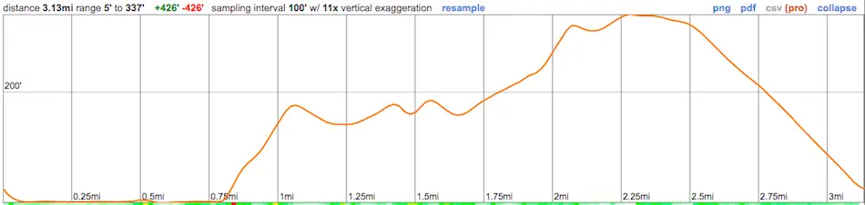
Distance
3.1+ Miles
Time
~2.5 Hrs
Difficulty
Easy
Season
All Year
Elevation Gain
338 Ft
Torrey Pines State Beach has some of the most breathtaking beach views and beach trails in SoCal. Escape the warm weather and treat yourself to a very breezy and dreamy adventure!
Torrey Pines State Beach Loop to Yucca Point and Razor Point is a 3.1-mile beach hike along the coastal beach within San Diego. It features various trails and lookouts. It’s rated as an easy hike with an elevation gain of about 338 feet. Dogs are not allowed at the beach or trails.
Did you know Torrey Pines is one of the best hikes in all of SoCal? It made it to my list of top trails. Click the link below to view 500 ft waterfalls, nuclear armageddon tunnels, nazi ruins, and more:
Best Hikes In Southern California
Map of Torrey Pines Beach Trail Loop
Torrey Pines Beach Parking & Directions
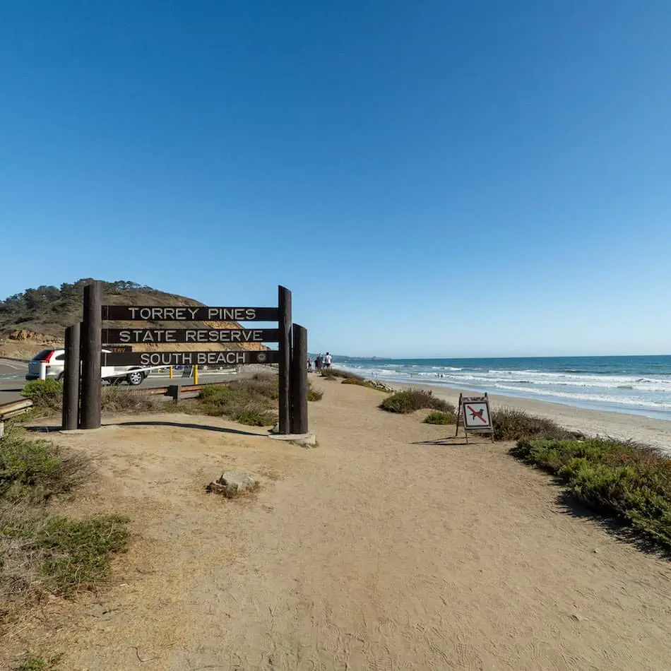
Torrey Pines State Beach is located at 12600 N Torrey Pines Rd, La Jolla, CA 92037.
Parking Information
The parking fee at Torrey Pines State Beach is $10 per vehicle. It’s open from 8 AM to sunset daily.
Click here for directions to the parking lot. You can also find free parking nearby Tower 3 & Tower 4.
Restrooms are located at the North Beach Lot.
The Adventure
Torrey Pines Beach trail is considered a loop, so you can either start walking up on the cement road and through additional parking lots or you can start the hike on the sandy beach.
For reference, check our guided map above!
QUICK TIP: You’ll need to check the tide levels ahead of time!
We started off at the beach since it was later in the day and we knew the tide levels would rise and make it more difficult to walk through.
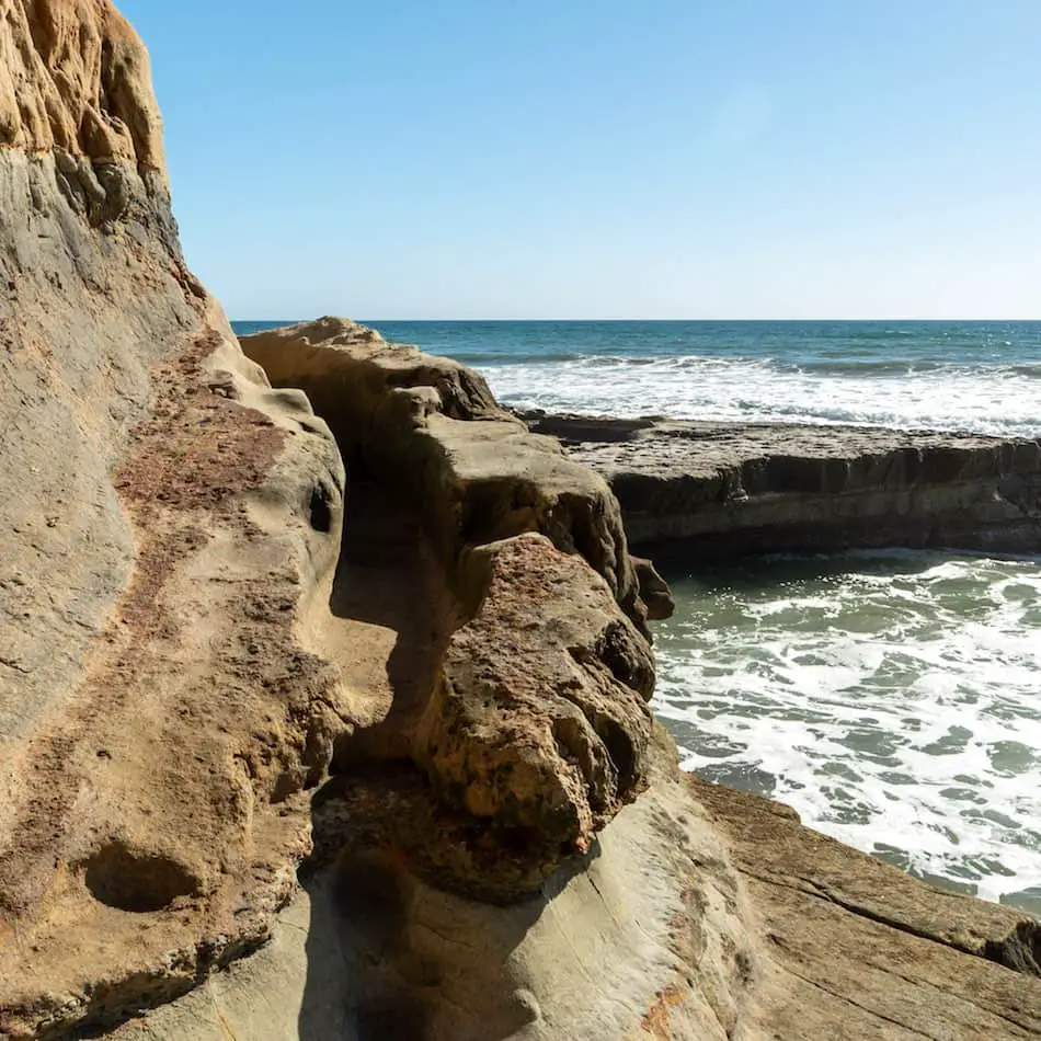
We walked along the cliffs and enjoyed the nice views. I was surprised to see there weren’t too many people for a Saturday.
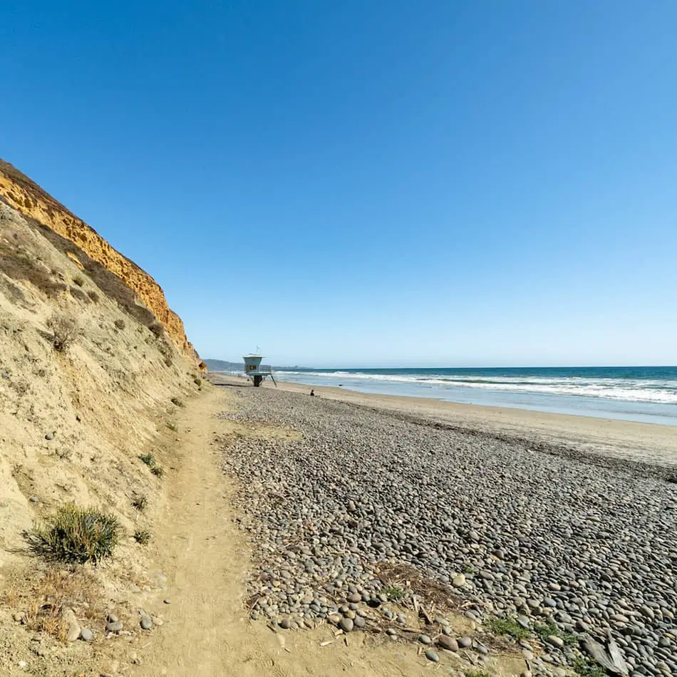
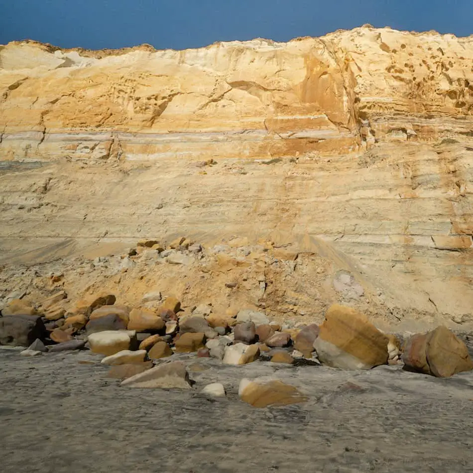
It really fascinated me to see the different striations and grooves on the rocks and cliffs. They are really colorful and beautiful in person!
Read More: 11 Best Hikes in SoCal
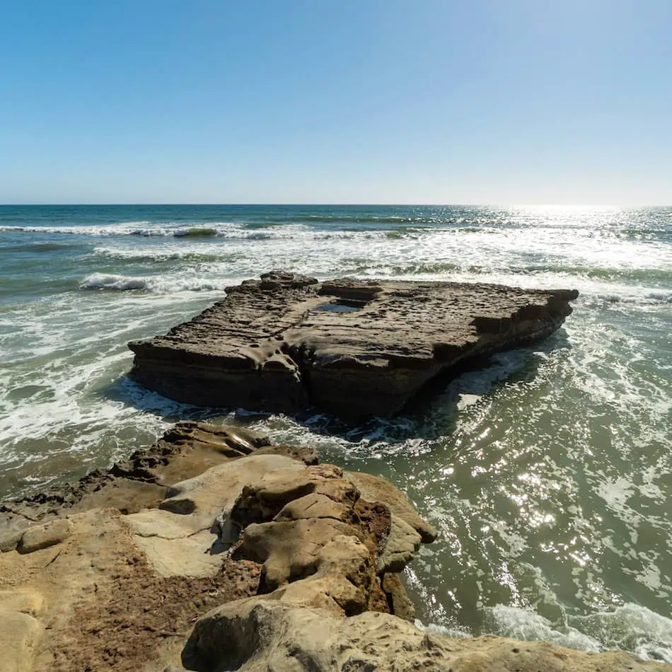
Before heading up to the trails, we made a stop at this very popular area known as Flat Rock.
There is a pool of water towards the center that’s about 5-6 feet deep. I don’t recommend swimming in it!
It was really fun to walk along this paved pathway against the beach bluff. Around the corner, I could see the neighboring beach.
I was able to feel the splashes of water when the waves crashed against Flat Rock.
Read More: 80ft Cedar Creek Falls & Huge Swimming Hole in SD County
We then headed up the stairs and to the beach trails.
As you can see, the sand looks dark and wet. The water does reach the very edge of these cliffs, which is why it’s important to check the tides beforehand!
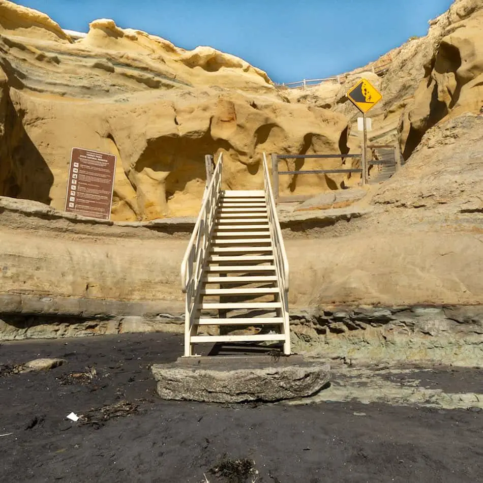
This section reminded me a lot of Annie’s Slot Canyon trail, which is not too far from this place.
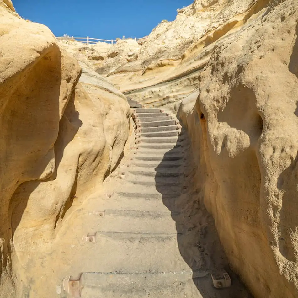
This is the main beach trail that leads up to the top of the cliffs.
There’s hardly any shade so I recommend wearing a sunhat and sunscreen.
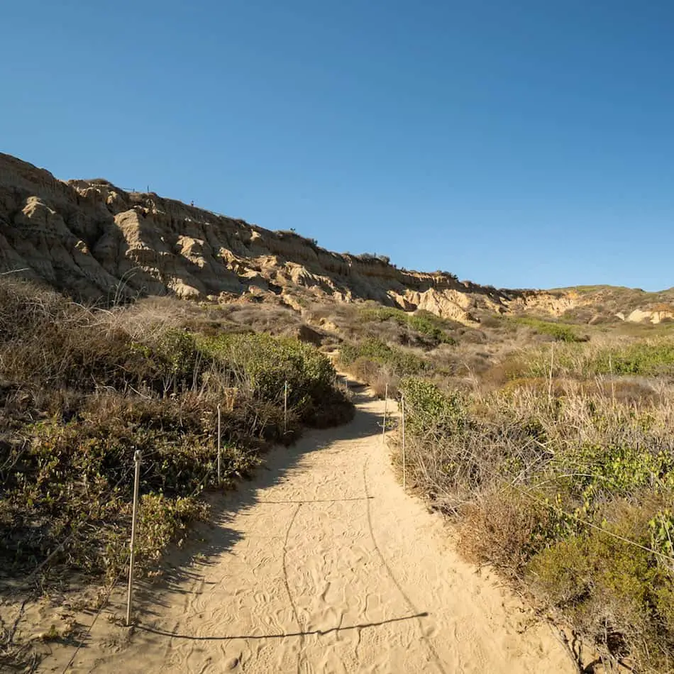
The next two trails are located at the top of the cliffs!
Read More: Ho Chi Minh Trail: Slot Canyon + Falls in SD
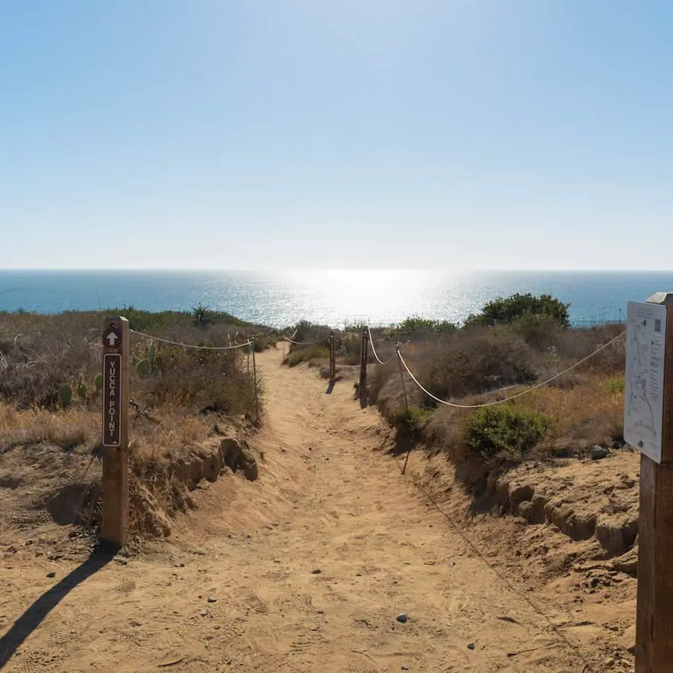
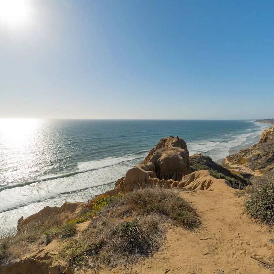
Yucca Point Trail
Yucca Point trail is the first stop at the top.
During the late winter and spring months, you can see the Yuccas in full bloom.
FUN FACT: Yucca plants often bear edible flowers and fruit!
This was one of my favorite views! You can see the trail that we came up from and even Flat Rock to the right.
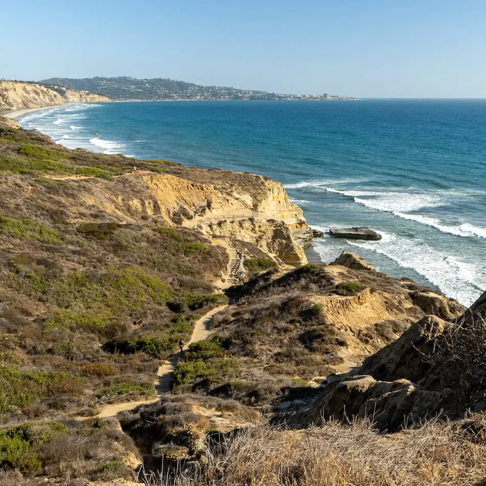
It is an extremely beautiful sight.
Read More: 7 Best San Diego Hikes You MUST Explore!
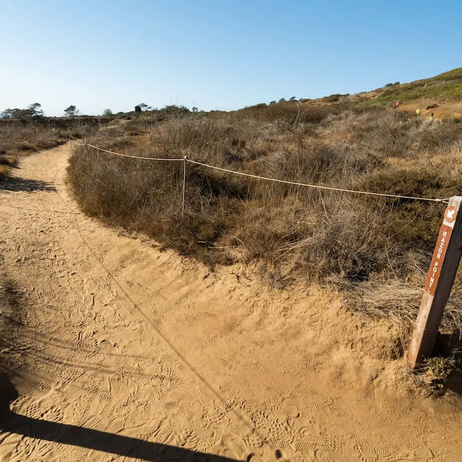
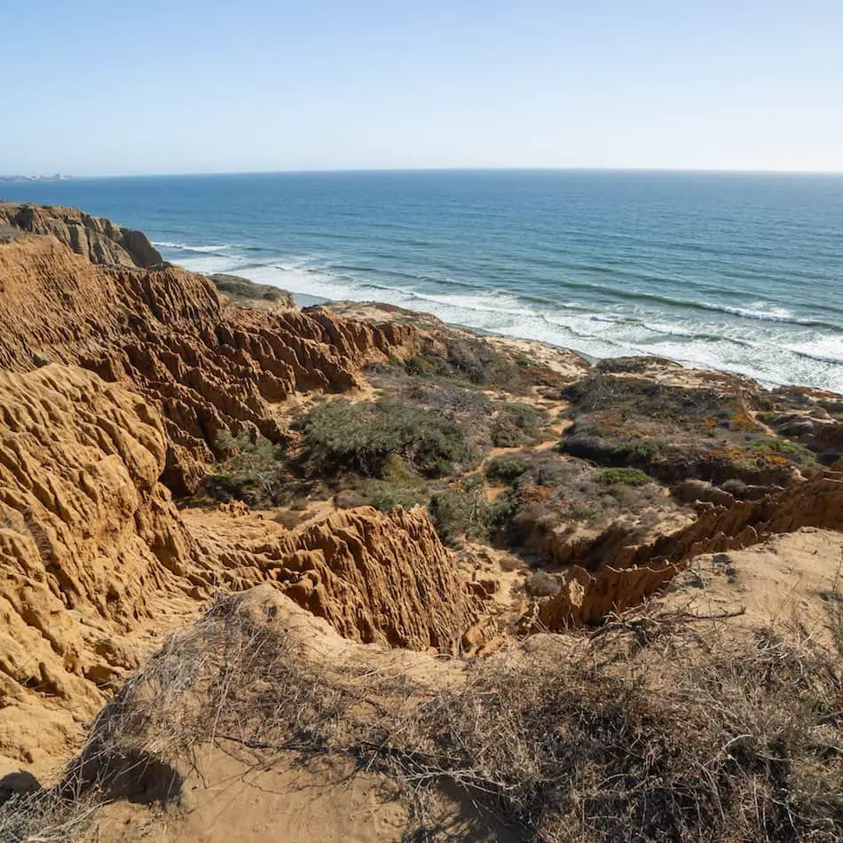
Razor Point Trail
Razor Point Trail has a completely different viewpoint that is also super beautiful and interesting!
The sunsets must be so epic here!
I loved this part. The ridges on these rock formations are absolutely astonishing. These formations look a lot more red-orange in person.
It is crazy to think that we have such breathtaking beach trails so close to home.
There are a ton of more trails that we walked through along the loop trail. But, Razor point and Yucca point have the best beach views.
I HIGHLY recommend spending the day in this part of San Diego. You’ll be able to enjoy amazing views and super fun trails! You can even hit the water right after.
Is Torrey Pines Hike Dog-Friendly?
Dogs are not allowed on the Torrey Pines State Reserve trails or beach area, even if they are leashed. This is to protect the natural reserve and resources within the park.


