
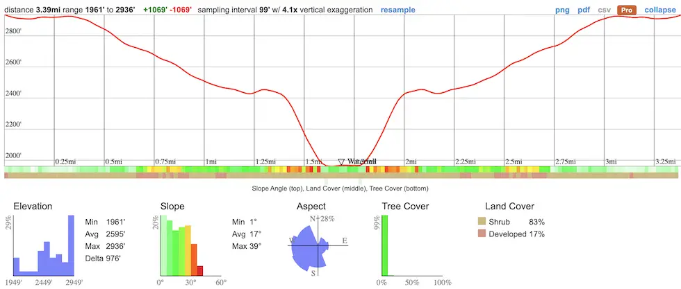
- Total Miles: 3.39
- Time: 2.5 hrs
- Difficulty: Moderate – Hard
- Best Season: Spring
- Elevation Gain: 1069 ft
- Max Elevation: 2936 ft
- Type of Trail: Out & Back
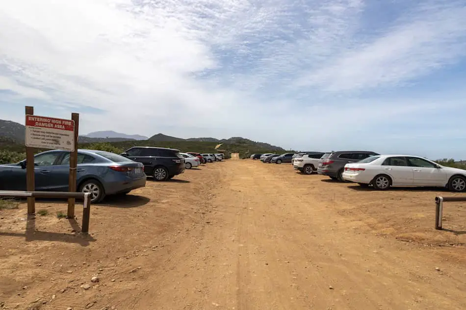
- Parking Lot: Fits 40+ cars
- Dogs: Allowed On A Leash
- Restrooms: Available At The Parking Lot
- Trail Popularity: Very High
Located roughly fifty miles east of downtown San Diego is one of the best waterfalls in all of SD County, and arguably the state. I’m not at all exaggerating when I say I can’t think of any other waterfall which resembles this massive cascade. It’s truly one of a kind.
Three Sisters Falls is a 3.39 mile roundtrip hike located near Santa Ysabel, which boasts three-tiers and multiple swimming holes. Spring is the best time to visit as it’s likely to have more water. This trail is very exposed to the sun, rated moderate to difficult, and is not dog or child-friendly, especially during the summer months. The dangerous descends which once required rope to get to the falls are no longer needed, as the trail has been re-newed for safety purposes.
Three Sisters Falls is hands down one of the best hikes in not only San Diego, but all of Southern California. To view the rest of that list, however, check out the post below:
Best Hikes In Southern California
Map of Three Sisters Falls
Address & Directions
You can click here for to be redirected to the Three Sisters Falls trailhead via Google Maps.
The last 5 miles on Boulder Creek Rd consisted of a dirt road. Although sedans can make it to the trailhead, I recommend bringing an SUV or truck to make life a little easier.
Helpful Links
SoCal Adventure Pass (required for parking in SoCal mountains)
Hiking Three Sisters Falls
I began my adventure by hiking down the same dirt road that connects to the parking lot.
I want to point out that virtually the entire trail is exposed to the sun, and pets have died from heatstroke on this trail. Come prepared with plenty of water and a hat!
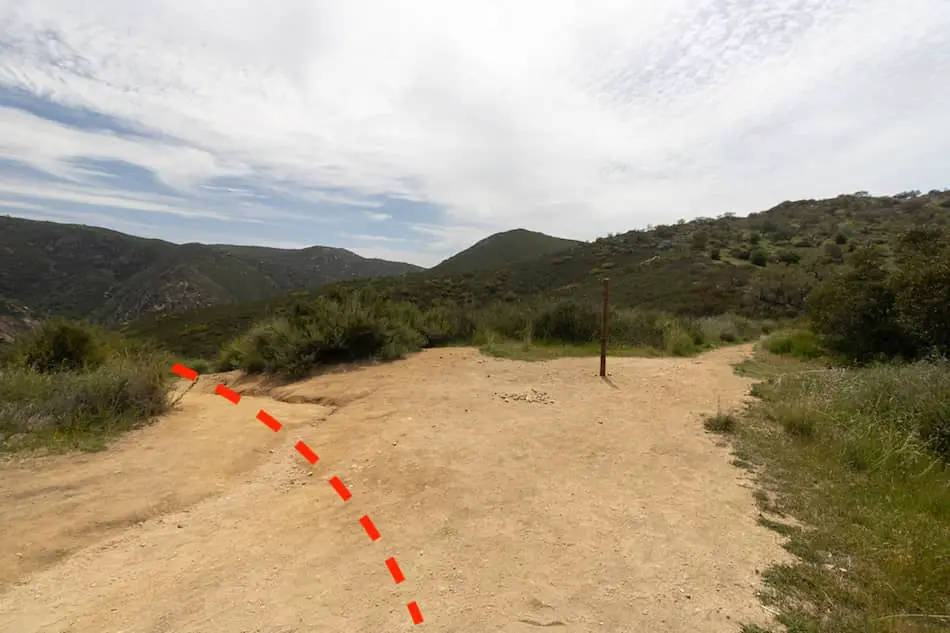
After walking up and down a few chaparral-covered hills, I made a left at the fork where the sign for Eagle Peak is located. Do NOT head up to Eagle Peak. Make a left to descend down a dirt trail instead.
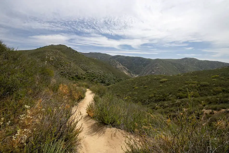
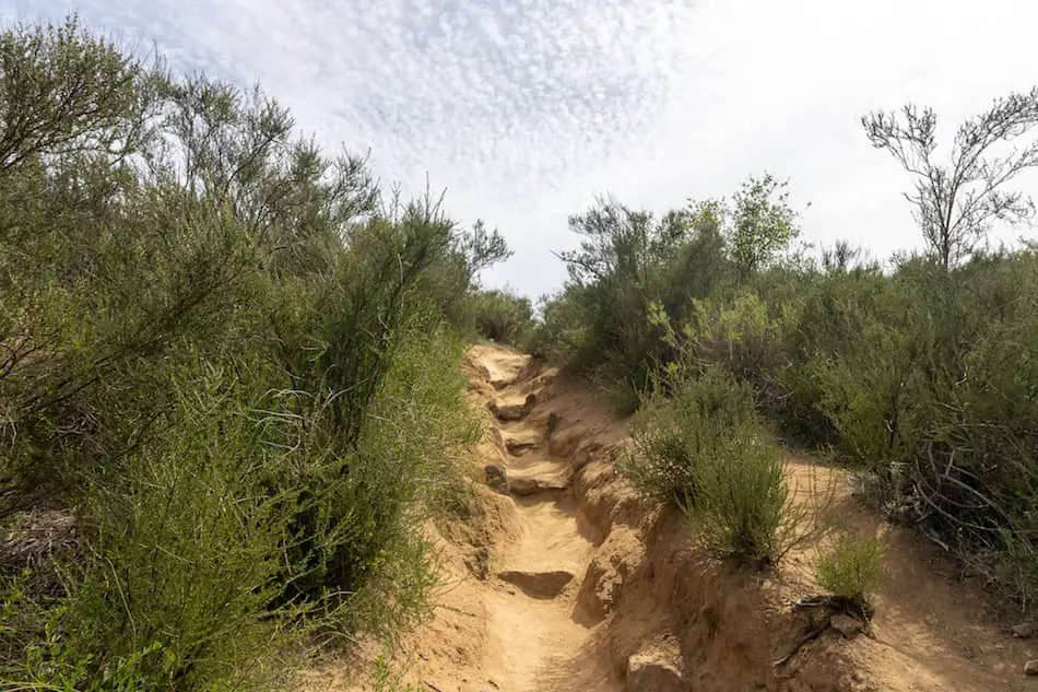
The trail becomes more rugged, steep, rocky, and some sections of the trail had loose gravel. There are also tons of beautiful wildflowers and bees along the way!
I experienced random pockets of heat throughout the trail. Mind you, it was only 75 degrees that day.
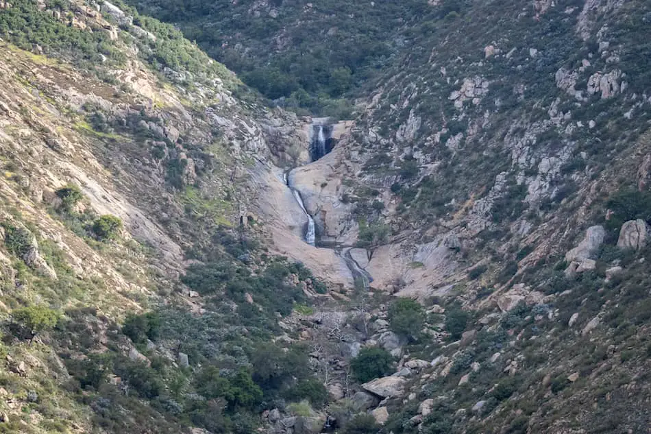
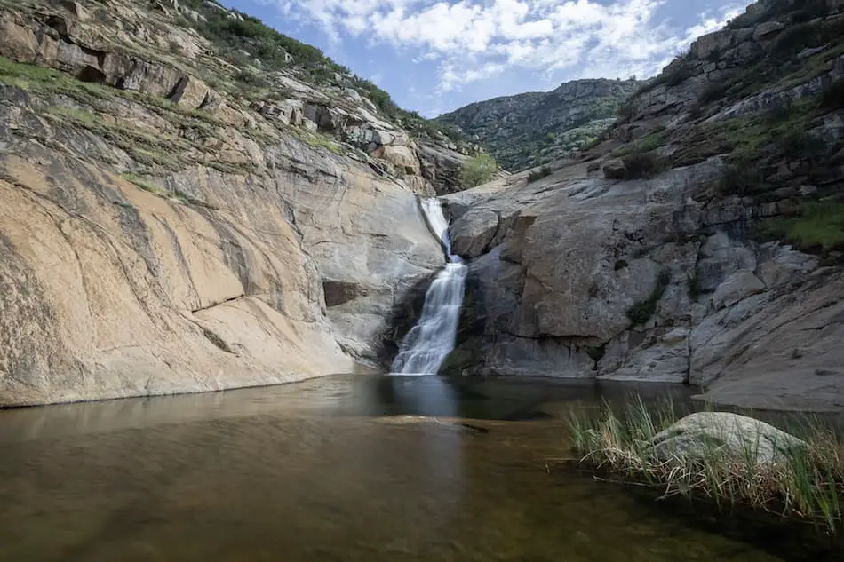
I was able to see spot Three Sisters Falls from roughly halfway through the hike. You can see all three tiers from this far. It looked so amazing!
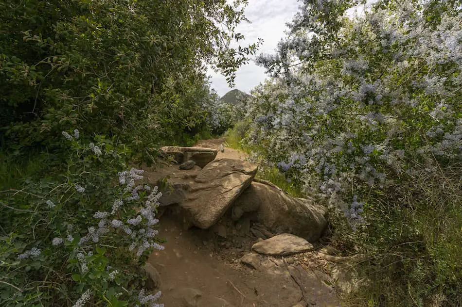
After descending to the canyon floor, the scenery transformed. The vegetation became more abundant, and Ceanothus flowers which you can see in the image below, surrounded the trail.
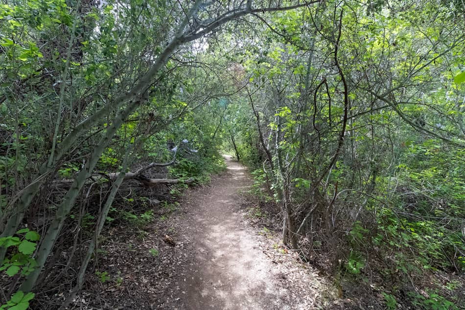
Walking under these shady trees was a delight. It felt much cooler in this section, but unfortunately, the shade was very short-lived.
This section reminded me of an enchanted forest.
The final part of the hike requires walking up a few steep steps.
Finally, I arrived at the falls.
From a distance, the falls resembles a long waterslide, but I don’t recommend sliding down as it can be dangerous.
I carefully walked across the steep granite rock which leads up to the middle tier, and wasted no time making my way to the top tier.
This is where good hiking boots come in handy. I use Merrel Moab mid hiking boot, as they provides ankle support, high ventilation, and of course, good grip.
Getting to the top tier, which measures about 25-30 ft and has a swimming hole for cliff jumping, can be tough, slippery, and dangerous! Please be very careful and don’t attempt if you’re afraid of heights or have poor balance.
Did you know Three Sisters Falls is one of the best waterfalls in San Diego? Not hard to believe right? However, the title for the most stunning SD waterfall, in my opinion, goes to Cedar Creek Falls. Click the link to check it out.
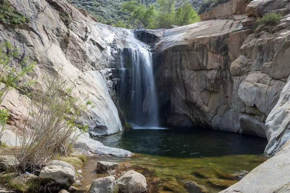
The second “sister” (middle tier) was the most impressive. This one is around 50 feet high and has a very large pool.
Digging this waterfall? Then you’ll love the post I put together for you called:
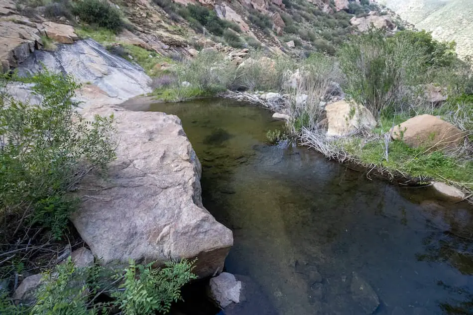
The bottom tier is definitely the smallest, measuring roughly 20 ft high but with a very gradual slope. The cool thing is that you can access more pools!
The lowest pool has a section that extends to the right.
Overall, this waterfall is about 170 feet tall/long! Three Sisters Falls is a definite must during the Spring months and after heavy rainfall.
You won’t be disappointed!
FAQ
Do You Need A Permit For Three Sisters Falls?
No permit is required to hike to the falls. However, you do need a SoCal Adventure Pass, which is required to park in all SoCal mountains.
Can you Swim at Three Sisters Falls?
Yes, you can swim in the top two tiers. I highly recommend taking a swimsuit or trunks.
How Deep Is Three Sisters Falls?
The middle and top tiers have swimming holes which can be as deep as 10 feet. However, they’re much shallower during the non-Spring seasons. Always be very careful if you plan on cliff jumping.
Can You Take Dogs to Three Sisters Falls?
Yes, you can take your dog to Three Sisters Falls. Be sure to take plenty of water for your pet since heatwaves can be deadly for both humans and animals.
Is Three Sisters Falls Child-Friendly Hike?
I don’t recommend taking small children to Three Sisters Falls. The heat can be unbearable from spring to the early fall months, and the trail is rated moderate to hard in difficulty as some sections can be someone steep.
Why Is It Called Three Sisters Falls?
The waterfall gets its name due to its three large tiers.


