- Total Miles: 1.3
- Time: 45 Min
- Difficulty: Easy
- Best Season: All Year
- Elevation Gain: 224 ft
- Max Elevation: 145 ft
- Type of Trail: Out & Back
- Dogs: Allowed On A Leash (Except The Slot Canyon)
- Restrooms: Not Available
- Trail Popularity: Very High
Take your family on a fun hike featuring a slot canyon and epic sandstone formations. The slot canyon is located in San Elijo Lagoon Ecological Reserve, and is so narrow you sometimes have to turn sideways to get through the whole thing. The last part requires climbing up a steel ladder!
Annie’s Slot Canyon Trail is an easy 1.3 mile roundtrip hike near Solana Beach. Much of the sunny trail is decorated with vibrant wildflowers, stunning ocean views, and of course, a fun and exciting slot canyon waiting to be explored. Dogs are allowed on the trail, with the exception of the slot canyon.
Annie’s Canyon is one of the best hikes not only in San Diego, but also in all of Southern California. Don’t miss out. Explore the best hikes by clicking the links below:
Best Hikes In Southern California
Map of Annie’s Canyon Trail
Directions & Parking
This version of Annie’s Canyon Trail begins from Gemma Parks Interpretive Trail. It’s more scenic and cuts deeper through the preserve than other versions.
To be redirected to the trailhead via Google Maps, click the link below.
150 Solana Point Cir, Solana Beach, CA 920754
Hours
6:00 am – 6:00 pm
Sundays they stay open until 8:00 pm.
Helpful Links
Annie’s Canyon Trail
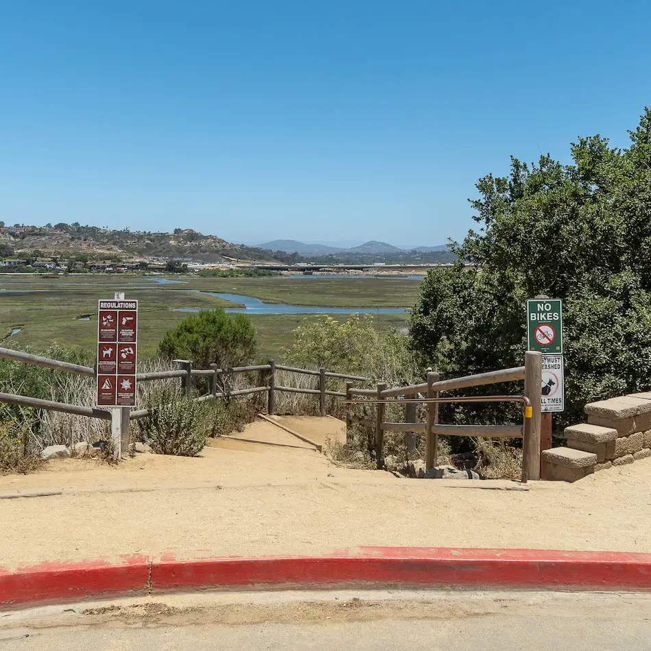
Once you arrive at the dead-end, the trailhead will be located to your right, leading away from the ocean and further into the San Elijo Lagoon Ecological Preserve.
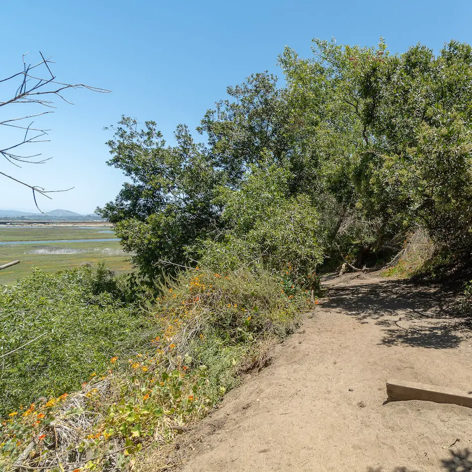
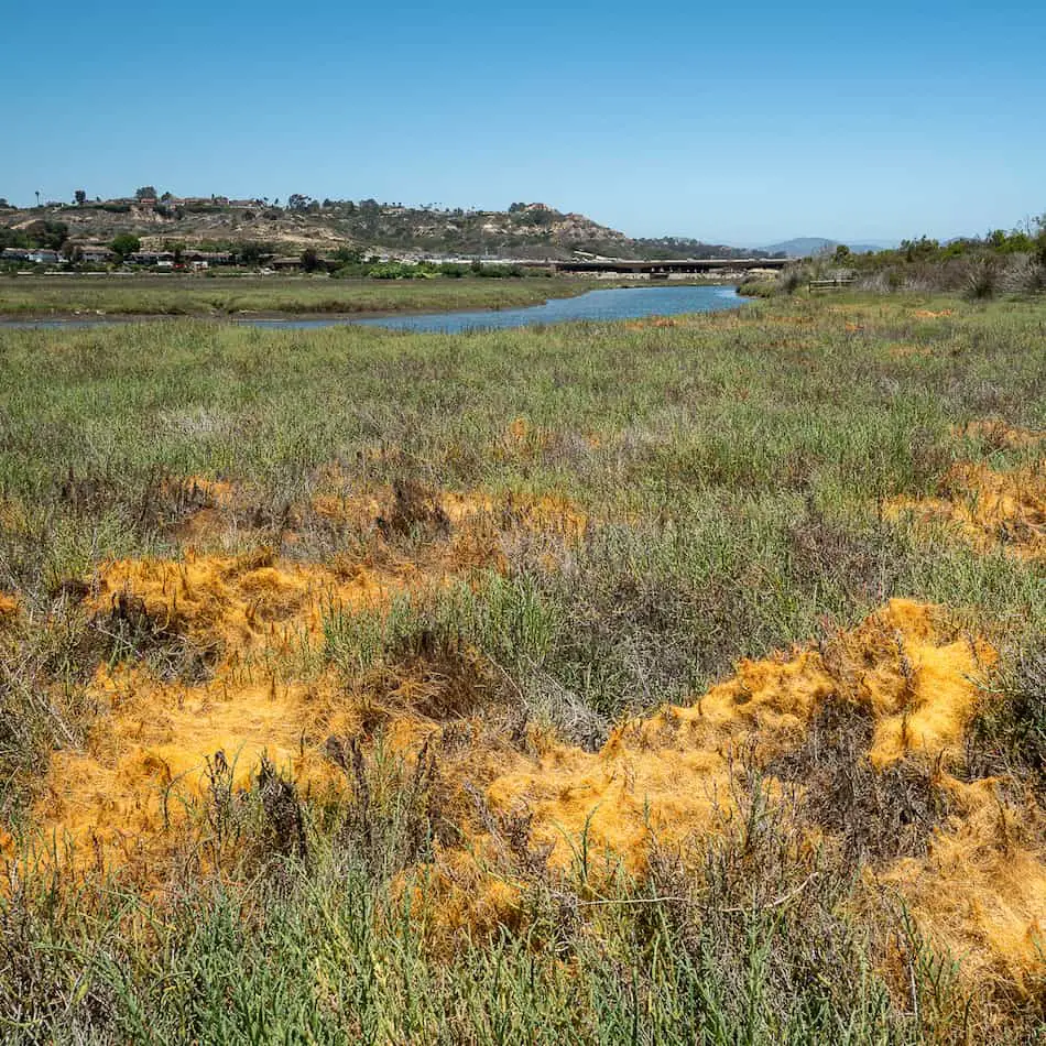
I love this trail because from the start you’re rewarded with amazing views of wildflowers, a beautiful green marsh, and a flowing creek.
Keep an eye out for a vibrant orange plant-like substance growing on the grass and other plants.
This is a parasite known as Cuscuta California and is harmless to its host but adds to the colorful scenery of the trail.
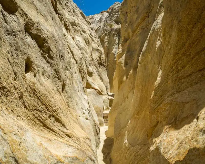
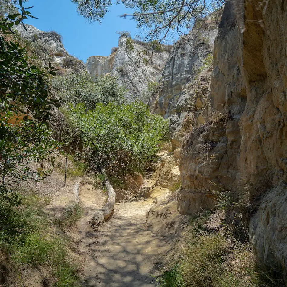
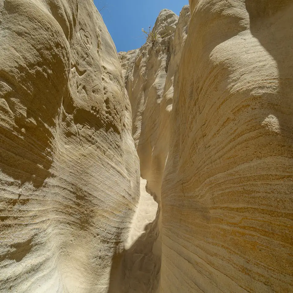
As soon as you enter the slot canyon, you’ll notice sandstone cliffs beginning to rise on both sides and the trail becoming increasingly more narrow.
Almost immediately after venturing into the narrow section of the slot canyon, you’ll see a small cave to your left, which you can explore if you’d like.
This is probably why the locals refer to Annie’s Canyon as the “Mushroom Caves.”
Read More: 80ft Cedar Creek Falls & Huge Swimming Hole in SD County
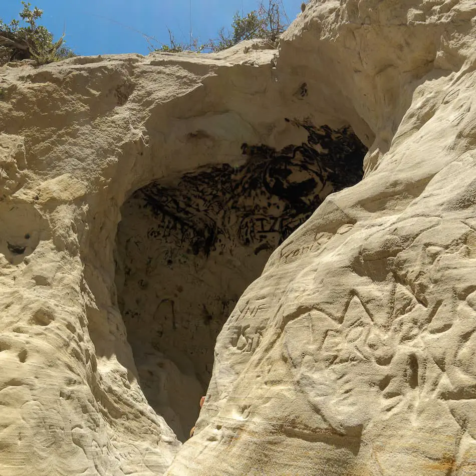
You’ll be able to see the cliffs on the opposite side of the canyon from inside the little cave. It’s a nice spot for a short break and to take in the beauty of the sandstone formations around you.
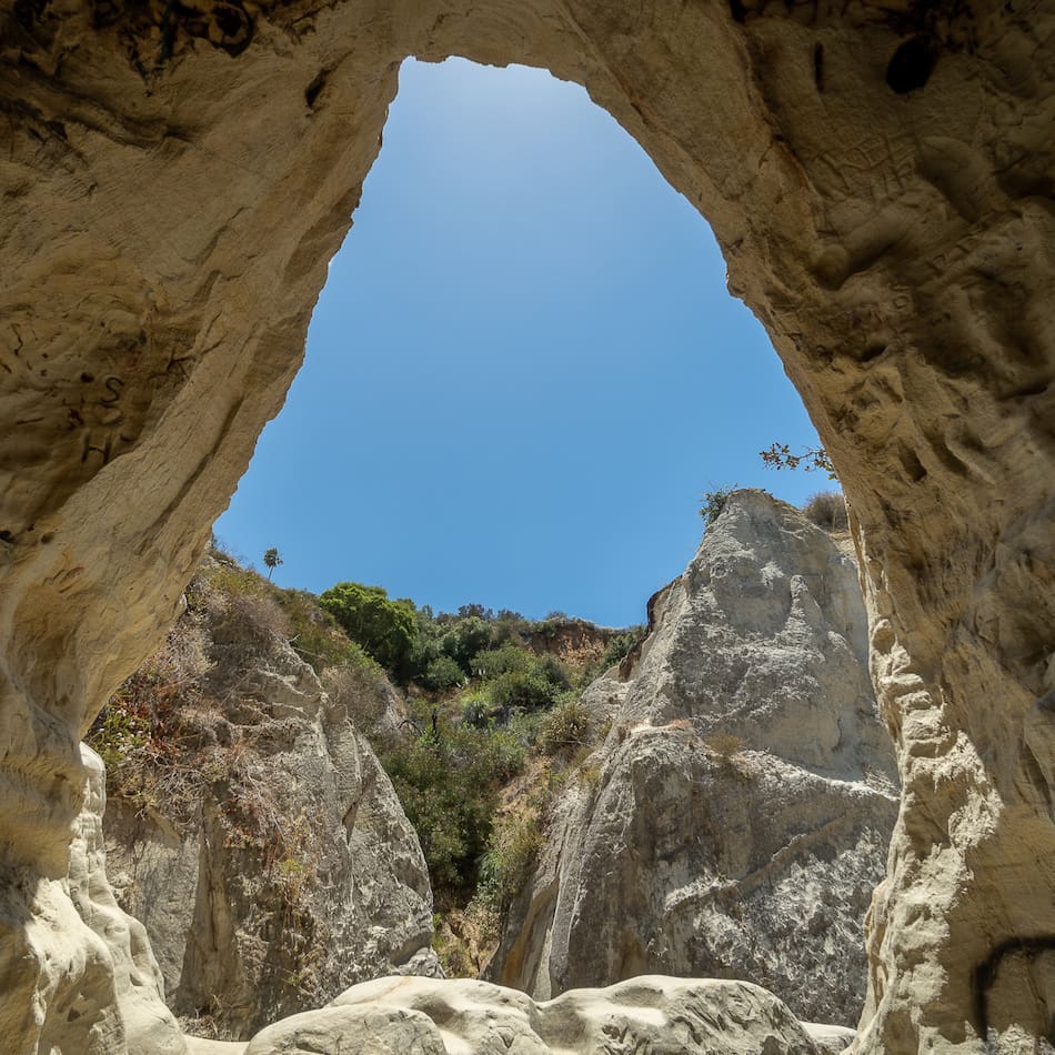
As you continue further up the canyon, the trail becomes narrower and the walls more captivating, almost as if someone carefully used brush strokes to mold the walls into their current formation.
Read More: Cowles Mountain: #1 Trail in San Diego County
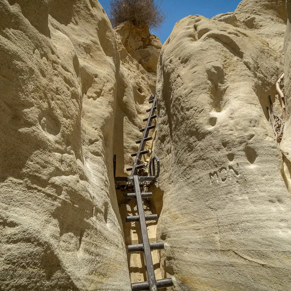
There is a steel ladder about 15 feet high located at the end of the slot canyon. Unless you turn back, this is the only way out so watch your step as it’s a long way up!
Note! If you visit on a weekend, the slot canyon may be crowded from beginning to end, making it impossible to head back the way you came. Therefore, make sure everyone who enters the slot canyon can either climb the ladder on their own or be carried up.
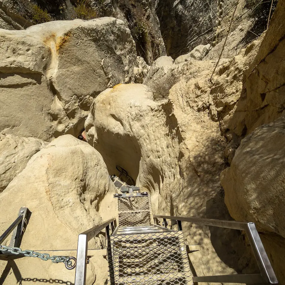
Here is a view looking down from the top of the ladder.
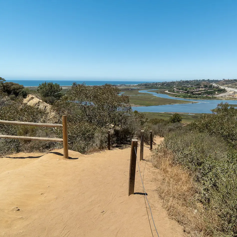
When you reach the top you’ll be rewarded with a view of the San Elijo Lagoon Ecological Preserve stretching all the way into the Pacific Ocean.
Want to explore a slot canyon hike with a waterfall that literally flows onto the beach? Check out the Ho Chi Mihn Trail which is also located in San Diego.
FAQ
How narrow is Annie’s Canyon Trail?
The slot canyon section of the trail is about 3 feet wide on average but can get as narrow as one foot, making it very difficult for one person to pass the person in front of them.
Where does Annie’s Canyon Trail start?
Annie’s Canyon Trail actually begins in a neighborhood that is adjacent to San Elijo Lagoon Ecological Preserve.
Is Annie’s Canyon Trail good for kids?
Annie’s Canyon is a great trail for kids because it is short, easy, not steep, and fun. The only section that may prove difficult for very small children is the last part of the slot canyon, which requires climbing up a roughly 15ft steel ladder. Unless the trail is empty, hikers will not be able to turn around and head back the way they came once inside the slot canyon. All terrain strollers can be used for the entirety of the trail with the exception of the slot canyon.
How long of a hike is Annie’s Canyon Trail?
The roundtrip distance is 1.3 miles.
How did Annie’s Canyon get its name?
According to The Coronado Times, Annie’s Canyon is named after a 30 year resident of Solana Beach and active conservationist. Thanks to her more than generous donation, the San Elijo Lagoon Conservancy was able to acquire the land from private landowners. They quickly cleaned up the trash and graffiti, and opened to the public in 2016.


