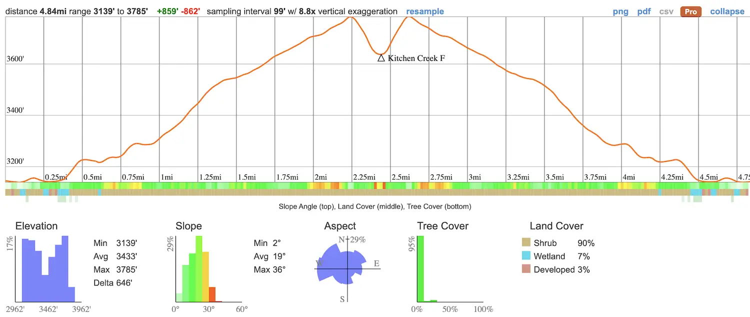
- Total Miles: 4.84
- Time: 2 Hrs
- Difficulty: Moderate
- Best Season: Spring
- Elevation Gain: 956 ft
- Max Elevation: 3794 ft
- Type of Trail: Out & Back
- Parking Lot: Fits ≈ 10 cars
- Dogs: Allowed On A Leash
- Restrooms: Not Available
- Trail Popularity: High
- Pics Taken On: May 13, 2021
This has to be one of my top favorite hikes in San Diego. Not only are there multiple natural pools, but there’s also a pretty large hidden waterfall at the end! This place is blowing up, so head over before it gets packed with people.
Kitchen Creek Falls is a 4.8-mile hike located in Pine Valley, within San Diego County. The hike takes you along the Pacific Crest Trail and features multiple natural pools and waterfalls. It’s considered an easy trail but getting to the hidden waterfall is difficult. Dogs are allowed on this trail. Not recommended for young children.
Want to explore more swimming holes, nazi ruins, abandoned gold mines, and more amazing hikes? Click the link below!
Best Hikes In Southern California
Kitchen Creek Falls Trail Map
Directions & Parking
Click here to be redirected to the Kitchen Creek Falls trailhead via Google Maps.
Helpful Links
SoCal Adventure Pass (required to park in SoCal mountains)
Hiking To Kitchen Creek Falls
The hike begins across the street from the parking lot.
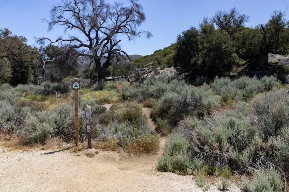
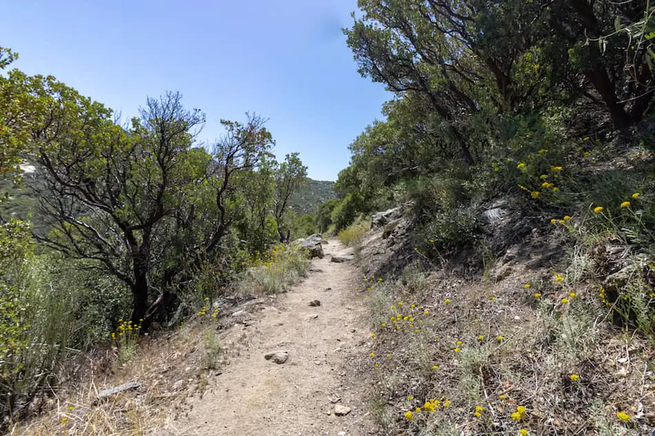
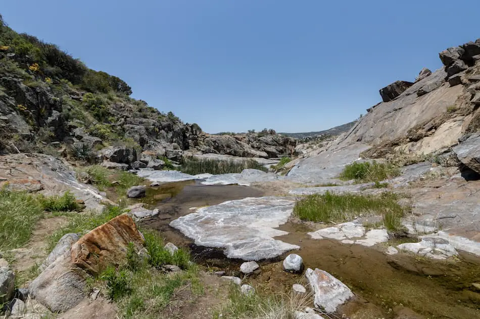
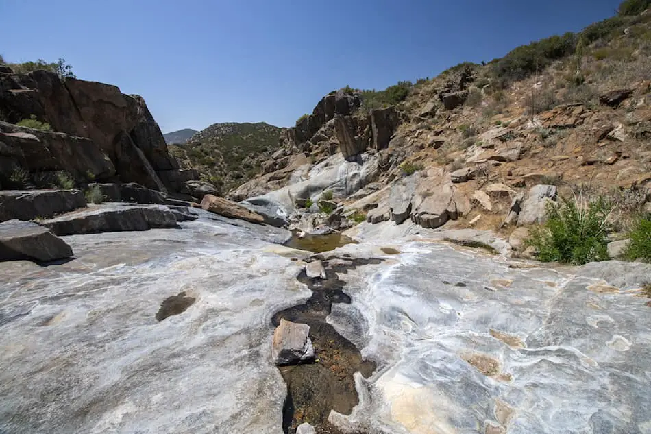
The day I went was pretty darn warm. Most of the trail looks like the image shown below. Hardly any shade at all if you come in the mornings or during mid-day.
The sun was unbearably hot. I had to take multiple breaks because of the boiling heat.
Please don’t forget to bring lots of water and a hat! It’s best to come very early in the morning or later in the day to avoid the harsh sun in the late spring and summer months.
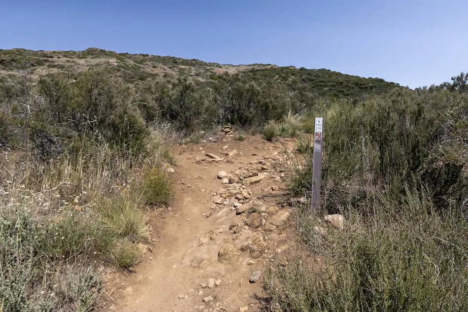
Closer to the end of the trail, you’ll see this sign. Be sure to stick to your left-hand side. This hike requires a bit of scrambling to get to the bottom.
Look out for signs of foot traffic and flat trails. There is more than one way to reach the floor to the pools.
Reaching the bottom, I decided to go explore the right side first.
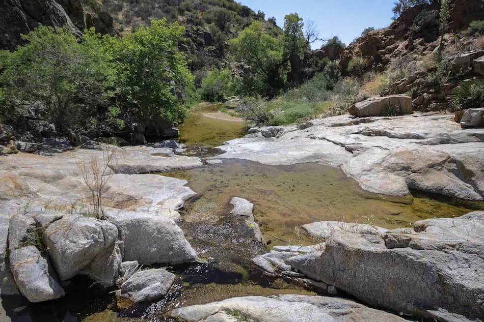
Exploring the Pools at Kitchen Creek Falls
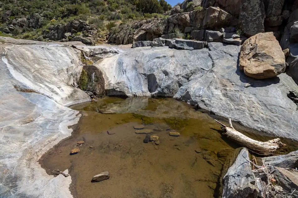
This was my first stop! There are plenty of pools that cascade up from the opposite view of the one shown below.
Be aware that there are snakes around here. I spotted one in the area.
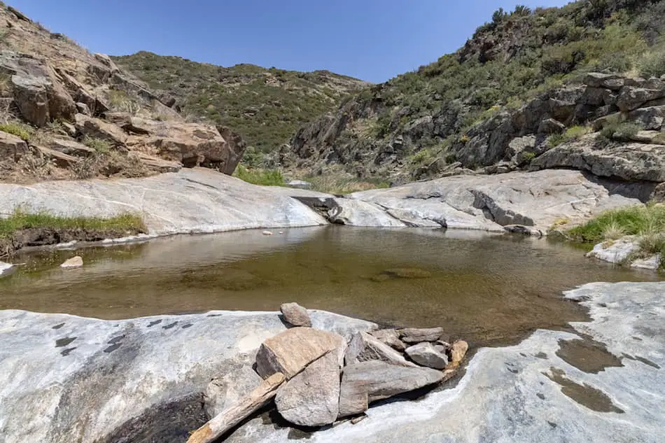
After checking that side out, I decided to explore the left side.
I was far more impressed by how many pools there were! Each has its own small waterfall.
There were many dragonflies gracefully flying around.
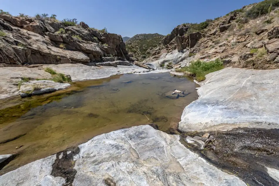
This was one of the biggest (and cleanest) natural pools. Yes, I got inside and didn’t regret it!
Here’s another angle of that same pool.
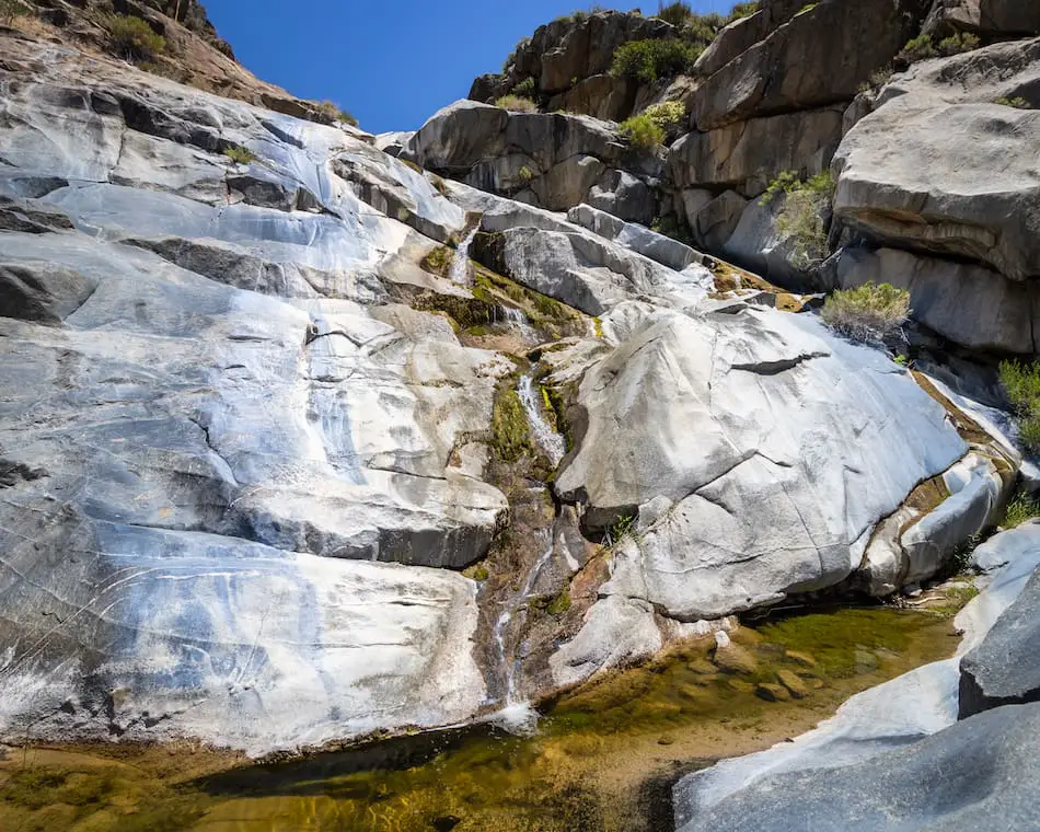
One of my favorite views. The stream leads down to the next pool.
This one is smaller and a lot more shallow.
Bonus Waterfall (Difficult)
Continuing on from this last pool, I had to carefully climb up a large slippery section. This area to the hidden waterfall is challenging. I don’t recommend proceeding if you’re not experienced. It can be very dangerous!
After climbing up the slippery section I ended up at the top of the falls.
While still facing the waterfall, I made my way down the right side of the canyon via a very loose and narrow dirt “trail.” This is the most dangerous section.
Shortly afterward, I found myself at the base of the falls, looking up at a 50 ft cascade.
Want to explore another swimming hole in San Diego County, but one where you can cliff jump? Check out the hike below!
This season has been a bit dry for waterfalls, but it was still super nice. I’ll be back here again when the waterfall is flowing with water!
I highly recommend doing this hike. It was so much fun exploring the different pools, getting in for a quick splash, and taking a look at this pretty big waterfall.
**Please be sure to keep this hike clean and graffiti-free! Let’s enjoy this SD hike for years to come.**


