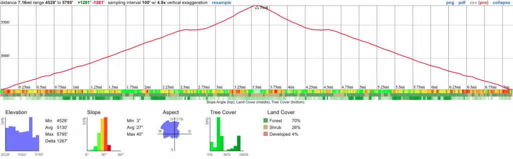
Distance
7.2 Miles
Time
3.5 Hrs
Difficulty
Moderate
Season
All Year
Elevation Gain
1281 Ft
- Dogs allowed on a leash
- Out & Back Trail
- No Restrooms available
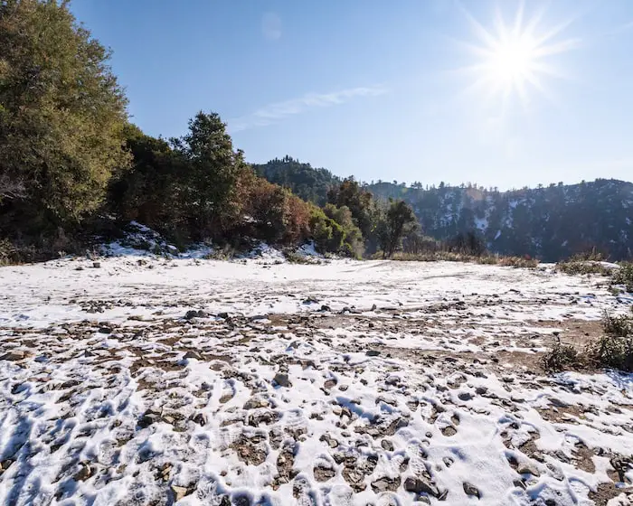
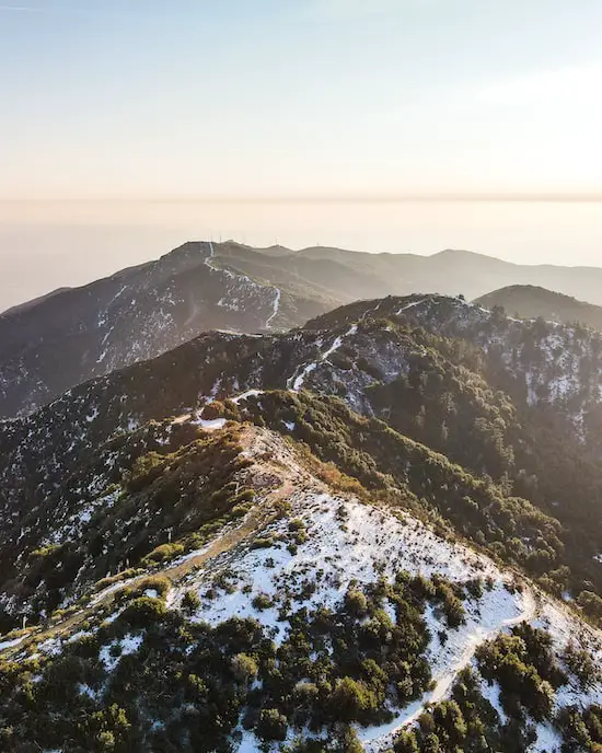
You can’t go wrong with a trail in the Mt Baldy area. Lower temperatures, possible snow, and amazing views. That’s what this trail has to offer.
Sunset Peak Trail is a moderately difficult hike in the San Gabriel Mountains featuring stunning panoramic views as far as the ocean. Meanwhile Mt Baldy towers high above Sunset Peak to the north. The entirety of the hike consists of a fire road.
Sunset Peak Trail Map

The red trail is the more popular, and it’s the one I’ll be sharing about below. It involves trekking up a dirt road for the entirety of the hike.
Sunset Peak Address & Directions
To be redirected to the trailhead on Google Maps, click the link below.
Glendora Ridge Rd, Mt Baldy, CA 91759
Check out these other amazing hikes in the San Gabriel Mts!
- Switzer Falls: 2-Tier Cascade in Bear Canyon
- 5 Mile Hike to Nuclear War Evacuation Tunnels
- 50ft Lewis Falls in Azusa Canyon
Sunset Peak Trail
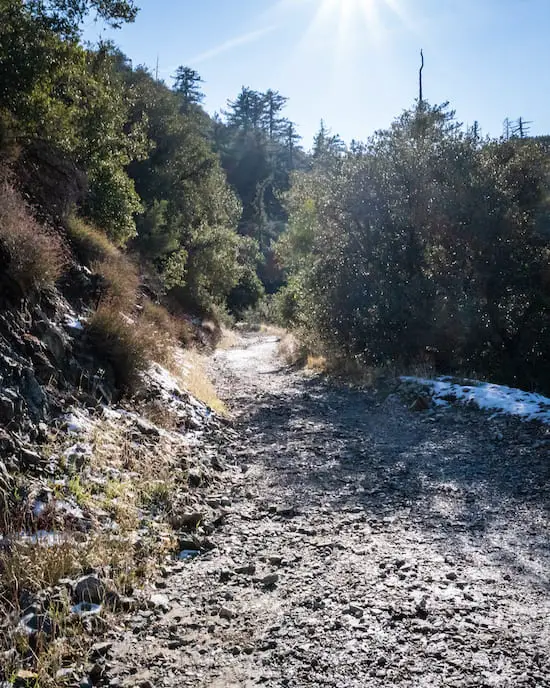
Sunset Peak Trail begins at Cow Canyon Saddle. Walk past the yellow gate and up the dirt road to get started.
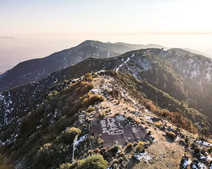
Most of the trail is located on the dark side of the mountain, which means the snow will tend to last a little longer. However, the same cannot be said of the peak.
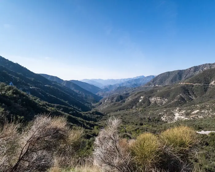
From the start, Cow Canyon and Coldwater Canyon split the mountain range and provide an amazing view as far as Mt Wilson and Strawberry Peak.
Glendora Mountain Road (GMR) is the road which you traveled up to get to the trailhead. You can see it on the lefthand side weaving its way far into the distance.
READ MORE: 7 BEST PASADENA HIKING TRAILS
The trail has no splits up until you reach this dirt lot. Instead of heading straight, turn around and continue heading up the mountain.
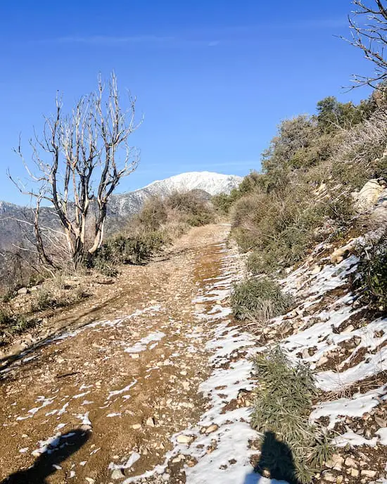
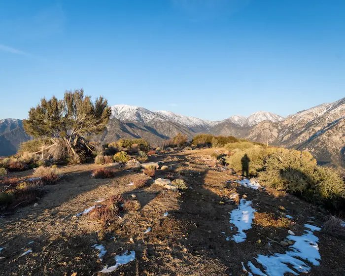
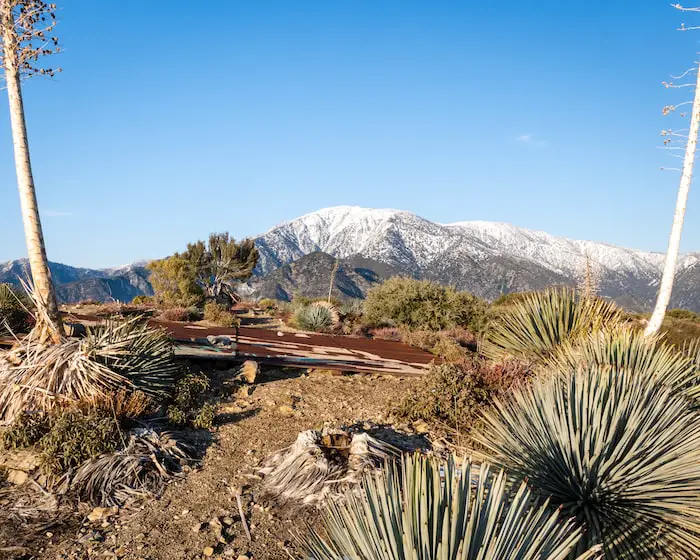
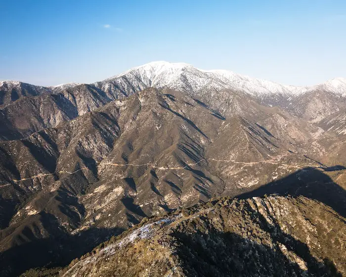
You’ll be facing Mt Baldy as it looms high overhead in the distance, making itself well known as the king of the San Gabriels.
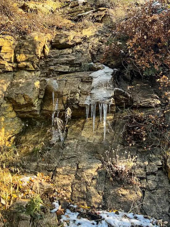
We visited two days after a good dump. The shady side of the mountain still had snow and even icicles in certain areas.
READ MORE: BEST HIKES IN LA: DON’T MISS OUT
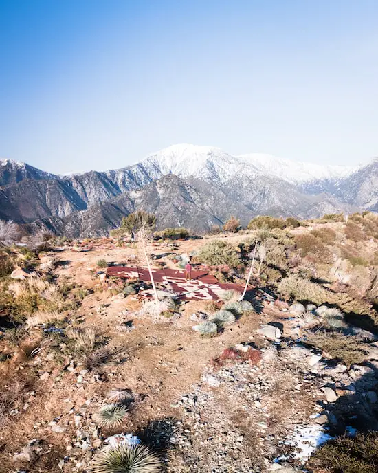
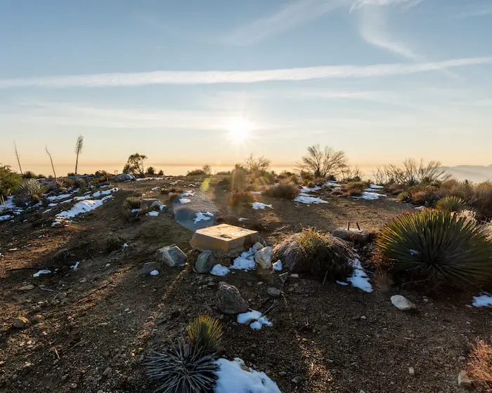
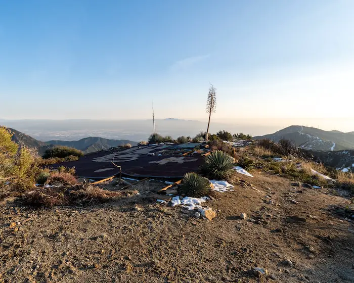
Someone built a shelter at the peak. It wasn’t exactly well suited for an overnight stay, but it gets the job done for a temporary visit at the peak lol.
The concrete blocks shown below were once the foundation of a fire tower that was located at the peak.
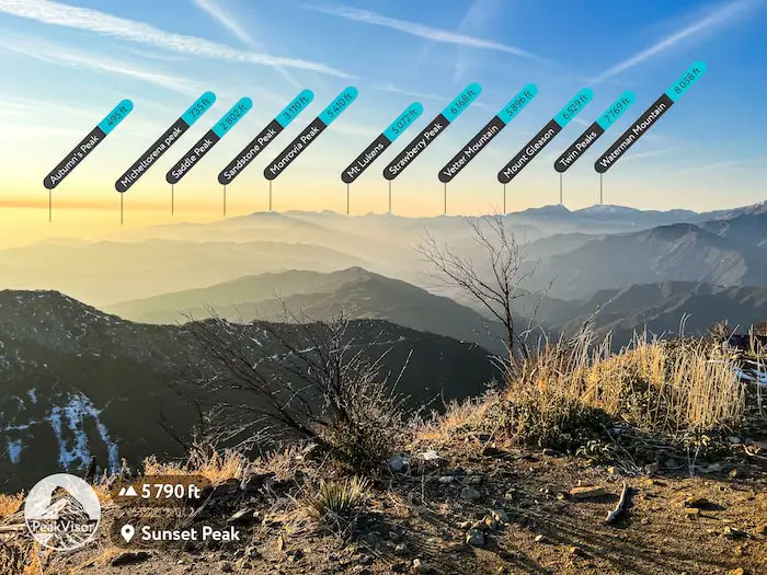
Unfortunately, there was so much smog that we couldn’t see much into the valley, but the views of Mt Baldy and the neighboring peaks more than made up for the loss.
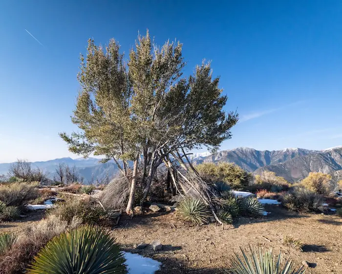
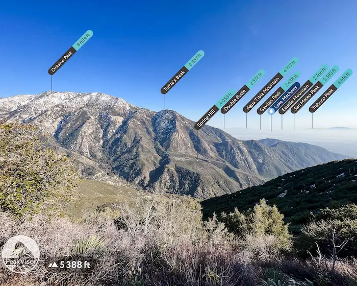
Spring Hill shown below is a neat looking saddle. I’d like to explore that soon as it shows signs that someone was settled there in the past.
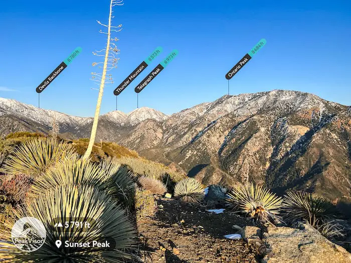
By the way, I used the app Peak Visor to identify peaks on my hikes.
READ MORE: 2ND LARGEST WATERFALL IN SOCAL – BONITA FALLS
You can’t say you made it to the peak until you’re standing on top of the old sheet metal roof!
The peak in the distance is Santiago Peak, the highest point in the Cleveland National Forest.
To the west, the entire skyline is filled with San Gabriel Mt peaks.
READ MORE: 7 MUST DO WATERFALLS IN SOCAL
The Baldy Bowl on Mt Baldy is shown in the background.
READ MORE: 3 BEST HIKES IN LAGUNA BEACH
READ MORE: 7 BEST SAN DIEGO HIKES