
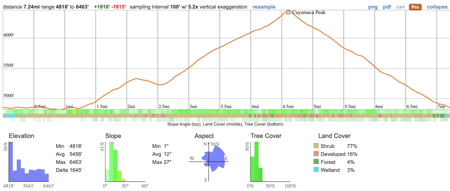
- Total Miles: 7.24
- Time: 4 Hrs
- Difficulty: Moderate – Hard
- Best Season: All Year
- Elevation Gain:1815 ft
- Max Elevation: 6463 ft
- Type of Trail: Loop
- Parking Lot: Available At The Campground
- Dogs: Not Allowed On Trail
- Restrooms: Available At The Campground
- Trail Popularity: High
- Pics Taken On: Feb 26, 2022
Cuyamaca Peak will be remembered in my history book as one of the hikes that surprised me the most. I as shocked by the view from the peak, which is now one of my all-time favorites, the fact that a Native American village was located along the trail, the amount of snow, and lastly, the cougar that growled at us from the brush (I’ll get into that later in this post) all made this hike one of my life’s most memorable.
Cuyamaca Peak via the Azalea Glen Trail is a 7.24 round trip mile hike beginning at the Paso Picacho campground in an oak woodland forest. The trail offers the opportunity to experience an abundance of wildlife, such as wild turkeys, bald eagles, vultures, and on very rare occasions, mountain lions. Cuyamaca Peak, which is the second-highest in the Cleveland National Forest at 6463 ft, boasts the best views of Cuyamaca Rancho State Park and as far as Anza Borrego and Mexico.
Want to explore slot canyons at the beach, enormous waterfalls, and more amazing views? Check out my complete list of San Diego County Hikes.
Cuyamaca Peak Trail Map
Directions
Click the link to be redirected to the parking lot and trailhead via Google Maps. Both are found at the Paso Picacho Campground.
Parking is $10
Park Info
Cuyamaca Rancho State Park Website
Phone: (760) 765-3020
Hours: 6 am – 8 pm
Quick Cuyamaca Peak Reference Guide
- Although it’s rare, mountain lion encounters are more frequent here than other mountain ranges (we had our 1st encounter). NEVER run from a mountain lion. Put your hands in the air to make yourself seem bigger and yell to scare the lion away.
- Take plenty of water and a hat as there is very little shade on the trail
- During the wintertime, Cuyamaca Rancho State Park can transform into a winter wonderland, so plan accordingly.
- Drones are not allowed in the park
- Dogs are only allowed in the campground and on the Lookout Fire Road.
- Trekking poles are highly recommended.
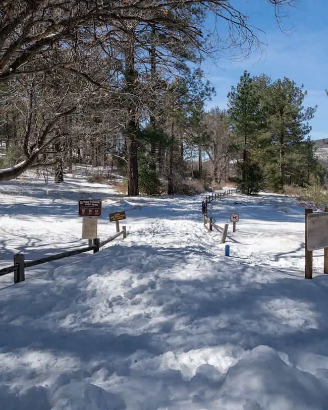
Azalea Glen Trail
We decided to hike via the Azalea Glen Trail because it’s more scenic and cuts through a meadow that was once the site of a seasonal Kumeyaay village. The Kumeyaay were the original residents of the Cuyamacas, dating as far back as 12000 BC!
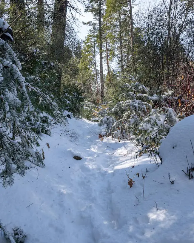
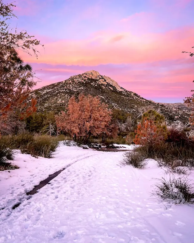
The trail begins by heading west via a single track that leads you through the campground. Seeing the Cuyamacas covered in snow is a real treat as snow storms aren’t as prevalent here compared to the San Bernardino or Angeles forests.
Regardless of limited snowfall, the Cuyamacas are home to some of the most beautiful waterfalls I’ve ever seen, such as Three Sisters Falls, a three tiered colossal giant with two swimming holes. You can view that waterfall here.
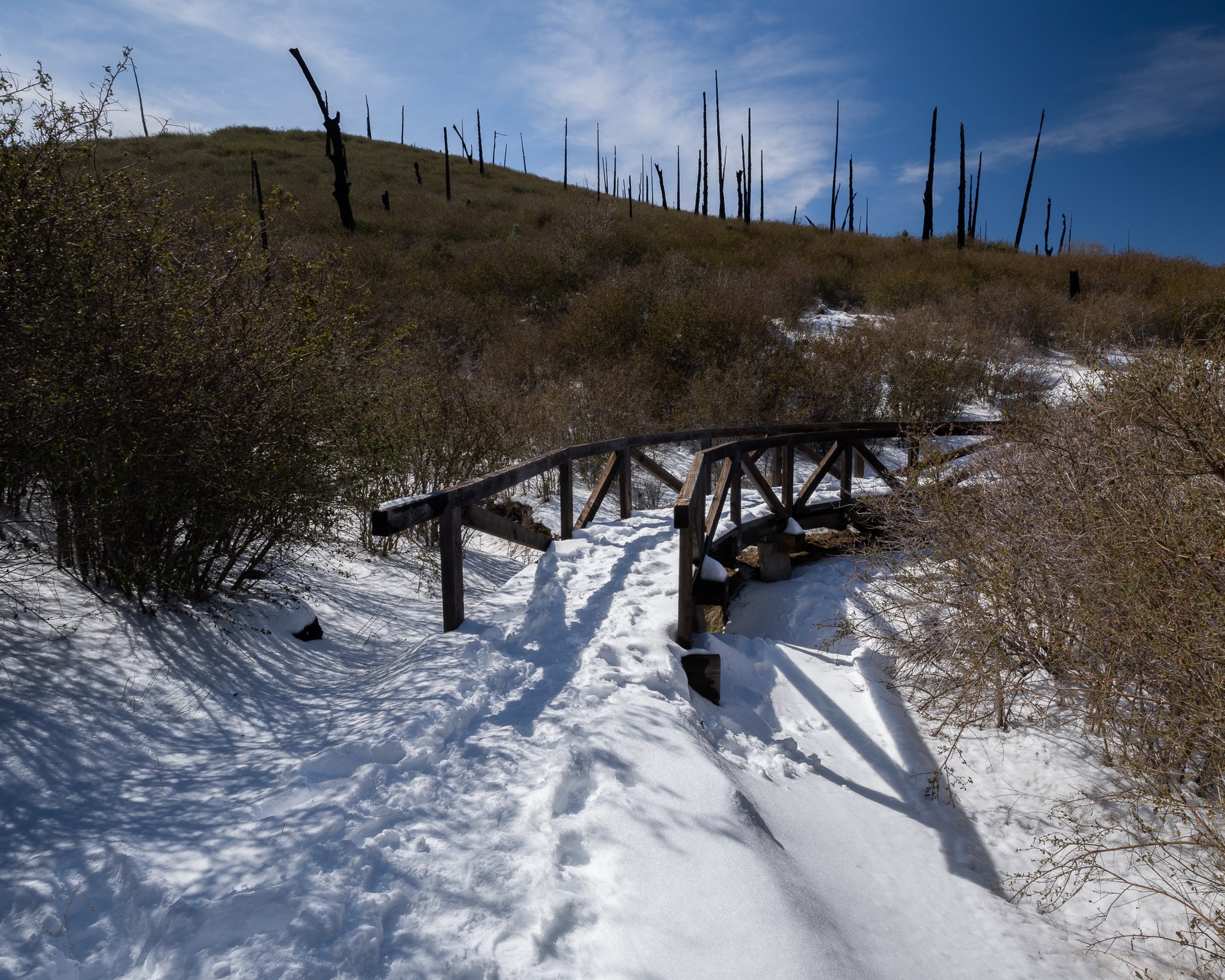
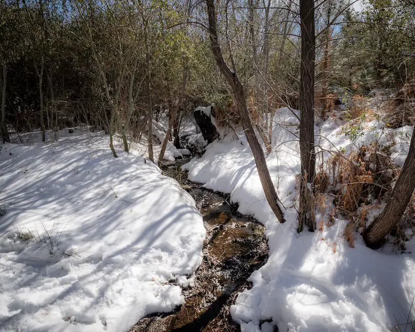
Wooden bridges guide you over creeks, adding more delight to the snowy landscape.
Unfortunately, the dead trees in the background are the remnants of one of the worst San Diego fires in history, the Cedar Fire, which was started by a lost hunter in 2003. To this day, the Cedar Fire is the reason why the park is not as dense with pine trees as it should be.
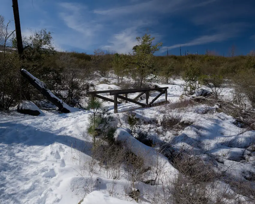
Shortly after the bridges, the trail becomes more enclosed and you’ll arrive at the first and only creek crossing.
It was after the creek crossing and right before reaching the Kumeyaay village site that we heard a very large animal growl at us. Although it was only about 10-15 ft to our immediate left, its perfect camouflage prevented us from spotting it.
The growl was so low and strong that we literally felt it, similar to the way you feel the bass emitting from large speakers.
I kept talking loudly as we slowly walked backward, never giving my back to what I suspected was one of the most feared predators in the mountains. When we got home we quickly searched for various animal growls, only to confirm that we had come face to face with a mountain lion.
The lion was most likely stalking deer, as we had seen many deer tracks on the trail. Luckily, he decided to let us off with a warning, so we kept walking until we reached the Kumeyaay village site and the morteros.
Morteros are holes in rocks used by the Kumeyaay to mash their food, most likely acorns. Due to the snow, I wasn’t able to get a shot, but you can click the link HERE to get redirected to an image of the morteros.
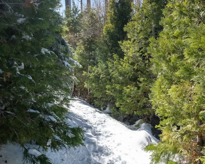
After the Kumeyaay village site, you’ll arrive at the most scenic part of the trail, which runs parallel to the creek and is surrounded by majestic pine trees and ferns.
Up until this point, the elevation gain is very minimal, but as soon as the scenic section ends you can expect a steeper trail. From Azalea Glen Trail you hop onto Azalea Spring Fire Rd for a very short descent.
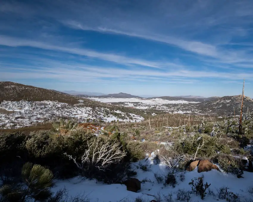
Don’t forget to look back from time to time as the views are amazing. Here we can see Middle Peak to the very left, Stonewall Peak to the very right, and Lake Cuyamaca (which is harder to see) lies in between.
Next to the lake is Stonewall Mine, a fun and easy loop hike featuring the ruins of the 19th century mine and a cabin that has been converted into a museum. The trail doesn’t really make you feel like you’re deep in the mountains, and since it’s such a short hike, I suggest combining it with another hike in the area.
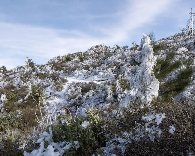
Once you transition onto the Conejos Trail from the Azalea Spring Fire Rd the landscape begins to transform into a true winter wonderland. Some of the branches were completely frozen and easily weighed up to 100 pounds.
Here’s a shot looking down on Stonewall Peak.
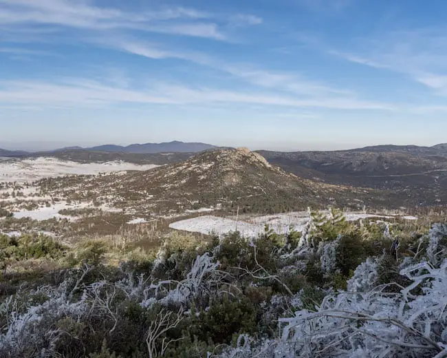
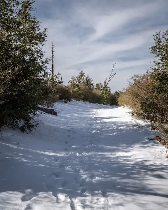
When you reach the last meadow and pine trees in the image below you know you’re almost there! The wind was blowing harder and we could hear the sound of icicles falling all around us. This hike is really something else.
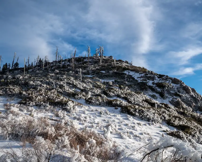
There she is! The antennas on the peak can be seen from the intersection of Conejos Trail and the Lookout Fire Rd intersect.
A couple of guys coming down from the peak told us to stay away from the antennas because the wind was knocking down 300-400 pound massive icicles.
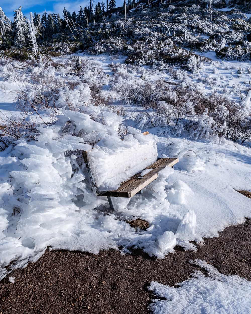
There’s a rest area with a bench looking out into the valley at the intersection. This isn’t the peak, but it’s still a breathtaking view. It’s hard to believe this is San Diego!
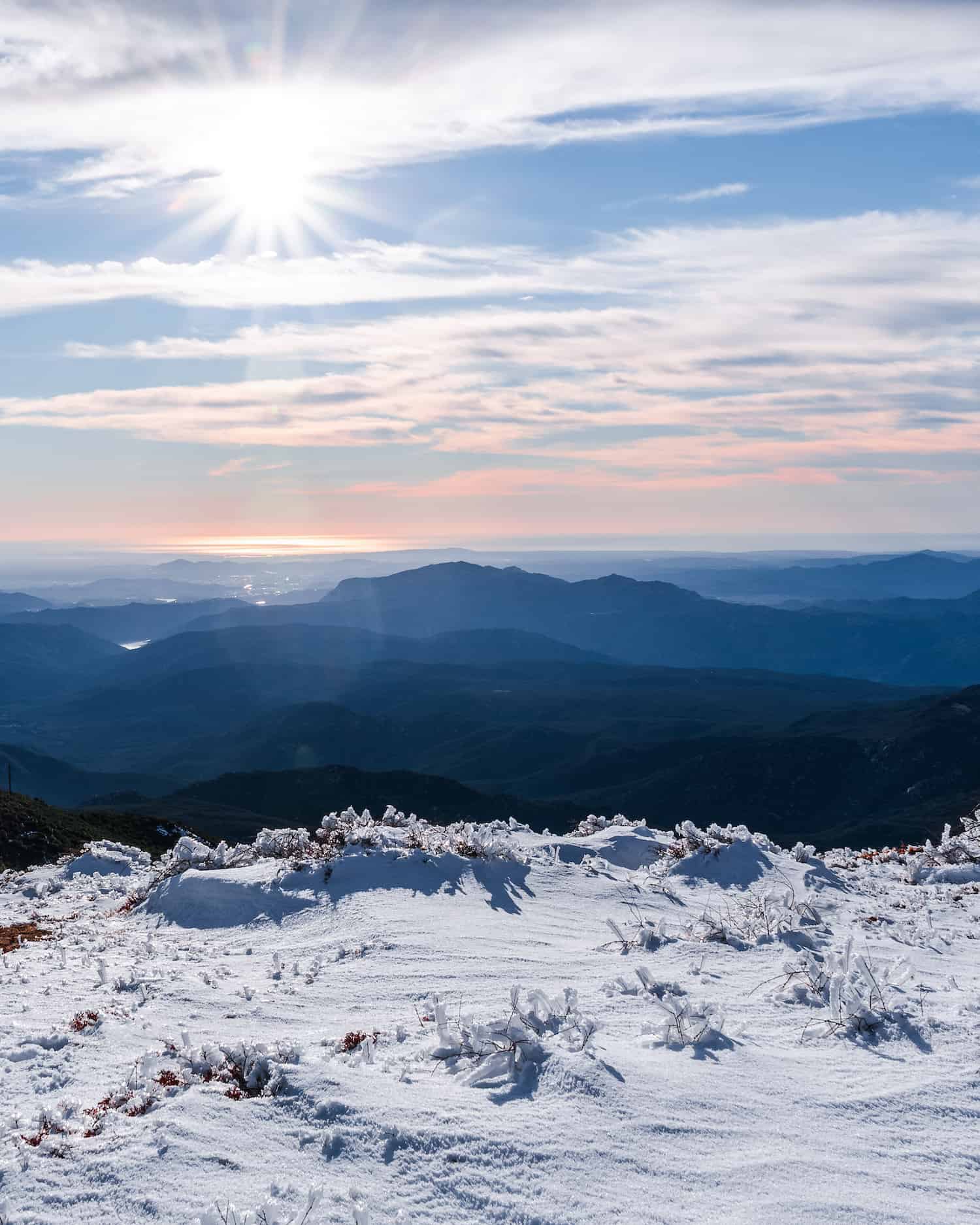
Even before reaching the peak, the beautiful Pacific Ocean comes into view. San Diego is one of California’s counties which offers various diverse settings. A true outdoorsman’s dream.
For example, the Saigon Trail, located in one of SD’s many beaches, is the only beach I know of which is home to a slot canyon.
The view of the entire valley below, where the 80-foot giant, Cedar Creek Falls, calls its home. By the way, Cedar Creek Falls is arguably one of the most impressive waterfalls in Southern California. You can view photos and directions in the full post here.
Unfortunately, we began to have some technical issues with my camera.
And to make matters worse, clouds shaded the valley. Had we made our way to the peak, I wouldn’t have been able to get a good shot, but here are some photos from right below the peak.
That concludes the end of this adventure.
If you want to get to the campground ASAP, I suggest taking the Lookout Fire Rd (shown below) back down to complete the 7.7-mile journey, as you enjoy the view of Stonewall Peak.
In case you’re wondering, stonewall peak, which is literally located across the street from the campground, is also open to the public. The peak offers one of my favorite panoramic views, which you can see by clicking here.
Otherwise, head back down the way you came to extend the hike even further. See you at the next one!


