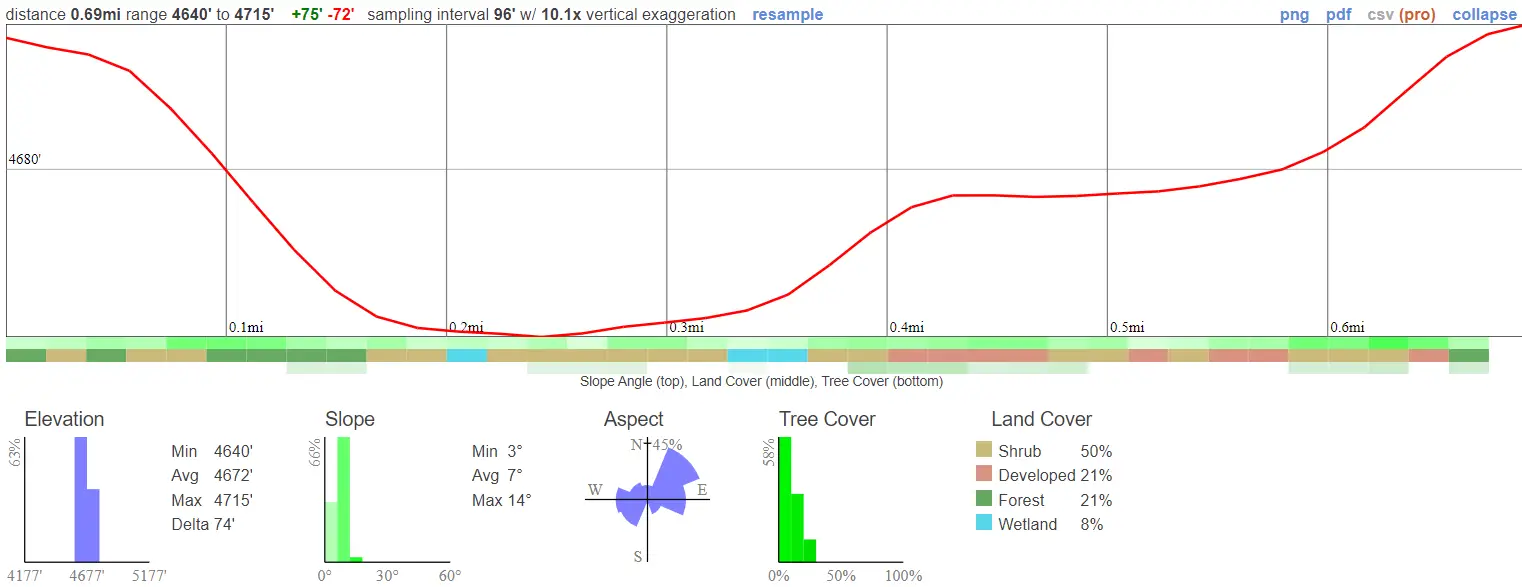
- Miles: 0.7
- Time: 20 min
- Difficulty: Easy
- Best Season: All Year
- Elevation Gain: 75 ft
- Max Elevation: 4640 ft
- Type of Trail: Loop
- Parking Lot: Fits ≈ 20 cars
- Dogs: Not Allowed
- Restrooms: Available At The Trailhead
- Trail Popularity: Moderate
- Pics Taken On: Jul 25, 2023
Deep in Cuyamaca Rancho State Park lies a must-visit site for all my fellow mountain history nerds. An abandoned gold mine calls your name.
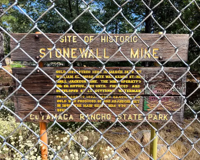
The Stonewall Mine, named after Confederate General Thomas J. “Stonewall” Jackson, is located at the trailhead adjacent to the parking lot, as is the cabin museum which features many vintage shots of the mine’s early history. Although the perimeter around the adit is fenced off, many old artifacts can still be seen from up close. The 0.7 mile loop, which begins at the mine, can be extended to over 3 miles and offers views of Lake Cuyamaca.
Looking forward to hiking in San Diego? Check out more awesome trails by clicking the link below:
Stonewall Mine Trail Map
Address & Directions
Click the link to be redirected to the Stonewall Mine via Google Maps.
Helpful Links
SoCal Adventure Pass (required for parking in CA mountains)
Stonewall Mine
As soon as I pulled into the parking lot, the mine came into full view.

The concrete walls which descend into the mound were once the entrance to the mine.

I’m not entirely sure, but I believe the machinery below is the actual cage which lowered the miners to the deeper levels of the mine. Feel free to correct me if I’m wrong by sending me an email at info@cahikingadventures.com
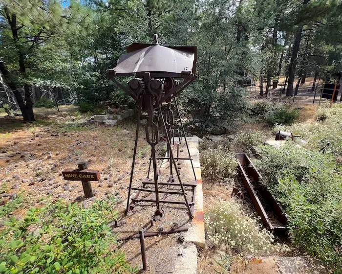
The box-looking object below is an ore cart that was once used to transport the ore out of the mines. The ore carts were placed on tracks, similar to trains, to facilitate movement.

Here’s another shot of the mine entrance, also known as the adit, but this time from the opposite side of the perimeter.

This log must have been a part of the mine’s structure. The mine is immediately to the left of the log, and if you look in the far distance you can see the little cabin museum in the back.

I almost didn’t pay a visit to the museum because I thought it was a privately owned cabin!

Here are some vintage shots of the mine’s heyday dating from the late 19th century to the early 20th century.


Stonewall Mine Trail
Once I was done exploring the mine and the museum, I headed east towards the lake to begin the hike.
I made a left at the first fork.

And another left at the second fork. Lake Cuyamaca was visible for the majority of the hike from this point forward.
Speaking of Cuyamaca, have you heard of Cuyamaca Peak? It’s a 7.7 mile trail with literal breathtaking views located only a few minutes away from the Stonewall Mine.

We cut the hike very short and headed back up the dirt road to the parking lot. However, you can continue to follow the side of the lake if you wish to extend the hike.
If you plan on following my same route, stay to the left again at the third fork. The dirt road will quickly turn into a paved road.

As soon as I saw the gate I knew we were back at the parking lot.

Since Stonewall Mine is very short, I highly recommend combining it with Stonewall Peak. The panoramic view from the peak is stunning to say the least.


