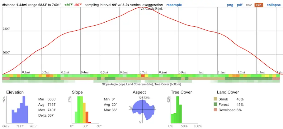
- Total Miles: 1.44
- Time: 1.5 Hrs
- Difficulty: Easy – Moderate
- Best Season: All Year
- Elevation Gain: 567 ft
- Max Elevation: 7401 ft
- Type of Trail: Out & Back
- Parking Lot: Road Turn Out Or Neighborhood
- Dogs: Allowed On A Leash
- Restrooms: Not Available
- Trail Popularity: High
- Pics Taken On: Feb 6, 2021
Castle Rock Trail in Big Bear, California is a heavily trafficked 1.44-mile roundtrip hike. The peak offers amazing views of the entire Big Bear Lake and the surrounding area. This trail is rated as a moderately difficult hike but is more than worth it. Parking is tricky, so be sure to review the parking instructions.
Check out the Best Big Bear Hikes to make the most out of your visit! You can easily combine Castle Rock Trail with a second nearby hike.
Castle Rock Trail Map
Directions and Parking
Getting to Castle Rock Trail is very easy, but can be a total pain if you don’t plan ahead. I’m talking about bumper to bumper traffic in the winter during the holiday and snow season.
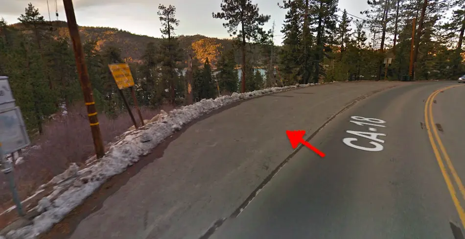
Here are the directions to the trailhead: Castle Rock Trail 1W03, Big Bear Blvd, Big Bear Lake, CA 92315.
I ended up parking in a road turnout, which fits only about 5 cars and can be seen in the image below: 34.237712, -116.961391.
However, you can also park in a nearby neighborhood.
Helpful Links
SoCal Adventure Pass (required to park in SoCal mountains)
Big Bear Weather And More (My friend’s YouTube channel. He updates us on all things Big Bear within a few hours of the event, including weather changes).
The Hike To Castle Rock
Once I parked my car, I carefully crossed the street when I saw it was safe.
You’ll want to be super careful when getting to the trailhead since it begins on a sharp turn on the street. The fast moving cars might not be able to see you, so be aware of that.
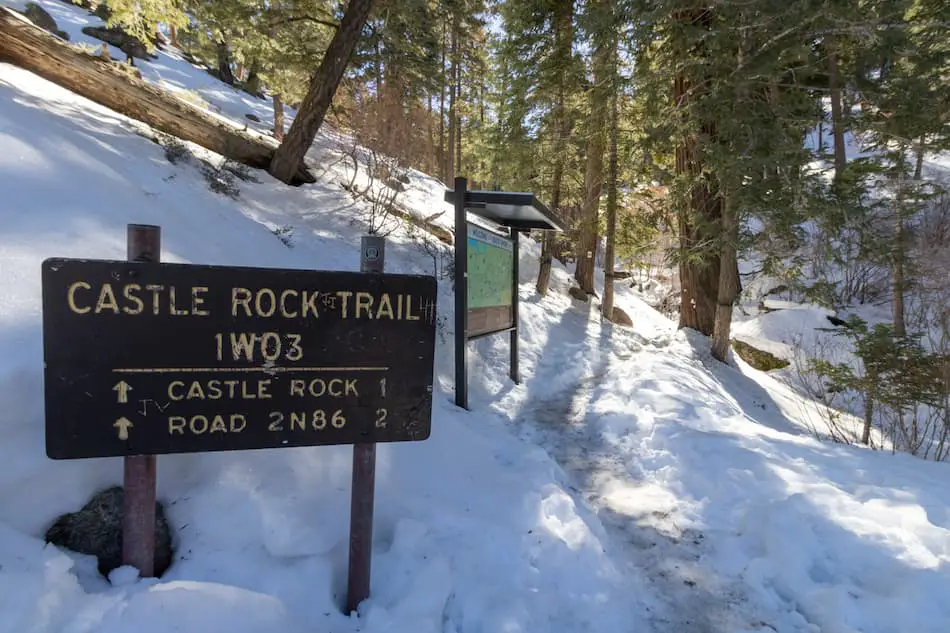
Here’s where the trailhead begins. I was in awe at the beauty of the sunlight shining through the trees and the snow glowing bright white. I know I was going to love this snowy, winter hike!
There’s a map that shows you an overview of the hike and area, in case you want to take a look.
Up ahead, I came across this bench that overlooks the snow and pine trees.
The sight is fantastic and you can probably take some cool pictures of yourself sitting on the bench, overlooking the views.
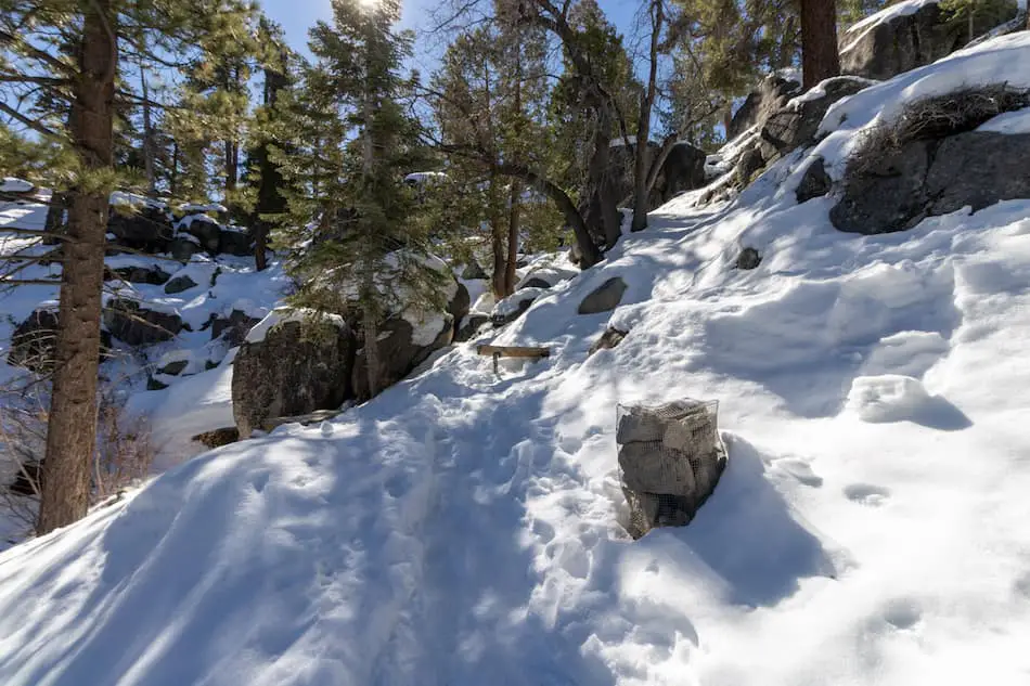
A little past the bench, there’s some steps that are pretty icy. This is probably the trickiest part of the hike. Luckily, I had my trusty trekking poles and grippy snow boots to help me out.
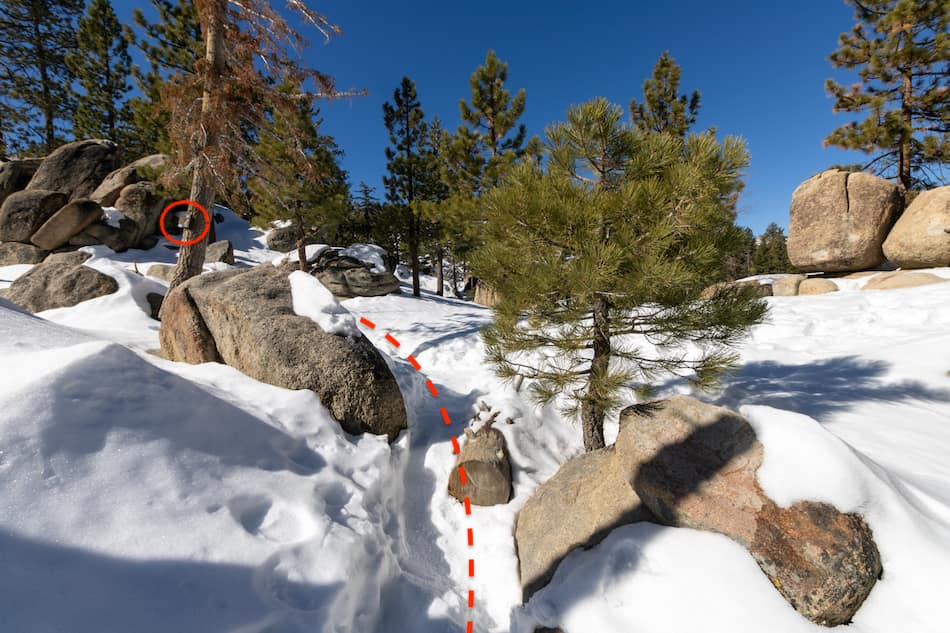
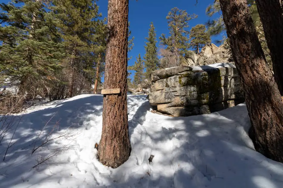
Further up, you’ll need to keep a lookout for this sign on the tree. Honestly, I was about to miss this because it camoflauged so well with the bark.
From there, I made a left and continued on.
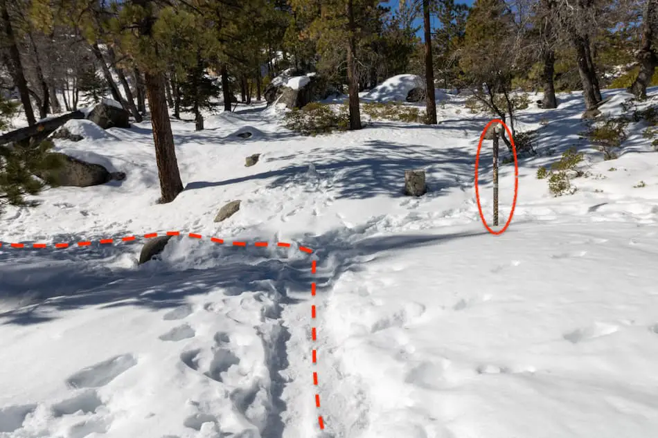
I kept walking and spotted this rusty pole. This is another signal to make a left.
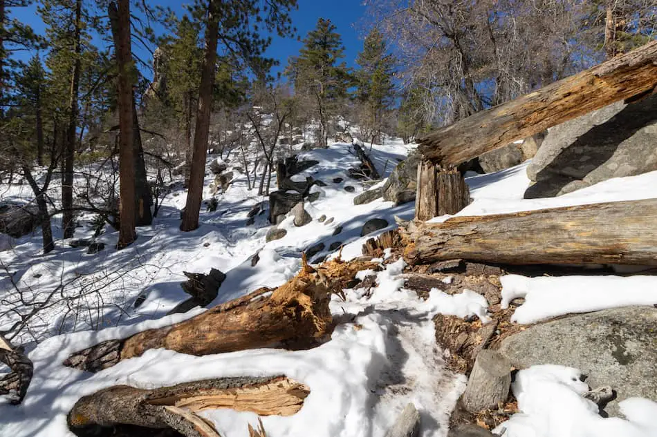
I saw these fallen trees and logs on the ground and walked over them. You can try walking around it if possible, but I ended up crossing through to make it more adventurous.
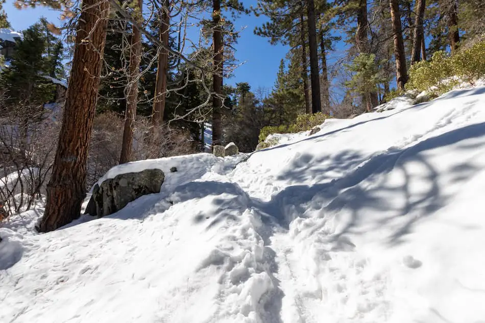
Another snapshot of the powdery snow and tall pine trees.
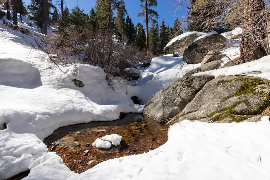
This next part wasn’t on the trail itself, but I ventured off for a bit when I heard trickles of water flowing from somewhere.
I was pleasantly surprised by this small pool of water. It looked beautiful with the sunlight glistening through the clear water. A closer look and you can see the leaves in this small pool.
Another picture-worthy spot and I wasn’t even at the peak yet!
Once back on the trail, I saw this sign posted on the tree as I got closer to the destination.
A confirmation that I was almost to the peak!
I could see Castle Rock Peak from here. This was one of my favorite views of this hike. It looks so very high up in person.
The trees and snow add to the awesomeness.
I highly suggest combining this trail with the Woodland Interpretive Trail, an easy 1.52-mile loop. A PDF guide detailing the trail’s plants and animal habitats can be downloaded in the full post.

As I got closer, I decided to follow the trail that looped around towards the front of the peak.
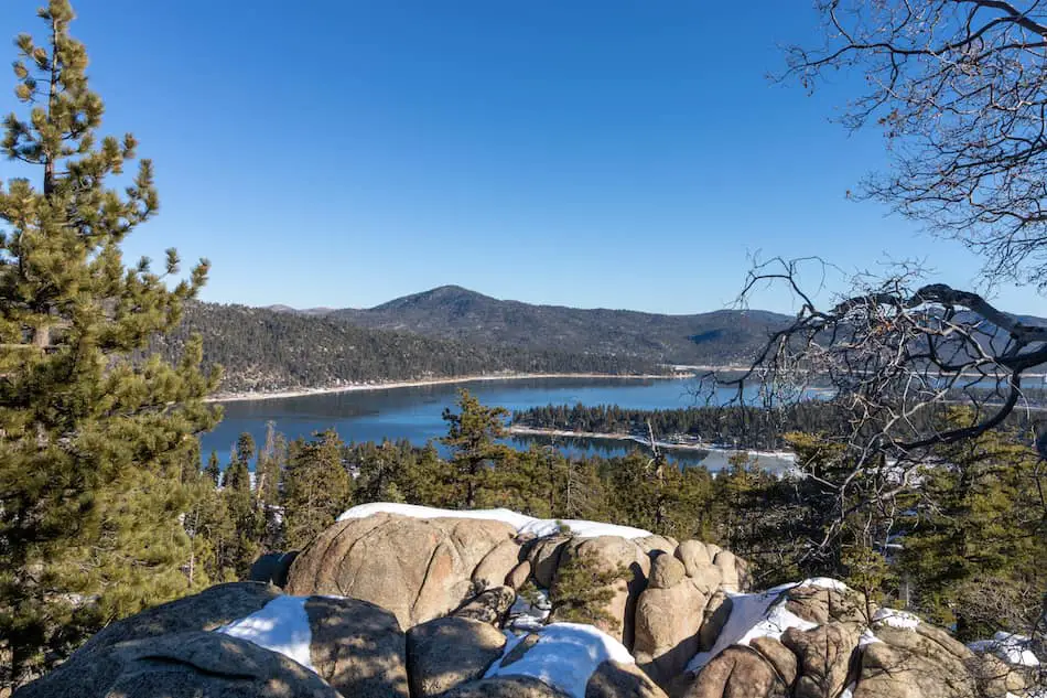
Finally, I made it to the peak! Take a look at this amazing view.
Looking for a more challenging Big Bear hike? Check out Cougar Crest Trail, a 5.43-mile hike that boasts amazing views of Big Bear Lake, the mountain resorts, and San Gorgonio, the largest peak in SoCal.
At over 600 feet elevation, you can see the entire Big Bear Lake area from the top of the peak. These are just incredible views that you won’t get anywhere else.
I highly enjoyed Castle Rock Peak Trail and feel it’s well worth doing after a few days of snowfall or any time of the year.
FAQs
Can You Climb To The Top Of Castle Rock?
Yes, it is possible to climb to the top of Castle Rock.
How Long Is Castle Rock Trail?
Assuming you head back after reaching Castle Rock, the trail totals at 1.44 miles.
Where Can I Park For Castle Rock Trail?
Parking is available in the nearby turnouts and neighborhood.
Is Castle Rock Trail Difficult To Hike?
Castle Rock is rated as easy to moderate difficulty. Although the hike is relatively short, it gets a little steep for one section. Lastly, the trail can be literally impossible to hike without snowshoes after heavy snowfall, and parts of the trail get very icy for a few days after it snows.


