
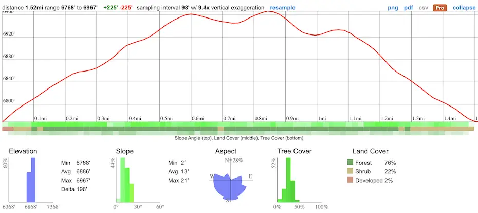
- Total Miles: 1.52
- Time: 45 min
- Difficulty: Easy
- Best Season: All Year
- Elevation Gain: 232 ft
- Max Elevation: 6967 ft
- Type of Trail: Loop
- Parking Lot: Fits 20+ Cars
- Dogs: Allowed On A Leash
- Restrooms: Available On The Trailhead
- Trail Popularity: High
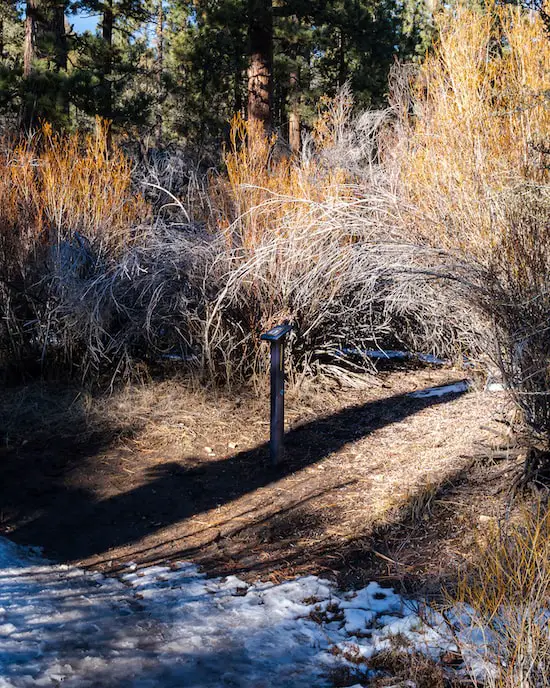
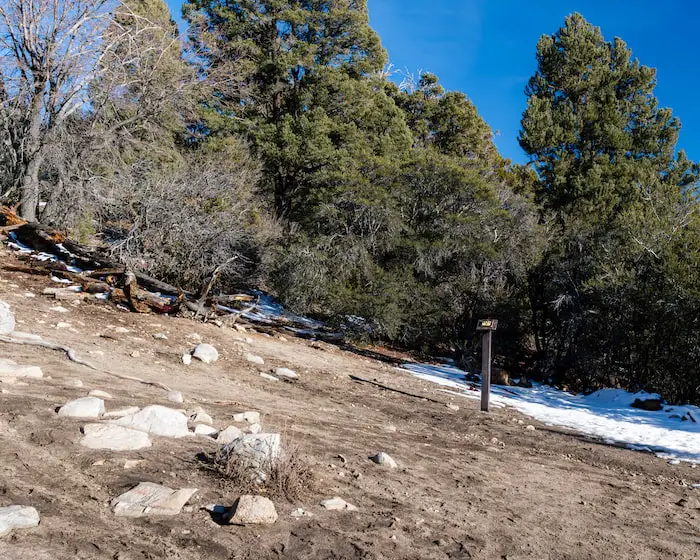
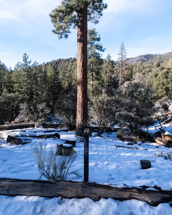
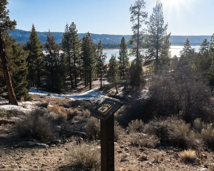
The Woodland Trail is an easy 1.5-mile round trip hike for the whole family located in Big Bear, CA. The loop includes 16 numbered markers along the trail which can be used along with a guide to learn fun information regarding the area. The slopes at the parking lot make for a fun (and free) area for kids to sled, while the slopes on the trail are gradual and easy enough for small children to hike.
All vehicles must show an Adventure Pass at the parking lot. Make sure to arrive early, especially if you’re visiting on a weekend as this is a VERY popular trail.
Want to make the most out of your Big Bear trip? Check out the post below.
Woodland Trail Map
Address & Directions
The Woodland Trail in Big Bear is located at 41948 N Shore Dr, Big Bear, CA 92314.
Helpful Links
SoCal Adventure Pass (required to park in SoCal mountains)
For those who don’t have a SoCal Adventure Pass, daily passes can be purchased at the Big Bear Discovery Center, nearby gas stations, or stores such as 7-11 for $5. If you’ve already purchased a SoCal adventure pass you don’t need to buy the daily $5 pass.
Big Bear Weather And More (My friend’s YouTube channel. He updates us on all things Big Bear within a few hours of the event, including weather changes).
The Woodland Trail
From this point forward I’ve written the post to be read as a children’s book while you hike the trail. I’ve made the writing very simple and will be including images for each marker.
Let’s start the hike!
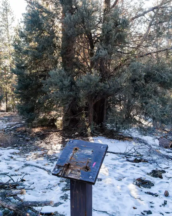
1) 1500 Year Old Western Juniper
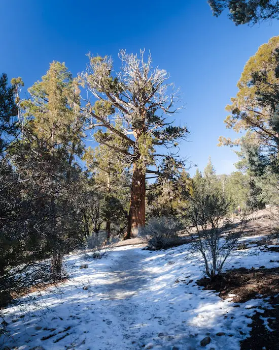
Look, it’s our first signpost, and it’s right next to this old Juniper Tree. When I say old, I mean OLD. It’s over 1500 years old!
This tree has been around before we had electricity or cars. Imagine what else these trees have come to see!
2) Mountain Mahogany (Ironwood)
The great Mountain Mahogany tree! This is a very dense and strong tree, that’s why locals call it “Ironwood”. Although it’s pretty hard to cut this tree down, it can make a fire last hours and hours! The wood is so heavy that it’ll sink down to the ocean floor instead of floating. It sure is one sturdy tree.
3) Downed Log: Grub Gallery
Bugs on the bark! If you look at the dead logs on the ground, you’ll be able to spot markings left by bark beetles, larval grubs, and other insects. That’s because these critters love feasting on weak trees. It helps the ecosystem make room for stronger trees.
Do you spot any of these helpful insects?
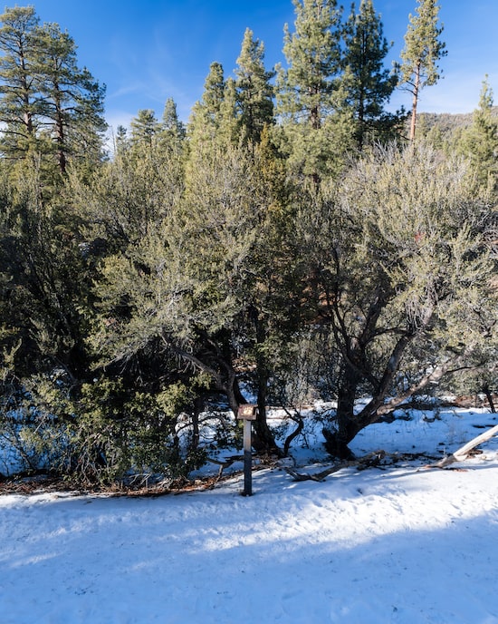
4) Willow Wishes
The watered Willow Bush. The willow bush is only found in areas where there’s water. You might see a stream flowing in the winter and spring months. What about when the streams dry up in the summer and fall? Well, there’s still water underground for them to survive!
Want to know something unique about the willow bark? They’re natural pain relievers when chewed!
5) Downed Trees
Fallen Trees. Remember when we mentioned earlier that the insects eat the dead logs off of fallen trees? Well, fallen trees aren’t just food for bugs. They’re also homes for other creatures such as snakes, lizards, and small mammals.
I know it can be sad to see trees that were once standing tall now broken on the ground, but they can still be helpful even after they aren’t alive anymore.
6) Jeffery Pine: Woodpeckers’ Granary
This tree is called the Jeffrey Pine. It’s used as a kitchen for Acorn Woodpeckers! These woodpeckers use their pointy beaks to poke through trees. Can you guess why they drill these holes? Yup, to store food such as acorns!
I highly suggest combining this hike with a nearby densely forested trail that features amazing views of Big Bear Lake. Check out the post below:
They work really hard during the warmer months because they get ready to have enough to eat for the cold and long winter. They want to keep warm and eat all the acorns they can feast on during the cold season.
See any of the holes or leftover acorn bits?
7) Different Types of Oaks
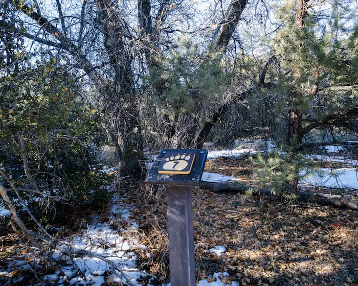
The oak trees! The California Black Oak and Canyon Live Oak are typically neighbors around here. Both of them produce lots of delicious acorns for many of the animals.
Can you name a few animals that love to munch on acorns?
8) Rings On A Tree
Guess how old these trees are! Did you know that a tree’s rings tell a lot about its age and the conditions it grew up in?
Tree rings that are closer together mean that the tree didn’t grow up in very good conditions, such as a drought. But, if it has more separated rings, then there was lots of water and healthy nutrients for it to grow.
Look at any of the chopped-down trees. How far apart or close do the rings look? Does it look like it lived a long life?
9) Woodrat Home
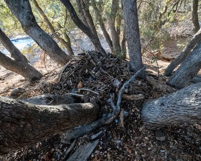
The ninth stop- a mansion! Okay, maybe it’s not a fancy mansion to us, but to the “packrat” it is. Their homes are made of broken branches, bark, pinecones, and leaves.
These “homes” can get really big because the woodrat loves to build! They like to live in the same house and build on it for years. They even have a special nesting room for the baby packrats.
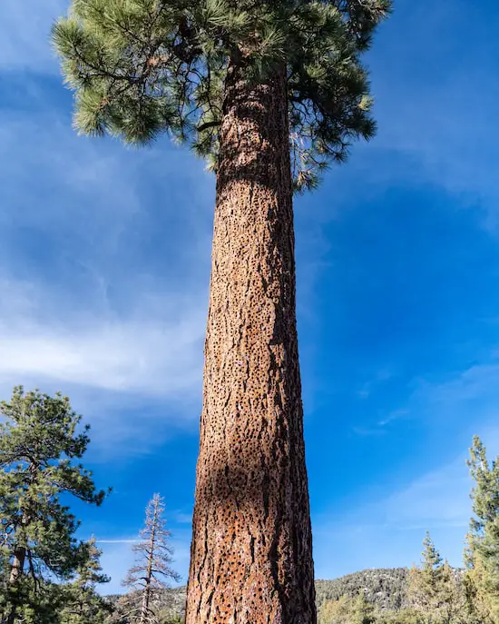
10) Fire Resistant Jeffrey Pine
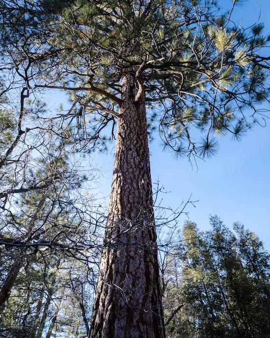
This next stop is all about the Jeffrey Pine fire survivors. These trees are large and magnificent. A lot of them can survive a blazing wildfire because of its thick bark that acts as armor.
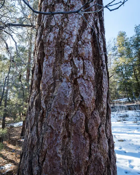
One interesting fact is that they might smell like vanilla! Check it out for yourself and smell the bark on the tree trunk.
11) San Gorgonio Peak (Old Grayback)
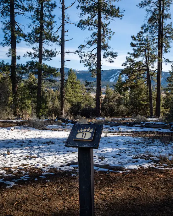
At the 11th stop, you will see good Old Grayback! This nickname is given to Mount San Gorgonio- the highest peak in SoCal. It’s 11,499 feet high! Unlike other mountains nearby, this one is gray because the conditions are so harsh that trees can’t grow there.
San Gorgonio is barely peaking above the closer mountain ranges in the image above.
12) Granite Rock
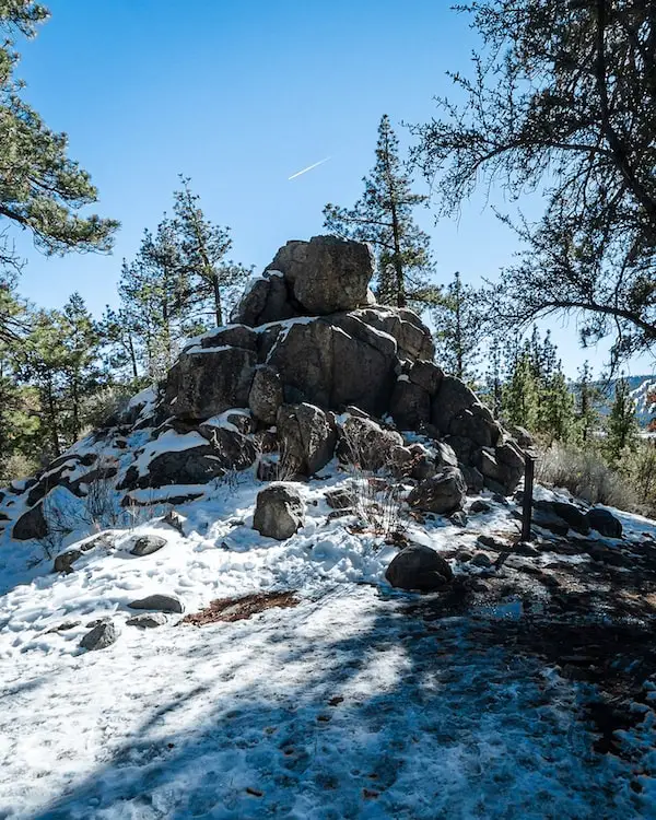
Check out these large boulders of granite. These are igneous rocks that are home to lizards and snakes…yikes!
Be very careful when climbing these large rocks. You don’t want to fall or run into any slithering snakes. But, you don’t want to worry too much if you’re hiking this trail in the winter. Most snakes are present during the hot summer months.
13) Yerba Santa & Rubber Rabbitbrush
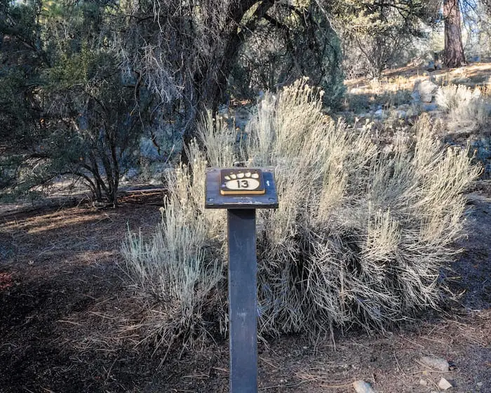
Chewing gum in the form of plants? Yup! The Yerba Santa plant flourishes in hot and dry areas. Luckily, the shiny leaves keep them from completely drying out. These leaves were also used as chewing gum by Indians. It’s been said that the leaves taste like spearmint, but I don’t recommend trying it.
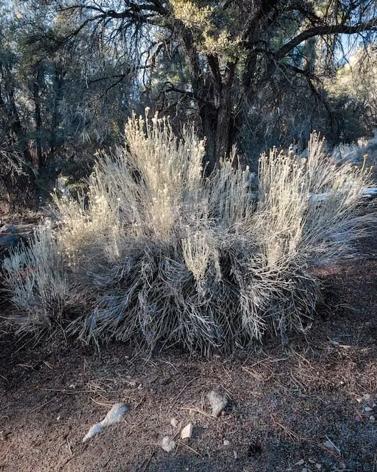
The Rubber Rabbitbrush was also used similarly. You can identify these plants by looking at the stems which are white and rubbery to the touch, hence the name. Native Americans used the bark wood of the bush to make it into chewing gum, teas, cough syrup, and more. Funny enough, rabbits don’t like the taste of these Rabbitbrush plants as you might’ve thought.
14) Mother Nature’s Highways
Did you know animals have their own pathways and routes like humans do? They’re called corridors. Try to spot the drainage and any animal prints! Mule deer, bobcats, and coyotes use them to travel down to the lake for a refreshing drink.
15) Pinyon Pine
At the 15th signpost, you’ll see the Pinyon Pine. These pine trees are the only single-needle pine in the world! Pine nuts from these trees provide food to many of the animals and even humans and they’re also packed with protein.
Can you name some of the animals that eat pine nuts? Have you ever tried them?
16) Twisted Living & Dead Junipers
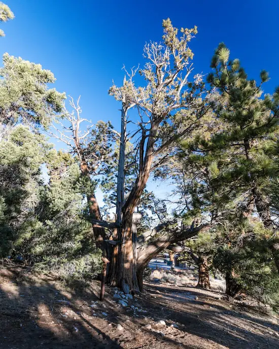
Our final stop. The twisted Juniper tree! Don’t they look like trees out of an enchanted forest? The reason it has a twisted appearance is that there are actually multiple trunks twisting together! The tree in the center is actually dead, while the ones that surround it are alive.
Looking for a bit more of a challenge? Check out the trail below which offers the best views of Big Bear Lake, San Gorgonio, and the mountain resorts. You won’t regret it!
What animals do you see living in this tree?
That completes the Woodland Interpretive Trail! I hope you had fun and learned some new things. Below are some nearby attractions you should check out after the hike. Catch you on the next trail!


