
Big Bear, CA is a beautiful mountain town located in the San Bernardino National Forest. It’s home to ancient Western Juniper trees, Big Bear Lake, two winter resorts, and of course, multiple forest hikes.
Today I’d like to share with you the four best Big Bear hikes, starting with the easiest and ending with the most challenging.
I hiked all of these trails in the winter when the trails were covered with snow. Therefore, I’ll be sharing everything you need to know about hiking at Big Bear after a good dump.
Big Bear Pro Tips
Pro Tip 1: Parking for all of the trails in this guide requires an annual or daily Adventure Pass, which you can purchase here. Daily passes can also be purchased in person at Big Bear gas stations and stores such as 711, and the Big Bear Discovery Center.
Pro Tip 2: If Big Bear receives more than 6 inches of snow, wait a few days for some of the snow to melt before visiting. Snow above six inches may be too deep for hiking and is probably better suited for snowshoeing. I once sank up to my waist at the Castle Rock trailhead.
Pro Tip 3: When planning a snow hike, please do yourself a favor and invest in microspikes. I can’t recommend enough how much of a difference they make. We use these right here and have never looked back.
Pro Tip 4: It goes without saying, but always check the weather forecast, especially during winter.
1) Woodland Trail: Easy Interpretive Loop
- Total Miles: 1.52
- Difficulty: Easy
- Best Season: All Year
- Elevation Gain: 232 Ft
- Time: 45 Min
- Dogs: Allowed On A Leash
- Restrooms: Available At The Trailhead
- Map, Directions, & Full Post: Woodland Interpretive Trail
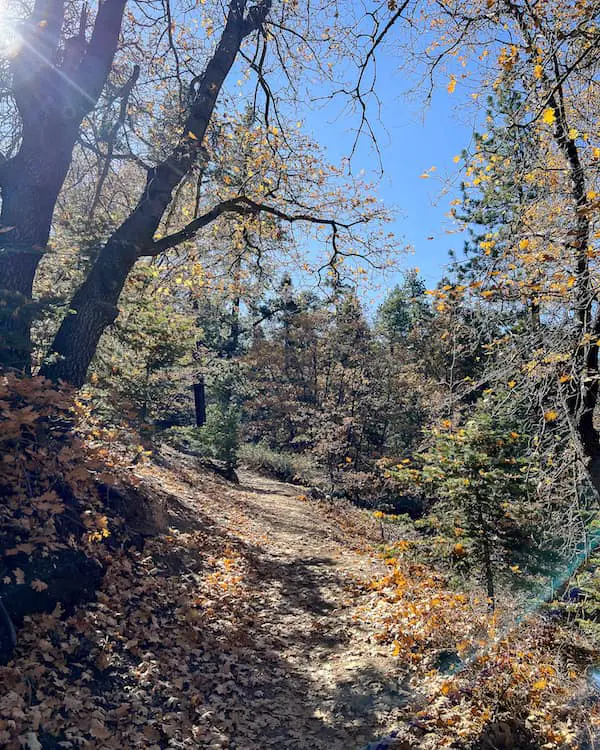
Woodland Trail is the easiest hike at Big Bear, making it ideal for the whole family. The woodsy trail features beautiful views of the lake and Snow Summit Resort.
Wooden markers are posted along the trail in numbered sequence, which features fun and educational information regarding the hike.
The information for each marker can be found in a PDF guide in the full post. However, we wrote the complete post in an interactive and simplified manner for parents to read to their kids as they’re on the trail.
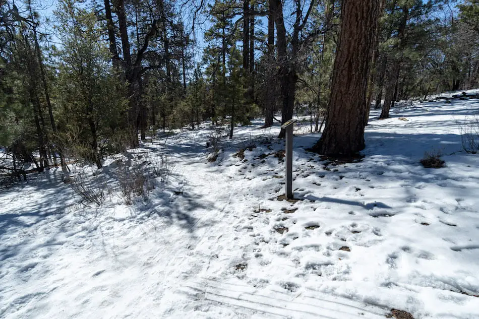
If you plan on visiting when it snows, please use microspikes. Although it’s an easy hike, it can get very slippery when ice begins to form.
The trail has a very gradual incline and lacks dangerous ledges, which is why it’s so ideal for kids. Needless to say, don’t forget to add the Woodland Trail to your Big Bear daycation.
2) Castle Rock Trail: Climbing A Huge Stone Formation
- Total Miles: 1.44
- Difficulty: Easy – Moderate
- Best Season: All Year
- Elevation Gain: 567 Ft
- Time: 1.5 Hrs
- Dogs: Allowed On A Leash
- Restrooms: Not Available
- Map, Directions, & Full Post: Castle Rock Trail
Unless you arrive super early, you’ll more than likely have to park in the neighborhood, specifically Lowe Dr, and walk to the trailhead. Always double-check that you’re allowed to park in any public area, especially when it snows.
Since this hike is on the dark side of the mountain, expect a lot more snow, shade, and trees.

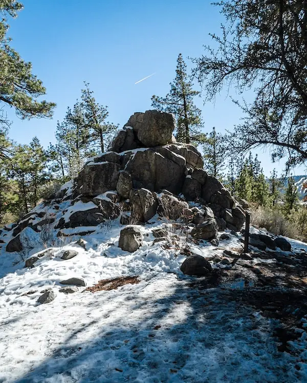
This trail is my favorite from all four Big Bear hikes. It’s very scenic, with lots of trees, and when it snows it looks like a winter wonderland. The view at the top is spectacular.
The trail bears (pun intended) its name because of the huge rock structure you have to climb to get the best views. It’s about the size of a 3 story building, with a flat “plateau” at the top, but it’s not a direct vertical climb.
You can make your way to the top by boulder scrambling up the much smaller boulders that make up the entire structure.
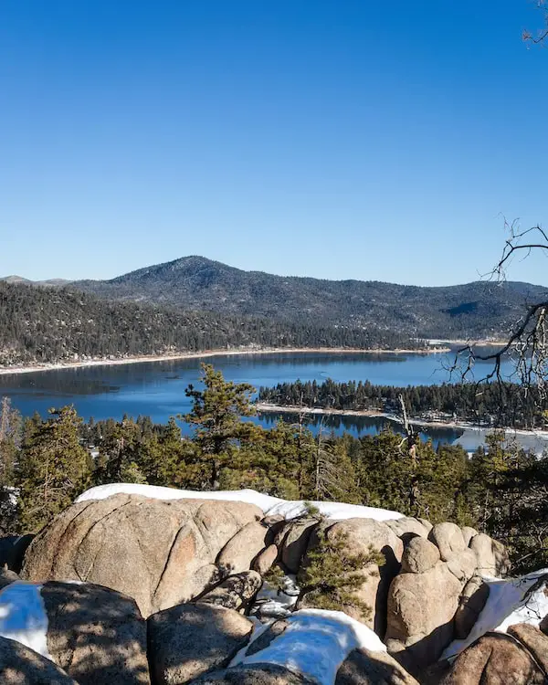
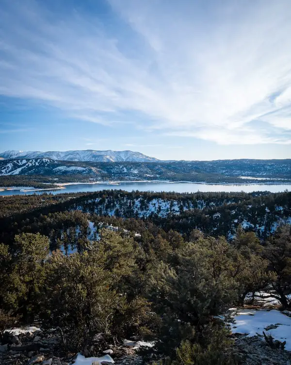
Once you’re at the top, you can see all of Bear Lake while Cougar Crest and Bertha Peak looming in the background. If possible, try to be at the top during Sunrise or Sunset. You won’t regret it.
3) Pine Knot Trail To Grand View Point
- Total Miles: 6.9
- Difficulty: Moderate
- Best Season: All Year
- Elevation Gain: 1158 Ft
- Time: 3.5 Hrs
- Dogs: Allowed On A Leash
- Restrooms: Available At The Trailhead
- Map, Directions, & Full Post: Pine Knot Trail To Grand View Point
Pro Tip: You’re allowed to park on the street so long as you’re within the confined area usually marked by orange traffic cones. If you park beyond the cones, you can be fined up to $150 for “parking during snow conditions.”
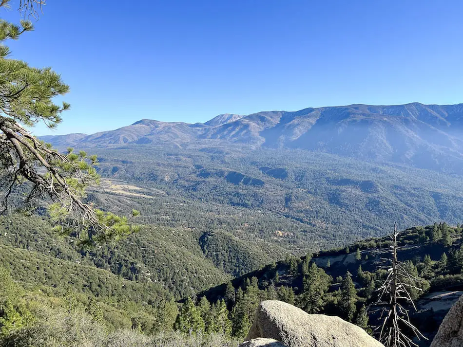
Alright, time to step it up a notch. Pine Knot Trail takes you to a nice little mountain saddle (Grand View) adjacent to Grand Peak where you’ll be rewarded with an amazing view of the tallest peak in Socal, San Gorgonio, and the valley where highway 38 runs through.
This hike intertwines with dirt roads for off-road vehicles. You may be miles into the hike when suddenly you see a jeep roaming through the trees. It’s very unexpected and super cool.
Pro Tip 2: Do you have family that wants to experience Grand View, but can’t hike the whole trail? You can off-road your way to the top and walk the remaining section, which is about ¼ of a mile one way.
However, a 4×4 vehicle is highly advised. Click the link here to get directions to the turnout that is closest to Grand View. Unfortunately, the dirt roads are closed during the winter months.
Pine Knot is Big Bear’s top-rated hike for a reason. The trail is very scenic, with lots of pine trees, and views of the lake here and there.
Fun Fact: Big Bear used to be called Pine Knot! Check out the full post to view vintage shots of the name during its use.
During the fall season, virtually everything on the trail is orange and yellow. It’s a hike you’ll never forget.
4) Cougar Crest Trail: Best Views Of Big Bear Lake
- Total Miles: 5.43
- Difficulty: Moderate – Hard
- Best Season: All Year
- Elevation Gain: 900 Ft
- Time: 3.5 Hrs
- Dogs: Allowed On A Leash
- Restrooms: Available At The Trailhead
- Map, Directions, & Full Post: Cougar Crest Trail
This scenic hike is the most challenging of all the hikes on our list. It’s not extremely difficult, but definitely too difficult for children.
The trail winds its way up the mountain until it reaches Cougar Crest, where you can enjoy a spectacular view of the lake, resorts, and San Gorgonio in the far background.
Further up the ridge is Bertha Peak, which you can access if you keep trekking up another 0.6 miles. You’ll see the sign for Bertha Peak at a junction once Cougar Crest comes to an end.
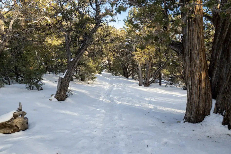
During the spring and summer months, the area looks like a sea of green pine trees, and during the winter, beautiful Western Juniper trees look like something out of a movie.
In my opinion, Cougar Crest Trail features the best view of Big Bear Lake. Definitely check out this hike, you’re going to love it.
What Is The Most Popular Hike In Big Bear?
The most popular hike in Big Bear is Pine Knot Trail To Grand View Point. How do I know this? Because I checked the number of All Trail reviews for each of the four hikes listed above, and Pine Knot Trail came on top.
Here are the number of reviews and average rating for all four trails as of December 4, 2023.
- Pine Knot Trail To Grand View Point: 4.7 out of 4087 reviews.
- Woodland Interpretive Trail: 4.6 out of 3382 reviews.
- Cougar Crest Trail: 4.7 out of 2774 reviews.
- Castle Rock Trail: 4.6 2247 reviews.
What Is The Easiest Hike In Big Bear?
The Woodland Trail is the easiest hike in Big Bear because it’s not only the shortest, but it also has a very low elevation gain.
What Is The Hardest Hike In Big Bear?
The hardest hike in Big Bear is Bertha Peak, which is essentially the exact same hike as Cougar Crest but with an additional 1.35-mile stretch from where Cougar Crest ends to get to the peak.
What Is Your Favorite Hike In Big Bear?
My favorite Big Bear hike is Castle Rock Trail (when it snows) because I enjoy boulder scrambling my way to the top of the rock formation, it’s very scenic with lots of pine trees everywhere, and the closeup view of the lake.
When there is no snow, my favorite hike is Pine Knot Trail, especially during the fall when many trees have beautiful and vibrant orange, yellow, and red leaves.
Is Big Bear Good For Hiking?
Big Bear is one of the best places to hike in Southern California. The dense forest, amazing lake views, small town, and deep snow make me feel like I’m no where near Los Angeles County where I currently live.
Does Big Bear Have Waterfalls?
The town of Big Bear does not have any waterfalls. However, there are waterfalls located near the base of the mountain. Check out Big Falls in the San Bernardino category in the main menu or type it into the Search Bar.
Where Is The Best Viewpoint In Big Bear?
Pine Knot Trail To Grand View Point has the best viewpoint In Big Bear, which is probably the reason why it’s the most popular trail in the area. You can see the valley where the 330 Hwy runs through and Mount Gorgonio in the back.
However, and this is just my opinion, the view from Cougar Crest looks even better after a good snowfall and during sunset. The resorts light up the snow-covered mountains, and Big Bear Lake in the foreground resembles a Christmas puzzle. It’s truly amazing.
If it hasn’t snowed and you’re not visiting during sunset, choose Pine Knot Trail.


