
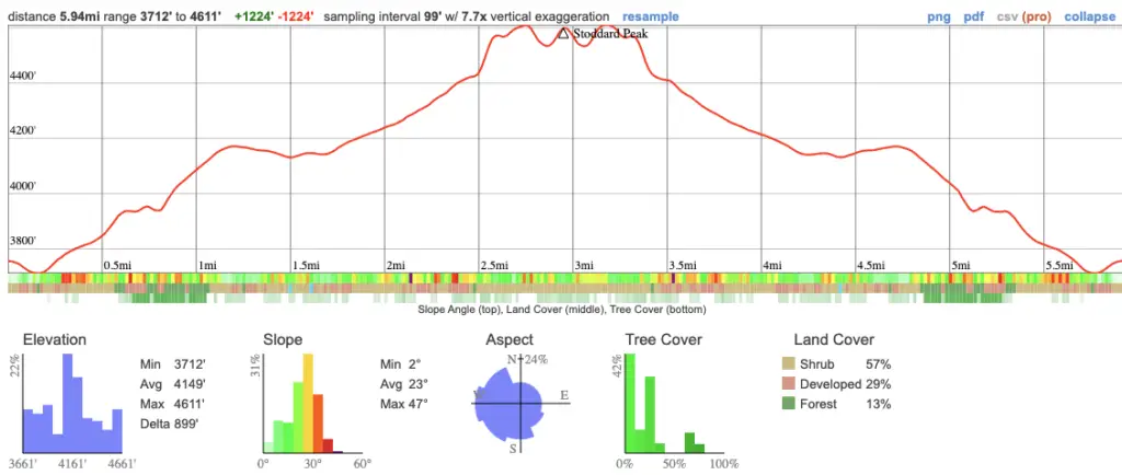
- Miles: 5.9 Roundtrip
- Time: 2.5 Hours Roundtrip
- Difficulty: Moderate
- Season: All Year
- Elevation Gain: 1224 ft
- Peak Elevation: 4611 ft
- Trail Type: Out & Back
- Restrooms? Not Available
- Dogs Allowed? Yes, on a leash
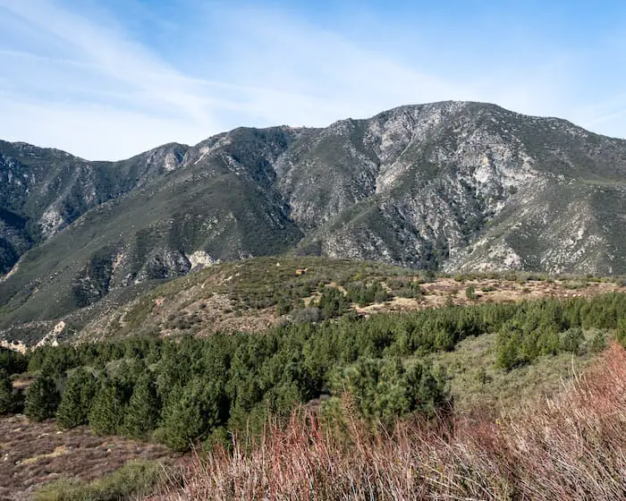
Take a windy dirt road up Stoddard Canyon to be rewarded with breathtaking views of the San Gabriel Valley and the surrounding mountain ranges.
Stoddard Peak is a well-known summit in the Mt Baldy area that has become popular in recent years. The trail is comprised of Barrett Stoddard Rd for the majority of the hike, but the last section switches to a steep ridge line that pushes most people to their limits. Nearby peaks, like Mt Baldy and Sunset Peak, surround the summit and tower above it. Thus, rewarding the peak bagger with a stunning panorama.
Click the following link if you’re looking for Stoddard Canyon Falls.
Stoddard Peak Trail Map
Stoddard Peak Directions
To be redirected to the trailhead via Google Maps, click the link here.
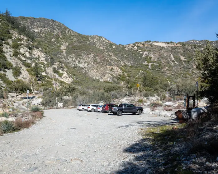
The parking lot is full during weekends, so be sure to arrive extra early.
Check out these other amazing hikes in the area!
- Switzer Falls: 2-Tier Cascade in Bear Canyon
- 5 Mile Hike to Nuclear War Evacuation Tunnels
- 50ft Lewis Falls in Azusa Canyon
Stoddard Peak Trail
The trailhead is located in a parking lot, and takes you up via Barrett Stoddard Rd, named after the man who once inhabited the canyon.
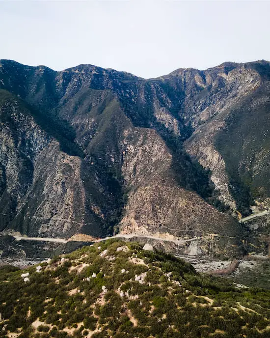
Stay on the east side of San Antonio Creek to begin ascending towards the peak.
The paved road on the opposite side of the creek is the famous Mt Baldy Rd and it takes you to the waterfall.
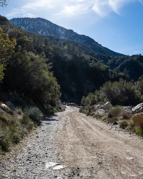
We had received a few storms a couple of weeks prior to visiting the area, and it was noticeable. The creek was full and the road was flooded.
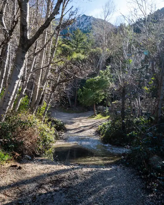
Barrett Stoddard Rd will lead you through a small residential area shaded by pine trees and alders. This will be the last shaded portion of the hike.
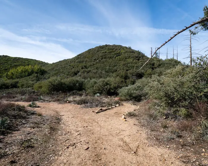
About halfway up the road, you’ll notice a large hill descending onto a meadow. This is Spring Hill.
The area looks like it may have been inhabited in the distant past.
READ MORE: 7 BEST PASADENA HIKING TRAILS
The area below is called Stoddard Flats, and here’s where it gets fun. Notice the rocks on the right side of the road? Head up that trail.
It’s quite overgrown in some areas, and can be difficult to find.
READ MORE: 2ND LARGEST WATERFALL IN SOCAL – BONITA FALLS
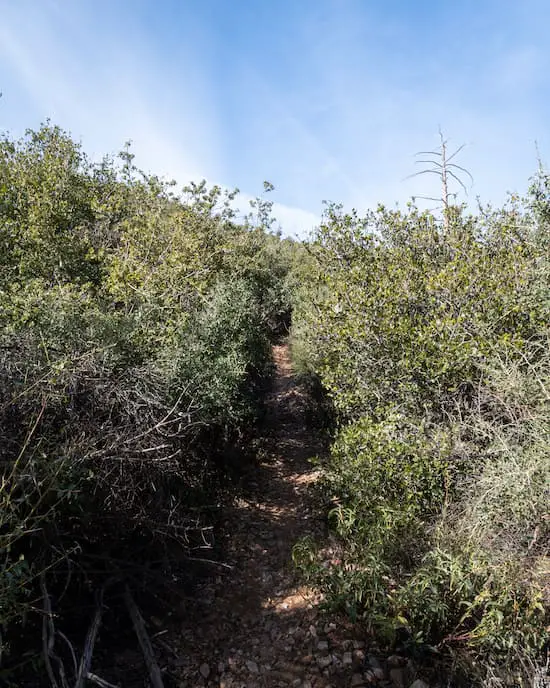
The trail is very steep and loose, as it follows the ridge all the way to the peak. Watch your step!
You haven’t made it to the peak until you see the marker with a number 12 on it! It’s the little post with a triangle at the top in the image below.
READ MORE: BEST HIKES IN LA: DON’T MISS OUT

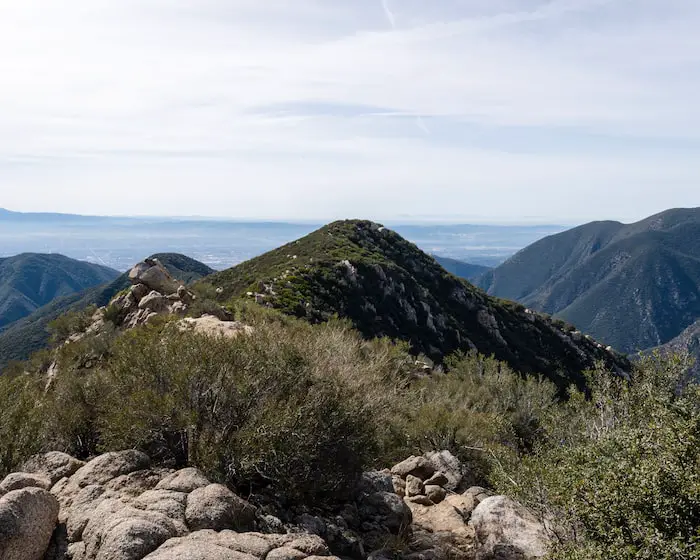
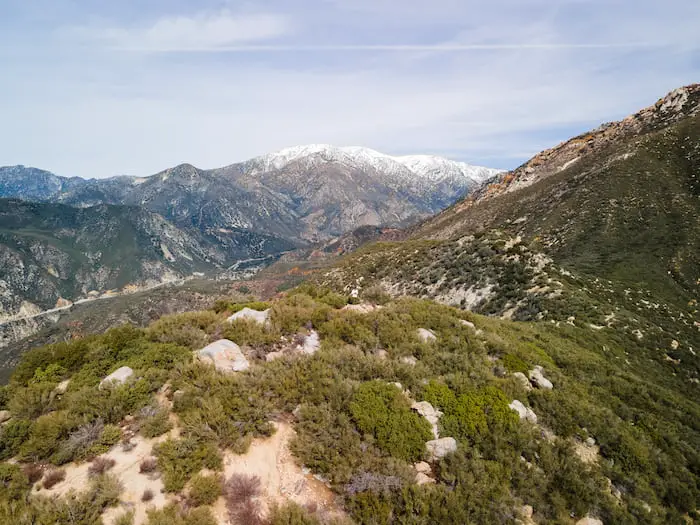
Stoddard Peak offers amazing views as far as Catalina Island, the Cleveland National Forest, and Mt Baldy towering behind you.
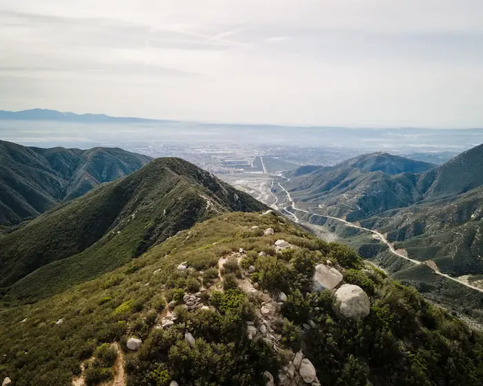
You’ll be able to see the road you drove up on from the peak as well as Sunset Peak.
READ MORE: 7 MUST DO WATERFALLS IN SOCAL
The king of the San Gabriels, Mt Baldy, made for an amazing backdrop.
I visited on a Wednesday, and had the peak to myself. Overall, it’s a great hike, especially for those who want to start bagging peaks, but aren’t ready to take on the big boys like Mt Baldy or Mt Wilson.
Head back down the way you came, and don’t forget to check out the falls when you get back down.


