
Distance
2.8 Miles
Time
~1-1.5 Hrs
Difficulty
Moderate
Season
All Year
Elevation Gain
971+ Ft
Experience breathtaking birds-eye views of various local sites of interest, such as Mount Wilson and Mount Lowe Peak, atop San Gabriel Peak.
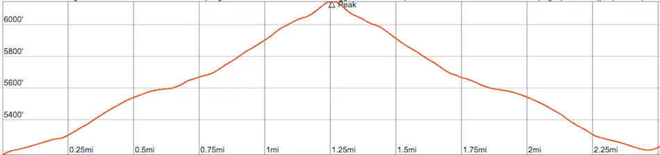
San Gabriel Peak is a moderate-level, short hike featuring views of various local hiking destinations. The summit is located within the San Gabriel Mountains near the city of Pasadena. There is a steady incline to the top with 971 feet of elevation gain.
Map of San Gabriel Peak
San Gabriel Peak Trail (Route we took)
Other Routes to San Gabriel Peak…
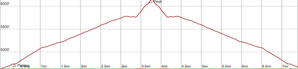
Mt Disappointment + San Gabriel Peak (4.4 Miles)

San Gabriel Peak via Red Box (7.3 Miles)
Directions to San Gabriel Peak
Click here for directions on google maps.
Other fun LA hikes for your weekend:
- Eaton Canyon Falls: Local’s Favorite Waterfall!
- Shoemaker Canyon: LA’s Nuclear Escape Tunnels
- Hike to a Teepee with Bee Farm and Views!
Hiking to San Gabriel Peak Trail
One of the best features about this hike is the amazing views witnessed throughout the entire trail, which begins via the Mt Lowe Fire Rd.
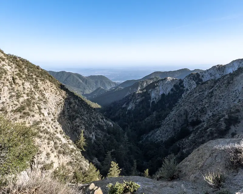
The first scenic view includes the lush and extremely popular Eaton Wash tucked between Mount Markham to the right and Occidental Peak to the left, before it empties into the lively city of Pasadena.
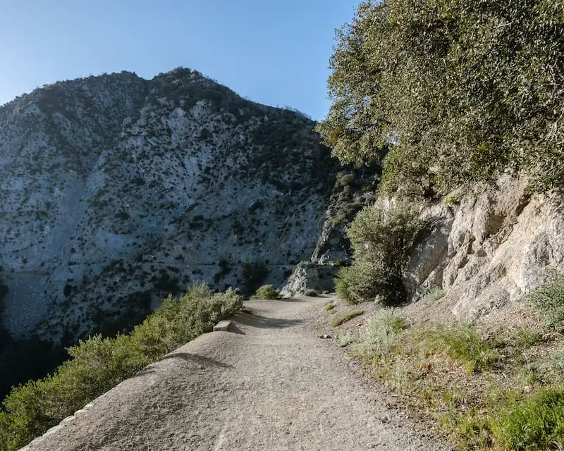
Mount Lowe Fire Rd, named after Thaddeus Lowe, a professor responsible for building the mountain railway, is now a rutted dirt road consisting of about 1/3 of the hike up to the peak.
However, don’t be fooled. The surrounding mountain ranges more than makeup for the dull road.
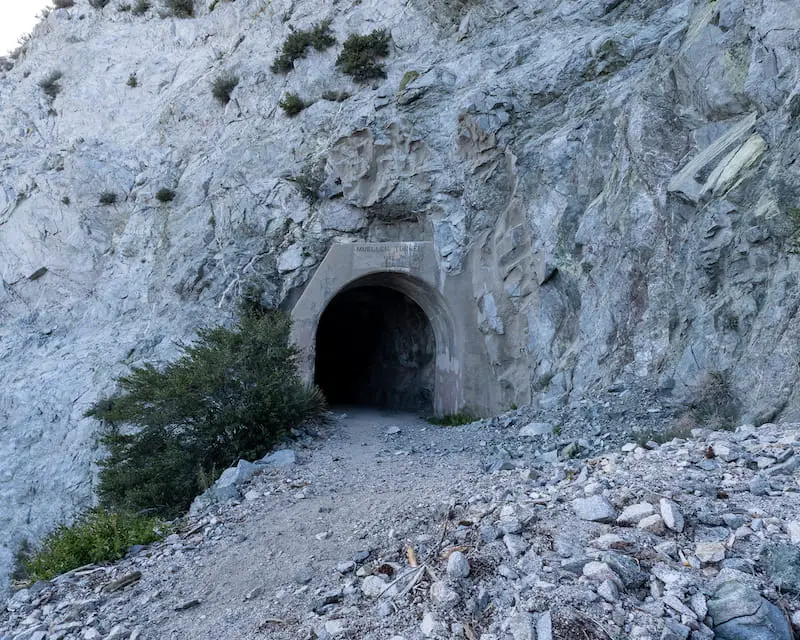
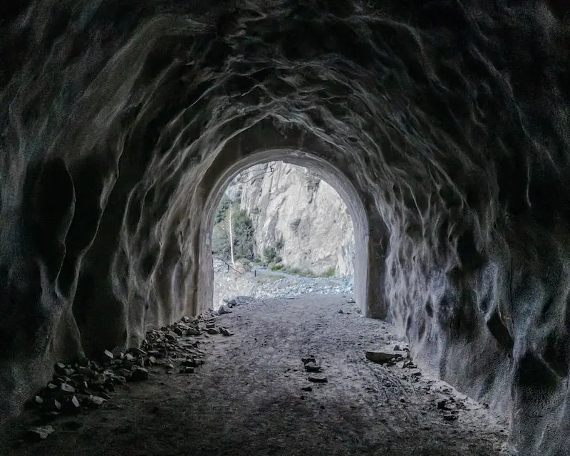
About halfway into the hike’s portion of the Mount Lowe Rd, you’ll arrive at the 100 yard-long Mueller Tunnel, built in 1942 by the Forest Service.
Fun Fact: If you look to the left of the tunnel, you’ll notice stakes along the canyon wall. These stakes are the only remnants of the trail originally used to trek around the mountain.
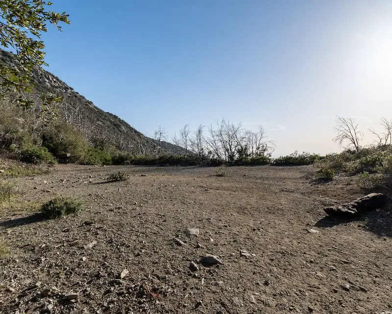
When you arrive at Markham Saddle, do not continue down Mount Lowe Fire Rd. Instead, make a right to hop onto the San Gabriel Peak Trail.
Read More: Super Short Hike in LA to Man-made Waterfall
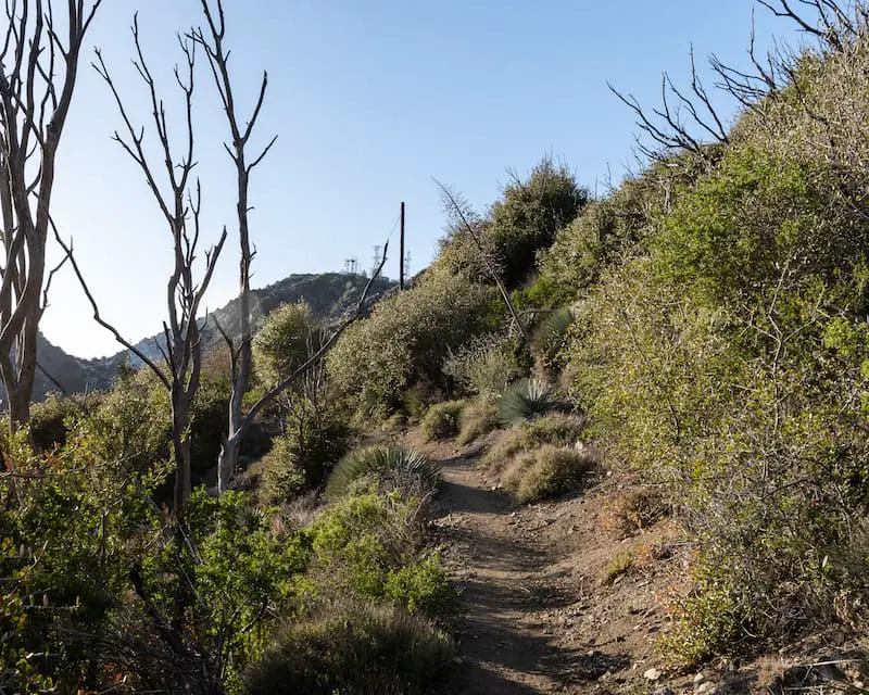
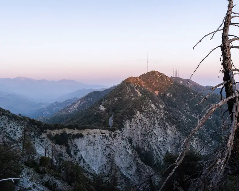
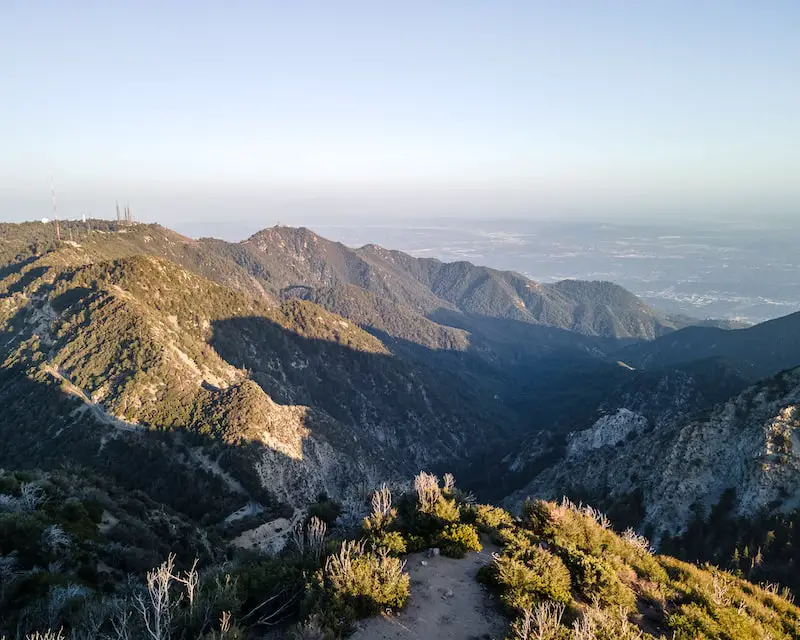
The San Gabriel Peak Trail quickly zig zags its way up the mountain while boasting views of Eaton Canyon to the East, Bear Canyon to the West, and many of the surrounding peaks, such as Mount Disappointment shown in the image below (look for the antennas).
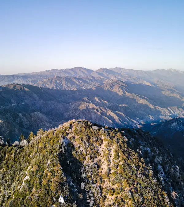
Below is Occidental Peak in the foreground covering most of Mount Wilson, a peak known for its multiple observatories, transmitter towers, and as one of the six pack of peaks.
Notice Mt Lowe Fire Rd precariously weaving its way up the mountain.
(The shot below was taken on our way back. Hence, the time change).
After roughly three quarters of a mile from Markham Saddle, you will arrive at the peak. If the skies are clear, Catalina Island can be seen 35 miles out to sea.
The two images below show San Gabriel Peak in the foreground flanked by Cedar Canyon, home of West Fork San Gabriel River, while Mount Lawlor is centered in the background, accompanied by the more rounded Strawberry Peak to the left.
Even if Catalina Island isn’t visible, San Gabriel Peak has many more breathtaking views to offer.
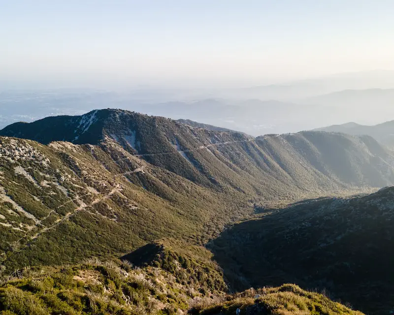
Below is Bear Canyon and Mount Lowe Peak (where the swing is sometimes located).
The road is the continuation of Mt Lowe Fire Rd which leads down to the historic sites, Inspiration Point and Echo ruins, both built by Professor Lowe.
Read More: Mount Lowe Hike to a Swing Above the Clouds
Here is a view of Mount Wilson and Occidental Peak from San Gabriel Peak, now joined by Mount Harvard to the right, which also boasts a few towers of its own.
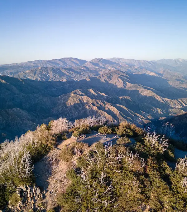
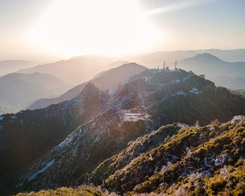
Last but not least, you’ll be able to look down on Mount Disappointment, which acquired its name in 1894 when the USGS surveyors incorrectly claimed it as the highest point in the area.
The large cemented square is a helipad, and the mountain ranges toward the far back/left side of the image are the Santa Susana Mountains. The smaller peak to the right is Josephine Peak.
Plan your weekend with this guide: 7 Hiking Trails in & Near Pasadena


