
- Total Miles: 4.02
- Time: 2.5 Hrs
- Difficulty: Easy
- Best Season: Spring
- Elevation Gain: 449 Ft
- Max Elevation: 1370 Ft
- Type of Trail: Out & Back
- Dogs: Allowed On A leash
- Restrooms: Available At The Parking Lot
- Trail Popularity: Extremely High
I’ve hiked Eaton Canyon Falls more than most trails as it was one of the first places I visited when I first began my outdoor journey. I know it like the back of my hand, and now I’m going to teach you how to make the best of it.
Eaton Canyon Falls is the most popular waterfall in the San Gabriel Mountains. The 4 mile hike requires crossing the white alder decorated creek multiple times as it weaves through the canyon’s steep and narrow walls, and ends at the beautiful 40 foot cascade. Parking lot and restrooms can be found at the trailhead. Dogs must be on a leash.
Eaton Canyon Falls is one of the most popular waterfalls in SoCal, and undoubtedly, the most popular in LA. Explore abandoned ruins, huge waterfalls, and amazing views by clicking the links below:
Best Waterfalls In Southern California
Eaton Canyon Trail Map
Choose from 3 trailheads depending on how much you want to hike. The distances for each trailhead is detailed below.
Address & Directions
Trailhead 1: 4.02 miles roundtrip. Elevation Profile shown below. The first and most popular of the three trailheads. It begins at the parking lot where the Nature Center is located.
Clicking the following link to redirected to the trailhead via Google Maps: 1750 N Altadena Dr, Pasadena, CA 91107.
Trailhead 2: 1.9 miles roundtrip. The second trailhead begins further up the canyon off of Pinecrest Dr where the Mount Wilson/Pinecrest Gate is located. Click here to get directions.
Keep in mind the hours for the Mt Wilson Toll Rd are 8am – 7:30pm Monday through Sunday.
Trailhead 3: 3.3 miles roundtrip. The third and least known route is the Henninger Trailhead off of N Altadena, which cuts halfway through the Eaton Wash. Keep in mind that crossing the wash may be a difficult feat during very rainy seasons.
You can get directions to the Henninger trailhead by clicking here.
Helpful Links
SoCal Adventure Pass (required to park in SoCal mountains)
Hiking Eaton Canyon Falls
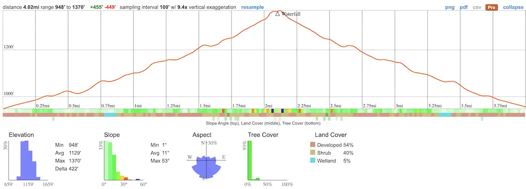
I started the hike via the most popular trailhead that begins at the Eaton Canyon Nature Center.
If you have kids, do them a favor and visit the nature center. It’s such an awesome place.
They have live animals on display, info on the surrounding area, and more. They’re open every day from 8-5pm except Mondays. The nature center phone number is (626) 398-5420.
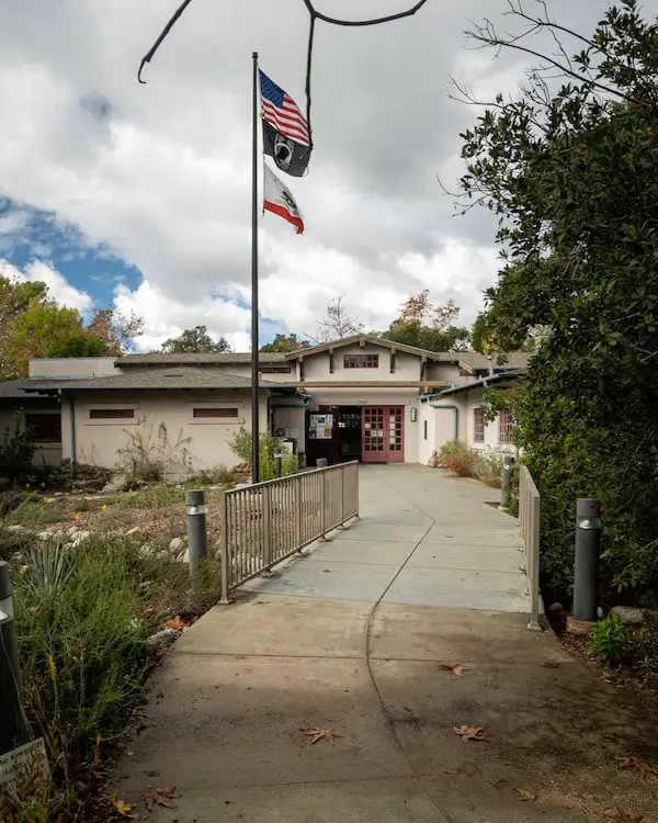
If you’re like me and eat like a horse after every hike, consider taking food to barbecue at the Eaton Wash. Why not make a full day out of your trip.
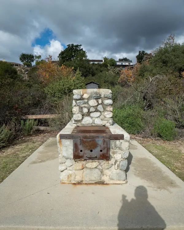
Below is the first creek crossing, which also happens to be the biggest.
After many years of visiting Eaton Canyon I noticed that water at the first creek crossing usually signifies a flowing waterfall. Thankfully, I was right again on this visit.
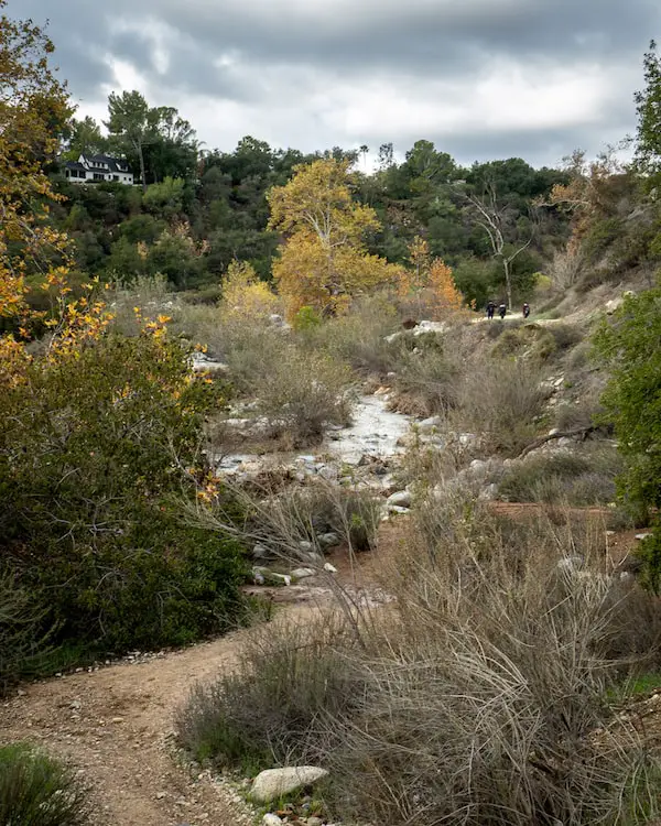
If you have family or friends that can’t make it to the falls, they’ll still be able to appreciate the beauty of the wash.
Multiple trails lead from the dirt road down into the wash, where the brush and water make it an enticing area for kids to play in.
The wash is safe the majority of the year, just make sure it’s not raining and the water level is low before giving your kids permission to explore.
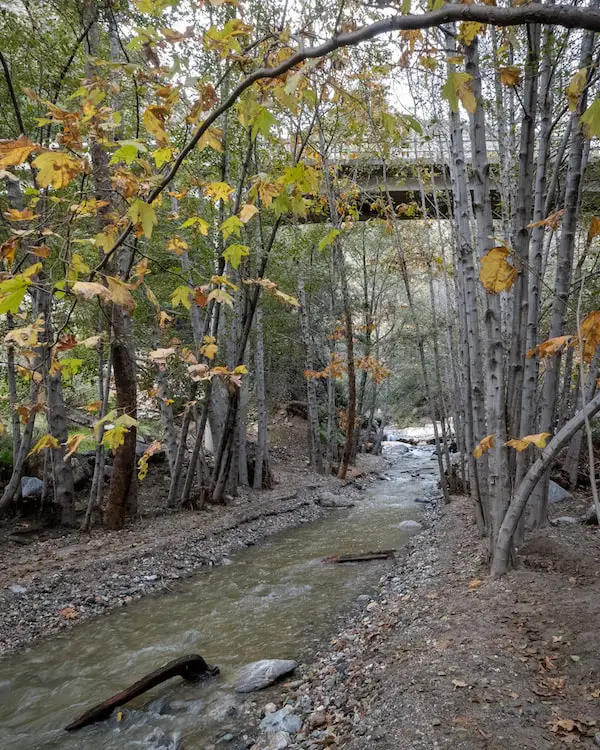
Once I reached the Chuck Ballard Bridge shown in the image below, I hopped off the dirt road and onto the trail that begins at the mouth of the canyon.
It’s at this point the hike gets much more scenic, with Western Sycamore trees and White Alders lining the creek bank for the majority of the hike.
The bridge can be used to access the dirt road known as the Mt Wilson Rd, the oldest American road in the San Gabriel Mountains that leads up to Henninger Flats, or Mt Wilson if you hike to the peak.
Henninger Flats is a mountain nursery founded by Theodore Parker Lukens (I read his biography that you can find here), a former mayor of Pasadena and friend of John Muir.
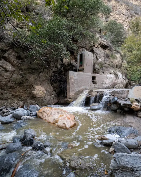
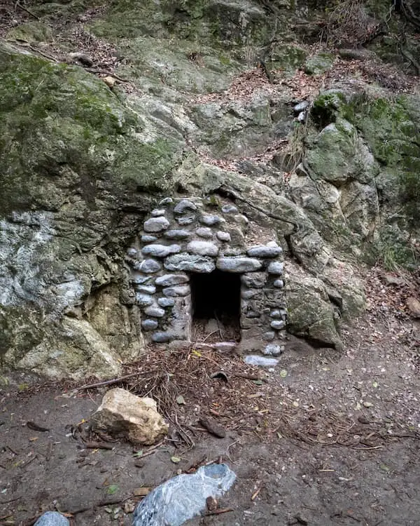
After searching both online and offline, I finally found the true purpose of the structure shown below.
Initially, I believed it was some sort of water pump, but according to John Robinson’s book The San Gabriels 2, it’s actually a stream gauging station used to measure water levels, and it’s not the only one.
More can be found in the San Dimas Experimental Forest which is unfortunately, closed to the public, but for a good reason. They’re doing marvelous work for our mountains in San Dimas.
If you love our mountain history, check out Robinson’s amazing book, The San Gabriels 2. Robinson’s work is invaluable in preserving our history, which is why his books are my most prized possessions.
Plus, if you decide to purchase the book I’ll receive a small commission that helps me keep this website going.
The creek is rarely more than 1-2 feet deep, but since it had just rained the day prior to my visit, some areas were 3-4 feet deep.
Hence, watch your step and really consider my advice regarding trekking poles and hiking boots.
I don’t know about you, but when I can hear a waterfall before I’m able to see it, it gets my heart pumping.
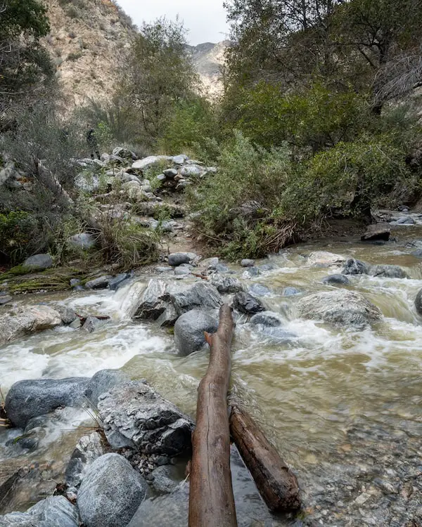
Below is the second to last creek crossing before I reached the falls. It’s about the same length as the first creek crossing, but there are less rocks and dry surfaces to cross on. Fortunately, it’s not deep (less than one foot).
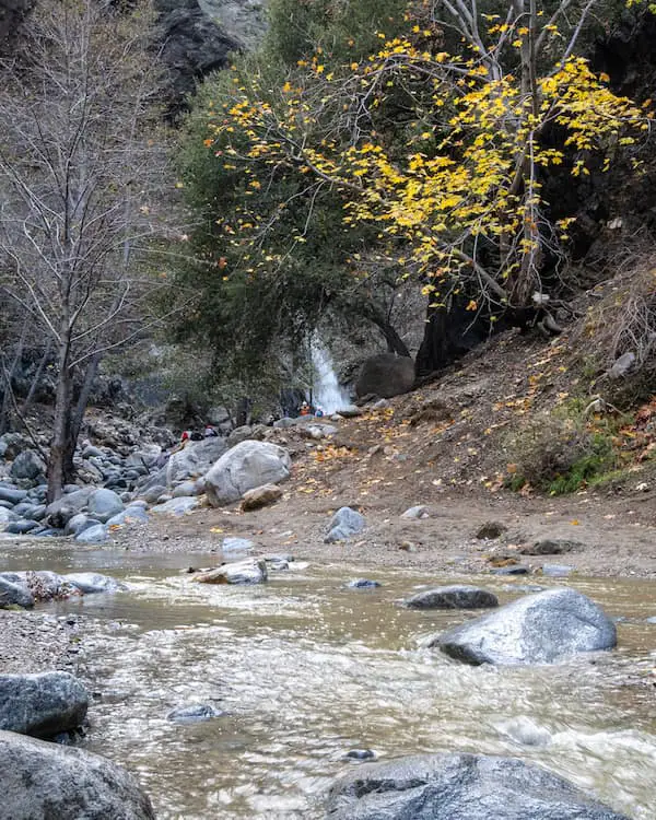
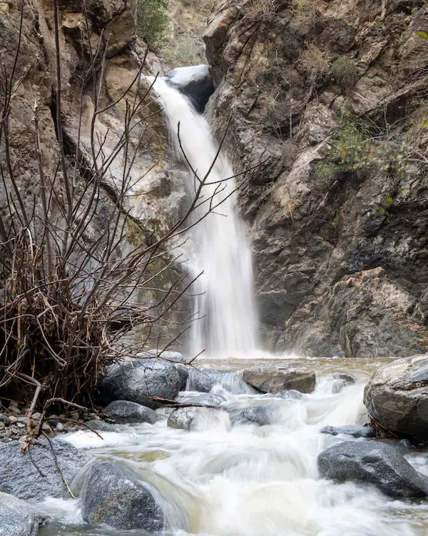
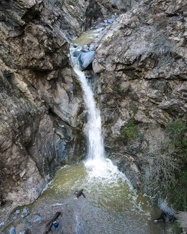
There she is, beautiful Eaton Canyon Falls.
Keep in mind the only reason the falls was flowing really well during my visit was due to the rain from the previous days.
However, if SoCal had a snow-packed winter, the falls may look just as full in the late spring.
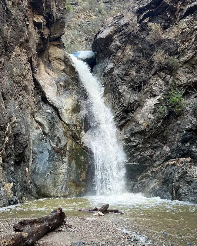
Fun fact: The rock wedged at the top of the falls has been there since at least the late 1800’s.
Want to hike more nearby waterfalls? Check out the post below!
I flew my drone to get a bird’s eye view of the falls when I remembered something very important.
Most people don’t know that there is a second falls above Eaton Canyon Falls, with a rockslide and swimming hole. However, it is no longer accessible.
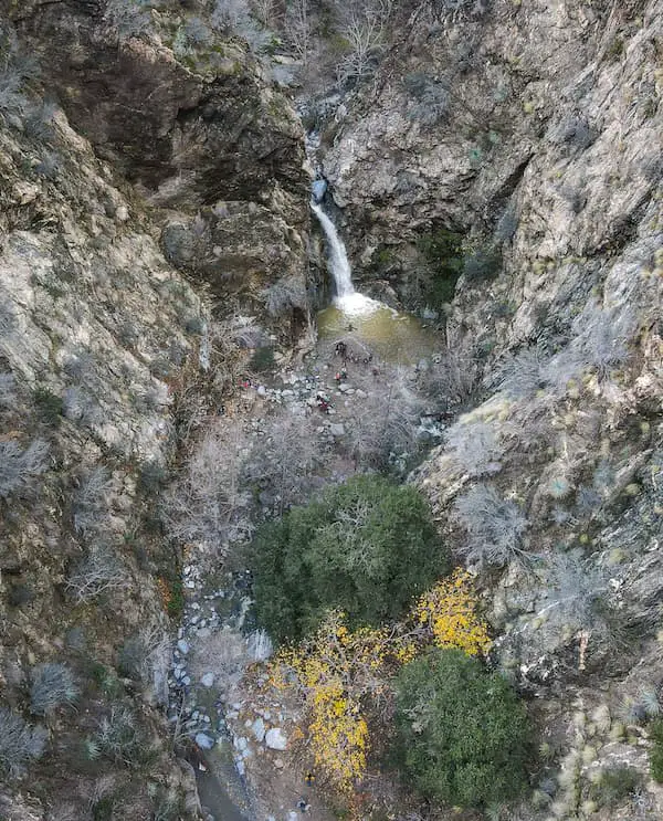
Visitors used to be able to access the second falls by venturing into one of the water tunnels in the area, but unfortunately, the tunnel has been closed.
Now, the only way to get to the falls is to climb up the super dangerous Razorback Ridge, which I do NOT recommend, as multiple people have been seriously injured and died attempting to do so.
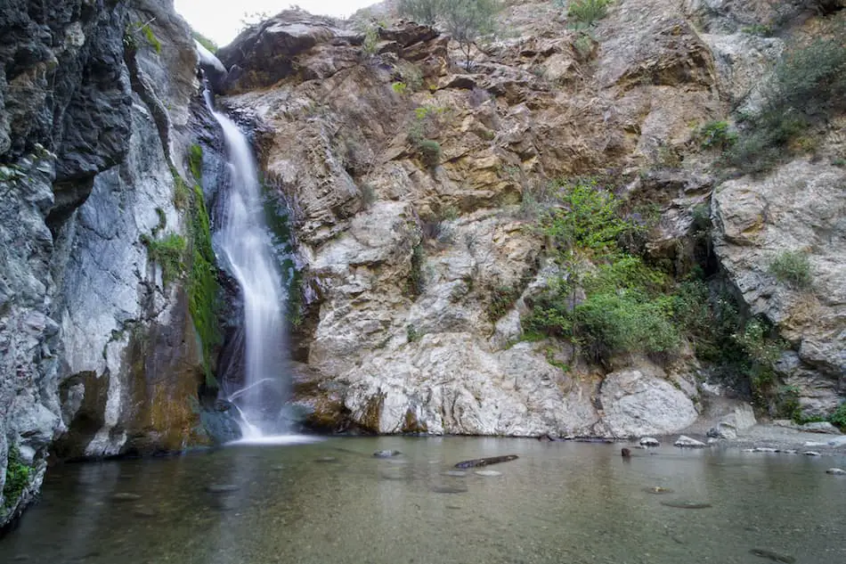
The image below is a shot I took of Eaton Canyon Falls in the spring of 2016-17ish, after a not too snow-packed winter. I wanted to include it to show you how the falls will more than likely be flowing during your visit.
Also, the falls tends to dry up pretty badly around midsummer, and won’t flow again until the following spring. Therefore, plan accordingly.
Don’t leave just yet! Explore abandoned ruins, more waterfalls, and amazing views by clicking the link below:
Eaton Canyon History
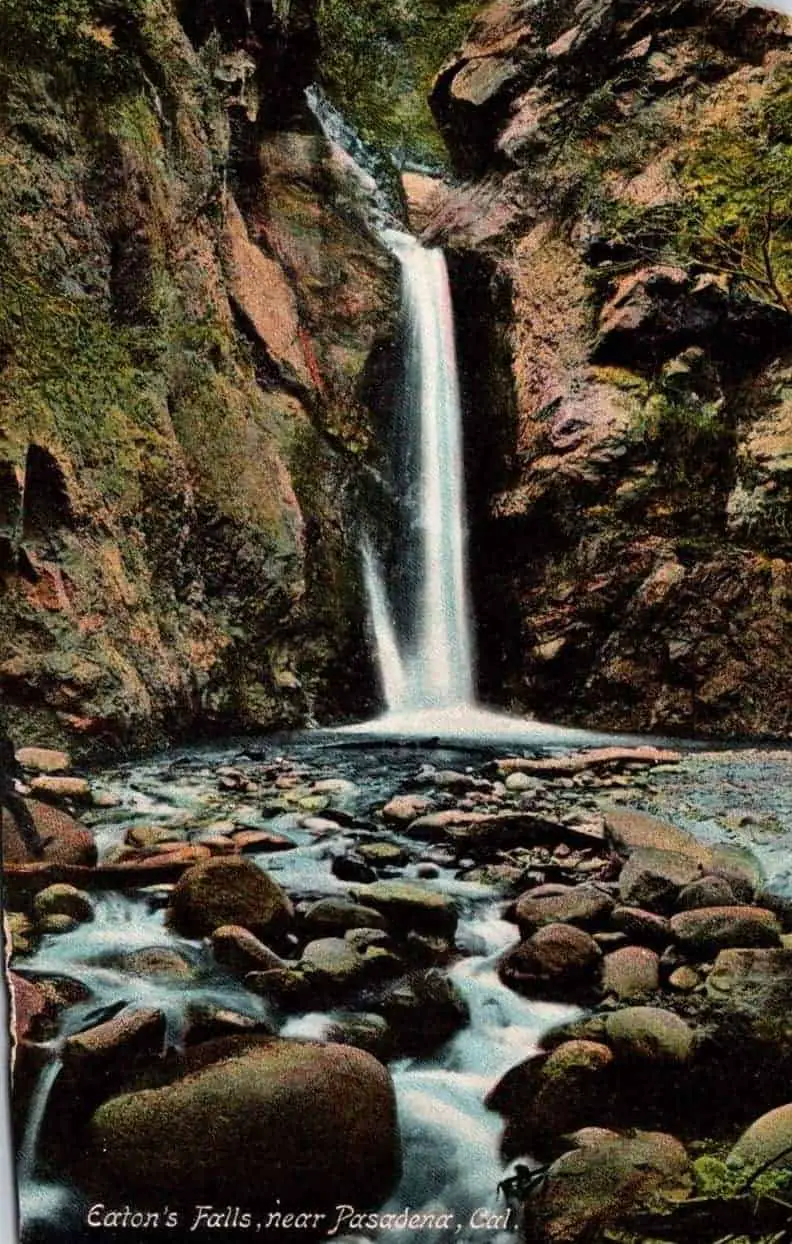
The image above is a vintage photograph I purchased depicting Eaton Canyon Falls at the beginning of the 20th century. Notice the rock which is currently lodged at the top of the falls is missing.
Eaton Canyon has a long and rich history beginning with the Tongva people, the Spanish, Mexicans, and last but not least the Americans.
Much of the Tongva history has been lost, but we do know the Spanish called Eaton Canyon, Canon Precipicio, which means the “Precipice Canyon” due its steep canyon walls.
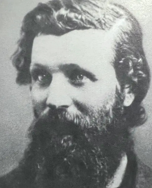
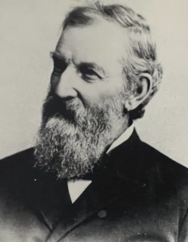
In 1877 legendary conservationist (and hero in my book), John Muir, shown below, visited Eaton Canyon Falls and dubbed it the Yosemite of the San Gabriels. What an honor!
Eaton Canyon had multiple uses including hunting, water for irrigation, and even gold prospecting.
Irrigation
Once CA became US territory, a man by the name of Judge Benjamin Eaton, for which the canyon is now named after, purchased Fair Oaks Ranch and the surrounding land in 1865.
The street cutting through Old Town Pasadena, Fair Oaks Ave, bears the name of this long forgotten ranch.
Judge Eaton, a patriarch of the San Gabriel Valley, was a pioneer in tapping water from the creek and used it to irrigate his ranch.
He built a water system consisting of miles of pipeline running through the canyon, which is still there!
Here’s a picture of one of those 157 year old pipes. Give or take a few years.
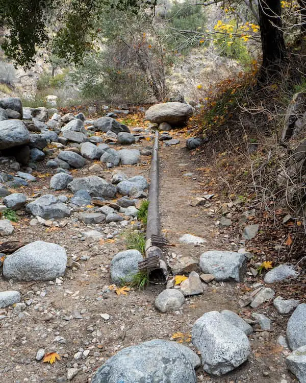
Many of the surrounding canyons in the San Gabriels contain these pipes, as they were also used for irrigation.
Water tunnels were constructed for irrigation purposes, with the longest measuring 600-700 ft.
Unfortunately, this tunnel was blasted in the 1980’s to block the entrance, but part of the rock wall still remains.
You can see the entrance of a different tunnel on your way to the falls.
It was one of these types of tunnels which allowed you to bypass the fatal Razorback Ridge, and safely access the second hidden waterfall in the Canyon.
Gold
Although hard rock mining never took place in Eaton Canyon, placer mining (panning for gold in the creek) wasn’t rare.
In 1853-1854, gold was found in Santa Anita Ranch (owned by Lucky Balwdin who now has a Belgian pub with my favorite beer named after him) and in the surrounding canyons including Eaton, Rubio, and Arroyo Seco.
Deep sand pits at the Eaton Wash which were used to look for gold still remain to this day.
Over the span of 18 years, a total of 2 million dollars worth of gold dust was sold from San Gabriel, Santa Anita, and Eaton Canyon.
-Thompson and West’s History of LA County
FAQs
How long is the Eaton Canyon Falls hike?
Eaton Canyon Falls is a total of 4.02 miles roundtrip when starting from the Nature Center parking lot.
Does Eaton Canyon have a waterfall?
Eaton Canyon has a 40 foot waterfall. In fact, the entire canyon has many waterfalls, which is why it’s one of the most popular canyons for rappelling.
Is Eaton Canyon Falls kid friendly?
Eaton Canyon Falls is most definitely kid friendly. There are no dangerous ledges, the water is not deep, and the trail has a low elevation gain.
Is Eaton Canyon Falls stroller friendly?
The trail is only stroller-friendly from the Nature Center to the mouth of the canyon where the Chuck Ballard Bridge is located. However, the trail from the mouth of the canyon to the falls is not stroller-friendly.
Do you need reservations to hike Eaton Canyon Falls?
Reservations are no longer required to hike Eaton Canyon.
Can you swim at Eaton Canyon Falls?
The pool at the base of the falls is not deep enough for swimming. However, cooling off in the pool and the falls is permitted.
Do you have to pay for parking at Eaton Canyon Falls?
Parking is free for all three Eaton Canyon Falls trailheads.
What city is Eaton Canyon Falls in?
Eaton Canyon is located in Pasadena, CA.
Does the waterfall flow in the autumn and winter seasons?
Eaton Canyon Falls usually dries up during the summer and is nothing more than a trickle during the fall and autumn.
When does Eaton Falls begin to flow?
Eaton Canyon Falls begins to flow every year around mid-spring.


