
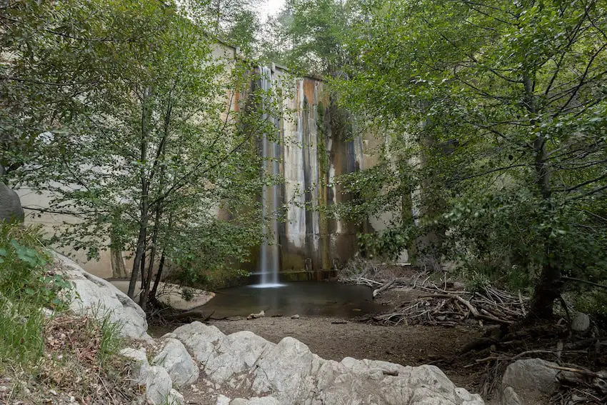
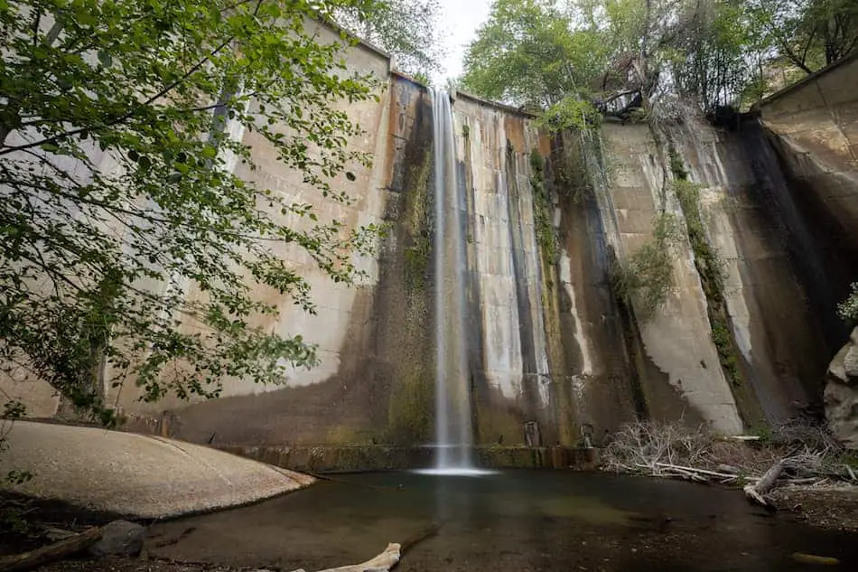
Brown Mountain Dam Waterfall is a must-do for SoCal residents! The breathtaking cascade towers above the abundant trees and forms a shallow 3-4 foot pool for you to cool off.
Brown Mountain Dam Waterfall is a scenic hike which can be accessed via two trailheads. The shorter route consists of a steep two mile hike, while the second route, which includes a portion of the Gabrielino Trail, totals a gradual 8.4 miles. Both end at the 81 foot man-made cascade located near La Canada Flintridge, California. Ruins, abundant vegetation, and creek crossings can be expected.
Brown Mountain Dam is, in my opinion, one of the best waterfalls in Pasadena and LA County. If you’d like to explore century year old ruins, enormous waterfalls, and more click the link below.
Brown Mountain Dam Map (Includes Both Trailheads)
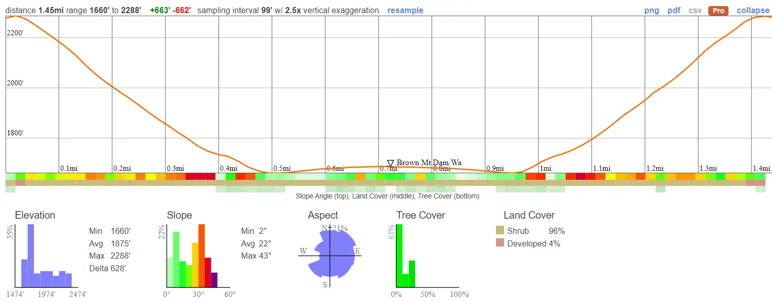
Brown Mountain Dam Elevation Profile – 1.45 Miles
- Miles: 1.45
- Time: 40 min
- Difficulty: Moderate
- Best Season: Late Spring
- Elevation Gain: 663 ft
- Max Elevation: 2288 ft
- Type of Trail: Out & Back
- Parking Lot: Fits ≈ 15 cars
- Dogs: Allowed
- Restrooms: Not Available
Click HERE to be redirected to the 1.45 mile trail via Google Maps.
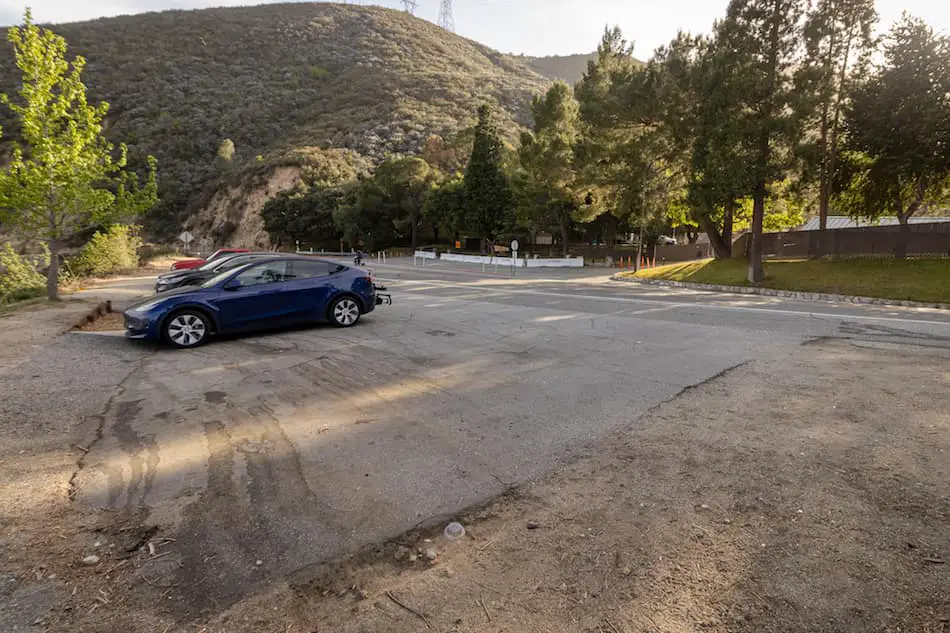
The trail begins right off the 2 hwy (shown below), literally across the street from the Angeles Crest Fire Station, and is considered the “shortcut” to the falls because it very quickly descends to the canyon floor.
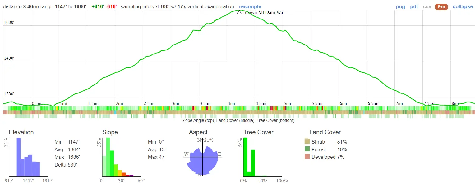
Brown Mountain Dam Elevation Profile – 8.46 Miles
- Miles: 8.46
- Time: 5 Hours
- Difficulty: Moderate
- Best Season: Late Spring
- Elevation Gain: 616 ft
- Max Elevation: 1686 ft
- Type of Trail: Out & Back
- Parking Lot: Fits ≈ 20 cars
- Dogs: Allowed
- Restrooms: Not Available
Click HERE to be redirected to the 8.46 mile trail via Google Maps.
This trail begins near JPL, which is why it’s sometimes referred to as the JPL Waterfall Hike. This trail follows the Arroyo Seco from start to finish.
Helpful Links
SoCal Adventure Pass (required for parking in CA mountains)
Brown Mountain Dam Waterfall Hike
Since we started the hike a bit later, we trekked to the falls via the shorter 2 mile hike.
Although it’s very short, you’ll be walking on a very narrow and steep dirt path. I don’t recommend bringing children on this hike. Come prepared with the right shoes as well!
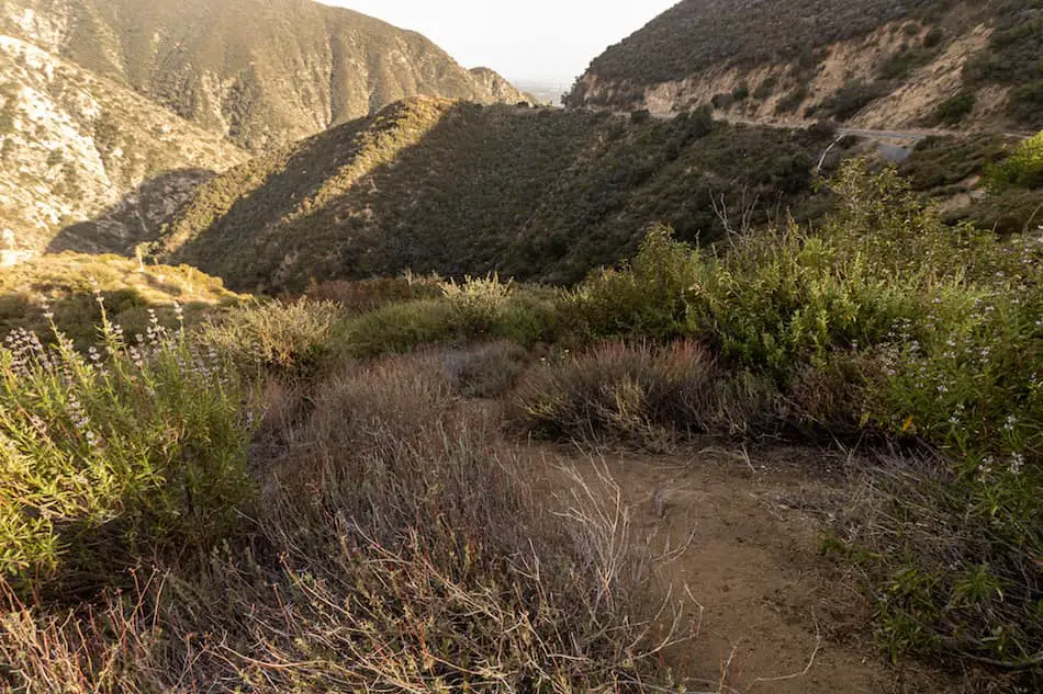
This trail begins at an elevation of about 2,207 feet, so expect some really nice views of the canyon and surrounding mountains.
The first section of the trail is steep and loose, but as you get further down the mountain side, the trail will become more gradual, and decorated with beautiful lilac-colored Chapparal Whitethorn that bloom in the spring.

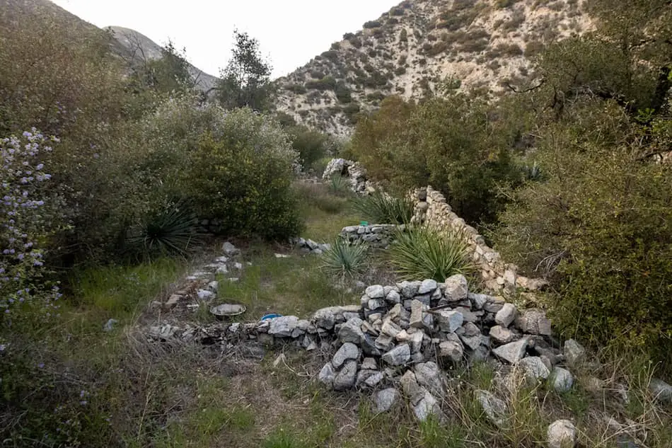
The last half-mile of the trail zig zags through cabin ruins covered with overgrown chaparral.
Remnants, like the chimney and/or fireplace, can still be seen.
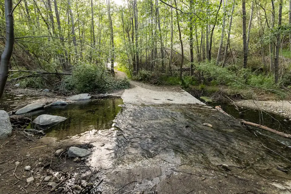
Finally, you’ve descended onto the canyon floor. Keep making your way upstream, you’re almost there!
In the evening, the sun shines through the While Alders and reflects off the creek water, making everything around you glisten with warm golden hour light.
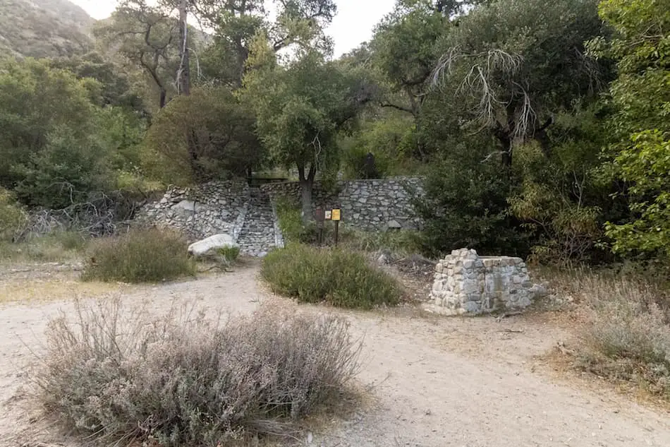
The last ruins you come across are the biggest. They were most likely destroyed in a fire or flood. Paul Little Picnic area is located next to the ruins.
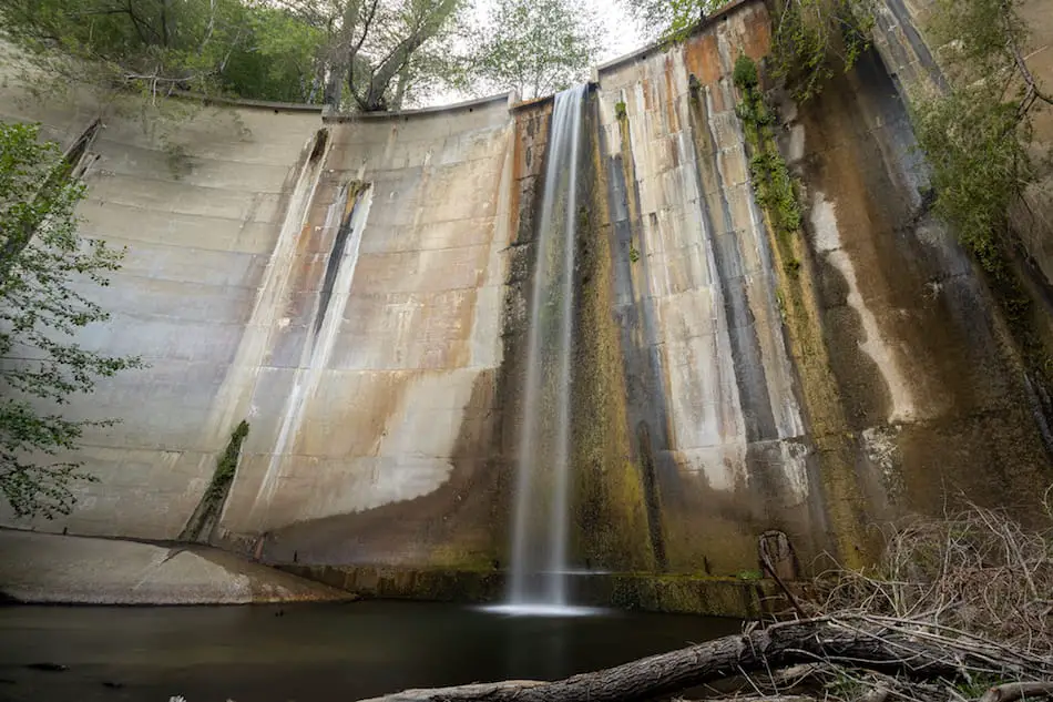
After crossing the Arroyo Seco one more time you will arrive at Brown Mountain Dam Waterfall!
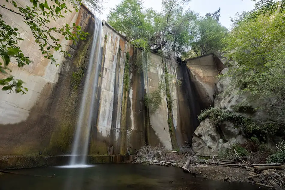
As you get closer to the dam, the gap in the trees begin to unfold the falls, like curtains unveiling the next scene.
We visited in April on a Saturday evening during a somewhat decent rainy season, but luckily the falls had a good amount of water, and we had it all to ourselves.
Moss grows on the canyon wall, adding to the greenery around you. The pool is about 3-4 feet deep, and the water is fresh as can be.
Another one of my favorite waterfalls in Pasadena is Eaton Canyon Falls, the most popular waterfall in the San Gabriel Mountains. Check it out, you won’t regret it!
Hop over the creek one last time to get a different perspective. You never know which angle will be your favorite shot.
Want to keep the adventure going? Check out Millard Falls, a very short hike to a 50 ft cascade. It’s relatively close to Brown Mountain Dam, so you can easily do both in the same day!
History of Brown Mountain Dam
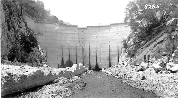
*BMD in 1943. Photo Credit: Arroyo Seco Foundation
Believe it or not, the Brown Mountain Dam was the first labor task undertaken by the US Forest Services Los Angeles River watershed program.
Construction of the dam began in the early 1940s, right around WW2.
Pools of water could already be seen by early March of 1943. Unfortunately, water wasn’t the only thing that was collecting.
Sediment, along with debris, began to build up at the back of the dam, causing some destruction to wildlife and fish habitats.
Today, the dam stands at an impressive 81 feet tall and 120 feet long. The waterfall flows almost all year, with the exception of droughts, which is why Brown Mountain Dam Waterfall has become one of the most visited falls in the San Gabriel Mountains.


