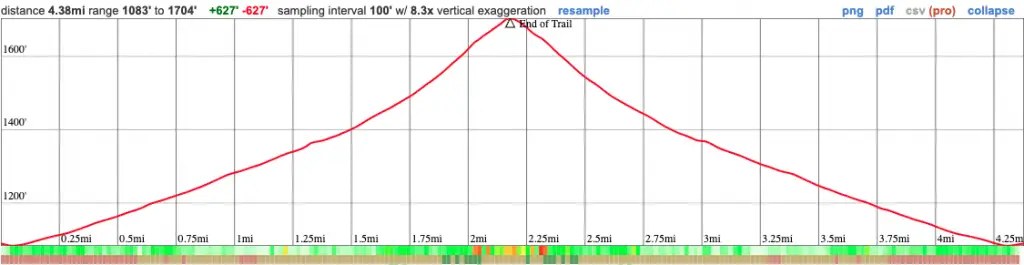
Distance
4.38 Miles
Time
2.5 Hrs
Difficulty
Easy
Season
All Year
Elevation Gain
705 Ft
- Dogs allowed on a leash
- Out & Back Trail
- Restrooms Not Available
Deep in the Corona woods, an abandoned mine lays waiting to be explored. Tell me this doesn’t get your heart pumping.
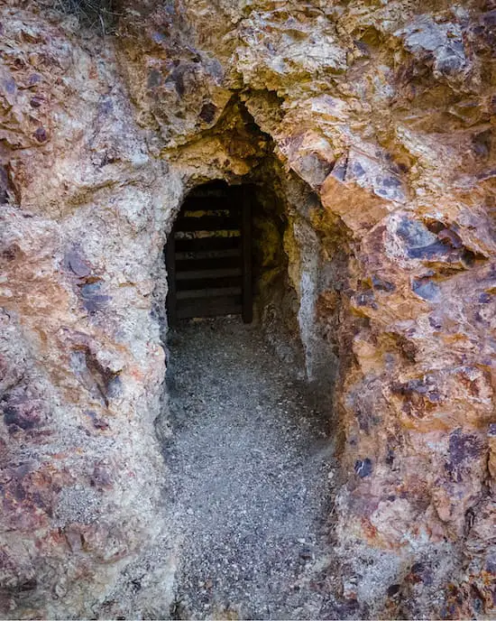
The Tin Mine Canyon Trail is a relatively flat and easy trek in Riverside County. Although the first half of the trail consists of either a dirt or paved road, the scenery drastically changes inside the canyon. Both mine portals are unfortunately closed. A long sleeved shirt and pants is highly recommended as poison oak is abundant inside the canyon.
For a complete list of hikes in Riverside County, check out the following link:
Tin Mine Canyon Trail Map
Tin Mine Canyon Address & Directions
To be redirected to the trailhead via Google Maps, click the following link: Skyline Dr, Corona, CA 92882
Parking is available on W. Foothill Pkwy, but due to the entire area being popular, expect lots of people on the weekends.
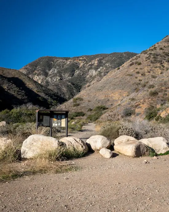
Tin Mine Canyon Trail
The hike begins on a paved road called Skyline Drive that is shared by hikers and bikers, and runs adjacent to people’s houses.
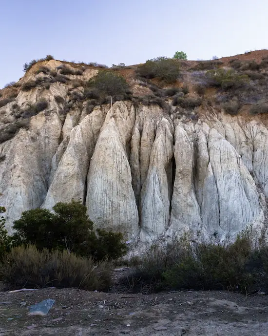
The start of the trek would have been rather dull if it wasn’t for the crazy looking sandstone formations shown below. The creek runs at the base of these formations.
After the first bend the view opens up and a beautiful morning sun illuminates picturesque green pastures.
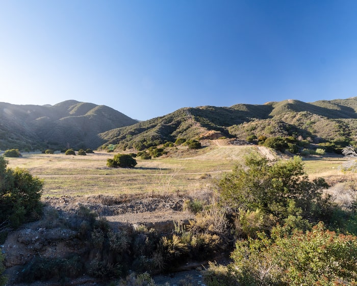
While most people head up the hill to the right, you’ll continue your trek by heading straight into the canyon.
This is where it gets good.
Read More: Two Trees Trail in Box Springs Mountain Regional Park
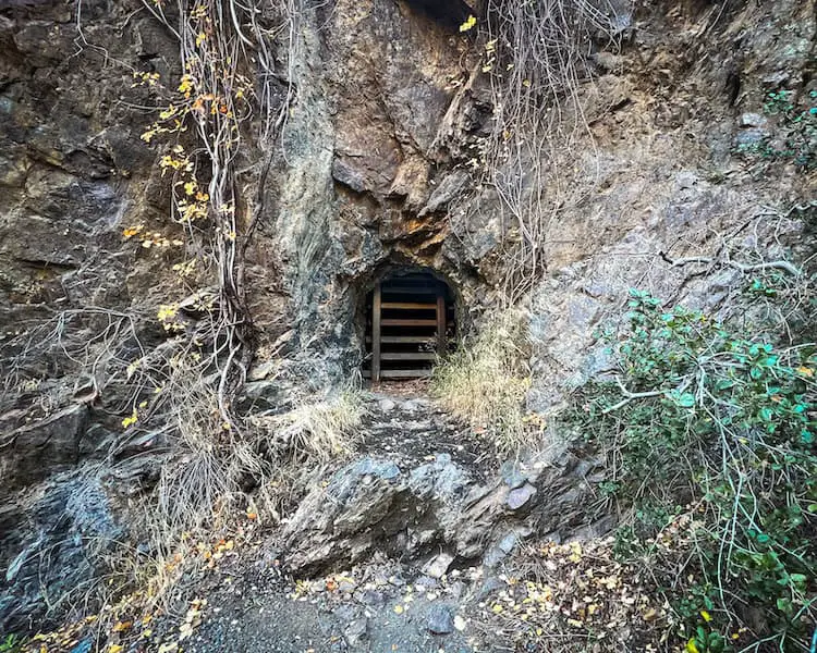
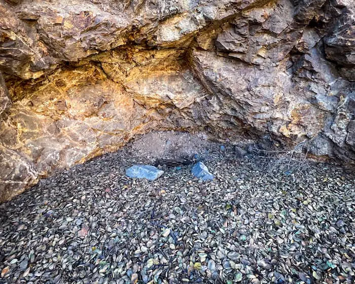
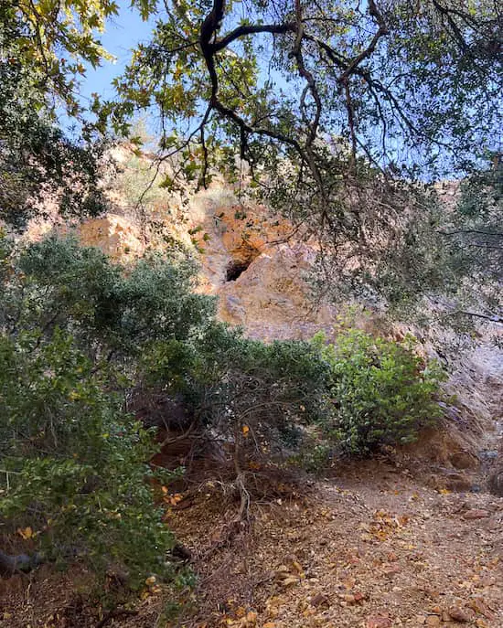
Before arriving at the main portal, there’s a concave dent on the left side of the canyon wall.
It seems like this used to be a shaft of some sort.
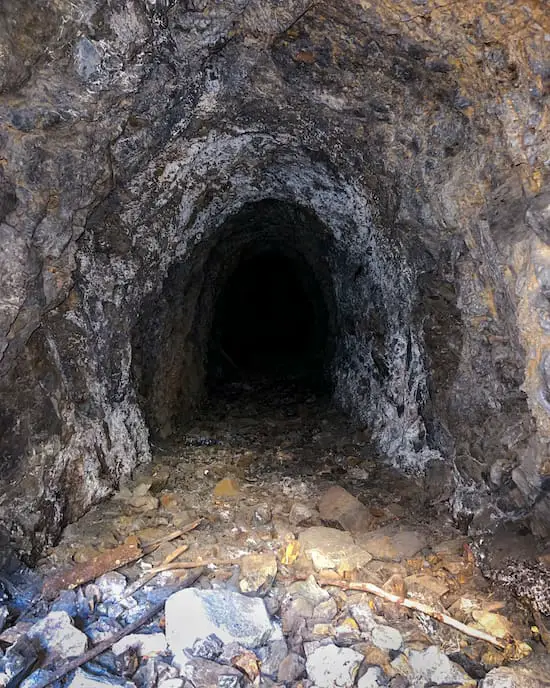
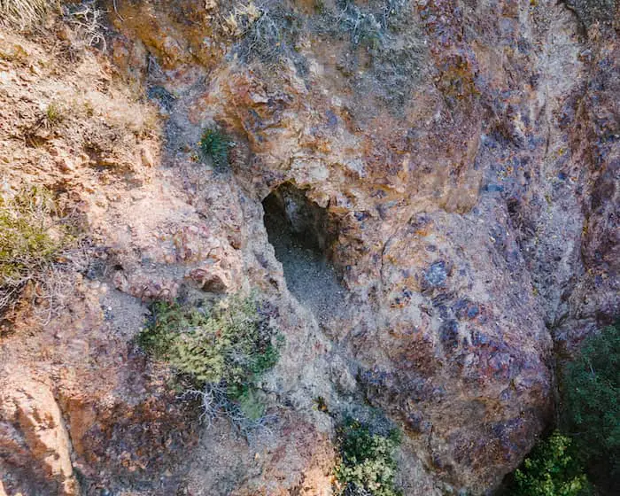
The primary mine looks like something out of a movie, with the wind violently blowing poison oak vines around the portal. There was no one else in the area.
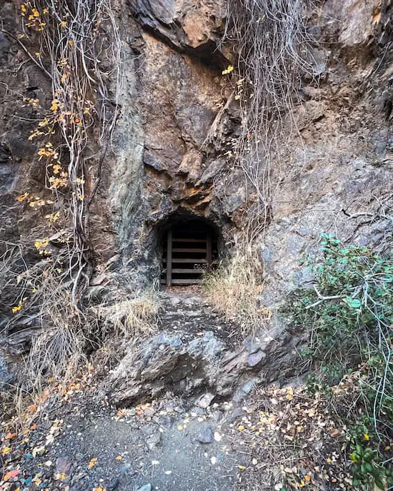
Only darkness as far as the eye can see.
Read More: Mt Rubidoux Trail: Amazing 360 Panoramic Views
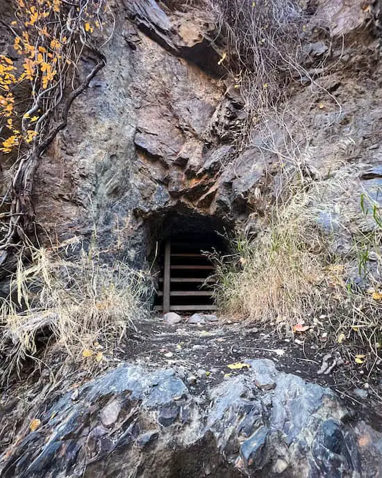
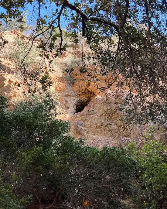
A bit further up the trail and to your left, you’ll see a second portal precariously located about 25 feet above the canyon floor.
Unfortunately, this one is also closed.
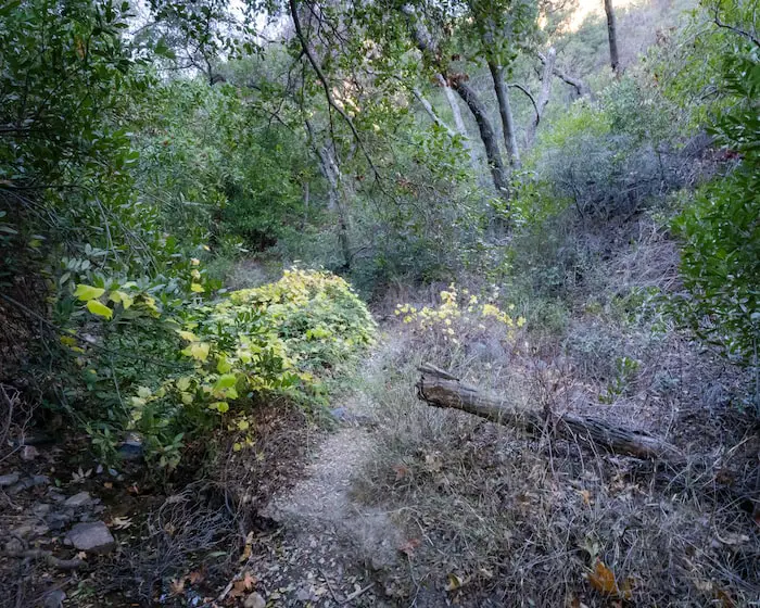
From this point forward the vegetation gets significantly dense, but also stunning. I felt like I was in the dense canyons of the San Gabriel Mts.
Poison oak is abundant, so long sleeves and pants are non-negotiable.
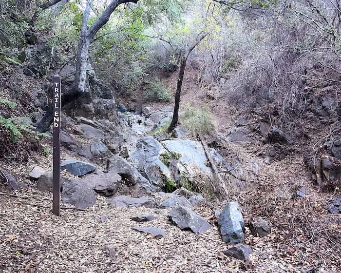
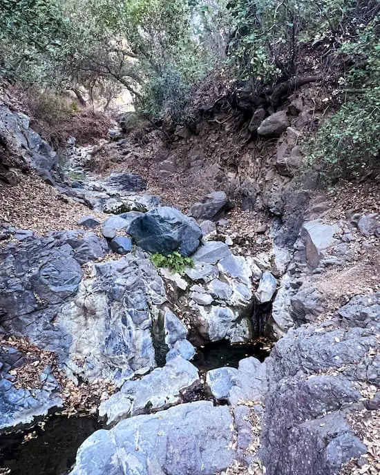
The trail abruptly ends, but the adventure doesn’t have to.
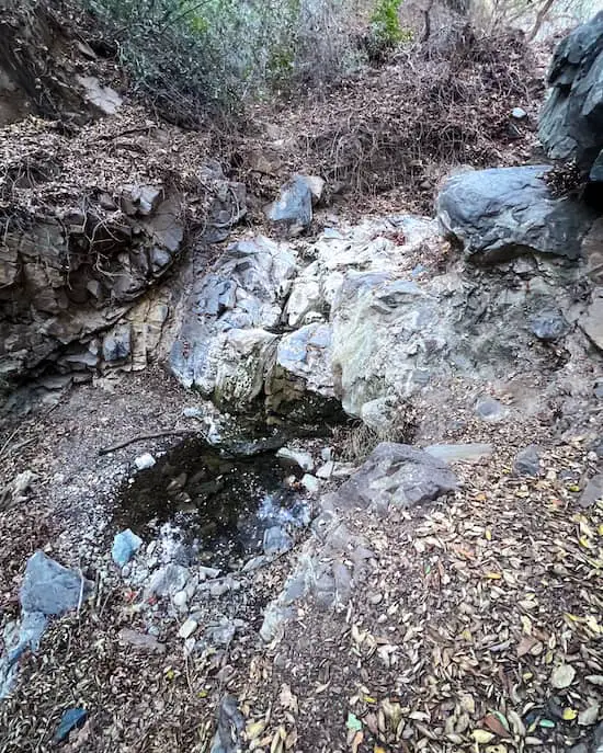
For those who enjoy a bit of rock scrambling, there are a series of small seasonal waterfalls further up the stream.
Had there been water, the creek would have been a real treat. Nevertheless, it’s a fun detour which only takes 10 minutes.
Read More: Pumpkin Rock: A Giant Halloween Boulder


