
Distance
2.5 Miles
Time
1.5 Hrs
Difficulty
Moderate
Season
All Year
Elevation Gain
977 Ft
- Dogs allowed on a leash
- Out & Back Trail
- Restrooms Not Available
Looking for a short hike before or after work? Two Trees Trail is just the hike for you!
Two Trees Trail is a short and fun hike in Box Springs Mountain Regional Park featuring wild donkeys, a small seasonal waterfall, and a stunning viewpoint of the valley below. A short detour up to a rocky peak can be added for those who crave more adventure. There is no shade on the trail, so packing a hat and plenty of water is a must.
For a complete list of hikes in Riverside County, check out the following link:
Two Trees Trail Map

Two Trees Trail Address & Directions
Click the link to be redirected to the trailhead on Google Maps 430 2 Trees Rd, Riverside, CA 92507.
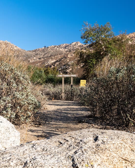
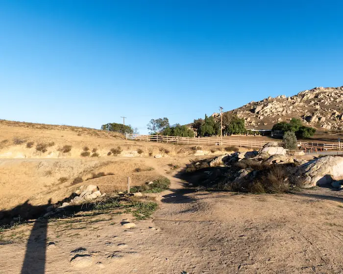
The trail begins at a very small dirt parking lot, so be sure to arrive extra early, especially on weekends!
Two Trees Trail
Two trees begins in a residential area. Word on the street is not to leave anything valuable in your car, especially after dark.
Fortunately, during our visit we saw nothing but friendly people and smiling faces.
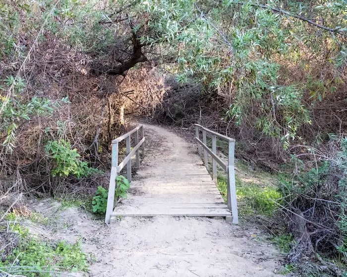
The trail begins on the canyon floor and requires traversing a dry creek bed via an old wooden bridge.
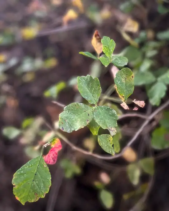
Keep an eye out for poison oak in this area. Remember, leaves of 3, let it be.
Poison Oak
Read More: Tin Mine Canyon Trail: Corona’s Forgotten Past
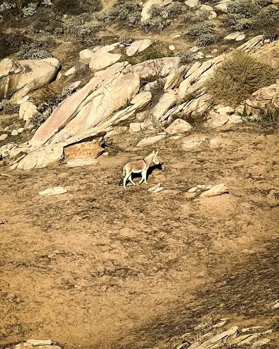
Shortly afterwards, you’ll find yourself climbing up the barren slopes, surrounded by wild donkeys and giant boulders.
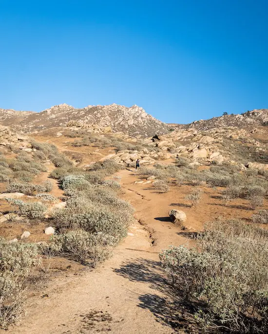
The wild donkeys are everywhere!
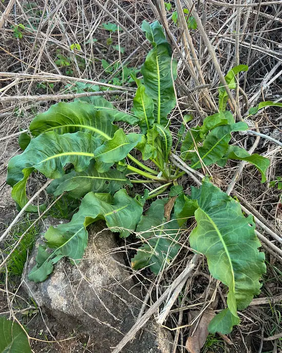
Here’s one looking for his buddies and probably some delicious Curly Dock for dinner.
Curly Dock
If you look to the south, you’ll have a clear view of Old Saddle Back, which consists of two peaks, Modjeska and Santiago, in the Cleveland National Forest. The latter being the highest point in the range.
If you’re lucky, you’ll also witness the train making its way through large green pastures, painting a picturesque image resembling old school puzzles.
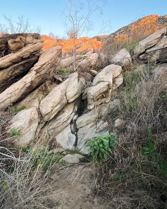
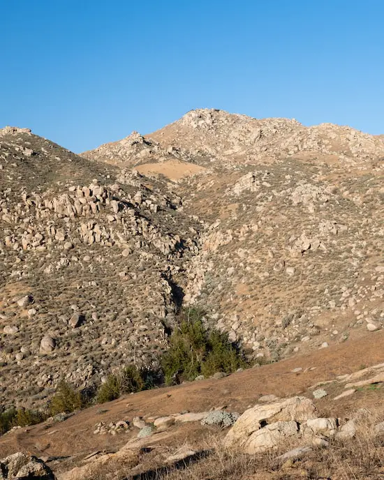
When you’re about halfway up the mountain, you’ll notice a small, roughly 8 foot dry waterfall to the left of the trail. It’s hard to miss.
Hopefully, if it continues to rain, the falls will be flowing.
To the north is an entire area I’d like to explore on my next visit. There are many good sign of running water, and where there is water, there are many surprises.
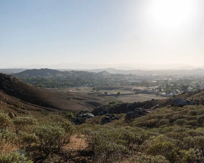
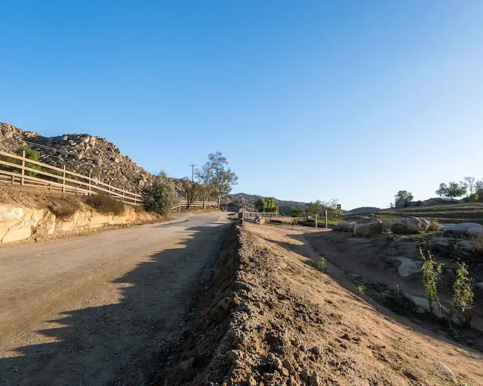
You’ve made it to the top! I was pretty shocked to see more residential homes in the area, but nevertheless, the views are beautiful.
Read More: Pumpkin Rock: Halloween Boulder
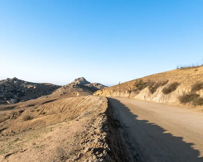
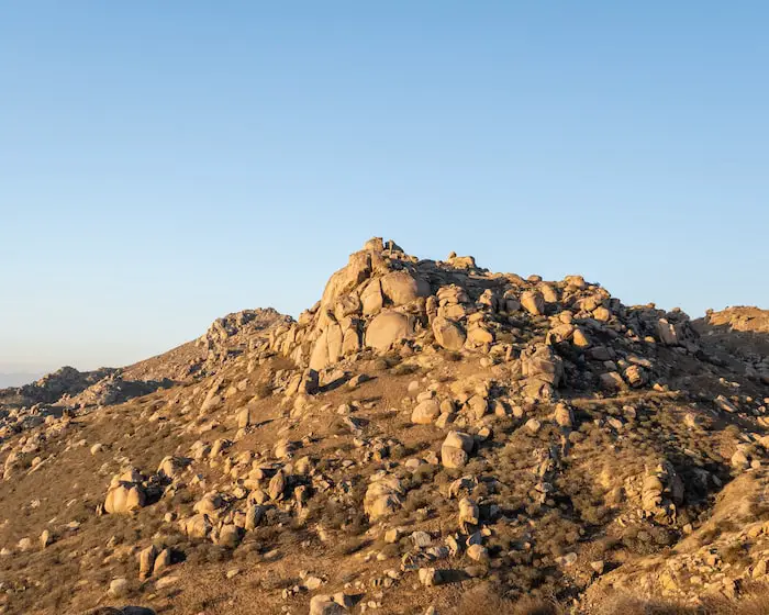
The rocky peak you see below is actually a view point which you can add onto the hike via an official and safe trail.
Simply head left after reaching the dirt road at your destination and you’ll see the trail up to the peak. You can’t miss it.
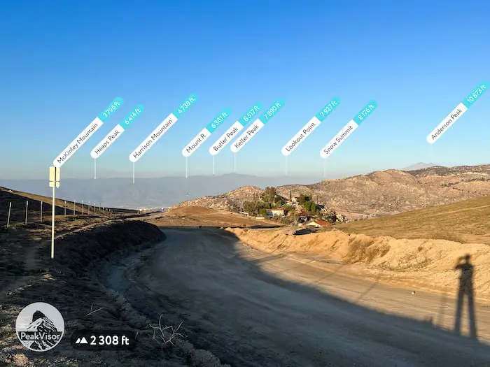
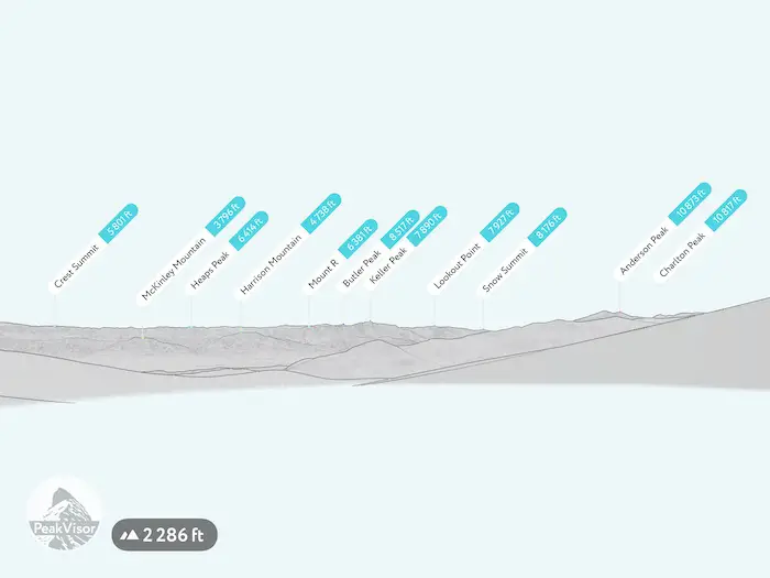
The dirt road is called Box Springs Mountain Rd, and if you head down the road for a bit, you’ll be rewarded with a stunning view of the San Bernardino National Forest, and some of its most lofty peaks.
By the way, I use the app Peak Visor to identify peaks on my hikes. I’m not affiliated. I just really love the app!
When you’re ready, head back the same way you came, and enjoy and amazing sunset backdrop.

Read More: Mt Rubidoux Trail: 360 Panoramic Views


