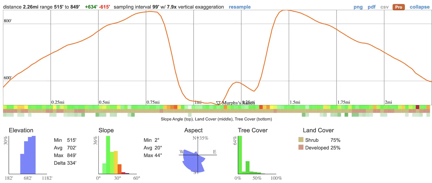
- Total Miles: 2.26
- Time: 45 min
- Difficulty: Easy
- Best Season: All Year
- Elevation Gain: 615 ft
- Max Elevation: 849 ft
- Type of Trail: Out & Back
- Parking Lot: Street Parking
- Dogs: Allowed On A Leash
- Restrooms: Not Available
- Trail Popularity: Very High
- Pics Taken On: May 1, 2021
Who would’ve thought that Rustic Canyon, in LA County, has so much eerie and shocking history related to Nazis and WW2? Yeah, you read that right. Crazy!
Murphy Ranch is a 2.6-mile hike in Rustic Canyon, near Pacific Palisades. It’s rated as moderately difficult due to lengthy, steep steps. There is no designated parking lot for this trail. This is a dog-friendly hike but is not recommended for small children.
Murphy Ranch is a one of a kind place in Southern California, but there are many more hikes which are just as remarkable. To explore 500 ft waterfalls, abandoned gold mines and tunnels, and many more, click the link below:
Best Hikes In Southern California
Map of Murphy Ranch Trail
Directions & Parking
Click the following link to be redirected to the trailhead via Google Maps: Murphy Ranch Trailhead.
There’s no parking lot for this trail. So, I ended up parking on Amalfi Dr.
From here, I walked and made a left on Capri Dr. Then, I made a left onto Casale Rd where the trailhead is located.
Helpful Links
SoCal Adventure Pass (required to park in SoCal mountains)
Check out these other hikes in LA!
Hiking To Murphy Ranch
The trailhead begins on a dirt road near some beautiful and quite expensive homes.
The neighborhoods there seem to be full of cameras and watchers. Honestly, I wouldn’t have expected there to be a trail right by these homes.
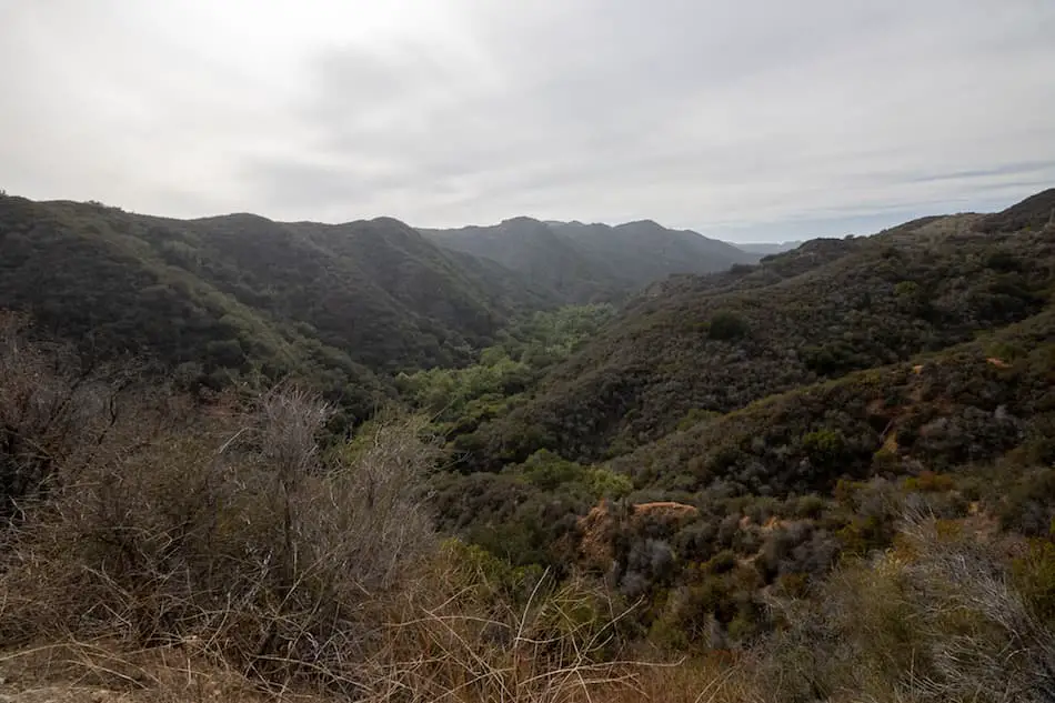
To the left, I could see the beautiful Santa Monica mountains.
There’s a hidden waterfall down by Rustic Creek. Guess I’ll have to come back and check that out!
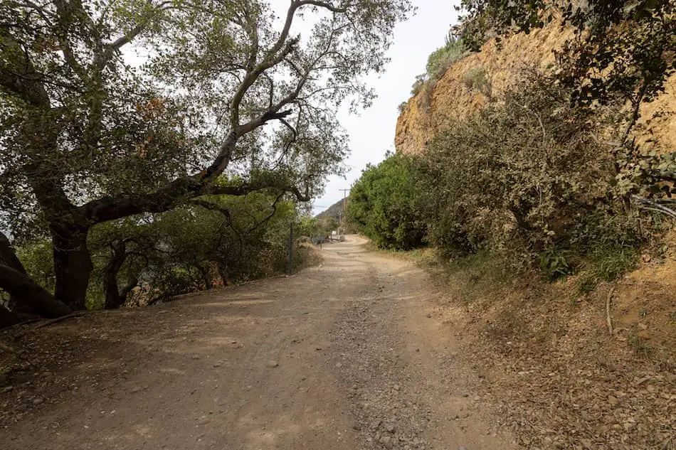
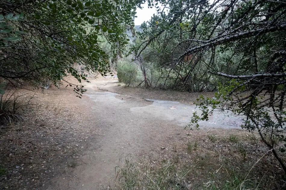
Most of the trail is on a rundown road that’s definitely in need of a good repair. It definitely feels abandoned already.
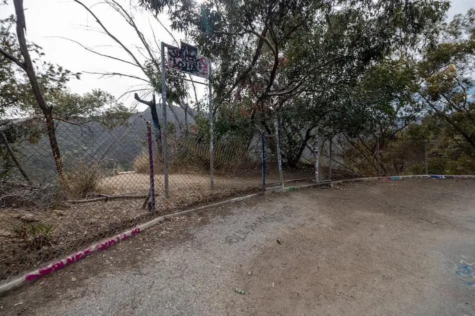
There’s also tons of graffiti on the road.
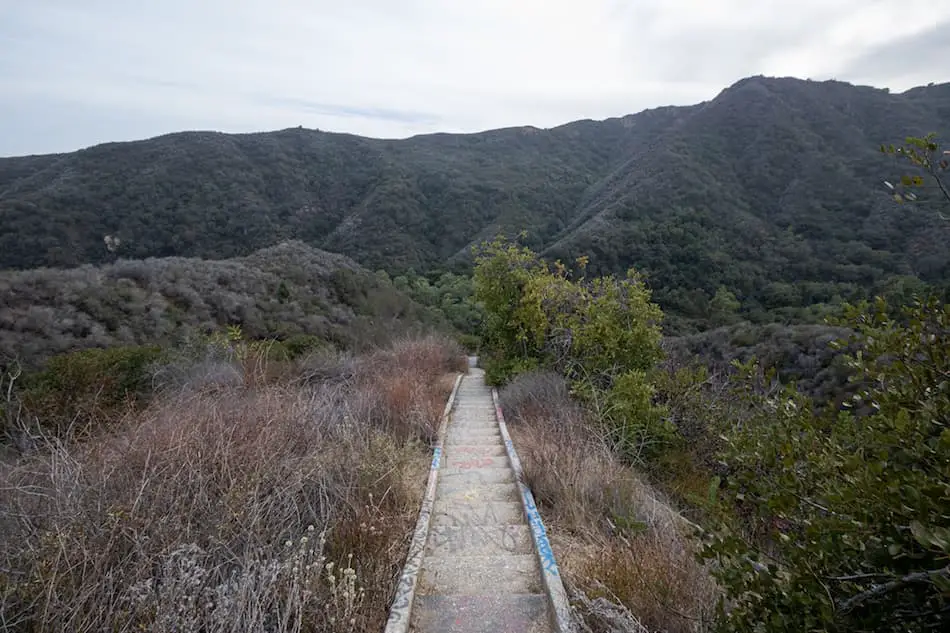
Right behind this gate is where the lengthy stairs begin. Be prepared with some water and a hat if you’re doing this on a sunny day.
It’s definitely a workout. On the bright side, the views are amazing!
After this heart-pumping cardio workout, I reached the canyon floor.
I continued on the left.
Luckily, there was hardly anyone here.
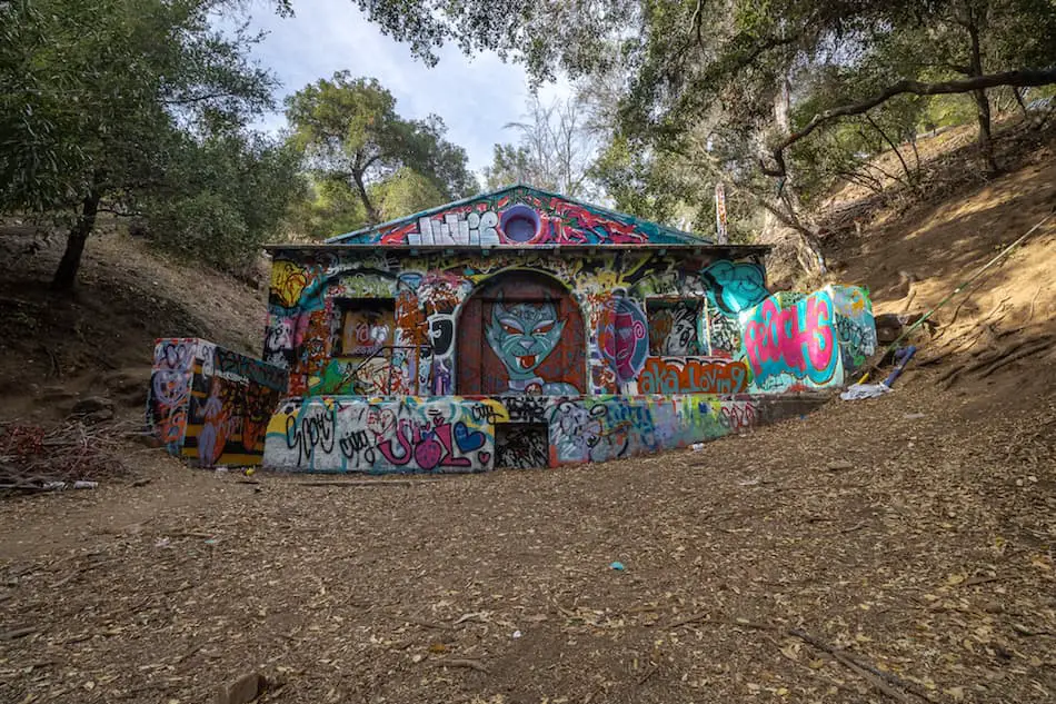
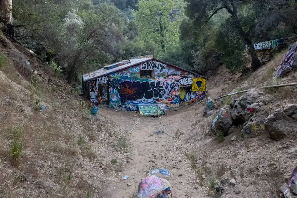
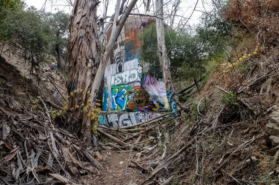
The powerhouse looks crazy with tons of graffiti. Sadly, it’s been boarded up.
Here’s how the backside looks.
There’s a tiny door that’s probably under 5ft tall.
This is the water tower in the back of the building.
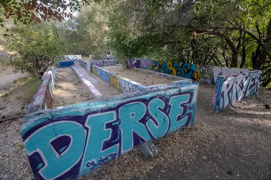
Next to the powerhouse, there are some steps that lead to the old”garden” area.
No flowers here, just short cement walls remain.
There’s plenty more to explore at Murphy Ranch such as the old machine shed.
But, I think the most interesting part of the hike is definitely the powerhouse. It’s an interesting photo spot for sure.
You can choose to do this as a loop or as a there-and-back trail. No matter what way you go, you’ll get interesting sights!
History of Murphy Ranch
Going to Murphy Ranch with some background knowledge makes this place way more interesting. Let’s get into the weird stuff!
It’s been said that there was a man and wife by the name of Winona and Norman Stephens who claimed to be very wealthy. Mrs. Stephens was into the “supernatural” and came across someone she believed to foresee the future.
This man, Mr. Shmidt, convinced the couple that the Nazis would invade and defeat the U.S. Soon after, they bought a huge piece of land in Pacific Palisades under the pseudonym “Murphy”. Their plans began in 1933.
The ranch was supposed to be self-sufficient, which is why they had the powerhouse and water tank built.
They had a blueprint of a giant mansion that was going to be built, with a “watchtower” and a giant library.
But, their plans of a doomsday utopia never fully went through and the enormous mansion was never built. Their ideas of a German invasion never came true either, thankfully.


