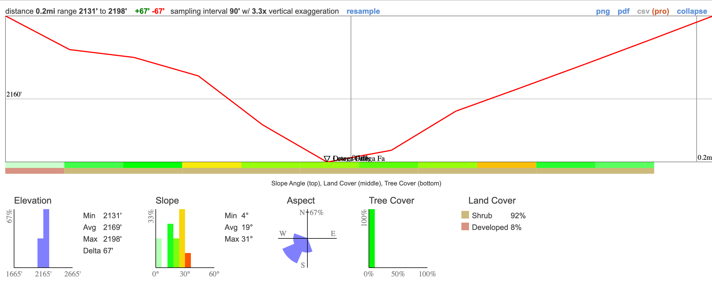
- Miles: 0.2
- Time: 25 min
- Difficulty: Easy
- Best Season: Spring
- Elevation Gain: 67 ft
- Max Elevation: 2198 ft
- Type of Trail: Out & Back
- Parking Lot: Turnout, Fits 20+ cars
- Dogs: Allowed on a leash
- Restrooms: Not Available
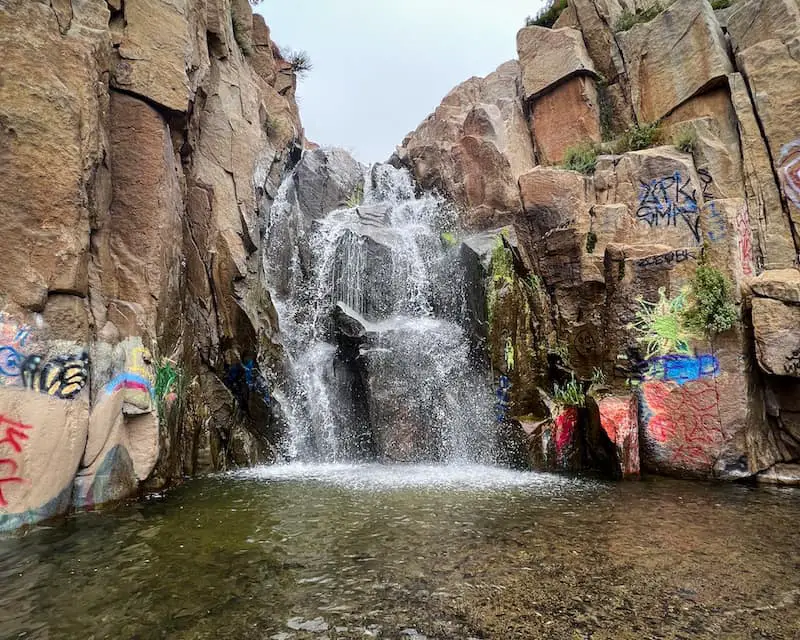
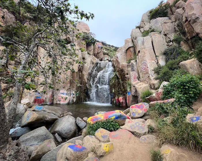
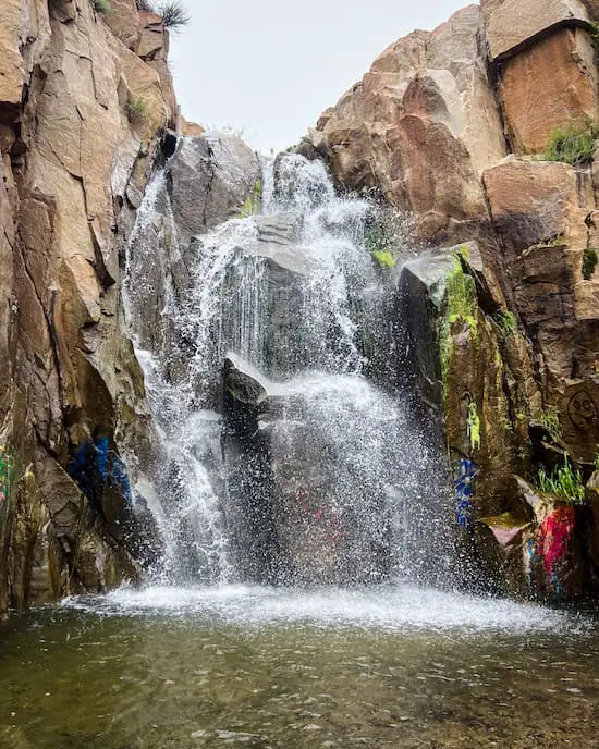
Excluding the plethora of graffiti, Ortega Falls is exceptionally stunning. Unlike most waterfalls which look like a thin stream flowing off a cliff, this waterfall is wide and roaring (assuming there’s plenty of water of course). There are actually two large falls on this trail.
The larger of the two waterfalls, which is known as Ortega Falls and measures a decent 40 feet high, is located right above the smaller one that I’ll call Lower Ortega Falls. In addition, much smaller falls can be found all throughout the creek. There is no shade on this trail. Hence, a hat and water are highly recommended. It is possible to climb to the top of the falls, but the pool is not deep enough for cliff jumping.
Were you looking to hike in the Riverside area? Check out more trails by clicking the link below:
Ortega Falls Trail Map
Directions
Click the link below to be redirected to the Ortega Falls Trailhead via Google Maps.
Ortega Falls Day Use Site, 33288 CA-74, Lake Elsinore, CA 92530
Helpful Links
SoCal Adventure Pass (required for parking in CA mountains)
Ortega Falls Trail
The trailhead is located on the west side of Highway 74, also known as Ortega Hwy. I hopped on the trail and wasted no time.
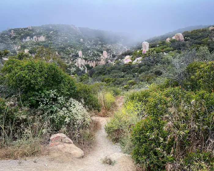
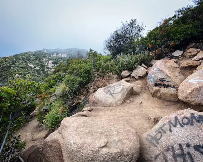
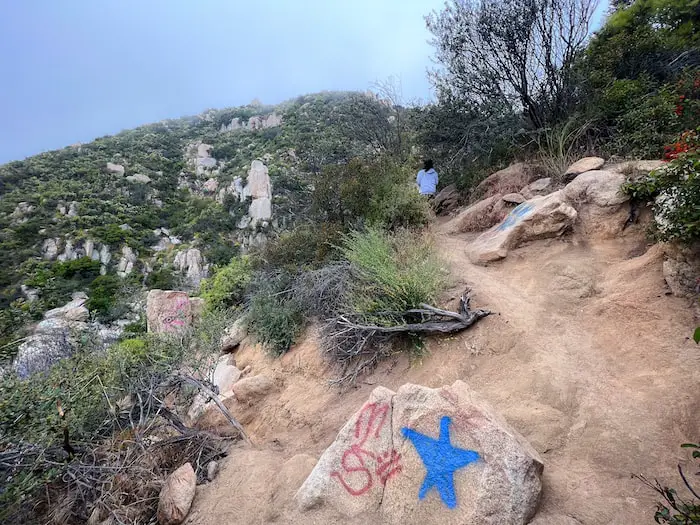
This trail splits many times, but don’t worry, I’ll make it super easy for you to get to the primary waterfall. Simply stay to the right every time you come to a trail split.
By doing so I arrived at Ortega Falls quickly and easily.
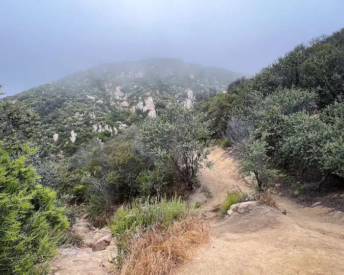
Below is an example of a split. The trail to the right is actually a bit tough to see.
The trail to the main falls is not at the bottom, lefthand side of the image. It’s straight ahead and required a bit of boulder scrambling, but nothing too extreme.
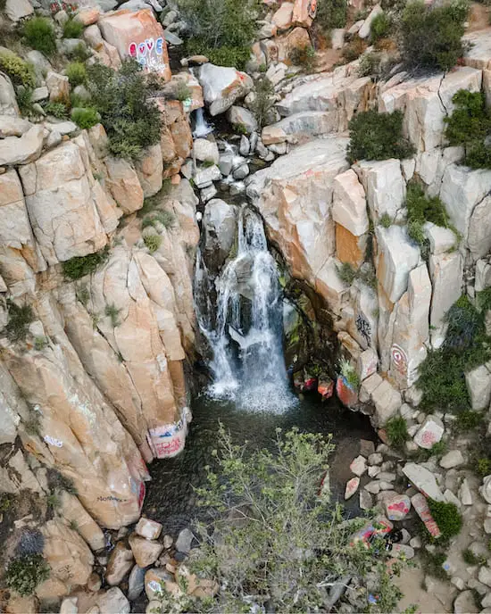
Once again I found myself in front of a fork. However, I wanted to explore the base of Lower Ortega Falls, so I took the trail to the left where the white arrow is painted.
When I got to the canyon floor, I saw one of many small falls flowing between two large boulders, but I wasn’t ready to give up, so I climbed the boulder on the right.
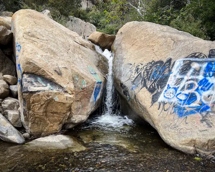
Unfortunately, I quickly found out that it’s very difficult to get to the base of Lower Ortega unless you’re willing to go for a swim.
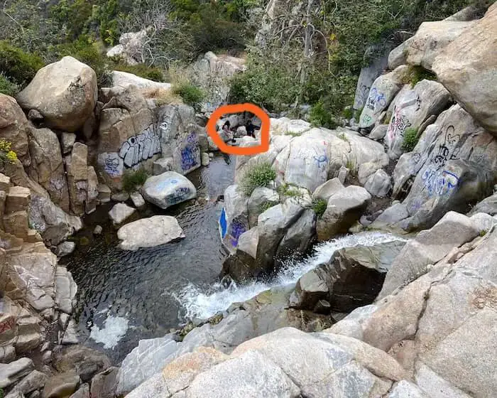
Notice the people in the shot below? That’s as far as I was able to get, and since the creek flows at a 90-degree angle, you can’t even see the falls flowing over the cliff, but hey, it was worth a try.
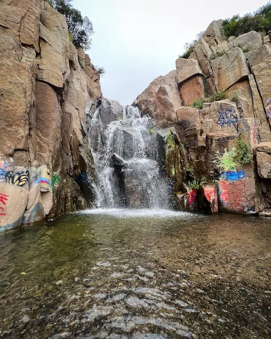
(I took the shot below after I had arrived at the main falls).
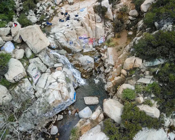
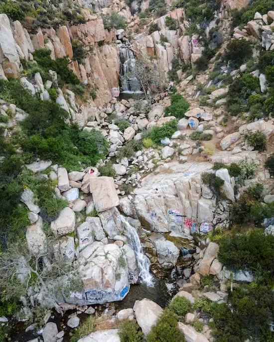
Here’s another shot of Lower Ortega that I took with my drone.
Betcha haven’t heard of the giant pumpkin rock in Riverside County. It gets a new coat of paint every year before Halloween so plan accordingly!
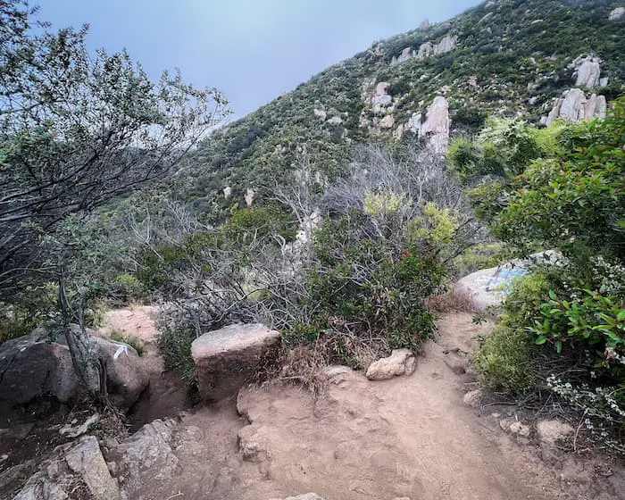
I made my way back to the main trail and found myself at another split yet again. The trail to the left in the image below ends at the dirt ledge to the right of the falls in the image above. However, I stayed to the right this time.
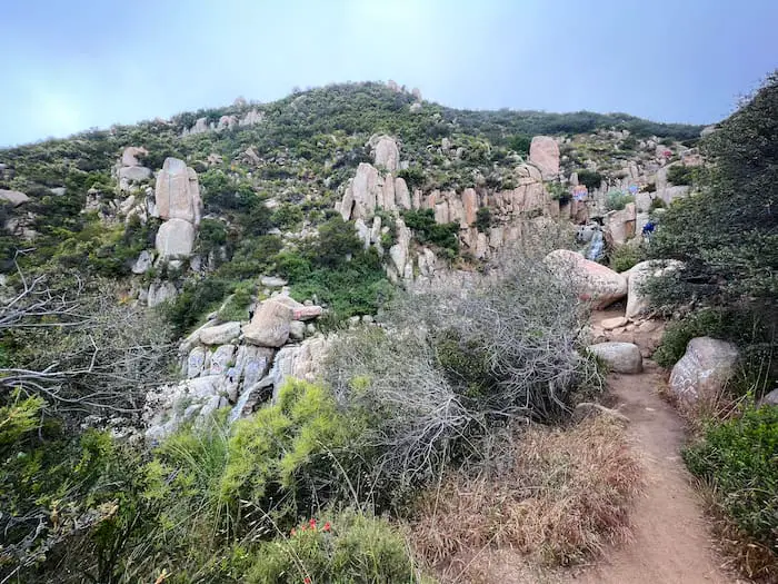
There was a point when I walked around the bend and was able to see both waterfalls from the trail. It got my heart pumping. All I could think about was getting to the main waterfall.
When I finally arrived at my destination, I was pleasantly surprised at the size of the waterfall, as it looks a lot smaller in pictures. If only people had respect and hadn’t covered it in graffiti.
Fun fact, Ortega Falls and Highway are named after Sgt. Jose Francisco Ortega, a Spanish sergeant who led the scouts of the 1769 Portola expedition. They were the first non-native people to see the area.
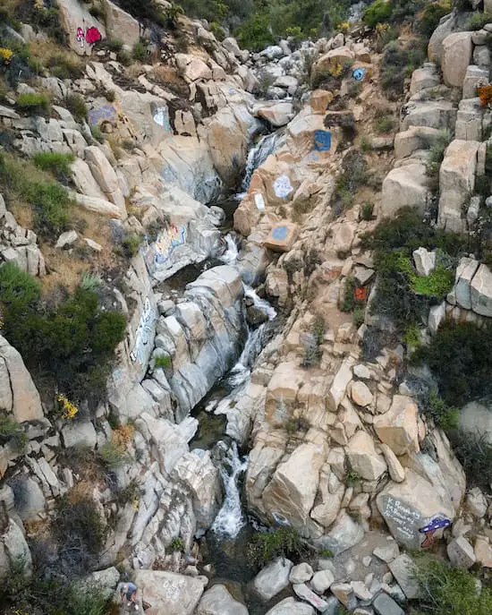
Once I arrived at the falls, I was able to walk a short distance to the top of Lower Ortega. The drone shot below shows how close both falls really are.
A beautiful little grotto is located right above the main waterfall….but wait, there’s more.
Further up the creek is a whole host of little cascades, which can be accessed by climbing up the right side of Ortega Falls, zig-zagging their way down the canyon.
Want to hike a trail closer to the city but still within Riverside County? Check out Mt Rubidoux, a 2.7-mile trek to a peak with breath-taking panoramic views, especially during the sunset.


