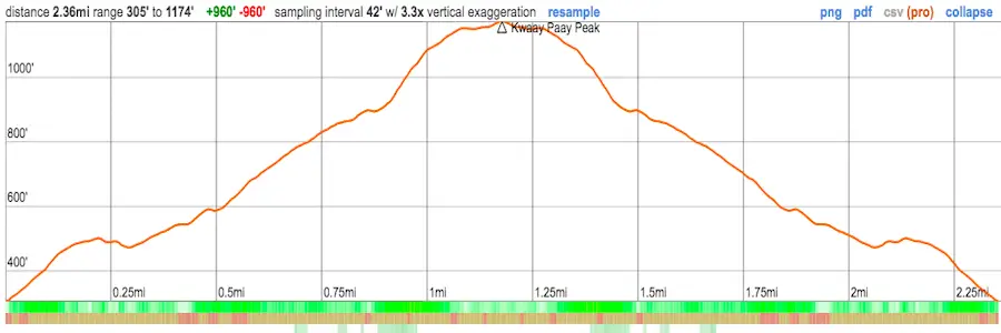
Kwaay Paay Peak Trail: A Hike with Panoramic Views

Share With Your Friends!

Distance

2.3 Miles

Time

~1.5 Hrs

Difficulty

Moderate

Elevation Gain

875 ft

Season

All Year

Bathrooms

No

Kwaay Paay Peak is a 2.3-mile trail located in Mission Trails Regional Park near Santee, California. It’s considered to be a moderate hike because of steep inclines. The elevation gain is 875 feet with views of San Diego and the ocean. Dogs are allowed on leashes.


Map of Kwaay Paay Peak Trail

Directions & Parking

To get to the Kwaay Paay Peak trail, I took the I-5 S to the I-805. The trailhead and parking area will be on Father Junipero Serro Trail in Santee, CA.

Click here for Google Maps directions.

There are a few parking lots on this road, but you can pretty much park anywhere along the street. There’s plenty of room.

Trailhead to Kwaay Paay Peak

The Kwaay Paay Peak trailhead begins on the side of the road and is pictured at the bottom.

I came on a Thursday morning, which means fewer people on the trail.

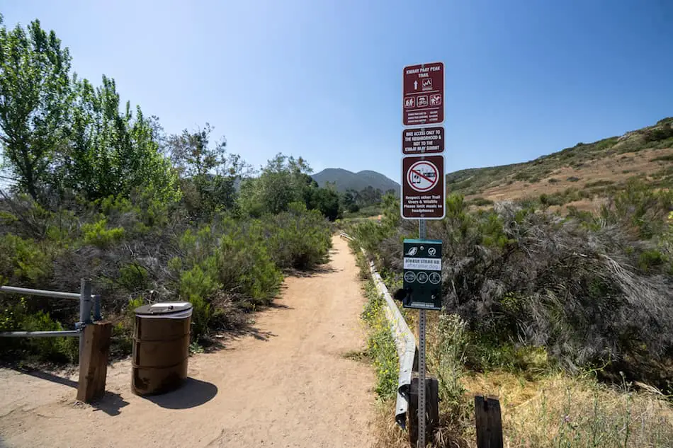
A few feet away, there are markers and signs pointing to the trail, so I continued on the right.

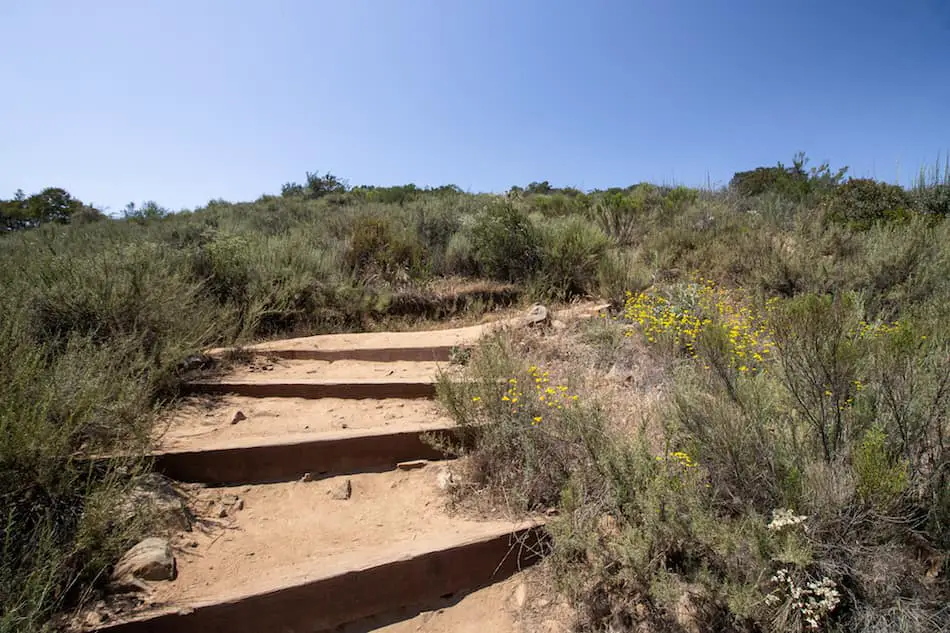
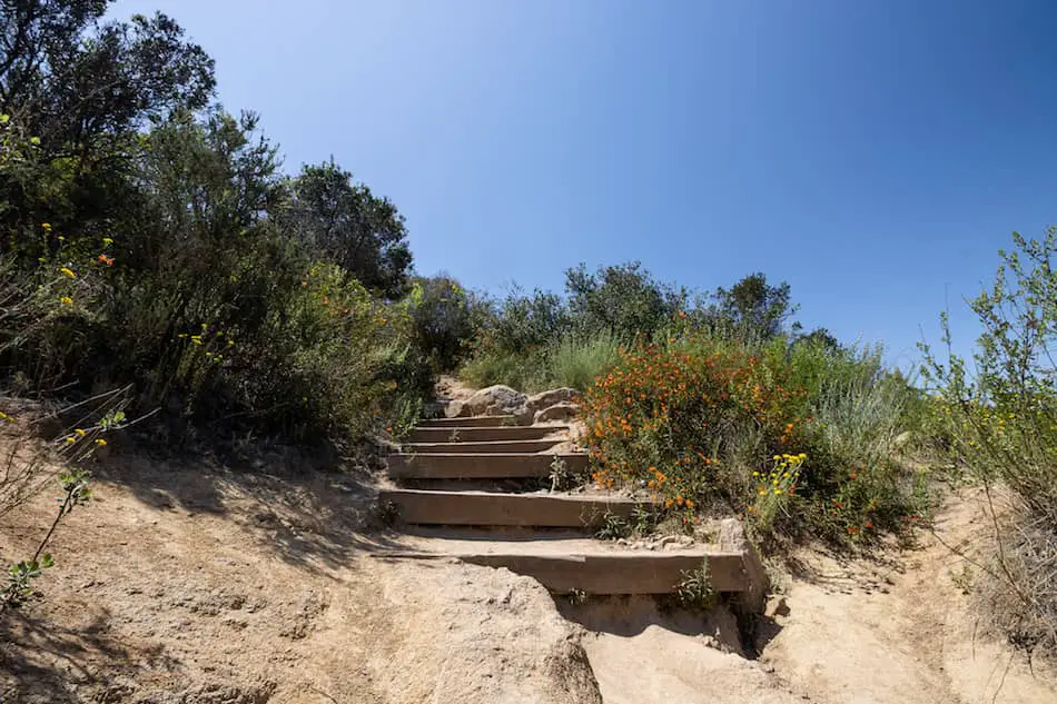
There are various large steps on this trail, which explains the quick ascend up to the peak.

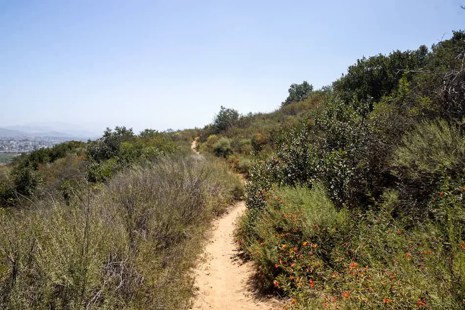
Further up the footpath, I saw more and more beautiful wildflowers of various colors. Orange, red, and purple flora made this mostly-dirt trail a lot more vibrant.

I was already breaking a sweat at this point. Mind you, it was a little past 12 PM and the sun was shining very brightly above me with little to no shade.

The last section, about 0.8 miles left, requires a good cardio workout and heart-pumping action up steep steps.

You’ll be sure to break a sweat so bring plenty of water.

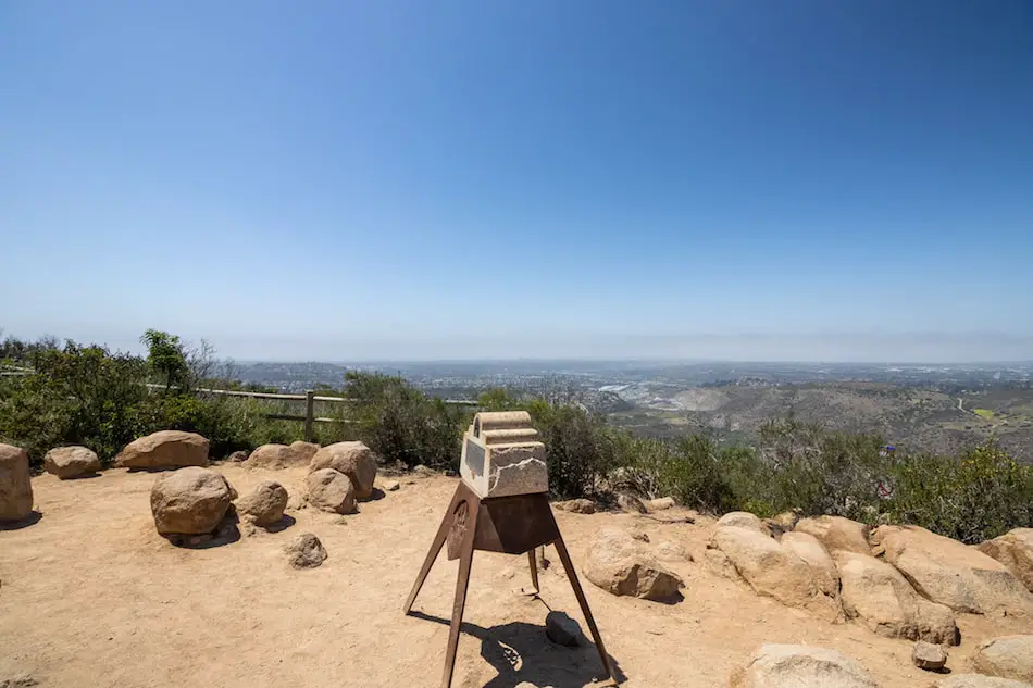
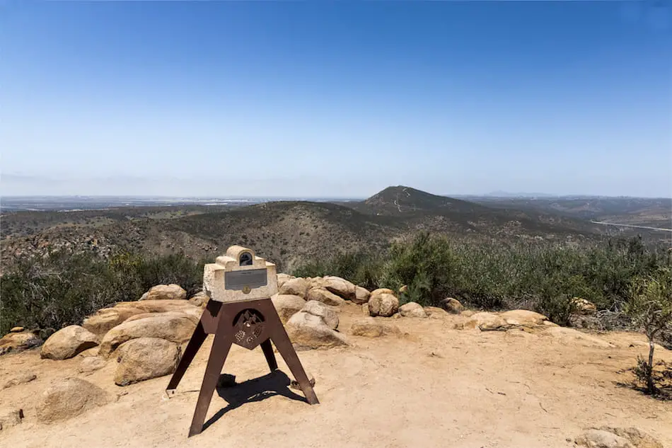
After a few water breaks and heavy breathing,  I was rewarded with an amazing panoramic view of San Diego, the beach, and the surrounding mountains.

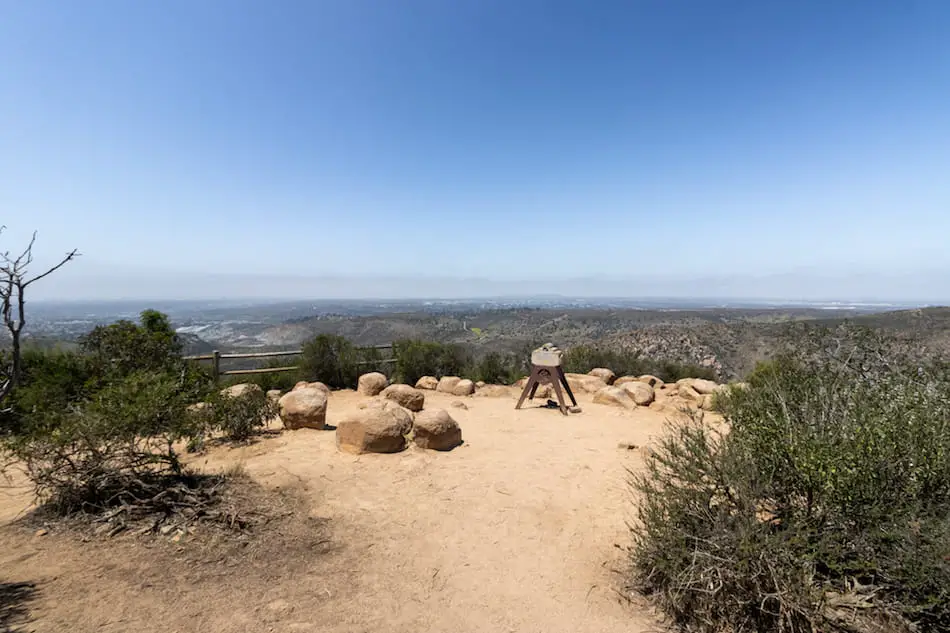
Here’s a closer shot. This left-side shows views of downtown San Diego and the beach. Unfortunately, it was hazy that day.

To the right, you can see North and South Fortuna mountain in the back.

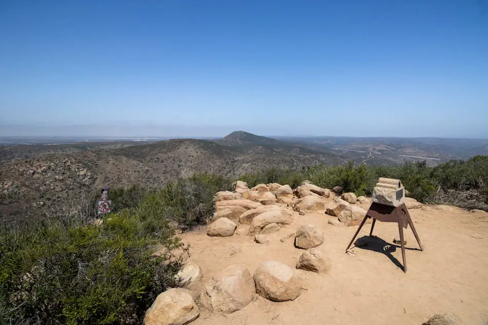
That highest peak is North Fortuna. Typically, they’re both done as a loop.

Yes, I’ll be hiking that one soon!

The hike to Kwaay Paay peak was a little tiring but very short with awesome panoramic views.

I’m sure it looks even better during sunset!

More to Explore!

[favorite_button]
Stoddard Peak Hiking Guide: Map, Directions, & Fun Facts

Stoddard Peak Hiking Guide: Map, Directions, & Fun Facts

5.9 miles Time: 2.5 Hours Roundtrip Difficulty: Moderate Season: All Year Elevation Gain: 1224 ft Peak Elevation: 4611 ft Trail Type: Out & Back Restrooms? Not Available Dogs Allowed? Yes, on a leash Take a windy dirt road up Stoddard Canyon to be rewarded with...

[favorite_button]
Henninger Flats: Hike to a Scenic Forest Nursery

Henninger Flats: Hike to a Scenic Forest Nursery

Distance: 5.04 miles roundtrip Time: 3.5 hours Difficulty: moderate Best Season: All year Elevation Gain: 1531 ft Max Elevation: 2543 ft Type of Trail: Out & Back Dogs: Allowed on a leash Restrooms: Available at the flats Feel like learning a bit of local mountain...

[favorite_button]
Sunset Peak Trail Guide: 2 Routes + Maps & Directions

Sunset Peak Trail Guide: 2 Routes + Maps & Directions

Distance  7.2 MilesTime 3.5 HrsDifficulty  Moderate Season All Year Elevation Gain 1281 Ft Dogs allowed on a leash Out & Back Trail No Restrooms available You can't go wrong with a trail in the Mt Baldy area. Lower temperatures, possible snow, and amazing views....

[favorite_button]
Etiwanda Falls: San Bernardino’s Most Popular Waterfall

Etiwanda Falls: San Bernardino’s Most Popular Waterfall

Distance 3.19 MilesTime2 HrsDifficulty ModerateSeasonAll YearElevation Gain803 Ft No dogs allowed Out & Back trail Restrooms not available Take a stroll through the foothills of the Angeles Forest and into a woodsy canyon where you'll be rewarded with a beautiful...

Hello, There!

I’m Phillip, and just like you, I feel very passionate about California and the outdoors. After many years of exploring amazing and hidden places, I thought I’d share them with you. Life goes by fast so get out there and enjoy it.  

Sign Up For Bonuses

Want to stay up to date with all the latest hikes? Join our community by clicking the link button below!

Join Us On Insta!

Legal Info

We only recommend what we use. This site is a participant in the Amazon Services LLC Associates Program, an affiliate advertising program designed to provide a means for sites to earn advertising fees by advertising and linking to Amazon.com. However, no company pays us to share these products with you. If you decide to purchase a product via one of our links, we will recieve a small compensation, which in turn, helps us to keep making videos and posts to share with all of you.