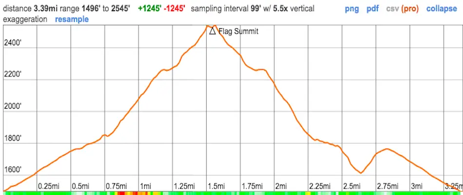
Distance
3.39 Miles
Time
~1.5 Hrs
Difficulty
Moderate
Best Time to Visit
Oct – Early June
Elevation Gain
1245 Ft
My experience at Bell View Trail was one of peace and solitude. We only encountered two groups of people, granted it was during the week. Although it’s not a very grandiose peak, the views are nevertheless amazing. I was able to see the golden hour sun rays reflecting off the beautiful Pacific Ocean and larger mountains towering over us.
The Bell View Trail to Flag Summit is a moderately difficult 3.39-mile roundtrip hike located in Trabuco Canyon within the Santa Ana Mountains. Most of the trail consists of a sunny dirt road with a decent elevation gain of 1245. Dogs are allowed, but must be on a leash.
Map of Bell View Trail to Flag Summit
Directions & Parking
For directions on your Google Maps, click here.
The trailhead is on Robinson Ranch Rd, near Trabuco Canyon and Rancho Santa Margarita. There is no parking lot, but there’s plenty of parking along the street.
Here are more OC hikes you’ll love!
Hiking Bell View Trail To Flag Summit
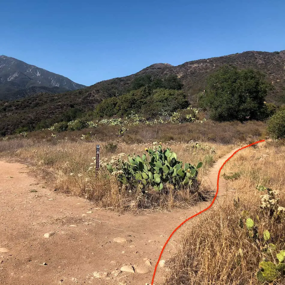
The hike begins in a tiny green park on the side of the road. Parking on the street is allowed. You’ll see two trailheads so make sure to take the one on the left.
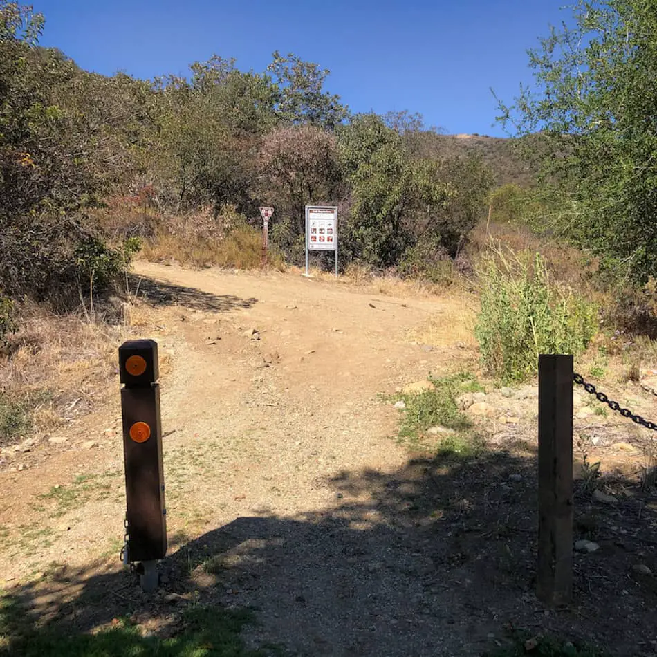
The majority of the hike will consist of a dirt road but don’t underestimate this road as it can get pretty steep in some sections as you get closer to Flag Summit.
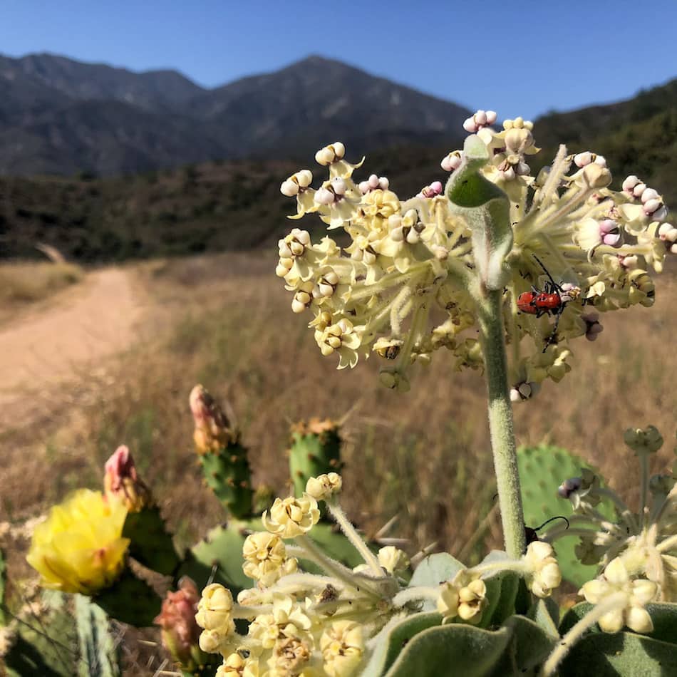
There are tons of cacti and succulents along the trail. Definitely keep an eye out for some unique-looking plants and insects.
I’ve yet to see any like the ones here at Trabuco Canyon. We spotted giant red beetles and bright purple flowers to name a few! (More on those flowers later).
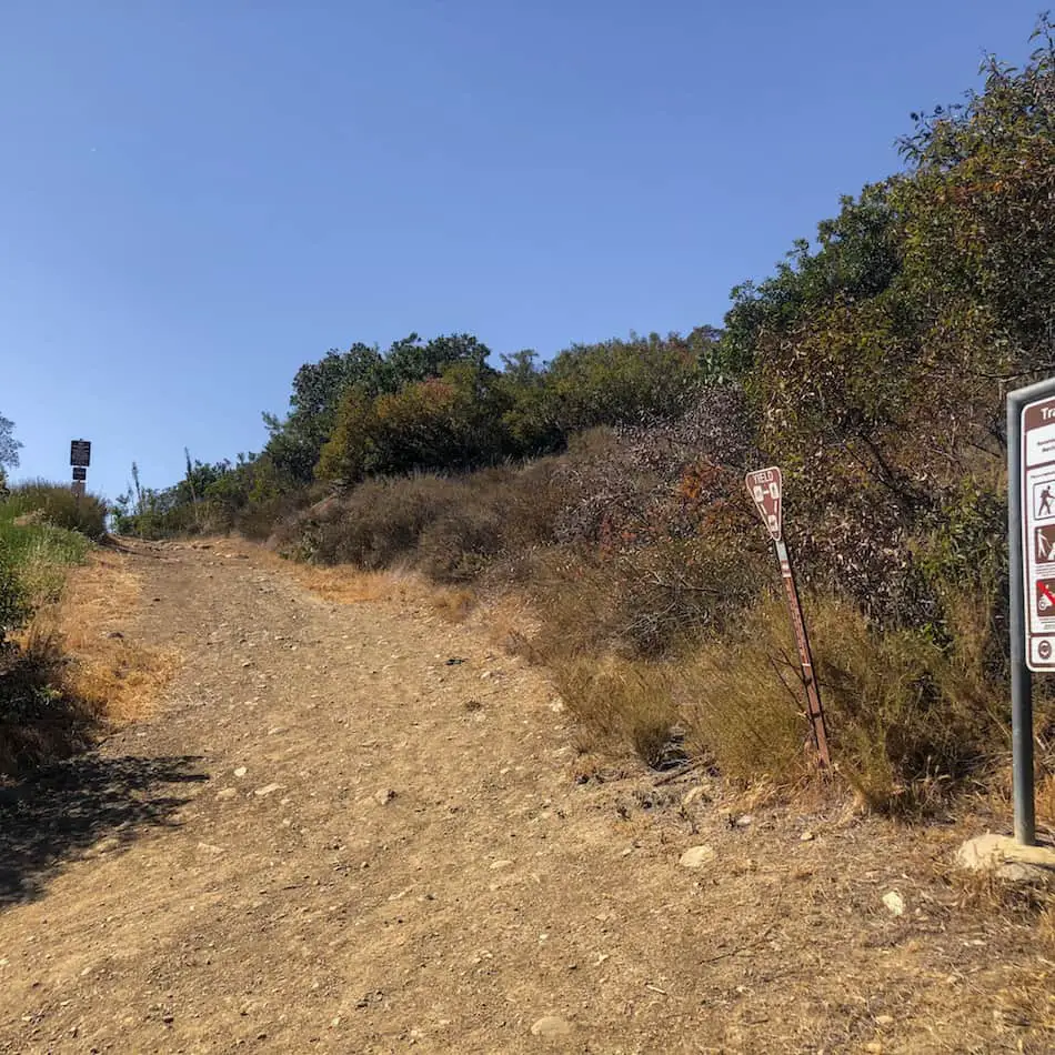
After the two big “switchbacks” you’ll come to a road split. You can head either left or right, but I highly recommend taking a right because this section of the trail becomes a single track with a bit more shade.
You can take the route to your left on your way back from the summit. (Need help? Check out our Map!)
The single track is denser with vegetation. Hence why it’s a more interesting route.
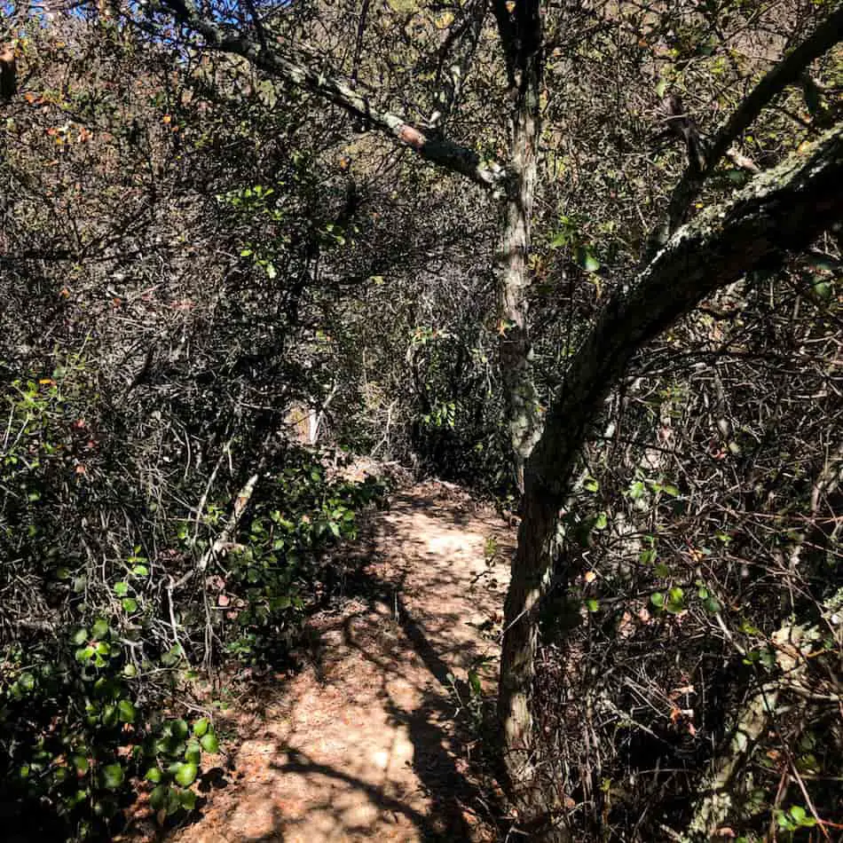
The single track comes to an abrupt end by merging with the dirt road from the first section of the hike.
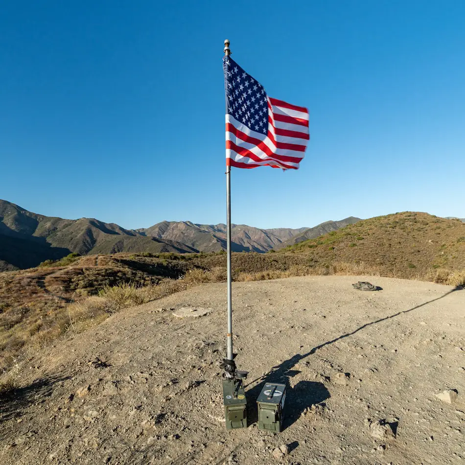
You should be able to clearly see the flag from this point.
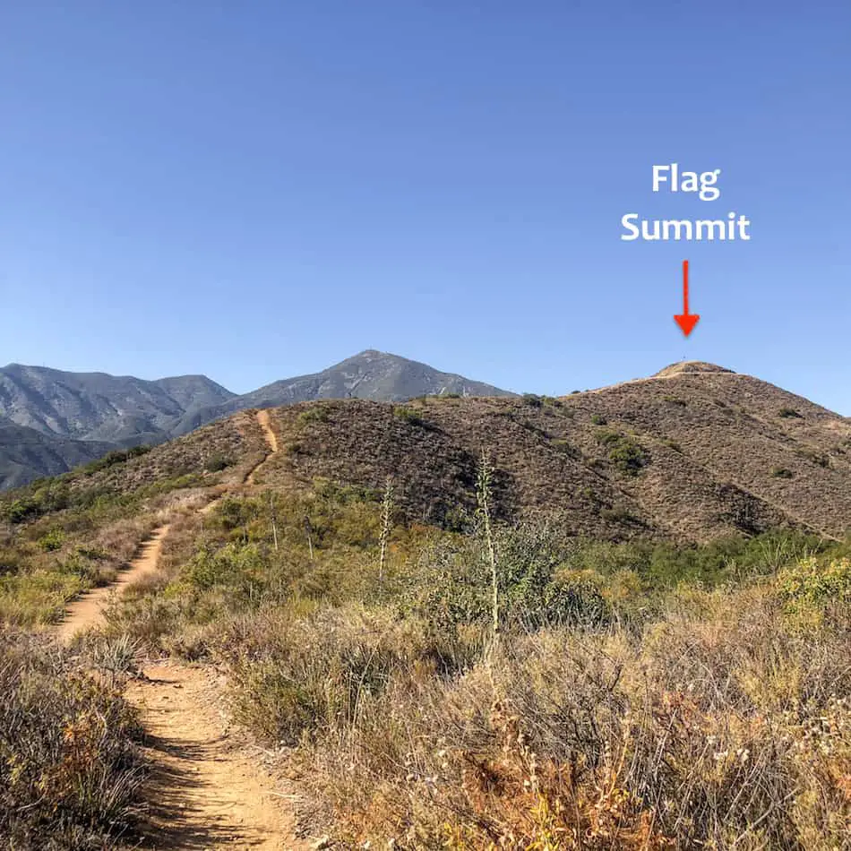
Almost there, just one last stretch!
The view at the top is breathtaking, to say the least. Even on a hazy day, you can clearly see the ocean and the cargo ships making their way to the Long Beach Port.
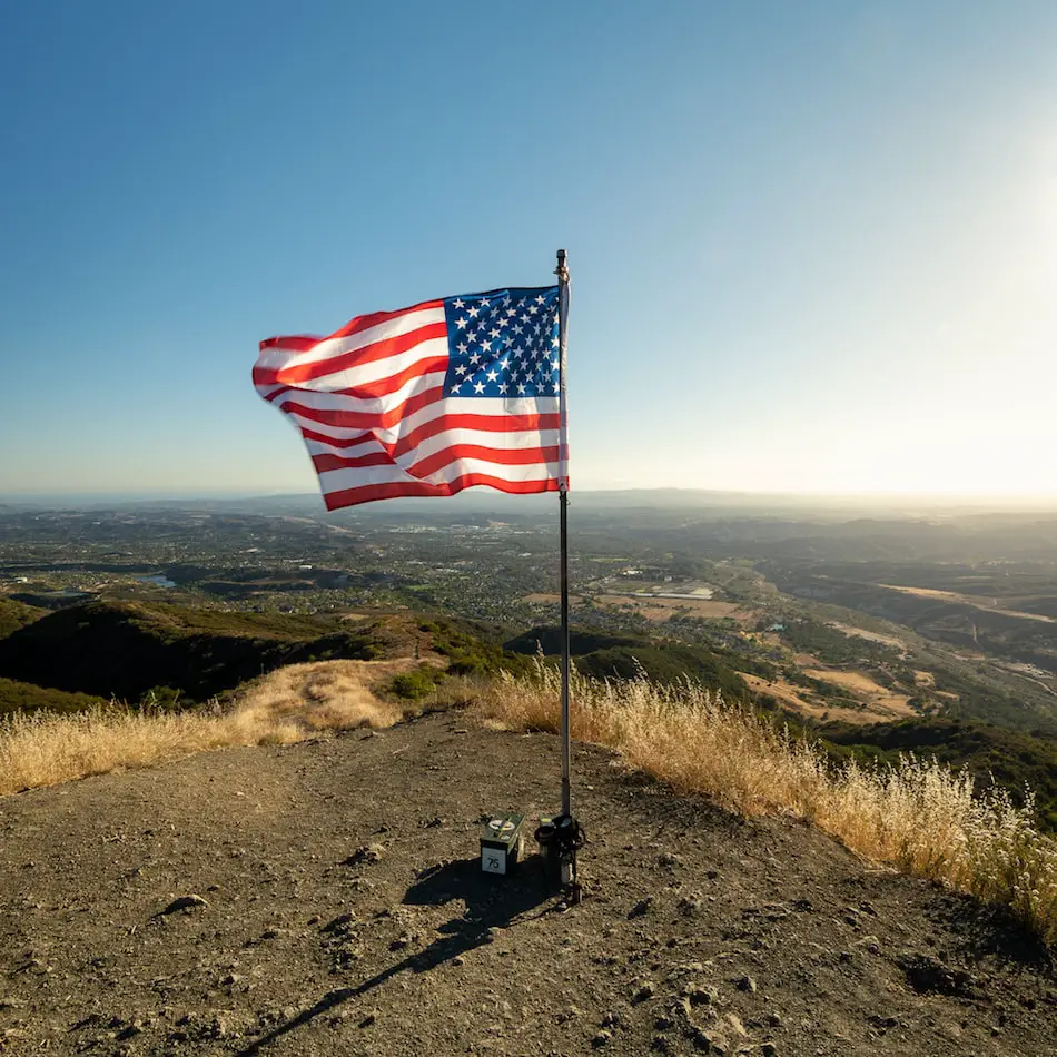
If you turn your back to the sea you’ll find yourself face to face with a majestic mountain range towering over you. You can’t get enough regardless of where you look.
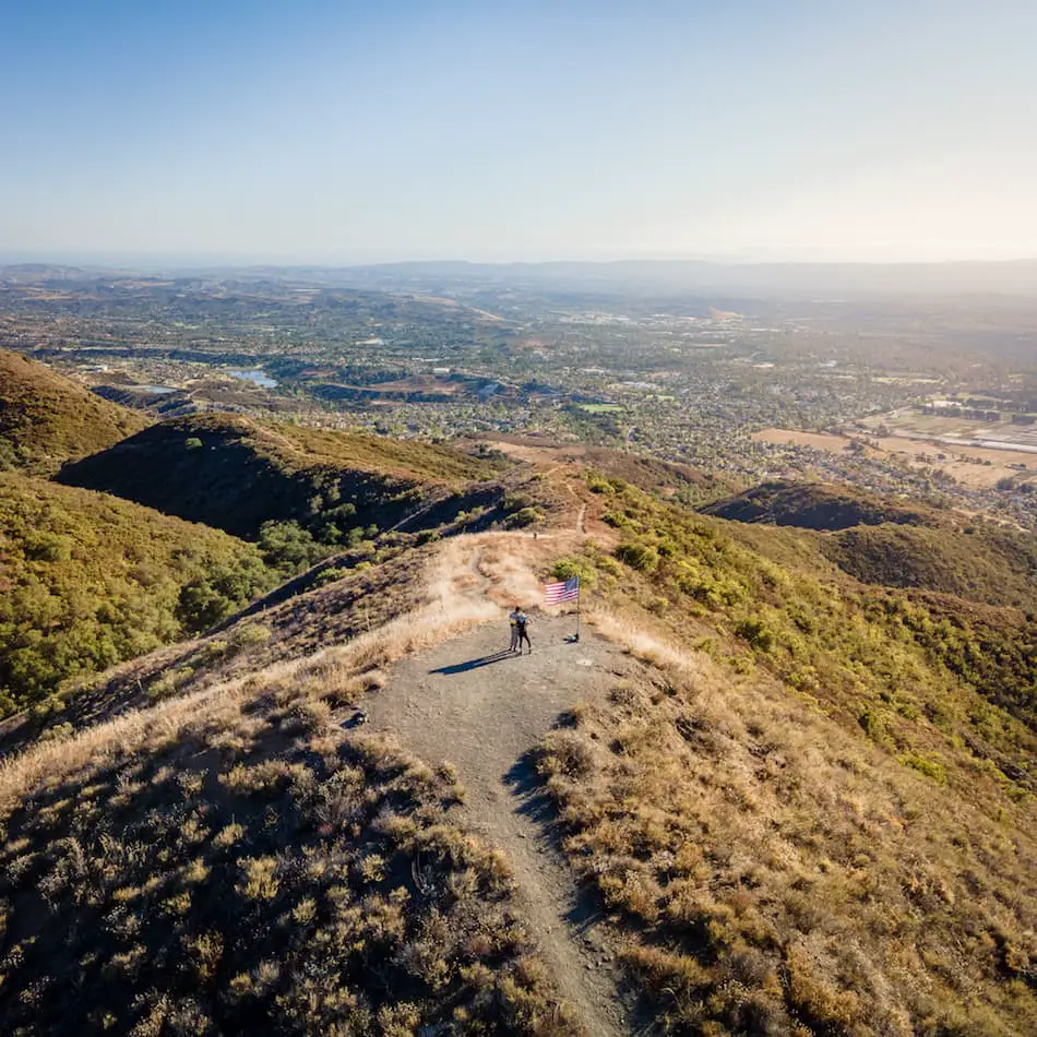
One last aerial shot of the summit. Look at that beautiful golden sunset.
I really enjoyed this hike in Orange County. There were tons of beautiful and unique wildflowers and nice views.
This is a great hike if you’re looking for something a little more patriotic around Independence Day!


