
Distance
5.2 Miles
Time
2 Hrs
Difficulty
Easy
Season
All Year
Elevation Gain
226 ft
Not a fan of Socal’s brutal heat? Visit Upper Newport Bay Nature Preserve to enjoy a beautiful coastal hike surrounded by white cliffs and amazing sunsets.
The scenic preserve is a 5.2-mile loop hike located in Newport Beach featuring the upper half of Newport Back Bay, but can be easily shortened or elongated to one’s preference. Its low elevation gain and cool temperatures makes it ideal for hikers of all skill levels regardless of the time of year. Its peak beauty, however, is during the spring, when all the flora has re-blossomed.
- Dogs are allowed but must be leashed
- The trail is both a loop and out & back
- Restroom available
Upper Newport Bay Preserve Trail Map
Upper Newport Bay Preserve Address
Click on the link below to be redirected to the trailhead.
2301 University Dr, Newport Beach, CA 92660
No permits or passes are required.
Looking for hikes in Orange County? Check out these trails!
- Top of the World at Laguna Beach: Beautiful Sunset Views
- Dripping Cave Trail: Old Secret Hideout For Bandits
- Bolsa Chica Ecological Reserve: Wetlands in HB
Upper Newport Bay Nature Preserve Hike
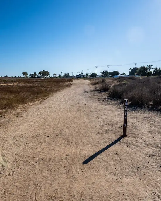
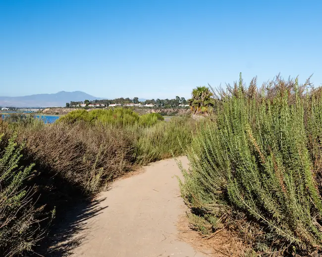
I began by first hiking the loop portion of the trail called the West Bluff.
However, if you want to save the best views for last, I suggest starting via the out and back and ending with the loop.
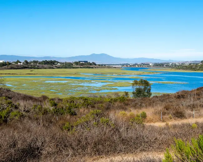
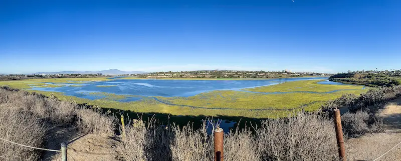
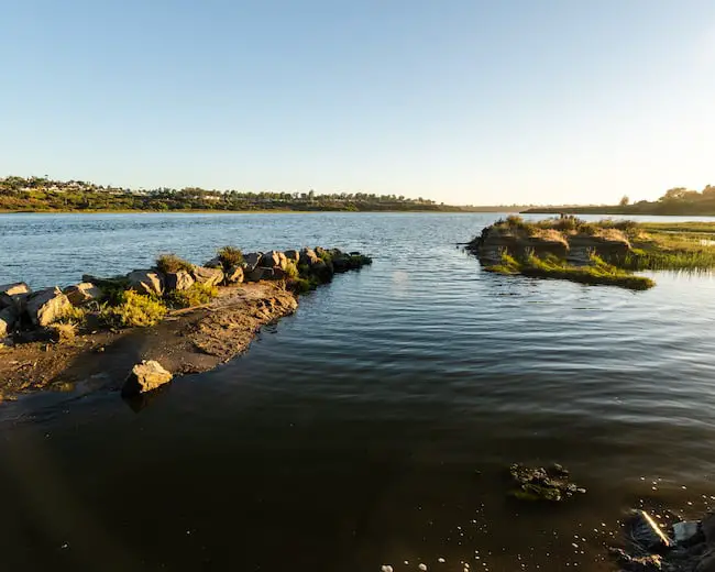
Almost immediately you’ll be rewarded with amazing views of the Cleveland National Forest and the wetlands in the foreground.
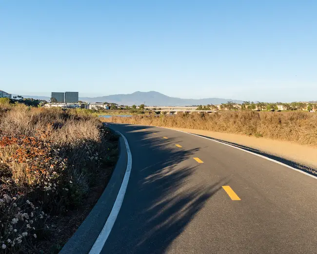
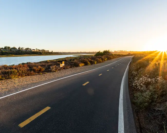
Although the majority of the loop consists of a dirt trail, a small section requires hopping onto the bike lane, so keep an eye out.
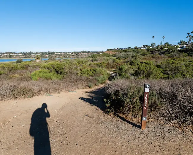
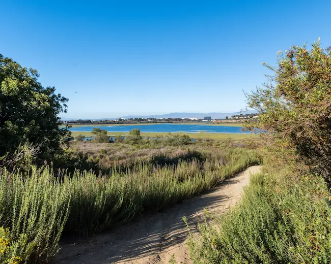
Switch onto the constellation trail to begin looping around. This is where the trail gets more interesting.
If you’re lucky, you may spot the Peregrine Falcon. I got to see it a couple of times during the same hike, so it’s very possible you will too!
Read More: 11 Best Hikes in SoCal
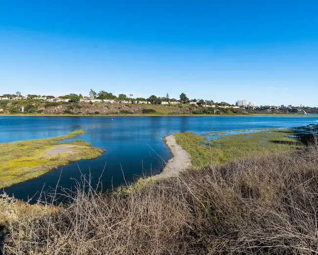
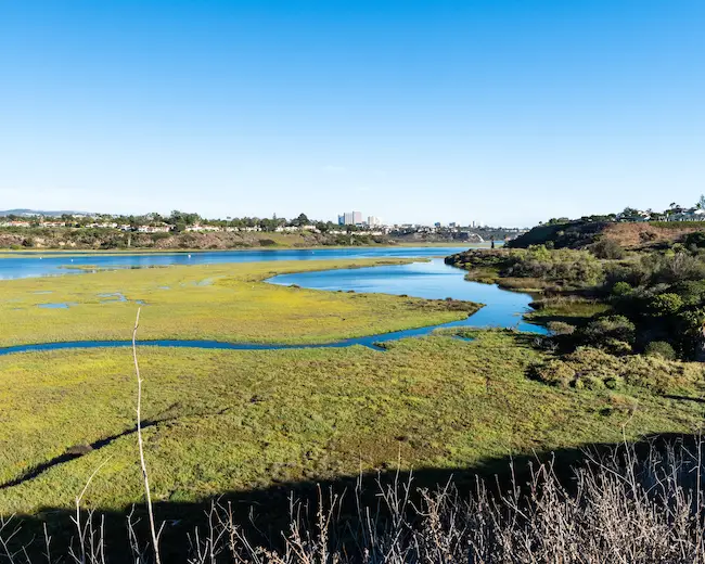
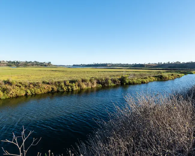
The shot below shows the southern region of Newport Back Bay, but unless you’re looking to hike 11 miles, this is where you’ll begin heading back towards the parking lot and onto the second portion of the trail.
Read More: Top 5 Hiking Trails in LA
If you were to turn your head north from the same location as the image above, you would see the entire picturesque estuary peaceful glimmering in the sun’s natural light.
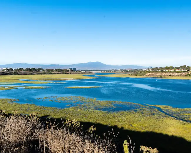
And to the left, you’d see the king of the San Gabriels, Mt Baldy, towering above the range.
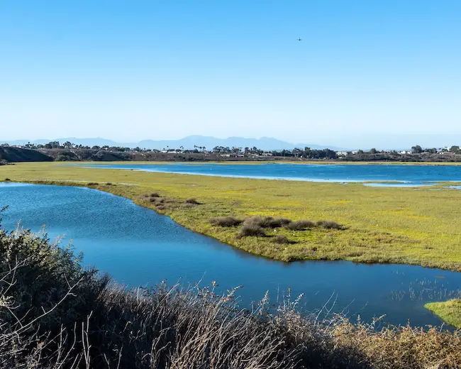
After passing a little wooden bridge, the trail will have multiple vantage points with amazing views of the entire marsh.
Read More: Eaton Canyon Falls 2022 Guide
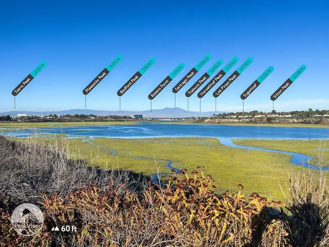
Huge shout out to Peak Visor once again for their awesome app (not affiliated, I just really like their app).
You can see Old Saddleback, which consists of the two largest peaks in the Santa Ana Mountains known as Santiago and Mojdeska Peak, the former being the taller mountain.
Read More: 7 Best Hiking Trails in Pasadena
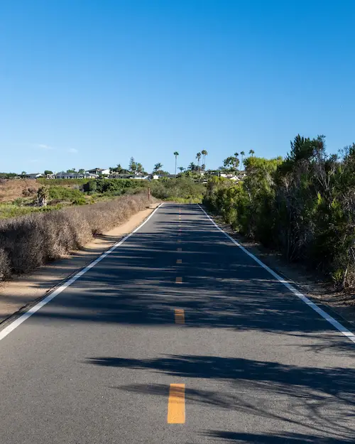
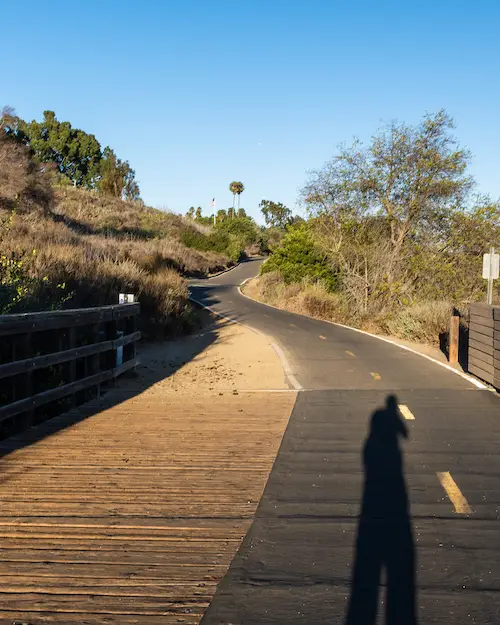
The trail doesn’t actually lead you back to the exact location of the parking lot. Rather, it leads you alongside the Santa Ana-Delhi Flood Control Channel and onto a bridge that runs across it.
Once you hop on the bridge, the rest of the hike is via the bike lane until you hit the street Jamboree. From there, switch onto a dirt road that parallels the street and ends at the water’s edge.
Read More: 7 Must-Do Waterfalls in SoCal
Once you’ve reached this point, take a moment to enjoy the views, then head back the way you came.
Read More: 3 Best Hikes in Laguna Beach
Upper Newport Bay Science Center
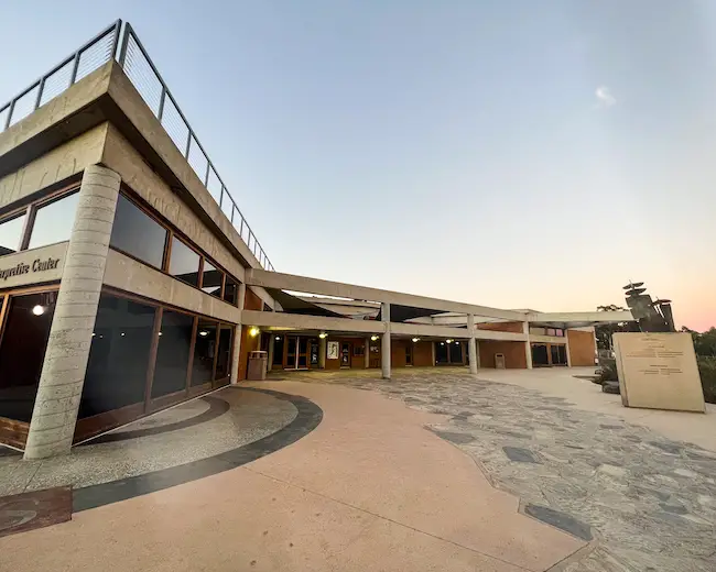
The Back Bay Science Center is currently open to the public. They’re located at:
600 Shellmaker Rd. Newport Beach, CA 92629.
Phone number: 949-640-9959
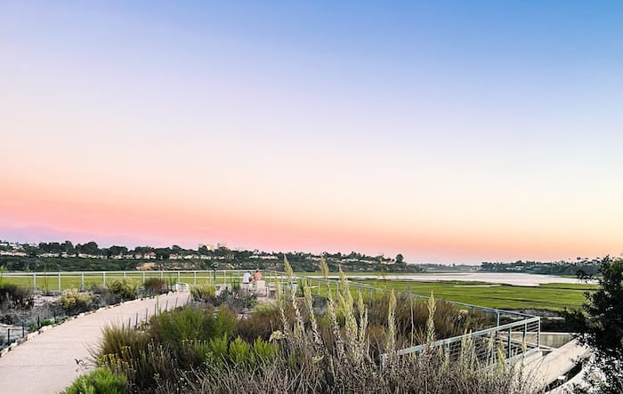
One of the very cool features of the science center is its rooftop lounge, which allows you to enjoy the sunset with a view of the entire wetlands!
You don’t even have to hike as it’s located right next to the parking lot.
Other Fun Activities At Upper Newport Bay Nature Preserve
- Fishing
- Bird watching
- Kayaking
- Horseback riding
- Cycling
- Boating
- Paddle Boarding
- Jogging
Upper Newport Bay Nature Preserve History
I can’t start from the very beginning without briefly mentioning the geological formation of the area. The white cliffs were formed 15 million years ago, while the bay was carved by the Santa River during the Pleistocene Epoch’s glacial era, which ended around 9000 BC.
Everything from mammoths, giant sloths, and bison have been founded in the reserve, which up until 1862, used to flow directly into the Pacific Ocean. Today you can enjoy over 200 species of birds, as well as thousands of plants, fish, and other wildlife, some of which are sadly endangered.
The first sign of human life in the area dates back to sometime around 7000 BC. The Tongva people, also known as Gabrielinos because of their association with the San Gabriel Mission, inhabited the area from 2000 years ago to when the Spanish arrived.
During the Spanish and Mexican eras, the surrounding land was mostly used for grazing by cattle or sheep, or what John Muir referred to as hoofed locusts.
After the annexation of California into the Union, Rancher James Irvine (same guy as the city of Irvine) bought the bay in 1864, and in 1870, the area was used as a bay. Hence the name new port.
The fight to preserve Upper Newport Bay began in the 1960s when concerned citizens successfully managed to protect the 752-acre preserve from developing into a water-skiing area.
Still hungry for more Upper Newport Bay knowledge? Click the link to download the very thorough Upper Newport Bay Ecosystem Restoration Feasibility Study PDF by the US Army Corps of Engineers.


