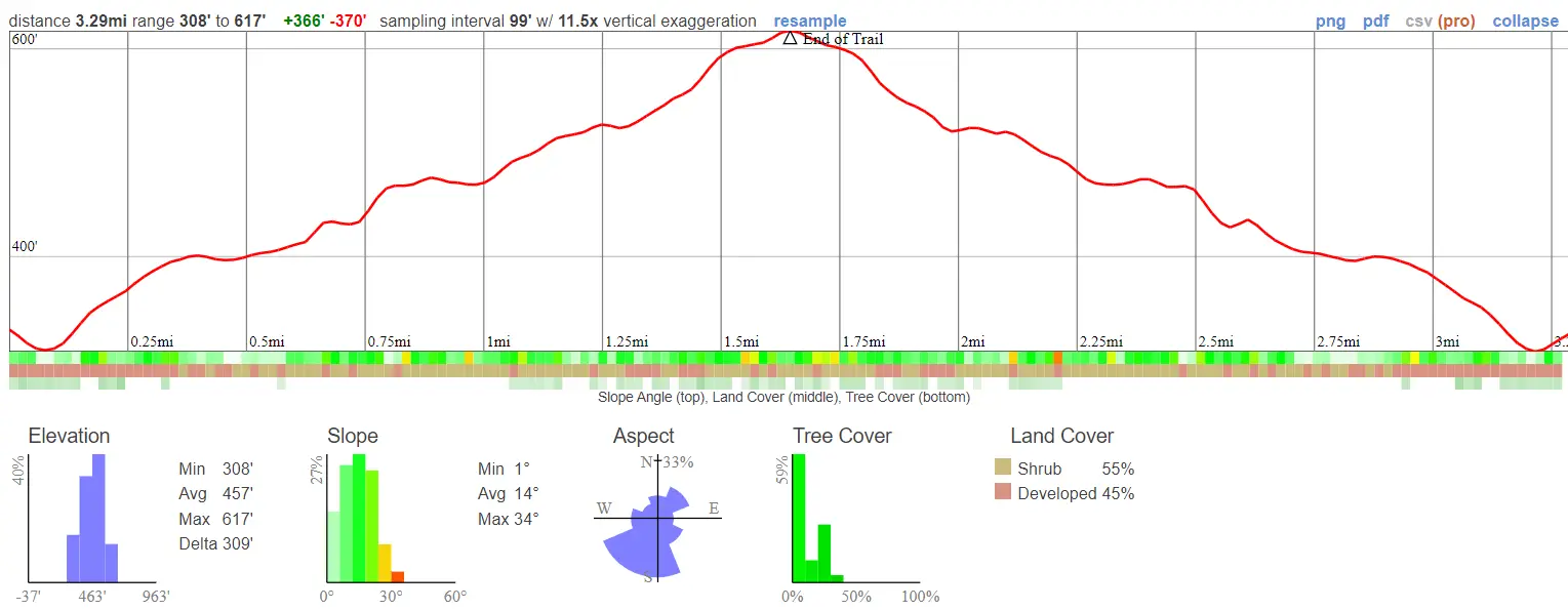
- Miles: 3.3
- Time: 90 min
- Difficulty: Easy
- Best Season: All Year
- Elevation Gain: 370 ft
- Max Elevation: 617 ft
- Type of Trail: Out & Back
- Parking Lot: Fits ≈ 20 cars
- Dogs: Not Allowed
- Restrooms: Available At The Trailhead
- Trail Popularity: High
- Pics Taken On: Aug 9, 2023
There exists in the heart of Whittier a preserve which unfortunately, is mostly unknown by the public…until now.
Sycamore Canyon Trail is a short and easy trail located in the Puente Hills Habitat Preservation. Since it’s smack dab in the middle of a concrete jungle, it’s more than ideal for a quick nature recharge right before or after heading to work. The beginning of the trail consists of hiking on Sycamore Canyon Rd, which offers little shade and is mostly dry. However, the road later turns into a dirt trail and the scenery becomes almost jungle-like.
Want to browse through more hikes in Los Angeles County? Click the link below!
Sycamore Canyon Trail Map
Address & Directions
Click the link below to be redirected to the Sycamore Canyon trailhead via Google Maps
5040 Workman Mill Rd, Whittier, CA 90601
Helpful Links
HabitatAuthority.org (Puente Hills Habitat Preservation Site)
Preserve Number: (562) 945-9003
Preservation Hours:
June to September: 9am – 6pm
October to May: 9am – 5pm
Make sure your car is out of the parking lot when they close the preserve, otherwise you’ll get a $100 – $150 fine.
Sycamore Canyon Trail
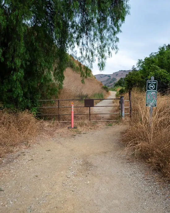
The trail begins at a dirt lot. If you have to use the restroom, now is the time as there is a porta potty at the lot.

I made a left as I hopped on to Sycamore Canyon Rd.

And then a right to stay on the road.
The trail seems pretty dull in the beginning but don’t be fooled, the scenery will definitely change.

I made my way through the gate which marks the beginning of the preserve. Remember, no dogs, bikes, or drones are allowed on any preservers as they can interfere with wildlife.

The tree below is one of the few spots which offers protection from the sun, at least for the beginning of the trail.

I noticed ruins on the left side of the road, but unfortunately, I couldn’t find any information on them.
These ruins may be unimpressive, but that’s certainly not the case for the abandoned Nazi ruins in the Santa Monica Mts. Check out the hike, you’ll definitely enjoy it!

Shortly after, I spotted manmade homes for bats off the side of the road. I didn’t see any bats, however, as I visited too early in the day.

About halfway through the hike I noticed the environment getting greener. The creek, which is located on the right side of the road, was densely adorned with this vibrant green plant.

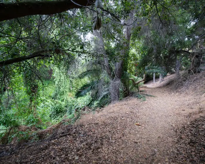
As soon as the road turns into a dirt trail, the vegetation closed in on me, and the preserve began to look more alive.

Eventually I ended completely under the forest canopy.
My favorite spot of the trail is the area where there is a swing hanging near the creek.

There is only one creek crossing in this hike, but it’s not at all difficult.

As I approached the end of the trail, the vegetation became even more dense. I remember thinking it looked like a rainforest due to the palms and vines.
Just like that, the hike was over. There is nothing specific at the end of the trail, just a few log steps leading deeper into the preserve.
Once I was done taking in the scenery, I made my way back the same way.

The adventure doesn’t have to end here! I highly recommend Mystic Canyon Trail in the Glendora Mountains. The views are amazing, especially during sunset.


