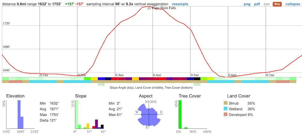
- Miles: 0.8
- Time: 45 min
- Difficulty: Moderate
- Best Season: Late Spring
- Elevation Gain: 157 ft
- Max Elevation: 1753 ft
- Type of Trail: Out & Back
- Parking Lot: Road Turnouts
- Dogs: Allowed On A Leash
- Restrooms: Not Available
- Trail Popularity: Extremely Low
- Pics Taken On: Aug 22, 2023
Hidden in the East Fork of the San Gabriel Canyon lies a beautiful 2-tier cascade. The entire hike is a true adventure. I had to cross the roaring San Gabriel River, bushwhack my way through a trail-less canyon, and climb over smaller waterfalls to get to Cape Horn Falls, all while avoiding poison oak.
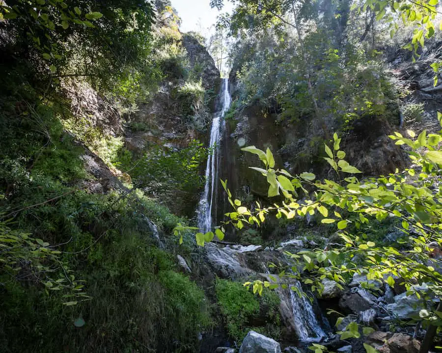
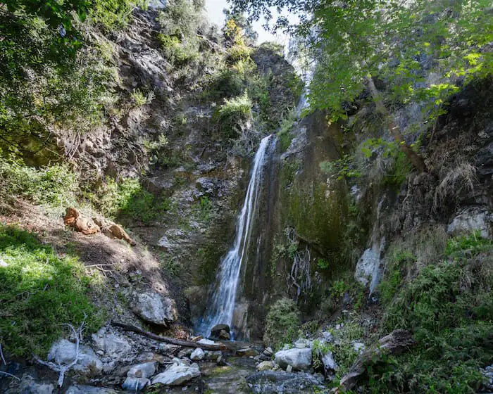
Cape Horn Falls is a roughly 70-foot waterfall that only flows after a really wet winter. The trail is virtually non-existent, which means hikers will have to bushwhack for some sections of the trail. Poison oak is abundant, and two small waterfalls must be climbed over to get to the primary waterfall. This hike is definitely not for beginners.
Please remember to leave no trace.
Cape Horn Falls Trail Map
Directions
To be redirected to the trailhead via Google Maps, click the link here. Parking is very limited, especially on weekends.
Do NOT leave anything valuable in your car, as this is the exact place where my truck was broken into.
Helpful Links
SoCal Adventure Pass (required for parking in CA mountains)
Cape Horn Falls Trail
Once again, don’t leave valuables in your car, as this place is known for low lives breaking into peoples’ cars.
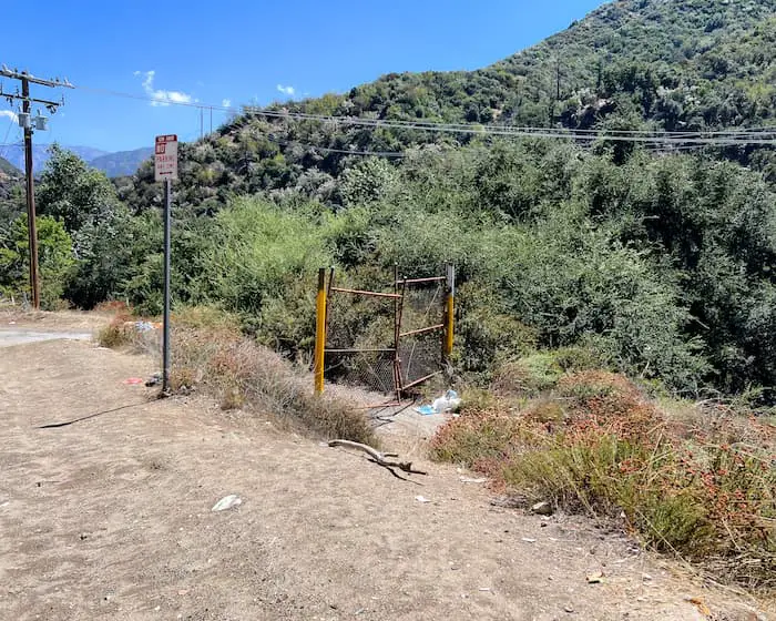
I parked a little further up the road and walked down until I saw the gate in the image below. This was the beginning of the adventure.
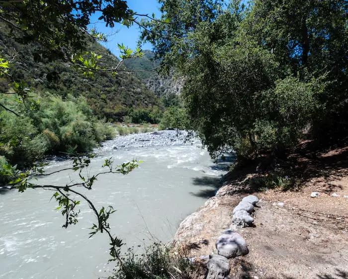
After walking past the gate, I made a left until I spotted this sign underneath the trees. This is the area where I crossed the San Gabriel River.
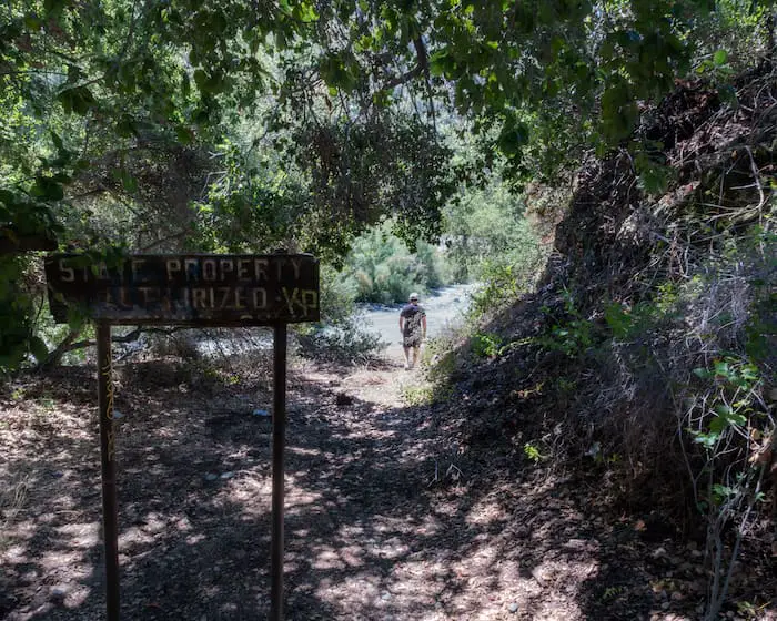
Since I visited two days after Hurricane Hilary, the river was deeper than usual. I found myself a sturdy walking stick and made my way across.
The deepest section of the river was only about 3.5 feet, but it’s usually a lot shallower.
I tried to enter the canyon by following the creek into the tributary. However, the creek, which was located on the right side of the canyon mouth, was surrounded by too much dense vegetation.
I had a much easier time entering the canyon from the left (the left side assuming you’re facing the canyon mouth shown below).
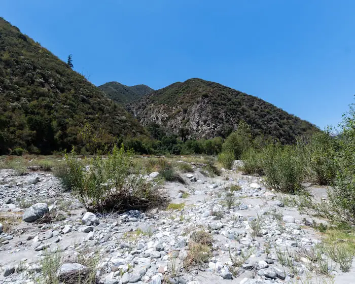
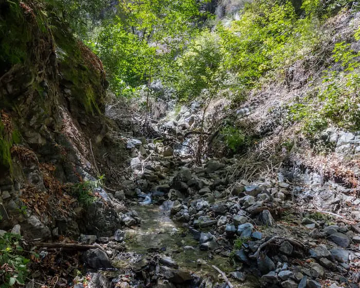
Once I entered Cape Horn Canyon, I bushwhacked my way across until I reached the stream that was located on the opposite side of the canyon.
From this point forward, all I did was trek upstream.
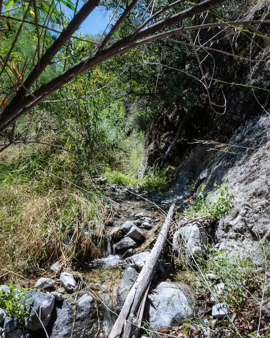
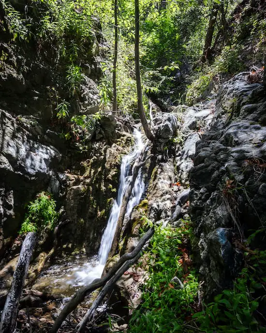
Keep an eye out for poison oak, as it’s abundant. The first major obstacle was a roughly six-foot waterfall. Although it wasn’t a big waterfall, it was incredibly slippery.
If climbing isn’t your forte, look for signs of a worn-out trail to the left of the falls, as you can go around.
Fortunately, about halfway through the hike, the vegetation cleared up. Still no trail, but it’s better than bushwhacking.
Shortly thereafter, I reach the second small waterfall. Luckily, this one was much easier to climb over, as it wasn’t as vertical as the first.
The canyon was quiet. We didn’t see a single person on the hike.
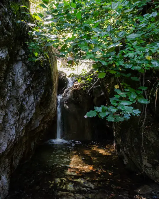
Just when I was starting to wonder if one of the small waterfalls was the secret Cape Horn Falls that I was looking for I heard the sound of roaring water in the distance, and spotted something glistening through the trees.
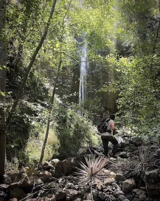
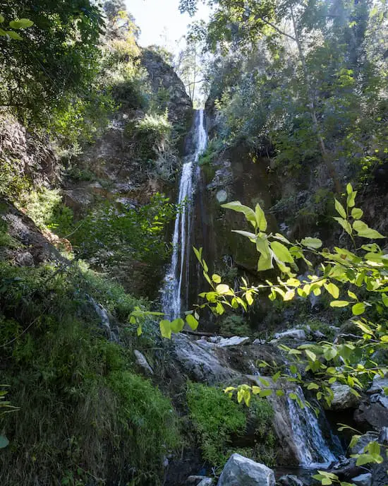
Destination reached! The waterfall was bigger than I thought it would be.
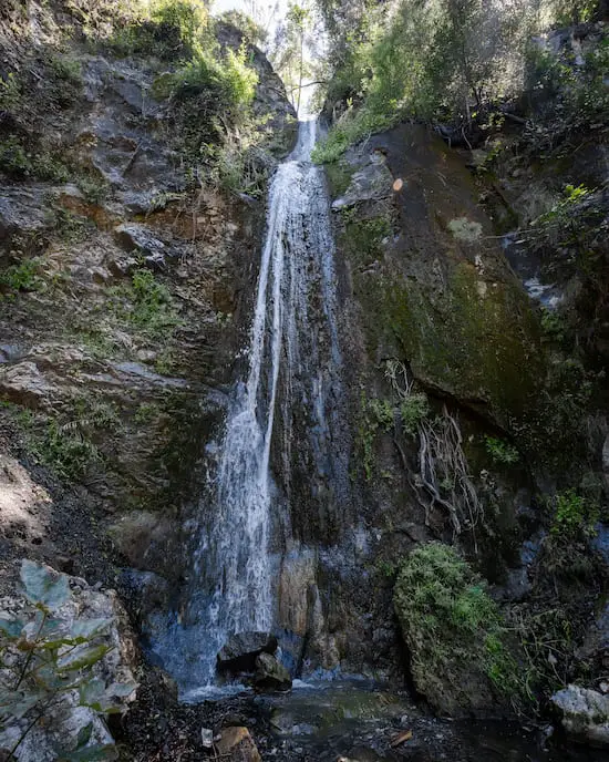
The falls had two main tiers, three if you include the tiny four-foot tier at the very bottom.
Did you know there are two abandoned tunnels in the East Fork? They were built in the 60’s to allow Los Angelinos to escape to the high desert in the event of a nuclear holocaust. I’m not kidding. Check out the post Shoemaker Canyon Rd.
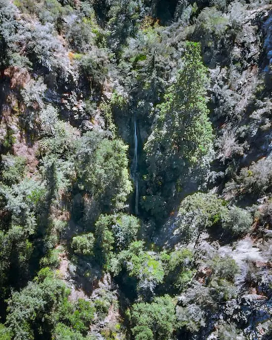
Unfortunately, it’s tough to see the entire top tier from the canyon floor, but after flying the drone, I realized that the top tier was actually larger than the bottom tier.
This hike was a true adventure. Thanks to the fact that there were no other people in sight and because I had to bushwhack my way through many sections, I felt like I was able to truly disconnect from the city and plug myself right into Mother Nature.
Cape Horn Falls is located in the East Fork, but did you know 50 ft Lewis Falls is located just up the North Fork? Click here to check it out. I highly recommend combining the waterfalls and making a day out of it, as both hikes are very short.


