
- Total Miles: 0
- Best Season: After Heavy Rainstorms
- Max Elevation: 2200 ft
- Parking Lot: Turnouts Fit ≈ 15 cars
- Dogs: Allowed On A Leash
- Restrooms: Not Available
- Pics Taken On: Feb 11, 2024
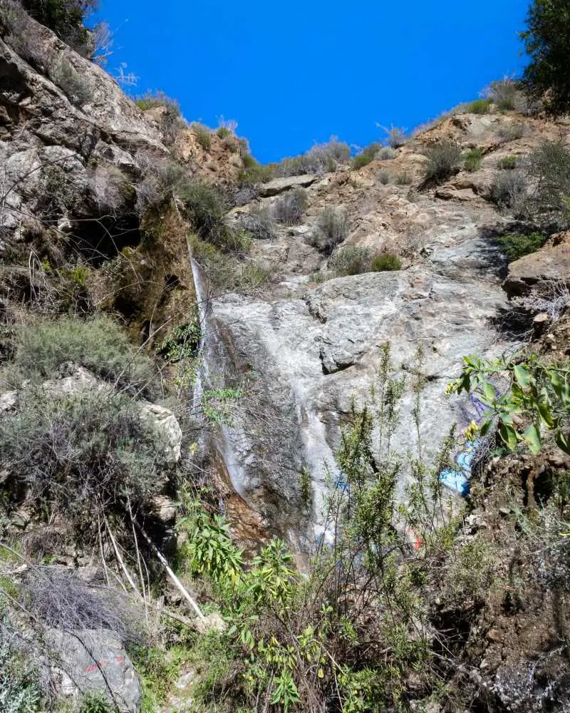
Earthquake Falls is a roughly 70-foot roadside waterfall located in Santa Clarita’s Little Tujunga Canyon near the Bear Divide, which comes back to life only after a decent amount of rain. I’m not exaggerating when I say the waterfall flows for only 2-3 days following a storm, and most years we don’t get sufficient rainfall to revive the cascade.
Hence, it’s a rare treat for outdoorsmen and women. Lastly, since hiking is not required, driving through the western portion of the Angeles National Forest to get to the falls can be a fun experience for the entire family.
I have one favor to ask. Please do not tag or name this place on social media, as it’s usually the precursor to tons of trash and graffiti. Thank you, enjoy, and remember to get to the bottom of the post for more amazing places.
Parking & Directions
To be redirected to Earthquake Falls via Google Maps click the link here.
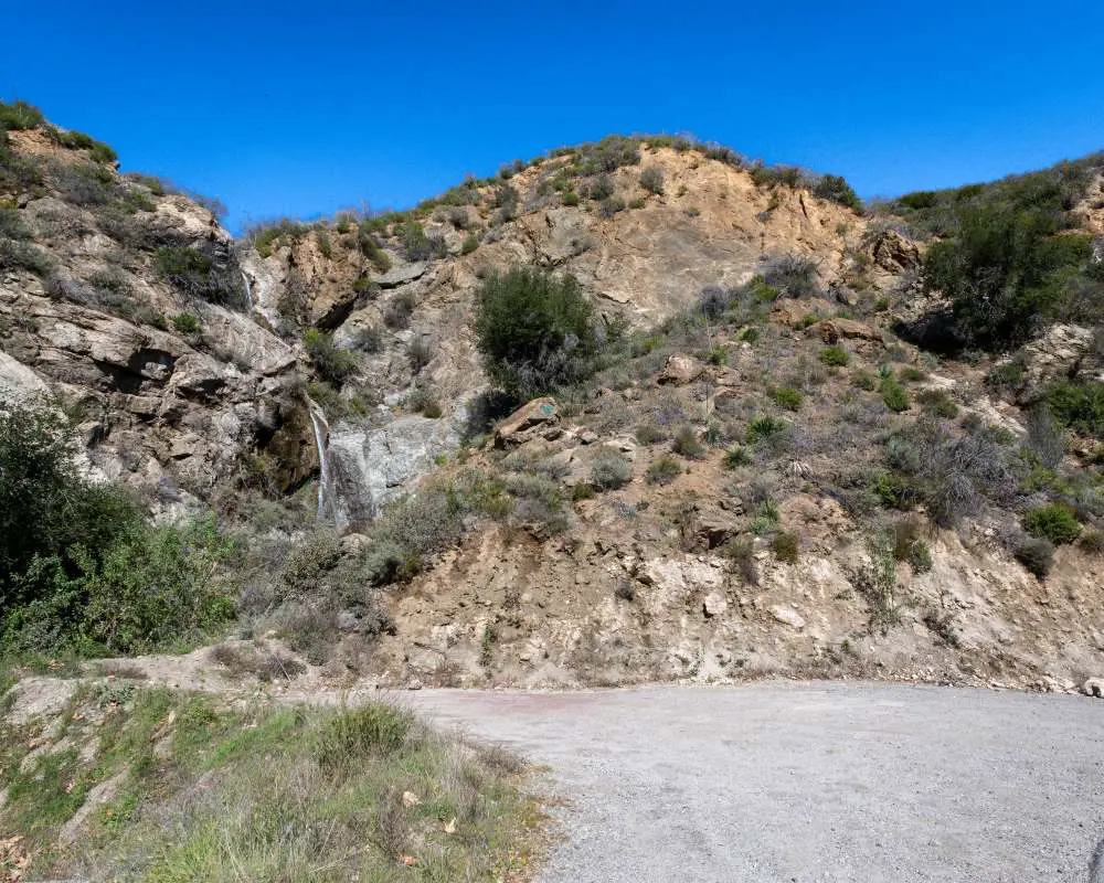
The “parking lot” consists of 3 dirt turnouts, as pictured below. There’s the primary turnout, a smaller one adjacent to it where my truck is parked and a third across the street.
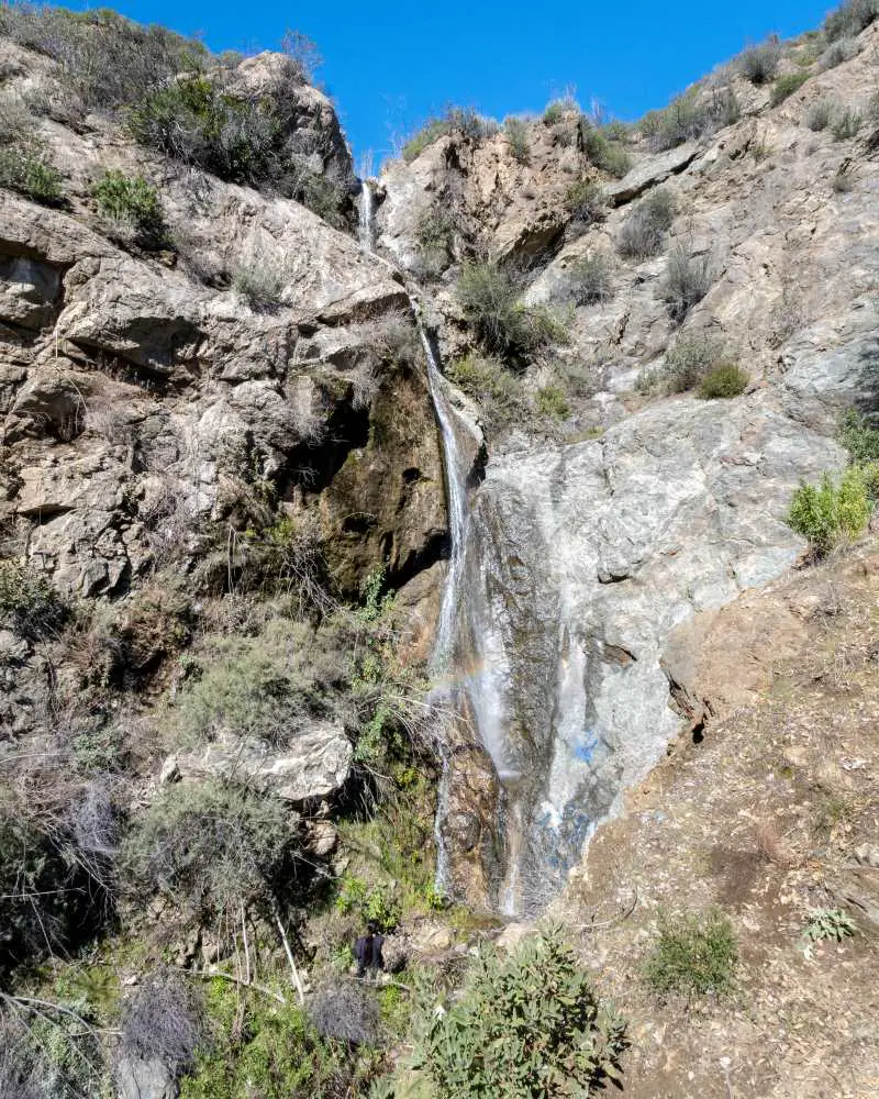
Earthquake Falls
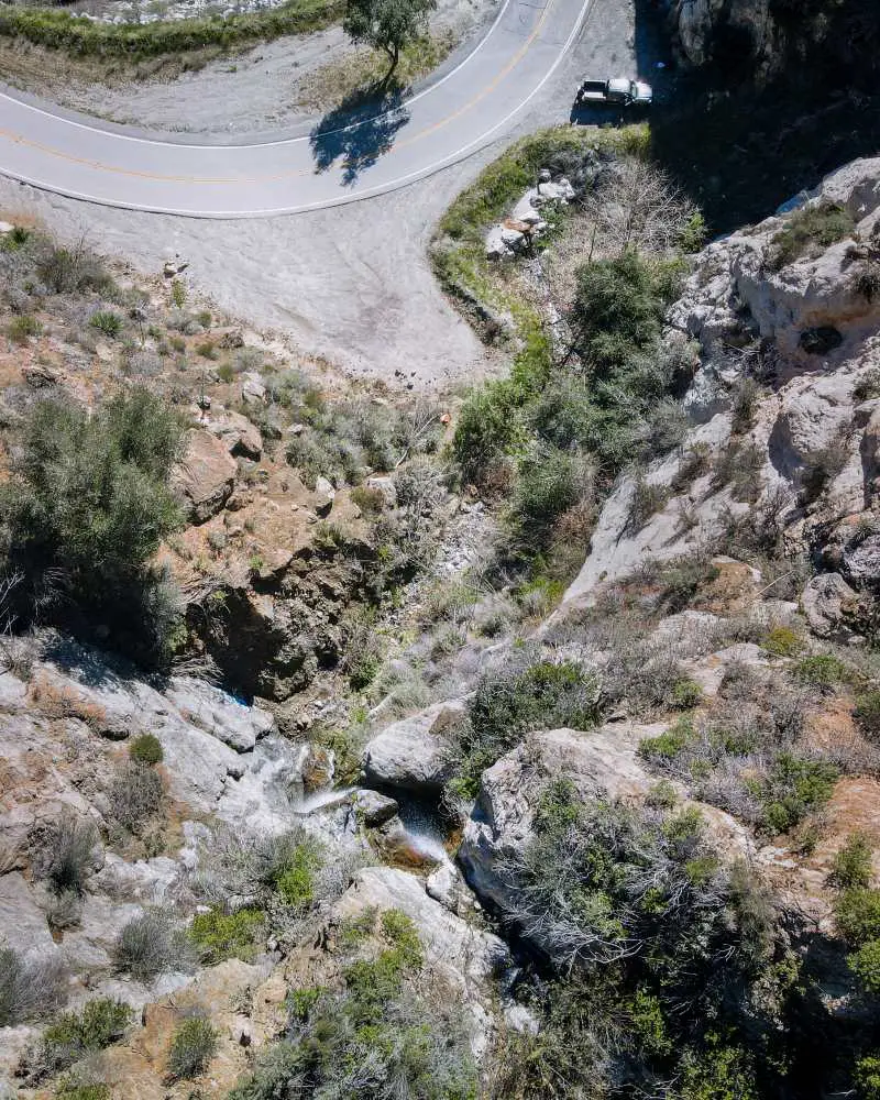
The waterfall can be seen flowing from Little Tujunga Canyon Rd. It has two tiers, the bottom measuring roughly 55 feet and the top about 15. The waterfall traverses the road through an underwater drainage and descends to the canyon floor where it merges with Pacoima Canyon Creek, eventually ending up in the Pacoima Reservoir.
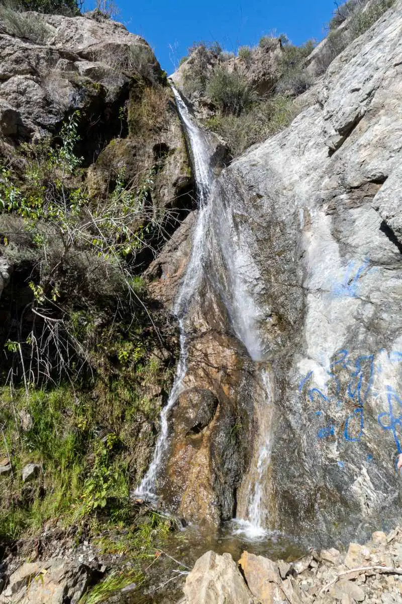
Believe it or not, I’ve yet to see the waterfall roaring. However, a friend who visited the falls while it was raining (about 4 days before my visit) shared a video with me, and in it, I could see a bit more water than in the image below.
Although I didn’t have to hike to get to the base of the falls, trekking through an overgrown 20-foot-long path is inevitable.
If you decide to do the same, keep an eye out for the infamous poison oak, a red and green shrub with three leaves that is notorious for growing near water and inducing painful rashes when coming in contact with your skin.
The origin of the waterfall’s name is derived from the location, namely the San Gabriel Faultline, which belongs to the group of San Andreas fault lines. Why Earthquake specifically is up for speculation.
Unfortunately, taggers have already found the falls.
In addition to exploring the base of the falls, I made my way up the cliff directly in front of the cascade to get a better look from the higher ground.
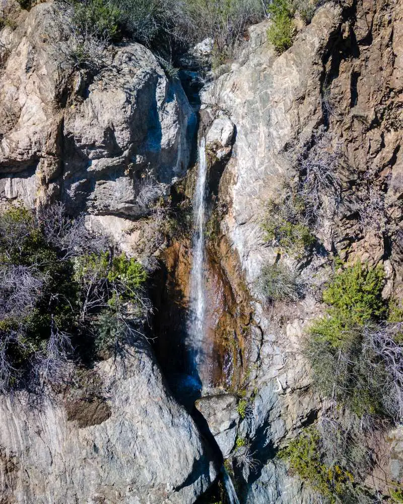
According to SoCal Region, the San Gabriel Fault is visible from the boundary between the light and dark rocks. Look closely, and you can see a line in the rocks running almost vertically between the two.
Both the Pacoima and Big Tujunga Canyons follow the trace of this fault.
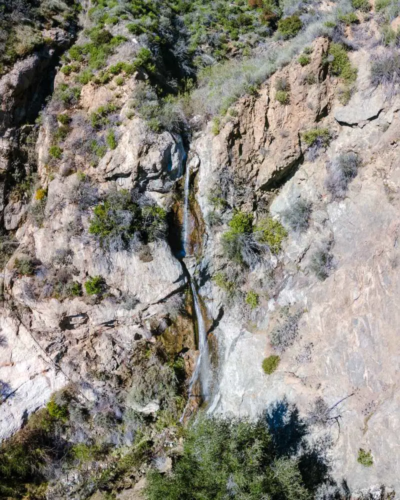
Here’s a closeup shot of the top tier.
Unfortunately, I couldn’t find a name for the creek where the falls is located. I guess we’ll call it Earthquake Creek.
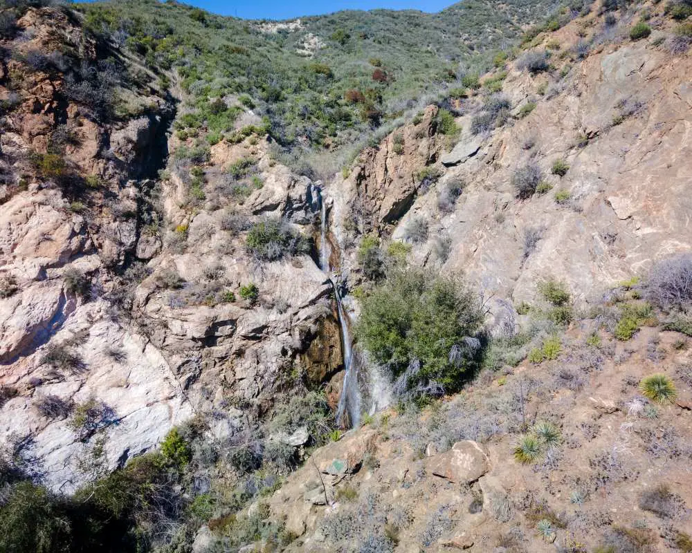
I flew the drone almost directly on top of the falls to get a good look at the surrounding area.
I’m amazed that such a large waterfall can flow in the dry chaparral region of Little Tujunga.
Did you know Little and especially Big Tujunga Canyons are littered with secret spots? I’ve had the privilege of exploring many of these places, which become available to you by creating an account and making one easy payment of free 99.
That’s right, it’s on the house. My only request is to kindly remember not to tag exact locations and avoid using names on social media. Have fun and be safe out there!


