- Total Miles: 2.5
- Time: 1 – 1.5 hrs
- Difficulty: Easy
- Best Season: Spring
- Elevation Gain: 482 ft
- Max Elevation: 707 ft
- Type of Trail: Loop
- Parking Lot: Fits ≈ 20 Cars
- Dogs: Allowed On A Leash (may not be suitable for dogs in the summer)
- Restrooms: Available At The Trailhead
- Trail Popularity: High
- Pics Taken On: Nov 22, 2023
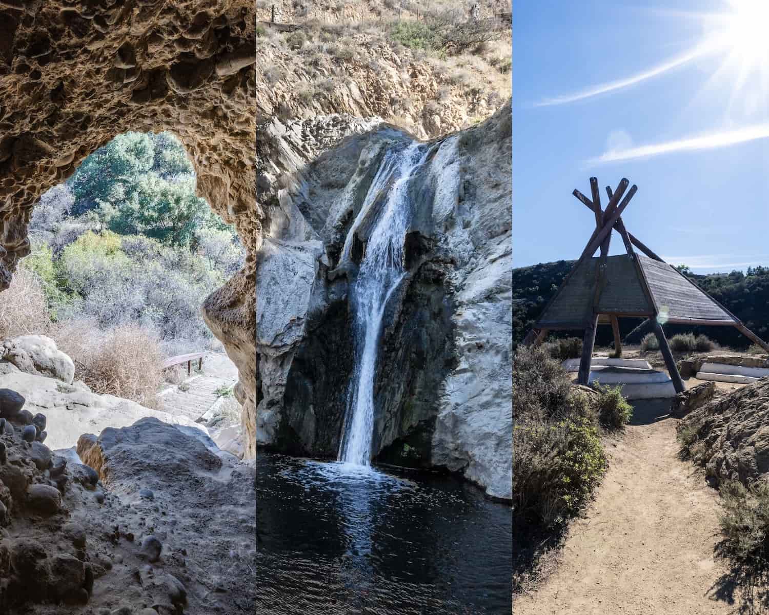
70-foot Paradise Falls is the last thing you’d expect to see in the dry and hilly grasslands of Conejo Valley, but it’s there, and it’s not the park’s only attraction.
A roughly 20-foot wooden teepee stands in a little knoll just up the road from the falls and an ancient cave in a nearby canyon that was once used by the Chumash natives makes for an ideal water break from the sun’s harsh rays.
Last but definitely not least, a large rock formation resembling a lizard head can be seen from the trail without having to take a detour. There are so many awesome reasons to hike Paradise Falls. Get out there, you won’t regret it!
Paradise Falls Trail Map
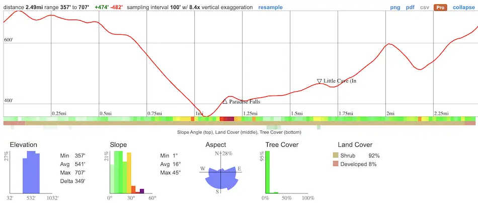
Click the link to Download The Printable PDF Map and view the markers with labels.
Parking & Directions
Click here to be redirected to the Paradise Falls Trailhead and parking lot via Google Maps.
No fee or permit is required to park at the trailhead lot.
Helpful Links
Paradise Falls Weather Forecast
Hiking Paradise Falls
I started the hike via the Mesa Trail, a dirt road with no shade and amazing views of Mountclef Ridge, the serrated volcanic outcropping on the right side of the image. There is virtually no shade in the entire hike, so plan accordingly.
The rule of thumb is 1 liter of water for 2 hours of hiking.
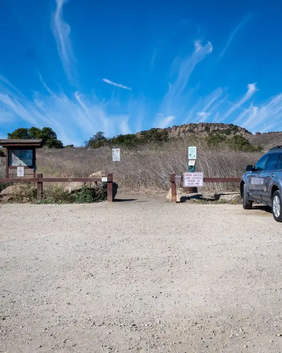
I took the trail on the right at the first fork to remain on the Mesa Trail.
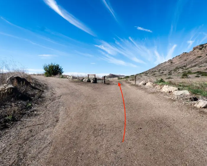
I didn’t grab a picture of the second fork but remember to turn left onto the North Teepee Trail, which also happens to be a dirt road.
Keep left at the third fork. The unnamed path on the right merges with the Stagecoach Bluff Trail which takes hikers past a giant rock formation called Lizard Rock.
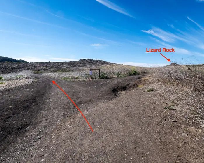
Since Lizard Rock could be seen across the grasslands from the North Teepee Trail, I decided to skip the Stagecoach Bluff Trail.
I’ve had pet lizards in the past, and I have to admit, Lizard Rock holds very true to its name.
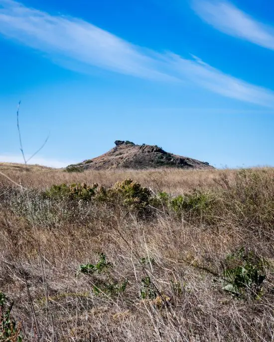
Wildwood Teepee
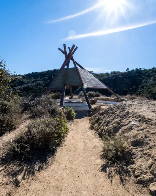
The large wooden teepee can be seen looming on a peaceful knoll from the top of the hill.

It stands about 20 feet high and offers a much-needed shaded break.
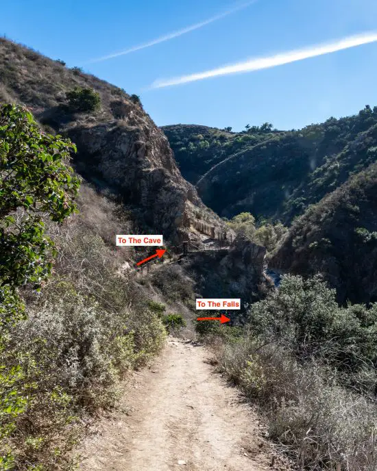
I continued down the road and made a left onto a nameless bike path in Wildwood Canyon.

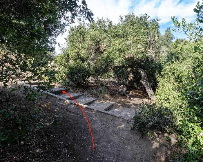
Then I made my way down to the falls. Make a mental note of the trail leading to the cave in the image below because this is the route you’re going to take after the falls to get to the cave.
By the way, the corner of the wall shown below is a viewpoint that overlooks the north fork of the Arroyo Conejo (Rabbit Creek in Spanish). More pictures on that in a bit. Back to the waterfall trail.
Here it is, the stunning Paradise Falls. The Arroyo Conejo plunges 70 feet off the ledge and into the enormous waterhole at the bottom of the canyon.
The volcanic rock has created rather interesting-looking formations, such as the little grotto on the left of the falls.
Paradise Falls
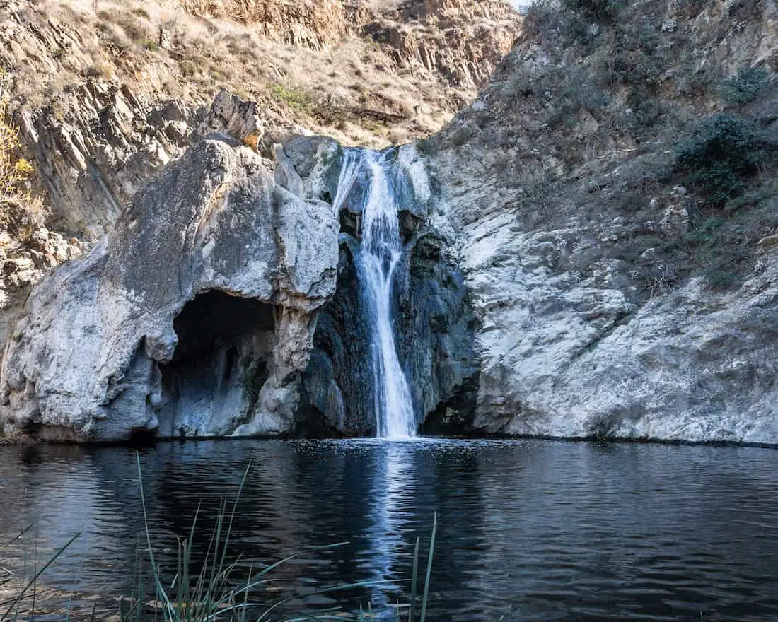
Unfortunately, swimming is not allowed at the waterhole as bacteria levels are very high.
It’s a shame because Paradise Falls probably has the second-largest pool in Southern California, the first being Cedar Creek Falls in San Diego.
Cattails that had become trapped below the pool allowed me to easily cross the creek and partly climb the right side of the canyon wall to get the best perspective. The sycamore trees to the left truly depict the enormous size of the falls.


You already know I busted out the drone.

After the falls I retraced my steps and hopped on the Wildwood Canyon Trail where the viewpoint is located.
Small waterfalls and pools right above Paradise Falls can be seen glistening in the morning sunlight. I was also able to see the brink of the falls flowing off the cliff and into the pool below. Nothing beats Mother Nature’s beauty.
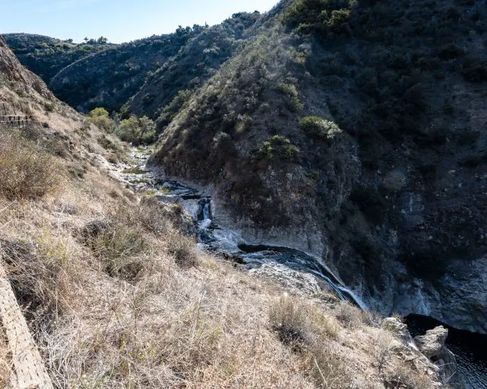
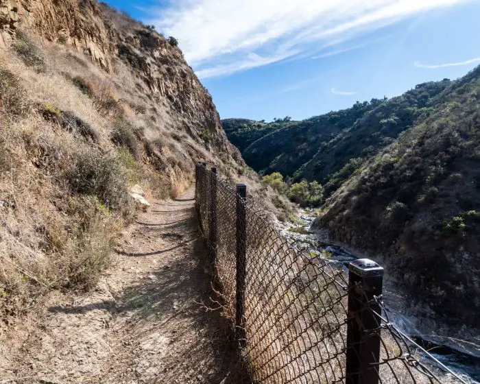
The lush riparian Wildwood Canyon Trail is a bit more scenic, as can be seen by the many coastal live oaks and cottonwoods.
Note: Apparently, there’s another small waterfall past the oak trees that I missed during my visit. You may have seen it on the map. It’s called Little Falls, and you best believe I’ll be going back soon to update this post.
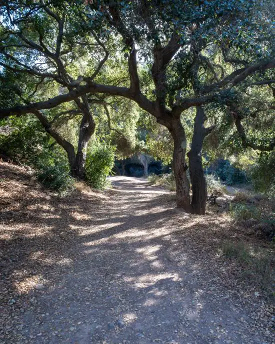
I continued straight at the following intersection. The dirt road to the left is the North Teepee Trail and leads up to the teepee.

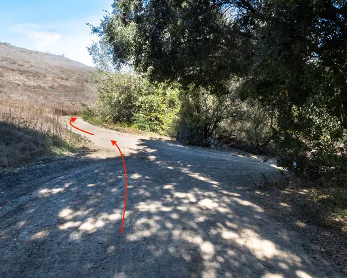
The Little Cave Trail is very short (not a dirt road). I made a left at the fork below and an immediate right to hop on the Little Cave Trail.
Little Cave (Indian Cave)
The Little Cave is propped up on the side of the hill with stairs leading up to the entrance. It was once used by the Chumash tribe who lived in the region.
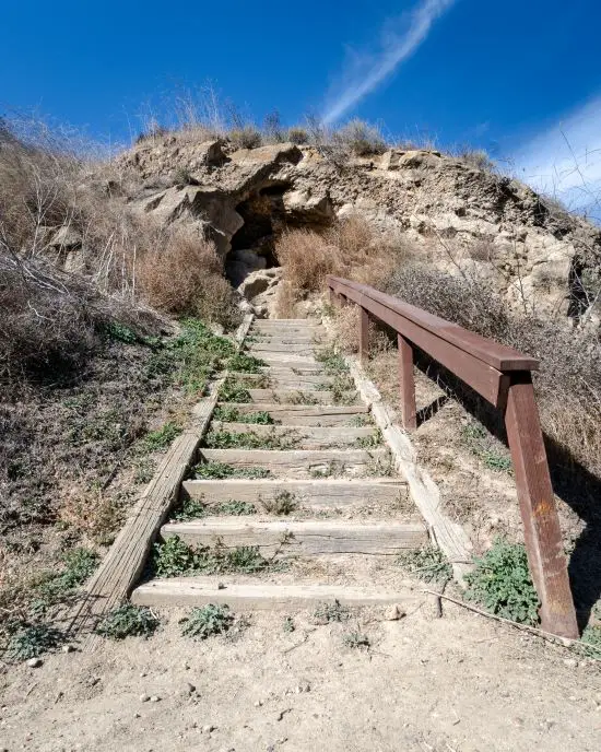
Visitors are welcome to explore the inside. The cave is about 20 feet deep and has an exit on the other end where you can see the surrounding area below.
Want to explore an even cooler and much larger cave located just a little further down the 101 freeway? Check out the Cave Of Munits!
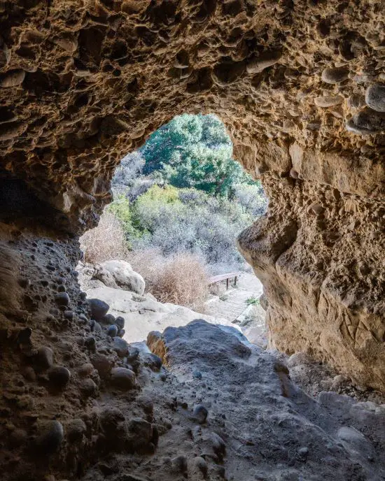
After exploring the cave, I retraced my steps via Little Cave Trail but turned right onto the dirt road to begin the ascend.

One switchback later, I hopped onto the Moonridge Trail, the last section of the hike.
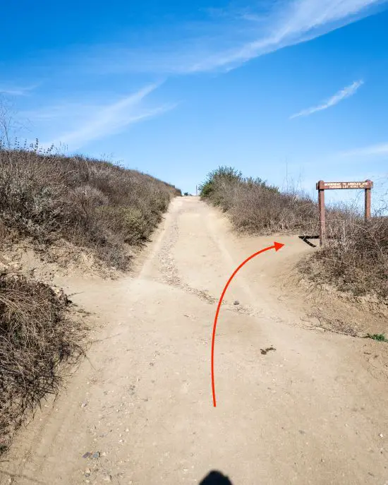
The trail ends on the opposite side of the parking lot as the trailhead. That’s a wrap!
FAQs
How Long Is Paradise Falls?
Paradise Falls is a total of 2.5 miles. However, it can be shortened or extended depending on one’s preference.
Can You Visit Paradise Falls?
Paradise Falls is currently open to the public.
Is A Permit Required To Hike Paradise Falls?
No type of fee or permit is required to hike Paradise Falls
How Do You Hike Paradise Falls?
- Begin the hike via the Mesa Trail from the parking lot.
- Make a left onto the North Teepee Trail
- Make a left onto an unnamed bike path (first trail after passing the teepee) until reaching the base of the falls.
- After exploring Paradise Falls retrace your steps and continue on the Wildwood Canyon Trail which follows the North Fork of Arroyo Conejo.
- Make a right onto the Little Cave Trail to explore the cave, then return the same way and make a right to hop back on the Wildwood Canyon Trail.
- Ascend the hill and make a right onto Moondridge Trail.
- Make a left to walk up the stairs and back into the parking lot.
Is Swimming Allowed At Paradise Falls?
Swimming and cliff jumping are not allowed at Paradise Falls as bacteria levels are dangerously high.

