
Distance
2.1 Miles
Time
~1.5 Hrs
Difficulty
Moderate
Season
All Year
Elevation Gain
620 Ft
Las Flores Canyon trail is a 2.1 mile, roundtrip, hike near Altadena, California that leads to 10 secret mines. This short, 1.5-hour trail is rated as moderately difficult due to narrow and steep paths. The elevation gain of this trail is 630 feet. Dogs are not recommended on this trail.
Want to explore the best hikes in the Pasadena? Check out the link below!
I just have one favor to ask. Please do not tag or name this place on social media, as that is the precursor to tons of trash and graffiti. Thank you and enjoy!
Map of Las Flores Canyon Trail
Directions and Parking
Here are clickable directions to the Cobb Estate Address: 3302 Lake Ave, Altadena, CA 91001
I parked along the street near the entrance. Keep in mind that this place is popular, so parking right by the entrance might be limited. However, you can park in the nearby neighborhoods as well.
The Hike Begins
The hike starts off beyond the tall gates.
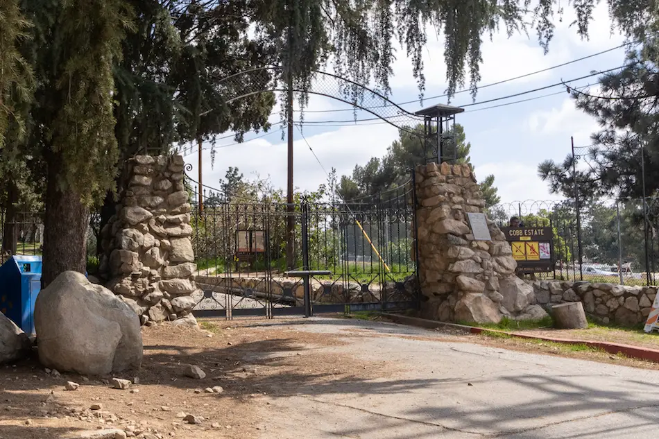
From here, I walked down the old and deteriorated paved road.
Passing the side road that leads up to Echo Mountain, I continued on the slightly steep path towards the now-graffitied ruins of what was the grand Cobb Estate. But, a little more information on the haunted estate later.
Unfortunately, the popularity and accessibility of this hike have led to vandalism.
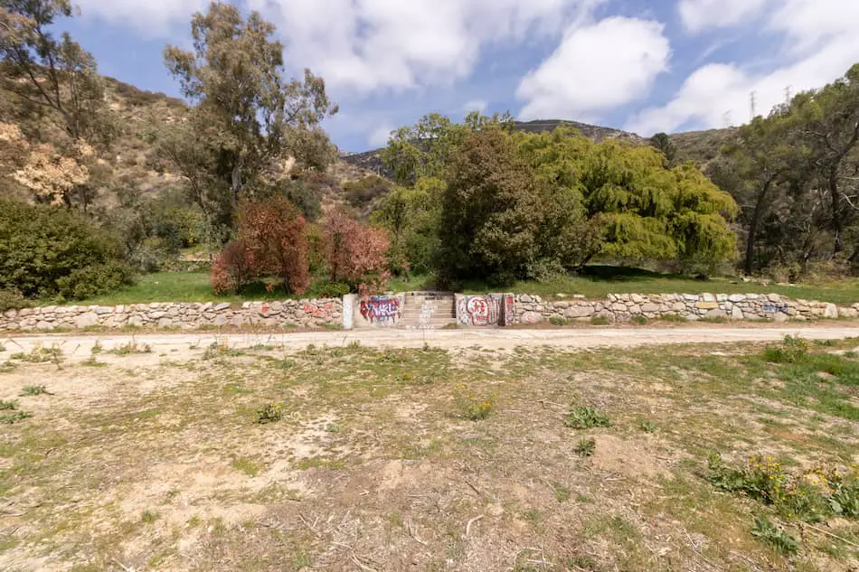
I could only imagine how this place looked many decades ago when the mansion was still standing strong.
A quick view up, I could see the ant-sized humans trekking their way towards Echo Mountain on a very sunny Sunday afternoon.
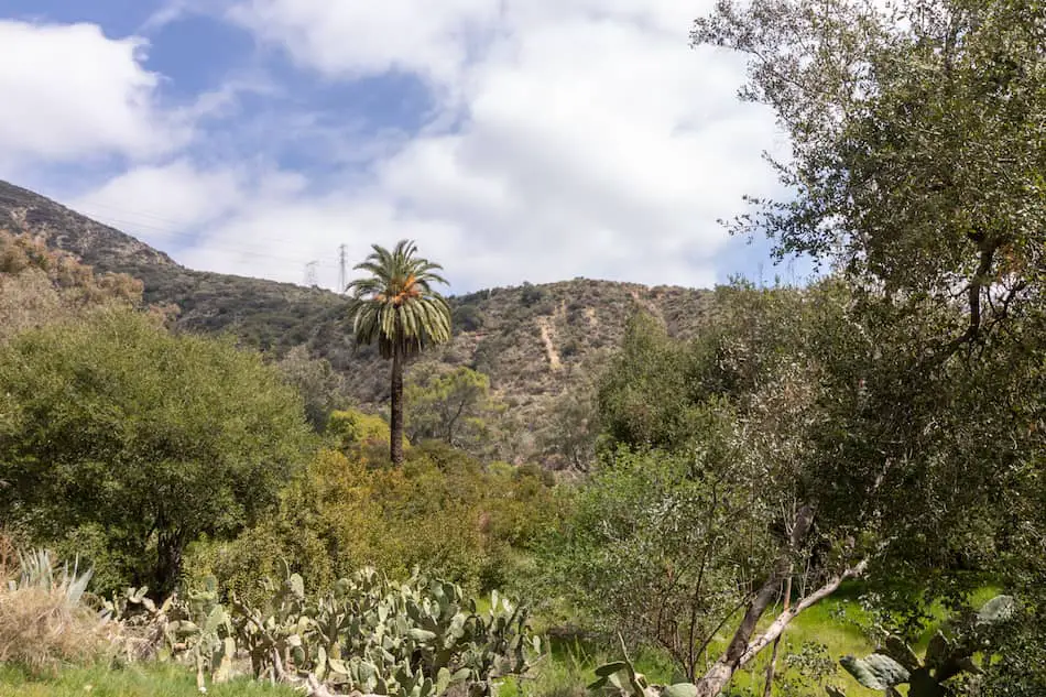
Continuing on the cracked pavement, I had spotted a deer crossing the road! Unfortunately, I couldn’t get a good picture. Elated by the sight, I happily resumed the walk.
Las Flores Canyon Trailhead
Walking along the dirt road I came towards a fenced building.
The dirt road splits into two, and the trailhead to Las Flores Canyon Trail begins on the right-hand side, off-trail from the main dirt road.
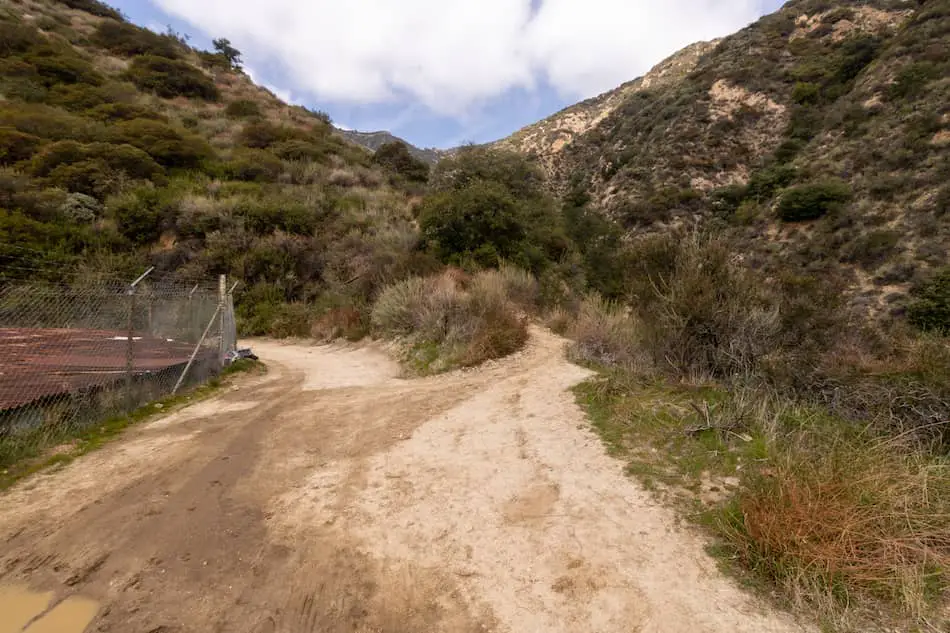
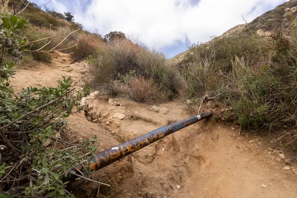
I spotted this rickety water pipeline and continued on the right side, which leads down the path.
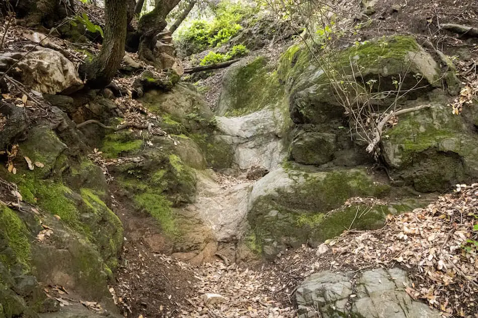
Now, I do consider this trail to be somewhat tricky and challenging for beginners. The reason being is that there are some very narrow pathways, such as the one below.
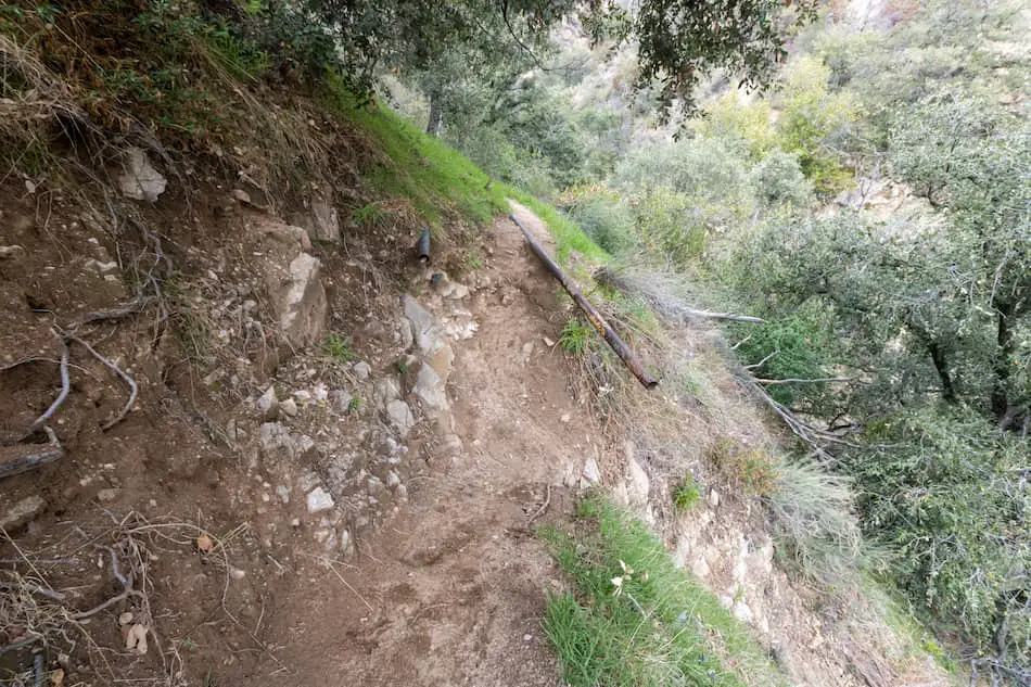
An accidental slip with the non-grip shoes or wrong-footing could lead you plummeting down the steep hill.
There were a few other tricky parts on the trail where I had to carefully walk through narrow footpaths. Be sure to take your time, there’s no rush getting to these lesser-known mines.
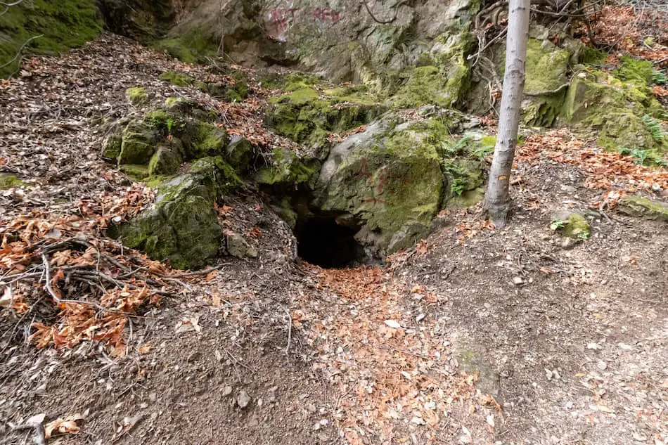
Mine #1 – Buckley Mine
The Buckley Mine is the first small mine that I spotted. It only goes in less than 15 feet. It was considered an exploratory mine and only operated from 1893 to 1894- very short-lived.
Mine #2 – Unidentified
Further down, I came across another mine/tunnel. For now, I’ll just call it the unidentified mine #1. I found this one located across from the dirt path I was on. You’ll see it, trust me. Feel free to peek inside if you’re curious!
Mine #3 – McNally Mine
The third mine I spotted was the McNally Mine. It was originally a gold mine but was then converted to a water tunnel. Its years of operation for gold were also from 1893 to 1894. It goes in about 315 feet or more.
About 43 feet in, the tunnel becomes really narrow. Probably too narrow for any adult to fit through. Sigh.
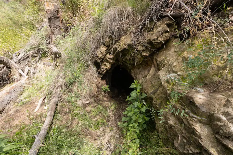
Mine #4 – Unidentified
Along the way, I spotted this other mine to the left of me. I’ll call this one the unidentified mine #2. It was a bit too small and narrow for me to comfortably fit through.
Unfortunately, I don’t know the story behind this one.
If you have any information, feel free to shoot me an email!
That was the last mine/tunnel I came across before getting to the main one.
Getting closer to the bigger mine, there’s a small waterfall. A nice little treat that I didn’t expect!
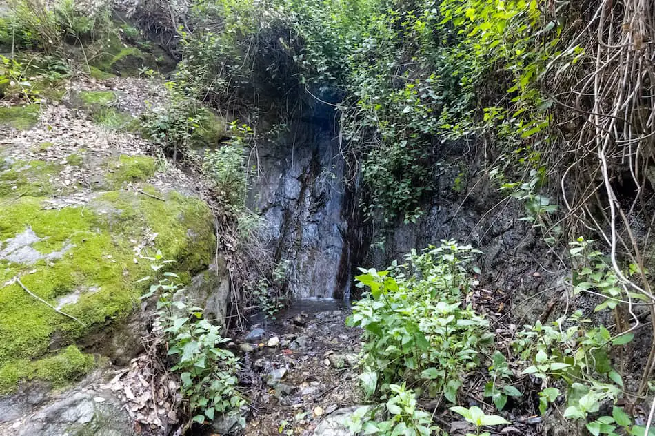
There was a bit more water flowing than what the picture shows.
I then came across what could potentially be a waterfall. After heavy rainfall, I could see it having a nice little flow or trickles of water.
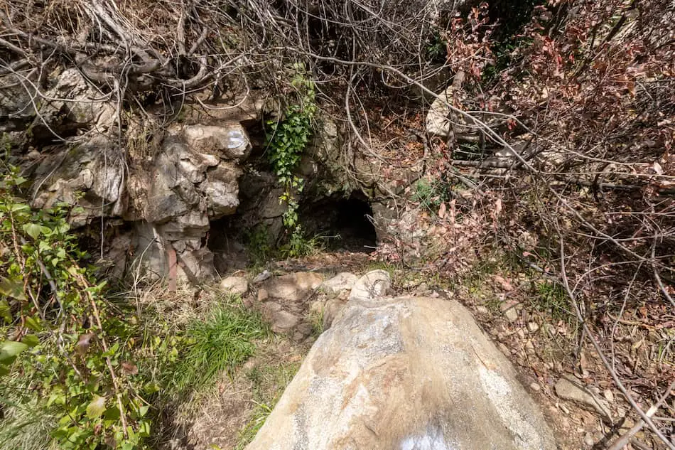
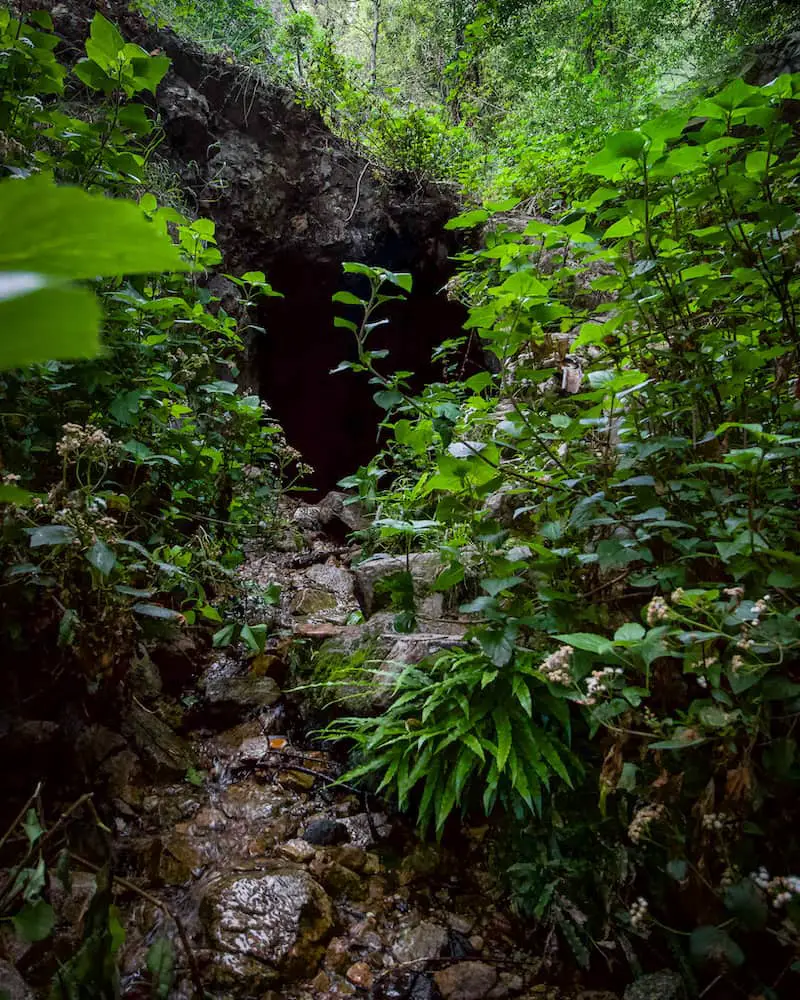
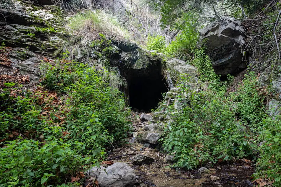
Mine #5 – The Main Mine
After climbing over some trees and steps, ascending down from the steep dirt trail, and then ascending up a rocky pebbled pathway, I finally came to Tunnel #4.
This mine, like the rest, only operated from 1893 to 1894 as a gold mine and now goes in about 100 feet. It’s definitely the most interesting and fun mine out of the five.
Something interesting about this mine is that there are tons of cave pearls. They resemble actual pearls but are much rougher in appearance.
Surprisingly, this mine has way more than what is normally found in mines or caves.
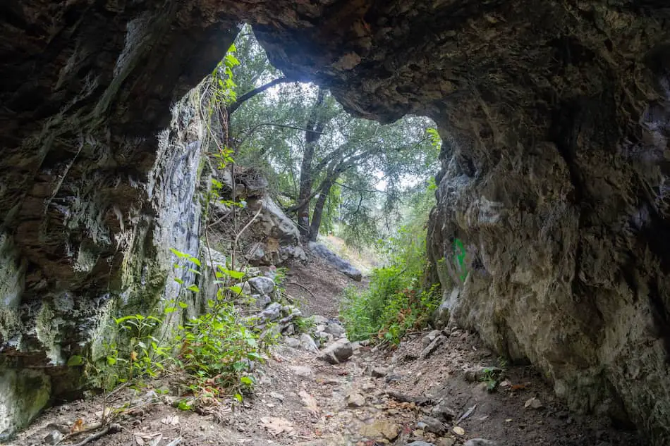
One of my favorite shots was from inside of the cave looking out.
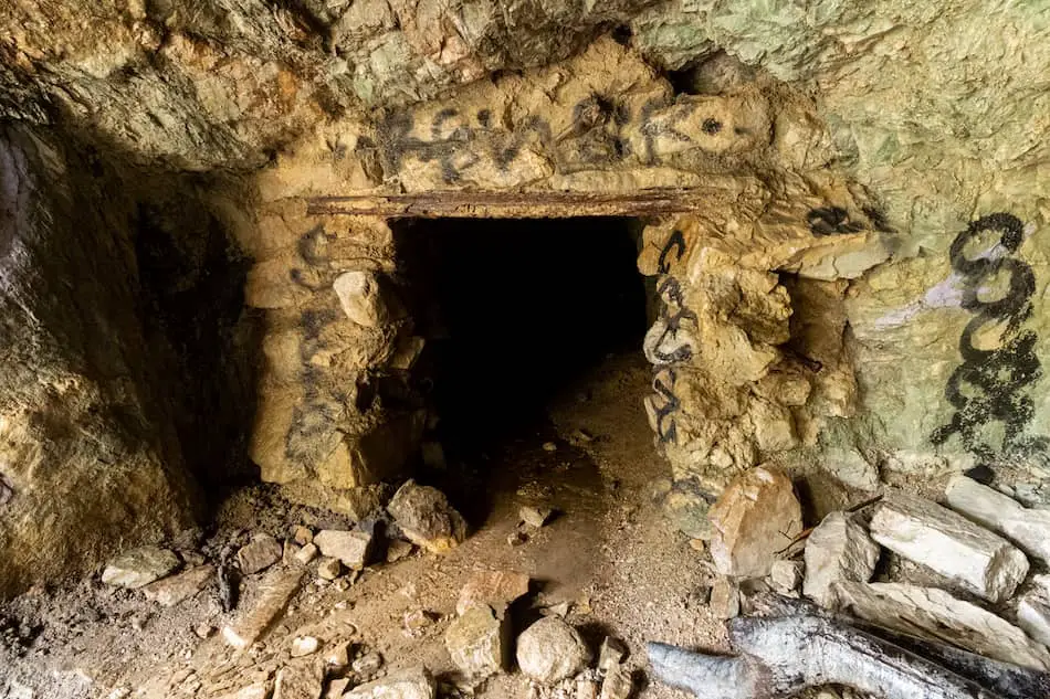
To the left of the mine is this portal entrance. I’ve gone inside before and crouched my way through until the tunnel’s ceilings got higher. I mostly had to walk through shin-deep water for a quarter of the first section.
I decided not to venture inside this time because it was radiating heat. It felt like a sauna, which was weird because it didn’t feel that way the first time.
Who knew Las Flores Canyon was home to multiple historic gold mines that you can still see and venture inside of today.
I definitely recommend this short, yet challenging trail if you’re looking to avoid the crowds.
History of Las Flores Canyon
Las Flores Canyon Mines
The mountains and canyons above Pasadena caught the attention of many prospectors during the Gold Rush.
Las Flores Canyon was a hot spot for mining operations, especially during 1893-1894. A man by the name of William Twaddell formed a mining company, staking out multiple claims here. Some of these were named the Golden Star, Monitor, and Bald Eagle.
Because of the water shortage at the time, they couldn’t afford to construct or finish a lot of these mines, which explains why these mines are so short.
The Cobb Estate
Known as the “haunted forest’ to many Angelinos, the Cobb Estate is definitely an intriguing place to visit.
Charles H. Cobb and his wife Carrie built their Spanish-style estate back in 1918. The home was lavish, elegant, and modern with its imported hardwood floors and exotic outdoor landscape. The house was one of the only homes to have air-conditioning, which was unheard of at the time.
Cobb lived at the estate until his demise in 1939. His home was then deeded to the Pasadena FreeMasons. Later, in 1959, the Brothers Marx had the home torn down.
Why does it get the nickname “haunted forest”? Well, it’s been said that Cobb’s spirit still roams the area. Another rumor that circulates is that the Brothers Marx haunt the place.
Allegedly, visitors have heard unidentified screams and feel as though they’re being followed.
But, who knows whether that’s true or not.
Body Found near Cobb Estate
To add to the creepiness, a woman was found dead near the Cobb Estate back in 2019.
Visitors had mentioned a foul smell coming from the tent. Sadly, police discovered it was a deceased body that had been there for some time. No one knows what happened to that poor woman.


