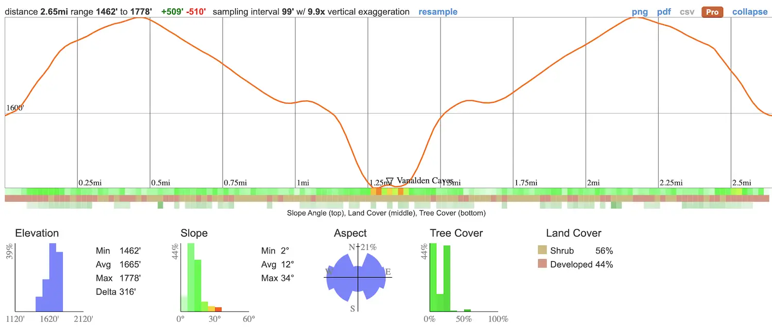
- Total Miles: 2.65
- Time: 60 min
- Difficulty: Easy
- Best Season: All Year
- Elevation Gain: 510 ft
- Max Elevation: 1778 ft
- Type of Trail: Out & Back
- Parking Lot: Fits 20+ Cars
- Dogs: Not Allowed
- Restrooms: Available At The Parking Lot
- Trail Popularity: Moderate
- Pics Taken On: Feb 20, 2021
Caves in Los Angeles? Yup, you read that correctly! These caves are called the Vanalden Caves, and they make for a very enjoyable hike.
The Vanalden Cave hike is an easy 2.7-mile trail located in Tarzana with only 510 feet of elevation gain. The trail features views of the San Gabriel Valley Mountains to the north and the Santa Monica Mountains to the southwest as it slowly descends into the canyon floor. Dogs aren’t allowed.
Since there aren’t very many natural caves in SoCal, I added the Vanalden Cave to my list of best hikes. Don’t miss out, explore the largest falls in SoCal, abandoned ruins, and more amazing places by clicking the link below:
Best Hikes In Southern California
Vanalden Caves Trail Map
Directions & Parking
Click the link to be redirected to the trailhead via Google Maps: Marvin Braude Mulholland Gateway Park
The parking lot is located on Resseda Blvd.
Helpful Links
SoCal Adventure Pass (required to park in SoCal mountains)
Park Phone: (310) 455-2465
Hiking To The Vanalden Caves
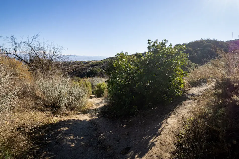
From the roundabout, begin your hike via the dirt road.
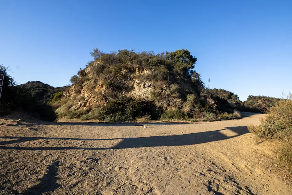
Shortly after, you’ll get to the Y split shown below. Make a right.
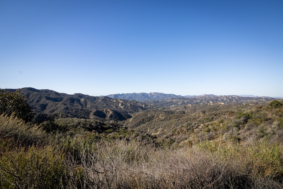
Don’t forget to pause and enjoy the view. After all, we venture into nature’s beautify to get away from the city.
The image below is the view of the Santa Monica mountains.
In order to get to the canyon floor, you’re going to have to keep an eye out for the single track that splits off the dirt road. It’ll be to your right and will stand out because of a wooden post stump.
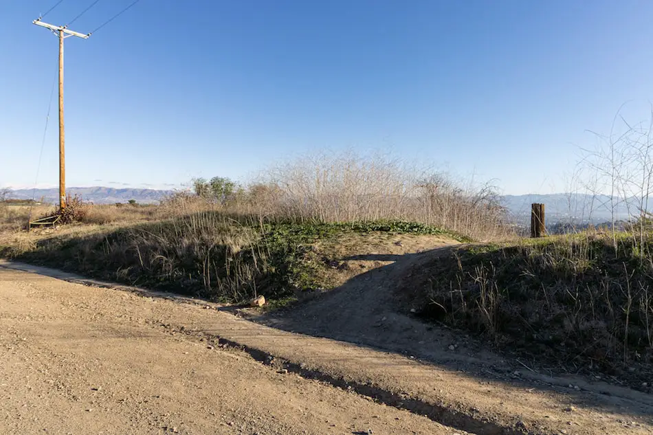
The single track will quickly descend in the direction of the San Gabriel Valley and reach another Y split after roughly 5-10 minutes. Make another right at the split.
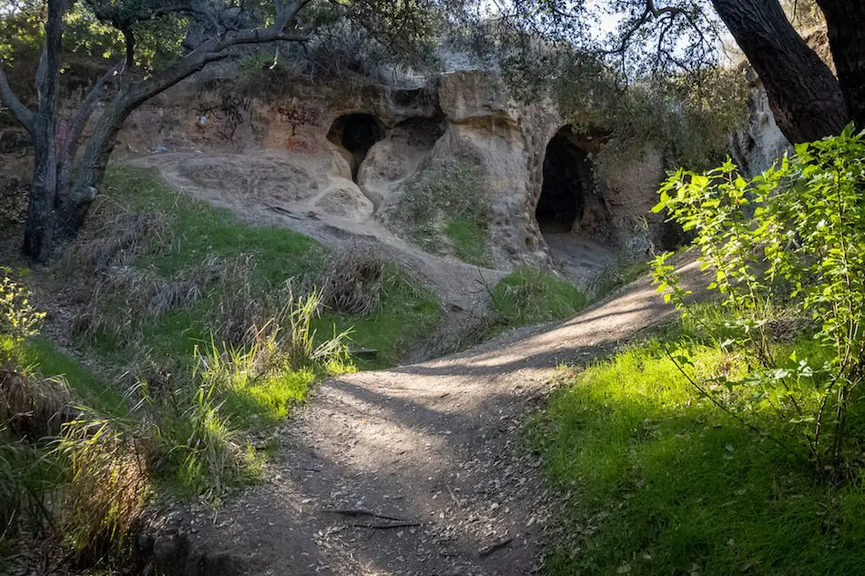
This section of the trail will lead you under the forest canopy and through a dry creek crossing where you will make a hard right and arrive at your destination shortly thereafter.
The mouth of the cave reaches a height of approximately 25 ft and has a depth of about 50 feet.
The cave is made of sandstone, a type of hardened sand, which is why you can see people carve into it.
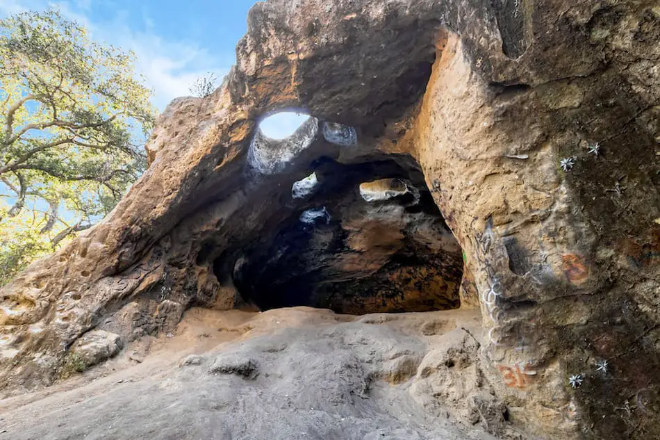
Even though the entrance is massive, you’ll quickly notice how much warmer it gets inside.
This place is amazing isn’t it? Fortunately, it’s not the only one. Explore abandoned gold mines, nuclear war escape tunnels, and more by clicking the link below:
You can also explore the top of the caves by following the single track in the image above. Just one switchback and you’ll find yourself on top of the caves.
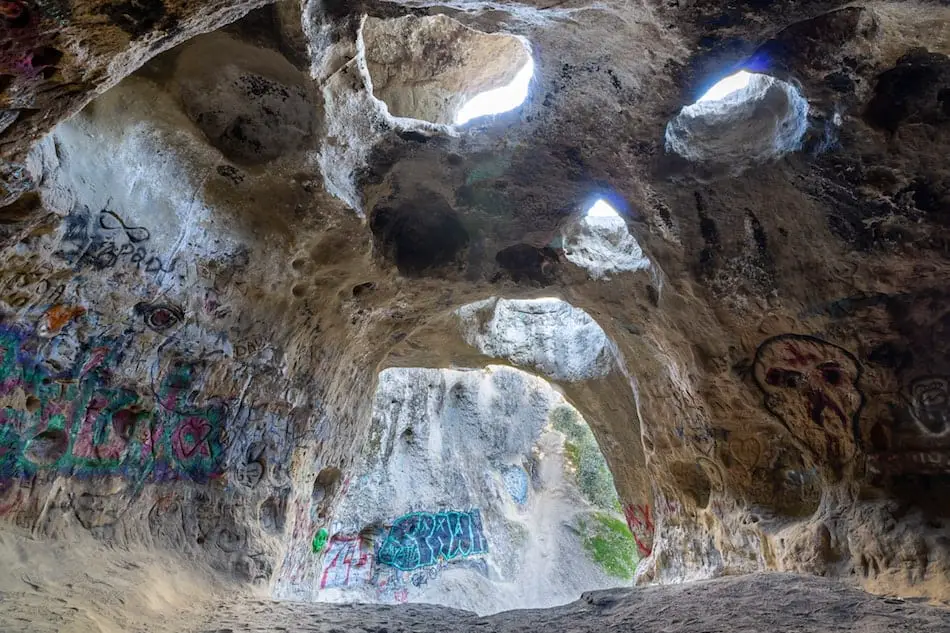
Unfortunately, it’s been super vandalized as word has spread on this awesome place. But, it’s still a super unique hike that you wouldn’t think to find near the busy Los Angeles county.


