Monkeyface Falls: Secret Cascade En Route to Big Bear

Share With Your Friends!

  • Miles: No Hiking Required
  • Best Season: Mid-Late Spring
  • Max Elevation:  4400 ft
  • Parking Lot: Fits ≈ 5 cars
  • Dogs: Allowed on a leash
  • Restrooms: Not Available
  • Pics Taken On: Aug 21, 2023

Next time you find yourself on the way to Big Bear do yourself a favor and stop at the intersection of Hwy 38 and Valley of the Falls Rd to witness a spectacular seasonal waterfall.

Monkeyface Falls is one of the four enormous waterfalls in the area.This must-see gem is AT LEAST 400 ft tall (I honestly believe it may be bigger than the largest waterfall in SoCal), but it only flows after a decent amount of rain. Try to get out there no longer than a week after heavy rain or a couple of days after ordinary rainfall.

Did you know the largest waterfall in SoCal is literally 5 minutes down the street? It’s called Big Falls, a 500 ft beast of a cascade located in the sleepy town of Forest Falls.

Monkeyface Creek Falls Map

Download Printable PDF Map

Directions

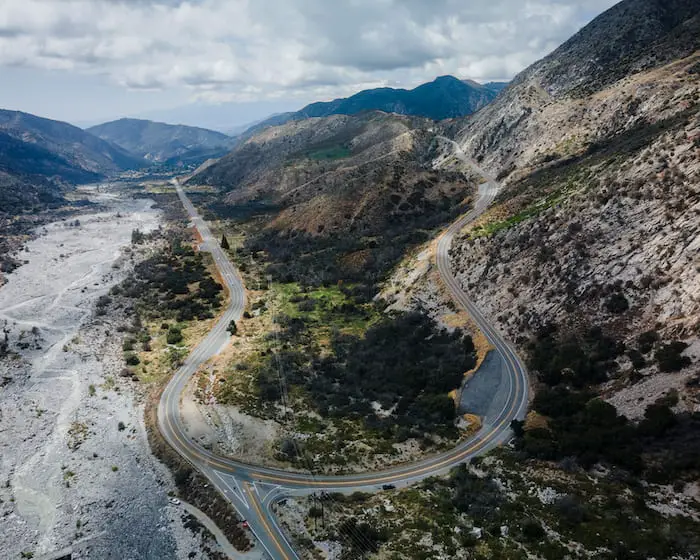
Click the link here to be redirected to Google Maps. There is no parking on Valley of The Falls Rd that is close enough to view the falls, so you’ll have to park on Hwy 38.

Helpful Links

Weather Forecast

SoCal Adventure Pass (required for parking in CA mountains)

Monkeyface Falls

I flew my drone from Hwy 38 to the falls in a matter of seconds. The reason I don’t recommend hiking up to the waterfall, especially after heavy rain, is because of the two rockslides at the entrance of the tributary.

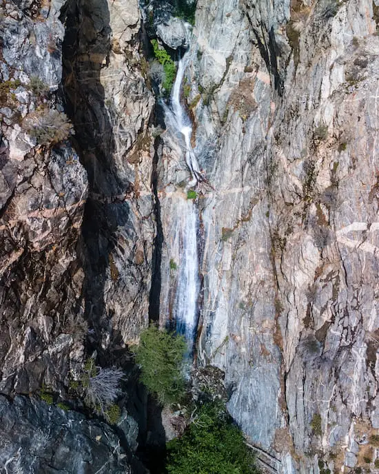
The image below is a shot of the bottom tiers.

Monkeyface Bottom Tiers

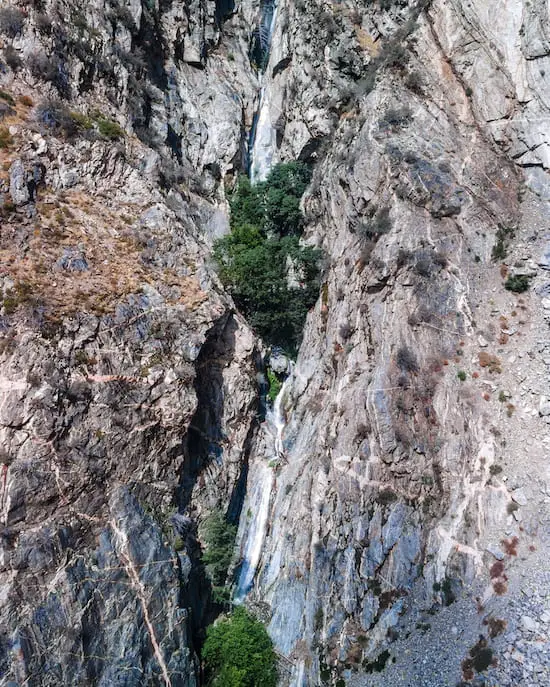
The tiers directly above look just as nice. Since I visited shortly after Hurricane Hilary, the falls had a good amount of water.

Monkeyface Falls Middle Tiers

Want to hike to another enormous waterfall which is also in San Bernardino County? Check out 495 foot Bonita Falls! It’s only a 1.4 mile hike located in the mountain town of Lytle Creek.

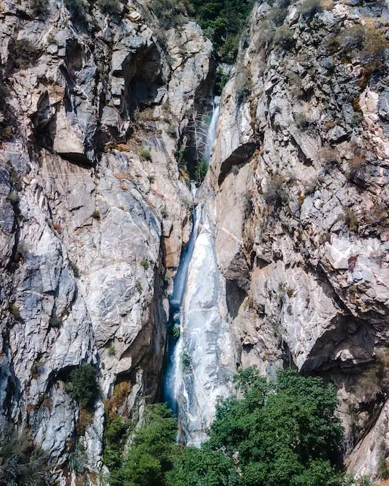
Here’s a shot of the bottom and mid-tiers.

Monkeyface Falls Bottom & Mid-Tiers

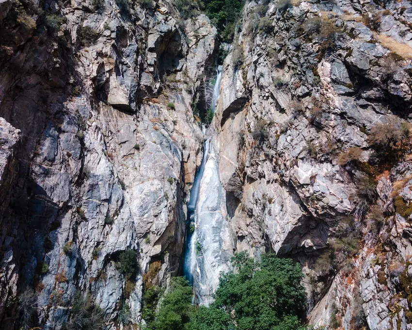
The waterfall was so enormous that I had to fly back hundreds of feet from the cascade in order to capture all of its tiers. The falls is easily 400-500 ft tall.

I’m not sure why they call it Monkeyface Creek Falls, as I don’t see the resemblance of any type of primate. Maybe you can spot something I don’t.

Monkeyface Falls all tiers

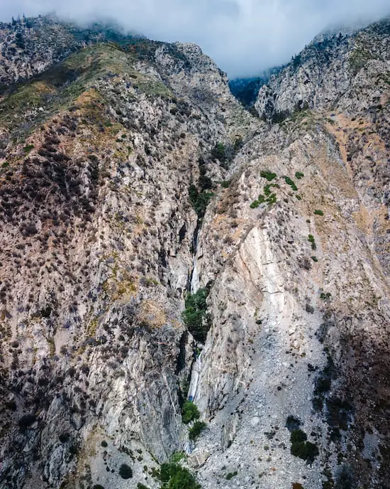
The truck below which looks like an ant is my Tacoma. I actually flew higher than what you see in the shot below in order to capture all of the waterfall’s tiers.

After visiting Big Falls and Monkeyface Falls, drive literally only two minutes up the road to check out Frustration Creek Falls, another one of the four enormous cascades in the area. You won’t regret it!

More to Explore!

[favorite_button]
Stonewall Mine: San Diego’s Forgotten Relic

Stonewall Mine: San Diego’s Forgotten Relic

Miles: 0.7 Time: 20 min Difficulty: Easy Best Season: All Year Elevation Gain: 75 ft Max Elevation: 4640 ft Type of Trail: Loop Parking Lot: Fits ≈ 20 cars Dogs: Not Allowed Restrooms: Available At The Trailhead Trail Popularity: Moderate  Pics Taken On: Jul 25, 2023...

[favorite_button]
Mystic Canyon Trail: Stunning Views In The Glendora Mts

Mystic Canyon Trail: Stunning Views In The Glendora Mts

Miles: 1.92 Time: 45 min Difficulty: Moderate Best Season: All Year Elevation Gain: 707 ft Max Elevation: 1907 ft Type of Trail: Out & Back Parking Lot: Turnout, Fits ≈ 20 cars Dogs: Allowed on a leash Restrooms: Not Available Trail Popularity: Low - Moderate Pics...

[favorite_button]
Ortega Falls: 2 Cascades Off Of Hwy 74

Ortega Falls: 2 Cascades Off Of Hwy 74

Miles: 0.2 Time: 25 min Difficulty: Easy Best Season: Spring Elevation Gain: 67 ft Max Elevation: 2198 ft Type of Trail: Out & Back Parking Lot: Turnout, Fits 20+ cars Dogs: Allowed on a leash Restrooms: Not Available Excluding the plethora of graffiti, Ortega...

[favorite_button]
Stoddard Canyon Falls: Rock Slide & Pool

Stoddard Canyon Falls: Rock Slide & Pool

Miles: 0.75 Time: 45 min Difficulty: Moderate Best Season: Spring Elevation Gain: 160 ft Max Elevation: 3781 Type of Trail: Out & Back Parking Lot: Dirt Lot, Fits 30+ Cars Dogs: Allowed on a leash Restrooms: Not Available Trail Popularity: High Pics Taken On: May...

Hello, There!

I’m Phillip, and just like you, I feel very passionate about California and the outdoors. After many years of exploring amazing and hidden places, I thought I’d share them with you. Life goes by fast so get out there and enjoy it.  

Sign Up For Bonuses

Want to stay up to date with all the latest hikes? Join our community by clicking the link button below!

Join Us On Insta!

Legal Info

We only recommend what we use. This site is a participant in the Amazon Services LLC Associates Program, an affiliate advertising program designed to provide a means for sites to earn advertising fees by advertising and linking to Amazon.com. However, no company pays us to share these products with you. If you decide to purchase a product via one of our links, we will recieve a small compensation, which in turn, helps us to keep making videos and posts to share with all of you.