
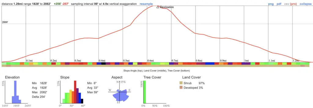
- Miles: 1.29 Roundtrip
- Time: 1.5 Hours Roundtrip
- Difficulty: Difficult
- Season: Late Spring
- Elevation Gain: 254 ft
- Max Elevation: 2082 ft
- Trail Type: Out & Back
- Parking Lot: Neighborhood Parking
- Restrooms? Not Available
- Dogs Allowed? Yes, on a leash
Rubio Canyon is very near and dear to me, as it holds long-forgotten history about the most fascinating time period in the San Gabriel Mountains, as well as a ton of waterfalls which only flow after extremely wet winters, such as the one we had in 2022-2023.
Please keep in mind this trail is difficult, as it requires treading through the creek for almost half the hike to get to the falls, and, at one point, boulder scrambling over ruins alongside precipitous 40-50 foot ledges. If you’re easily intimidated by heights or have poor balance, wait until you have more experience before tackling this hike.
Waterfalls found on this trail from first to last:
- Maidenhair
- Cavity Chute
- Bay Arbor
- Ribbon Rock & Moss Grotto (bottom & top tier)
- Grand Chasm (Rainbow)
- Lodged Boulder (Suspended Boulder)
- Roaring Rift – bottom tier of Thalehaha
- Thalehaha (Bridal Veil) 80ft and largest of all
- Leontine – Named after professor Lowe’s wife
The first 3 falls have unfortunately, been lost to history. However, there is a dry waterfall at the beginning of the trail which may be one of the first two falls.
**Note: All waterfalls after Ribbon Rock & Moss Grotto are located deeper in the canyon and cannot be viewed unless you climb up an extremely dangerous canyon wall, which I HIGHLY discourage.
At least one couple was rescued this year while attempting to scale up to the vantage point. Play it safe and don’t risk your life or the lives of the voluntary (SAR) search and rescue teams. Lastly, wear long sleeves and pants, as I was covered in ticks during my first visit in the summer of 2017.
Rubio Canyon Trail Map
Rubio Canyon Directions
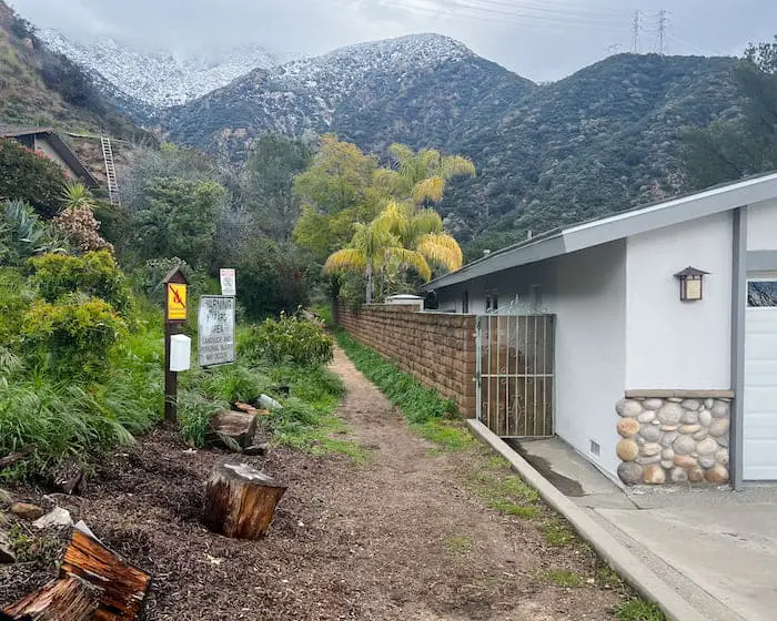
To be redirected to the Rubio Canyon Trailhead, click the link here.
The trailhead is located in a dirt alleyway between two private homes, so please be respectful. Thank you guys! 🙂
Check out these other LA hikes!
Rubio Canyon Trail
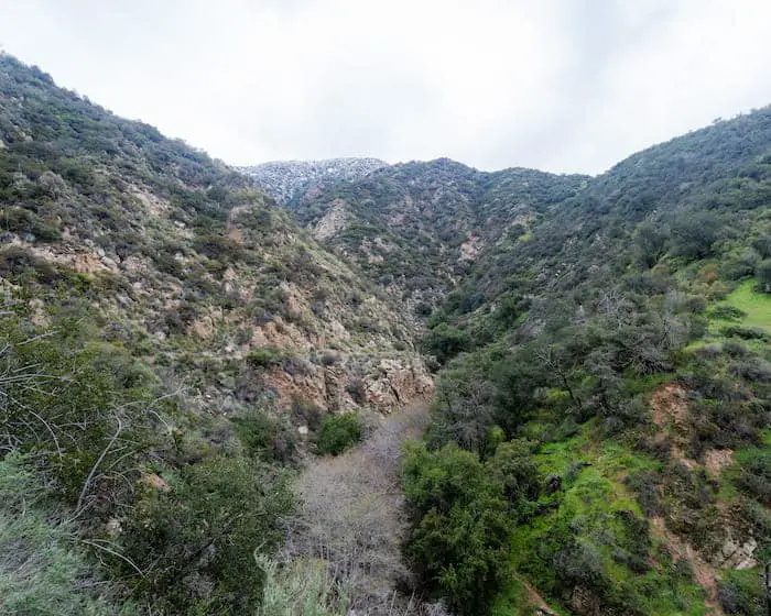
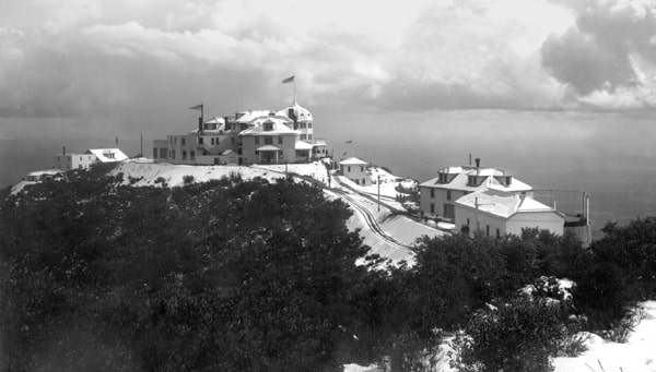
I had been not so patiently waiting for a wet winter, and when we finally got one, Rubio Canyon was my first hike. Notice how low the snow line is in the image below.
The last time we got this much rain, I was a high school sophomore in 2005.
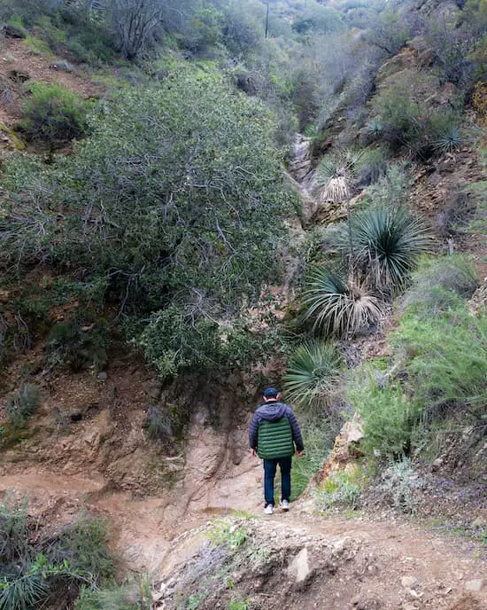
Immediately, the scenery transforms into a luscious canyon, with White Alders lining the banks of Rubio Canyon Creek. The last time I visited this place was in 2017, and I clearly remember the canyon being much drier.
Notice the bend in the image below.
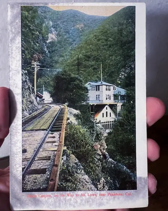
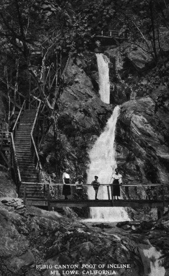
That bend is where I believe the Rubio Pavilion was once located. The pavilion, shown below as part of my collection of vintage shots, was built by Professor Thaddeus Lowe, as a one-of-a-kind attraction for visitors.
Before reaching the bend, however, I passed a dry waterfall, which I believe may be one of two falls: Maidenhair Falls or Cavity Chute Falls.
Here’s a shot of Maidenhair Falls from 1998 by the awesome hiking blog, Dan’s Hiking Pages. Check it out and see what you think. Unfortunately, I couldn’t find any shots of Cavity Chute Falls.
The Great Incline
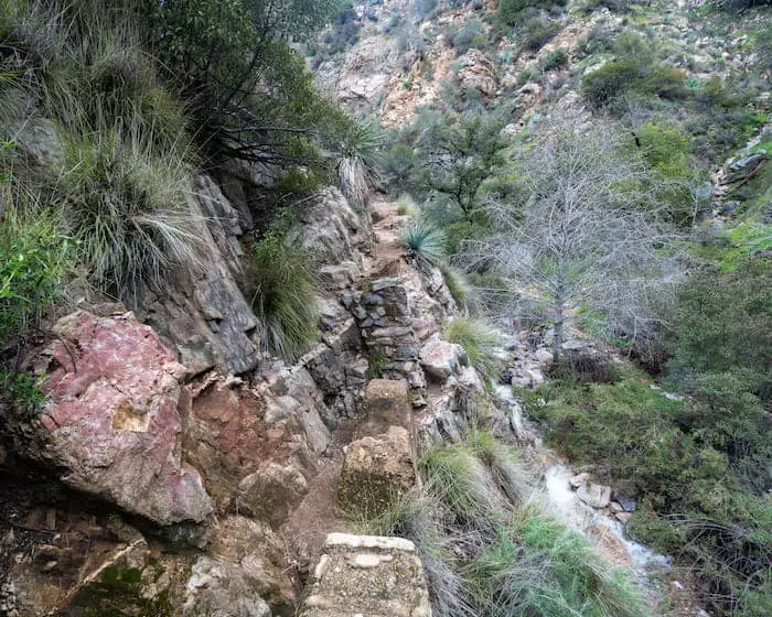
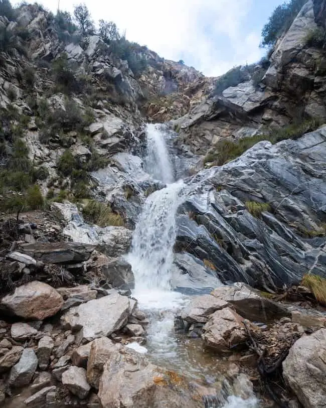
The shot below shows the most dangerous part of the trail. To continue the hike, I had to scramble up stone ruins, which I believe to be the remnants of the Great Incline.
You can either head right or left (both are the same trail). The right side, which is dangerously close to the ledge, is slightly easier to climb, as it’s less steep. However, the left route adjacent to the canyon wall is a much more vertical climb and measures about 6-8 feet.
Pick your poison and watch your step.
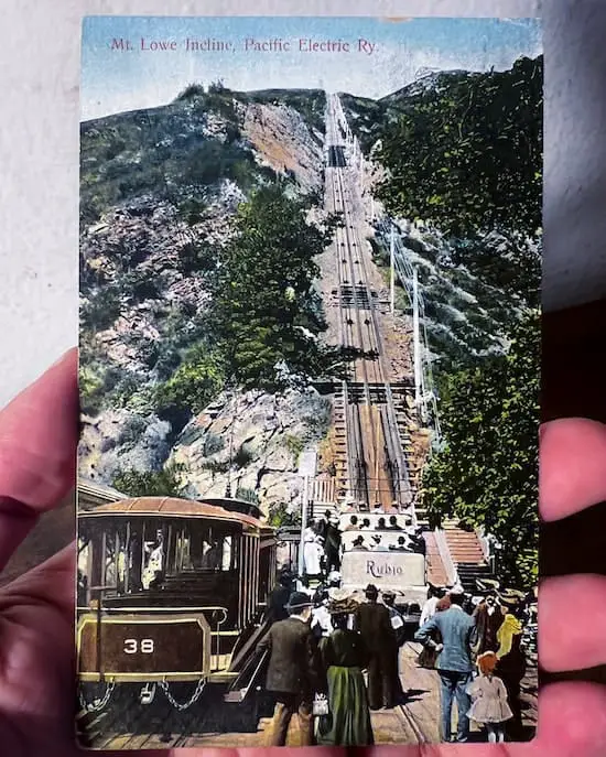
Here’s another one of my vintage shots showing what the Great Incline used to look like.
From the pavilion, visitors had the option of taking either the gradual Mt Lowe Railway (trolley at the bottom left) or riding up the Great Incline via the White Chariots to Echo Mountain, now known as the Echo Mtn Ruins.
Do you like exploring ruins? Check out the Abandoned Nazi camp in the Santa Monica Mountains.
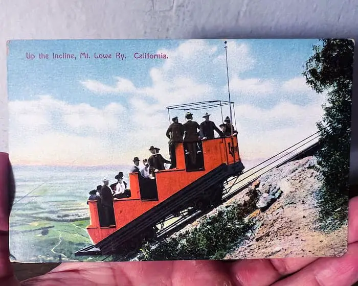
Fun fact: although the chariots were white, I found this vintage shot of a red chariot.
Before the existence of color photography, color had to be manually added to the picture. I believe the red chariot below was probably due to an error, which is why I had to add it to my collection.
Echo Mountain ruins before they were ruins.
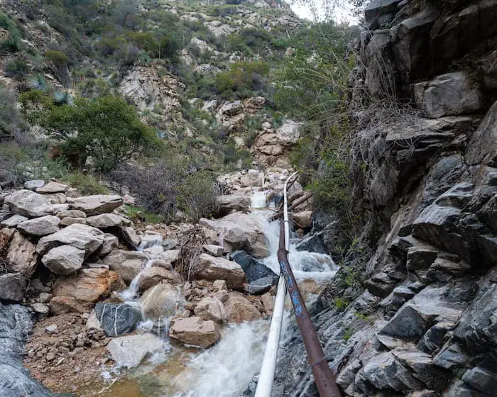
Back to the trail! Another sketchy section included a 6-foot boulder scramble to the ground, but without the “death ledge” as my friends in the biking community call them.
Two things to keep in mind regarding the image below:
1. If you look to the left and behind you from where I was standing when I took the shot, you can see the Incline Railway trailhead. You can hike up to the Echo Mtn. ruins via this overgrown trail (I forgot to take the shot, don’t judge me).
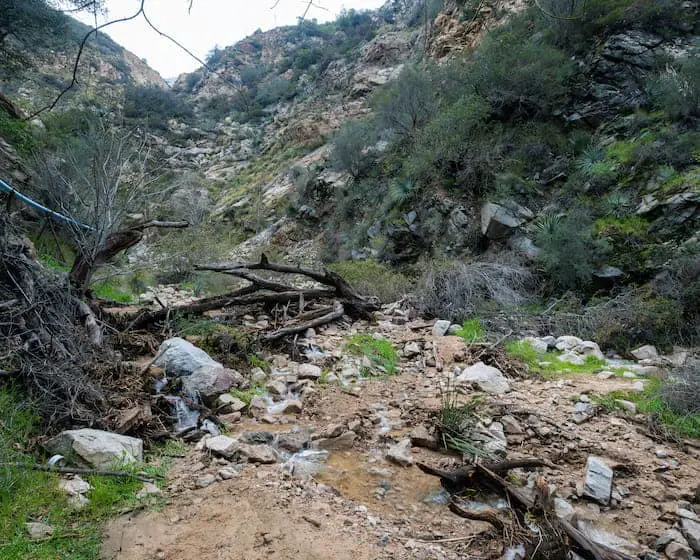
2. After climbing down the boulder, I began venturing off the trail by trekking upstream.
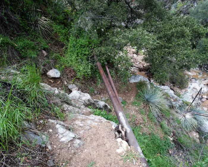
Your feet will get wet. It’s virtually impossible to make it to the falls without walking inside the creek, at least when I visited.
Here is a shot showing the section of the hike where I began trekking off-trail.
Luckily, there is only one way to and from the falls.
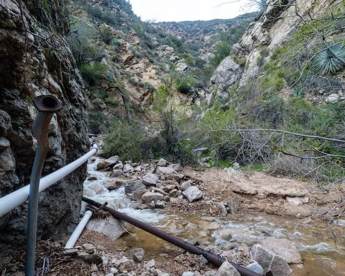
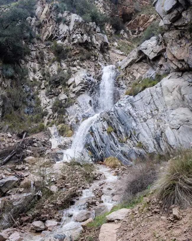
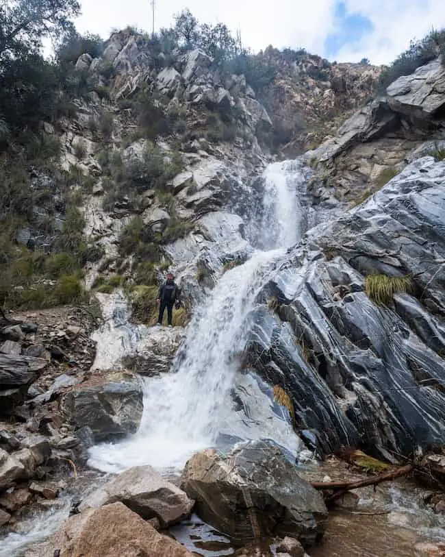
I couldn’t believe I was finally looking at Ribbon Rock & Moss Grotto flowing. I waited 6 years for the opportunity.
The area surrounding the falls included a pretty large clearing and a plethora of rocks and debris.
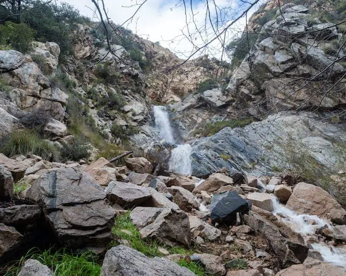
In fact, the bottom tier (Ribbon Rock), had been almost completely buried for the first part of the 21st century. You can see what that looked like right here. The falls aren’t as large as they used to be over a century ago.
However, most of Ribbon Rock has been uncovered in recent years.
Want to explore another nearby waterfall? Eaton Canyon Falls is the most popular falls in LA and is only 10 minutes away from Rubio Canyon!
These shots were taken in Feb 2023.
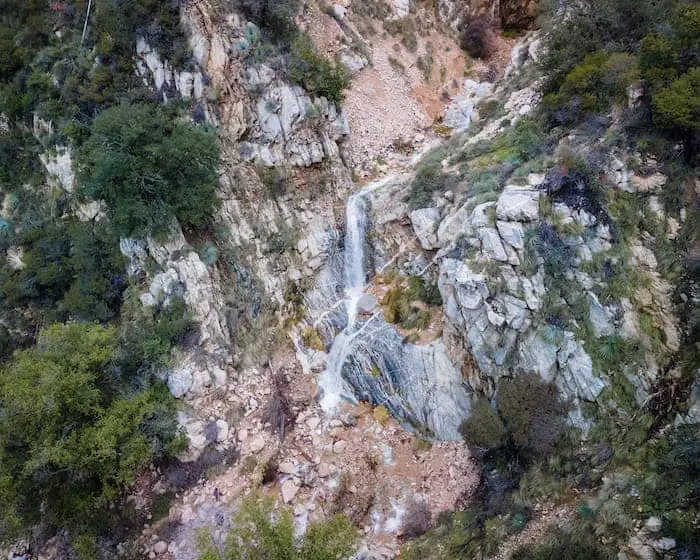
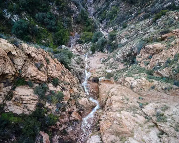
Aerial view of Ribbon Rock & Moss Grotto.
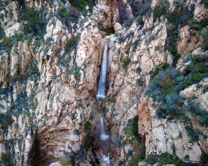
Near the top of the canyon is Thalehaha Falls & Roaring Rift Falls, the latter being the bottom tier. At 80 feet tall, Thalehaha is the largest of all the falls.
Looking down from Grand Chasm Falls to Ribbon Rock. Can you see the three of us standing at the very bottom?
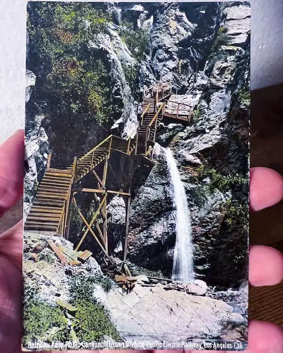
Although I don’t have a current picture of Grand Chasm (Rainbow Falls), I have another vintage shot for you. Check it out.
Read More: Best Waterfalls in Southern California.


