
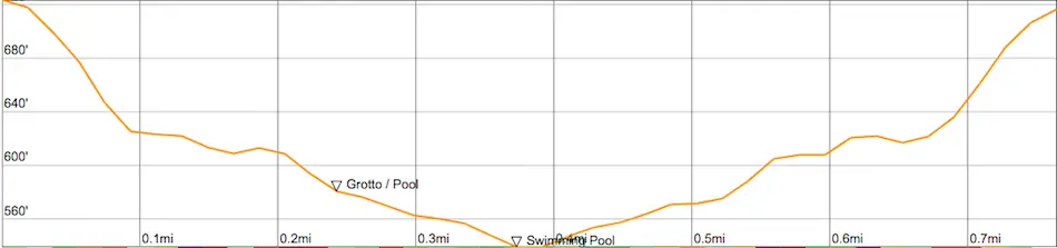
Distance
~1 Mile
Time
45 Min
Difficulty
Moderate
Season
All Year
Elevation Gain
187 Ft
Deep in the Santa Monica Mountains, a secret storm drain referred to by the locals as the Topanga Time Tunnel, provides access to a secret 8 foot grotto, insane looking rock formations, and various large waterholes.
The Topanga Time Tunnel is a short 1 mile hike located in a beautiful mountain community known as Topanga. The virtually nonexistent trail, which requires boulder scrambling and multiple creek crossings, is less than ideal for beginners.
Topanga Time Tunnel Quick Reference Guide
- Take long sleeves and pants as poison oak is abundant
- Don’t go alone, or tell someone where you’re going. The area is very secluded.
- This hike requires boulder scrambling and climbing over fallen trees.
- For best views, visit in the morning, when the sunlight illuminates the canyon
- Unless there’s been heavy rainfall, your feet will not get wet.
Map of Topanga Time Tunnel
Directions & Parking
There is no designated parking for this hike. However, a turnout, which can fit two cars, is available across the street from the tunnel.
Get directions to the turnout by clicking HERE.
Click HERE to view the exact location of the turnout in 1st person. The trailhead is located just right up the street (westward) on the left side of the road where the railing is located. Look for a little dirt trail that leads down to the tunnel. The tunnel should be visible almost immediately after descending the trail.
If the turnout isn’t available, you can find free parking further up the road between Jalan Jalan Imports and Fernwood Market.
Looking for more LA county hikes? Checkout these posts!
Hiking The Topanga Time Tunnel
Depending on where you parked, getting to the tunnel requires carefully avoiding traffic as you may have to cross the street or hug the canyon wall as cars pass you by.
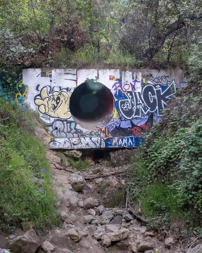
Hop over the guardrail located 20 ft down from the “slippery when wet” sign as soon as possible and make your way down the dirt trail where the tunnel will become immediately visible.
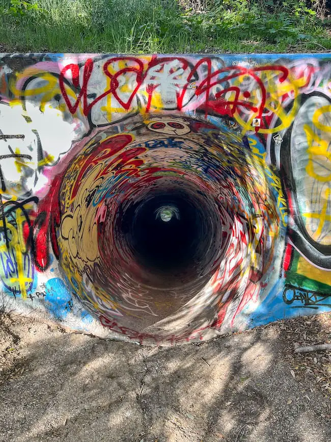
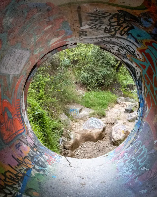
Make your way inside and head right after coming out of the other end.
Get ready to be transported into a beautiful green paradise hidden by a dense forest canopy.
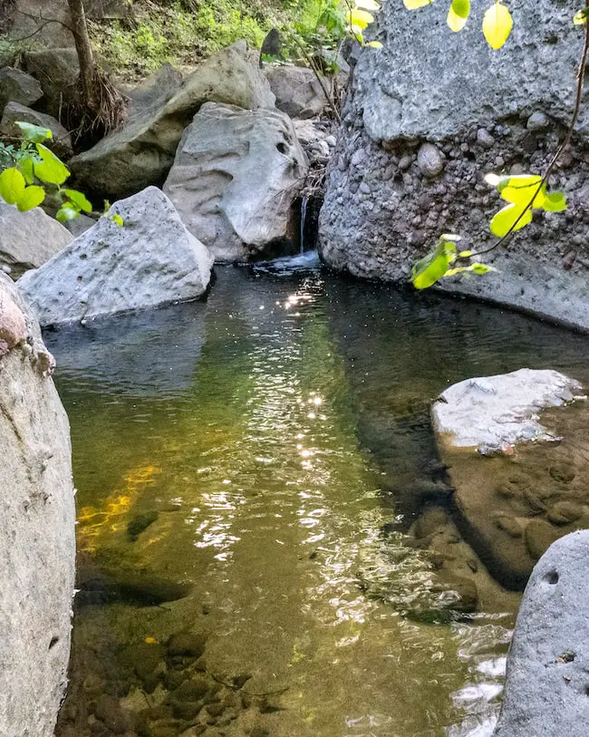
An abundance of springs are located on both sides of Lower Topanga Creek, which explains why the canyon has plenty of water in the summer and multiple swimming holes.
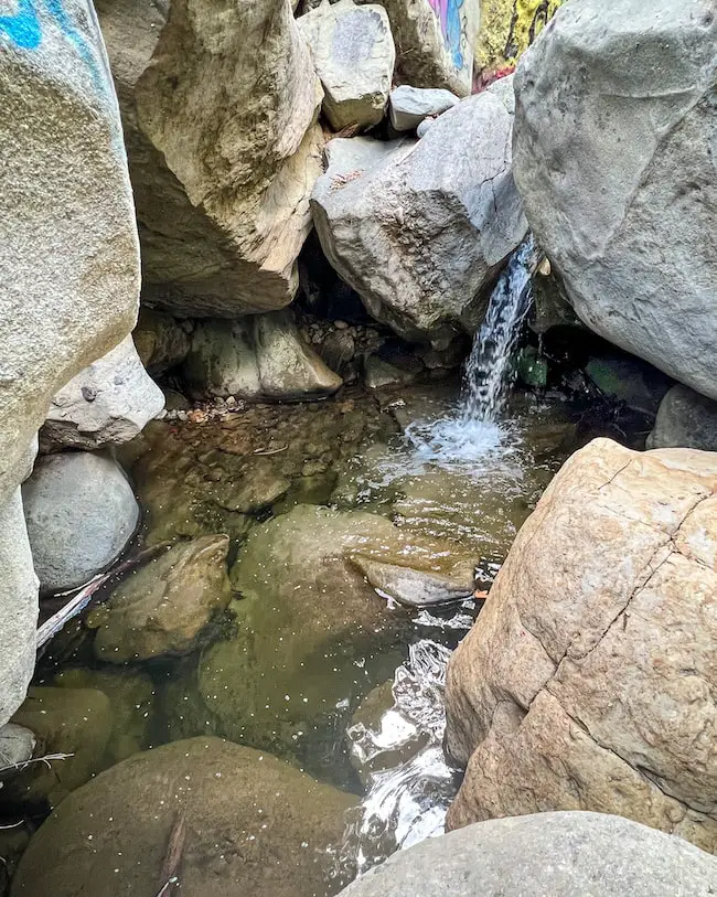
Within a few minutes, you will arrive at a tiny waterfall with a four foot glistening pool. The waterhole is fresh and crystal clear.
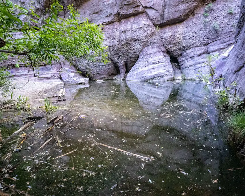
Shortly thereafter, you’ll arrive at another beautiful waterhole. However, this pool boasts an 8 foot grotto (the largest cascade on the hike).
The waterhole is also about 4 feet deep, and is completely surrounded by massive boulders.
Read More: Vanalden Caves in The Santa Monica Mountains
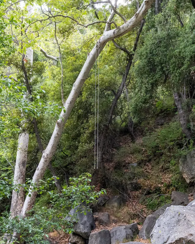
If you look downstream from the grotto, you’ll notice ropes high up in the trees. The ropes were used for a swing many years ago. Unfortunately for us, the swing is no longer there.
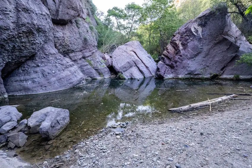
The creek widens as you make your way downstream and creates more waterholes.
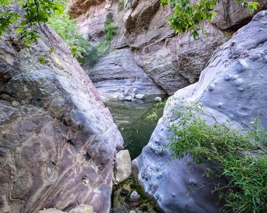
Notice how the boulders are subtly transforming into a slight purple color.
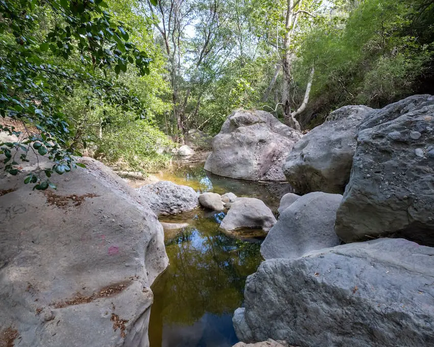
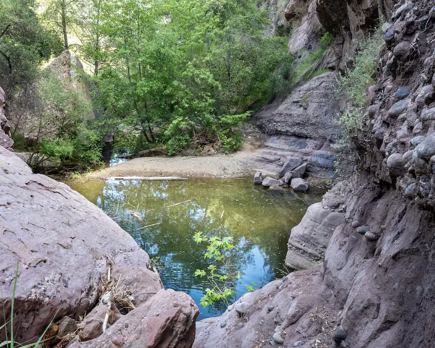
The creek squeezes its way between two enormous boulders and empties into a large waterhole.
You have arrived at the biggest swimming hole.
Read More: Murphy Ranch: Abandoned Nazi Ruins in Santa Monica Mountains
You can venture onto the right side of the creek before it empties into the swimming hole to get a good view from upstream.
The pool is deep, about 6-8 feet, and the surrounding rocks are now fully purple.
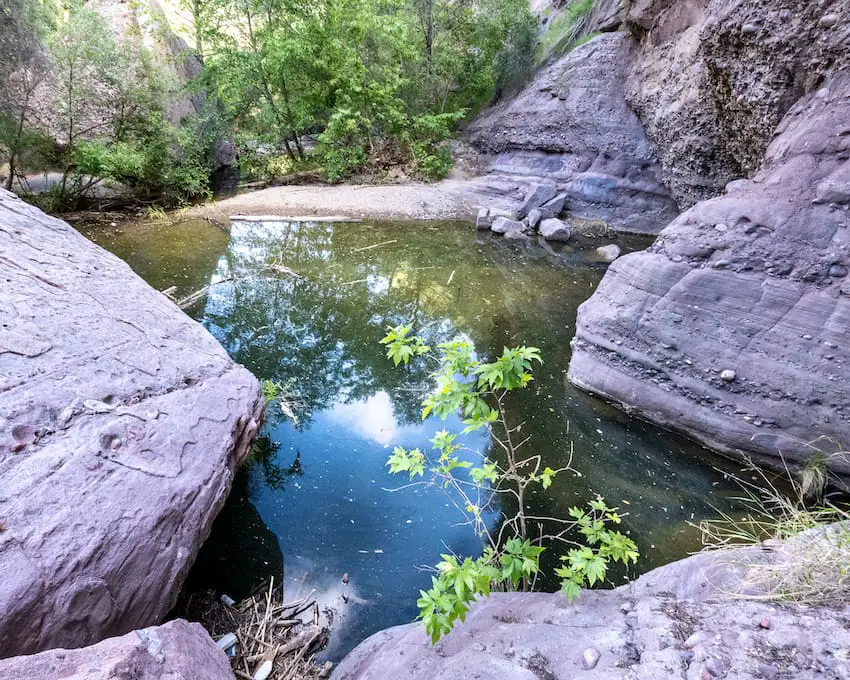
Head back towards the creek to make your way to the front of the waterhole. The pool becomes pretty cluttered with debris on the opposite side of the canyon wall.
Read More: Big Falls: 500ft Waterfall in San Bernardino
Last but not least, head over to frontside of the waterhole where the little beach area is located. In case you’re wondering, yes people do swim here.
I highly recommend visiting in the morning when the sun lights up the swimming hole.
Apparently, when we got home we realized there’s an additional large pool just a few minutes downstream from the swimming hole shown above.
It’s not as big, but it looks just as deep. The hike is 1 mile roundtrip if you include the 2nd large waterhole. I highly recommend checking it out!
Once you’re done, head back the way you came and into the portal we’ve come to know as the Topanga Time Tunnel.
Read More: Best Hikes in Southern California; Falls, Ruins, Peaks


