Two Trees Trail in Box Springs Mountain Regional Park

Two Trees Trail in Box Springs Mountain Regional Park

Distance 

2.5 Miles

Time

1.5 Hrs

Difficulty 

Moderate

Season

All Year

Elevation Gain

977 Ft

  • Dogs allowed on a leash
  • Out & Back Trail
  • Restrooms Not Available

Looking for a short hike before or after work? Two Trees Trail is just the hike for you!

Two Trees Trail is a short and fun hike in Box Springs Mountain Regional Park featuring wild donkeys, a small seasonal waterfall, and a stunning viewpoint of the valley below. A short detour up to a rocky peak can be added for those who crave more adventure. There is no shade on the trail, so packing a hat and plenty of water is a must.

For a complete list of hikes in Riverside County, check out the following link:

Riverside Hikes

Two Trees Trail Map

powered by Advanced iFrame

two trees trail elevation profile

Download Printable PDF Map


Two Trees Trail Address & Directions

Click the link to be redirected to the trailhead on Google Maps 430 2 Trees Rd, Riverside, CA 92507.

The trail begins at a very small dirt parking lot, so be sure to arrive extra early, especially on weekends!

Two Trees Trail

Two trees begins in a residential area. Word on the street is not to leave anything valuable in your car, especially after dark.

Fortunately, during our visit we saw nothing but friendly people and smiling faces.

Two Trees Trailhead

The trail begins on the canyon floor and requires traversing a dry creek bed via an old wooden bridge.

Keep an eye out for poison oak in this area. Remember, leaves of 3, let it be.

Wooden Bridge at Two Trees trail

Poison Oak

poison oak at two trees trail

Read More: Tin Mine Canyon Trail: Corona’s Forgotten Past

Shortly afterwards, you’ll find yourself climbing up the barren slopes, surrounded by wild donkeys and giant boulders.

The wild donkeys are everywhere!

Here’s one looking for his buddies and probably some delicious Curly Dock for dinner.

Wild Donkey at Two Trees Trail

Curly Dock

Curly Dock at Two Trees Trail

If you look to the south, you’ll have a clear view of Old Saddle Back, which consists of two peaks, Modjeska and Santiago, in the Cleveland National Forest. The latter being the highest point in the range.

If you’re lucky, you’ll also witness the train making its way through large green pastures, painting a picturesque image resembling old school puzzles.


When you’re about halfway up the mountain, you’ll notice a small, roughly 8 foot dry waterfall to the left of the trail. It’s hard to miss.

Hopefully, if it continues to rain, the falls will be flowing.

two trees trail seasonal waterfall

To the north is an entire area I’d like to explore on my next visit. There are many good sign of running water, and where there is water, there are many surprises.

You’ve made it to the top! I was pretty shocked to see more residential homes in the area, but nevertheless, the views are beautiful.

Read More: Pumpkin Rock: Halloween Boulder 

The rocky peak you see below is actually a view point which you can add onto the hike via an official and safe trail.

Simply head left after reaching the dirt road at your destination and you’ll see the trail up to the peak. You can’t miss it.

The dirt road is called Box Springs Mountain Rd, and if you head down the road for a bit, you’ll be rewarded with a stunning view of the San Bernardino National Forest, and some of its most lofty peaks.

By the way, I use the app Peak Visor to identify peaks on my hikes. I’m not affiliated. I just really love the app!

san bernardino national forest from two trees trail

san bernardino national forest peak visor two trees trail

When you’re ready, head back the same way you came, and enjoy and amazing sunset backdrop.

two trees trail

Read More: Mt Rubidoux Trail: 360 Panoramic Views

Cowles Mountain: #1 Trail in San Diego County

Cowles Mountain: #1 Trail in San Diego County

Distance 

3 Miles

Time

1.5 Hrs

Difficulty 

Moderate

Season

All Year

Elevation Gain

908 Ft

  • Dogs allowed on a leash
  • Out & Back Trail
  • Restrooms  Available at The Trailhead

Ready for a quick adventure to a sunny peak in the San Carlos neighborhood? If so, I have just the hike for you.

Cowles Mountain in Mission Trails Regional Park is considered the most popular trail in San Diego County, and is also the highest point in the city. It offers amazing 360 panoramic views ranging from Orange County to Mexico, and lake Murray. There is no shade on this trail.

Cowles Mountain Map

powered by Advanced iFrame

Cowles Mountain Elevation Profile

Download Printable PDF Map

Cowles Mountain Directions

Click the link to be redirected to the Cowles Mountain Parking Lot on Google Maps.

Cowles Mt has multiple trailheads, and this one happens to be the most popular. Therefore, expect massive crowds on the weekends.

I went on a Wed at 9:30ish am and it was surprisingly not too heavily trafficked.

If the lot is full, you can park on Golfcrest Dr. right in front of the parking lot, but on the weekends even that too gets full.

More San Diego hikes you’ll love!


Cowles Mountain Trail

Your journey to Cowles Mt Peak begins on a series of stone steps which quickly convert into a dirt single track.

Remember, there is no shade on this trail so don’t forget your hat and water!

Cowles Mountain Trailhead

Although it’s hard to see in the image below, the city of San Diego is visible from the trail almost from the very beginning.

Cowles Mountain Trail

As you continue your way up, Cowles Mt Peak looms over the subpeak in the foreground.

Giant boulders decorate the mountainside, giving off that unique look of the Southern end of Cleveland National Forest.

Read More: 11 Best Hikes in Socal

Cowles Mountain Trail

You’ll notice a few trail splits during your trek, but as long as you stay left at every fork, you’ll make it to your destination.

The steps shown below mark the beginning of the switchbacks, which are the last section of the trail before reaching the peak.

Cowles Mountain Trail

After a quick and pleasant trek up the mountain, you’ve reached the summit marker, and the highest point in the city of San Diego.

Cowles Mountain Peak

In case the text on the marker is too small to read, here is what it says:

Cowles Mountain

Elevation 1,591 Feet Above Sea Level

Mission Trails Regional Park

Cowles Mountain is the dominant feature of Mission Trails Regional  Park and the highest point in the city of San Diego. It was named to honor George A Cowles, a pioneer leader of San Diego County in the 1870’s. This mountain was part of the Rancho Mission San Diego land grant.

Cowles Mountain was purchased jointly by the City and County of San Diego on December 31, 1974.

Dedicated October 1984.

www.MTRP.org

Read More: 80ft Cedar Creek Falls & Huge Swimming Hole in SD County

Kwaay Pay Peak lies right over those antennas.

Read More: Annie’s Canyon Trail in San Diego County

The mountain range in the back is the Cleveland National Forest.

Cowles Mountain

The dirt road is called Cowles Mountain Service Road, and is actually one of the less trafficked alternative routes to the peak, totaling 2.9 miles as a roundtrip loop.

Cuyamaca Peak is the 2nd highest peak in San Diego County, and gets snow in the winter! Fun fact, Hot Springs Mountain is the county’s highest peak.

Read More: 7 Must-Do Waterfalls in Socal

Tecate Peak gets its name because it overlooks the city of Tecate in Mexico, where I happen to have family. It’s also the name of the very popular Mexican beer.

Surprisingly, Tecate Peak is barely located within US jurisdiction.

Lyons Peak & Tecate Peak view from Cowles Mountain

Cowles Mountain Aerial View

Lake Murray, shown below, can actually be seen almost from the very beginning of the hike, but I saved it for the end  because the peak offers the best views.

For those who visit the lake, you’ll be rewarded with a stunning backdrop of beautiful Cowles Mountain.

Read More: 7 Best San Diego Hikes You MUST Explore!

Read More: Ho Chi Minh Trail: Slot Canyon + Falls in SD


Cowles Mountain History

Probably the most interesting history fact regarding Cowles Mt, is the fact that a Kumeyaay Winter Solstice site was once located on the trail.

Lasting for a few days before and after the solstice, people were able witness a peak splitting the rising sun to the east. (Thank you Hidden San Diego for this amazing find).

Unfortunately, the peak was destroyed many years ago.

According to MTRP.org Cowles Mountain is named after George A. Cowles, a kind and ambitious man, as well as one of the first San Diego ranchers.

However, the mountain was originally known as S mountain, thanks to 500 San Diego State University students who painted a 400ft tall “S” on the side of the mountain in 1931. The tradition of repainting the letter S lasted well into the 1980’s, but hasn’t been repainted since.

Cowles settled in in El Cajon valley in 1877 and purchased roughly four thousand acres of land, consisting of two ranches known as Magnolia Ranch (if it sounds familiar that’s because it’s now a street name), and Woodside Ranch.

On his ranches, he grew and sold:

  • fruit trees
  • olives
  • potatoes
  • olives
  • grapevines

He also raised horses and cattle. However, it was Cowles’ fruits and grapevines which attracted the most attention.

Thanks to Cowles, San Diego gained worldwide fame as an ideal farming region.

Although he passed away in 1887, the community which sprung out of his Woodside Ranch became known as Cowlestown.

He left his estate to his beloved widow, Jennie, who continued the ranching legacy until the1890’s. She remarried to Milton Santee, a real estate developer, in 1890 and moved to San Diego City.

Cowlestown became officially known as Santee in 1893 (ouch).


FAQ

Can you hike Cowles Mountain at night?

Yes, people hike Cowles Mountain at night. Especially on weekends, it’s not at all unusual to find lots of people hiking up to Cowles Mountain in the dark.

How many calories do you burn while hiking Cowles Mountain?

Although the answer will vary with each person, you can expect to burn roughly 500 calories on your Cowles Mountain hike.

Is Cowles Mountain hard?

I would rate Cowles Mountain as moderately difficult.

How long does it take to get to the top of Cowles Mountain?

It’ll take you roughly 1.5 hours to reach the top of Cowles Mountain.


Quail Hill Trail in Irvine Open Space Preserve

Quail Hill Trail in Irvine Open Space Preserve

Distance 

1.8 Miles

Time

45 min

Difficulty 

Easy

Season

All Year

Elevation Gain

152 Ft

  • Trail type: Loop
  • Restrooms: Yes, in the parking lot
  • Dogs: Yes, on a leash

Didn’t have enough time to get outside this weekend? Checkout this hike, especially if you live in or near Orange County!

Quail Hill Trail, sometimes referred to as Quail Loop Trail, is a very easy hike for the entire family to enjoy. It’s located in the city of Irvine and nestled between golden hills adjacent to the 405 fwy. The trail features a vista point of Santiago Peak, the tallest peak in the Santa Ana Mountains, a seasonal pond, and interpretative audio guides.


Quail Hill Trail Map

powered by Advanced iFrame

quail hill trail elevation profile

Download Printable PDF Map

Quail Hill Trail Address & Directions

Click the link to be redirected to the trailhead on Google Maps.

34 Shady Canyon Dr, Irvine, CA 92603


More Orange County hikes to check out!


Quail Hill Trail

Your speedy adventure begins in a shady parking lot and in between two Sycamore trees.

Remember to keep an eye for wildlife like rattlesnakes, hares, quails, and roadrunners, and dial 949-743-5943 to listen to the interpretive audio messages while on the trail.

quail hill trailhead

Almost from the beginning you’ll have amazing views of Old Saddleback, the nickname for the two highest peaks in the Santa Ana Mountains, Modjeska and Santiago, the latter being the tallest. 

Santiago Peak from Quail Loop Trail

The entirety of the trail consists of a dirt road. Checkout that skyline in the back.

Read More: 11 Best Hikes in SoCal

quail loop trail

Although the 405 fwy runs parallel to part of the loop, you may not even notice it, as you’re surrounded by beautiful golden hills.

A section on the Northside of the trail is actually a seasonal pond! Unfortunately, it was dry when I visited, but I’ll be going back as soon as we get some rain.

Read More: Top 5 Hiking Trails in LA

Old Saddleback from Quail Hill Trail

quail hill trail

If you need a quick nature getaway, plan a visit to Quail Hill Trail, especially during the sunset. You won’t regret it!

Read More: 7 Must-Do Waterfalls in Socal

quail loop trail meadow

sunset at Quail Hill Trail

Read More: 3 Best Hikes in Laguna Beach

Ho Chi Mihn Trail in San Diego: Slot Canyon & Waterfall!

Ho Chi Mihn Trail in San Diego: Slot Canyon & Waterfall!

  • Total Miles: 0.62
  • Time: 20 min
  • Difficulty: Hard
  • Best Season: All Year
  • Elevation Gain: 278 ft
  • Max Elevation: 330 ft
  • Type of Trail: Out & Back
  • Parking Lot: Street Parking
  • Dogs: Not Allowed
  • Restrooms: Not Available
  • Trail Popularity: High
  • Pics Taken On: Sept 28, 2022

I hope you guys are ready for a one of a kind adventure because there are very few hikes like this one!

Named by local surfers in the 1960’s, the Ho Chi Minh Trail (AKA Saigon Trail) in La Jolla is a short and technical trail that leads hikers through a beautiful slot canyon, steep ruts, and loose sandy ledges. In order to complete the journey, a rope must be used to descend onto the (clothing optional) Black Beach where a little luscious waterfall flows over the side of the sandstone cliff.

Want to explore more slot canyons, the largest SoCal falls, nazi ruins, and more? Check out the post below:

Best Hikes In Southern California

powered by Advanced iFrame

Ho Chi Minh Trail Elevation Profile

Download Printable PDF Map

Address & Directions

Click the link to be redirected to the trailhead on Google Maps.

9883 La Jolla Farms Rd, La Jolla, CA 92037

Helpful Links

Weather Forecast

Ho Chi Minh Trail

The trail begins in a quiet neighborhood via a small dirt alley between private properties.

It’s quite a popular route for surfers and those paying a visit to Black Beach.

Almost instantly you’ll enjoy amazing views of the canyon and the ocean.

The trail ascending up the canyon wall is one of two detours leading up to a viewpoint with stunning views of the beautiful Pacific Ocean.

When you reach the canyon floor, you’ll come across the infamous plank.

Luckily, it’s only about 3-4 feet above the ground, so if you don’t want to risk an injury, you can make your way down to the bottom and climb back up the other side.

This is the spot where most people take the wrong path. The correct way is to stay left, above the first slot canyon.

However, some people, like yours truly, intentionally climbed down to explore a bit more.

If you do decide to climb to the bottom of the first slot canyon (shown below), you’ll notice the walls closing in on you and a tall ledge marking the end of this detour.

You’ll have to turn back and climb back up the way you came to continue on the main trail.

Explore a hike with multiple swimming holes and a secret waterfall in SD County? Check out the post below.

Kitchen Creek Falls

Now that you’re back on the main trail, you’ll quickly arrive at the famous slot canyon where most people take pics.

The formations are other worldly, with the top of the slot canyon looking like a human brain (or maybe it’s just me).

There it is, the main attraction.

The last section of the trail begins to show signs of life as it runs parallel to the creek which now boasts running water and mossy decorated banks.

The end is officially in sight.

Before climbing down the canyon mouth, you’ll notice water running down the cliff wall to your left and an abundance of vegetation surrounding the area.

Oh, it gets better.

However, to be rewarded with a tropical paradise and waterfall, you must prove you’re a worthy adventurer by climbing down to the beach using a rope left behind by the locals.

The 12ish foot waterfall may not look like much, but the treasure lies in its uniqueness.

Few waterfalls flow directly onto a beach, as this one does, and when coupled with another rare attraction, a slot canyon, this hike literally is one of a kind.

SoCal’s most beautiful waterfall is also located in San Diego County, and it has the largest swimming hole I’ve ever explored. Check it out, click the link below:

80ft Cedar Creek Falls & Huge Swimming Hole

Upper Newport Bay Nature Preserve: Avoid The Summer Heat

Upper Newport Bay Nature Preserve: Avoid The Summer Heat

Distance 

5.2 Miles

Time

2 Hrs

Difficulty 

Easy

Season

All Year

Elevation Gain

226 ft

Not a fan of Socal’s brutal heat? Visit Upper Newport Bay Nature Preserve to enjoy a beautiful coastal hike surrounded by white cliffs and amazing sunsets.

The scenic preserve is a 5.2-mile loop hike located in Newport Beach featuring the upper half of Newport Back Bay, but can be easily shortened or elongated to one’s preference. Its low elevation gain and cool temperatures makes it ideal for hikers of all skill levels regardless of the time of year. Its peak beauty, however, is during the spring, when all the flora has re-blossomed.

  • Dogs are allowed but must be leashed
  • The trail is both a loop and out & back
  • Restroom available

Upper Newport Bay Preserve Trail Map

powered by Advanced iFrame

Download Printable PDF Map

Upper Newport Bay Preserve Address

Click on the link below to be redirected to the trailhead.

2301 University Dr, Newport Beach, CA 92660

No permits or passes are required.

Looking for hikes in Orange County? Check out these trails! 

Upper Newport Bay Nature Preserve Hike

I began by first hiking the loop portion of the trail called the West Bluff.

However, if you want to save the best views for last, I suggest starting via the out and back and ending with the loop.

upper newport bay nature preserve trailhead

Almost immediately you’ll be rewarded with amazing views of the Cleveland National Forest and the wetlands in the foreground.

upper newport bay nature preserve trail

Although the majority of the loop consists of a dirt trail, a small section requires hopping onto the bike lane, so keep an eye out.

upper newport bay nature preserve trail

Switch onto the constellation trail to begin looping around. This is where the trail gets more interesting.

If you’re lucky, you may spot the Peregrine Falcon. I got to see it a couple of times during the same hike, so it’s very possible you will too!

Read More: 11 Best Hikes in SoCal

upper newport bay nature preserve constellation trail

upper newport bay nature preserve

upper newport bay nature preserve

The shot below shows the southern region of Newport Back Bay, but unless you’re looking to hike 11 miles, this is where you’ll begin heading back towards the parking lot and onto the second portion of the trail.

Read More: Top 5 Hiking Trails in LA

upper newport bay nature preserve

If you were to turn your head north from the same location as the image above, you would see the entire picturesque estuary peaceful glimmering in the sun’s natural light.

upper newport bay nature preserve

And to the left, you’d see the king of the San Gabriels, Mt Baldy, towering above the range.

Mount Baldy from Upper Newport Bay Nature Preserve

After passing a little wooden bridge, the trail will have multiple vantage points with amazing views of the entire marsh.

Read More: Eaton Canyon Falls 2022 Guide

upper newport bay nature preserve vantage point

Old Saddleback from Upper Newport Back Nature Preserve

upper newport bay nature preserve

Huge shout out to Peak Visor once again for their awesome app (not affiliated, I just really like their app).

You can see Old Saddleback, which consists of the two largest peaks in the Santa Ana Mountains known as Santiago and Mojdeska Peak, the former being the taller mountain.

Read More: 7 Best Hiking Trails in Pasadena 

peak visor cleveland national forest from upper newport bay nature preserve

upper newport bay nature preserve

The trail doesn’t actually lead you back to the exact location of the parking lot. Rather, it leads you alongside the Santa Ana-Delhi Flood Control Channel and onto a bridge that runs across it.

upper newport bay nature preserve

Once you hop on the bridge, the rest of the hike is via the bike lane until you hit the street Jamboree. From there, switch onto a dirt road that parallels the street and ends at the water’s edge.

Read More: 7 Must-Do Waterfalls in SoCal

upper newport bay nature preserve

upper newport bay nature preserve

upper newport bay nature preserve

Once you’ve reached this point, take a moment to enjoy the views, then head back the way you came.

upper newport bay nature preserve

Read More: 3 Best Hikes in Laguna Beach


Upper Newport Bay Science Center

upper newport bay nature preserve nature center

The Back Bay Science Center is currently open to the public. They’re located at:

600 Shellmaker Rd. Newport Beach, CA 92629.

Phone number: 949-640-9959

One of the very cool features of the science center is its rooftop lounge, which allows you to enjoy the sunset with a view of the entire wetlands!

upper newport bay nature preserve

You don’t even have to hike as it’s located right next to the parking lot.

Other Fun Activities At Upper Newport Bay Nature Preserve

  • Fishing
  • Bird watching
  • Kayaking
  • Horseback riding
  • Cycling
  • Boating
  • Paddle Boarding
  • Jogging


Upper Newport Bay Nature Preserve History

I can’t start from the very beginning without briefly mentioning the geological formation of the area. The white cliffs were formed 15 million years ago, while the bay was carved by the Santa River during the Pleistocene Epoch’s glacial era, which ended around 9000 BC.

Everything from mammoths, giant sloths, and bison have been founded in the reserve, which up until 1862, used to flow directly into the Pacific Ocean. Today you can enjoy over 200 species of birds, as well as thousands of plants, fish, and other wildlife, some of which are sadly endangered.

The first sign of human life in the area dates back to sometime around 7000 BC. The Tongva people, also known as Gabrielinos because of their association with the San Gabriel Mission, inhabited the area from 2000 years ago to when the Spanish arrived.

During the Spanish and Mexican eras, the surrounding land was mostly used for grazing by cattle or sheep, or what John Muir referred to as hoofed locusts.

After the annexation of California into the Union, Rancher James Irvine (same guy as the city of Irvine) bought the bay in 1864, and in 1870, the area was used as a bay. Hence the name new port.

The fight to preserve Upper Newport Bay began in the 1960s when concerned citizens successfully managed to protect the 752-acre preserve from developing into a water-skiing area.

Still hungry for more Upper Newport Bay knowledge? Click the link to download the very thorough Upper Newport Bay Ecosystem Restoration Feasibility Study PDF by the US Army Corps of Engineers.

Switzer Falls Hiking Guide: 2 Falls, Chapel Ruins, Swing (Closed)

Switzer Falls Hiking Guide: 2 Falls, Chapel Ruins, Swing (Closed)

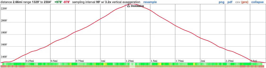
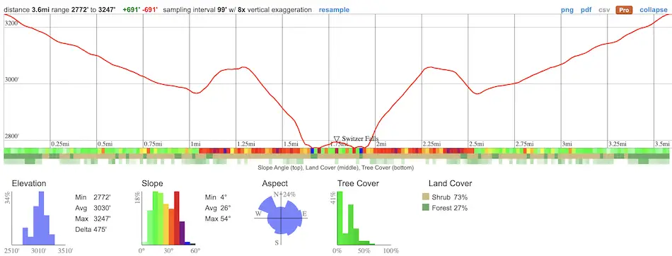
The following info doesn’t include the ruins detour nor the extra trek up to Silver Spray Falls.
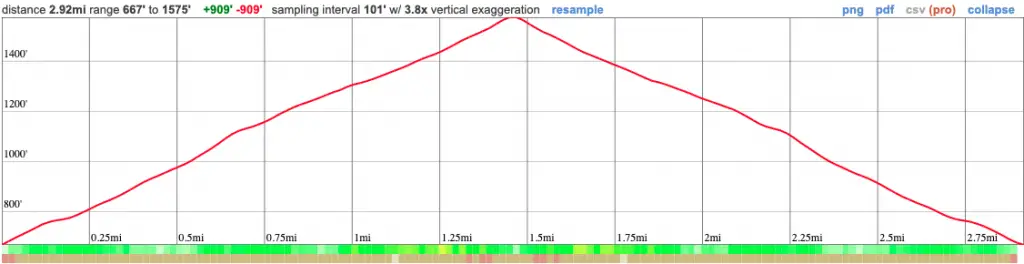
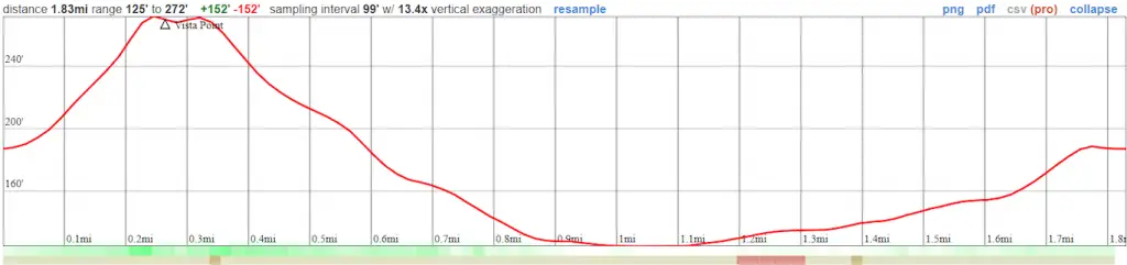
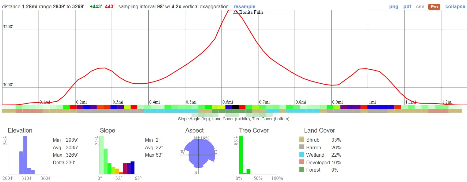
  • Total Miles: 3.6
  • Time: 2 hrs
  • Difficulty: Moderate
  • Best Season: Spring (2023 is an exception. It’s flowing as of Dec 2023)
  • Elevation Gain: 691 ft
  • Max Elevation: 3247 ft
  • Type of Trail: Out & Back
  • Parking Lot: Fits ≈ 30 cars
  • Dogs: Allowed On A Leash
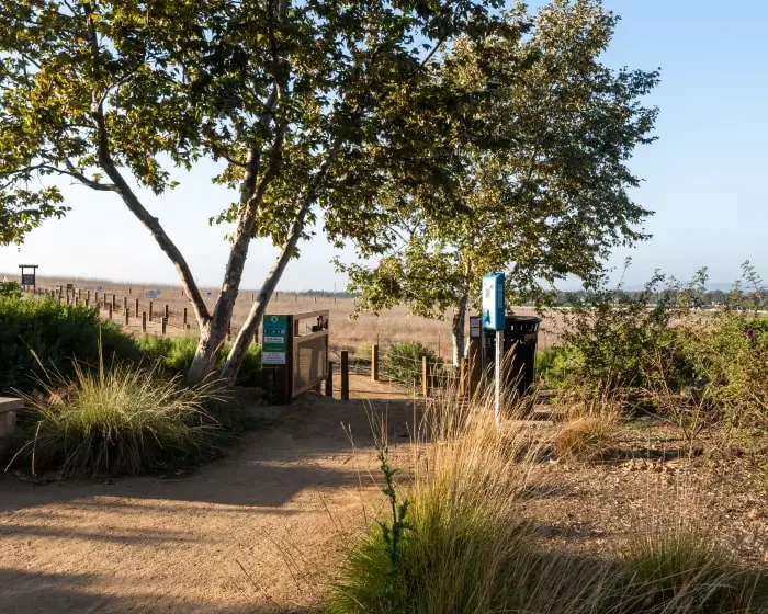
  • Restrooms: Available On The Trailhead
  • Trail Popularity: Very High
  • Pics Taken On: Dec 7, 2023

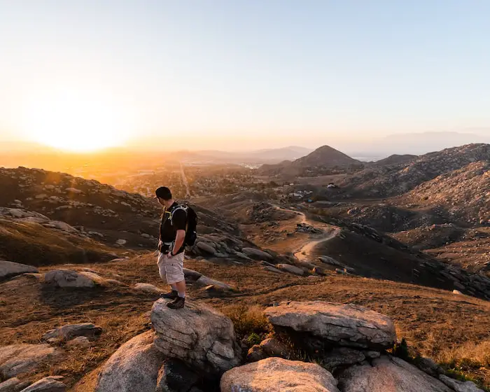
Looking for a trail that offers it all?

The scenic Switzer Falls, which begins via the Gabrielino Trail in the Angeles National Forest, features a two-tier cascade, and is one of my favorite hikes as it offers various fascinating features. For adventurers, chapel ruins can be explored by taking a short but somewhat challenging detour that begins about halfway to Switzer Falls, and a forgotten/secret waterfall can be explored further upstream from the primary falls.

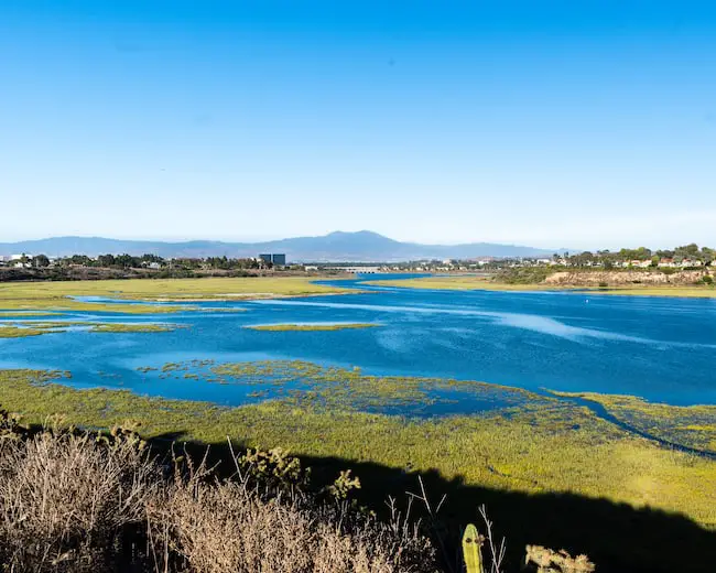
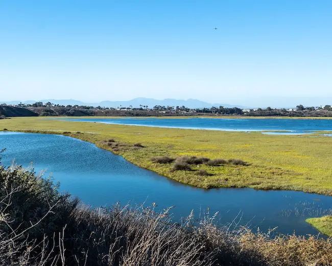
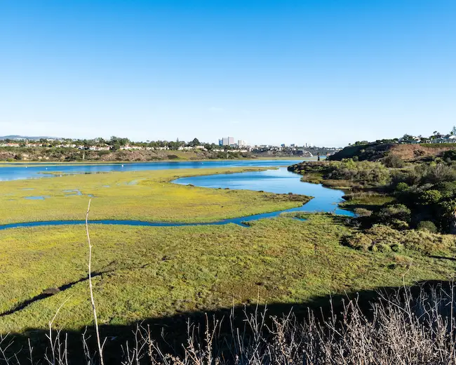
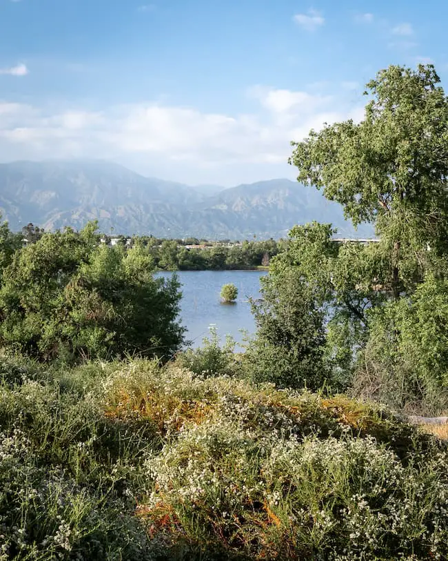
A swing is located near the end of the hike, but wait there’s more. The view of the Arroyo Seco zig-zagging its way down Bear canyon and the surrounding peaks is spectacular to say the least. Trust me, this hike will not disappoint.

Want to explore the best waterfalls in the county of LA? Check out the post below to view huge, snowy, and scenic waterfalls.

Best Waterfalls In Los Angeles

Switzer Falls Trail Map

powered by Advanced iFrame

Switzer Falls Elevation Profile

Download Printable PDF Map

The chapel ruins add a total of 0.2 miles, and the forgotten waterfall adds 0.41 miles. Hiking to Switzer Falls, the chapel ruins, and the forgotten falls totals the hike at 4.2 miles. All three can be found in the map above.

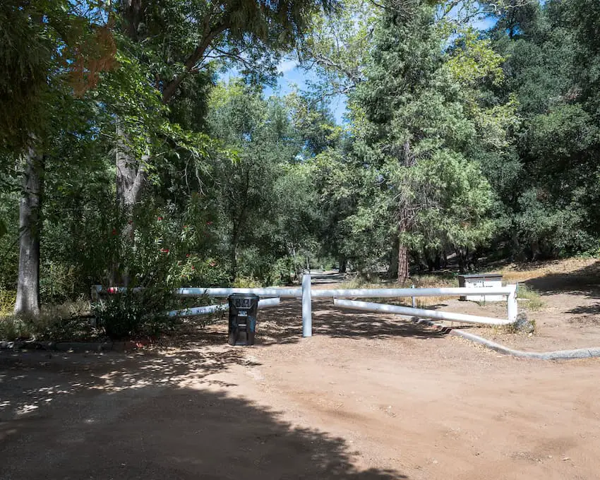
Parking & Directions

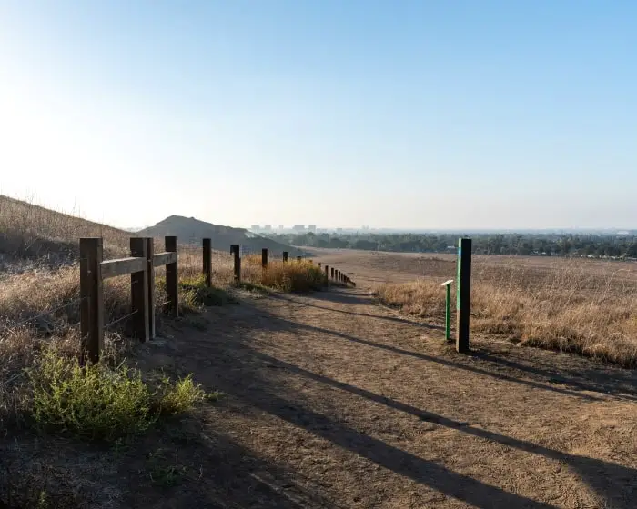
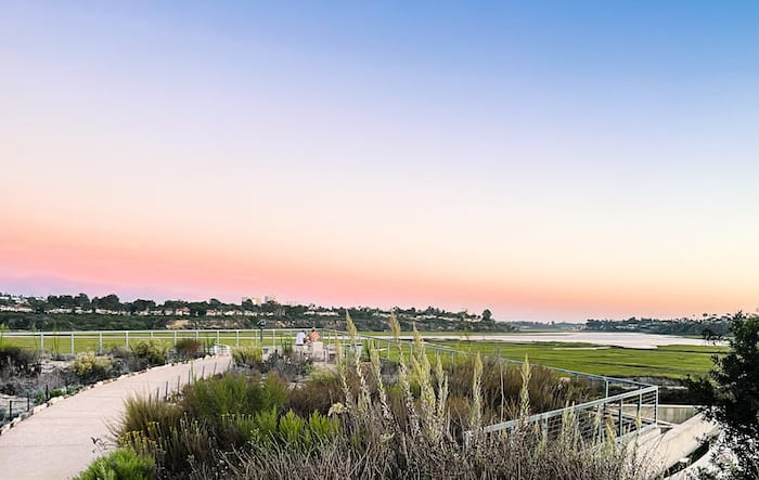
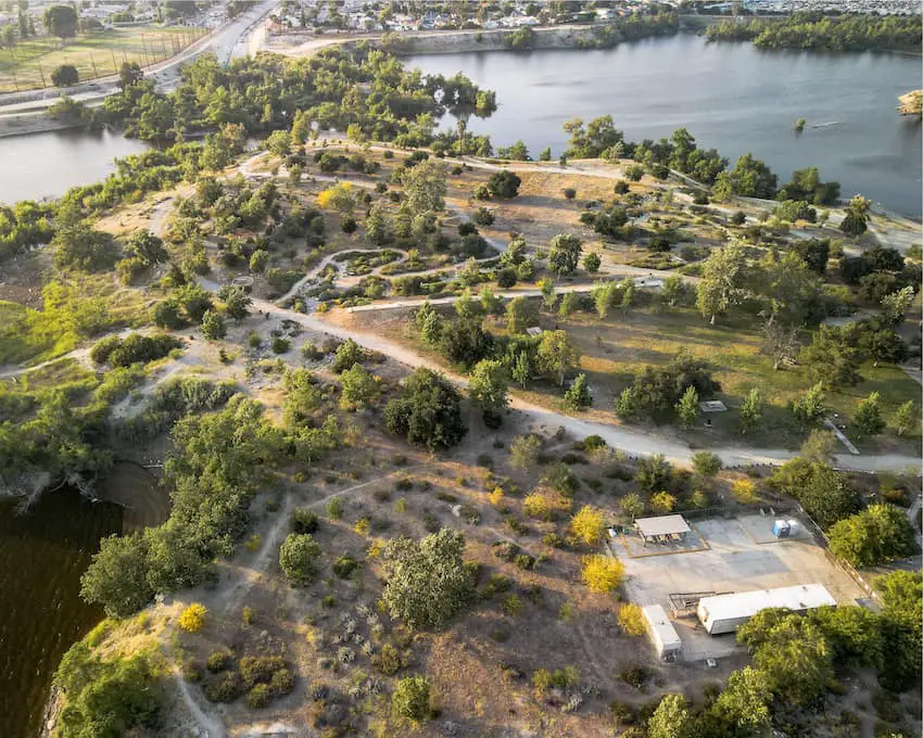
There are 2 available parking lots. The first is at the top, right off the 2 Hwy, and the second is at the bottom of the Switzer Truck Trail. If you park at the top expect to add another steep mile or so to the hike (roundtrip).

Click the link to be redirected to Switzer Falls Picnic Area (trailhead) via Google Maps. 

Helpful Links

Switzer Falls Weather Forecast

SoCal Adventure Pass (Required For Parking)

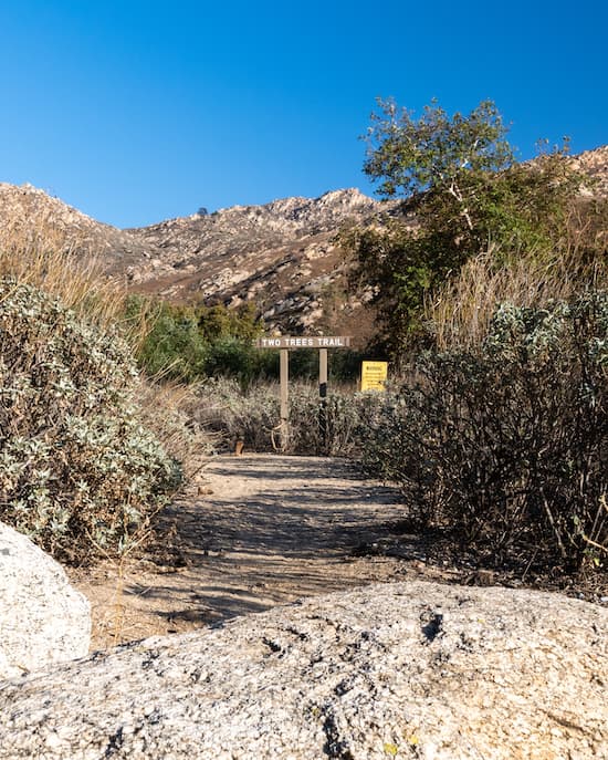
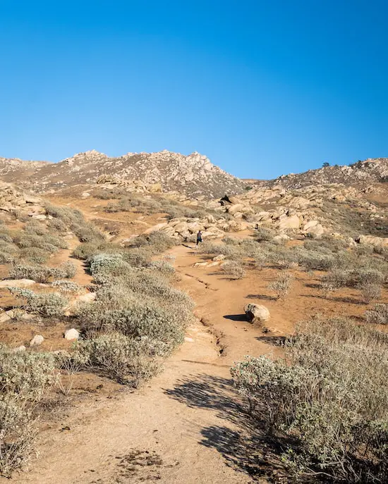
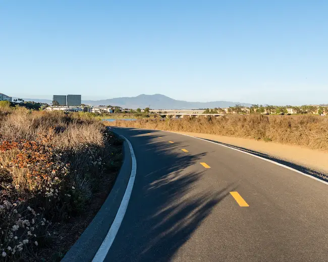
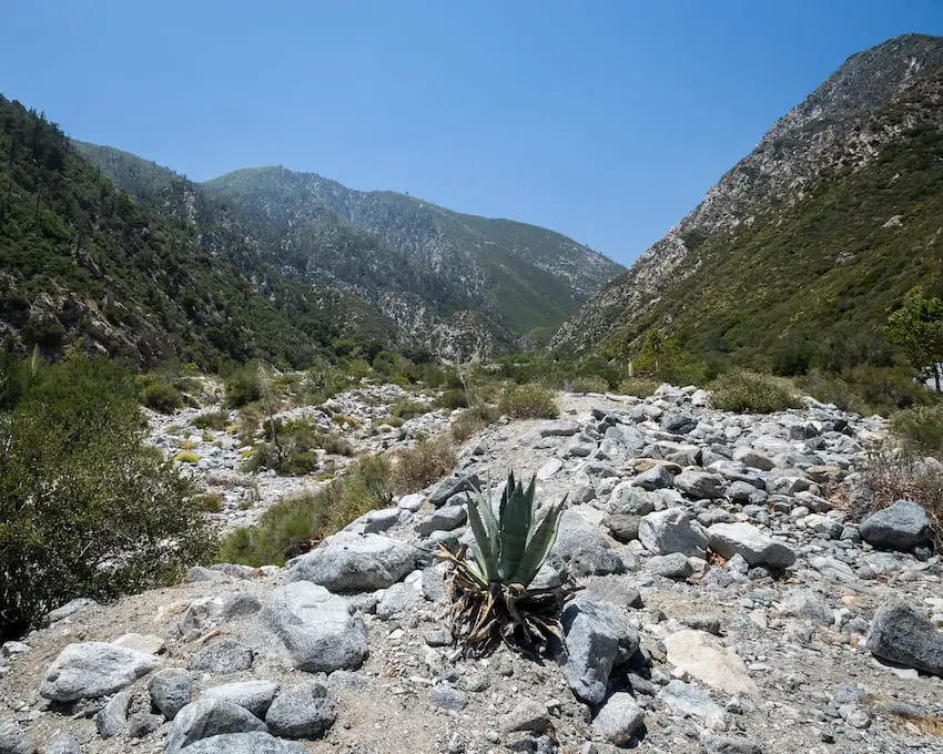
Hiking Switzer Falls

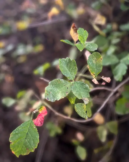
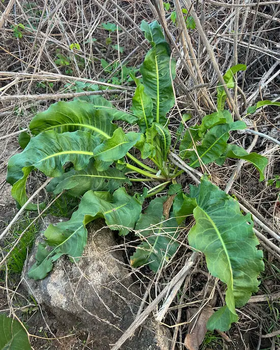
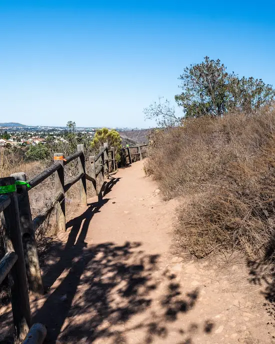
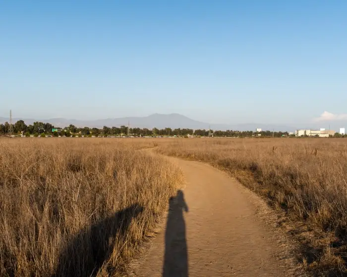
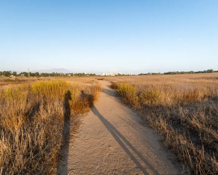
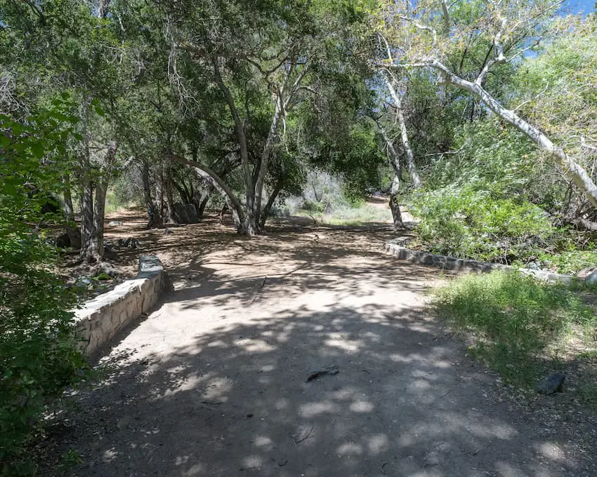
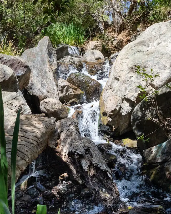
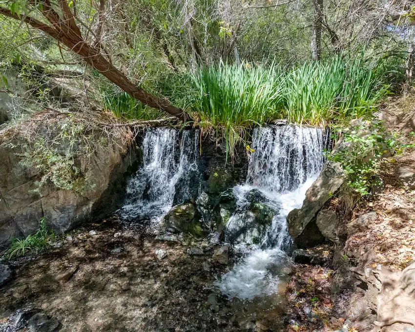
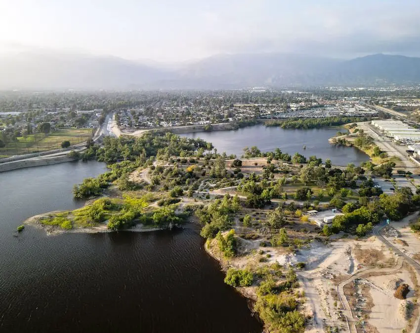
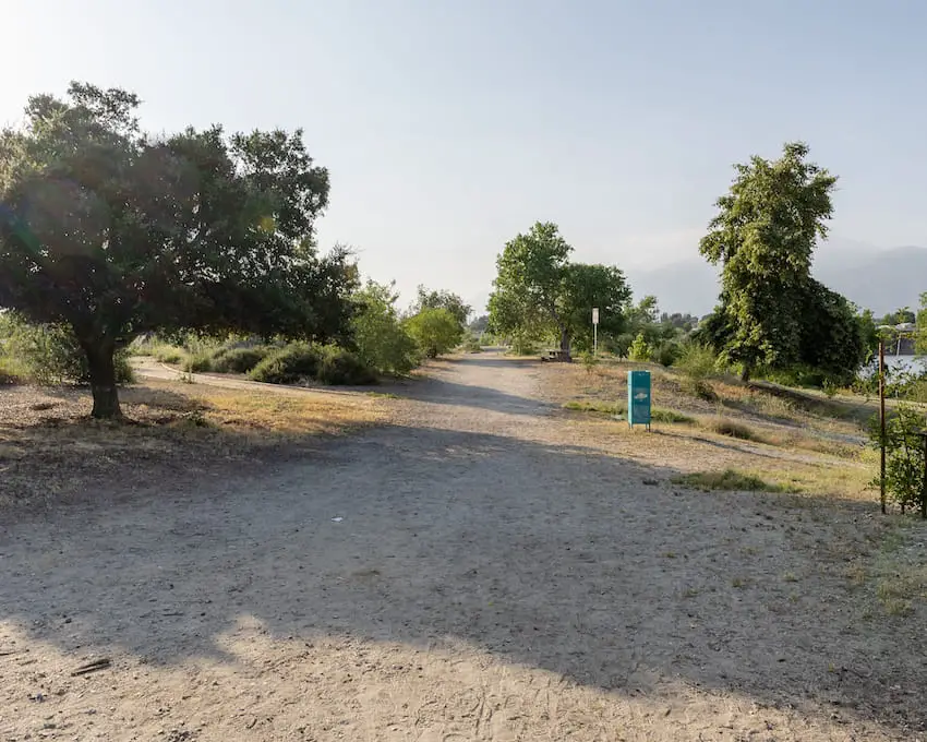
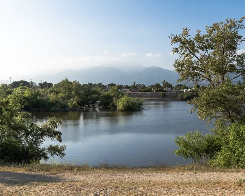
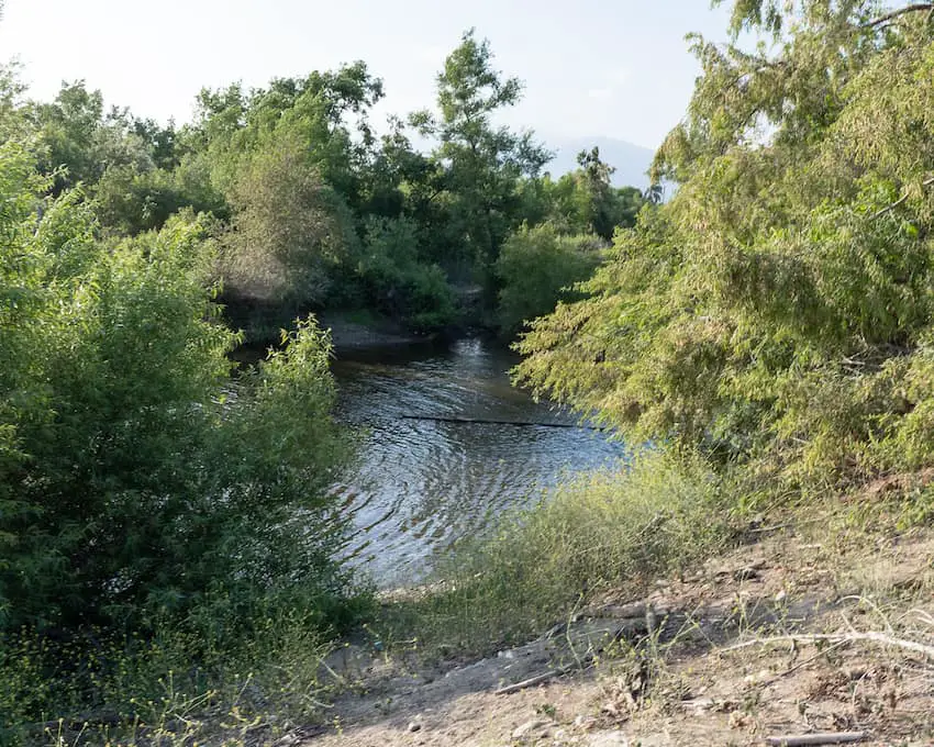
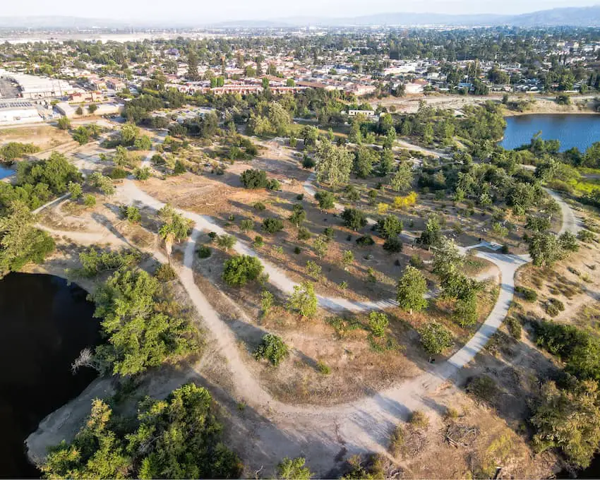
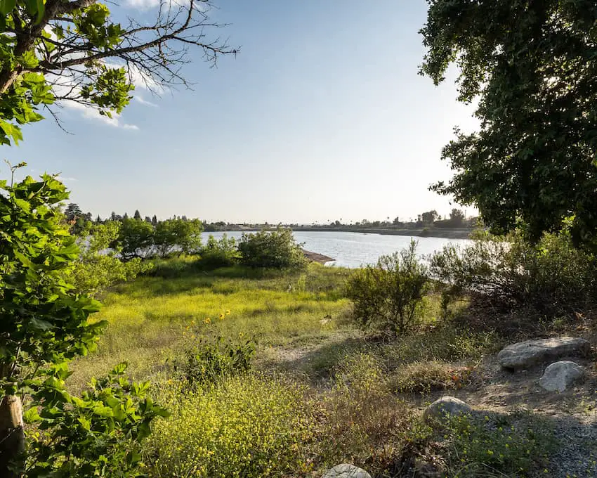
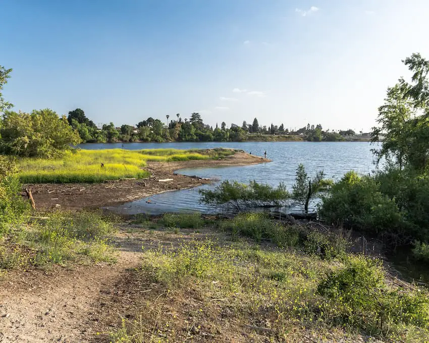
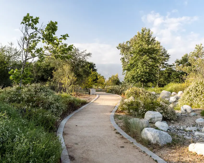
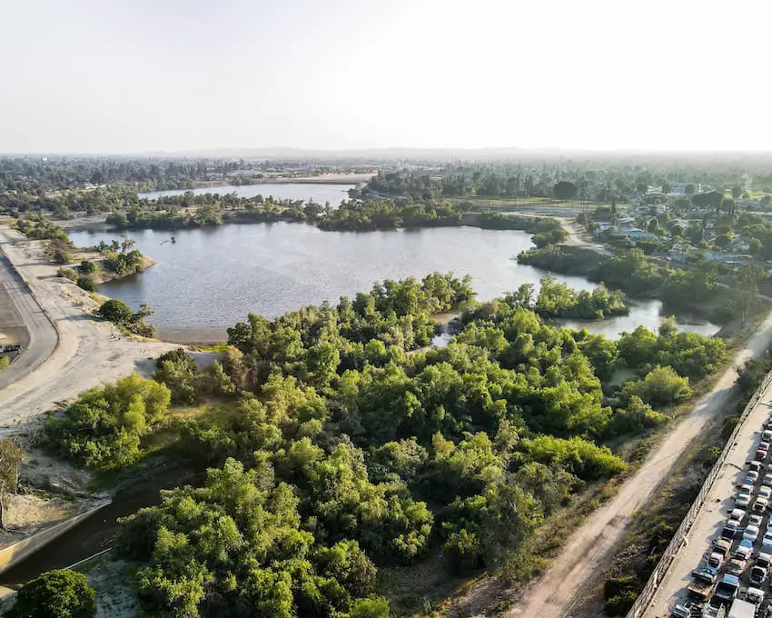
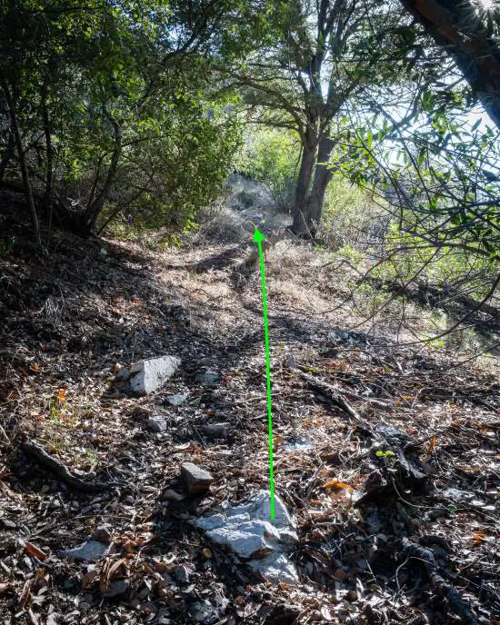
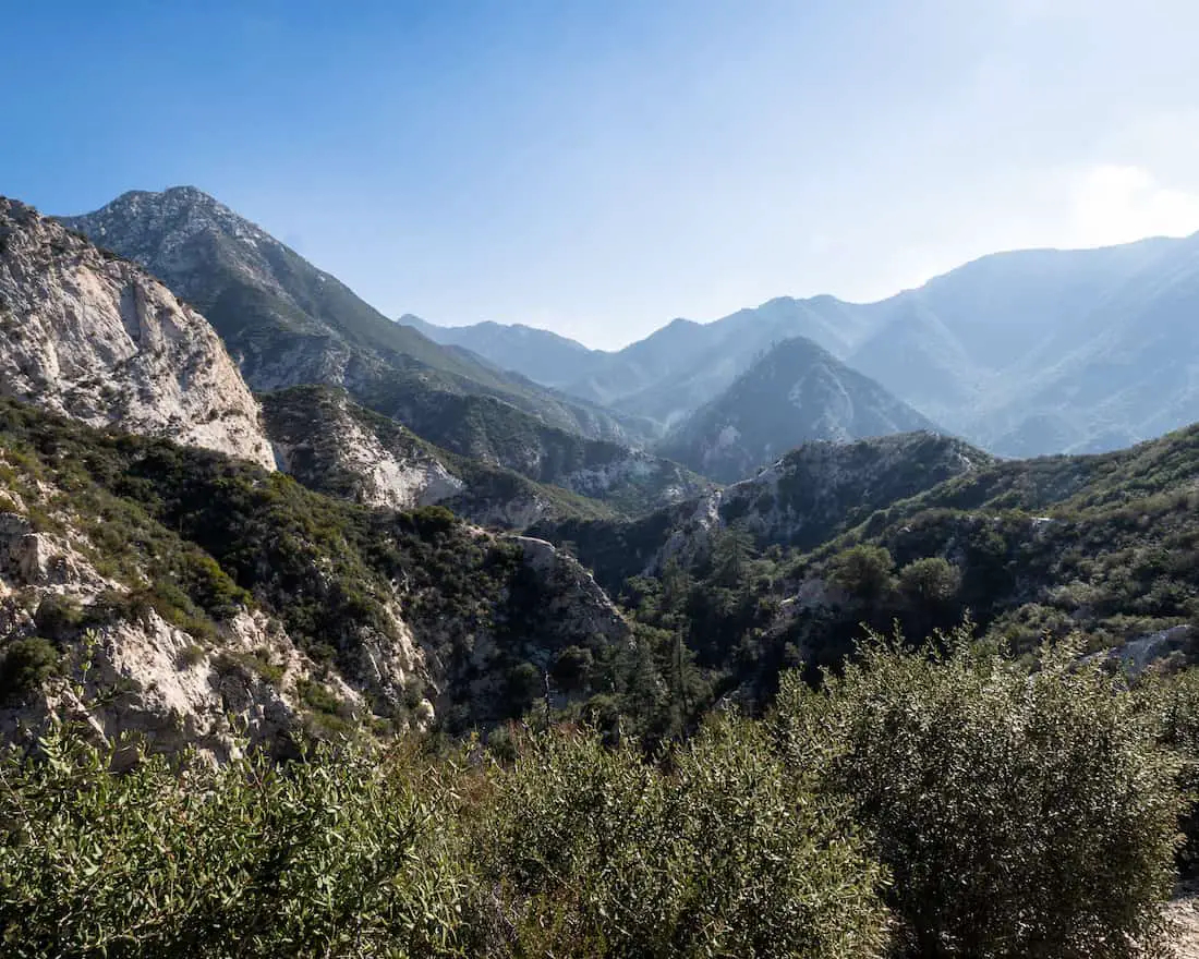
The hike begins in the densely vegetated Bear Canyon, and, since the majority of the trail ran adjacent to the Arroyo Seco creek, plenty of shade was provided by white alders, sycamores, and oak trees.

The actual name of the trail is the Gabrielino Trail, named after the Tongva peoples who were native to the region. They were called Gabrielinos by the Spanish after the mission of San Gabriel in Los Angeles, but I digress.

Switzer Falls Trailhead

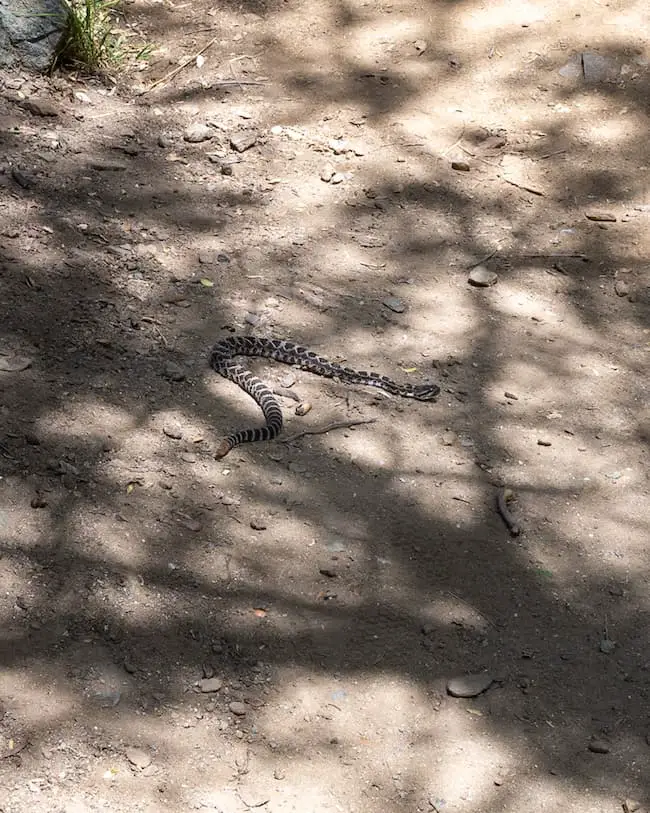
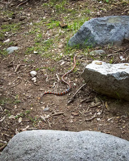
The canyon is home to an abundance of wildlife. I’ve seen everything from deer, quail, and a California King Snake (shown below).

switzer falls california king snake

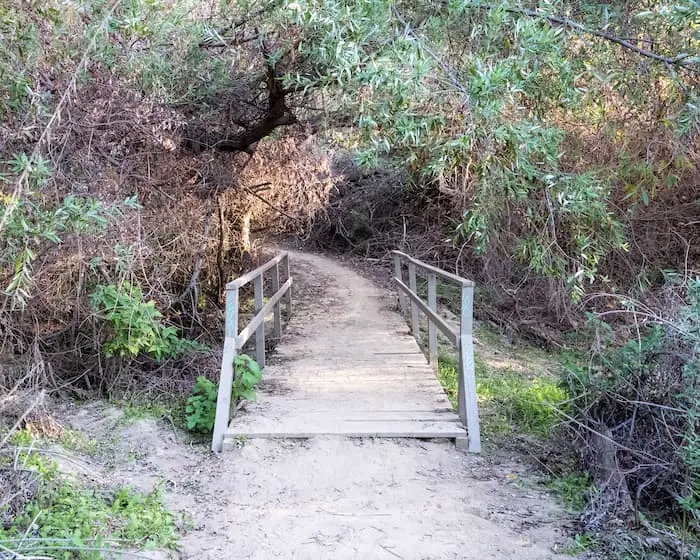
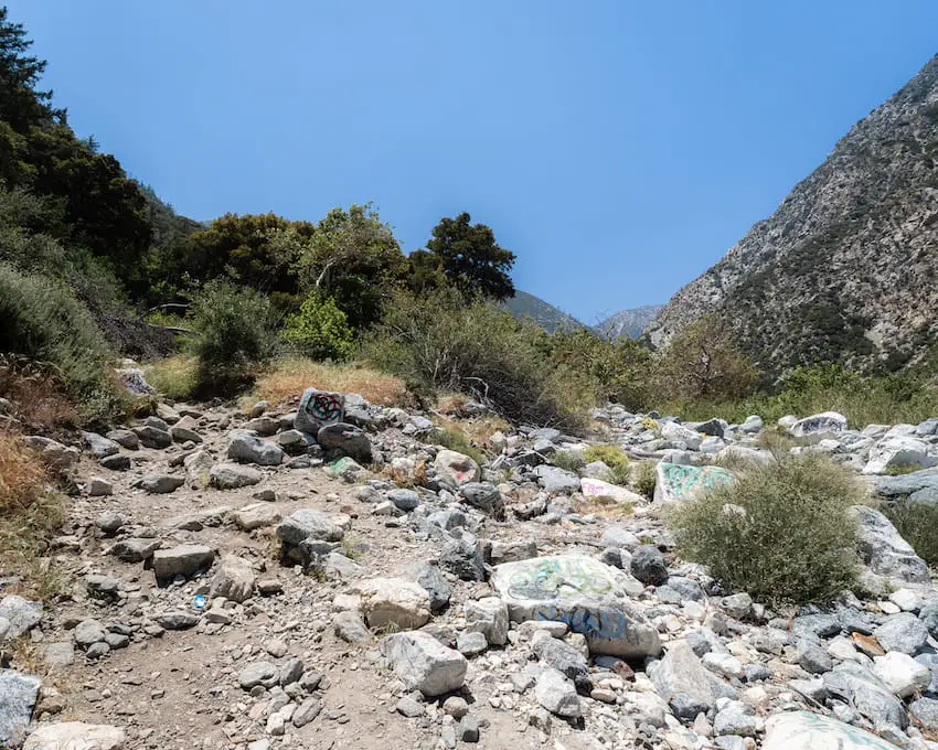
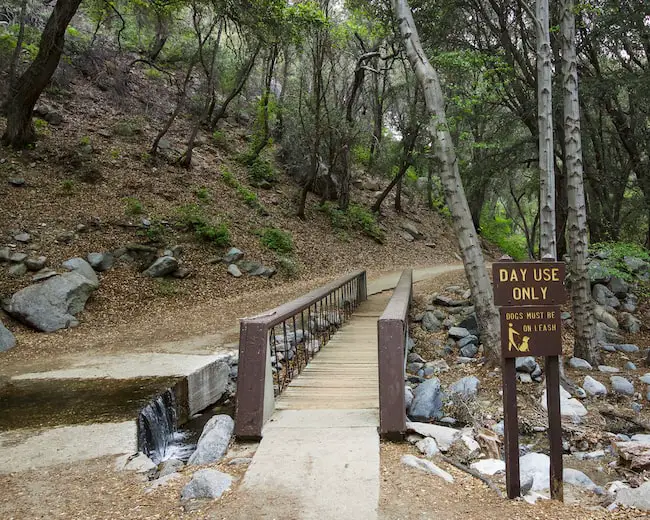
Getting to the falls requires crossing the creek quite a few times. If your balance is not the best, consider using trekking poles.

I use the Trailbuddy poles, which I highly recommend. They’re super cheap and reliable.

Creek Crossing On Switzer Falls Trail

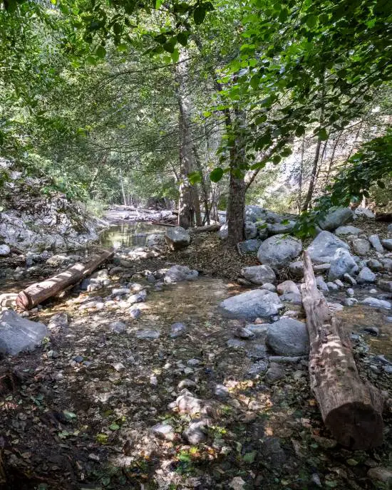
Due to the many oak trees, shallow banks along the creek, and access to the valley via the creek, I always suspected Bear Canyon to have been a seasonal home for Native Americans.

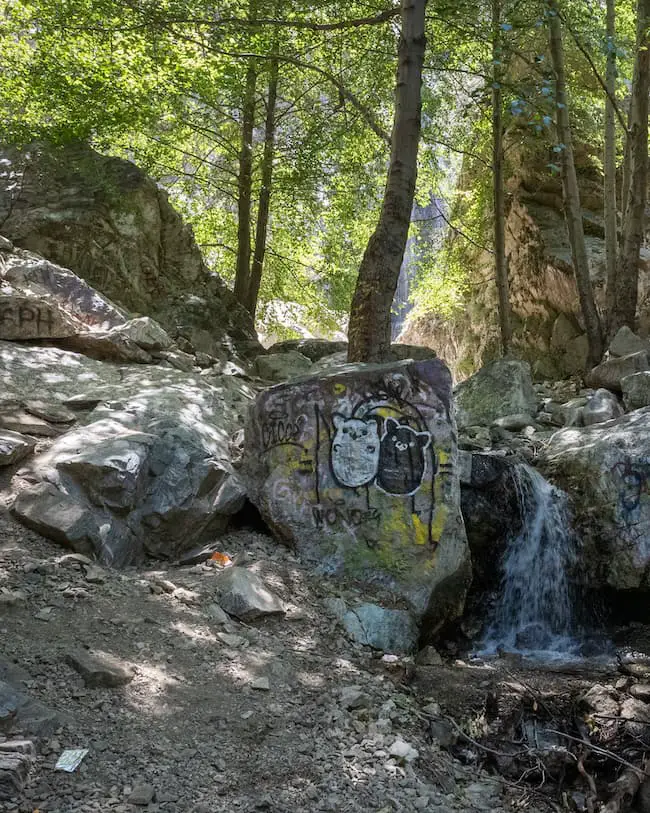
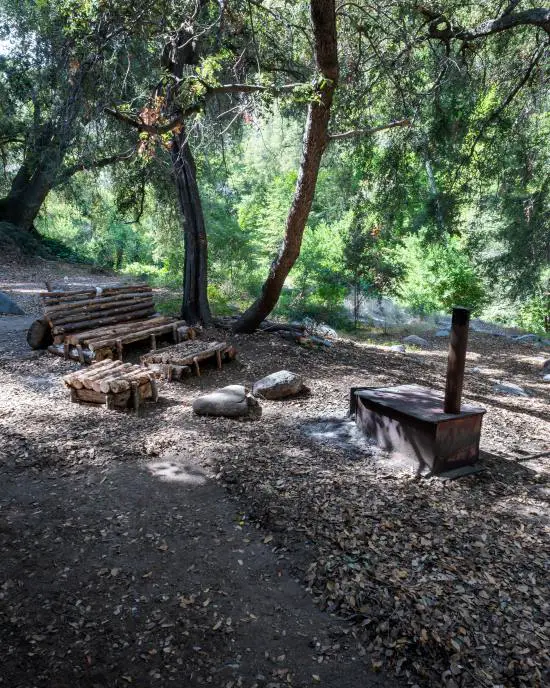
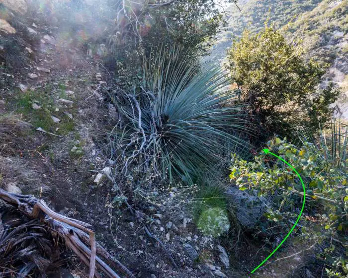
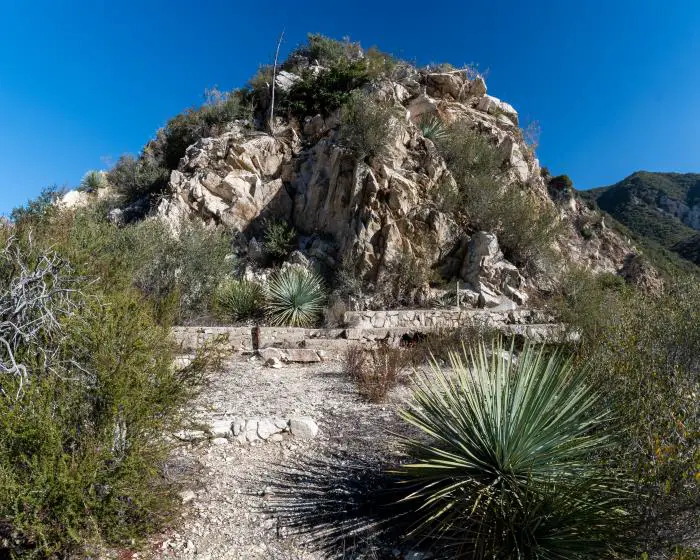
Someone built a table and chair out of logs near the fork where the chapel detour begins, and I must admit, they did a phenomenal job. My hat goes off to you sir or madam.

Log Chair & Bench

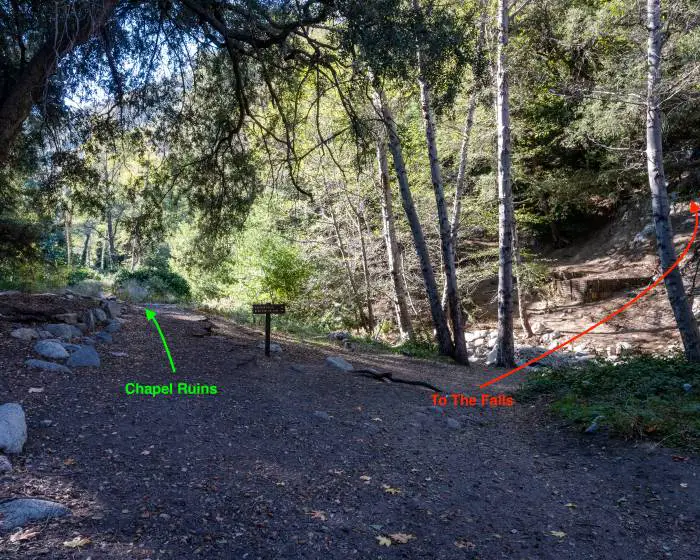
Keep in mind that if you decide to take the chapel detour you WILL be pricked by razor-sharp yuccas, as the trail is completely overgrown in some sections.

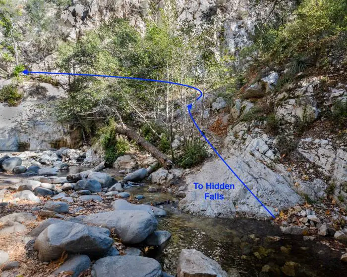
Also, make a mental note of the image below. You’ll be returning to this fork after the ruins to hop back on the Gabrielino Trail toward Switzer Falls.

Switzer Land Chapel Ruins Detour

Christ (Switzer Land) Chapel Ruins Detour

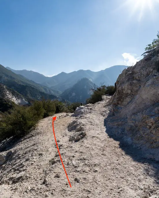
After making a left at the fork to begin the detour, I made another left at the stone wall (image below). The trail, if you can call it that, was rather steep and loose, and almost immediately curved to the right.

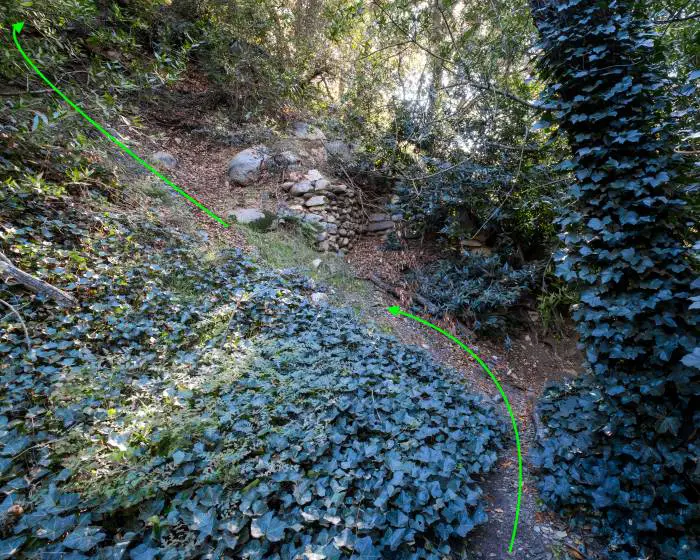
I took the path to the left at the next fork.

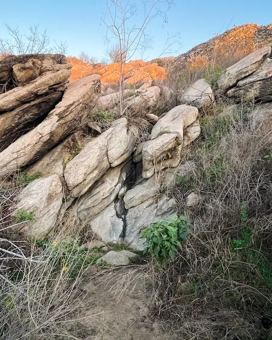
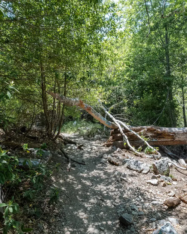
From this point on the trail got VERY overgrown and remained that way until I arrived at the ruins, which was only after a 30-foot stretch or so.

For the last fork shown below, I made a right.

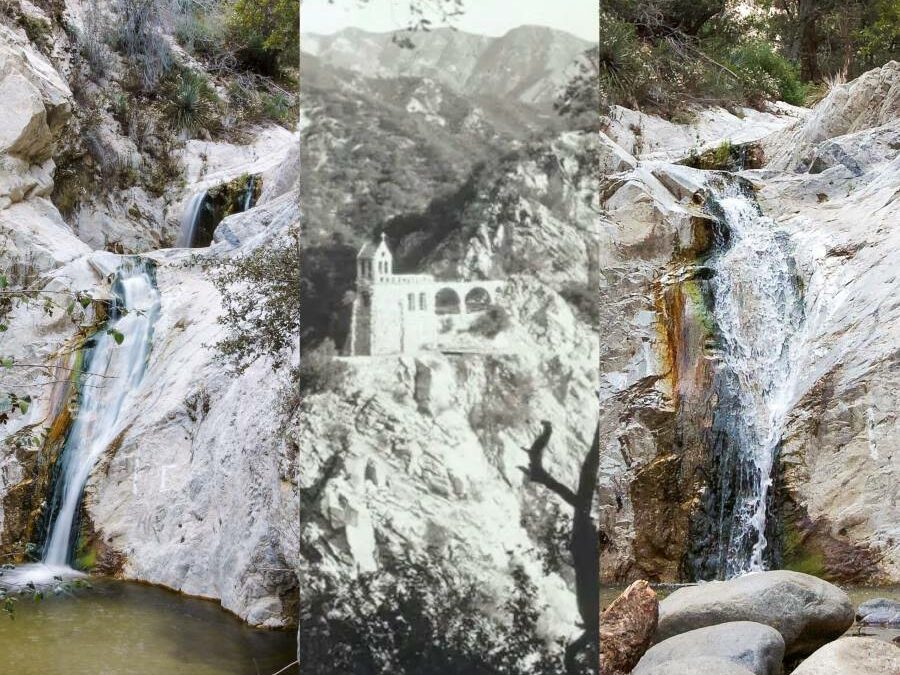
The view at the ruins was beyond stunning and more than worth getting poked by yuccas. The image below shows the building’s foundation and what appear to be concrete steps, but may also have been part of the foundation.

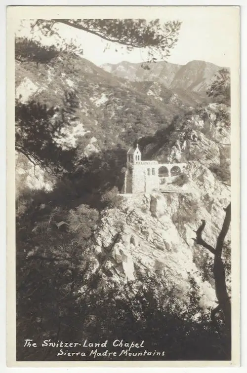
Christ Chapel was built in 1924, had an amphitheater that seated 200 people, and offered an insane, jaw-dropping view of the mountains. I don’t think I’d be able to pay attention during service with a view like that!

Take a mental note of the chapel’s arches because I’ll be coming back to them shortly.

Want to explore a 40-foot waterfall with a rock slide and pool? Check out Stoddard Falls in San Antonio Canyon.

Switzer Land Chapel Arches

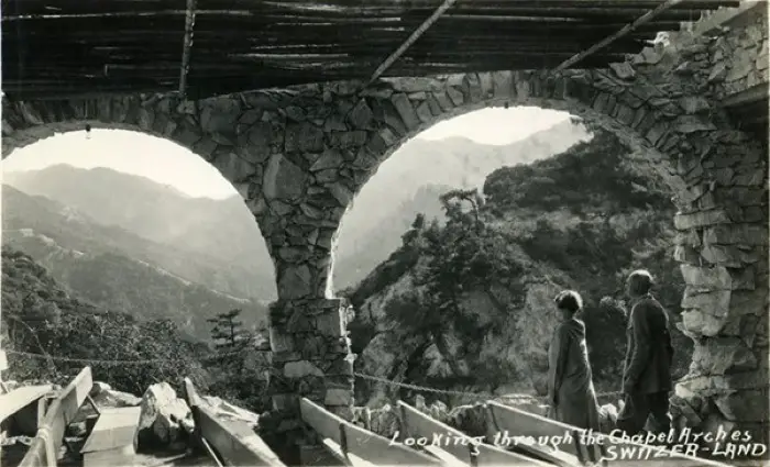
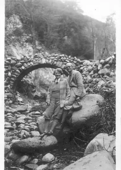
Photo: Switzer Land Owners Lloyd & Bertha Austin | Source: Photobucket/cougarmagic

That marks the end of the ruins detour.

I returned to the Gabrielino Trail the same way, crossed the creek at the fork, and began ascending the opposite side of the canyon.

Back On The Gabrielino Trail To Switzer Falls

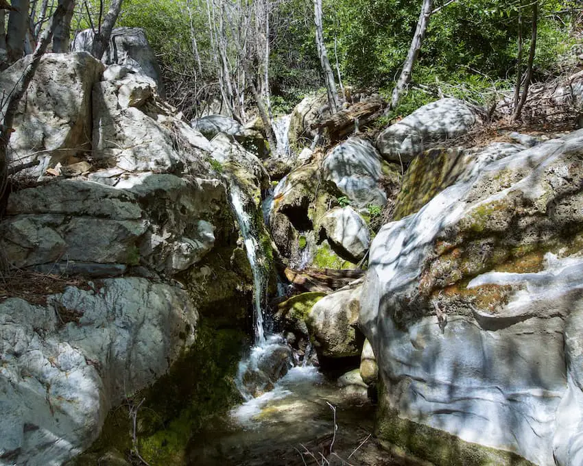
Not long after I had begun ascending, I heard the sound of roaring water that was much too loud to be the creek.

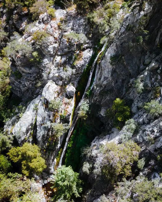
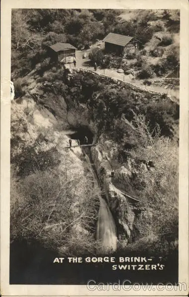
I looked down and saw the brink of the forgotten falls flowing through a very narrow section of the canyon that was once known as the Gorge Brink in the resort days. The trail to the top of the hidden falls is no longer open to the public.

The Gorge Brink At Switzers

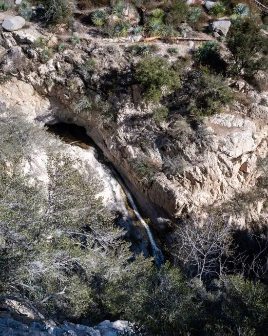
Since Bear Canyon was a paradise mountain resort, it’s common to see vintage pictures depicting structures that no longer exist, such as those in the photograph of the Gorge Brink below.

Switzer's Camp

I marched on but didn’t get too far as something on the opposite side of the canyon caught my eye.

Remember the arches I pointed out earlier? They’re still on the mountain!

Switzer Land Chapel Arch Ruins

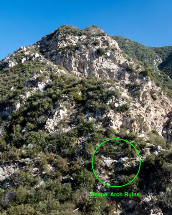
Here’s an image showing the entire Switzer Land Chapel.

Switzer Land Chapel Vintage Shot

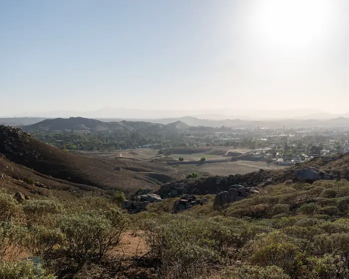
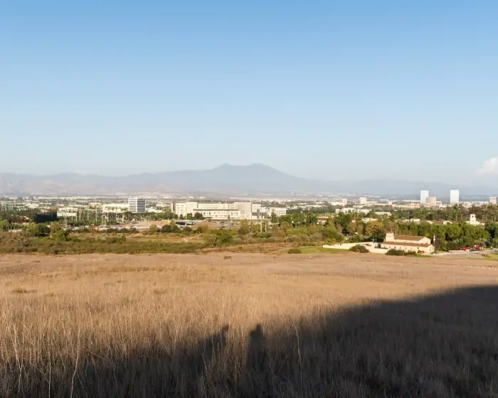
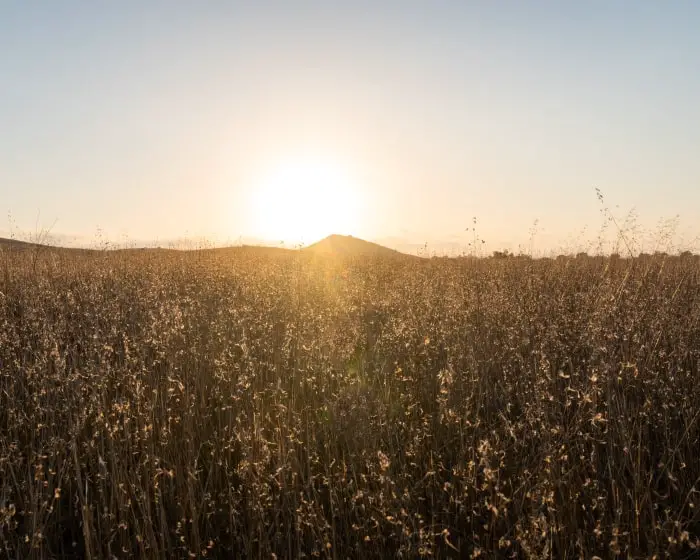
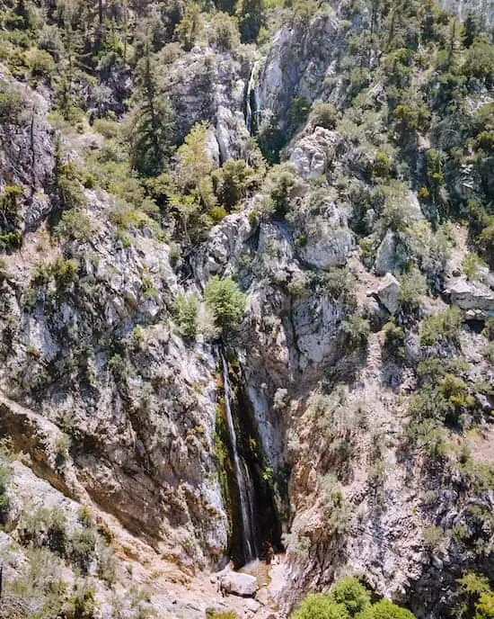
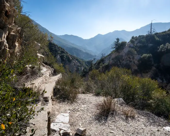
The view from this section of the trail is one of my three favorite views in Southern California. Yeah, it’s that good.

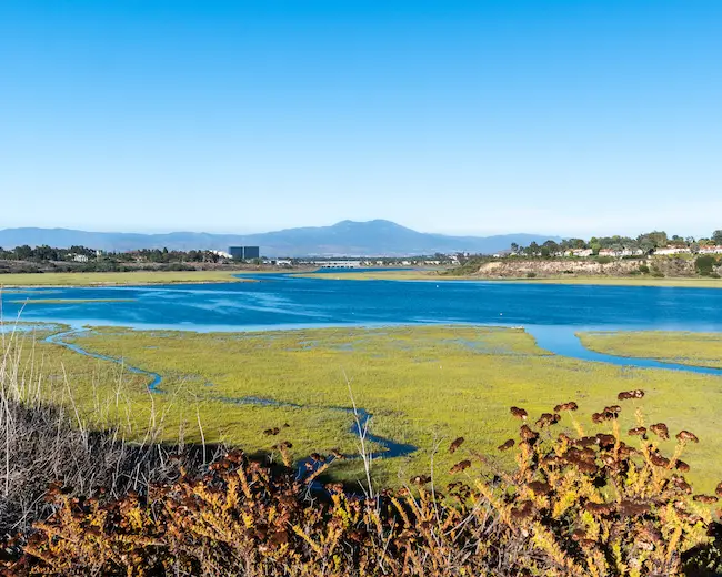
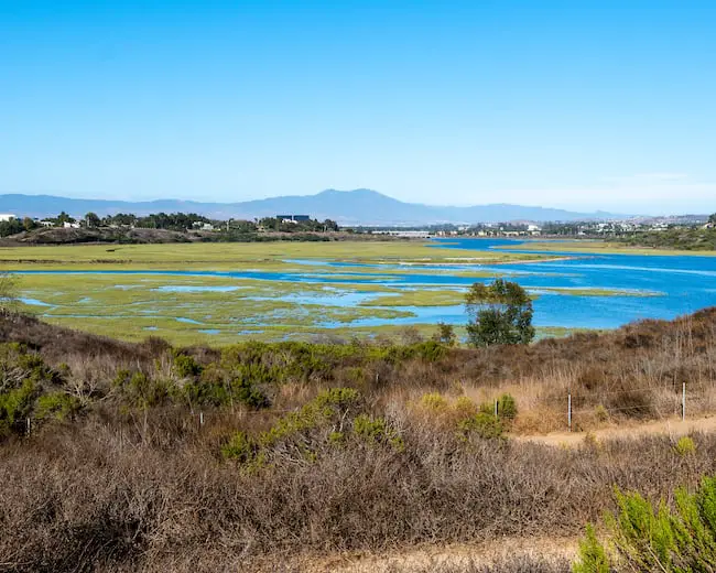
Notice how the Arroyo Seco zig-zags its way down Bear Canyon.

I turned left at the fork to switch from the Gabrielino Trail to the Bear Canyon Trail and begin my descent back to the Arroyo Seco.

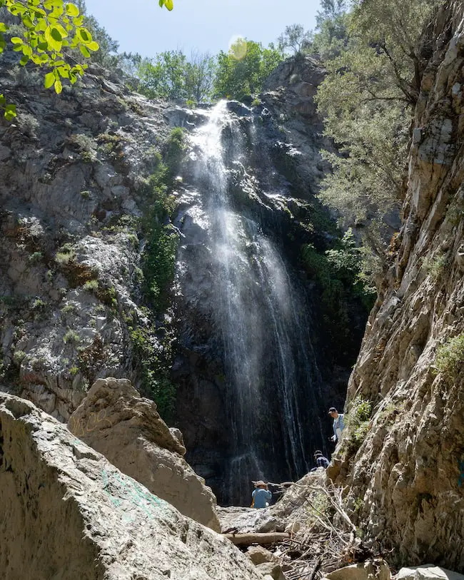
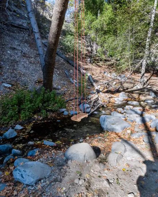
Back inside the canyon, I headed upstream to the falls via the Lower Switzer Falls Trail. A wooden swing was located a few minutes before I arrived at the falls. Thank you to whoever took the time to set it up.

Swing On The Switzer Falls Trail

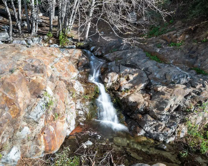
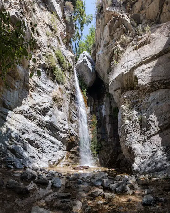
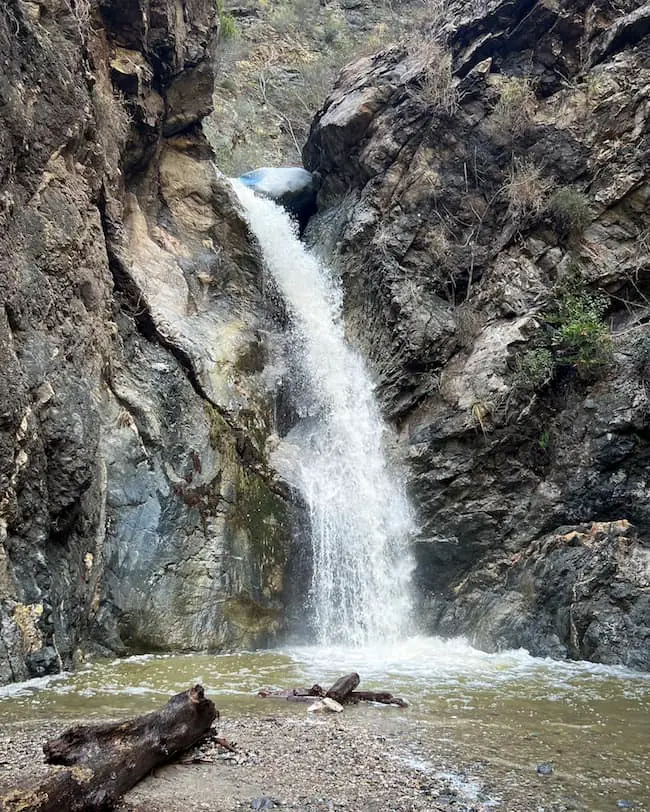
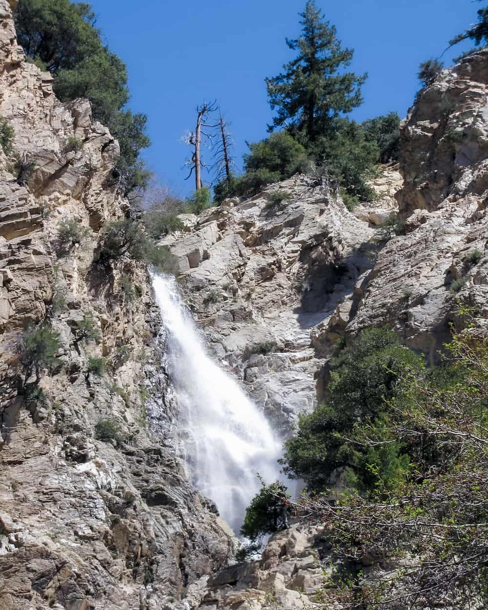
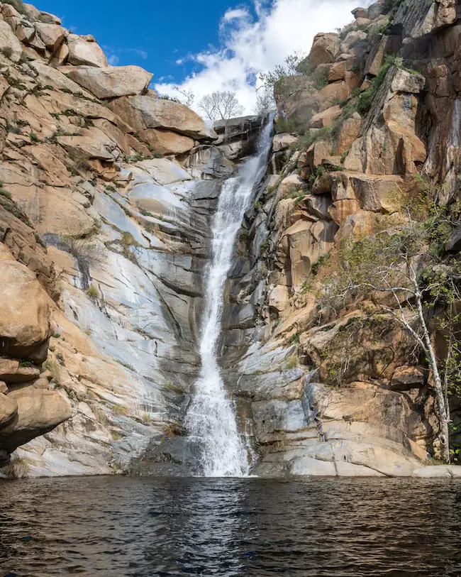
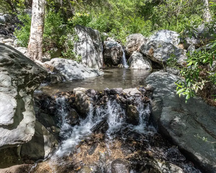
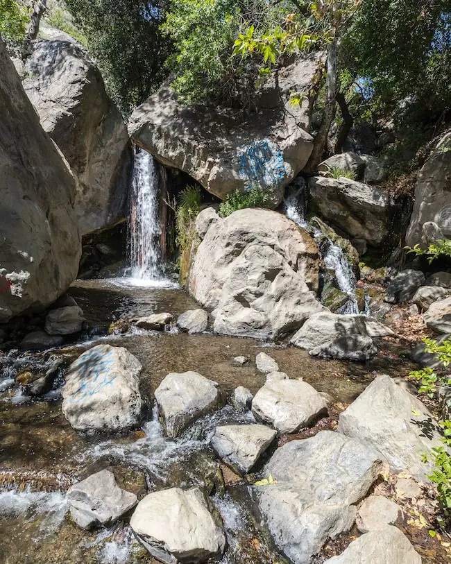
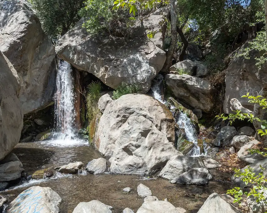
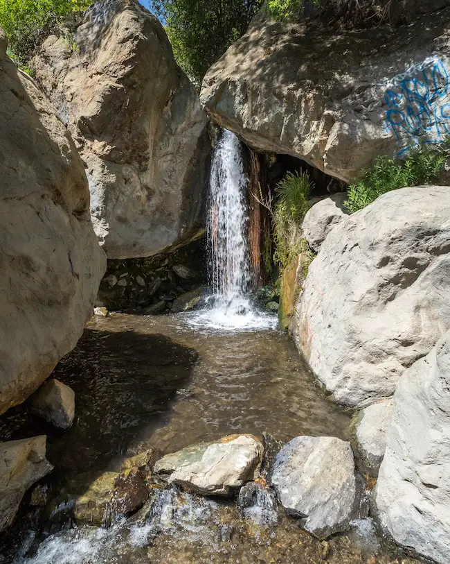
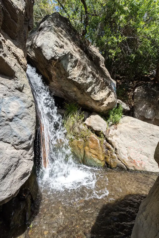
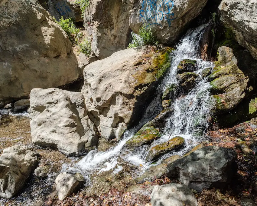
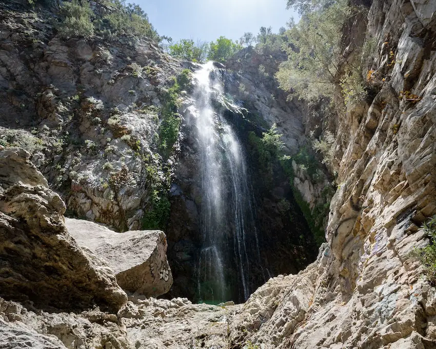
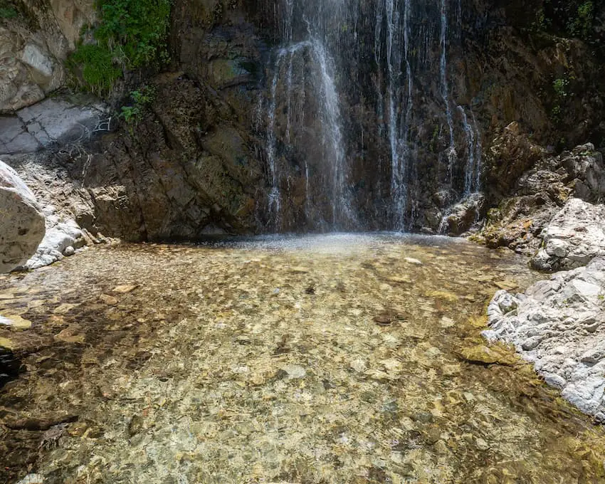
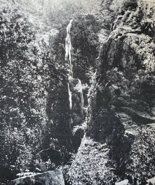
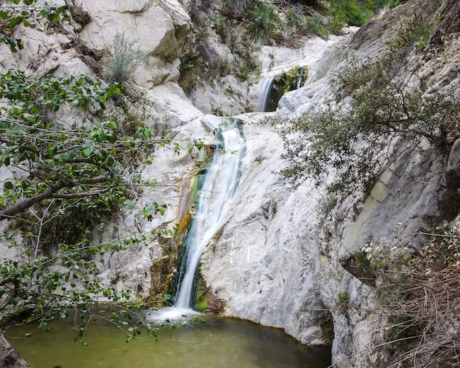
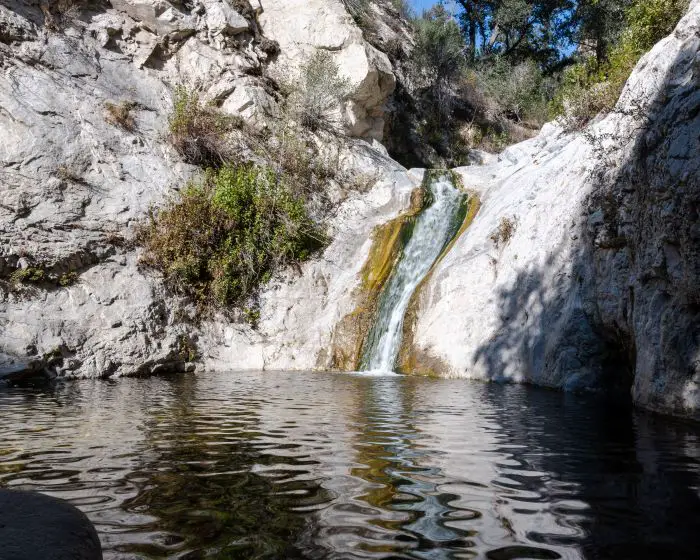
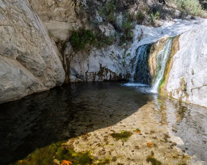
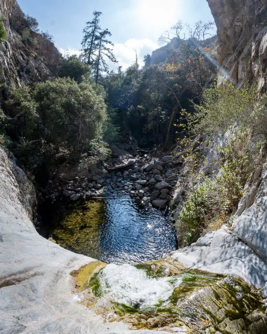
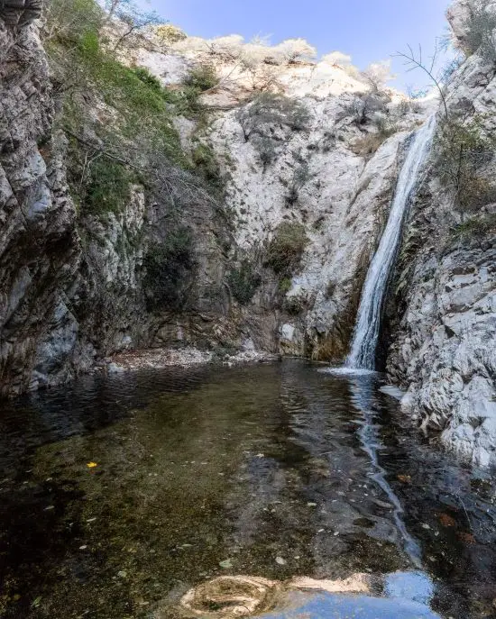
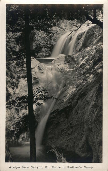
There it is! The beautiful Switzer Falls, a breathtaking two-tier monolith roaring over the granite rock.

Lower Switzer Falls

switzer falls

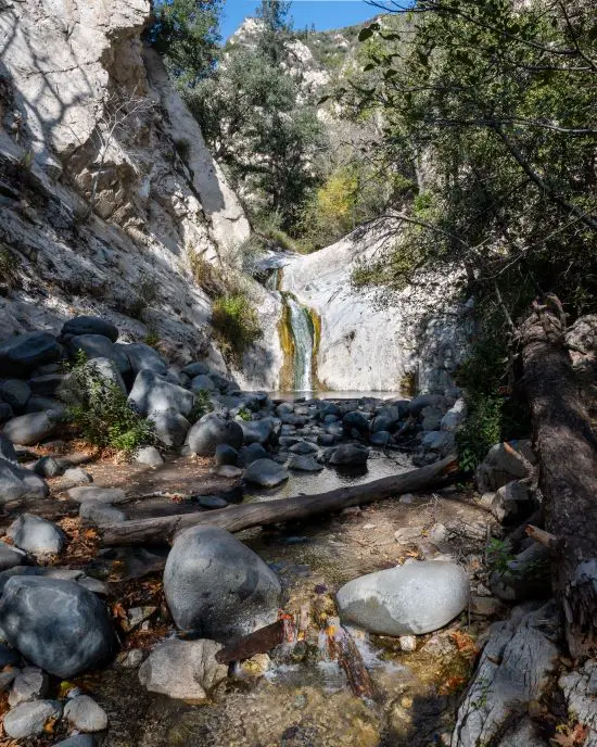
The pool can get up to four feet deep in the spring.

Swtizer Falls is stunning, but it’s far from the most breathtaking falls in the San Gabriels. Check out this much more impressive, and enormous waterfall in San Antonio Canyon. Did I mention it gets snow in the winter?!

Switzer Falls Bottom Tier

Here is a shot of Switzer Falls’ top tier.

Switzer Falls Top Tier

Switzer Falls is sometimes referred to as Lower Switzer Falls, and if there’s a lower waterfall you best believe there’s an upper. Let’s begin the trek to the forgotten falls!

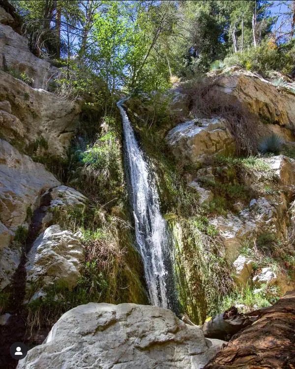
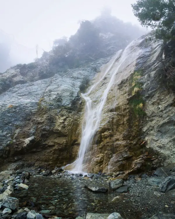
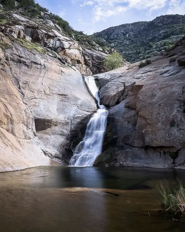
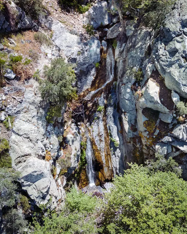
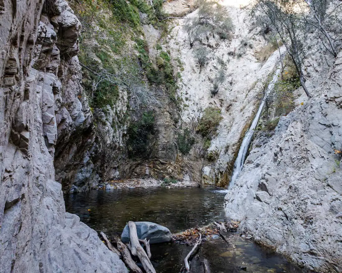
Switzerland Falls AKA Silver Spray Falls (Forgotten Falls)

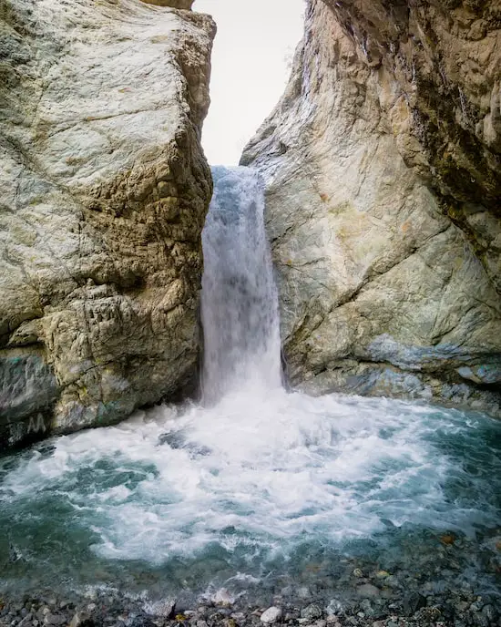
The forgotten falls has been referred to as Upper Switzer Falls, Switzerland Falls, and Silver Spray Falls. I like Silver Spray Falls so I’ll be using that name for the rest of the post.

I made my way over Lower Switzer Falls by climbing up the east side of the canyon. The trail leading over the falls is steep, slippery, and requires a bit of climbing. Don’t attempt it if you don’t feel comfortable.

Trail Leading To Upper Switzer Falls

After climbing up the side of the canyon, I took a shot while standing on top of the bottom tier, and noticed I had the whole place to myself. Nothing beats the great outdoors.

Like with the chapel detour, the trail is virtually nonexistent, but luckily, it was no where near as overgrown, and definitely no yuccas.

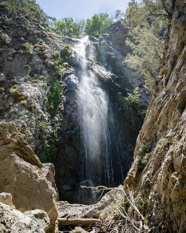
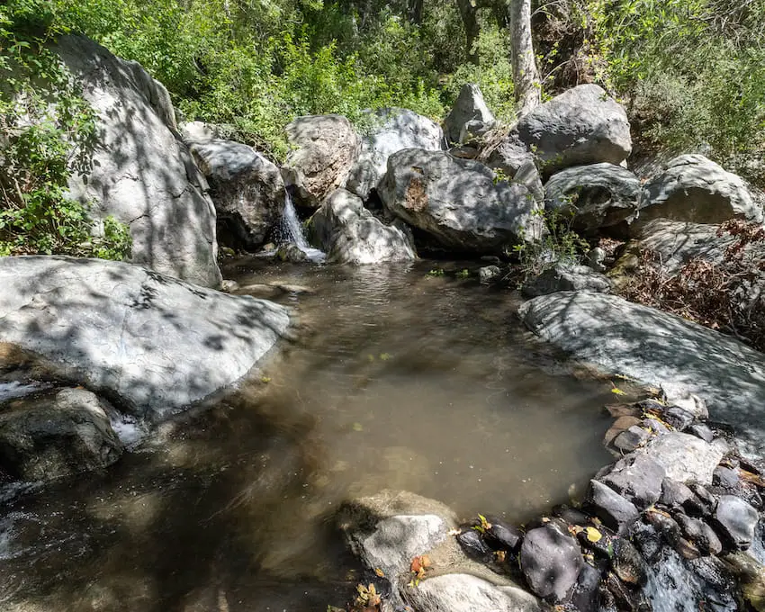
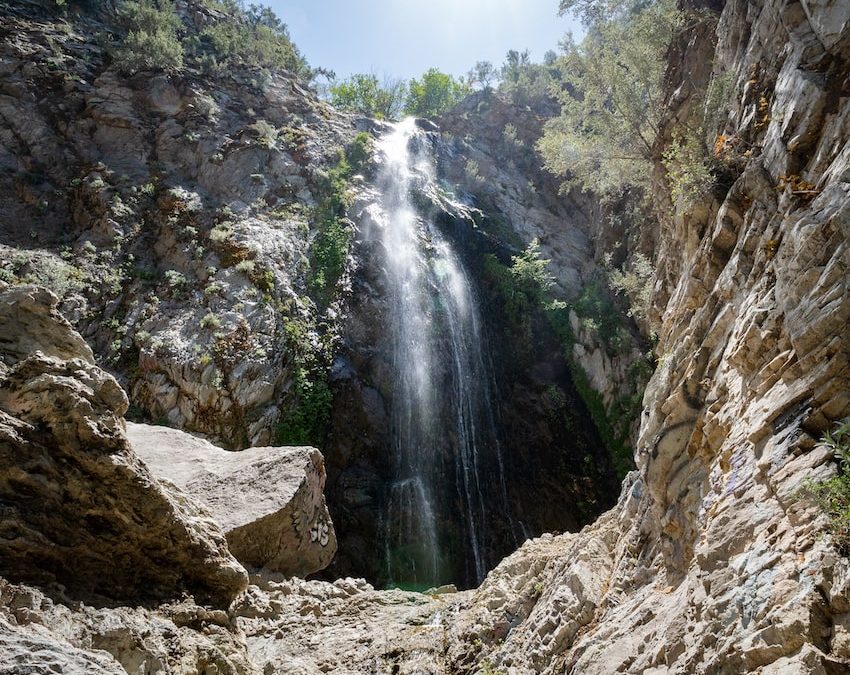
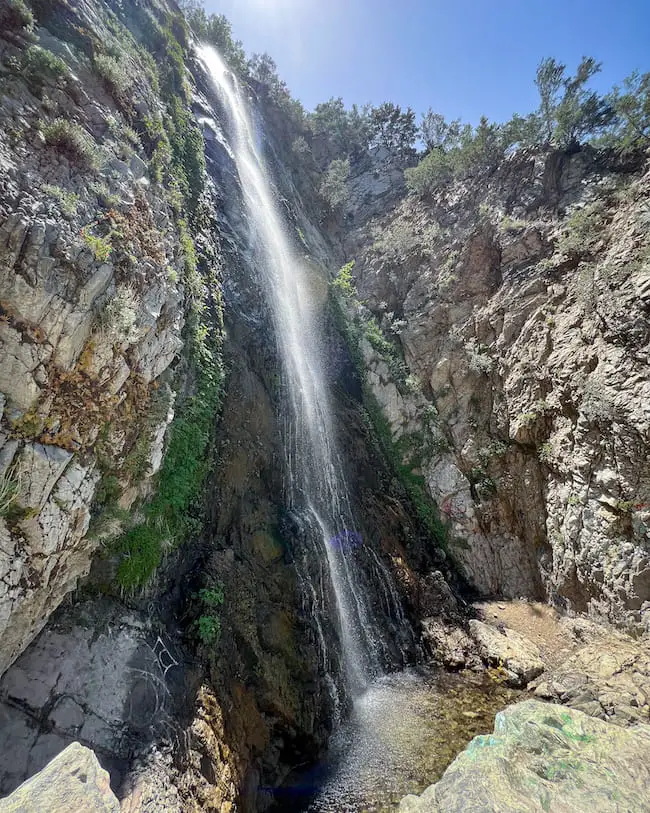
After 0.2 miles from the lower falls I arrived at Silver Spray Falls. It was much larger than its lower counterpart, measuring about 50 feet in height.

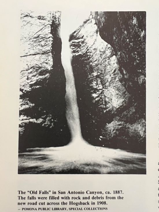
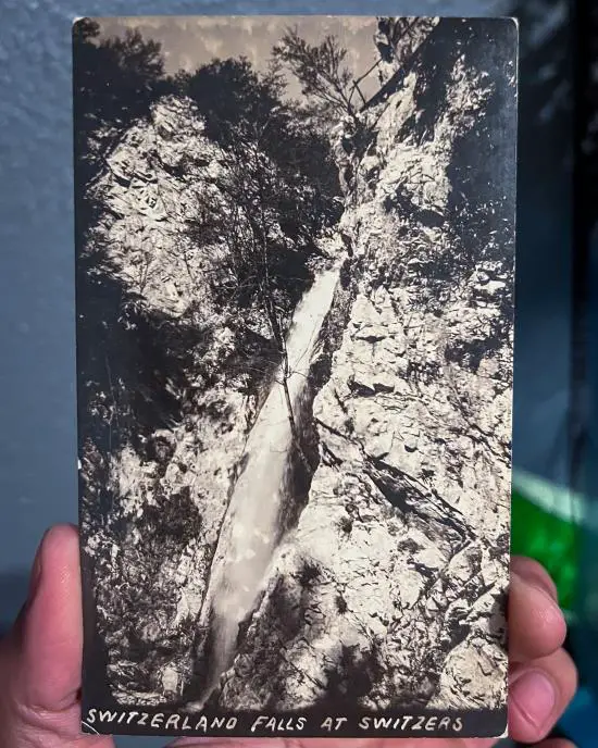
Silver Spray Falls was not a secret when Switzer’s Camp was still open. How do I know this? Well, I managed to find multiple vintage pictures of the falls, one of which I immediately purchased for my collection.

I’m guessing the waterfall was completely forgotten when the camp closed down in the first half of the 20th century, a common occurrence among camps and waterfalls after the creation of mountain highways and automobiles.

Upper Switzer Falls (Secret Waterfall)

Hidden Falls

The adventure doesn’t have to end here. Explore a very easy and extremely scenic 50 foot waterfall in Soldier Creek in the North Fork of the San Gabriel Canyon that flows year-round.

Silver Spray Falls Arroyo Seco

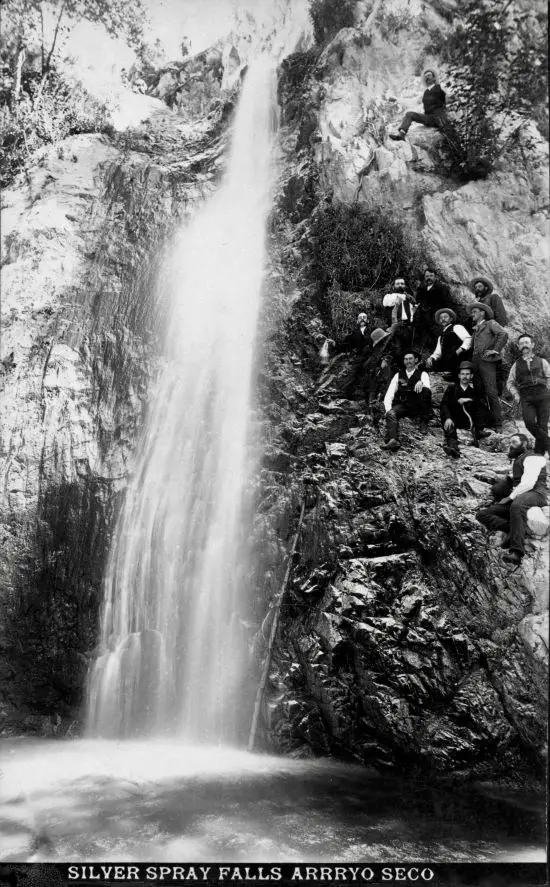
Photo: Pasadena Museum of History | SouthPasadena.com News

Upper Switzer Falls

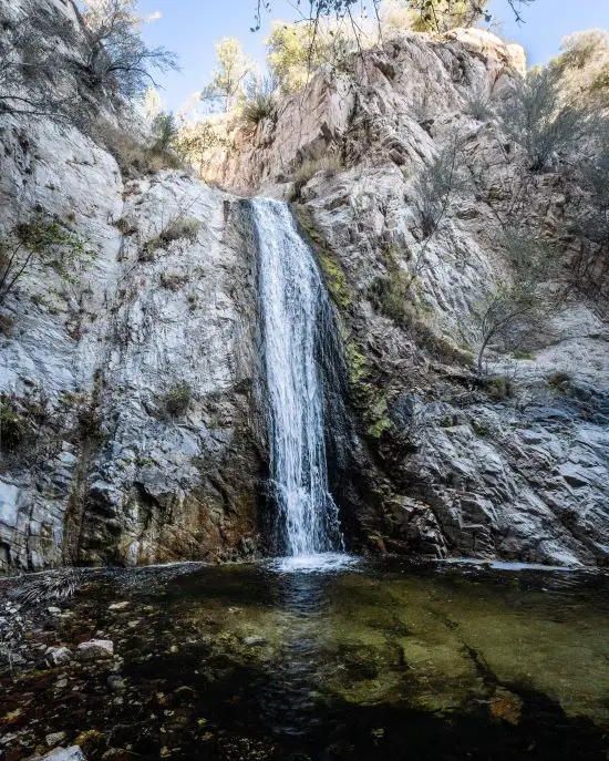
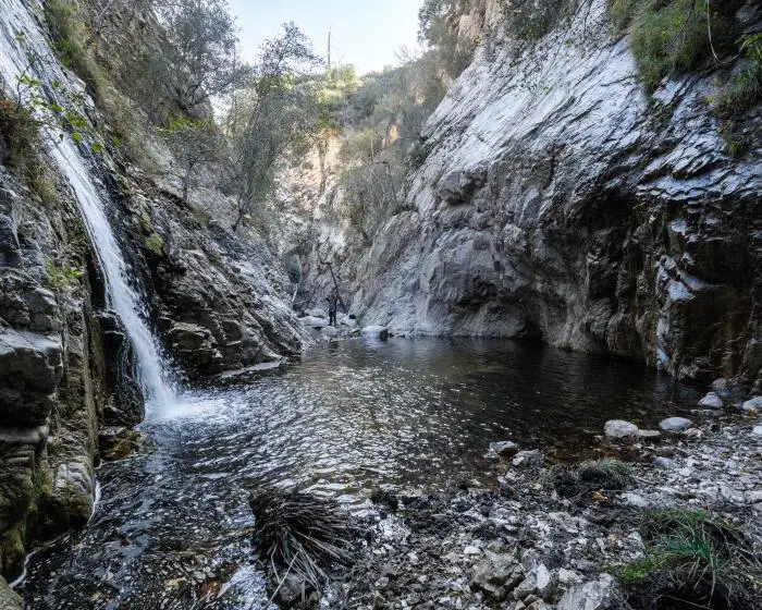
Just as impressive was the size of its pool, which filled the majority of the corner of the canyon.

I had to walk across the knee-deep pool to grab this next shot. The water was so cold that my legs began to sting. Nothing new, or so I thought.

After roughly 10 minutes in the pool, I began experiencing a new level of stinging in my toes that I’d never felt before. Although they were throbbing, I couldn’t feel my toes making contact with my boots. I lost all feeling of touch except intense pain.

It was epic and worth the picture. Here you go.

Upper Switzer Falls Pool

History Of Switzer’s Camp (AKA Switzer Land)

switzer falls history

According to Joh Robinson in his book, The San Gabriels, Switzer Falls’ recorded history begins in 1884 with a man named Commodore Perry Switzer shown below.

Switzer was an adventurous man who was fed up with his dull carpenter life. After his expert mountain climber friend, Robert K Waterman pointed out the spot, Switzer was committed to opening a resort.

commodore perry switzer

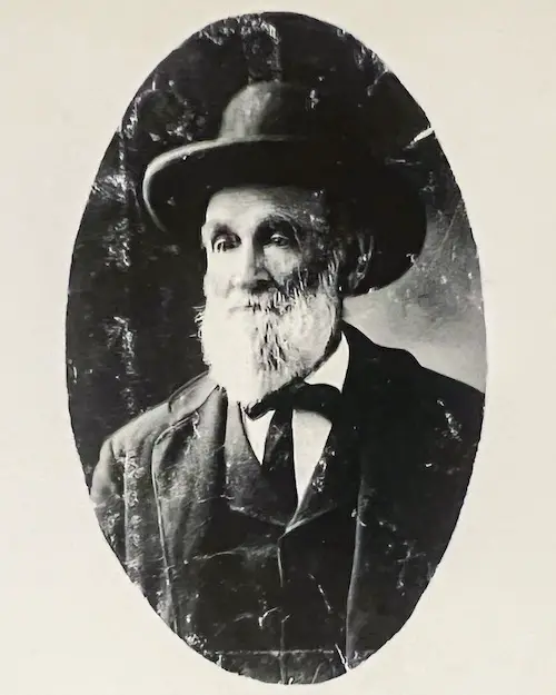
With a help of his wealthy friend, Harvey Walker, he opened a hostelry in the San Gabriel Mountains right alongside the Arroyo Seco. He charged $1.50 per day for room and board and called it Switzer’s Camp.

According to author Robert H. Peterson in his book, “Altadena’s Golden Years,” Switzer completed the first trail to the resort in 1884 with the help of Bob Waterman, John Simmons, and Henry Thompson, and was about 8 miles long.

The trail began near the mouth of Millard Canyon and meandered up the Arroyo Seco before descending 3000 feet to the camp’s elevation. The trail was later changed to avoid the strenuous climb.

Visitors could access the camp by either hiking, horseback, or taking a 5 hour trip via Switzer’s “mountain canaries” (his burros), which would pick up guests at the mouth of the canyon twice a week.

Switzer’s was a success from the start, with people from the valley flocking in droves to the perfect little getaway. In 1887, the legendary John Muir himself visited the camp and spoke highly of it.

John Muir

One of the many fun activities visitors enjoyed was hiking to nearby attractions, such as Mt Disappointment, Strawberry Peak, or, you guessed it, Switzer Falls, but hunting, fishing, and horseback riding was also popular.

The stream and pools below the waterfalls were stocked with trout.

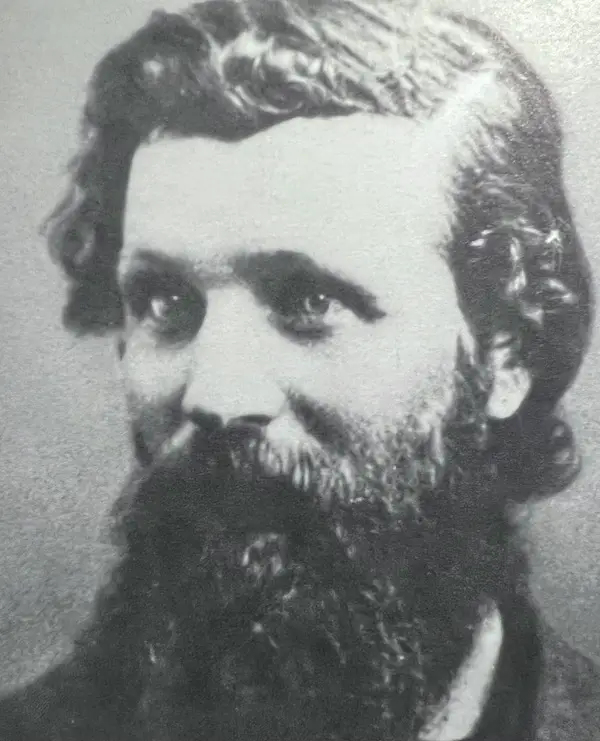
In 1896 a fire wiped out everything in the camp with the exception of one cabin. In 1905, Clarence S. Martin, who previously owned a camp resort on Mt Wilson that bore his name, and Brainerd bought and rebuilt the resort. Martin ran Switzer’s Camp until the time of his death in 1911.

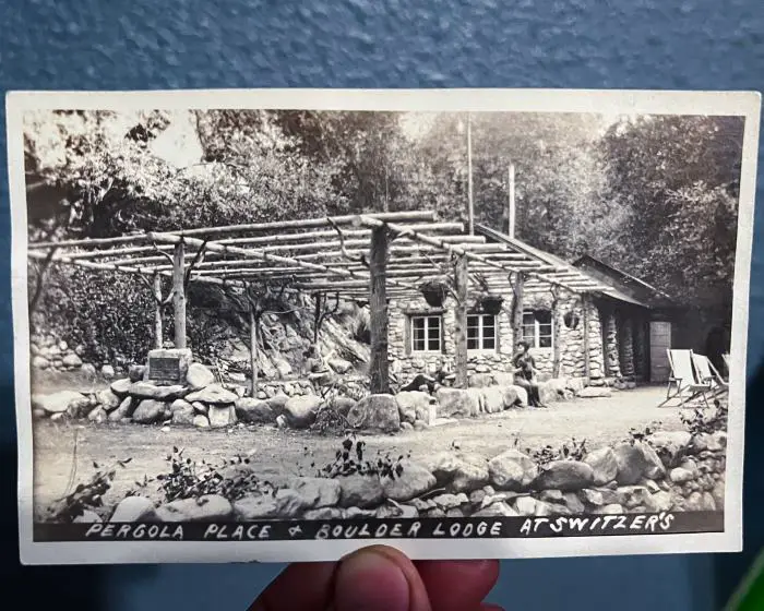
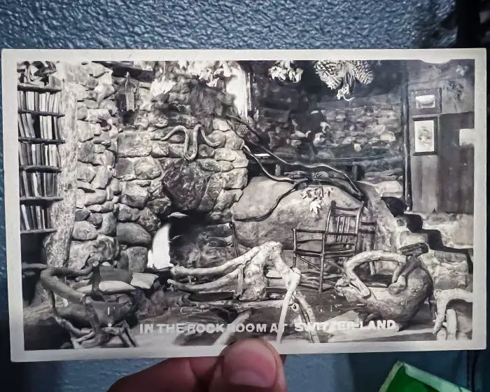
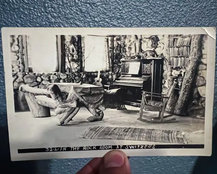
Christian couple Lloyd and Bertha Austin of Los Angeles (shown below) purchased the resort in 1912, changed the name to Switzer Land, and grew the enterprise to its largest size. They were responsible for building the stunning Switzer Land Chapel, and many additional cabins, Boulder Lodge being the most well-known.

As the name implies, it was built completely out of boulders. The inside was called the Rock Room, and it contained a library, piano, and fireplace.

Boulder Lodge At Switzer's Camp

Rock Room At Switzer Land

Rock Room At Switzer's

Clifford E. Clinton and Ramson M. Callicott purchased the resort from the Austins on Jan 1, 1936, but were sadly forced to close a few years later due to terminal illness.

Ken Fitzgerald kindly provided a detailed history of the camp’s last owners, Edgar and Libby Swanson, who also happened to be his grandparents. His parents, Leo and Norma Fitzgerald took over Switzers while his grandparents ran a different camp at Mt Wilson.

Due to a terrible forest fire in 1959 and public safety, Switzer Land was forced to permanently close down, ending a bygone era of square dancing, fishing, and hunting.  All buildings were razed by the Forest Reserve, including the chapel.

However, the famous Switzer Falls trail lives on, with plenty of hikers filling the parking lots every weekend in order to visit the beautiful cascade.

FAQs

How Long Of A Hike Is Switzer Falls?

If you begin the hike at the Switzer Falls Picnic Area, expect a total of 3.6 miles or 4.2 miles if you include both the chapel ruins detour and the trek to the forgotten falls.

How Hard Is The Switzer Falls Trail?

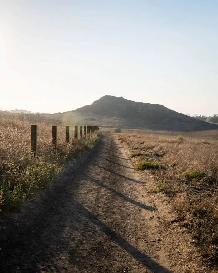
The trail is moderately challenging. The ascend out of the canyon located about halfway between the parking lot and Switzer Falls is the most challenging section.

Do You Need A Pass For Switzer Falls?

The only permit or pass you need is the Adventure Pass required to park in any SoCal mountains.

Is Switzer Falls Open?

Switzer Falls is currently open.

How Long Does It Take To Hike Switzer Falls?

The average hiker can complete the Switzer Falls hike in roughly 1 hour and 45 minutes to 2 hours (not including the ruins and forgotten falls).

11 Best Waterfall Hikes in Southern California: 2026 Update

Looking for breathtaking waterfalls in Southern California? After 15 years of exploring our local mountains, I’d be more than happy to share with you what I think are the11 most awe inspiring cascades, many of which are also the largest in Socal.

All of the following are extremely popular natural waterfalls. If you visit on a weekend make sure to arrive extremely early (7am the latest). Otherwise expect very large crowds.

Generally speaking, the best time to visit any waterfall is from mid spring to early summer. However, the time will slightly vary depending on the amount of water produced by the waterfalls’ springs.

Don’t forget to display your adventure pass when you visit these places, and as always, pack out whatever you pack in! Alright, let’s begin the adventure!

11) Etiwanda Falls: San Bernardino’s Most Popular Waterfall

Etiwanda Falls

  • Distance: 3.19 miles
  • Difficulty: Easy
  • Best Season: Spring
  • Elevation Gain: 756 ft
  • Time: 1.5 Hrs
  • Dogs: Not Allowed 
  • Restrooms: Not Available 
  • Map, Directions, & Full Post: Etiwanda Falls

Take an easy stroll through North Etiwanda Preserve in the foothills of the San Gabriel Mountains. Although the entirety of the trail consists of a dirt road, the views of the valley and the surrounding mountain ranges make up for the dullness.

There is no shade on this trail until you get to the falls. Fortunately, once I arrived at the falls the abundant White Alders transformed the scenery into a dreamy woodland.

There’s a much smaller waterfall that flows into a round pool located below the main falls, but I don’t recommend climbing down for a closer look as it’s very steep and dangerous.

For those of you who are also history nerds regarding our local mountains, the hike has remnants of the ranching area, when ranchers would tap the water from Etiwanda Creek for their herds.

10) Lewis Falls: Flows Most Of The Year

Lewis Falls

  • Distance: 0.73 miles
  • Difficulty: Moderate
  • Best Season: Spring – Fall
  • Elevation Gain: 328 ft
  • Time: 35 min
  • Dogs: Allowed On A Leash
  • Restrooms: Not Available 
  • Map, Directions, & Full Post: Lewis Falls

Lewis Falls is a must-do hike for hikers of all experience levels. The trail is mostly shaded and highly vegetated. In fact, one of my favorite things about the hike is the enormous cedar trees, some of which stand at over 100 ft.

Unlike most waterfalls which dry up in early to late summer, Lewis Falls flows almost year-round, from spring to fall. If we get a really wet winter, such as the one we just had in 2023, the falls may flow the entire year.

Bonus Secret Fun Fact: Even cooler than the giant cedar trees is the 20 ft waterfall (shown below) halfway through the hike that goes unnoticed by the vast majority of hikers, and understandably so.

The bonus falls can’t be seen from the trail, and getting to the falls requires climbing down a fallen cedar tree.

bonus waterfall on lewis fall trail

Due to the abundant plant life, the entire hike is extremely scenic. Literally the second I hopped on the trail I felt like I was transported to a different state where the mountainous regions are known for their greenery.

Do yourself a favor, and get out to Lewis Falls.

9) Millard Falls: Scenic Hike In Altadena (Closed)

Millard Canyon Falls

  • Distance: 1.3 miles
  • Difficulty: Easy
  • Best Season: Spring
  • Elevation Gain: 308 ft
  • Time: 45 min
  • Dogs: Allowed On A Leash
  • Restrooms: Available At The Campground
  • Map, Directions, & Full Post: Millard Canyon Falls

Millard Falls is a beautiful 50 ft cascade located in the foothills of the San Gabriel Mts which gets a good amount of water flow every year during spring time. Additionally, the trail is easily one of the most scenic in the Angeles Forest.

The falls boasts white granite rock and vibrant green moss, making it unique among its SoCal contemporaries. The vast majority of the trail is covered by the forest canopy and adorned by Sycamores and White Alders.

The trail’s gradual incline, lots of shade, lack of steep ledges, and rare poison oak sightings makes it an ideal hike for small children and dogs, but be prepared for multiple creek crossings. The crossings are not difficult, however, as they’re very narrow and shallow.

Bonus secret fun fact: The top of the falls can be accessed by climbing up the east side of the canyon wall. However, I don’t recommend doing so unless you’re an experienced climber as it’s very steep.

8) Stoddard Canyon Falls: Rockslide And Pool!

Stoddard Canyon Falls

  • Distance: 0.75 miles
  • Difficulty: Easy
  • Best Season: Spring
  • Elevation Gain: 160 ft
  • Time: 35 min
  • Dogs: Allowed On A Leash
  • Restrooms: Not Available
  • Map, Directions, & Full Post: Stoddard Canyon Falls

Stoddard Falls is a very easy hike to a 40 ft waterfall in San Antonio Canyon. From the get go one of the first things I noticed was the pristine water in the creek. I’m not kidding, it was crystal clear blue, like that of a chlorinated swimming pool, minus the chlorine of course.

The hike begins on a paved road, then sharply descends the canyon wall via a dirt trail. Once at the canyon floor, I found myself boulder hopping my way up the last section of the trail.

As the title suggests, Stoddard Falls forms a natural rock slide. However, the swimming hole at the base of the falls may only be deep enough during the spring, when water flow increases.

Bonus Secret Fun Fact: Stoddard Falls’ actual name is “The Old Falls,” not Stoddard. Here’s a shot from 1887 which can be found in my favorite book, The San Gabriels.

Stoddard Falls' real name

7) Eaton Canyon Falls: The Yosemite of The San Gabriels (Closed)

eaton canyon falls

  • Distance: 4.02 miles
  • Difficulty: Easy
  • Best Season: Spring
  • Elevation Gain: 455 feet
  • Time: 2.5 hours
  • Dogs: Allowed On A Leash
  • Restrooms: Available At The Parking Lot
  • Map, Directions, & Full Post: Eaton Canyon Falls

Eaton Canyon Falls is one of the most popular waterfalls in the Angeles National Forest, second only to Etiwanda Falls. It was dubbed the Yosemite of the San Gabriels by John Muir.

This trail actually has 3 trailheads, which you can see on the map. The 1st trailhead is the most popular. It begins at the Nature Center, and requires hiking through most of the Eaton Wash.

The trail follows the creek for the entire hike, which means visitors will have to cross the creek via precariously laid out rocks and logs about 7ish times. Hence, if you don’t have good balance, I highly recommend a good pair of trekking poles. I use these right here.

Although the trail totals over 4 miles, the low elevation gain and partial shade inside the canyon make this a very enjoyable hike.

The trail ends when you arrive at the 40 foot cascade. Unfortunately, the pool is not deep enough to allow for swimming, but getting drenched underneath the falls is highly recommended.

Bonus secret fun fact: Just over the falls and about a 1/4 mile further up the canyon lays a secret waterfall with a big slide and a swimming hole. Reaching it requires rappelling gear.

6) San Antonio Falls: Fun Family Hike

San Antonio Falls

  • Distance: 1.33 miles
  • Difficulty: Easy
  • Best Season: Spring
  • Elevation Gain: 277 feet
  • Time: 30 min
  • Dogs: Allowed On A Leash
  • Restrooms: Not Available
  • Map, Directions, Video, & Full Post: San Antonio Falls

San Antonio Falls is one of the largest in the San Gabriels Mts. Most online guides claim it’s 75 feet high, but I believe that only applies to the bottom tier. I think it’s closer to 200 feet high as can be seen from my drone video in the full post.

The majority of the hike consists of a paved road with amazing views of the luscious green canyon below and the San Gabriel Valley. Towards the end of the hike, the paved road connects to a dirt trail which leads down to the base of the falls.

The elevation at the falls is a whopping 6400 feet, which means, yup you guessed it, winter snow!

There is no shade on this trail, but I highly recommend visiting around 10am-12pm on any given day because that’s when the sunlight illuminates the waterfall and makes San Antonio Falls glisten in all its beauty.

San Antonio Falls is one of the few waterfalls that boasts a decent water flow year round. 

Bonus secret fun fact: San Antonio Falls is a multi-tiered waterfall. What most people don’t know is that you can make your way up to the top tiers, one of which has a little pool perfect for cooling off and relaxing!

5) Big Falls: Highest Waterfall In Southern California

Big Falls Trail

  • Distance: 0.66 miles 
  • Difficulty: Easy
  • Best Season: Spring – Summer
  • Elevation Gain: 174 feet
  • Time: 25 min
  • Dogs: Allowed On A Leash
  • Restrooms: Available At The Parking Lot
  • Map, Directions, & Full Post: Big Falls

At a height of 500 feet, Big Falls has rightfully earned its name. It’s actually the tallest waterfall in Socal and one of the largest in the state.

This giant consists of five tiers, with the larger tiers making up the top of the falls. The waterfall is so enormous that you can see the top tier as you’re driving up to the parking lot.

The trail ends at the lowest tier, which is about 20 feet tall. You can see the next tier further up the creek from the base of the falls and all the way to the 2nd highest tier. It’s a truly amazing experience.

By the way, the Big Falls parking lot offers both free and paid parking. Free parking is located on the lefthand side of the lot. Otherwise, you can purchase a recreation day pass at the kiosk or Elk General Store.

The hike is mostly shaded and the creek is LITTERED with smaller waterfalls. I have never seen so much water and waterfalls in my life, but that explains why Big Falls has a decent amount of water year round.

Bonus secret fun fact: You can actually make your way up to the second highest tier, but I don’ t recommend it for the faint of heart.

4) Bonita Falls: 2nd Highest Waterfall In SoCal

Bonita Falls

  • Distance: 1.28 miles
  • Difficulty: Easy
  • Best Season: Spring
  • Elevation Gain: 443 ft
  • Time: 45 min
  • Dogs: Allowed On A Leash
  • Restrooms: Available At Bonita Campground
  • Map, Directions, & Full Post: Bonita Falls

495 foot Bonita Falls is easily one of the most stunning falls in SoCal, and has more water year round than most waterfalls. Unfortunately, it’s gotten the worst of trash and graffiti.

The trail begins at the Bonita Campground, which charges $10 for parking. If you pay the campground fee, an adventure pass is no longer needed.

Make your way across the canyon, known as South Fork Lytle Creek, and look for any signs of other people’s tracks. The majority of the hike requires trekking through a dry riverbed which consists of mostly rocks and boulders.

However, once you head into the tributary, the environment rapidly transitions into a green paradise. If you manage to arrive at the falls between the hours of 12 and 2pm, Bonita Falls will glisten more beautifully than any other waterfall in SoCal.

Bonus secret fun fact: There’s not one, but TWO secret waterfalls directly above Bonita Falls that most people don’t know about. When you include all three tiers, Bonita Falls measures a whopping 495 feet, making it the second largest falls in SoCal.

However, climbing up to the top two tiers is highly unadvised as many rescues have already taken place. One small mistake can cost you your life.

3) Sturtevant Falls: Arcadia’s Beloved Gem

  • Distance: 3.3 miles
  • Difficulty: Easy – Moderate
  • Elevation Gain: 400 ft
  • Time: 1 hr 45 min
  • Dogs: Allowed On A Leash
  • Restrooms: Available At The Parking Lot

Due to the Bobcat Fire, Sturtevant Falls was closed in September 2020 but has officially reopened and is just as beautiful as before (Hermit Falls further downstream is closed).

At a height of 50 feet, Sturtevant Falls is on the smaller end, but what it lacks in size it clearly makes up for in looks.

The trail begins at Chantry Flats and immediately descends via a steep cemented road with very little shade, which you’ll have to ascend on your way back. The road transitions into a dirt trail once you arrive at the canyon floor.

From this point onward the trail is mostly shaded and surrounded by an abundance of vegetation. Upon arriving at the falls, you’ll notice people taking a trail over the waterfall and continuing their journey into the canyon.

That trail is the Gabrielino trail, and it takes you to Sturtevant Camp then as high as Mount Wilson. However, our journey ends at the base of the falls, with one of the nicest looking cascades in SoCal.

Bonus secret fun fact: Once Sturtevant Falls reopens, so will Hermit Falls, which is located further down the canyon but is connected to Sturtevant Falls.

Hermit Falls is smaller, only 30 ft high, but is very popular with the locals because its swimming hole is deep enough for cliff jumping.

2) Cedar Creek Falls & Devil’s Punchbowl

cedar creek falls

  • Distance: 5.5 miles
  • Difficulty: Moderate – Hard
  • Best Season: Spring
  • Elevation Gain: 1026 ft
  • Time: 3 hrs
  • Dogs: Allowed On A Leash
  • Restrooms: Available At The Parking Lot
  • Map, Directions, & Full Post: Cedar Creek Falls

In order to hop on the trail, you must purchase a $6 parking permit in advance, which you can find here. Yes, they do check. They have a sign-in sheet at the trailhead, which also explains why there’s no trash or graffiti on the trail.

Roughly 3/4 of the hike is completely exposed, so plan accordingly. Unlike most hikes, the trail begins by descending onto the canyon floor, then makes its way into a tributary where the giant awaits your presence.

As you get closer, you’ll see the top of the falls towering over everything in the canyon. Cedar Creek, which is arguably the most beautiful waterfall in SoCal, plunges over the side of an 80 foot cliff and into a massive swimming hole known as the Devil’s Punchbowl. Unfortunately, cliff jumping, even from smaller ledges, is prohibited.

While most waterfalls consist of a thin stream free falling off a cliff, Cedar Creek Falls is very wide when it’s flowing, and makes contact with the canyon wall a few times before reaching the pool, which is why it produces a louder roar.

I felt like I was in the presence of a giant, a skyscraper waterfall if you will. Although Bonita falls is an additional 20 ft higher, Cedar Creek Falls gave off a larger and much more powerful presence.

Bonus secret fun fact: There’s a smaller pool at the top of the falls which allows you to lean right on the edge of the cliff and look down at the Devil’s Punchbowl. It’s much less known and the perfect place to relax.

1) Three Sisters Falls: San Diego’s #1 Waterfall

Three Sisters Falls

  • Distance: 3.39 miles
  • Difficulty: Moderate – Hard
  • Best Season: Spring
  • Elevation Gain: 1069 ft
  • Time: 3.5 – 4 hrs
  • Dogs: Allowed On A Leash
  • Restrooms: Available At The Parking Lot
  • Map, Directions, & Full Post: Three Sisters Falls

Based off the number of All Trails reviews, Three Sisters Falls is the most popular waterfall in Southern California, but I’d argue Cedar Creek Falls is the most breathtaking.

Much like Cedar Creek, the trail to the 150 foot Three Sisters Falls also begins by descending, and is mostly exposed to the elements. Hence, pack plenty of water and a hat.

Trash and graffiti is virtually nonexistent, adding to the setting’s beauty.

The waterfall’s name is derived from its three tiers. The top tier stands at about 25-30 feet high. The middle tier, which is the nicest of the three, is a decent 50 feet tall, and the bottom tier is roughly 20 feet high.

The top two tiers contain swimming holes deep enough for cliff jumping.

I think what makes Three Sisters Falls so unique is its resemblance to a river with waterfalls, rather than a waterfall with tiers.

In other words, the waterfall follows a much more gradual descend down the canyon compared to most creeks which plunge off the side of a huge cliff.

Well, if you were looking for hiking trails with waterfalls in Southern California I hope I provided enough of them to keep you busy for a few weeks. Each one of these places has unique things to offer, whether that’s views, pools, or simply a good time.

All that’s left to do is to get out there and create your own California adventure.

Bouquet Falls: Santa Clarita’s Ultimate Secret

Bouquet Falls: Santa Clarita’s Ultimate Secret

Distance 

0.8 Miles

Time

25 Min

Difficulty 

Easy

Season

Spring

Elevation Gain

88 Ft

Bouquet Falls is a lesser-known waterfall in the Angeles National Forest. The hike is extremely short and easy, thus, perfect for the entire family.

Although most people don’t know about the falls, it’s nevertheless covered in graffiti. However, I still recommend checking it out.

Map of Bouquet Falls

powered by Advanced iFrame

Download Printable PDF Map

Directions to Bouquet Falls

35191 Bouquet Canyon Rd, Santa Clarita, CA 91390

Click here for directions on Google Maps.

Hiking to Bouquet Falls

The parking lot at Bouquet Falls is very small, and adjoins nearby houses, so please be very respectful by keeping your voices down as you begin the hike.

Your short adventure begins by walking past the white gate.

Watch out for rattlers during the spring and summer seasons! Should you come across a rattle snake, simply walk around them.

They’re not one to follow you. They just want to be left alone.

Thanks to the significant amount of water, you can expect an abundance of vegetation and shade throughout the entirety of the trail.

Almost immediately, you’ll come to a small 4-5ft waterfall with a pool measuring roughly 2-3 ft deep.

This is a great place to cool off and relax.

After one creek crossing and tons of graffiti later, you will arrive at the largest of the waterfalls containing two beautiful cascades spilling over a rocky ledge.

This is not Bouquet Falls, but in my opinion, it’s more impressive than Bouquet.

To the left, a stunning 15-20ft grotto boasts a reddish vine-like plant which hangs down behind the falls and resembles a horsetail.

Meanwhile, the cascade to the right follows a more gentle descent down the canyon via deep green moss covered rocks.

The adventure isn’t over! Keep making your way up the canyon either to the left or the right of the falls. This section requires a bit of easy boulder scrambling.

Notice Bouquet Falls at the top of the image shown below.

Congratulations, you’ve made it to Bouquet Falls.

The set of cascades only measure about 4 ft in height, but what they lack in size they make up for in abundance of water and vegetation.

Note: if you have family or friends who can’t hike but want to see the falls, they can do so by parking on a small dirt shoulder off the side of the road, which allows you to see Bouquet Falls up close!

Bonita Falls: 2nd Largest SoCal Waterfall + Bonus Tiers

Bonita Falls: 2nd Largest SoCal Waterfall + Bonus Tiers

  • Miles: 1.28
  • Time: 45 min
  • Difficulty: Easy
  • Best Season: Spring
  • Elevation Gain: 443 ft
  • Max Elevation: 3269 ft
  • Type of Trail: Out & Back
  • Parking Lot: Fits ≈ 10 cars
  • Dogs: Allowed On A Leash
  • Restrooms: Available At The Campground
  • Trail Popularity: Very High
  • Pics Taken On: May 16, 2022

Most people have hiked to Bonita Falls, but what they don’t know is that two secret tiers lay directly above, and when added together, measure a total of 495ft!

Bonita is a beautiful waterfall located in South Fork Lytle Creek and the second largest in the San Bernardinos. The hike is an easy 1.28 miles roundtrip. Most of the trail is comprised of a dry riverbed surrounded by rugged ridges, and a scenic tributary towards the end.

Bonita Falls is one of the best hikes in SoCal along with abandoned gold mines, nazi ruins, and multiple scenic waterfalls. Check out the posts below to choose your next adventure: 

Best Hikes In Southern California

Best Waterfalls In Southern California

Bonita Falls Trail Map

powered by Advanced iFrame

Bonita Falls Elevation Profile

Download Printable PDF Map

Address & Directions

Click the following link to be redirected to the Bonita Ranch Campground via Google Maps: 900 S Fork Rd, Lytle Creek, CA 92358

***Parking at Bonita Ranch Campground is $10.

It’s sometimes possible to park off the side of Lytle Creek Rd to avoid the campground fee. However, you’ll have to cross Lytle Creek in order to head into South Fork, which may be a bit difficult for those with poor balance.

Helpful Links

Weather Forecast

SoCal Adventure Pass (required for parking in SoCal mountains)

Bonita Falls Trail

If you begin your trek from Bonita Campground, make your way to the opposite side of the canyon as this is where you’ll find a “trail.”

The hike doesn’t have a nice groomed trail because, as you’ll notice, the only way to the falls is via a dry riverbed with tons of boulders and rocks.

It’s hard to imagine, but raging floods are known to occur here during higher than average rainy seasons.

As you head into the canyon, stay as far left as you can and keep an eye out for a dirt trail leading up into the tributary (a smaller canyon with a creek feeding into the main canyon). Shown below.

It’ll be very apparent that the trail continues into a scenic tributary, but if it abruptly ends, you’ve taken the wrong trail and must continue hiking into South Fork via the riverbed.

As you make your way into the tributary, the landscape dramatically changes from barren and rocky to dense green vegetation.

Beautiful cottonwood trees and white alders adorn the trail, but so does the notorious poison oak with its three-pronged leaves.

Notice Bonita flowing behind the trees in the picture below. Unfortunately, Bonita Falls has gotten the worst of trash and graffiti.

Within minutes, you’ll hear the sound of roaring water gushing over the edge of a 100-foot cliff. A giant awaits your presence.

The boulder scrambling has finally paid off. The enormous Bonita Falls, which translates to “beautiful” falls in Spanish, lives up to its name.

Bonita glistens in the sun unlike any other waterfall I’ve ever seen. It’s a sight you’ll never forget. To experience this for yourself, try to arrive at the falls between the hours of noon and 2 pm when the sun directly illuminates the cascade. Just keep in mind the large crowds at that time.

Bonita Falls

The pool is not deep enough for swimming (only about 2 feet), but it’s still worth taking a dip in the refreshing water fed from the icy springs on the north slope of the Cucamonga Wilderness, especially on those extremely hot sunny days.

While most people enjoy their time at Bonita Falls’ lowest tier, few are aware of the secret cascades located directly above. The mid-tiers are much smaller than the rest, while the top tier is roughly half the size of the lower 100ft tier.

Do not attempt to climb up to the falls as it’s very dangerous. Numerous rescues have already taken place.

Luckily, I was able to take a drone shot of the falls. Below is a picture of the mid-tiers.

Below is the top tier.

Bonita Falls Top Tier

Here’s a shot of all the tiers. The mid-tiers may be hard to see.

bonita falls all tiers

Only Big Falls, rising up to 500ft (5ft higher) outranks Bonita.

Want to visit the LARGEST waterfall in SoCal? Check out Big Falls Trail in the tiny mountain town of Forest Falls. It’s only a .66 mile easy hike to the bottom of the falls.

Bonita Falls History

Although much of the history has been lost, it’s safe to say the Taaqtam people, known as Serranos (mountaineers) by the Spanish, also enjoyed visiting the falls as we do today.

Their village, Muscupiabit, which translates to “place of the pinyon pines,” was located in Cajon Pass where the 15 Fwy cuts through the mountain ranges.

The aggressive, and sadly, extinct California Grizzly bear roamed the area along with present-day mountain lions, ring-tailed cats, and big horn sheep, the latter being most likely to be encountered by day hikers.

For a brief period in the 1880s Bonita Falls was renamed Emerald Falls, but the name never managed to stick with the community.

In 1905 W.W. Carlisle filed a claim in South Fork in 1905. One claim was located at Bonita Falls, and the other five were miles up the canyon.

However, Carlisle wasn’t too fond of people wandering onto his claim to get a glimpse of Bonita Falls. Glenn Ranch visitors frequently reported a crazy man hiding in the trees warning them to stay out, or else.

Thankfully, Bonita Falls is now public land. Crazy miners hiding in the bushes are no longer a problem, but unfortunately, the current issue has become the immense amount of litter and graffiti.


Peck Road Water Conservation Park: Riparian Sanctuary

Peck Road Water Conservation Park: Riparian Sanctuary

Many parks have lost their touch with their wild side, resembling a larger version of your lawn. Peck Park retains its unkept and natural beauty, boasting two lakes, stunning views of the San Gabriel and San Bernardino Mountains, and offering a wide variety of recreational activities. 

The 5 acre recreational park was built on an old quarry site, and offers a half a mile loop along the edge of the lakes. However, those who wish to elongate their walk can use the bike lanes, which wrap around the south lake. 

Dogs are allowed, but must be on a leash. 

Note: Peck Park is a safe place to visit during the day. However, I highly recommend leaving the park before sundown, as there may be individuals with ill intentions at night. 


Amenities:

  • Cycling 
  • Bird Watching
  • Walking 
  • Fishing
  • Barbeque
  • Restrooms
  • Picnic Table

    Hours: 

    6:00 am to 8:00 pm

    Monday – Sunday

    Phone Number:

    626 334-1065 

    Directions

    5401 N Peck Road, Arcadia CA 91006

    No parking fee is required 

    Map

    powered by Advanced iFrame

    Download PDF Map

    Want to explore more of LA? Check these out!

    Peck Road Park Half Mile Loop

    The loop begins via a dirt road near the edge of the lake on the north side of the recreational park. 

    A dirt trail parallels the dirt road for those who want to follow the lake shore for the entirety of the park (which is what we did). 

    It’s a peaceful walk, offering views of the San Bernardino and Angeles National Forests with the lake in the foreground. 

    Once you reach the west side of the park, a 40-50 “canal” connects the two lakes. During times of low water level, you can walk across the need to walk around the entire southern lake. 

    Read More: Eaton Canyon Falls Ultimate Guide

    Below is a view from the opposite side of the “canal.”

    Make your way towards the southern lake by following the dirt trail, which is below the dirt road and about 30 feet away from the lakeshore. 

    Wild mustard, an invasive species known for taking over many Southern California hills and parks, has found a home at Peck Park. 

    Read More: Teepee Trail near Pasadena

    The southern lake is a great spot for fishing, especially during sunset. I almost always see fishermen in that spot. 

    Fish in the lakes include: 

    • Largemouth Bass
    • Catfish
    • Crappie
    • Bluegill
    • Carp

    Trout is no longer stocked here. Eating the fish in the lake is highly discouraged. 

    Once you’re done exploring the south side of the park, hop back on the dirt road. You’ll notice small dirt paths diverging from the road, with gardens decorating the sides. 

    This is as groomed as it gets at Peck Park. 

    Read More: Santa Fe Dam Recreation Area

    The loop is completed once you’ve reached the green field adjoining the parking lot. 

    Looking for something fun to do this weekend? Check out the Old LA Zoo: Abandoned Ruins

    History of Peck Rd Park

    180 acre Peck Rd Park was once an alluvial pebble quarry, similar to the other quarries in the area. 

    The Army Corps proceeded to channel the Rio Hondo and San Gabriel Rivers into the area, creating a shallow basin containing the typical LA Basin urban watershed.  

    Peck Rd Park serves several functions, including municipal water and stormwater supply management, outdoor recreation activities, transportation, and the protection of certain habitats. 

    The double lakes hold water year round, and in 1975, the LA County Parks obtained jurisdiction of the east side of the park, where the restrooms and parking lot are located. 

    Since then, LA County Parks has invested in the area, transforming the landscape from a dull and barren quarry to a more recreational park that has become part of the Emerald Necklace (a multi-city bike loop that is very popular with the locals). 

    Both the Sawpit and Arcadia Wash are responsible for feeding into the park’s lakes, which form the headwaters of the Rio Hondo River. The Rio Hondo River merges with the LA River further south in the South Gate area. 

    The lakes are also managed by the LA County’s Flood Control for controlling floods. 

    The park’s riparian habitat, which is surrounded by a sea of concrete, serves as a wildlife sanctuary for the 250 of the 500 birds that reside or migrate through California. 

    Like other riparian ecosystems, you can expect to find varying types of Willow Trees, Mulefat, and Western Sycamores.  

    For news stories regarding Peck Road Park, click the link here. Then, click the link which says Permalink under the title that catches your attention to download the PDF file containing the URL linking to the story.