Looking for abandoned creepy places, breathtaking views, and stunning waterfalls? Say no more. I browsed through my entire site and chose the trails which I believe are the most breathtaking, jaw-dropping, hikes that’ll leave you thinking, “How is this located in Southern California,” or “How did I not know this place existed.”
Plus, I’ll provide fun facts (if applicable), detailed stats, and the best seasons to visit, so that you can make the most out of your visit. If you decide to hike one of these trails, click the link to the full post which contains more photos, a printable PDF map you can download, directions, and additional info.
Here are SoCal’s best hikes in order from least to most amazing.
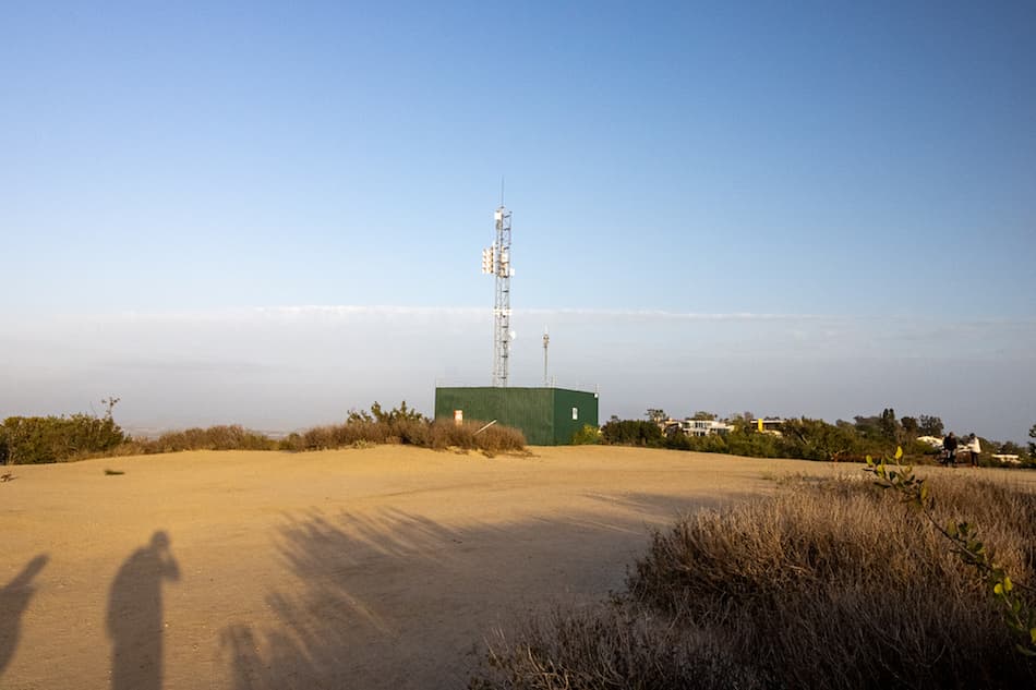
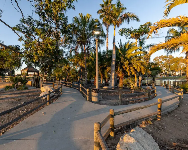
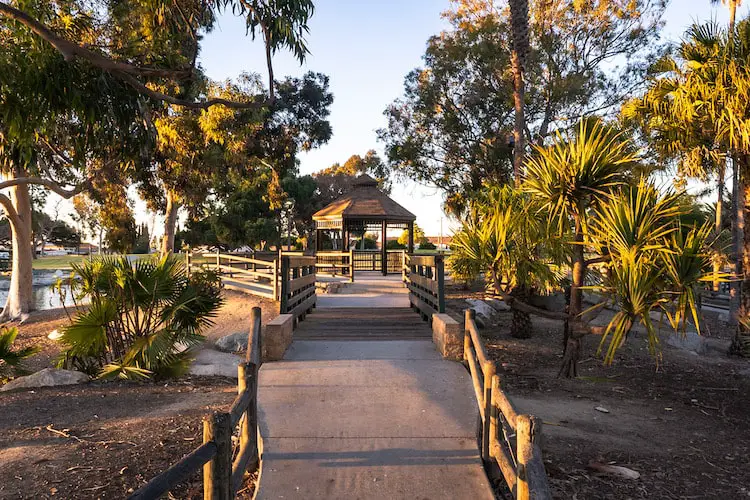
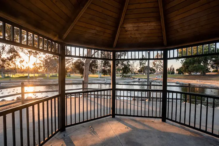
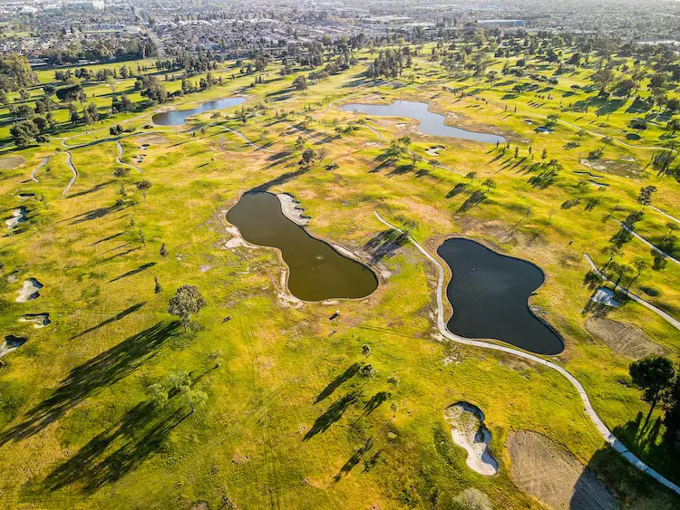
26) Mt Rubidoux: Most Popular Trail In Riverside County

- Total Miles: 3.13
- Difficulty: Easy
- Best Season: All Year
- Elevation Gain: 551 Ft
- Time: 60 Min
- Dogs: Allowed On A Leash
- Restrooms: Available At The Park
- Map, Directions, & Full Post: Mt Rubidoux Trail
Built 116 years ago in 1907, Mt Rubidoux has gone from a local landmark to Riverside’s most highly trafficked trail, and for a good reason.
The panoramic view from the top was breathtaking. To the north I was able to see the Angeles and San Bernardino National Forests, and to the south, Old Saddleback, the two highest peaks in the Santa Ana Mts.
Fun Fact: The cross is not the only landmark on the trail. Due to its resemblance to the Rapunzel Tower, TikTokers have increased the popularity of The World Peace Bridge & Tower, a stone tower and bridge that arches over the trail. Check out the full post to see pics.
If you enjoy peak sunsets, Mt Rubidoux should be a must-do on your list.
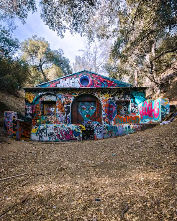
25) Pumpkin Rock: Hikers’ Favorite Halloween Trail

- Total Miles: 1.69
- Difficulty: Easy
- Best Season: All Year
- Elevation Gain: 458 Ft
- Time: 45 Min
- Dogs: Allowed On A Leash
- Restrooms: Available At The Parking Lot
- Map, Directions, & Full Post: Pumpkin Rock Trail
Get in season by hiking to a giant pumpkin boulder located in the western town of Norco, CA.
The easy trail takes you up through golden hills which offer amazing views of the valley and the Angeles and San Bernardino National Forests. The pumpkin is also a great place to enjoy the sunset.
Fun Fact: Although there’s graffiti in the featured image, the locals are generous enough to repaint the boulder every year before Halloween to get it ready for visitors. I just happened to visit in the summer.
Pumpkin Rock is not the only painting on the hill. There are smaller boulders with additional paintings that I believe you’ll find very intriguing.
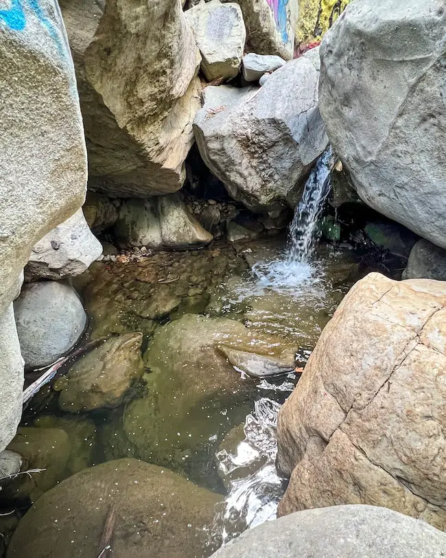
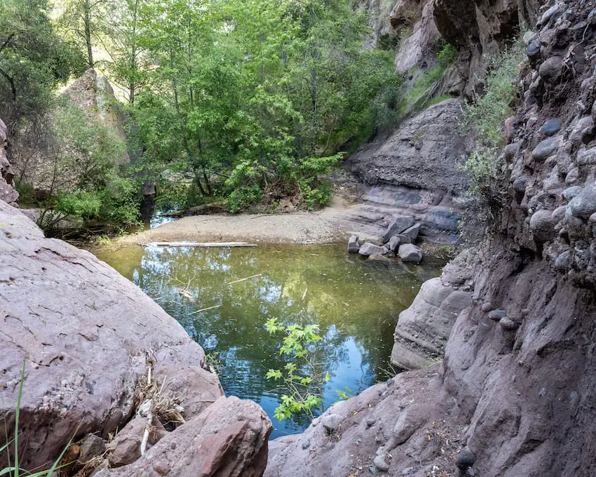
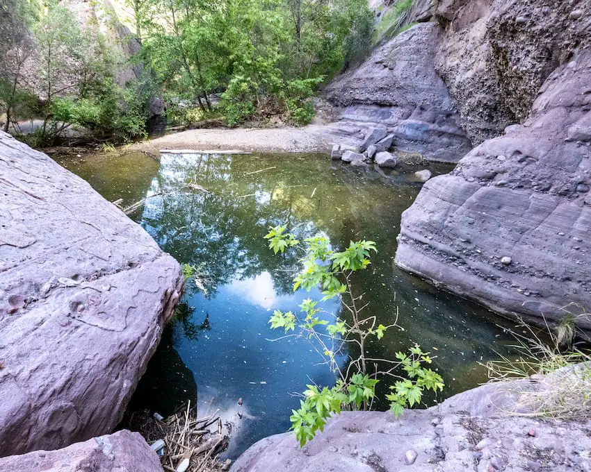
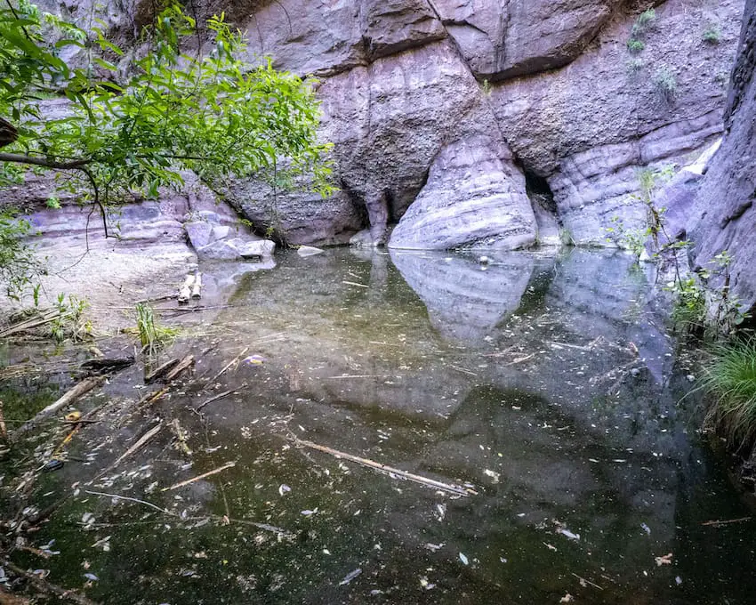
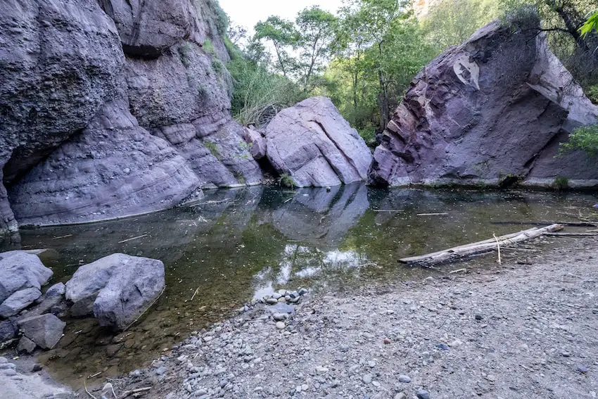
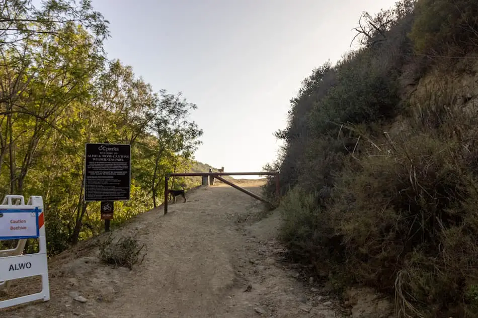
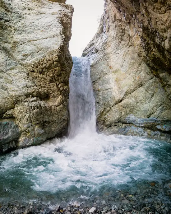
24) Ho Chi Minh Trail: Slot Canyon, Falls, & Beach
- Total Miles: 0.62
- Difficulty: Easy
- Best Season: All Year
- Elevation Gain: 278 Ft
- Time: 20 Min
- Dogs: Not Allowed
- Restrooms: Not Available
- Map, Directions, & Full Post: Ho Chi Minh Trail
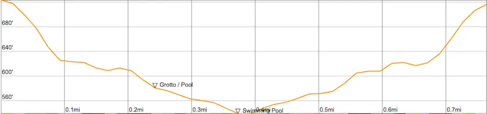
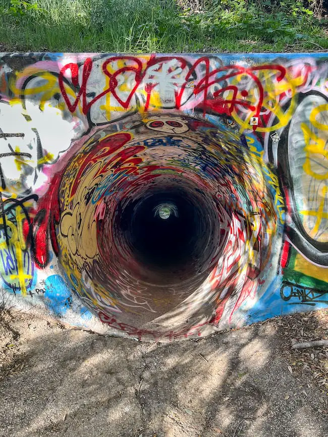
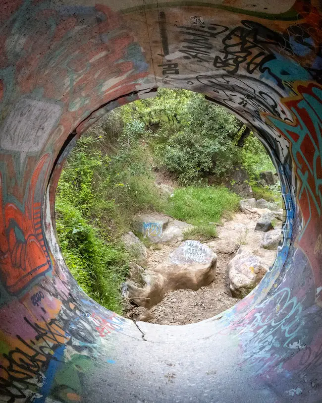
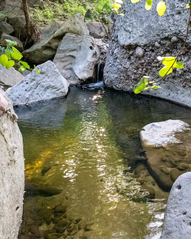
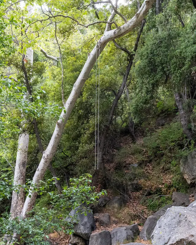
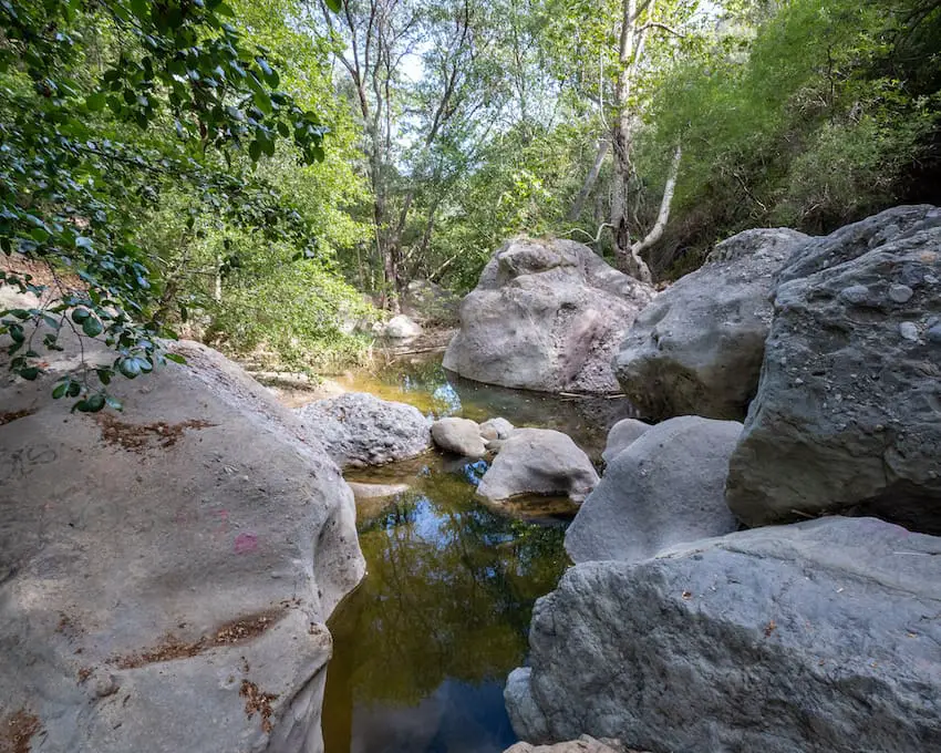
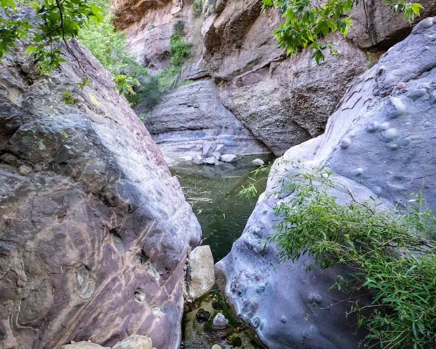
The Ho Chi Minh Trail may be the most unique trail in all of Southern California because although it’s only 0.62 miles long, it features a slot canyon, waterfall, and the trail ends right on the beach.
I’ve hiked for virtually my entire life, and can’t think of another trail that has all three features.
Fun Fact: There are TWO slot canyons, but the less visited slot canyon (which you’ll get to first on the trail) requires climbing down into it. If you can do so, it’s worth it. Head over to the full post to view the less trafficked slot canyon.
After walking through the main slot canyon, I ended up on a narrow and slippery trail that runs adjacent to the beach. However, to get down to the beach itself, I had to use a rope left behind by the locals to help me descend a very steep and slippery slope.
Once at the bottom, I quickly headed to the 12-15 foot waterfall which flowed over the canyon mouth and into the ocean.
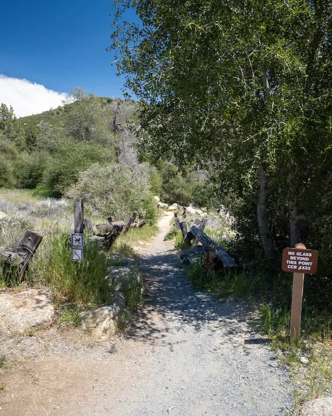
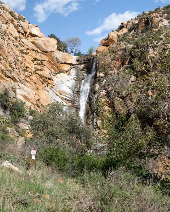
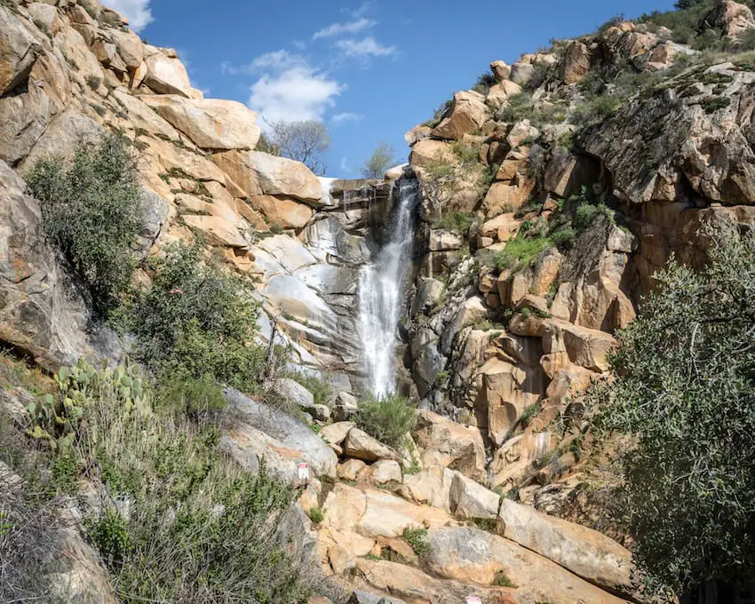
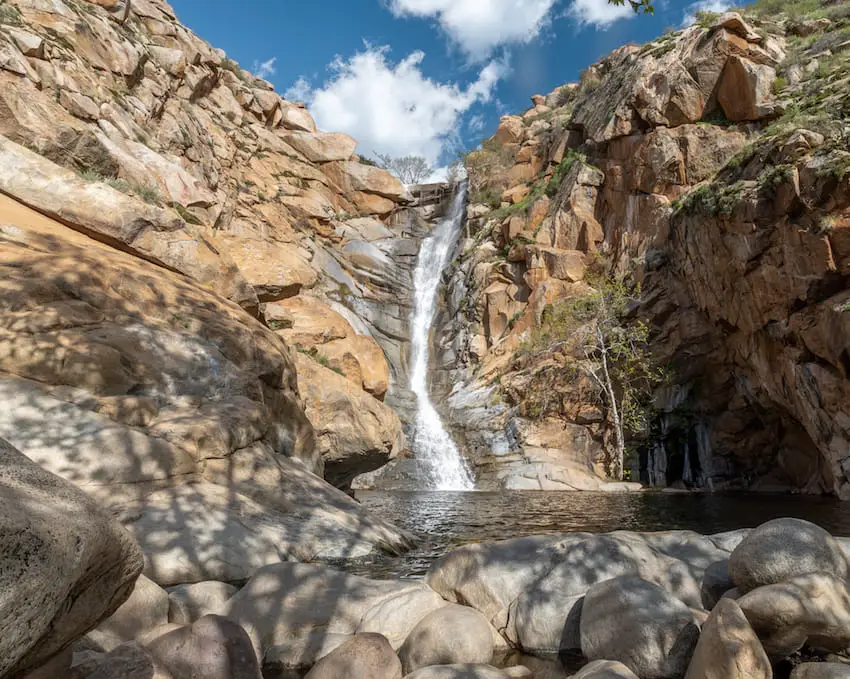
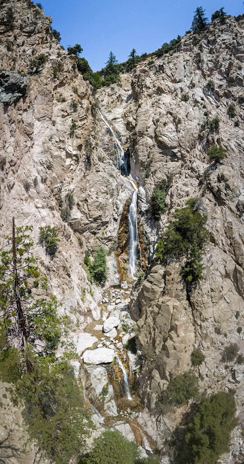
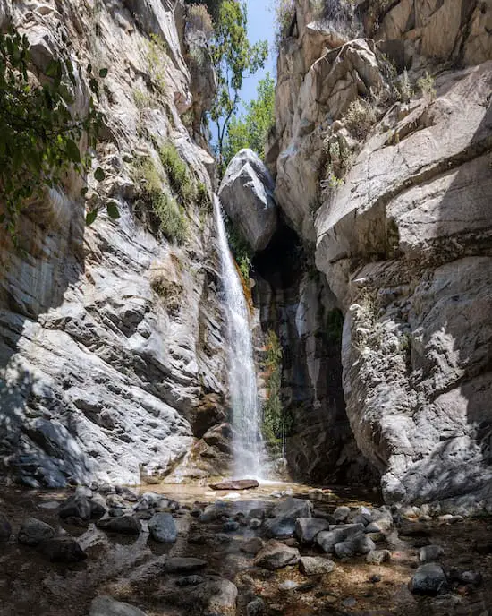
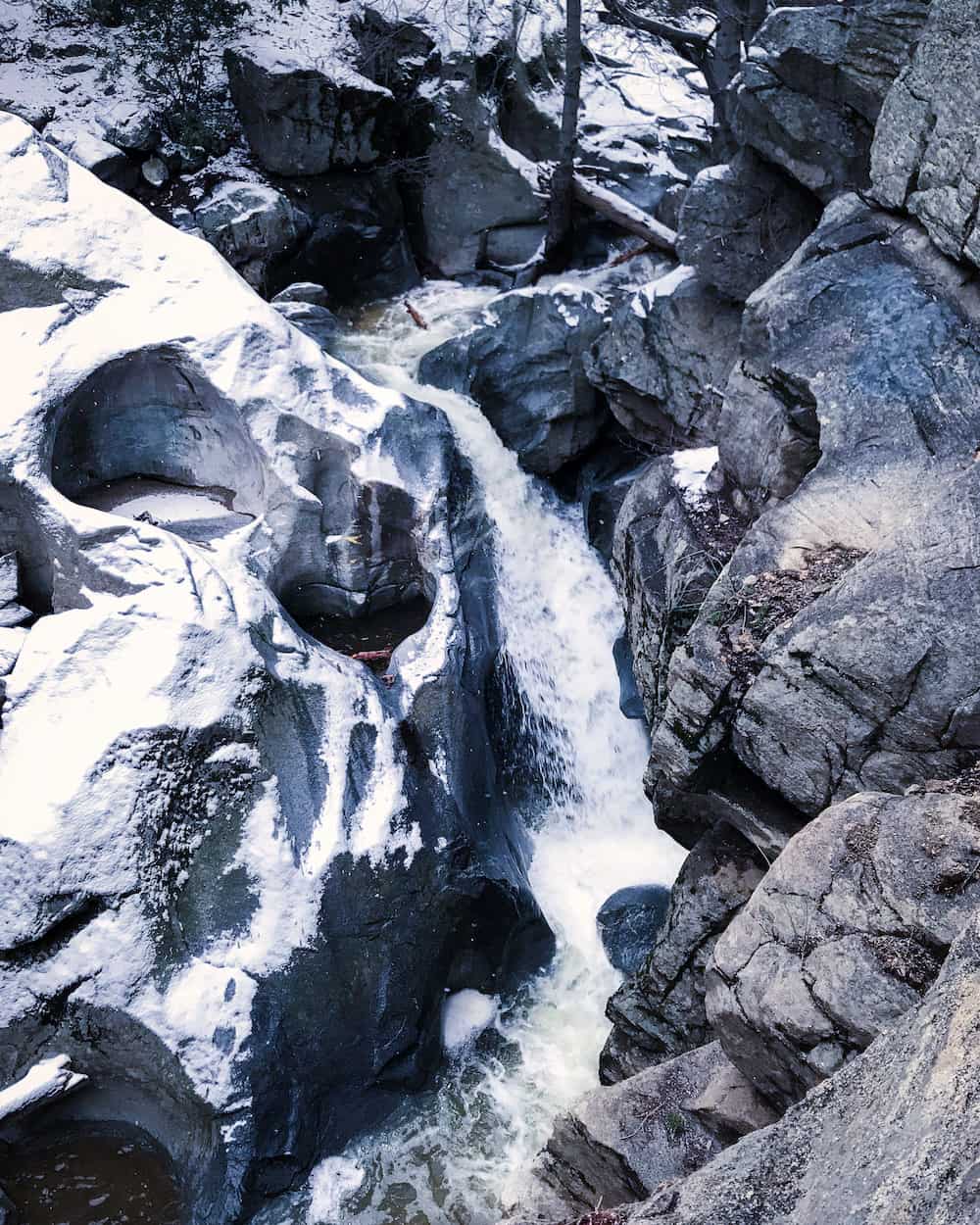
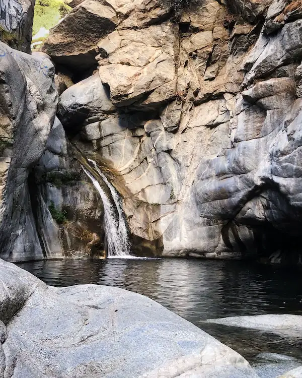
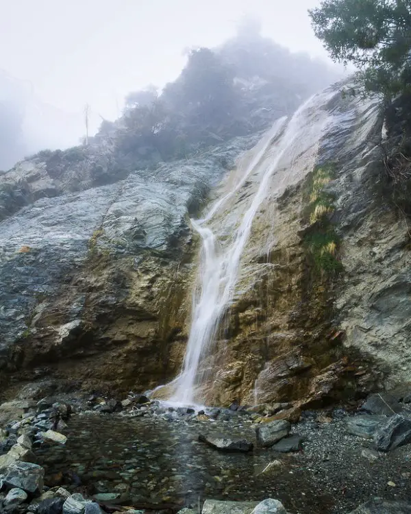
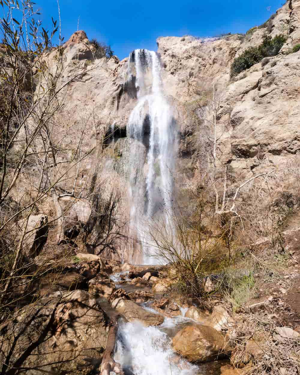
23) Bonita Falls: 2nd Largest Waterfall In SoCal
- Total Miles: 1.28
- Difficulty: Easy
- Best Season: Spring
- Elevation Gain: 443 Ft
- Time: 45 Min
- Dogs: Allowed On A Leash
- Restrooms: Available At The Campground
- Map, Directions, & Full Post: Bonita Falls Trail
At 495 feet, Bonita Falls is only 5 feet smaller than the largest waterfall, Big Falls (mentioned later in this post). However, it’s still worth a visit.
The bottom tier, which measures about 100 feet, is the only tier that can be seen from the canyon floor, and climbing up to the top tiers is not recommended, as it’s extremely dangerous.
To get to the falls, I trekked through the dry riverbed of Lytle Creek’s South Fork, then ventured into a tributary where the scenery immediately changed.
The landscape transformed from a dry riverbed with small boulders littered throughout, to a luscious green environment filled with wildlife. Poison oak is present so keep an eye out.
Unfortunately, Bonita Falls has become one of the worst trashed trails in SoCal. If you visit, please remember to pack out what you pack in. Also, make sure not to leave any valuable belongings in your car while you hike, as people have been known to break into cars.
Hence, I recommend parking at the campground. $10 can save you from a broken window.
Fun Fact: The middle and top tiers have rarely been seen, but I managed to get a few shots with my drone. Check out the full post to see what they look like.
22) Millard Canyon Falls: Paradise In Altadena (Closed)
- Total Miles: 1.3
- Difficulty: Easy
- Best Season: Spring – Summer
- Elevation Gain: 308 Ft
- Time: 45 Min
- Dogs: Allowed On A Leash
- Restrooms: Available At The Campground
- Map, Directions, & Full Post: Millard Canyon Falls
Want to quickly hike a trail with a large waterfall and dense vegetation without traveling deep in the mountains? This trail is right for you.
Located in the foothills of Altadena, Millard Falls is a must-do for hikers of all skill levels. The majority of the trail is shaded by the White Alders and Western Sycamores that adorn the narrow canyon.
Although there are multiple creek crossings, they’re small and shallow, allowing for people with poor balance to easily get across.
A unique feature of Millard Falls is its white marble-like stone, which contrasts with the vibrant green moss. This trail gets very busy, so be sure to arrive extra early on weekends.
Fun Fact: There’s a hidden trail on the east side of the canyon near the falls which leads to the top of the waterfall. It’s steep and sketchy, so if you’re not comfortable with heights I suggest taking a pass on this one.
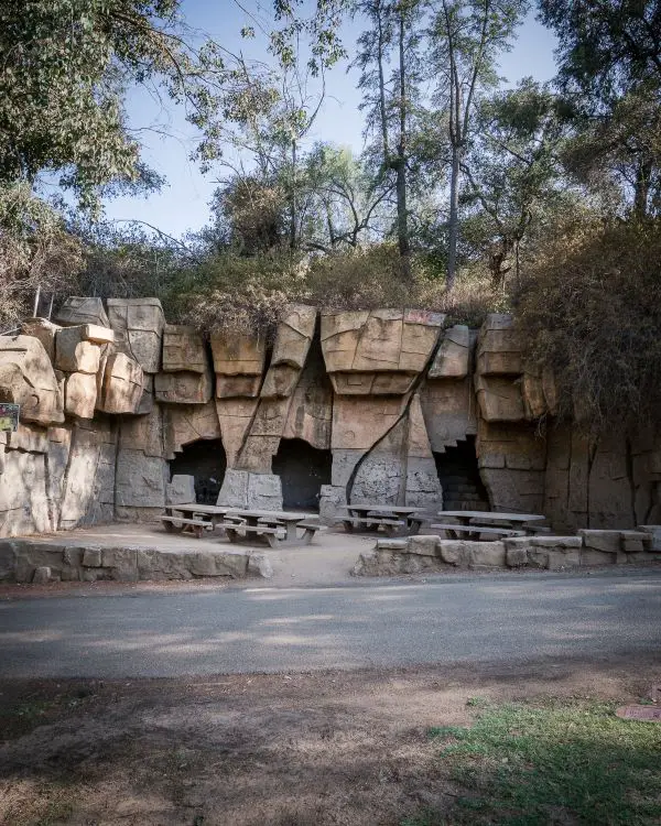
21) Old LA Zoo: Relics From The Past
- Total Miles: 2.63
- Difficulty: Easy
- Best Season: All Year
- Elevation Gain: 374 Ft
- Time: 60 Min
- Dogs: Allowed On A Leash
- Restrooms: Available At The Merry Go Round
- Map, Directions, & Full Post: Old LA Zoo
Griffith Park is home to century-old memories which have been largely forgotten by the new generations. The LA Zoo that is operating today is not the city’s original zoo.
Bears were once housed in structures like the one you see in the image above, a space much too small and inhumane for such large animals. Although the Old LA Zoo closed down in 1966, many of the structures are still there and can be visited via a short hike through the hills.
The structures are located in an area of Griffith Park that gets lots of visitors during the day, making it safe for hikers.
Fun Fact: Some say the abandoned zoo is haunted, but I’ll let you decide after your visit.
20) Kitchen Creek Falls: Swimming Holes & Secret Falls
- Total Miles: 4.84
- Difficulty: Moderate
- Best Season: Spring – Summer
- Elevation Gain: 956 Ft
- Time: 60 Min
- Dogs: Allowed On A Leash
- Restrooms: Not Available
- Map, Directions, & Full Post: Kitchen Creek Falls
Kitchen Creek Falls is a real treat for hikers. The trail isn’t anything special, but the destination sure is.
Kitchen Creek is located in a sunny canyon. Multiple swimming pools glistened in the sun, and I wasted no time jumping in. Due to the intense heat, the water felt amazing, and not at all cold.
The pools are only about three feet deep, but that’s enough for a floaty.
Fun Fact: Most people don’t know about the falls! If you want to learn how to get down to the base of the hidden waterfall, check out the full post!
I do NOT recommend climbing down to the base of the falls for those who are novice hikers, as it’s challenging and dangerous.
The waterfall was breathtaking to say the least. I was not expecting a 50-foot waterfall in that area, but that’s San Diego County for you.
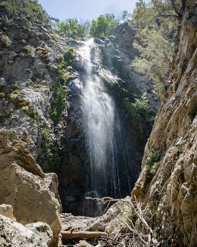
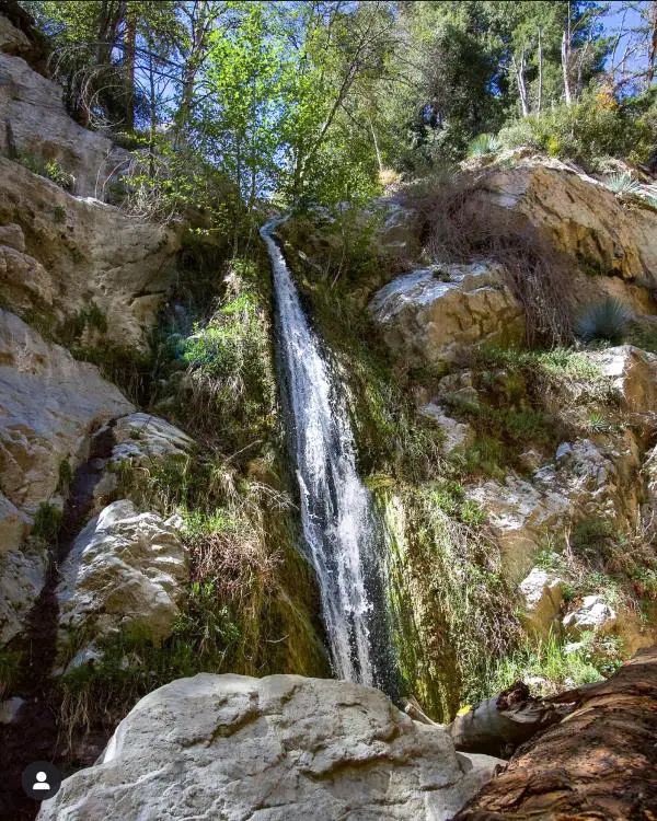
19) Lewis Falls Plus 2nd Falls No One Knows About
- Total Miles: 0.73
- Difficulty: Easy
- Best Season: Spring – Summer
- Elevation Gain: 328 Ft
- Time: 35 Min
- Dogs: Allowed On A Leash
- Restrooms: Not Available
- Map, Directions, & Full Post: Lewis Falls Via Soldier Creek
This trail is a must-do for all hikers. The luscious greenery makes it very scenic and shaded. The beautiful 50-foot waterfall is located in the North Fork of the San Gabriel Canyon, just a few minutes before arriving at Crystal Lake.
Fun Fact: There’s a smaller waterfall about halfway into the hike! It requires a bit of climbing, but if you like an adventure it’s worth it. Check out the full post to learn how to get to the hidden waterfall.
Additionally, while most waterfalls dry up during the summer, Lewis Falls flows almost year-round!
Expect a few creek crossings, maybe a rattlesnake, and a great time. Parking is very limited for this hike, so be sure to arrive extra early.
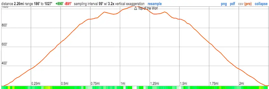
18) Murphy Ranch: Abandoned Nazi Ruins (Closed)
- Total Miles: 2.26
- Difficulty: Easy
- Best Season: All Year
- Elevation Gain: 615 Ft
- Time: 45 Min
- Dogs: Allowed On A Leash
- Restrooms: Not Available
- Map, Directions, & Full Post: Murphy Ranch Trail
Deep in the Santa Monica Mountains, under the cover of the forest canopy, eerie Nazi ruins are waiting to be explored by the next adventurous hiker.
During World War 2, a couple by the name of Winona and Norman Stephens were fully convinced Hitler would win the war. Therefore, they purchased a ranch under the pseudonym, Murphy.
Their goal was to build a self-sustaining ranch, which explains the powerhouse and water tank on the premises. Fortunately for us, they were horribly wrong and the ruins have now become another interesting hiking destination.
Most of the entrances to the inside of the structures have been blocked, but the outside can still be explored.
To get to the ruins, you can take the more gradual paved road or the brutally inclined 524 concrete steps that lead straight down the canyon wall.
When it comes to hikes involving mountain ruins, don’t hesitate too long to check them out, as many of them are completely demolished, regardless of the hike’s popularity.
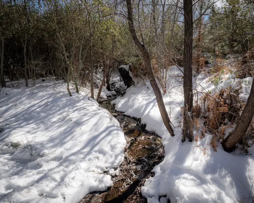
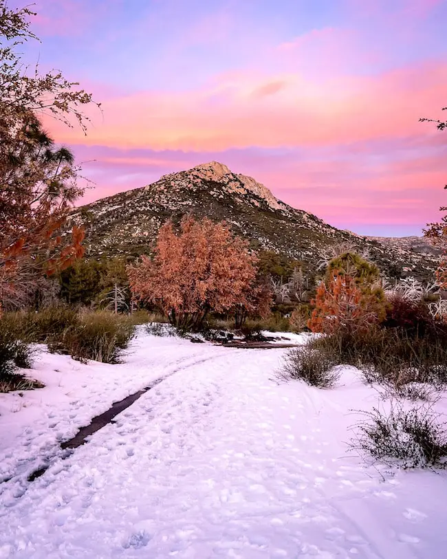
17) Heart Rock Trail: Winter Wonderland At The Falls
- Total Miles: 1.87
- Difficulty: Easy
- Best Season: Spring
- Elevation Gain: 392 Ft
- Time: 45 Min
- Dogs: Allowed On A Leash
- Restrooms: Not Available
- Map, Directions, & Full Post: Heart Rock Trail
Due to the abundant pine trees and the cozy little town of Crestline where it’s located, Heart Rock Trail made it to this list. However, there’s an additional unique aspect of this hike that you’ll absolutely love.
The waterfall is only about 25 feet tall, but if you look closely in the image above, you’ll be able to see a heart-shaped carving to the left of the cascade. This is a naturally occurring phenomenon that I have yet to see repeated in any other waterfall hike.
Fun Fact: As you probably already realized from the featured image, Heart Rock Trail gets snow, and when it does, it transforms the town of Crestline into one of my favorite places in SoCal. It literally looks like a winter wonderland.
The trail, which is shaded by a sea of pine trees, follows the creek up until the falls. Everything around me was covered in snow the last time I visited, and I couldn’t have been more delighted
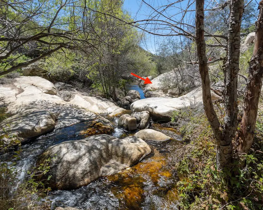
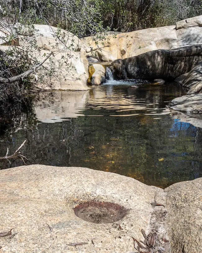
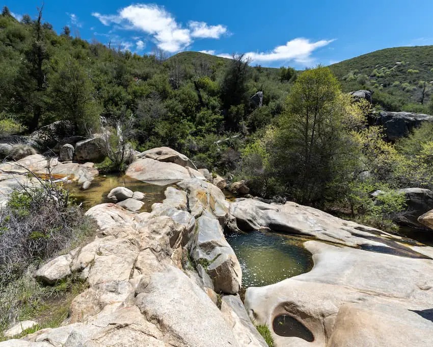
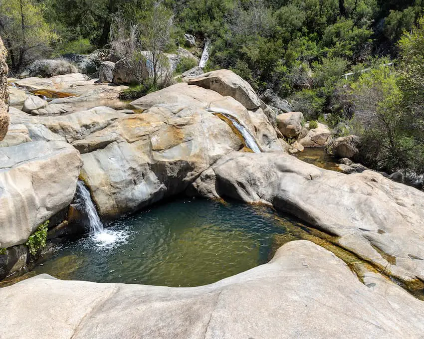
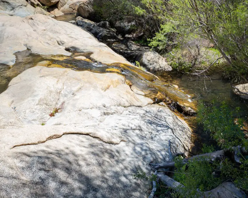
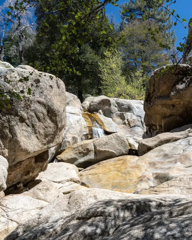
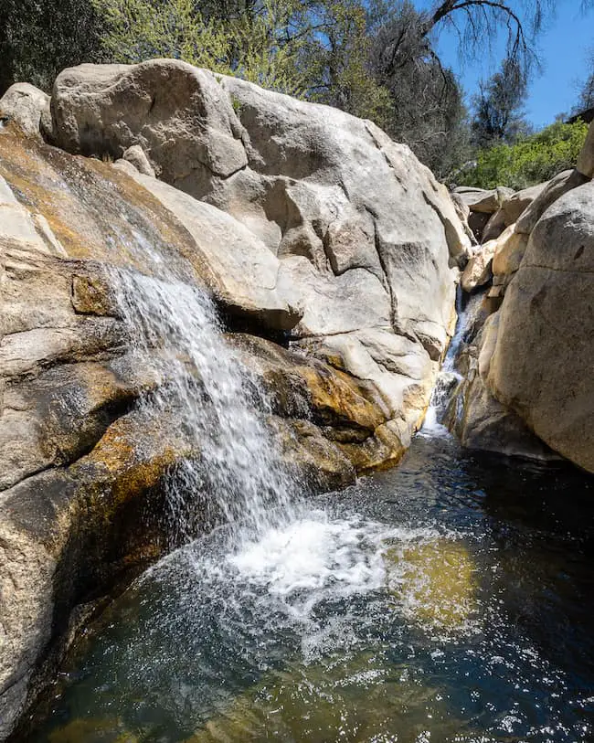
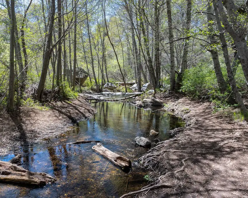
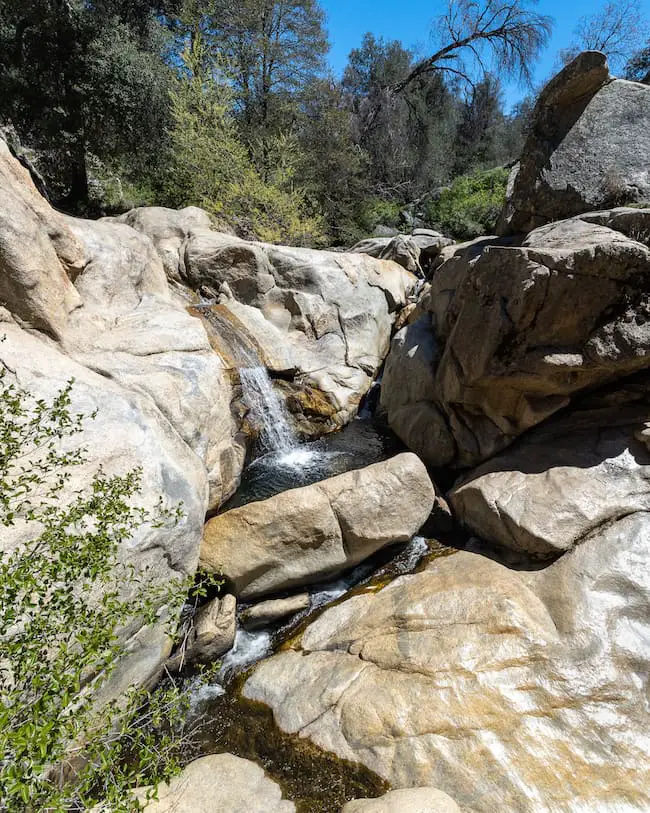
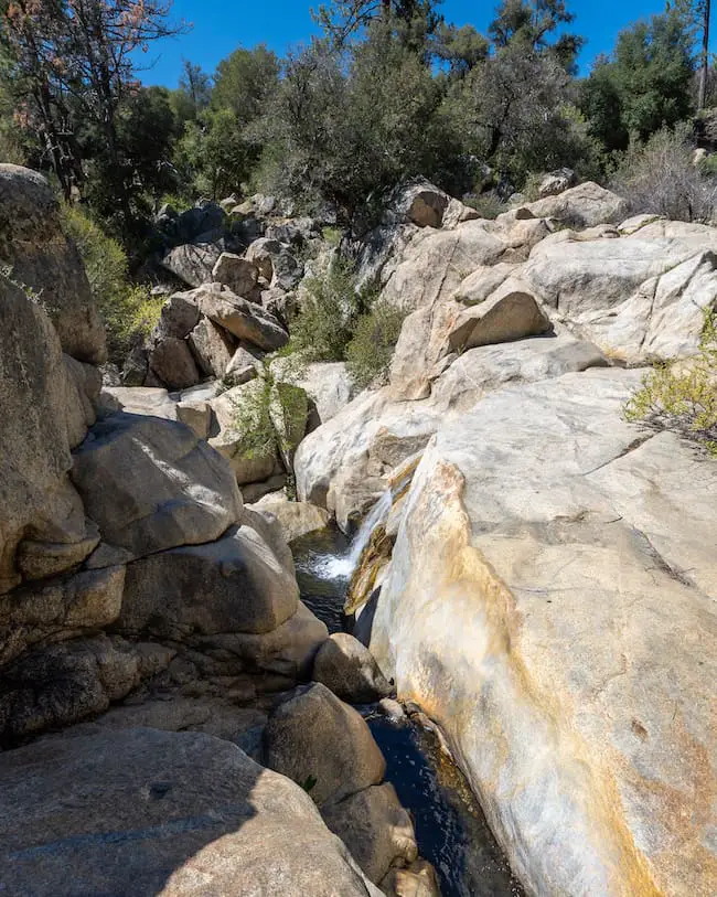
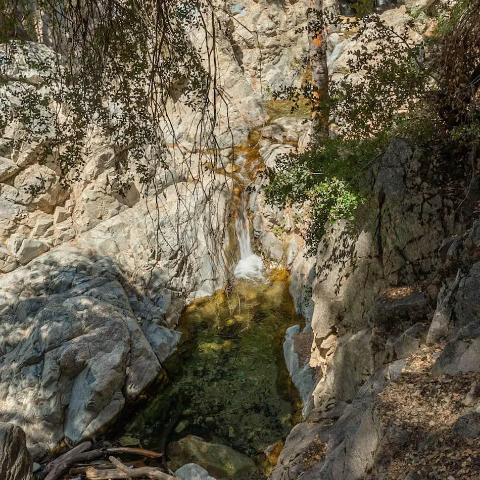
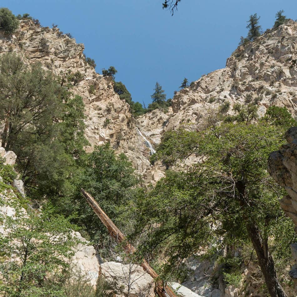
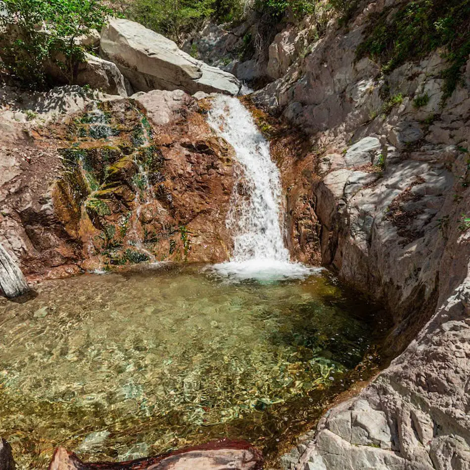
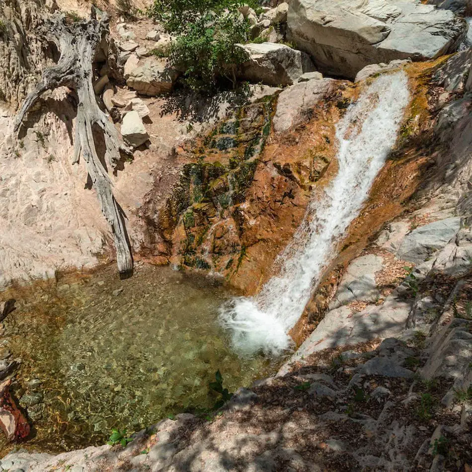
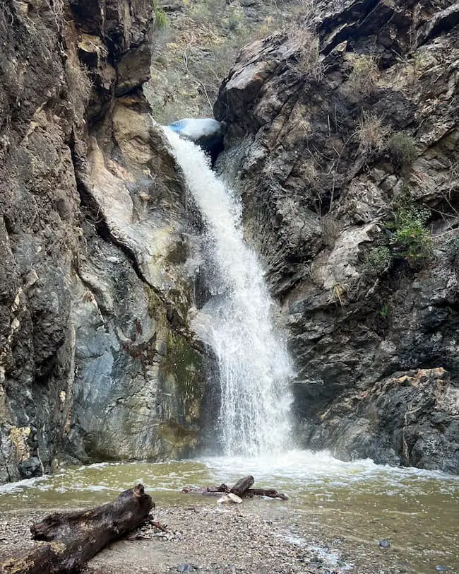
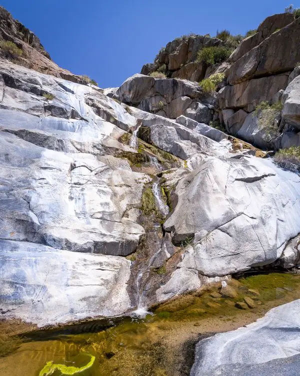
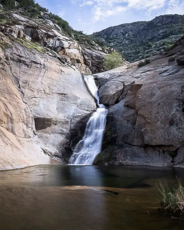
16) Stoddard Canyon Falls: Rockslide & Pool
- Total Miles: 0.75
- Difficulty: Moderate
- Best Season: Spring
- Elevation Gain: 160 Ft
- Time: 45 Min
- Dogs: Allowed On A Leash
- Restrooms: Not Available
- Map, Directions, & Full Post: Stoddard Canyon Falls
Stoddard Falls is a 40-foot waterfall located in San Antonio Canyon, but unlike most other waterfalls, this one has a rockslide and pool. Always test the depth of the pool before sliding down, as Stoddard Falls is known to have low water in late summer to early spring.
The majority of the trail consists of an abandoned and gradually descending paved road that follows San Antonio Creek down the canyon. The dirt trail that splits off the paved road is somewhat steep, loose, and difficult to spot.
Once I got down to the canyon floor, the luscious greenery and crystal-clear water left me mesmerized. I’ve yet to see water more blue and clear than that of this creek.
I made my way upstream and within a few minutes, arrived at the base of the falls.
Fun Fact: Stoddard Falls’ real name is actually The Old Falls. I found this out from an old vintage photo which you can view in the full post.
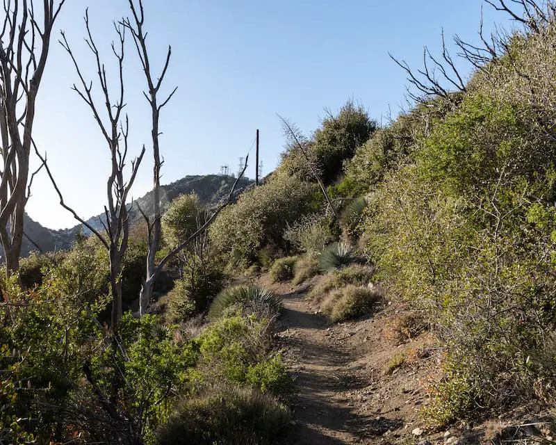
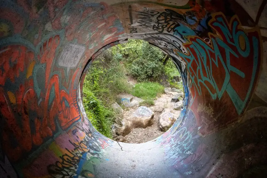
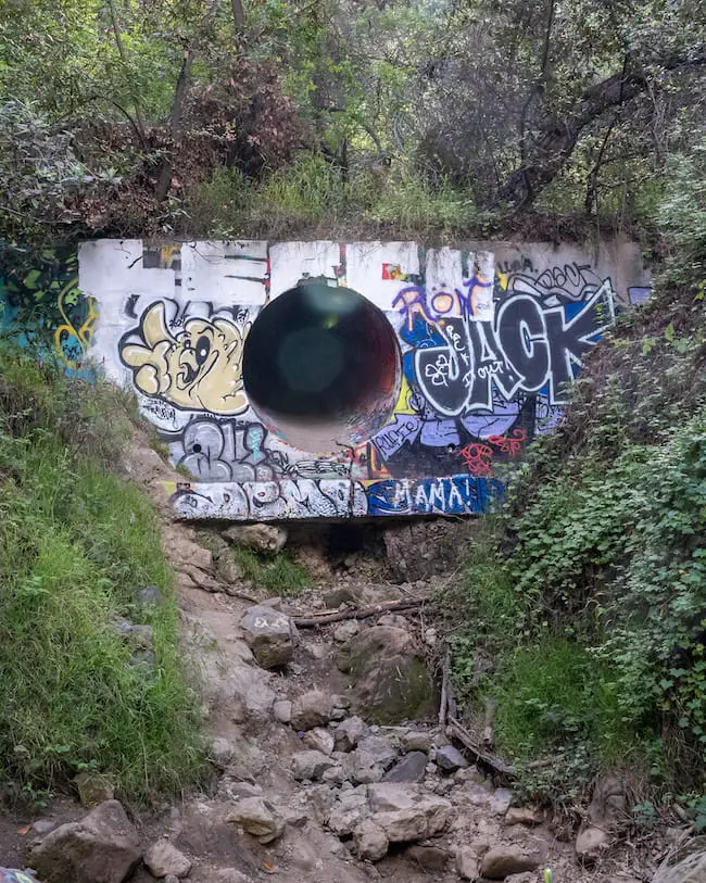
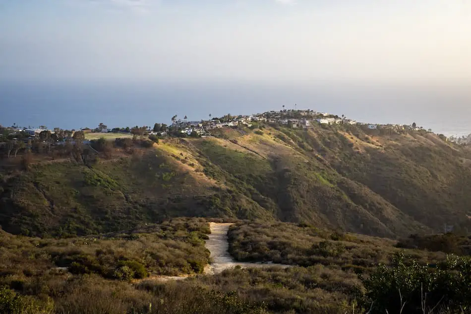
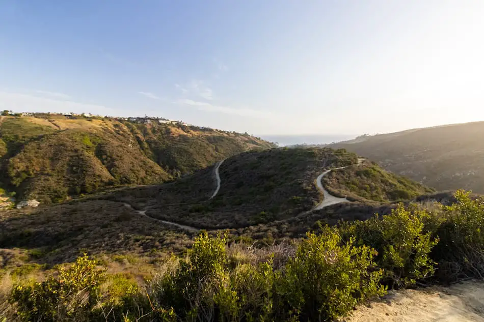
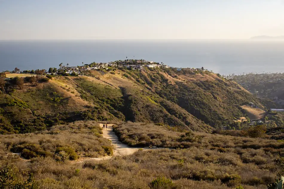
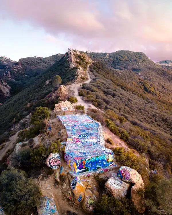
15) Topanga Lookout Trail: Best Views In Santa Monica Mts (Closed)
- Total Miles: 2.26
- Difficulty: Easy
- Best Season: All Year
- Elevation Gain: 348 Ft
- Time: 60 Min
- Dogs: Allowed On A Leash
- Restrooms: Not Available
- Map, Directions, & Full Post: Topanga Lookout Trail
Topanga Lookout without a doubt takes the prize for the best views in the Santa Monica Mts. From the lookout, I was able to see virtually all of the Angeles and San Bernardino National Forests.
However, what makes this view special is the vast mountain ranges that surround the platform below me on three sides. It literally made me feel like I was flying.
The graffitied platform was once the concrete foundation for a fire tower but is now used as a hiking destination and stage for artists. Expect very large crowds on weekends.
14) Hermit Falls (Closed)
- Total Miles: 2.5
- Difficulty: Easy
- Best Season: Spring
- Elevation Gain: 715 Ft
- Time: 60 Min
- Dogs: Allowed On A Leash
- Restrooms: Available At The Parking Lot
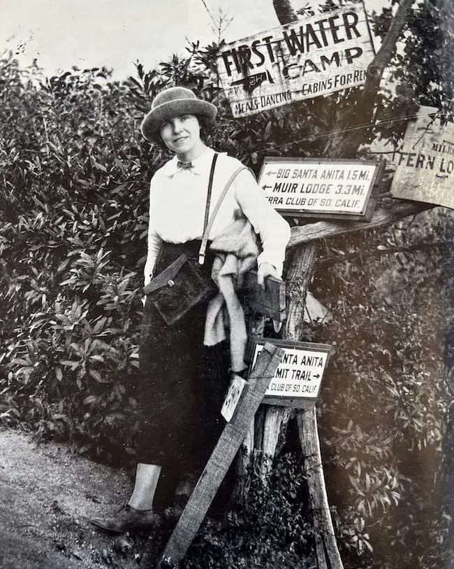
Hermit Falls is the best spot in the San Gabriel Mts for cliff jumping. It’s located in Santa Anita Canyon and shares the same trailhead (Chantry Flats) with another waterfall on this list, Sturtevant Falls.
Unfortunately, the area has been temporarily closed due to the Bobcat Fire that occurred in 2020.
When it was still open, Hermit Falls would receive tons of visitors every weekend with the intention of jumping off the 30-foot ledge and into the deep water hole at the base of the falls.
A second much higher ledge on the opposite side of the canyon was also used for cliff jumping, but getting to it required climbing up a very steep and loose trail. In order to get back to the primary 30-foot ledge, we would use a rope to climb up roughly 20 feet.
Sometimes, I’d hike from Chantry Flats down to Hermit Falls, then hop on a trail that led me through the canyon floor up to Sturtevant Falls.
Hermit Falls was one of my favorite places, but due to its growth in popularity, lowlifes wasted no time covering the ENTIRE surrounding canyon with graffiti.
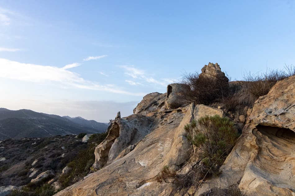
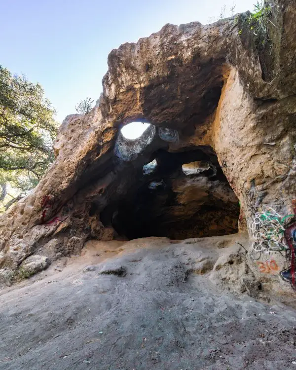
13) Vanalden Cave In The Santa Monica Mountains
- Total Miles: 2.65
- Difficulty: Easy
- Best Season: All Year
- Elevation Gain: 510 Ft
- Time: 60 Min
- Dogs: Allowed On A Leash
- Restrooms: Available At The Parking Lot
- Map, Directions, & Full Post: Vanalden Caves
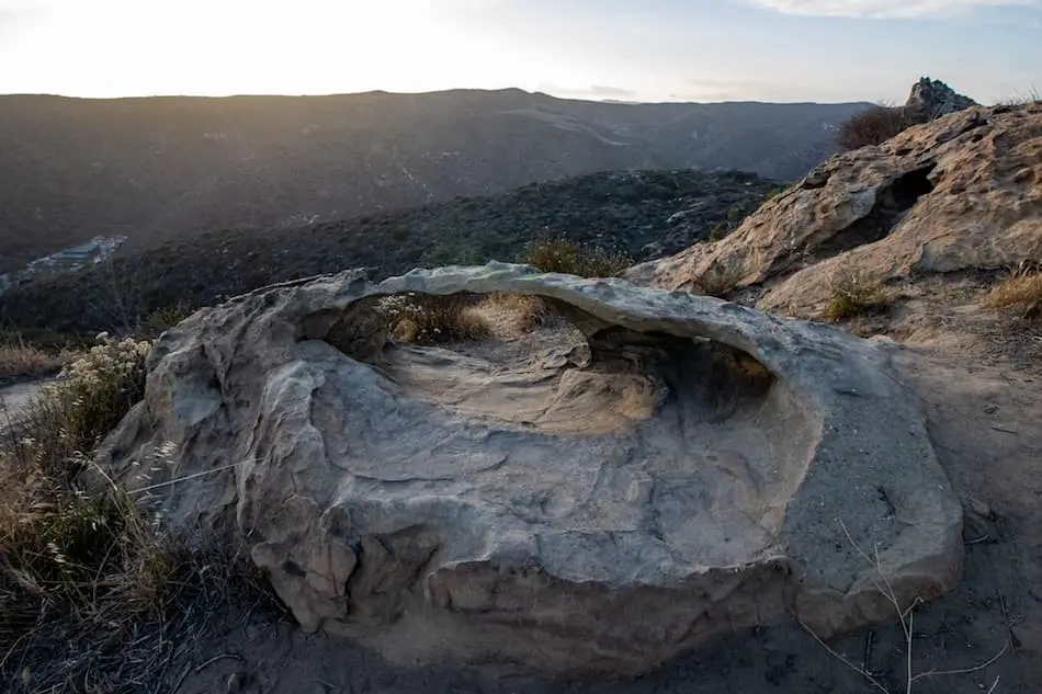
The Santa Monica Mountains are home to an awesome sandstone cave which can be accessed via a short and easy hike.
The trail begins on a dirt road with amazing views of the Angeles and San Bernardino National Forests to the north, and the vast Santa Monica Mountains and the ocean to the south.
Towards the end of the hike, you’ll hop onto an actual trail located on the right side of the road and quickly descend to the canyon floor.
The trail leads you over a dry creek bed underneath the forest canopy. Shortly thereafter, you will see the cave tucked away into the corner of the canyon.
The cave is roughly 30 feet deep and 14 feet tall. Unfortunately, lowlifes have already covered the caves with graffiti.
Fun Fact: A short trail continues up the side of the mountain and leads you to the top of the cave where big holes in the ceiling allow you to peer inside from above.
These caves are an adventure unlike any other in the Santa Monica Mountains.
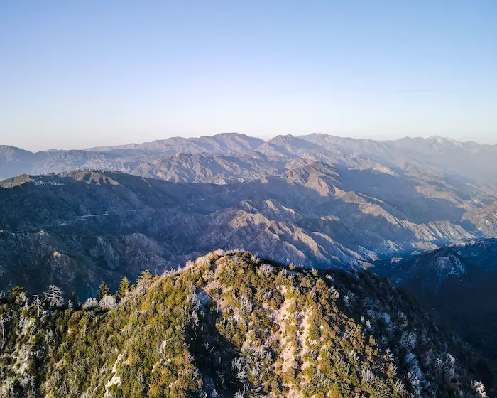
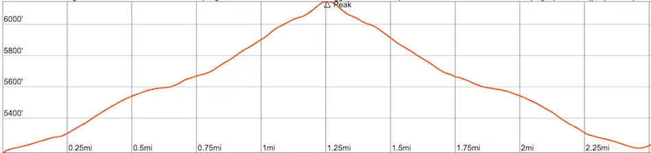
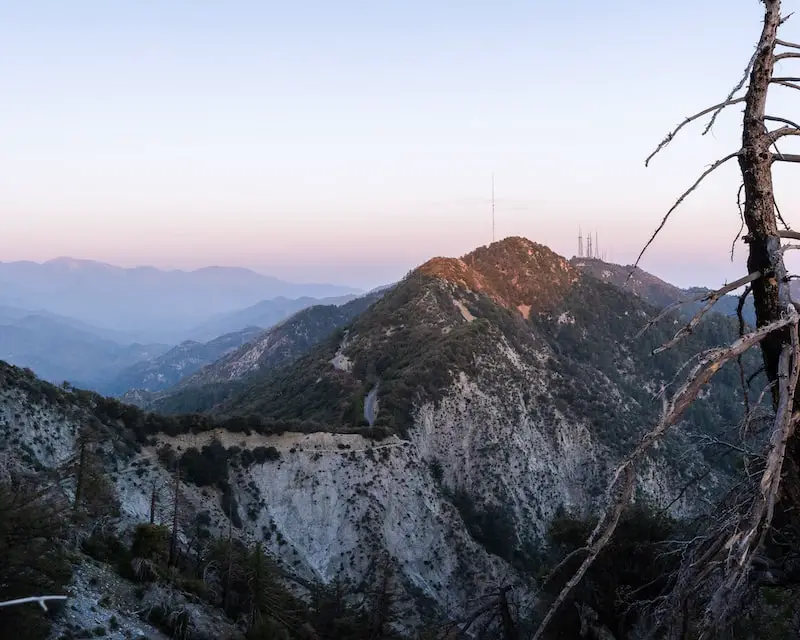
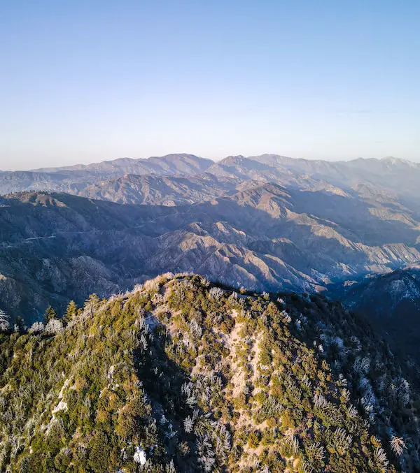
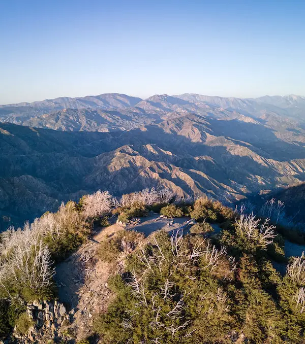
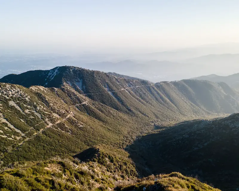
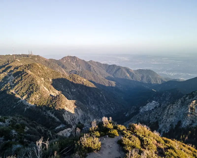
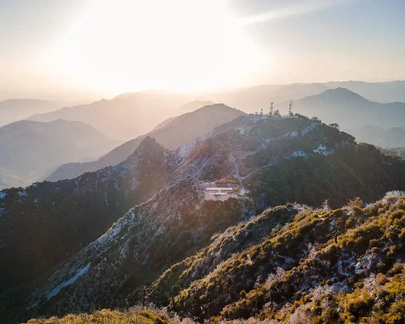
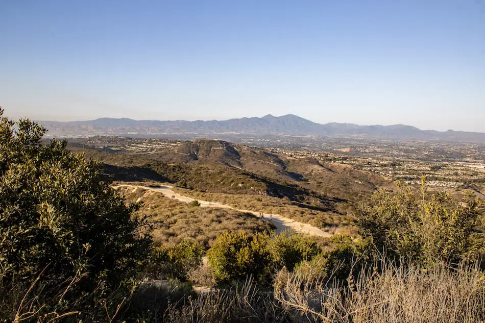
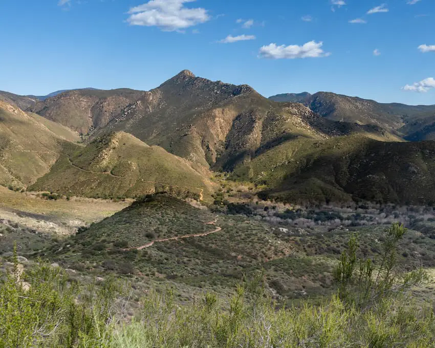
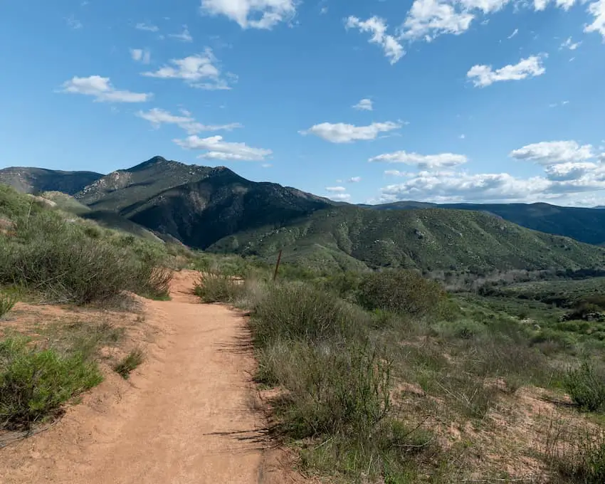
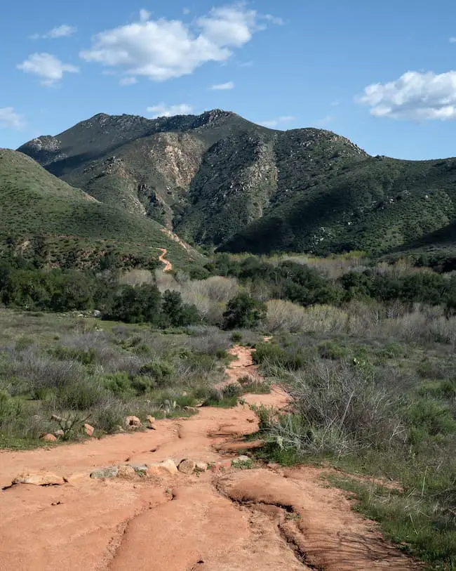
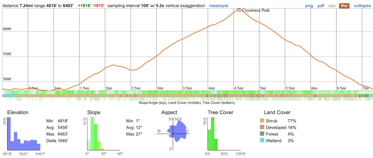
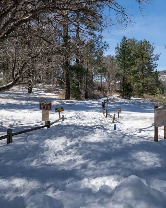
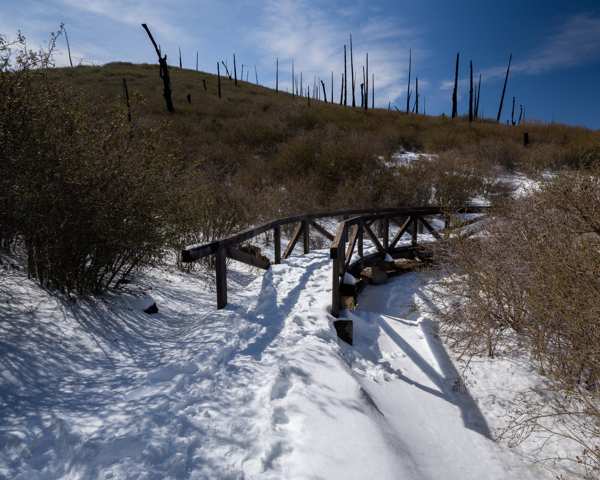
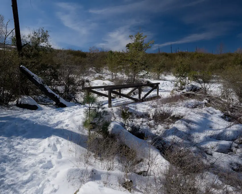
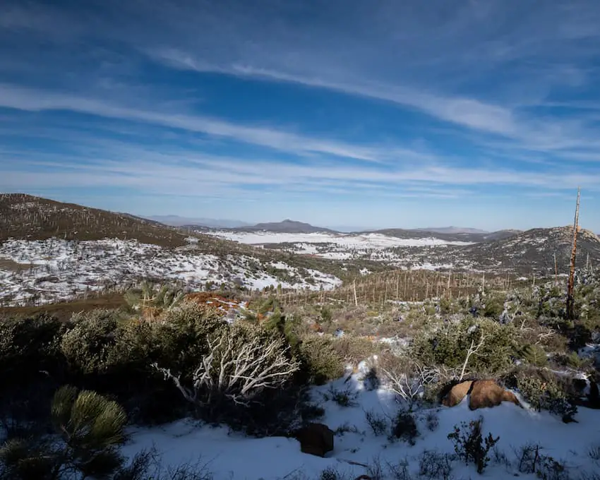
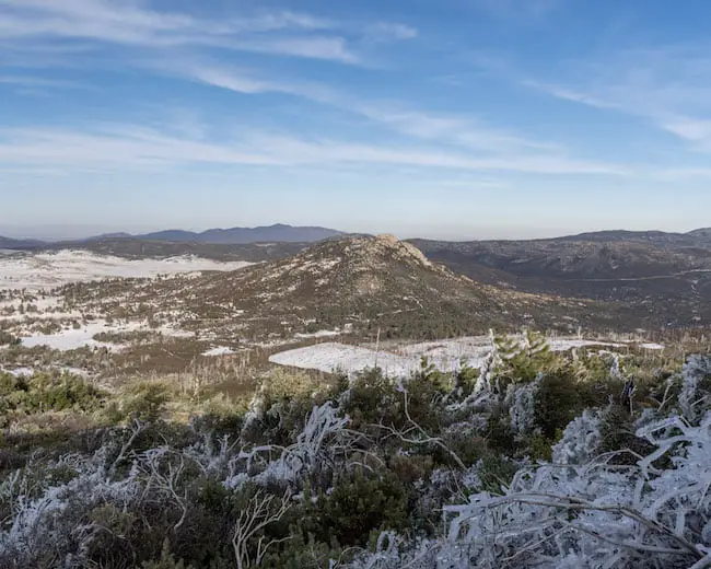
12) Cuyamaca Peak: Best Views In San Diego County
- Total Miles: 7.24
- Difficulty: Moderate – Hard
- Best Season: All Year
- Elevation Gain: 1815 Ft
- Time: 4 Hrs
- Dogs: Not Allowed On Azalea Glen Trail
- Restrooms: Available At The Campground
- Map, Directions, & Full Post: Cuyamaca Peak Trail
Cuyamca Peak is the second highest peak in the Cleveland National Forest, trailing only behind Hot Springs Mt by about 20 feet, but in my opinion, it offers better views as it’s closer to the ocean, and due to the mountain’s formation.
While many peaks have surrounding mountain ranges that are similar in height, Cuyamaca’s south-eastern face basically looks like a wall. It makes you feel like you’re standing on an enormous ledge that overlooks the valley below, similar to the Topanga Lookout Trail I previously mentioned.
There are two ways up the mountain, via the Azalea Glen Trail or directly up the Lookout Fire road, the latter being steeper. By the way, dogs are allowed at the campground and the fire road, but not the Azalea Glen Trail.
I took the scenic Azalea Glen trail up to the peak and came down the fire road to complete a loop.
Fun Fact 1: There are multiple slabs of rock on the Azalea Glen trail containing bedrock mortars which were created thousands of years ago by the Kumeyaay Native Americans to grind their food. Definitely check those out!
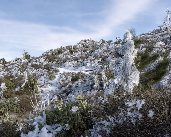
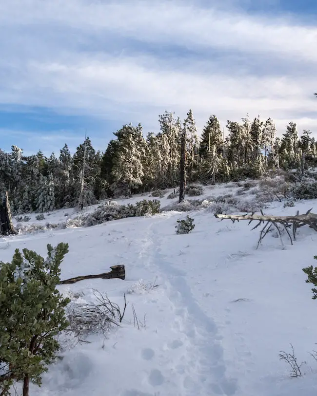
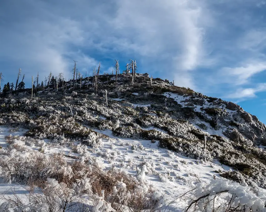
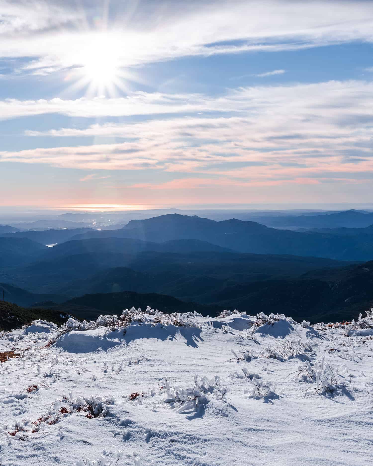
Fun Fact 2: Cuyamaca Rancho State Park turns into a winter wonderland after a good dump! The antennas at the peak are known to form giant icicles that come crashing down and can be dangerous, so heads up!
Fun Fact 3: My girlfriend and I had our first mountain lion encounter on the Azalea Glen trail. If you’re taking small children, don’t let them out of your sight!
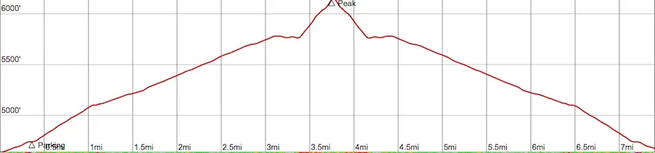
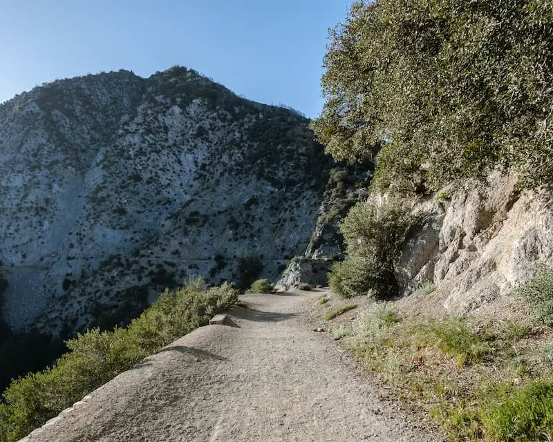
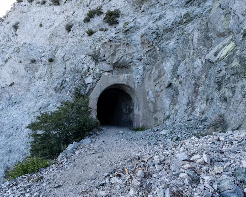
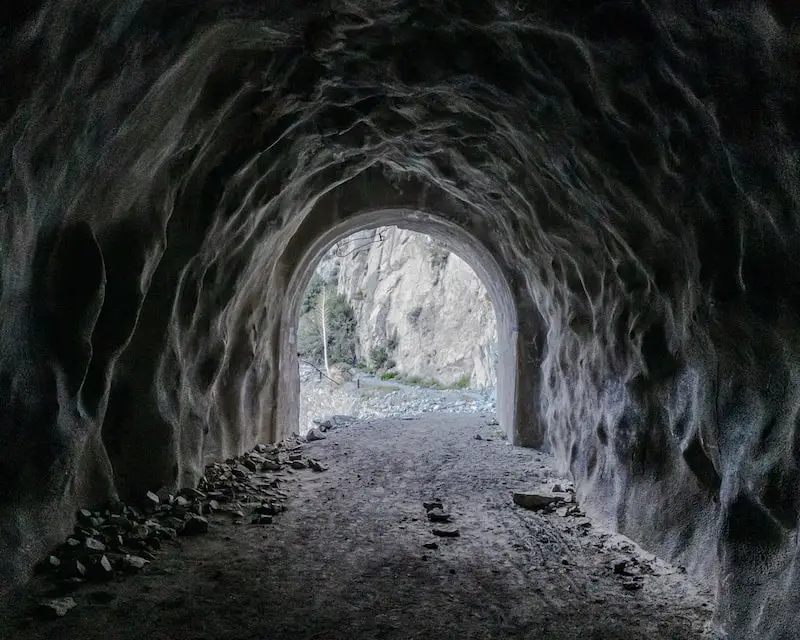
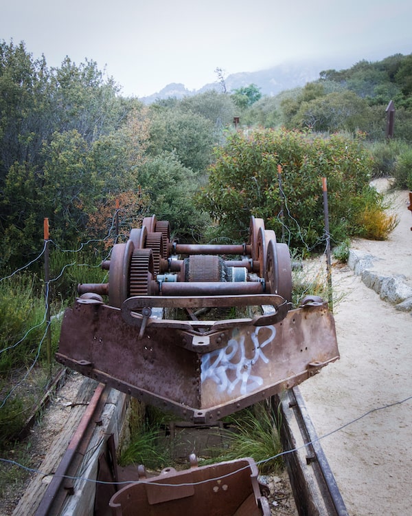
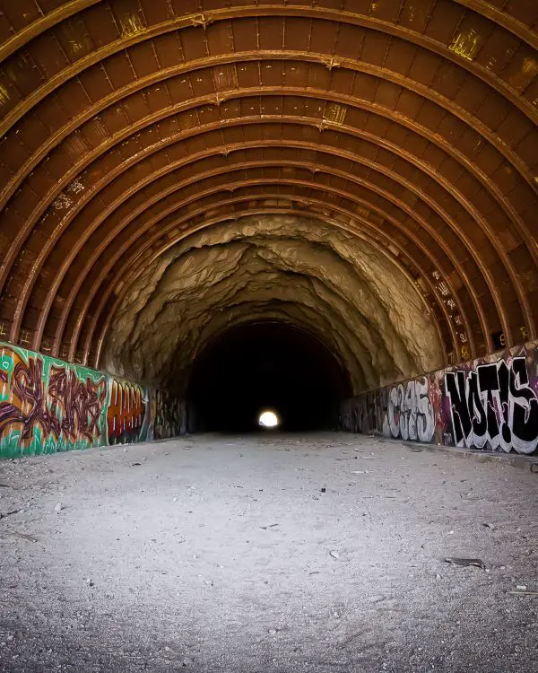
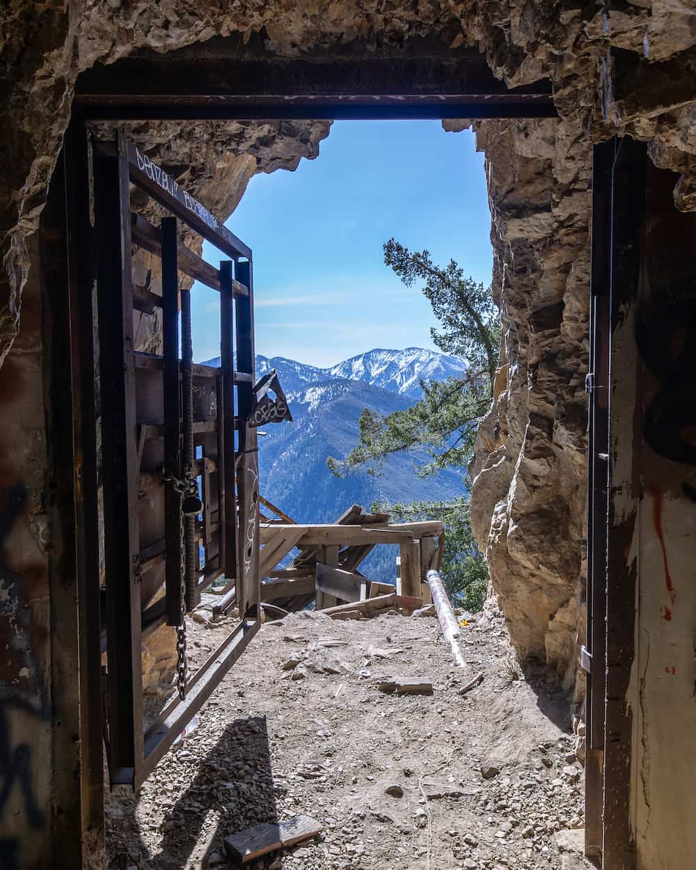
11) Shoemaker Canyon Rd: LA’s Nuclear War Escape Tunnels
- Total Miles: 5
- Difficulty: Easy
- Best Season: All Year
- Elevation Gain: 1404 Ft
- Time: 2.5 Hrs
- Dogs: Allowed On A Leash
- Restrooms: Not Available
- Map, Directions, & Full Post: Shoemaker Canyon Rd
During the midst of the Cold War in the 1950’s, Los Angelinos feared a nuclear attack from the Soviet Union (rightfully so).
Due to the limited number of roadway exits out of SoCal, the people in LA decided to build a road through the San Gabriel Mts in order to safely get to Nevada.
However, the high cost of building the road along with persistent conservationists finally put an end to the project. Today, the road and its two tunnels have become very popular hiking destinations.
The parking lot is home to the Shoemaker Viewpoint, which offers amazing views of the San Gabriel River, Iron Mountain, and Heaton Flats. The entirety of the trail consists of trekking along a dirt road, with the second tunnel marking the end of the hike.
Fun Fact: There are two bonus water drainages underneath the road which offer a different perspective of the valley below. More on these drainages in the full post.
If that’s not enough, you can look for the long-forgotten Shoemaker Mine. I’ve yet to find it, but maybe you’ll have better luck.
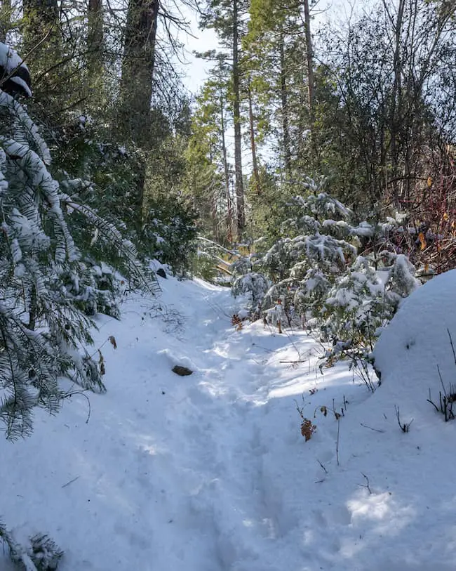
10) San Antonio Falls: Scenic 75 Ft Waterfall
- Total Miles: 1.33
- Difficulty: Easy
- Best Season: Spring – Summer
- Elevation Gain: 277 Ft
- Time: 30 Min
- Dogs: Allowed On A Leash
- Restrooms: Not Available
- Map, Directions, Drone Video & Full Post: San Antonio Falls
San Antonio Falls is a beautiful multi-tiered waterfall in the Mt Baldy area that flows longer into the year than most cascades. Most online guides claim the falls is 75 feet high, but I believe that to be the height of only the bottom tier. The drone video in the full post proves it’s closer to 200 feet high when all tiers are included.
The trail mostly consists of Falls Rd, a gradually inclining paved road that leads to a viewpoint of the waterfall, before ascending up to the Baldy Bowl Trailhead.
A dirt trail begins at the viewpoint and descends onto the canyon floor where the base of the falls is located. The beginning of the dirt trail gets a little sketchy and may be difficult for people with really poor balance, but that’s as difficult as the hike gets.
Fun Fact: San Antonio Falls gets snow every year!
The trail is very scenic, in my opinion, especially after a good snowfall when the abundant pine trees in the canyon are covered in snow, making it look like a winter wonderland.
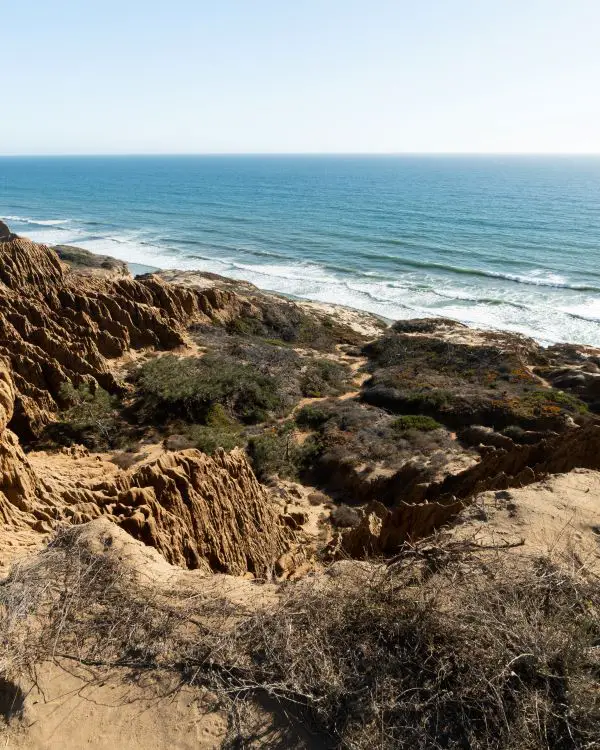
9) Torrey Pines: SoCal’s Best Beach Trail
- Total Miles: 3.1
- Difficulty: Easy
- Best Season: All Year
- Elevation Gain: 338 Ft
- Time: 2 Hrs
- Dogs: Not Allowed
- Restrooms: Available At The Beach
- Map, Directions, & Full Post: Torrey Pines Beach Trail
Torrey Pines State Beach Loop is unlike any other hike for one primary reason; the trail includes both walking on the beach and trekking through the cliffs and pine trees.
You can begin the trail at either the beach or cliff parking lots.
While on the beach, you can expect to walk along huge sandstone cliffs towering hundreds of feet above the sand. These cliffs are very unstable. Hence, visitors are urged not to get too close, as parts of the cliff can come crashing down.
Once you begin making your way up the cliffs, you’ll notice the entire trail consists of sand.
Fun Fact: The endangered Torrey Pine is native only to this beach, and can be found everywhere you look.
The cliffs contain various lookouts, each offering amazing views of the cliffs and the ocean. Make sure you plan your visit during low tide, otherwise, you won’t be able to walk on the beach!
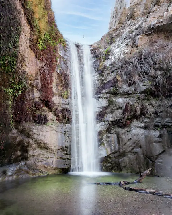
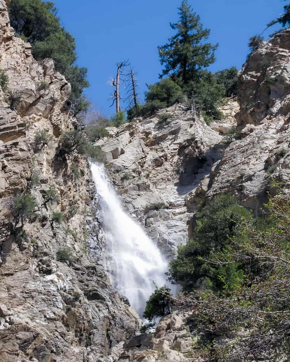
8) Sturtevant Falls: San Gabriel’s Must-Do Hike
- Total Miles: 3.3
- Difficulty: Easy – Moderate
- Best Season: Spring
- Elevation Gain: 708 Ft
- Time: 1.5 Hrs
- Dogs: Allowed On A Leash
- Restrooms: Available At The Parking Lot
Sturtevant Falls is, in my opinion, the most stunning waterfall in the San Gabriel Mountains and it is officially open!
I’ve hiked this trail countless times as it’s very close to my parent’s house. Hence, I know it like the back of my hand.
I rated the difficulty as easy to moderate because the beginning of the trail requires descending down a steep paved road for 3/4 miles, which is all good and dandy. The way back, however, is a different story. It had me huffing and puffing the first time.
The paved road ends at the canyon floor, where the scenery transforms into a luscious green paradise. A small bridge used to provide access over the creek but has now since been destroyed. You can still see its ruins a bit further downstream, but don’t worry, the area is still accessible. Neat little cabins are dispersed throughout the canyon, and tall sycamore trees shade the majority of the trail.
An opening in the forest canopy allowed the waterfall to garner full attention from its visitors, and the green moss on the canyon wall provided more contrast for the falling stream.
The waterfall is roughly 50 feet high and flows over a very narrow opening in the canyon. Meanwhile, hikers trudge along the extremely narrow trail at the top of the falls toward Sturtevant Camp.
When it has lots of water, the falls fill its surrounding area with mist, giving it an ethereal and dreamlike appearance.
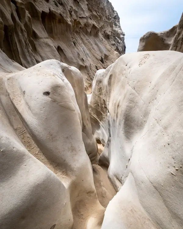
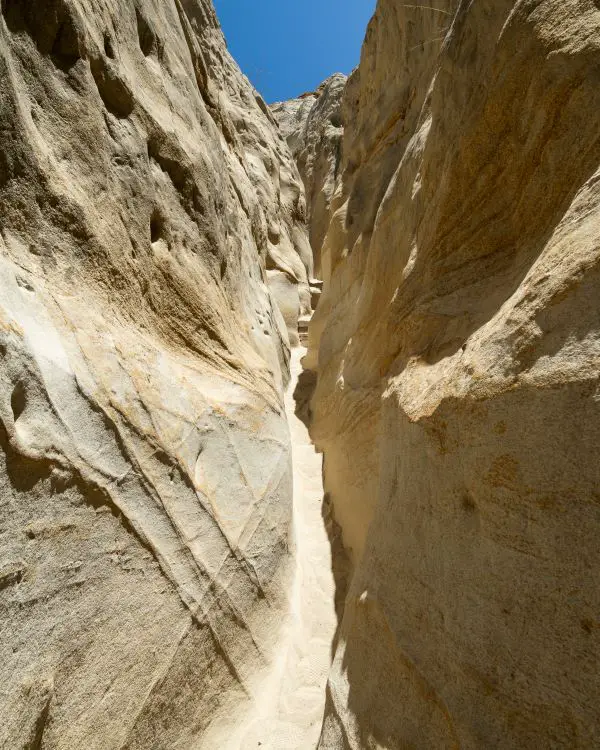
7) Annie’s Canyon: San Diego’s #1 Slot Canyon
- Total Miles: 1.3
- Difficulty: Easy
- Best Season: All Year
- Elevation Gain: 224 Ft
- Time: 45 Min
- Dogs: Allowed On-Trail But Not The Slot Canyon
- Restrooms: Not Available
- Map, Directions, & Full Post: Annie’s Canyon
Annie’s Canyon is a beautiful slot canyon located in San Elijo Lagoon Ecological Preserve. During the weekend, you can undoubtedly expect a crowd.
The trail’s beauty is enhanced by the wildflowers that call this place home. You can expect to walk alongside the marsh for the majority of the hike, then arrive at a recreational park near the end, with the entrance to the slot canyon on your right.
The setting immediately transforms before your eyes.
30-foot sandstone walls begin to close in on you in a mesmerizing way, and the wavy horizontal lines carved into the sandstone give off the impression of painted brush strokes.
At one point the canyon becomes so narrow that most people will have to turn sideways.
Explore a small cave then make your way up the ladder to arrive at the top of the slot canyon where you will be rewarded with a beautiful view of the preserve.
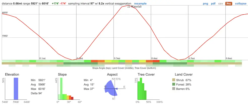
6) Big Falls: Largest Waterfall In SoCal
- Total Miles: 0.66
- Difficulty: Easy
- Best Season: Spring – Summer
- Elevation Gain: 174 Ft
- Time: 25 Min
- Dogs: Allowed On A Leash
- Restrooms: Available At The Parking Lot
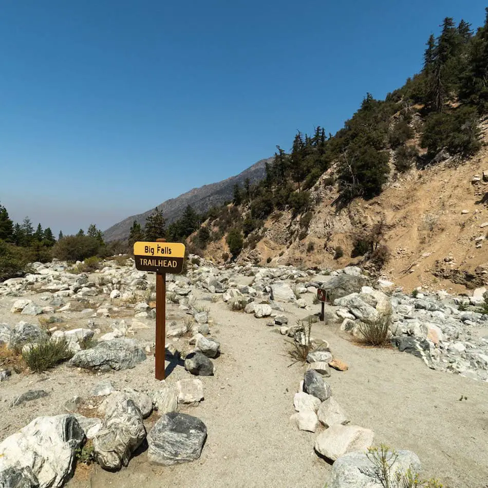
- Map, Directions, & Full Post: Big Falls Trail
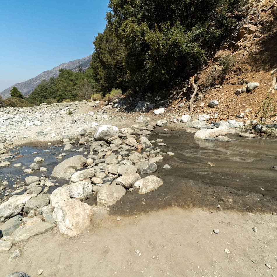
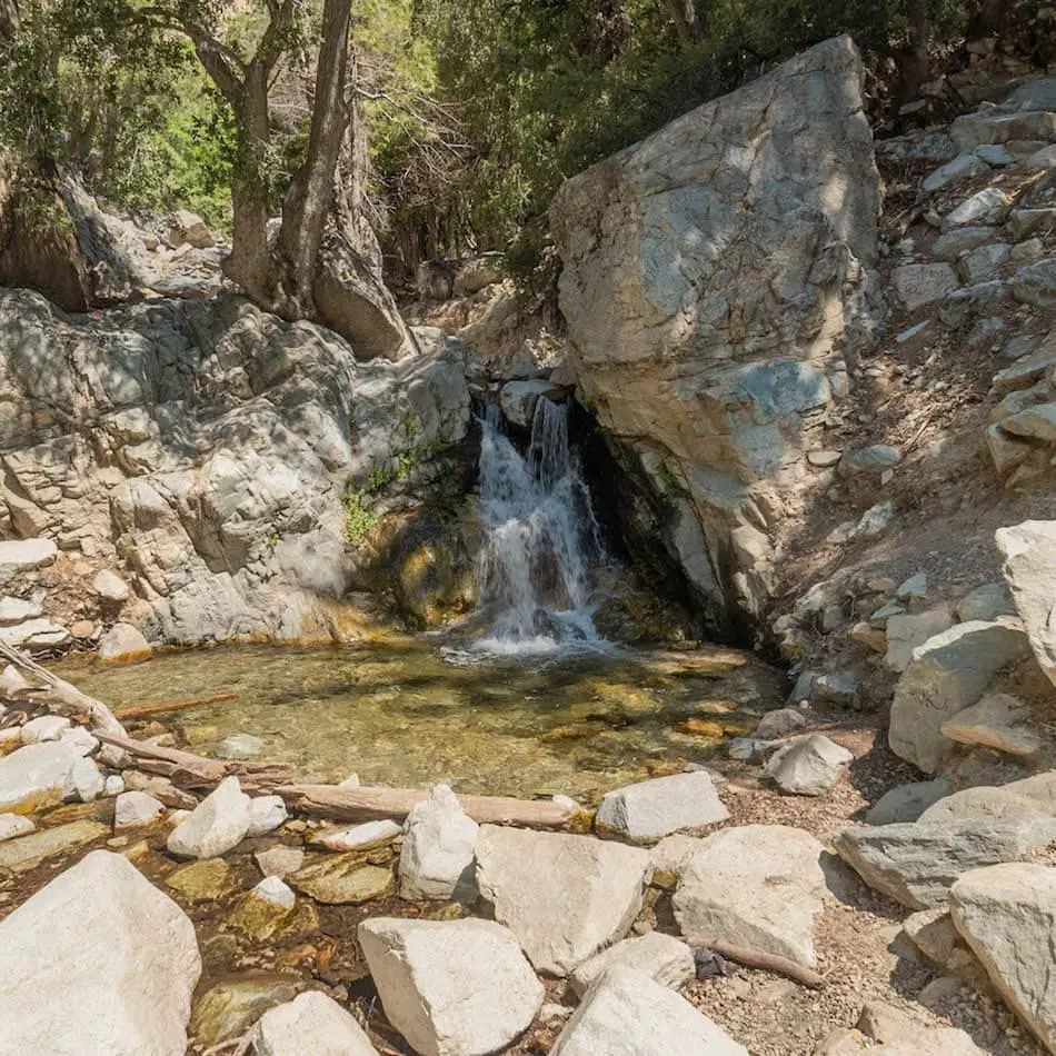
The biggest waterfall in Southern California is located in the little, sleepy mountain town of Forest Falls in San Bernardino County.
The colossal 500-foot giant, which consists of 10+ tiers, is so gigantic it can be seen from the road as you’re driving up to the parking lot. Even though the official trail is only 0.66 miles long, multiple flowing waterfalls can be expected all throughout.
Some people like to make their way to the upper tiers, which are bigger than the ones at the bottom. However, getting to the top requires boulder scrambling. If you’re not comfortable with heights or climbing, I suggest playing it safe and sticking to the main trail.
The trail is very scenic, thanks to the abundant pine trees in the canyon.
Fun Fact 1: Big Falls gets snow! Keep an eye on the weather forecast during the winter.
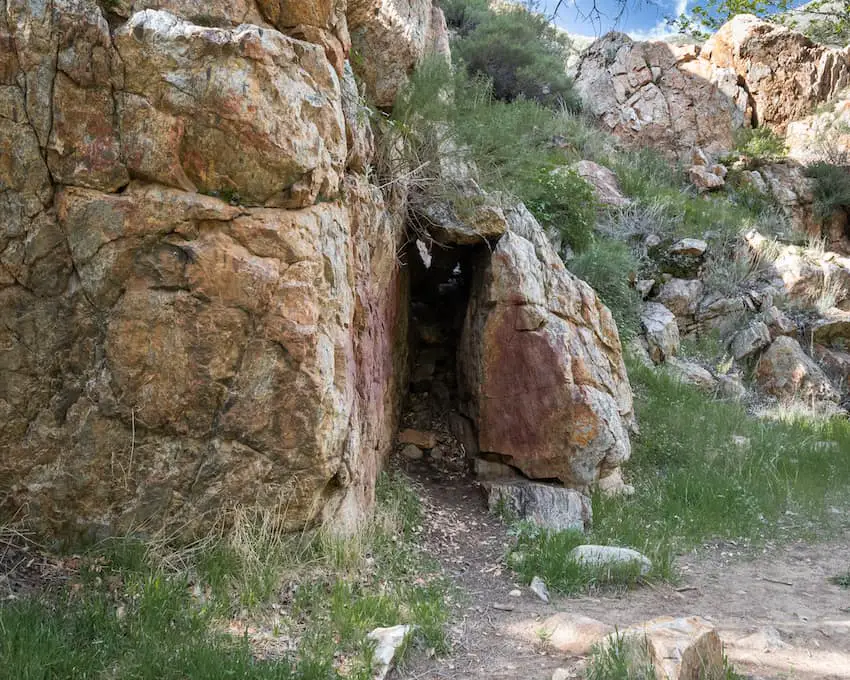
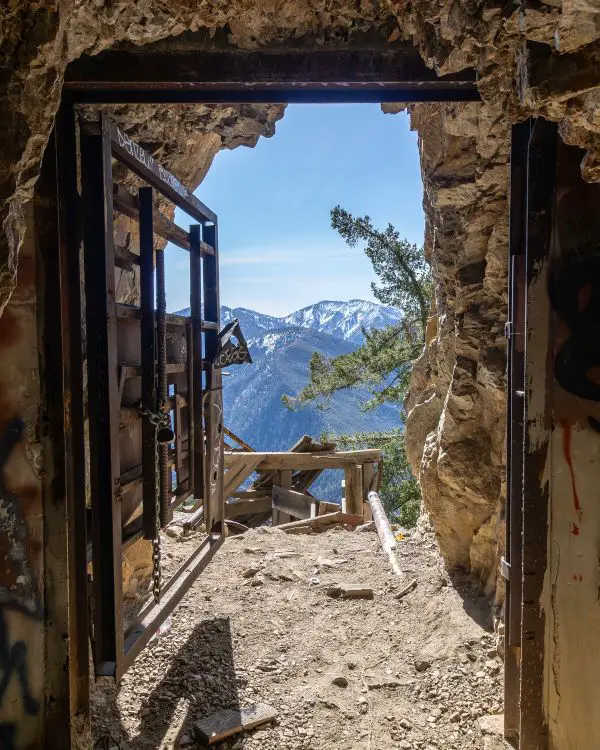
5) Big Horn Mine & Vincent’s Cabin: Creepy Abandoned Ruins
- Total Miles: 3.84
- Difficulty: Easy
- Best Season: All Year
- Elevation Gain: 983 Ft
- Time: 2.5 Hrs
- Dogs: Allowed On A Leash
- Restrooms: Available At The Parking Lot
- Map, Directions, & Full Post: Big Horn Mine Trail
Deep in the headwaters of the San Gabriel River, an abandoned gold mine is still accessible to hikers. The founder, Charles T. Vincent, built a cabin about a mile away from the mine which currently stands.
128 years later, both structures have become popular hiking destinations.
Fun Fact: Unlike the other 300 LA prospects, the Big Horn is massive in size, and the inside can still be explored.
The trail begins off the 2 Highway, weaving its way through a dense pine tree forest while boasting breathtaking views of San Antonio Peak, the highest peak in the San Gabriels.
The remaining structures of the Big Horn Mine can be thoroughly explored before heading into the portal. Unfortunately, part of the building was washed away by Mother Nature.
Microspikes and trekking poles are HIGHLY suggested if you plan to visit after a heavy snowstorm, as three sections of the trail become extremely narrow. Should you slip, it’ll be a long way down.
Inside the mine, tunnels split into various directions, huge pits big enough to swallow multiple cars lay scattered throughout the mine, and the only sound is that of water droplets falling from the ceiling.
As you make your way back, take a short detour to visit Vincent’s Cabin located in a small clearing. Vincent lived in this cabin when Grizzly Bears roamed the area.
Not surprisingly, he was attacked by 3 bears. He managed to shoot two and claimed the third kill with his knife. Unfortunately, he later succumbed to his injuries in an LA hospital where he confessed to fleeing the state of Arizona after killing three men.
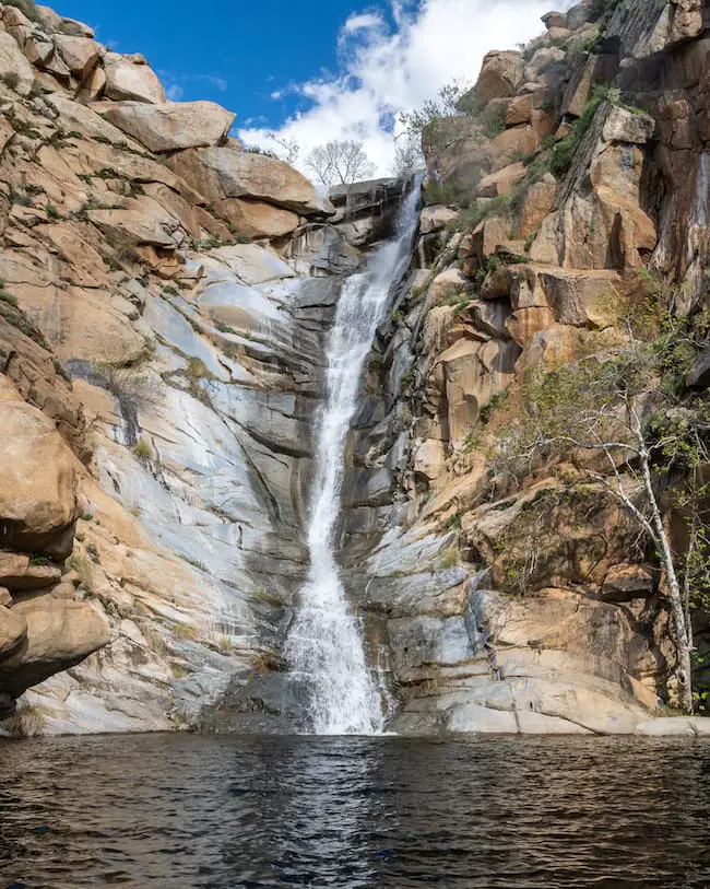
4) Three Sisters Falls: San Diego’s Most Popular Waterfall
- Total Miles: 3.39
- Difficulty: Moderate – Hard
- Best Season: Spring
- Elevation Gain: 1069 Ft
- Time: 2.5 Hrs
- Dogs: Allowed On A Leash
- Restrooms: Available At The Parking Lot
- Map, Directions, & Full Post: Three Sisters Falls Trail
This massive three-tiered cascade has won over the hearts of San Diegans.
While most waterfalls stand upright, the roughly 150-foot Three Sisters Falls flows down the canyon in a much more gradual descent.
The start of the hike requires trekking down to the canyon floor, much like Cedar Creek Falls. Hence, the hard part is reserved for the end. Believe me, the way back is a workout!
I don’t suggest taking your pooch during the summer months as it gets excruciatingly hot in this area. Pack extra water and a hat, and expect huge crowds on the weekends, so get there super early!
Fun Fact: The top tier contains a swimming hole deep enough for cliff jumping. Getting to it requires rock scrambling and careful footing, but if you’re the adventurous type it shouldn’t be too difficult. Plus, you’ll be rewarded with a slightly less crowded 25-30 foot cascade.
The bottom tier looks more like a natural water slide measuring roughly 30 feet in length. At 50 feet, the middle tier is the tallest, and although it has a large swimming hole I don’t think it’s deep enough for cliff jumping.
If you live or are visiting Socal, Three Sisters Falls is a must-do!
3) Escondido Falls: Most Breathtaking LA Falls
- Total Miles: 3.49
- Difficulty: Easy
- Best Season: Spring
- Elevation Gain: 507 ft
- Time: 1.5 Hrs
- Dogs: Allowed On A Leash
- Restrooms: 1 Porta Potty At The Parking Lot
- Map, Directions, & Full Post: Escondido Falls
At 150 feet high, the Upper Escondido Falls is without a doubt the most stunning waterfall in LA County. Some may even say all of Southern California.
Unfortunately, the last section of the trail leading up to the top falls is closed to the public as it is steep, loose, and dangerous for most people. On the upside, the top of the cascade can be seen flowing from the trail.
The trail ends at Lower Escondido Falls, a 50 ft limestone waterfall which is impressive in an of itself. The broad cascade is adorned with green moss and ferns while sycamore trees boast their vibrant yellow and orange leaves.
Nearly the first half of the hike consists of a paved road. However, once I hopped on the official trail, I found myself following the well shaded Escondido Creek through a riparian and oak woodland.
If you plan on hiking this trail, try to get out there as fast as possible following a good rainstorm, as the falls is dry most of the year.
2) Bridge To Nowhere: SoCal’s Most Famous Ruins
- Total Miles: 9.5
- Difficulty: Moderate – Hard
- Best Season: All Year
- Elevation Gain: 1246 Ft
- Time: 4.5 Hrs
- Dogs: Allowed On A Leash
- Restrooms: Available At The Parking Lot
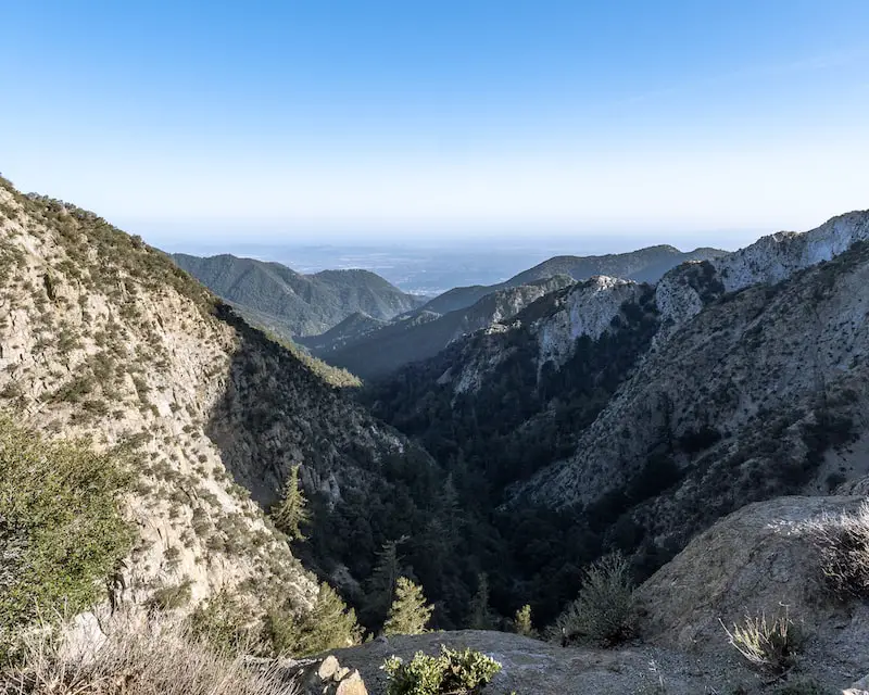
Deep in the East Fork of the San Gabriel Canyon, a random bridge looms over the creek. Not a single vehicle is to be seen for miles, yet the bridge gets visitors on a daily basis.
Construction for the Bridge To Nowhere began in 1936, but it quickly ceased after a major flood changed the landscape and destroyed the road leading up to the bridge. The original intent was to connect the San Gabriel Valley with the little mountain town called Wrightwood.
Nowadays, it’s become Southern California’s most popular abandoned place, and, if I’m correct, the second most popular trail. The first is Eaton Canyon Falls.
The trail begins at Heaton Flats, follows the San Gabriel River upstream through beautiful narrows, and ends at the bridge where deep water holes in the creek provide hikers a way to cool off. It’s not uncommon to see a herd of majestic bighorn sheep roaming the area.
Fun Fact: The private company, Bungee America currently owns the bridge, which they use for their customers.
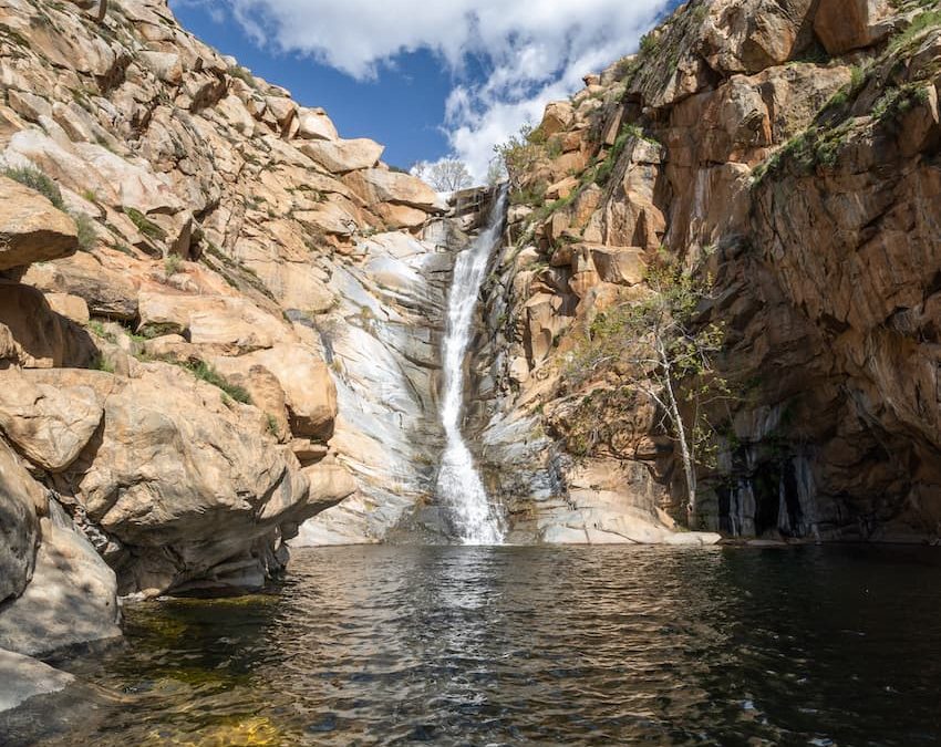
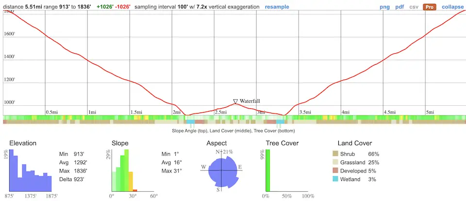
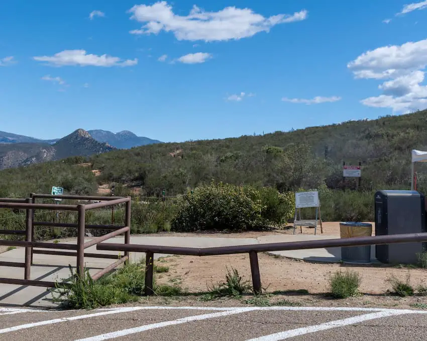
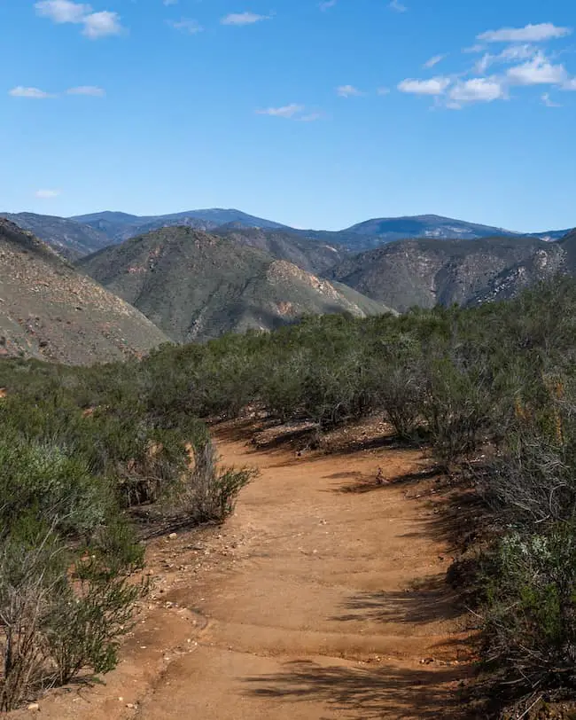
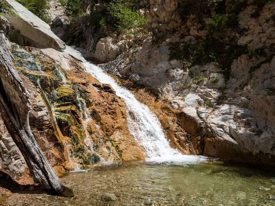
1) Cedar Creek Falls: SoCal’s Most Stunning Waterfall
- Total Miles: 5.5
- Difficulty: Moderate
- Best Season: Spring
- Elevation Gain: 1026 ft
- Time: 2.5 Hrs
- Dogs: Allowed On A Leash
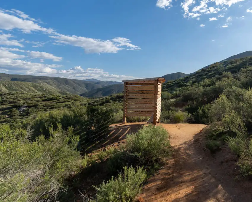
- Restrooms: Available At The Parking Lot
- Map, Directions, & Full Post: Cedar Creek Falls
Cedar Creek Falls is, in my opinion, San Diego’s most beautiful waterfall. The 80-foot cascade towers over everything in its surrounding area, and the orange tint on the cliff walls only adds to its beauty.
When you’re at the base of the falls, it feels like you’re standing before a giant or a skyscraper. It’s a really humbling experience.
If the breathtaking view isn’t enough of a reason to visit, the waterfall’s swimming hole is enormous and deep. Although cliff jumping is not allowed, swimming definitely is. Therefore, expect a crowd on the weekends.
Visiting the falls requires a $6 permit, which I highly suggest you purchase weeks in advance. It’s 6 bucks per car, not per person.
Thanks to the permit, the waterfall is graffiti-free and trash is almost non-existent. Keep in mind this hike becomes excruciatingly hot in the summer, and the waterfall is more likely to be dry, so try to visit in the spring!
Fun Fact: There’s a pool at the top of the falls.
When Is The Best Time To Hike In Southern California?
Unless you love the snow as I do, the best season to hike in Southern California is spring for three reasons.
1 Avoid SoCal Summers
First of all, SoCal summers can be brutal, reaching temperatures of 100+ degrees Fahrenheit. Heat strokes are not uncommon, as many trails (usually the ones not located in canyons) are very exposed.
2 Flowing Waterfalls
Secondly, unlike the northern part of the state, most SoCal waterfalls dry up after a few weeks. Spring is the best time of the year to catch them flowing. Some waterfalls dry up before spring even ends.
3 Vibrant Colors
Southern California is hot zone for biodiversity, both plants and animals. Every spring our hills and mountains are covered in the bright yellow invasive plant, the wild mustard.
In some cases when rain was abundant during the winter, we get a multi-colored poppy super bloom, which is arguably one of the stunning landscapes you’ll see in the state.
Additionally, most plants come back to life during the spring, such as ferns and virtually every type of flower.
Is It Safe To Hike In Southern California?
Hiking in SoCal can be safe and fun. However, you must always be prepared to act in an emergency situation, and you should become familiar with the area where you plan on hiking to avoid dangerous mountain conditions and people.
Wild Animals
Bears, mountain lions, and rattle snakes are probably the most dangerous animals in our state. However, encounters are rare, especially lions, and an attack is even more uncommon. However, you should still know what to do just incase you do come in contact with one of them.
Plants
The most notorious plant in SoCal is poison oak, a three leafed menace which lurks in most canyons, especially those abundant with water. The leaves are sometimes spotted with a red/burgundy color.
When poison oak comes in contact with the skin, it produces a painful and irritating rash that can last up to two weeks and sometimes blister. Remember the saying, “leaves of three, let it be” to identify and avoid poison oak.
Unless you know exactly what you’re doing, I suggest refraining from foraging. A large quantity of plants which are not dangerous to touch can be lethal to consume.
People
Unfortunately, people with ill intentions take refuge in the mountains. I’ve heard of crazy individuals harassing and threatening hikers in places like the Big Horn Mine, Ice House Canyon Trail, and Hogback.
Additionally, car break-ins are very frequent in areas like Azusa Canyon and Big Tujunga. Someone broke into my truck in the East Fork of the San Gabriel River. I’ve also heard very sketchy people hanging around the Shoemaker Tunnels after dark.
If you’re hiking anywhere in LA County, leave all your valuables at home. Unfortunately, crime has gotten pretty bad, but luckily, I’ve yet to hear about any muggings or murders in the mountains.
Dangerous Mountain Conditions
The biggest threat to your safety is exposure to dangerous mountain conditions such as flash floods and snowstorms. However, it’s not uncommon for people to get lost in mild weather conditions and succumb to starvation or lack of water.
Here are some quick tips to keep you safe in the outdoors:
- Carry a printed or topo map in addition to GPS on your phone
- Learn how much water to carry (roughly 1 liter per 2 hours of hiking)
- Learn what gear is necessary for winter conditions (micro spikes, windbreaker, multiple layers, anti-glare eye protection, among other things).
- Tell a family or friend where you’re going and when you’ll be back
- Learn to recognize dangerous conditions such as areas susceptible to landslides, avalanches, flash floods, etc.
- Learn basic outdoor survival skills such as which plants are edible, how to find and purify water, and how to build shelters